BlockBefore
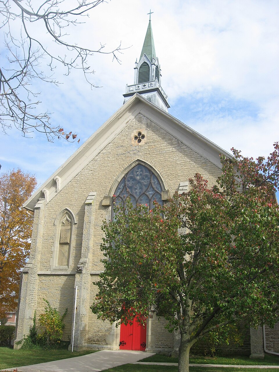
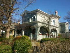
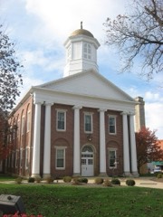
Photograph of Saint Mary's Episcopal Church
Photograph by Nyttend, Public domain. Via Wikimedia Commons.

Saint Mary's Episcopal Church and Parish House

Listed on the National Register of Historic Places in 1988. A historic map-sheet match is not published yet. The record needs a coordinate-quality review before it can be joined to a sheet boundary.

From the record

“Mary's Episcopal Church is a historic Episcopalian parish in the city of Hillsboro, Ohio, United States. Constructed during the middle of the 19th century, this Gothic Revival church building has been named a historic site.”

Wikipedia article Saint Mary's Episcopal Church (Hillsboro, Ohio), CC BY-SA 4.0.

one of 14 National Register listings in Highland County · listed in 1988 · category: Building.

Sources: the Wikipedia article · the case file at the National Archives · the National Register database, National Park Service · the Wikipedia article

The listing

  • What is counted as historic. The nomination lists 1 building as contributing to the listing.
  • Address. 232 N. High St., Hillsboro, 45133
  • When was it listed? 1988-09-08
  • Category. building
  • Township. Liberty township
  • Architectural style. Gothic Revival
  • Architect. John R. Hamilton
  • National Register reference number. 88001421 - the number the National Park Service assigned this property when it was listed, and the key its nomination file is catalogued under at the National Archives.

Fires near this property

2 since 2006

Regional context, not property-specific evidence. The federal wildfire occurrence database lists 2 fires within 5 miles of Saint Mary's Episcopal Church and Parish House between 2006 and 2007, burning about 11 acres in total. None started naturally. None was recorded as arson. Distance is straight-line from the map coordinates, so a fire counted here may appear on a neighbouring settlement's page as well.

Reported cause Fires
Debris and open burning2

The most recent of them, most recent first, with the day each was reported and the service that recorded it.

DateCause SizeReported by Name on the report
26 April 2007Debris and open burning10 acresOhio Department of Natural Resourcesnot named
4 March 2006Debris and open burning1.0 acresOhio Department of Natural Resourcesnot named

Every fire recorded in Highland County

Specimens collected near this property

12 of 754 shown

Regional context, not property-specific evidence. Museums hold 754 specimens collected within 10 miles of Saint Mary's Episcopal Church and Parish House between 1894 and 1973: 532 Animalia, 156 Fungi, 53 Plantae, 12 Protozoa, 1 Unrecorded. 12 distinct Species records are shown. Collected by 14521, A W SHARER, A. Braun and others. Each is a physical object with a catalogue number, and each entry opens the museum's record. This is what was collected and kept, not a survey of what lives here - nothing can be concluded from a species being absent.

Image SpeciesYear Collected by Where, as recorded
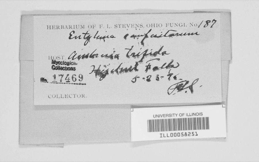
Specimen of Entyloma compositarum Farl.Entyloma compositarum Farl.1894F. L. StevensHighland Falls.
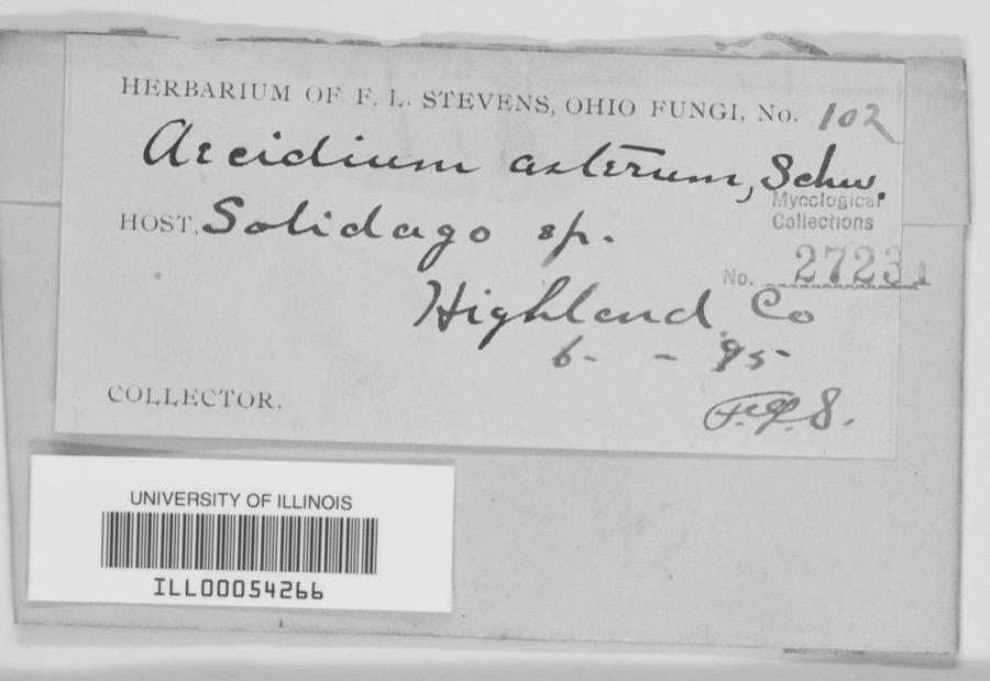
Specimen of Aecidium asterum Schwein.Aecidium asterum Schwein.1895F.L. Stevens
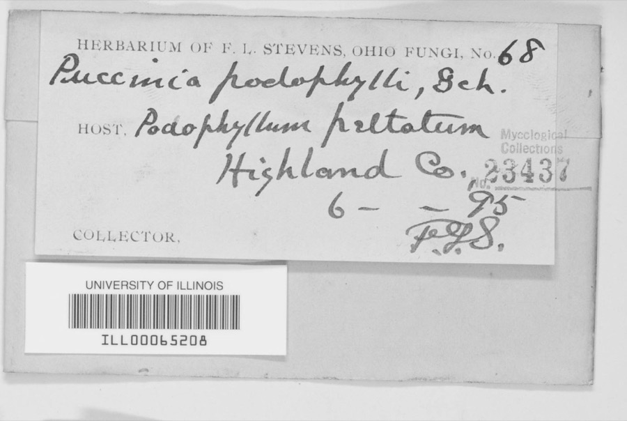
Specimen of Puccinia podophylli Schwein.Puccinia podophylli Schwein.1895F. L. StevensHighland County
A photograph of the species Dizygopleura Ulrich, not of this specimenDizygopleura Ulrich & Bassler, 1923 (fossil)1921Bucher & E. Ulrich.5mi W Of Sinking Spring (Thin Cherty Layer In Lower Part Of Bisher Member)
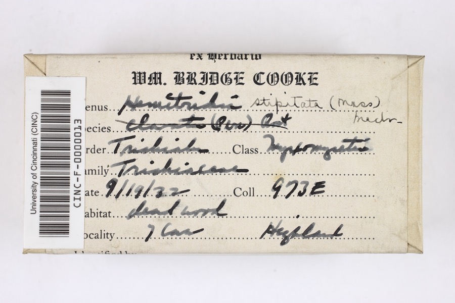
Specimen of Hemitrichia stipitata (Massee) T.Macbr., 1899Hemitrichia stipitata (Massee) T.Macbr., 18991922Cooke, William BridgeSeven Caves (Highlands Nature Sanctuary)
A photograph of the species Cephalozia curvifolia, not of this specimenCephalozia curvifolia (Dicks.) Dumort.1924M. A. Taylor
A photograph of the species Cololejeunea biddlecomiae, not of this specimenCololejeunea biddlecomiae (Austin ex Pearson) A.Evans1924M. A. Taylor
A photograph of the species Conocephalum conicum, not of this specimenConocephalum conicum (L.) Underw.1924M. A. Taylor
A photograph of the species Lophocolea heterophylla, not of this specimenLophocolea heterophylla (Schrad.) Dumort.1924M. A. Taylor
A photograph of the species Reboulia hemisphaerica, not of this specimenReboulia hemisphaerica (L.) Raddi1924M. A. Taylor
A photograph of the species Bombus impatiens, not of this specimenBombus impatiens Cresson, 18631926not recorded
A photograph of the species Notropis volucellus, not of this specimenNotropis volucellus volucellus1926Wickliff, E. L. (Edward L.)water unknown, #1 Highland Co, n/a, township n/a

All 754 specimens within 10 miles, at the Global Biodiversity Information Facility.

Mines and quarries near this property

5 within 5 miles

Regional context, not property-specific evidence. The federal mineral resources record lists 5 workings within 5 miles of Saint Mary's Episcopal Church and Parish House: 3 past producers, 1 plant, 1 producer. 2 still produce. What was taken out: Sand and Gravel, Construction, Stone, Crushed/Broken, Limestone, General. Distance is straight-line from the map coordinates, so a quarry counted here may appear on a neighbouring settlement's page as well.

Where SiteCommodity StatusRecorded
New Vienna QuarryLimestone, GeneralPast ProducerSedimentary
New Vienna Mill & QuarryStone, Crushed/BrokenPlant
Own Crews QuarryStone, Crushed/BrokenProducer
Ruggles Sand and Gravel PitSand and Gravel, ConstructionPast ProducerSedimentary
Ruggles Sand and Gravel PitSand and Gravel, ConstructionPast Producer

Every working recorded in Highland County

Storms near this property

60 of 69 shown

Regional context, not property-specific evidence. The National Weather Service names Hillsboro, the town this property stands in, in 69 storm reports between 1994 and 2024: 41 thunderstorm wind, 18 hail, 7 flash flood, 1 tornado. No death or injury is recorded in these reports. Each account below is quoted exactly as the forecast office filed it, from the NOAA Storm Events Database, and each date opens the federal record of that event.

WhenEvent Place namedHarm What the report says
June 2021Flash FloodHillsboro$50,000A culvert was washed on on U.S. Route 62 near Northview Drive.
May 2006Tornado (F0)Hillsboro$30,000A brief tornado moved along a half mile path just north of Rocky Fork Lake. A restaurant along North Shore Road sustained minor siding damage. A real estate office along North Beach Road had portions of its aluminum roof peeled back or completely ripped off. The most extensive damage occurred to a residence about a tenth of a mile to the north-northeast of the real estate office. The home sustained major roof damage, and had an enclosed patio on its front porch completed removed and strewn behind the home. The majority of the patio was deposited into a deck and above ground pool behind the house, causing additional damage. A few trees between six and twelve inches in diameter were snapped between the real estate office and the residence.
July 2015Thunderstorm WindHillsboro$25,000Numerous trees were downed onto several houses along Ivy Hill Road. A garage door and wall were damaged at one residence. A few homes also had shingle and siding damage.
December 2013Thunderstorm WindHillsboro$20,000Trees were blown down county wide due to thunderstorm winds. Some of the debris caused roads to be closed.
June 2019Thunderstorm WindHillsboro$15,000Windows were blown out of the senior center in Hillsboro. Also large branches were knocked down.
May 2011Thunderstorm WindHillsboro$15,000Trees and power lines were down due to damaging thunderstorm winds. A barn was also damaged due to the winds.
May 2020Thunderstorm WindHillsboro$10,000A tree fell onto a vehicle.
June 2020Thunderstorm WindHillsboro$10,000Numerous trees were reported knocked down throughout the city.
June 2020Thunderstorm WindHillsboro$10,000Approximately ten large trees were knocked down at the Hillsboro Cemetery.
June 2019Thunderstorm WindHillsboro$10,000Some large branches were broken along with roof and window damage.
January 2012Thunderstorm WindHillsboro$10,000Several trees were reported down and roof damage occurred due to damaging thunderstorm winds.
February 2008Thunderstorm WindHillsboro$10,000A tree was knocked down on a house, causing minor damage.
May 2003Thunderstorm WindHillsboro$10,000A roof was blown off a mobile home and several trees up to two feet in diameter were snapped near the base of the trunk along Dade Road. A storm survey determined the damage was caused by straight line winds, with gusts estimated up to 70 MPH.
May 1998Thunderstorm WindHillsboro$10,000Winds lifted a roof off a building. Also, trees were downed some of which fell on cars.
May 2024Thunderstorm WindHillsboro$5,000A few large trees were downed and a fence was blown over at Liberty Park.
May 2016Thunderstorm WindHillsboro$5,000Several trees were downed in the Hillsboro area. Power lines were also downed on Woodland Drive.
May 2011Thunderstorm WindHillsboro$5,000Trees were blown down due to damaging thunderstorm winds. One tree fell onto a house due to the winds.
June 2002Thunderstorm WindHillsboro$5,000Several trees were knocked down.
March 2001Thunderstorm WindHillsboro$5,000Numerous trees down citywide
July 1999Thunderstorm WindHillsboro$5,000Numerous large tree limbs were knocked down, some of which fell across roads.
July 1994HailHillsboro$5,000Trees were downed and large hail fell.
July 1994Thunderstorm WindHillsboro$5,000Trees were downed and large hail fell.
September 1996Flash FloodHillsboro$5,000no account filed
April 2020Thunderstorm WindHillsboro$4,000Trees were knocked down along Ohio Route 73 near Diven Road.
June 2020Thunderstorm WindHillsboro$4,000Several large trees were knocked down along OH-124.
September 2024Thunderstorm WindHillsboro$3,000A few trees were downed.
February 2009Thunderstorm WindHillsboro$3,000Trees were knocked down.
August 2009Thunderstorm WindHillsboro$3,000Trees and powerlines were reported down due to damaging thunderstorm winds.
June 2008Thunderstorm WindHillsboro$3,000Trees were knocked down.
December 2006Thunderstorm WindHillsboro$3,000Several large tree limbs were downed.
May 2004Thunderstorm WindHillsboro$3,000Several trees were knocked down. One large 10 inch limb fell across State Route 73.
November 2004HailHillsboro$3,000Power poles were also downed.
August 2003Thunderstorm WindHillsboro$3,000Trees were knocked down.
June 2001Thunderstorm WindHillsboro$3,000Trees down throughout town
October 2001Thunderstorm WindHillsboro$3,000Trees and powerlines were blown down in town.
June 1998Thunderstorm WindHillsboro$3,000Trees downed.
July 1995Thunderstorm WindHillsboro$3,000Several trees downed.
May 2009HailHillsboro$3,000no account filed
May 2010Flash FloodHillsboro$2,000Flash flooding occurred on many streets and rural roads across the county.
April 2017Thunderstorm WindHillsboro$1,000A tree was knocked down along Green Road.
June 2014Thunderstorm WindHillsboro$1,000A tree was downed on Careytown Road due to thunderstorm winds.
November 2013Thunderstorm WindHillsboro$1,000A storage shed was blown off of its foundation due to thunderstorm winds.
June 2012Thunderstorm WindHillsboro$1,000The power was reported out due to damage caused by thunderstorm winds.
July 2012Thunderstorm WindHillsboro$1,000A large tree was downed due to damaging thunderstorm winds.
July 2012Thunderstorm WindHillsboro$1,000A tree was down on Dunlap Road due to thunderstorm winds.
May 2012Flash FloodHillsboro$1,000Very high water was reported over Route 62 and Highway 50 due to heavy rain.
August 2010Thunderstorm WindHillsboro$1,000Large limbs were reported down due to damaging thunderstorm winds.
July 2002Thunderstorm WindHillsboro$1,000Two foot diameter trees were blown down, blocking the access to hiking trails in Paint Creek State Park.
July 2019FloodHillsboro-A few roads had high water on them in the Hillsboro area.
June 2014Heavy RainHillsboro-A few inches of water was over roadways due to heavy rainfall.
April 2005Flash FloodHillsboro-A vehicle became trapped in high water on State Route 247 south of Hillsboro.
May 2002Flash FloodHillsboro-High water covered the intersection of Blazer Road and US Route 50.
April 1999Flash FloodHillsboro-Heavy rainfall caused street flooding in town.
July 1994HailHillsboro-Hail combined with gusty winds did significant crop damage to corn fields.
April 2020HailHillsboro-no account filed
May 2019HailHillsboro-no account filed
July 2011HailHillsboro-no account filed

Every storm recorded in Highland County

Newspapers printed here

0 digitised pages

1 paper published in this town, digitised by the Library of Congress and free to read: 0 issues, 0 pages. Every page is searchable, so a name or a street can be looked for directly in what the town printed about itself at the time.

NewspaperPublished
The News-Herald1886 to 1973

Map coverage status

No historic map-sheet match is published for this property yet. That does not mean no map exists. This record needs a coordinate-quality review before it can be joined to a sheet boundary. Browse the county's mapped places while that work is pending.

Named in the fire insurance atlases

Sanborn surveyors printed an index of the town's establishments at the front of each atlas. This property is named in one, read straight off the scanned sheet.

From the nomination file

2,319 words on record

When this property was proposed for the National Register, someone wrote the case for it: what the building is, and why it matters. That document is a federal record in the public domain. It is quoted below word for word, never summarised. The text was read off the scanned case file by machine, so the occasional stray character is the recogniser's and the 1970s typewriter's.

Statement of significance

Certifying official has considered the significance of this property in relation to other properties: Applicable National Register Criteria Period of Significance 1854-1855, 190Z Significant Person Architect/Builder J.R. Hamilton, Architect (Cincinnati) Charles Henning & Shinn Bros, (Hillsbero) (local contractors) Saint Mary's Episcopal Church with its connecting parish house is being nominated to the Brothers, the church is one of three late nineteenth and early twentieth century religious vaulted ceiling, six arched stained glass windows, the original oak pews, marble wainscoting, The architect for Saint Mary's Episcopal Church was J.R. Hamilton, a native of England. Before immigrating to the United States in 1851, Hamilton made his reputation designing churches and asylums.

In 1853 he moved to Cincinnati where he practiced alone and as a career. Other buildings attributed to Hamilton, including the Hillsboro Female College as well as several residences and commercial buildings in Cincinnati, have been demolished. to Saint Mary's Epsicopal Church include the Welsh Presbyterian Church in Columbus (NR artist responsible for the Saint Cecilia window, Charles J. Connick, also created windows for the Cathedral Church of Saint John the Divine in New York City. Saint Mary's Episcopal Church was the first of two religious buildings in Hillsboro designed Victorian Gothic style utilizing sandstone. The oiner nineteenth century church is the Methodist Episcopal (Greek Revival, 1853).

Saint Mary's Catholic Church was built in 1902 and, while it displays some Gothic Revival elements, its brick walls have been stuccoed. X See continuation sheet 1907 Architecture 1855 Significant Dates Areas of Significance (enter categories from instructions) partner in the firm Hamilton and Rankin.Little documentation is available on Hamilton's architect J.R.Hamilton and the Hillsboro contracting firm of Charles Henning and Shinn Cultural Afiliation structures in Hillsboro still being used for its original purpose.

Read the complete 2,319-word case file.

The whole case file for this property - 2,319 words, 24 pages, reproduced complete.

Quoted from the National Register nomination for reference 88001421, 24 pages, held by the National Archives in Record Group 79. See the catalogue record.

Listed places nearby

6 within 8 miles

Other National Register properties close enough to walk or drive between, ordered by distance from this one. Both positions come from the same geocoding pass that matched these properties to their map sheets.

Photograph PropertyDistance Listed
Mother Thompson Houseunder 500 feet1982
Morrow-Overman-Fairley House0.1 miles1984
Highland County Courthouse0.2 miles1978
Highland Egg and Poultry Company Building0.2 miles2002
Scott, William, House0.7 miles1987
Trop Farm3.8 miles1982

Sources for this property

National Archives recordThe nomination case file for reference 88001421 in Record Group 79.
Wikipedia articleCommunity-written account of this property, licensed CC BY-SA.
Highland CountyAll 14 listed properties in this county.

Provenance

  • Listing record. National Park Service National Register of Historic Places, listed-properties dataset, current to 2026-05-22.
  • Map join. Address geocoded through the United States Census geocoder, then tested against the published boundary of every sheet in the USGS Historical Topographic Map Collection.
  • How this page is made. Listing fields come from federal records; map-sheet coverage is a labelled coordinate-to-boundary calculation, not a source-field claim.
  • Wildfire. Short, Karen C. 2022. Spatial wildfire occurrence data for the United States, 1992-2020 [FPA_FOD_20221014]. 6th Edition. Fort Collins, CO: Forest Service Research Data Archive. https://doi.org/10.2737/RDS-2013-0009.6 Collected with United States Government funding and usable without additional permissions or fees.
  • Specimens. Global Biodiversity Information Facility (GBIF), https://www.gbif.org/. Only records licensed CC0 or CC BY are used. Records licensed CC BY-NC are excluded because this site carries advertising. Images are checked individually and any whose licence is non-commercial, no-derivatives or unreadable is refused.
  • Mines and quarries. USGS Mineral Resources Data System (MRDS) https://mrdata.usgs.gov/mrds/ A work of the United States government, no copyright under 17 U.S.C. 105.
  • Storms. NOAA National Centers for Environmental Information, Storm Events Database https://www.ncei.noaa.gov/stormevents/ A work of the United States government, no copyright under 17 U.S.C. 105. Narratives are quoted verbatim from the National Weather Service report and are not edited or summarised.