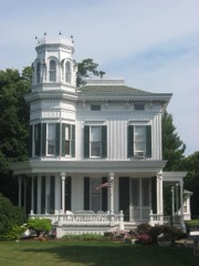
Listed on the National Register of Historic Places in
1995. A historic map-sheet match is not published yet. The record needs a coordinate-quality review before it can be joined to a sheet boundary.
From the record
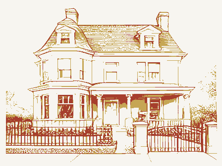
“Charles Andres House is a historic house on Middle Bass Island in Lake Erie, off the northern coast of Ohio. The house was built by winemaker Charles Andres, a German immigrant who moved to Middle Bass Island in 1854.”
Wikipedia article Charles Andres House, CC BY-SA 4.0.
one of 21 National Register listings in Ottawa County · listed in 1995 · category: Building.
National Register reference number.95001196- the number the National Park Service assigned this property when it was listed, and the key its nomination file is catalogued under at the National Archives.
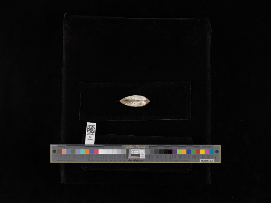
Specimens collected near this property
12 of 7,223 shown
Regional context, not property-specific
evidence. Museums hold 7,223 specimens
collected within 10 miles of Andres, Charles, House between 1871 and
1975: 6,373 Animalia, 793 Plantae, 47 Fungi, 5 Unrecorded, 5 Chromista. 12 distinct Species records are shown.
Collected by A. Bushell, A. J. Eames, A. J. Pieters and others. Each is a
physical object with a catalogue
number, and each entry opens the museum's record. This is what was
collected and kept, not a survey of what lives here - nothing can be
concluded from a species being absent.
No historic map-sheet match is published
for this property yet. That does not mean no map exists. This record needs
a coordinate-quality review before it can be joined to a sheet boundary.
Browse the county's mapped places while that work is
pending.
From the nomination file
2,898 words on record
When this property was proposed for the
National Register, someone wrote the case for it: what the building is,
and why it matters. That document is a federal record in the public domain.
It is quoted below word for word, never summarised. The text was read off the scanned case file by machine, so the
occasional stray character is the recogniser's and the 1970s
typewriter's.
Statement of significance
During the late 1800 s and early 1900 s Ohio ranked third among the states, behind at a premium, was that it was a form of land use that could support a family on only a few Of the twenty-nine Middle Bass Island subscribers listed in the 1874 atlas, twenty-two were 1866-1922 Agriculture Architecture Significant Person See continuation sheet Significant Dates German immigrants.
Charles Andres was in many ways typical of the many small winegrowers who constituted the The Charles Andres House is significant historically for its association with the Lake All twenty-nine of the Middle Bass subscribers listed included grape-growing among their Erie Islands winegrowing district and architecturally as an excellent example of the of Ottawa County and Kelleys Island and Sandusky in Erie County.In fact he Bass Islands Applicable National Register Criteria Islands region was one of the most prominent winegrowing districts in the United States. Many of the Bass Island winegrowers were immigrants from Germany who settled on the business in Sandusky and were a major sub-group within the populations of the Bass Islands.
Architect/Builder a township which includes South Bass Island, Middle Bass Island and North Bass Island in Ethnic heritage Period of Significance Andres House is one of the best preserved examples of the island's vernacular architecture. One reason for the popularity of grape growing on the islands, where land was valued the leading industry of that time in Put-In-Bay Township, Areas of Significance (enter categories from instructions) Wine growing was by far acre vineyard than an average farmer could from a 160 acre farm. employed for the production of fruit.
Quoted from the National Register nomination
for reference 95001196, 28 pages, held by the National Archives in Record
Group 79. See the
catalogue record.
Listed places nearby
4 within 8 miles
Other National Register properties close
enough to walk or drive between, ordered by distance from this one. Both
positions come from the same geocoding pass that matched these properties
to their map sheets.
Listing record. National Park Service National Register of Historic Places, listed-properties dataset, current to 2026-05-22.
Map join. Address geocoded through the United States Census geocoder, then tested against the published boundary of every sheet in the USGS Historical Topographic Map Collection.
How this page is made. Listing fields come from federal records; map-sheet coverage is a labelled coordinate-to-boundary calculation, not a source-field claim.
Specimens. Global Biodiversity Information Facility (GBIF), https://www.gbif.org/. Only records licensed CC0 or CC BY are used. Records licensed CC BY-NC are excluded because this site carries advertising. Images are checked individually and any whose licence is non-commercial, no-derivatives or unreadable is refused.
 Block
Block