 Block
Philip, South Carolina
18 topographic sheets cover this place, the earliest surveyed in 1919 and the latest in 1990. It stands in the Mount Pleasant census division. It lies in ZIP code area 29466. It lies near Parker Island. The Survey maps it on the Cainhoy quadrangle.
Topographic sheets covering this place
8 surveys from 18 printed sheetsMatched by testing this settlement's coordinate against the published boundary of every sheet in the United States Geological Survey's historical collection. Each opens the scanned sheet at the Survey.
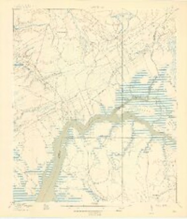
- 1919 USGS Wando quadrangle1:21120, 5 printings
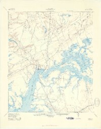
- 1943 USGS Wando quadrangle1:24000, 3 printings
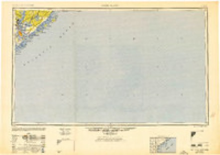
- 1948 USGS James Island quadrangle1:250000, 2 printings
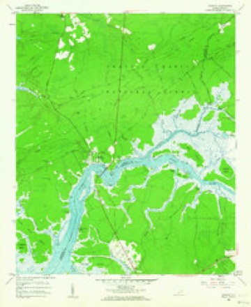
- 1958 USGS Cainhoy quadrangle1:24000, 3 printings
- 1968 USGS James Island quadrangle1:250000
- 1969 USGS James Island quadrangle1:250000, 2 printings
- 1986 USGS James Island quadrangle1:100000
- 1990 USGS James Island quadrangle1:100000
Photographs
1 photograph, 1939Taken for the Office of War Information and the Farm Security Administration, who photographed the country between 1935 and 1944. Works of United States government photographers, with no known restriction on use. Each opens its catalogue record.

Johnston, Frances Benjamin, 1939. Library of Congress
Fires near this place
173 since 1992Regional context, not property-specific evidence. The federal wildfire occurrence database lists 173 fires within 5 miles of Philip between 1992 and 2019, burning about 2,972 acres in total. 3 started naturally. 38 were recorded as arson. Distance is straight-line from the map coordinates, so a fire counted here may appear on a neighbouring settlement's page as well.
| Reported cause | Fires |
|---|---|
| Missing data/not specified/undetermined | 73 |
| Debris and open burning | 45 |
| Arson/incendiarism | 38 |
| Natural | 3 |
| Equipment and vehicle use | 3 |
| Misuse of fire by a minor | 3 |
| Smoking | 3 |
| Recreation and ceremony | 2 |
| Other causes | 2 |
| Power generation/transmission/distribution | 1 |
The most recent of them, most recent first, with the day each was reported and the service that recorded it.
| Date | Cause | Size | Reported by | Name on the report |
|---|---|---|---|---|
| 4 August 2006 | Natural | 6.2 acres | South Carolina Forestry Commission | not named |
| 21 August 1995 | Missing data/not specified/undetermined | 35 acres | South Carolina Forestry Commission | not named |
| 13 August 1995 | Missing data/not specified/undetermined | 12 acres | South Carolina Forestry Commission | not named |
| 1 August 1993 | Missing data/not specified/undetermined | 1.0 acres | South Carolina Forestry Commission | not named |
| 6 July 2007 | Debris and open burning | 5.0 acres | South Carolina Forestry Commission | not named |
| 22 July 2011 | Debris and open burning | 197 acres | South Carolina Forestry Commission | not named |
| 2 July 1996 | Missing data/not specified/undetermined | 45 acres | South Carolina Forestry Commission | not named |
| 19 July 2010 | Missing data/not specified/undetermined | 3.2 acres | South Carolina Forestry Commission | not named |
Settlements close enough to share some of these fires:
Mines and quarries near this place
6 within 5 milesRegional context, not property-specific evidence. The federal mineral resources record lists 6 workings within 5 miles of Philip: 3 past producers, 2 unknowns, 1 producer. 1 still produces. What was taken out: Sand and Gravel, Construction, Sand and Gravel, Construction, Clay, Clay, Titanium, Iron. Distance is straight-line from the map coordinates, so a quarry counted here may appear on a neighbouring settlement's page as well.
| Where | Site | Commodity | Status | Recorded |
|---|---|---|---|---|
| Island Pit | Sand and Gravel, Construction, Clay | Unknown | Sedimentary | |
| Island Pit | Sand and Gravel, Construction, Clay | Producer | ||
| Wando Quadrangle | Titanium, Iron | Unknown | Placer , Modern , Beach | |
| East Copper #1 | Sand and Gravel, Construction | Past Producer | Sedimentary | |
| R & L Pit | Sand and Gravel, Construction | Past Producer | Sedimentary | |
| Yaupon Pit | Sand and Gravel, Construction | Past Producer | Sedimentary |
Storms near this place
31 since 2007Regional context, not property-specific evidence. The National Weather Service names Philip in 31 storm reports between 2007 and 2025: 16 thunderstorm wind, 9 hail, 3 flash flood, 3 lightning. No death or injury is recorded in these reports. Each account below is quoted exactly as the forecast office filed it, from the NOAA Storm Events Database, and each date opens the federal record of that event.
| When | Event | Place named | Harm | What the report says |
|---|---|---|---|---|
| October 2015 | Flash Flood | Philip | $728,550 | Law enforcement reported several roads and intersections closed due to flooding in Mount Pleasant. Roads closed included Highway 41 at the intersection of Dunes West Boulevard, Dunes West Boulevard at the intersection of Kings Gate Lane, National Drive from the Porchers Bluff Road traffic circle, Rivertowne Parkway at the Rivertowne County Club, Carolina Park Boulevard at the intersection of Darrell Creek Trail, Guerins Bridge Road and Highway 41 between Bessemer Road and Holbeck Creek. A NWS employee also reported roads flooded and impassable due to high water in the Rivertowne subdivision. |
| October 2015 | Flash Flood | Philip | $728,550 | Law enforcement reported Highway 41 closed at Horlbeck Creek due to flooding. |
| July 2022 | Lightning | Philip | $10,000 | Charleston County dispatch reported that lightning struck a house on Daniels Pointe Boulevard and started a fire. |
| August 2019 | Lightning | Philip | $10,000 | The Charleston County 911 Call Center reported a structure fire due to lightning along the 1900 Block of Hubbell Drive. Minimal damage was reported to the 3rd floor along with water damage. |
| November 2013 | Thunderstorm Wind | Philip | $5,000 | A National Weather Service storm survey confirmed that straight line wind damage occurred with winds estimated between 65 and 75 miles per hour. A few homes had siding ripped off and minor shingle damage along Sandy Pointe Lane. A front porch also had minor damage on one home. Also, palm trees were damaged along the road. |
| June 2019 | Thunderstorm Wind | Philip | $1,750 | The public shared a picture on social media of a large tree branch that fell onto power lines near the intersection of Planters Pointe Boulevard and South Carolina 41. |
| April 2019 | Thunderstorm Wind | Philip | $1,500 | A NWS employee relayed a report of a tree limb through a car windshield. |
| August 2017 | Lightning | Philip | $1,000 | The Mount Pleasant Police Department reported a tree down due to a lightning strike near the intersection of Hamlin Road and Rifle Range Road. |
| June 2013 | Thunderstorm Wind | Philip | $1,000 | A NWS employee reported a large tree down on Rivertowne County Club Drive. |
| June 2025 | Thunderstorm Wind | Philip | - | A social media picture showed a tree down across a residential driveway along Hatchway Drive. |
| April 2022 | Thunderstorm Wind | Philip | - | The Awendaw-McClellanville Fire Department reported trees down on the 1200 Block of Hamlin Road. |
| April 2020 | Thunderstorm Wind | Philip | - | A trained spotter reported a tree snapped and down on a car along Classic Court. |
| April 2019 | Thunderstorm Wind | Philip | - | A NWS employee relayed a report of a tree uprooted in a business parking near the intersection of Highway 41 and Wood Park Drive. A parked car was also damaged. |
| April 2019 | Thunderstorm Wind | Philip | - | The media reported multiple trees down in the Dunes West neighborhood. |
| April 2019 | Thunderstorm Wind | Philip | - | A Charleston County emergency manager reported a 1 foot diameter tree uprooted and several basketball goals tipped over in Planters Pointe. |
| August 2019 | Hail | Philip | - | A social media post indicated nickel size hail outside Laurel Hill County Park. |
| September 2017 | Thunderstorm Wind | Philip | - | A National Weather Service employee reported 2 large trees down near the intersection of Highway 41 and the entrance to the Park West subdivision. |
| June 2016 | Thunderstorm Wind | Philip | - | A NWS employee reported a large tree down near the traffic circle at the entrance to Park West subdivision. |
| June 2016 | Thunderstorm Wind | Philip | - | Social media indicated trees down at Charleston National Golf Club. |
| July 2016 | Thunderstorm Wind | Philip | - | A report of a tree down in the Park West subdivision was received via Facebook. |
| July 2015 | Thunderstorm Wind | Philip | - | The public reported a tree down on a sport utility vehicle in the Dunes West subdivision of Mount Pleasant. |
| July 2015 | Thunderstorm Wind | Philip | - | A report of a tree blown down across Heathland Way in the Charleston National subdivision was received through social media. |
| September 2013 | Hail | Philip | - | The public reported nickel size hail in Park West near the Mount Pleasant Regional Airport. |
| September 2013 | Hail | Philip | - | Quarter size hail was reported near Cainhoy, SC. |
| July 2012 | Hail | Philip | - | Trained spotter reported quarter size hail at the intersection of Highway 17 and Highway 41. |
| August 2012 | Flash Flood | Philip | - | Law enforcement reports that police are assisting a motorist stranded in high water. |
| May 2008 | Hail | Philip | - | A trained weather spotter reported nickel size hail 3 miles south-southeast of Cainhoy, South Carolina. Winds were also estimated at 45 mph. |
| May 2008 | Hail | Philip | - | Golf ball sized hail was reported near the East Cooper Airport in Mount Pleasant, South Carolina. |
| May 2008 | Hail | Philip | - | Golf ball size hail was reported in the Dunes West Subdivision. The hail lasted 5 minutes. |
| June 2008 | Hail | Philip | - | The public reported quarter size hail 5 miles northeast of Mount Pleasant, South Carolina. |
| July 2007 | Hail | Philip | - | no account filed |
Nearest settlements
The eight closest, with where each one stands in the county. Distances are straight-line, computed from the Geographic Names Information System coordinates.
| Map | Place | Distance | Sheets |
|---|---|---|---|
| Martins Point Landing | 1.4 miles | 18 | |
| Porcher Bluff | 3.3 miles | 17 | |
| Whitehall Terrace | 3.6 miles | 14 | |
| Snowden | 3.6 miles | 17 | |
| Ten Mile | 3.7 miles | 13 | |
| Palmetto Fort | 3.8 miles | 17 | |
| Chandler | 4.3 miles | 13 | |
| Wando Estates | 4.3 miles | 17 |
Provenance
This settlement is recorded in the Geographic Names Information System as feature 1231647. The sheet list is computed by point-in-boundary test against the United States Geological Survey's historical topographic inventory. Both are works of the United States government and carry no copyright under 17 U.S.C. 105.
Wildfire. Short, Karen C. 2022. Spatial wildfire occurrence data for the United States, 1992-2020 [FPA_FOD_20221014]. 6th Edition. Fort Collins, CO: Forest Service Research Data Archive. https://doi.org/10.2737/RDS-2013-0009.6 Collected with United States Government funding and usable without additional permissions or fees.
Mines and quarries. USGS Mineral Resources Data System (MRDS) https://mrdata.usgs.gov/mrds/ A work of the United States government, no copyright under 17 U.S.C. 105.
Storms. NOAA National Centers for Environmental Information, Storm Events Database https://www.ncei.noaa.gov/stormevents/ A work of the United States government, no copyright under 17 U.S.C. 105. Narratives are quoted verbatim from the National Weather Service report and are not edited or summarised.