 Block
East Sioux Falls, South Dakota
8 topographic sheets cover this place, the earliest surveyed in 1955 and the latest in 1985. It stands in Sioux Falls City. It lies in ZIP code area 57110. The Survey maps it on the Brandon quadrangle. It stands 1,339 feet above sea level.
On record in East Sioux Falls
Buildings and businesses the archive holds for this place. Each opens its own page, with the source record it came from.
On the National Register within a mile 1 record
The National Register names another town for these. They stand within one mile of this settlement's coordinate.
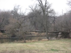 Bridge at Iverson Crossinglisted 1996 · 0.4 miles away
Topographic sheets covering this place
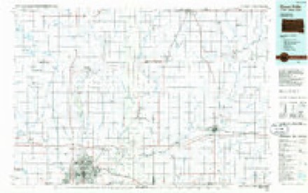
4 surveys from 8 printed sheetsMatched by testing this settlement's coordinate against the published boundary of every sheet in the United States Geological Survey's historical collection. Each opens the scanned sheet at the Survey.
- 1955 USGS Sioux Falls quadrangle1:250000, 3 printings
- 1958 USGS Sioux Falls quadrangle1:250000
- 1962 USGS Brandon quadrangle1:24000, 2 printings
- 1985 USGS Sioux Falls quadrangle1:100000, 2 printings
In the county-history sources
79,863 words on this townshipHistory of Minnehaha County, South Dakota. Containing an Account of Its Settlements, Growth, Development and Resources ... Synopsis of Public Records, Biographical Sketches .., published 1899 names this settlement in its chapter on Sioux Falls City. These are the passages that mention it, exactly as the scans read.
From the first settlement of Sioux Falls until the present time, it has been used more or less for building- purposes. The Dubucpie House, already noticed, was constructed of this stone in the roug-h, in a roug-h way, but that structure tumbled down long- ago. The Queen Bee mill is constructed of this stone, but it was erected by workmen who were masters of their trade, and it stands to-day without any appreciable sig-ns of decay. But it was not until about fifteen years ag-o that the valuable properties of this stone beg-an to be appreciated, especially its commercial value. J. H. Drake opened the Monarch quarry in the city on the east side of the river, and another quarry was opened about two miles southeast of the city, followed ])y the opening- of quarries at Dell Rapids and East Sioux Falls. It was not known until about this time that it could be easily manufactured into paving- blocks, and the methods now in use in preparing- it for Imilding- purposes were in a crude state. But paving- blocks were manufactured and shipped to Omaha and other cities, and were found to be all that could be desired for the paving- of streets upon which there is a larg-e amount of traffic. In 1888, when the question of paving- Phillips avenue in Sioux Palls came before the city council, the material to be used was thoroug-hly discussed, and althoug-h its first cost would undoubtedly be g-reater than other materials in common use for paving-, still, the well known durability of this stone, and the fact that it would be a lasting- advertisement of its admirable qualities for such purposes, broug-ht the members of the council to a unanimous vote for its adoption.
Passage source: History of Minnehaha County, South Dakota. Containing an Account of Its Settlements, Growth, Development and Resources ... Synopsis of Public Records, Biographical Sketches .., published 1899.
For several years quite an eifort was made to attract the attention of contractors and builders, and others eng-ag-ed in public improvements, to the properties of this stone and it resulted in quite extensive shipments from this city, Dell Rapids, and East Sioux Falls. Some fine public building-s were erected in Chicag-o and other cities of this material. The manufacture of paving- blocks was also quite extensively eng-ag-ed in at the points enumerated above, but the hard times lessened the demand, and the quarries, so active for awhile, have for the last few years been comparatively idle. It is a dinner-pail-brigade industry, and now that prosperity has returned, it requires only an org-anized well directed effort to bring- this inexhaustible source of wealth into the channels of commerce.
Passage source: History of Minnehaha County, South Dakota. Containing an Account of Its Settlements, Growth, Development and Resources ... Synopsis of Public Records, Biographical Sketches .., published 1899.
Machine-read from a century-old scan, so expect the errors a machine makes: misspelled names, dropped words, stray characters.
Fires near this place
62 since 1998Regional context, not property-specific evidence. The federal wildfire occurrence database lists 62 fires within 5 miles of East Sioux Falls between 1998 and 2020, burning about 1,493 acres in total. None started naturally. 3 were recorded as arson. Distance is straight-line from the map coordinates, so a fire counted here may appear on a neighbouring settlement's page as well.
| Reported cause | Fires |
|---|---|
| Missing data/not specified/undetermined | 29 |
| Debris and open burning | 15 |
| Equipment and vehicle use | 6 |
| Smoking | 4 |
| Arson/incendiarism | 3 |
| Fireworks | 2 |
| Misuse of fire by a minor | 1 |
| Railroad operations and maintenance | 1 |
| Recreation and ceremony | 1 |
The most recent of them, most recent first, with the day each was reported and the service that recorded it.
| Date | Cause | Size | Reported by | Name on the report |
|---|---|---|---|---|
| 11 September 2012 | Missing data/not specified/undetermined | 10 acres | South Dakota Wildland Fire Suppression | ALBERS |
| 9 August 2012 | Missing data/not specified/undetermined | 1.0 acres | South Dakota Wildland Fire Suppression | 2012-429 |
| 9 July 2015 | Missing data/not specified/undetermined | under an acre | South Dakota Wildland Fire Suppression | HCFD10136 |
| 7 July 2012 | Smoking | 1.0 acres | South Dakota Wildland Fire Suppression | 2012-392 |
| 5 July 2007 | Fireworks | under an acre | South Dakota Wildland Fire Suppression | not named |
| 30 July 2014 | Missing data/not specified/undetermined | 10 acres | South Dakota Wildland Fire Suppression | BIRD |
| 18 July 2007 | Recreation and ceremony | under an acre | South Dakota Wildland Fire Suppression | not named |
| 30 June 2013 | Debris and open burning | 1.0 acres | Minnehaha County | 2013-384 |
Settlements close enough to share some of these fires:
Mines and quarries near this place
10 of 19 shownRegional context, not property-specific evidence. The federal mineral resources record lists 19 workings within 5 miles of East Sioux Falls: 12 past producers, 5 producers, 2 unknowns. 5 still produce. What was taken out: Sand and Gravel, Construction, Stone, Crushed/Broken. Distance is straight-line from the map coordinates, so a quarry counted here may appear on a neighbouring settlement's page as well.
| Where | Site | Commodity | Status | Recorded |
|---|---|---|---|---|
| Quartzite Quarry | Stone, Crushed/Broken | Past Producer | ||
| Quartzite Quarry | Stone, Crushed/Broken | Past Producer | ||
| Quartzite Quarry | Stone, Crushed/Broken | Past Producer | ||
| Quartzite Quarry | Stone, Crushed/Broken | Past Producer | ||
| Brandon City Pit | Sand and Gravel, Construction | Past Producer | ||
| Brandon Materials | Sand and Gravel, Construction | Producer | ||
| City of Sioux Falls Gravel Pit | Sand and Gravel, Construction | Producer | ||
| Eagle Materials Co Cactus Hills | Sand and Gravel, Construction | Producer | ||
| Hayes Standard Gravel Co. | Sand and Gravel, Construction | Unknown | ||
| Highway Pit | Sand and Gravel, Construction | Past Producer |
Storms near this place
34 since 2008Regional context, not property-specific evidence. The National Weather Service names East Sioux Falls in 34 storm reports between 2008 and 2026: 17 hail, 10 thunderstorm wind, 4 flash flood, 2 heavy rain. The reports record 2 injuries. Each account below is quoted exactly as the forecast office filed it, from the NOAA Storm Events Database, and each date opens the federal record of that event.
| When | Event | Place named | Harm | What the report says |
|---|---|---|---|---|
| July 2008 | Lightning | East Sioux Falls | 2 hurt | A lightning strike at a construction site on the east side of Sioux Falls injured two male workers who had just begun their shift. One of the workers was hospitalized. |
| August 2021 | Thunderstorm Wind | East Sioux Falls | $30,000 | A portion of a deck overhang and half of the roof was blown off a house by thunderstorm wind gusts. The roof piece lodged against a neighbors residence. Property damage costs are a rough estimate. |
| August 2021 | Thunderstorm Wind | East Sioux Falls | $10,000 | Thunderstorm winds damaged siding and roofing on a building east of Sioux Falls. |
| August 2021 | Thunderstorm Wind | East Sioux Falls | $2,000 | Thunderstorm winds downed several large tree limbs at the Mary Jo Wegner Arboretum, some as large as one foot in diameter. Property damage costs are a rough estimate. |
| August 2021 | Thunderstorm Wind | East Sioux Falls | $2,000 | Thunderstorm wind gusts uprooted several 8 year old pine trees. Property damage costs are a rough estimate. |
| July 2025 | Thunderstorm Wind | East Sioux Falls | - | Thunderstorm wind gusts were measured by a personal weather station. |
| July 2025 | Flash Flood | East Sioux Falls | - | Areas near Veterans Parkway and 10th Street were impassible due to standing water. |
| July 2025 | Thunderstorm Wind | East Sioux Falls | - | Thunderstorm wind gusts were measured by a personal weather station. |
| July 2025 | Flash Flood | East Sioux Falls | - | Two to three feet of water inundated streets near 41st Street and Copper Creek Avenue. Water was over the tires of a trailer. |
| July 2025 | Flash Flood | East Sioux Falls | - | Two to three feet of water covered the intersection of 53rd Street and Sycamore Avenue. Photo provided in social media. |
| August 2021 | Flash Flood | East Sioux Falls | - | Water pooled up to two feet deep in the backyard of an apartment complex near 41st Street and South Dakota Highway 11. |
| July 2019 | Thunderstorm Wind | East Sioux Falls | - | Wind split a small maple tree. |
| August 2018 | Thunderstorm Wind | East Sioux Falls | - | Fence and tree damage. |
| August 2017 | Heavy Rain | East Sioux Falls | - | Reported at the intersection of 42nd and Sycamore. |
| June 2015 | Thunderstorm Wind | East Sioux Falls | - | Thunderstorm winds caused widespread tree damage. |
| June 2014 | Thunderstorm Wind | East Sioux Falls | - | Thunderstorm winds caused tree damage, including a large branch blown down. |
| April 2026 | Hail | East Sioux Falls | - | no account filed |
| April 2026 | Hail | East Sioux Falls | - | no account filed |
| July 2025 | Hail | East Sioux Falls | - | no account filed |
| July 2025 | Hail | East Sioux Falls | - | no account filed |
| May 2023 | Hail | East Sioux Falls | - | no account filed |
| April 2022 | Hail | East Sioux Falls | - | no account filed |
| May 2022 | Hail | East Sioux Falls | - | no account filed |
| May 2022 | Hail | East Sioux Falls | - | no account filed |
| May 2022 | Hail | East Sioux Falls | - | no account filed |
| August 2021 | Hail | East Sioux Falls | - | no account filed |
| August 2021 | Hail | East Sioux Falls | - | no account filed |
| August 2021 | Hail | East Sioux Falls | - | no account filed |
| June 2019 | Hail | East Sioux Falls | - | no account filed |
| August 2018 | Hail | East Sioux Falls | - | no account filed |
| August 2017 | Heavy Rain | East Sioux Falls | - | no account filed |
| June 2017 | Hail | East Sioux Falls | - | no account filed |
| June 2014 | Hail | East Sioux Falls | - | no account filed |
| June 2014 | Hail | East Sioux Falls | - | no account filed |
Nearest settlements
The eight closest, with where each one stands in the county. Distances are straight-line, computed from the Geographic Names Information System coordinates.
| Map | Place | Distance | Sheets |
|---|---|---|---|
| Anderson Subdivision | 1.1 miles | 9 | |
| Split Rock Heights | 2.2 miles | 9 | |
| Pine Lakes Addition | 2.2 miles | 9 | |
| Hill Ridge Development | 2.6 miles | 9 | |
| Rowena | 2.8 miles | 8 | |
| Ingberg Tracts | 3.0 miles | 9 | |
| Indian Hill Division | 3.1 miles | 8 | |
| Cactus Heights | 3.9 miles | 9 |
Elsewhere
Matched on this settlement's Geographic Names Information System number rather than its name, so it cannot be a different place of the same name in another state.
| Wikipedia article on East Sioux Falls | An encyclopaedic summary. Its text is share-alike, so it is linked here rather than copied. |
| Wikidata item Q5329398 | The structured record the population and elevation above come from. Public domain (CC0). |
Provenance
This settlement is recorded in the Geographic Names Information System as feature 1254861. The sheet list is computed by point-in-boundary test against the United States Geological Survey's historical topographic inventory. Both are works of the United States government and carry no copyright under 17 U.S.C. 105.
Wildfire. Short, Karen C. 2022. Spatial wildfire occurrence data for the United States, 1992-2020 [FPA_FOD_20221014]. 6th Edition. Fort Collins, CO: Forest Service Research Data Archive. https://doi.org/10.2737/RDS-2013-0009.6 Collected with United States Government funding and usable without additional permissions or fees.
Mines and quarries. USGS Mineral Resources Data System (MRDS) https://mrdata.usgs.gov/mrds/ A work of the United States government, no copyright under 17 U.S.C. 105.
Storms. NOAA National Centers for Environmental Information, Storm Events Database https://www.ncei.noaa.gov/stormevents/ A work of the United States government, no copyright under 17 U.S.C. 105. Narratives are quoted verbatim from the National Weather Service report and are not edited or summarised.