 Block
Norton Acres, South Dakota
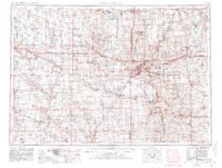
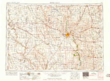
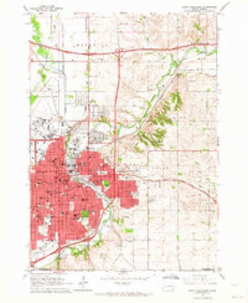
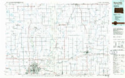
9 topographic sheets cover this place, the earliest surveyed in 1955 and the latest in 1985. It stands in Sioux Falls City. It lies in ZIP code area 57104. The Survey maps it on the Sioux Falls East quadrangle.
Topographic sheets covering this place
4 surveys from 9 printed sheetsMatched by testing this settlement's coordinate against the published boundary of every sheet in the United States Geological Survey's historical collection. Each opens the scanned sheet at the Survey.
- 1955 USGS Sioux Falls quadrangle1:250000, 3 printings
- 1958 USGS Sioux Falls quadrangle1:250000
- 1962 USGS Sioux Falls East quadrangle1:24000, 3 printings
- 1985 USGS Sioux Falls quadrangle1:100000, 2 printings
In the county-history sources
79,863 words on this townshipHistory of Minnehaha County, South Dakota. Containing an Account of Its Settlements, Growth, Development and Resources ... Synopsis of Public Records, Biographical Sketches .., published 1899 has no passage naming this settlement, which was common for smaller places. Its township is covered in full.
The chapter on Sioux Falls City covers the township.
Read the chapter on Sioux Falls City - 79,863 words.
Fires near this place
103 since 1999Regional context, not property-specific evidence. The federal wildfire occurrence database lists 103 fires within 5 miles of Norton Acres between 1999 and 2020, burning about 1,732 acres in total. 4 started naturally. 1 was recorded as arson. Distance is straight-line from the map coordinates, so a fire counted here may appear on a neighbouring settlement's page as well.
| Reported cause | Fires |
|---|---|
| Missing data/not specified/undetermined | 57 |
| Debris and open burning | 10 |
| Smoking | 9 |
| Fireworks | 8 |
| Equipment and vehicle use | 7 |
| Natural | 4 |
| Misuse of fire by a minor | 3 |
| Power generation/transmission/distribution | 2 |
| Arson/incendiarism | 1 |
| Recreation and ceremony | 1 |
| Railroad operations and maintenance | 1 |
The most recent of them, most recent first, with the day each was reported and the service that recorded it.
| Date | Cause | Size | Reported by | Name on the report |
|---|---|---|---|---|
| 25 September 2014 | Missing data/not specified/undetermined | 36 acres | South Dakota Wildland Fire Suppression | FULTON TREE LINE FIRE |
| 14 September 2020 | Railroad operations and maintenance | under an acre | South Dakota Wildland Fire Suppression | I90 FIRE |
| 6 August 2020 | Natural | 1.0 acres | South Dakota Wildland Fire Suppression | N. KIWANIS FIRE |
| 4 August 1999 | Smoking | under an acre | Alcester Volunteer Fire Department | LEE Z. |
| 25 August 1999 | Misuse of fire by a minor | under an acre | Sioux Falls Fire Department | 1605 S. SILVER CREEK |
| 2 August 2007 | Missing data/not specified/undetermined | under an acre | South Dakota Wildland Fire Suppression | not named |
| 19 August 2008 | Equipment and vehicle use | 1.0 acres | South Dakota Wildland Fire Suppression | not named |
| 11 August 1999 | Natural | 1.0 acres | Mound City Volunteer Fire Department | KON THORSTENSON |
Settlements close enough to share some of these fires:
Mines and quarries near this place
10 of 19 shownRegional context, not property-specific evidence. The federal mineral resources record lists 19 workings within 5 miles of Norton Acres: 9 producers, 7 unknowns, 3 past producers. 9 still produce. What was taken out: Sand and Gravel, Construction, Stone, Crushed/Broken. Distance is straight-line from the map coordinates, so a quarry counted here may appear on a neighbouring settlement's page as well.
| Where | Site | Commodity | Status | Recorded |
|---|---|---|---|---|
| Concrete Materials Co Quarry | Stone, Crushed/Broken | Producer | ||
| Concrete Materials Company Quarry | Stone, Crushed/Broken | Producer | ||
| Quartzite Quarry | Stone, Crushed/Broken | Unknown | ||
| Quartzite Quarry | Stone, Crushed/Broken | Unknown | ||
| Wisconsin Granite Co. | Stone, Crushed/Broken | Past Producer | ||
| Beckman Sand and Gravel Pit | Sand and Gravel, Construction | Producer | ||
| Bill Gage Gravel Pit | Sand and Gravel, Construction | Past Producer | ||
| City of Sioux Falls Gravel Pit | Sand and Gravel, Construction | Producer | ||
| Eagle Materials Co Cactus Hills | Sand and Gravel, Construction | Producer | ||
| Eagle Sand and Gravel Co. | Sand and Gravel, Construction | Unknown |
Storms near this place
17 since 2008Regional context, not property-specific evidence. The National Weather Service names Norton Acres in 17 storm reports between 2008 and 2024: 9 flood, 4 flash flood, 3 thunderstorm wind, 1 hail. No death or injury is recorded in these reports. Each account below is quoted exactly as the forecast office filed it, from the NOAA Storm Events Database, and each date opens the federal record of that event.
| When | Event | Place named | Harm | What the report says |
|---|---|---|---|---|
| September 2019 | Flood | Norton Acres | $10,000 | After excessive two-day rainfall during September 10-12 (8.74 inches at Flandreau, 7.81 inches at Dell Rapids and generally 3 to 4 inches around Sioux Falls), the Big Sioux River at Sioux Falls North Cliff (gage site SXFS2) reached the third highest stage on record of 10.06 feet above flood stage on September 14. Significant rural flooding occurred east of Sioux Falls, with the inundation of Timberline Road and parts of 60th Street north. |
| June 2010 | Thunderstorm Wind | Norton Acres | $5,000 | Thunderstorm winds blew down power poles. |
| June 2010 | Thunderstorm Wind | Norton Acres | $1,000 | Thunderstorm winds snapped a power pole at the intersection of Interstate 229 and Benson Road. |
| June 2024 | Flood | Norton Acres | - | The Big Sioux River Sioux Falls N. Cliff rose above flood stage the evening of June 21st, cresting around 5.71 feet above flood stage (21.71 feet) on June 22nd. This crest is in the Moderate Stage. The river then fell below flood stage on the morning of June 27th. For a more comprehensive description of flood damage, please see other entries for Minnehaha County. |
| August 2022 | Flash Flood | Norton Acres | - | Multiple vehicles were stranded in high water in the streets of northern and western Sioux Falls. |
| July 2021 | Thunderstorm Wind | Norton Acres | - | A semi-truck was tipped over by thunderstorm winds near Interstate 90 mile marker 401. |
| June 2019 | Flood | Norton Acres | - | A continuation of flooding from May, the Big Sioux River at Sioux Falls N. Cliff (gage site SXFS2) began the month at 2.72 feet above flood stage. Significant amounts of agricultural land downstream of Sioux Falls remained flooded, and further impeded spring planting. |
| July 2019 | Flood | Norton Acres | - | The Big Sioux River at Sioux Falls North Cliff Avenue (gage site SXFS2) crested 1.54 feet above flood stage on July 17. 60th Street North and Timberline Road were inundated by water, along with considerable amounts of crop and pasture land. |
| March 2019 | Flood | Norton Acres | - | Snow melt and heavy rainfall (measured 2.74 inches at Hartford, 2.25 inches at Colton and 2.49 inches at Sioux Falls) resulted in extensive flooding of agricultural land downstream of Sioux Falls. The Big Sioux River at Sioux Falls North Cliff Avenue (gage site SXFS2) reached a crest 4.97 feet above flood stage on March 15. The river would crest again later in the month due to water routed from upstream melting (separate entry). |
| March 2019 | Flood | Norton Acres | - | The second, and higher crest of the month, The Big Sioux River at Sioux Falls North Cliff Avenue (gage site SXFS2) reached a crest 6.06 feet above flood stage on March 26. The river remained in moderate flood stage at the end of the month. |
| July 2019 | Flash Flood | Norton Acres | - | Up to 2 feet of water pooling in street. 17 vehicles were reported stranded in high water. |
| May 2019 | Flood | Norton Acres | - | This is a continuation of flooding from April. The Big Sioux River at Sioux Falls North Cliff Ave. (gage site SXFS2) spent all but a brief period from May 17-21 in flood. Late month rains pushed the river to a crest into moderate flood stage at 4.09 feet above flood stage on May 30. Significant agricultural flooding persisted, with no opportunity for spring planting throughout the flood plain. The river remained at moderate flood stage at the end of the month. |
| April 2019 | Flood | Norton Acres | - | Runoff from occasional precipitation in late March and April maintained significant flooding of agricultural land near the Big Sioux River east of Sioux Falls. The Big Sioux River at Sioux Falls North Cliff Avenue (gage site SXFS2) crested twice at moderate flood stage during the month. The first crest was 4.58 feet above flood stage on April 1, with a second crest at 3.77 feet above flood stage on April 22. Minor flooding continued at the end of the month. |
| September 2018 | Flood | Norton Acres | - | Rainfall across the Sioux Falls metro area from September 18-20 totaled generally 4 to 7 inches. Minor flooding resulted along the Big Sioux River with crop and pasture land downstream of Sioux Falls impacted by flood waters as the Big Sioux River at North Cliff Avenue in Sioux Falls (gage site SXFS2) briefly crested 0.1 foot above flood stage on September 21. |
| June 2011 | Flash Flood | Norton Acres | - | Heavy rain caused flooding of several streets in Sioux Falls. |
| June 2008 | Flash Flood | Norton Acres | - | Heavy rain caused flash flooding in the industrial park on the north side of Sioux Falls, and enough flooding of roads to stall vehicles on the west side of Sioux Falls. |
| May 2022 | Hail | Norton Acres | - | no account filed |
Nearest settlements
The eight closest, with where each one stands in the county. Distances are straight-line, computed from the Geographic Names Information System coordinates.
| Map | Place | Distance | Sheets |
|---|---|---|---|
| Froelich Addition | 0.8 miles | 9 | |
| Sioux Falls | 1.9 miles | 9 | |
| Cactus Heights | 2.3 miles | 9 | |
| Meadow View Addition | 3.0 miles | 9 | |
| Martindale Addition | 3.3 miles | 9 | |
| Ingberg Tracts | 3.3 miles | 9 | |
| Skyline Heights | 3.7 miles | 9 | |
| Swanson's Tracts | 3.7 miles | 9 |
Provenance
This settlement is recorded in the Geographic Names Information System as feature 1259253. The sheet list is computed by point-in-boundary test against the United States Geological Survey's historical topographic inventory. Both are works of the United States government and carry no copyright under 17 U.S.C. 105.
Wildfire. Short, Karen C. 2022. Spatial wildfire occurrence data for the United States, 1992-2020 [FPA_FOD_20221014]. 6th Edition. Fort Collins, CO: Forest Service Research Data Archive. https://doi.org/10.2737/RDS-2013-0009.6 Collected with United States Government funding and usable without additional permissions or fees.
Mines and quarries. USGS Mineral Resources Data System (MRDS) https://mrdata.usgs.gov/mrds/ A work of the United States government, no copyright under 17 U.S.C. 105.
Storms. NOAA National Centers for Environmental Information, Storm Events Database https://www.ncei.noaa.gov/stormevents/ A work of the United States government, no copyright under 17 U.S.C. 105. Narratives are quoted verbatim from the National Weather Service report and are not edited or summarised.