 Block
Sioux Falls, South Dakota
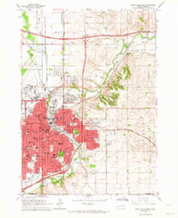
9 topographic sheets cover this place, the earliest surveyed in 1955 and the latest in 1985. It stands in Sioux Falls City. It lies in ZIP code area 57103. The Survey maps it on the Sioux Falls East quadrangle. 192,517 people lived here at the 2020 count. It stands 1,470 feet above sea level.
Research this city
On record in Sioux Falls
Buildings and businesses the archive holds for this place. Each opens its own page, with the source record it came from.
On the National Register 12 of 74 shown
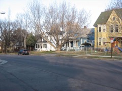 All Saints Historic Districtlisted 1984
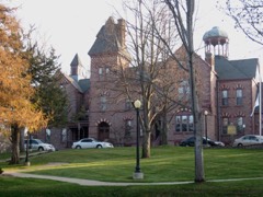 All Saints School Main Buildinglisted 1973
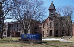 Augustana College Historic Buildingslisted 1977
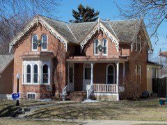 Marion E. Bowen Houselisted 1976
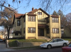 Brooks Brothers Homelisted 1996
 Carnegie Free Public Librarylisted 1973
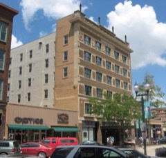 Carpenter Hotellisted 1986
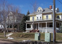 Cathedral Historic Districtlisted 1974
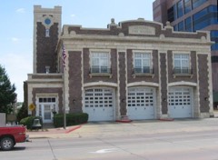 Central Fire Stationlisted 1980
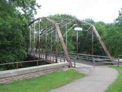 Cherry Rock Park Bridgelisted 2003
 Edward Coughran Houselisted 1976
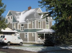 E. J. and Alice Daniels Houselisted 1989
Population over time
15 figuresSioux Falls grew from 2,164 to 192,517 between 1880 and 2020. These are the recorded population figures Wikidata holds for this place, reached through the Geographic Names Information System number this page is keyed on rather than by name, so they belong to this place and not to another of the same name. Most are census counts, but not all are: an early figure may be a founding or settlement estimate, and an estimate published within five years of a census is left out. The change column is computed, and is left blank where more than 20 years separate a figure from the one before it, because a gap that long is not a change between two counts.
| Year | People | Change |
|---|---|---|
| 1880 | 2,164 | |
| 1890 | 10,177 | +8,013 (+370%) |
| 1900 | 10,266 | +89 (+1%) |
| 1910 | 14,094 | +3,828 (+37%) |
| 1920 | 25,202 | +11,108 (+79%) |
| 1930 | 33,362 | +8,160 (+32%) |
| 1940 | 40,832 | +7,470 (+22%) |
| 1950 | 52,969 | +12,137 (+30%) |
| 1960 | 65,466 | +12,497 (+24%) |
| 1970 | 72,488 | +7,022 (+11%) |
| 1980 | 81,182 | +8,694 (+12%) |
| 1990 | 100,814 | +19,632 (+24%) |
| 2000 | 123,975 | +23,161 (+23%) |
| 2010 | 153,888 | +29,913 (+24%) |
| 2020 | 192,517 | +38,629 (+25%) |
Topographic sheets covering this place
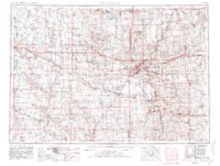
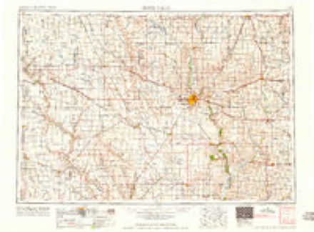
4 surveys from 9 printed sheetsMatched by testing this settlement's coordinate against the published boundary of every sheet in the United States Geological Survey's historical collection. Each opens the scanned sheet at the Survey.
- 1955 USGS Sioux Falls quadrangle1:250000, 3 printings
- 1958 USGS Sioux Falls quadrangle1:250000
- 1962 USGS Sioux Falls East quadrangle1:24000, 3 printings
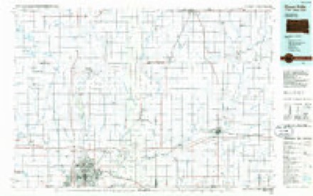
- 1985 USGS Sioux Falls quadrangle1:100000, 2 printings
In the county-history sources
79,863 words on this townshipHistory of Minnehaha County, South Dakota. Containing an Account of Its Settlements, Growth, Development and Resources ... Synopsis of Public Records, Biographical Sketches .., published 1899 names this settlement in its chapter on Sioux Falls City. These are the passages that mention it, exactly as the scans read.
Causes of deaths in Minnehaha county and City of Sioux Falls: Scarlet fever, county 3, city 4; measles, city i ; diphtheria and croup, county 10, city 3; enteric fever, county 7, city 2; malarial fever, county i; diarrheal diseases, county 11, city 5; cancer and tumors, county 2; consumption, county 4, city 7; pneumonia, county 9, city 4; childbirth and puerperal diseases, county 3, city I.
Passage source: History of Minnehaha County, South Dakota. Containing an Account of Its Settlements, Growth, Development and Resources ... Synopsis of Public Records, Biographical Sketches .., published 1899.
It was at this juncture of aifairs that the writer became a resident of Sioux Falls, and had the pleasure of listening- to the report of this committee, consisting- of L. S. Swezev and A. C. Phillips. .V g-ood deal of interest was manifest at these meeting-s, and very few, if any, of the provisions of the proposed charter escaped discussion. When the charter had been completed by the committee and received the sanction of the public in the form of a bill for enactment by the territorial leg-islature then in session at Yankton, it was conveyed there by a committee, and became a law on March 3, 1883.
Passage source: History of Minnehaha County, South Dakota. Containing an Account of Its Settlements, Growth, Development and Resources ... Synopsis of Public Records, Biographical Sketches .., published 1899.
The first city election took place on the 3d day of April, 1883, and it was the last one held at a sing-le polling- place. The contest for mayor was spirited. There were three candidates in the field, namely, Jacob Schaetzel, Jr., C. W. Hubbard and Dexter J. Knapp; 806 votes were cast, Schaetzel receiving- 414, Hubbard 376 and Knapp 16. By referring- to the list of city officials it will be seen that a strong- council was elected, and for business capacity, the mayor and aldermen who had in charg-e the aifairs of the city the first year of its existence, has not been surpassed if equaled since then. The city, of course, inherited the ()l:>lig'ations of the \illag-e as well as its assets. The Daily Press, at the time Sioux Falls became a city, published the following- statement of the debits and credits of the defunct village: "The financial condition of the villag-e at this time shows that the amount of indebtedness on account of the g-eneral fund was S22,20(); the village was bonded to the amount of S2<),000 for aid in securing- the earlier completion of the St. Paul Railroad; the indebtedness on account of the board of education inchidint*- bonds was S2(),80O, makino- a total inde])tedness of about S69,000, to be assumed by the city. The total assets to be turned over to the city niav be enumerated as follows: fire apparatus worth $7,000; real estate in the way of lots, eng'ine and truck houses, prison, etc., $2,- 500; rio-ht of way and depot jj-rounds for the Milwaukee Railroad, S6,- 500; school property, including- thirty-two city lots, three brick school houses and one frame, S33,000; for the S20,()00 railroad bonds the villa<j-e was amply compensated, at but a small per cent of the amount other communities have paid for similar enterprises, which made the total assets S69,000, an exact balance for the indebtedness it was called upon to assume."
Passage source: History of Minnehaha County, South Dakota. Containing an Account of Its Settlements, Growth, Development and Resources ... Synopsis of Public Records, Biographical Sketches .., published 1899.
Machine-read from a century-old scan, so expect the errors a machine makes: misspelled names, dropped words, stray characters.
Read the whole chapter on Sioux Falls City - it names this place 148 more 148 times.
Fires near this place
74 since 1999Regional context, not property-specific evidence. The federal wildfire occurrence database lists 74 fires within 5 miles of Sioux Falls between 1999 and 2020, burning about 114 acres in total. 2 started naturally. 1 was recorded as arson. Distance is straight-line from the map coordinates, so a fire counted here may appear on a neighbouring settlement's page as well.
| Reported cause | Fires |
|---|---|
| Missing data/not specified/undetermined | 35 |
| Fireworks | 9 |
| Debris and open burning | 8 |
| Equipment and vehicle use | 7 |
| Smoking | 5 |
| Misuse of fire by a minor | 3 |
| Natural | 2 |
| Other causes | 1 |
| Arson/incendiarism | 1 |
| Railroad operations and maintenance | 1 |
| Recreation and ceremony | 1 |
| Power generation/transmission/distribution | 1 |
The most recent of them, most recent first, with the day each was reported and the service that recorded it.
| Date | Cause | Size | Reported by | Name on the report |
|---|---|---|---|---|
| 25 September 2014 | Missing data/not specified/undetermined | 36 acres | South Dakota Wildland Fire Suppression | FULTON TREE LINE FIRE |
| 4 August 1999 | Smoking | under an acre | Alcester Volunteer Fire Department | LEE Z. |
| 25 August 1999 | Misuse of fire by a minor | under an acre | Sioux Falls Fire Department | 1605 S. SILVER CREEK |
| 2 August 2007 | Missing data/not specified/undetermined | under an acre | South Dakota Wildland Fire Suppression | not named |
| 11 August 1999 | Natural | 1.0 acres | Mound City Volunteer Fire Department | KON THORSTENSON |
| 9 July 2015 | Missing data/not specified/undetermined | under an acre | South Dakota Wildland Fire Suppression | HCFD10136 |
| 7 July 2012 | Smoking | 1.0 acres | South Dakota Wildland Fire Suppression | 2012-392 |
| 6 July 2007 | Fireworks | under an acre | South Dakota Wildland Fire Suppression | not named |
Settlements close enough to share some of these fires:
Mines and quarries near this place
10 of 20 shownRegional context, not property-specific evidence. The federal mineral resources record lists 20 workings within 5 miles of Sioux Falls: 9 producers, 7 unknowns, 4 past producers. 9 still produce. What was taken out: Sand and Gravel, Construction, Stone, Crushed/Broken. Distance is straight-line from the map coordinates, so a quarry counted here may appear on a neighbouring settlement's page as well.
| Where | Site | Commodity | Status | Recorded |
|---|---|---|---|---|
| Concrete Materials Co Quarry | Stone, Crushed/Broken | Producer | ||
| Concrete Materials Company Quarry | Stone, Crushed/Broken | Producer | ||
| Quartzite Quarry | Stone, Crushed/Broken | Unknown | ||
| Quartzite Quarry | Stone, Crushed/Broken | Unknown | ||
| Quartzite Quarry | Stone, Crushed/Broken | Past Producer | ||
| Quartzite Quarry | Stone, Crushed/Broken | Past Producer | ||
| Wisconsin Granite Co. | Stone, Crushed/Broken | Past Producer | ||
| Beckman Sand and Gravel Pit | Sand and Gravel, Construction | Producer | ||
| Bill Gage Gravel Pit | Sand and Gravel, Construction | Past Producer | ||
| City of Sioux Falls Gravel Pit | Sand and Gravel, Construction | Producer |
Storms near this place
60 of 327 shownRegional context, not property-specific evidence. The National Weather Service names Sioux Falls in 327 storm reports between 1993 and 2026: 169 hail, 96 thunderstorm wind, 32 flash flood, 13 flood. The reports record 1 death and 6 injuries. Each account below is quoted exactly as the forecast office filed it, from the NOAA Storm Events Database, and each date opens the federal record of that event.
| When | Event | Place named | Harm | What the report says |
|---|---|---|---|---|
| May 2022 | Thunderstorm Wind | Sioux Falls | 1 killed | A tree was blown down onto a house. A large tree was also blown down on a car which resulted in the fatality of the driver. |
| July 2008 | Lightning | East Sioux Falls | 2 hurt | A lightning strike at a construction site on the east side of Sioux Falls injured two male workers who had just begun their shift. One of the workers was hospitalized. |
| August 2013 | Hail | South Sioux Falls | 1 hurt, $1,000,000 | Large hail damaged numerous vehicles and broke windows. A woman suffered minor injuries from the hail after taking refuge in a vehicle. |
| September 2019 | Thunderstorm Wind | South Sioux Falls | 1 hurt, $750,000 | Significant damaging winds impacted areas for several blocks around 41st Street and Glendale Avenue. Two apartment buildings had roofs torn off. One injury resulted from roof debris collapsing on a person in a single-family home. The fabric portion of an inflatable sports dome was destroyed by the strong winds. Numerous large trees were uprooted or snapped, blocking roadways and damaging a few homes. |
| June 2003 | Thunderstorm Wind | Sioux Falls | 1 hurt, $10,000 | Thunderstorm winds blew a truck off Interstate 29, injuring the driver. The winds also blew the roof off a garage. |
| April 2001 | Lightning | Sioux Falls | 1 hurt, $5,000 | Lightning struck a house, injuring a man standing in the wet basement of the house. The lightning also damaged the roof and a wall of the house. |
| June 2004 | Flash Flood | Sioux Falls | $10,000,000 | Rainfall of 3 to 8 inches caused flooding of numerous basements. Structural damaged was caused to several of the basements as walls caved in. Ground floors of several residences, businesses, and schools were flooded, including a dentists office. There was significant damage to contents in the flooded buildings, including carpets, furniture, clothing, electronic equipment, and electric wiring. A mobile home park was especially hard hit, with all 37 units in the park flooded, and some units completely washed out. Many roads were flooded, and several were partly washed out, mainly at intersections. One parking lot caved in, with a driver barely escaping in his vehicle. Water and sewer lines were damaged during the cave-ins of the lot and of the basements. Several vehicles were damaged by flooding. Several parks in the city were flooded and closed, as was the zoo. |
| August 2013 | Hail | West Sioux Falls | $4,000,000 | Large hail broke windows and damaged many vehicles, as well as siding and roofs. One automobile dealer with a large temporary outdoor display reported four thousand vehicles were damaged. |
| September 2019 | Tornado (EF2) | South Sioux Falls | $3,000,000 | Shortly after touchdown just southeast of O'Gorman High School, the tornado struck a multi-story apartment building and removed a majority of the roof. Numerous trees were uprooted in residential areas north of 41st Street as the tornado continued in a general southeast direction. The tornado crossed 41st Street into a more commercial district, causing significant structural damage to several businesses, including the removal of the roof from one strip mall and exterior walls from another building. After another quarter mile of travel to the southeast, the tornado destroyed an apartment building garage. The tornado lifted before reaching the corner of 49th Street and Western Avenue. Average path width was 50 yards. Property damage costs are rough estimates. |
| June 2014 | Hail | South Sioux Falls | $3,000,000 | Large hail caused widespread damage to vehicles, windows, roofs, and siding. |
| June 2001 | Hail | Sioux Falls | $2,000,000 | Large hail severely damaged vehicles and also broke windows and damaged siding in some buildings. The hail was reported at several places around the city, but the damage was greatest in the southeast part of Sioux Falls.One insurance company expected about three thousand claims from vehicle owners. |
| June 2001 | Hail | Sioux Falls | $2,000,000 | no account filed |
| June 2001 | Hail | Sioux Falls | $2,000,000 | no account filed |
| June 2001 | Hail | Sioux Falls | $2,000,000 | no account filed |
| June 2001 | Hail | Sioux Falls | $2,000,000 | no account filed |
| June 2001 | Hail | Sioux Falls | $2,000,000 | no account filed |
| June 2001 | Hail | Sioux Falls | $2,000,000 | no account filed |
| June 2001 | Hail | Sioux Falls | $2,000,000 | no account filed |
| March 2019 | Flood | South Sioux Falls | $1,450,000 | Snow melt and heavy rainfall (measured 2.74 inches at Hartford, 2.25 inches at Colton, and 2.49 inches at Sioux Falls) resulted in extensive flooding of the Sioux Falls park system near the natural channel of the Big Sioux River around the southern side of Sioux Falls. Water, and the broken ice cover from the river system, caused extensive damage to city property with numerous bridges and buildings completely destroyed, equipment damaged, and miles of bike trail washed out. Around 80 homes were inundated by floodwater with evacuation of 17 residents and their pets, as water reached the highest levels since construction of the homes. Water filled the tunnel on 57th Street under Interstate 229, flowed onto several portions of Interstate 229, and over 26th Street east of Interstate 229 and Cliff Avenue south of I-229. The Big Sioux River at Western Avenue (gage site WAVS2) reached the highest stage on record cresting 9.15 feet above flood stage on March 14. The river remained at minor flood stage at the end of the month. Property damage costs are rough estimates. |
| May 1993 | Hail | Sioux Falls | $500,000 | Large hail dented many cars on the east side of Sioux Falls. |
| July 2002 | Flash Flood | Sioux Falls | $150,000 | Heavy rain caused flooding of numerous streets, and caused sewers to back up in a four block area. At least 60 homes suffered significant damage from the flooding of basements by the sewer backup. |
| August 2013 | Hail | Sioux Falls | $100,000 | Large hail, driven by estimated 55 mph winds, damaged vehicles, broke windows, and damaged siding. |
| August 2013 | Thunderstorm Wind | South Sioux Falls | $100,000 | Thunderstorm winds damaged several businesses, including a large retail store which was also struck by lightning. The large store lost part of its roof, while the stockroom of the same store and its contents were also damaged. A canopy type tent was destroyed, and a 20 foot retaining wall was blown down. The winds caused extensive tree damage, including several trees blown down, one of which blocked a major intersection when it fell. |
| August 2013 | Hail | South Sioux Falls | $100,000 | Large hail was accompanied by estimated 55 mph winds. The hail damaged vehicles in the area. |
| August 2002 | Flash Flood | Sioux Falls | $100,000 | Heavy rainfall up to six and a half inches caused widespread street flooding. There was around a foot of standing water in many places, and several motorists were stranded trying to drive through flooded areas. Many basements were also flooded. At least one basement wall collapsed, and another suffered severe cracking. |
| June 2001 | Thunderstorm Wind | Sioux Falls | $100,000 | Thunderstorm winds caused tree and power line damage. One large tree severely damaged a moving car when it was blown over. |
| May 2000 | Hail | Sioux Falls | $100,000 | Large hail broke windows in homes and damaged vehicles. |
| June 2000 | Lightning | Sioux Falls | $100,000 | Lightning struck a tree, part of which fell on a house, heavily damaging the roof and upper floor. A fire. either from the lightning or from the tree falling on the house, caused further damage. |
| June 1999 | Thunderstorm Wind | Sioux Falls | $100,000 | Thunderstorm winds blew down concrete walls of a store under construction, and caused tree damage. |
| September 2019 | Thunderstorm Wind | Sioux Falls | $50,000 | The facing and part of the roof of a business was torn off by thunderstorm winds. Surrounding areas had significant damage to trees, with several snapped or uprooted. |
| September 2019 | Thunderstorm Wind | South Sioux Falls | $50,000 | Winds collapsed a residential structure and trapped three people. However, none were injured. |
| August 2015 | Flash Flood | Sioux Falls | $50,000 | Heavy rainfall of 3 to 5 inches caused flooding of streets with water a foot deep. |
| August 1996 | Thunderstorm Wind | Sioux Falls | $50,000 | no account filed |
| August 2021 | Thunderstorm Wind | East Sioux Falls | $30,000 | A portion of a deck overhang and half of the roof was blown off a house by thunderstorm wind gusts. The roof piece lodged against a neighbors residence. Property damage costs are a rough estimate. |
| September 2019 | Thunderstorm Wind | South Sioux Falls | $25,000 | Significant tree damage occurred at Tomar, Yankton Trails, and Tuthill Parks. Numerous large trees were snapped or uprooted. |
| September 2019 | Thunderstorm Wind | Sioux Falls | $20,000 | Several trees down, with one onto a residence causing damage to roof and siding. |
| September 2002 | Lightning | Sioux Falls | $20,000 | Lightning struck a house, causing an attic fire. |
| April 2001 | Lightning | Sioux Falls | $20,000 | Lightning destroyed a church steeple. The strike scattered many pieces of stone from the steeple over the ground near the church, some pieces as many as 100 feet away. Several vehicles were damaged by the stone pieces. |
| August 2000 | Thunderstorm Wind | Sioux Falls | $20,000 | Thunderstorm winds caused tree damage and blew shingles off some roofs. |
| June 1999 | Hail | Sioux Falls | $20,000 | Large hail dented 18 vehicles at the Army National Guard station, and broke windows in several of the vehicles. |
| June 1996 | Thunderstorm Wind | Sioux Falls | $20,000 | no account filed |
| August 2021 | Thunderstorm Wind | East Sioux Falls | $10,000 | Thunderstorm winds damaged siding and roofing on a building east of Sioux Falls. |
| September 2019 | Flood | South Sioux Falls | $10,000 | After excessive two-day rainfall during September 10-12 (8.74 inches at Flandreau, 7.81 inches at Dell Rapids, and generally 3 to 4 inches around Sioux Falls), the Big Sioux River at Western Avenue (gage site WAVS2) reached the 9th highest stage on record of 5.21 feet above flood stage on September 13. Extensive flooding of city parks within the greenway occurred, along with high water closing portions of east 41st Street near Lincoln High School. |
| June 2009 | Thunderstorm Wind | South Sioux Falls | $10,000 | Thunderstorm winds blew down trees and power lines, and damaged power poles. |
| July 2005 | Lightning | Sioux Falls | $10,000 | Lightning struck a house, setting fire to the roof. The attic and some of the siding were damaged. |
| June 2001 | Thunderstorm Wind | Sioux Falls | $10,000 | Thunderstorm winds destroyed a barn. |
| April 2004 | Hail | Sioux Falls | $10,000 | no account filed |
| April 2004 | Hail | Sioux Falls | $10,000 | no account filed |
| June 2020 | Thunderstorm Wind | Sioux Falls | $5,000 | Shingles were blown off a house. Property damage costs are rough estimates. |
| September 2019 | Flash Flood | Sioux Falls | $5,000 | Water ponded to a depth of 2 to 3 feet near 33rd Street and Minnesota Avenue. |
| June 2010 | Thunderstorm Wind | South Sioux Falls | $5,000 | Thunderstorm winds blew down light poles. |
| September 2005 | Thunderstorm Wind | Sioux Falls | $5,000 | Thunderstorm winds damaged an airplane and blew out about a dozen car windows at Joe Foss Field. |
| June 1999 | Thunderstorm Wind | Sioux Falls | $5,000 | Thunderstorm winds caused tree damage. |
| September 1997 | Thunderstorm Wind | Sioux Falls | $5,000 | Thunderstorm winds blew in car windows and caused tree damage. |
| July 1995 | Thunderstorm Wind | Sioux Falls | $5,000 | Thunderstorm Winds of unknown speed flipped over a mobile home in transit. |
| July 1997 | Thunderstorm Wind | Sioux Falls | $5,000 | no account filed |
| October 1997 | Thunderstorm Wind | Sioux Falls | $5,000 | no account filed |
| August 2021 | Thunderstorm Wind | East Sioux Falls | $2,000 | Thunderstorm winds downed several large tree limbs at the Mary Jo Wegner Arboretum, some as large as one foot in diameter. Property damage costs are a rough estimate. |
| August 2021 | Thunderstorm Wind | East Sioux Falls | $2,000 | Thunderstorm wind gusts uprooted several 8 year old pine trees. Property damage costs are a rough estimate. |
| September 2019 | Thunderstorm Wind | Sioux Falls | $2,000 | Several large trees were uprooted or snapped. |
Nearest settlements
The eight closest, with where each one stands in the county. Distances are straight-line, computed from the Geographic Names Information System coordinates.
| Map | Place | Distance | Sheets |
|---|---|---|---|
| Cactus Heights | 1.9 miles | 9 | |
| Norton Acres | 1.9 miles | 9 | |
| Froelich Addition | 2.5 miles | 9 | |
| Ingberg Tracts | 2.9 miles | 9 | |
| South Sioux Falls (historical) | 3.1 miles | 9 | |
| Split Rock Heights | 3.1 miles | 9 | |
| Pine Lakes Addition | 3.4 miles | 9 | |
| Hill Ridge Development | 3.5 miles | 9 |
Elsewhere
Matched on this settlement's Geographic Names Information System number rather than its name, so it cannot be a different place of the same name in another state.
| Wikipedia article on Sioux Falls | An encyclopaedic summary. Its text is share-alike, so it is linked here rather than copied. |
| Wikidata item Q131335 | The structured record the population and elevation above come from. Public domain (CC0). |
Provenance
This settlement is recorded in the Geographic Names Information System as feature 1267670. The sheet list is computed by point-in-boundary test against the United States Geological Survey's historical topographic inventory. Both are works of the United States government and carry no copyright under 17 U.S.C. 105.
Wildfire. Short, Karen C. 2022. Spatial wildfire occurrence data for the United States, 1992-2020 [FPA_FOD_20221014]. 6th Edition. Fort Collins, CO: Forest Service Research Data Archive. https://doi.org/10.2737/RDS-2013-0009.6 Collected with United States Government funding and usable without additional permissions or fees.
Mines and quarries. USGS Mineral Resources Data System (MRDS) https://mrdata.usgs.gov/mrds/ A work of the United States government, no copyright under 17 U.S.C. 105.
Storms. NOAA National Centers for Environmental Information, Storm Events Database https://www.ncei.noaa.gov/stormevents/ A work of the United States government, no copyright under 17 U.S.C. 105. Narratives are quoted verbatim from the National Weather Service report and are not edited or summarised.