This documentation was initiated as a mitigation measure prior to the federally funded construction of the Route 146/Massachusetts Turnpike Interchange Project by the Massachusetts Highway Department. This documentation was prepared between April and September by: Richard E. Greenwood, Industrial Archaeologist, in association with the University of Massachusetts Archaeological Services, The Environmental Institute, Blaisdell House, University of Massachusetts, Amherst, MA c See also "Blackstone Canal Lock No. 24" (HAER No. MA-78) BLACKSTONE CANAL WORCESTER-MILLBURY SEGMENT HAER No.
MA-146 (Page 2) Historical Narrative Blackstone Canal Company The Blackstone Canal Company, chartered in in both Massachusetts and Rhode Island, was the enterprise of a consortium of Providence merchants and capitalists interested in expanding Providence's commercial hinterland, and a smaller group of their counterparts in Worcester eager to stimulate local agriculture and industry. The venture, which was inspired by the success of the Erie Canal, benefitted directly from the wealth of training and experience that the nascent American engineering profession had gained during the construction of the New York canal.
The canal promoters hired Benjamin Wright, the chief engineer of the middle section of the Erie Canal, to supervise the initial survey of the Providence to Worcester route in The field survey in was carried out by Holmes Hutchinson of Utica, New York, another Erie Canal engineer. Hutchinson returned to conduct the detailed resurveyJ in and to oversee construction from to The 45-mile-long canal ran most of the way in the Blackstone River valley except for a 5-mile stretch in the Moshassuck River valley at the southern end. It alternated its course between sections of dug trench and stretches of slackwater navigation in the river.
Forty-eight stone locks and one of wood enabled boats to overcome the rise in elevation from tidewater in Providence to the terminal basin in Worcester.2 The canal trench was designed as a "prism," i.e. with a trapezoidal cross section, generally measuring 34' wide at the top, tapering to 18' at the bottom and containing 4' of water. 1 For a complete history of the Blackstone Canal, see Richard E. Greenwood, A History of the Blackstone Canal, (Providence: Rhode Island Historical Preservation Commission, MS . 2 Ibid, pp. The best record of the canal route is "A Map of the Blackstone Canal and its Appendages as constructed in the year compiled by actual survey by E.N. Phelps, Resident Engineer".
This hand-drawn and tinted map was prepared by Edward Phelps as the resident engineer for the Blackstone Canal Company. Stott suggests the map was produced in based on information in the John W. Lincoln correspondence, Blackstone Canal Company Papers, American Antiquarian Society. The Phelps map is in the library of the Rhode Island Historical Society. BLACKSTONE CANAL WORCESTER-MILLBURY SEGMENT HAER No. MA-146 (Page 3) The side walls were built on3 a 1/2 slope, with the banks rising at least 3' above the water. The canal was essentially an earthen structure created by work crews using picks, shovels, and wheelbarrows to excavate and embank.
For construction purposes Hutchinson divided the canal into sixty-seven sections which were then let to individual contractors who assembled their small work teams. The construction contracts included general provisions, such as the clause that stipulated only the "most pure, solid and compact and water-tight earth" be used in constructing the canal banks. "Vegetable mould, leaves, roots, sticks and brush" were expressly prohibited.4 Individual contracts might also include more detailed construction requirements. The prices paid for this work varied according to conditions, more being paid for digging through hardpan or digging below a certain depth. The price paid to the contractor per cubic yard of excavation ranged from 7.5 cents to 18 cents.
For embankment, payment reached as high as 27 cents per cubic yard. Common laborers on the canal received approximately $12 a month.5 The locks that connected the canal levels were essentially stone chambers, 10' wide and 82' long between the gates, with an average lift of Lock 43 had a lift of The construction of the lock began with excavation of the lockpit. As the floor of the pit was to be some 2' to 3' below the water level, a pump was employed to facilitate the work. Once the sills and plank floor were constructed, masons built the chamber walls and abutments. The stonework was granite, 5' thick at the base and approximately 13' high. The exposed faces of the walls were built of coursed split granite blocks with hammered beds and dressed faces; the backing of the walls was rubble.
The facing courses were laid in the best water lime then available, the Chittinango, New York, lime which had been discovered during the 3 Ibid, pp. 4 Surviving construction contracts, "Articles of Agreement", can be found in the Brown Family Papers, PB 52 (John Carter Brown Library MSS Collection); and the Edward Carrington Papers (Rhode Island Historical Society Library MSS Collection). 5 Greenwood, A History of the Blackstone Canal, pp. This information has been culled from construction contracts in the Brown Family Papers and the ledger entries in the Carrington Collection. 6 "Field Book No. 3"; Blackstone Canal Company Collection, Worcester Historical Museum. BLACKSTONE CANAL WORCESTER-MILLBURY SEGMENT HAER No. MA-146 (Page 4) construction of the Erie Canal.
After the masonry was completed, carpenters then hung a pair of gates at either end of the chamber. Each pair of gates was fitted with paddle gates at the bottom which were opened to fill or drain the chamber.7 Canal construction also required several types of ancillary structures, including stone culverts to carry streams under the berms and prevent erosion, and wooden bridges with stone abutments, to carry roads and farm lanes over the canal. Worcester-Millbury Level When Hutchinson laid out the Massachusetts route in he located the canal at the north end of Millbury and south end of Worcester in a dug trench on the east side of the Blackstone River.
The present-day Worcester-Millbury Segment includes much of the canal's Mile 40, and comprises most of a single level which originally stretched between Locks 43 and 44. The lower lock. Lock 43, was located approximately south of the Worcester-Millbury city/town line; the upper lock, Lock 44, was located approximately north of the line. The canal in this segment was built at the edge of the river's floodplain by cutting into the hillside on the east and using the excavated earth to build an embankment on the west. The west bank, which carried the towpath, followed a straight course, while the east bank occasionally followed the natural contours of the hillside or widened to provide lay-bys for canal boats.8 Hutchinson's "Field Book No.
3" indicates that the Worcester- Millbury Segment fell within Sections 62 and Jeremiah Gay and Sons were the contractors for Section 62 and 63 (as well as Sections .10 The Canal's Mixed Legacy The canal was fully operational by the fall of and though the next several years were not without problems, the Company began to see the first returns on its investment. However this period of prosperity was brief, as several factors 7 Ibid, pp. 8 See the Phelps map. 9 "Field Book No. 3"; Blackstone Canal Company Collection, Worcester Historical Museum. 10 Allen, Assistant Engineer, to John Davis, Esq., October PB 52, Brown Family Papers. BLACKSTONE CANAL WORCESTER-MILLBURY SEGMENT HAER No. MA-146 (Page 5) combined to bring a premature end to the canal's use for water- borne transportation.
The canal's problems included the seasonal interruptions caused by winter ice, summer drought and floods, as well as a water rights dispute with the mill owners on the lower Blackstone River.11 The single greatest cause of the canal's failure, however, was the advent of the railroad. Jealous of Providence's incursion into Worcester County, Boston's commercial interests turned to the newly matured technology of the steam-powered railroad. The Boston and Worcester Railroad was begun in and 12 completed in with a branch line to Millbury opened by The railroad provided faster service throughout the year and its impact was immediate. In revenue from canal tolls dropped by 20 percent and the canal ceased to be a paying venture.
It continued to operate on a limited basis, however, until the Providence and Worcester Railroad, chartered in and completed in assumed the canal's role as the primary freight and passenger carrier in the Blackstone Valley.13 The legal history of the Blackstone Canal Company in Massachusetts ended in when the legislature allowed the company to sell off its property in that state. In Rhode Island, the Canal Company's initial attempts to dissolve itself were frustrated by the opposition of the mill owners on the Blackstone River. Although many of them had initially opposed the canal, they came to rely on its system of dams, reservoirs, and feeder canals for regulating the river's flow.14 After several petitions 11 A discussion of the controversy over water rights can be found in Richard E.
Greenwood, "Natural Run and Artificial Falls: Waterpower and the Blackstone Canal," in Rhode Island History, May Vol. 49, No. 2, pp 12 Charles F. Adams, Railroads: Their Origin and Problems (New York: Putnam's Sons, pp. 13 Richard Bayles, ed.. History of Providence County (New York: Preston & Co., Vol. I, p. George A. Stockwell, "Millbury" in History of Worcester County (Boston: Jewett & Co., Vol. II, p. Charles G. Washburn, Industrial Worcester (Worcester, Mass: Davis Press, p. 56.
14 Holmes Hutchinson had initially created this system to satisfy the complaints of these manufacturers; the storage reservoirs were designed to supply the Blackstone River with additional water to offset the water that the canal diverted from the lower Blackstone River into the Moshassuck River in Smithfield, Rhode Island. By storing surplus waters from the rainy months, the BLACKSTONE CANAL WORCESTER-MILLBURY SEGMENT HAER No.
MA-146 (Page 6) to the legislature, the Canal Company was finally allowed to liquidate its Rhode Island holdings in The Blackstone Canal proved to be a costly failure for its investors, absorbing and returning approximately in tolls.15 However, as William Lincoln observed in the canal was "more useful to the public than to the owners," as the canal stimulated economic growth along its route, especially in the upper Blackstone Valley towns such as Millbury.16 Some of this growth was a result of the canal's beneficial effect on water power on the Blackstone River, created by its storage reservoirs and the artificially elevated waters of the canal, which offered new or enhanced opportunities for water-power generation in a number of locations.17 The long stretch of canal south of Lock 43 was one such location and not long after the canal was abandoned in Massachusetts local developers acted to take advantage of it.
The section north of Lock 43 was apparently abandoned though maps from the Walling map of Worcester County to the USGS Worcester South, Massachusetts, quadrangle map continue to show it as a waterway, presumably fed by runoff from the upland to the east.18 Since the abandonment of the Worcester-Millbury Segment in the mid-nineteenth century, there have been numerous incidents of dumping, filling, and borrowing along its length.
Although the mid-twentieth century reconstruction of the old Worcester- Millbury Road (State Route as a four-lane divided highway largely spared this segment, the filled slopes of the present Route 146/Route 20 overpass and ramps, and the eastern abutment of the Route 20 bridge over the Blackstone River, were built over reservoirs also reduced the danger of floods and helped alleviate the summer droughts that plagued water-powered industry. 15 Greenwood, A History of the Blackstone Canal, p. 97. 16 William Lincoln, History of Worcester (Worcester: p. 17 See Richard E. Greenwood, "Natural Run and Artificial Falls: Waterpower and the Blackstone Canal", Rhode Island History, Vol. Vol. 49, No. 2, May pp. 18 Henry F. Walling, "Map of Worcester County, Massachusetts" (Boston: Wm. E.
Baker & Co., United States Geological Survey, "Worcester South, Massachusetts" Quadrangle Map, edition. BLACKSTONE CANAL WORCESTER-MILLBURY SEGMENT HAER No. MA-146 (Page 7) the segment's southern terminus. No visible evidence currently exists for either Lock 43 or Lock 44; presumably the finish stone of both locks was salvaged at some time after Holmes Hutchinson Engineer of the Blackstone Canal Holmes Hutchinson obtained his training in canal design and construction on the Erie Canal. At the commencement of the Blackstone Canal enterprise, Hutchinson was a section engineer on the Erie under the direction of Chief Engineer, Benjamin Wright. Hutchinson assisted Wright in the initial survey for the Blackstone Canal and then took over for the final survey and the construction.
Hutchinson returned to the Erie Canal, serving as Chief Engineer between and During his tenure there he designed and supervised the construction of the Erie's first enlargement. He was also the chief engineer of the Cumberland and Oxford Canal, a 20-mile long canal running between Sebago Lake and Portland, Maine, which opened in and he worked with James F. Baldwin in the initial surveys for a railroad route across western Massachusetts.19 Physical Description The Worcester-Millbury Segment of the Blackstone Canal as it presently exists runs some in a generally north-south orientation at an angle of approximately 350 degrees.
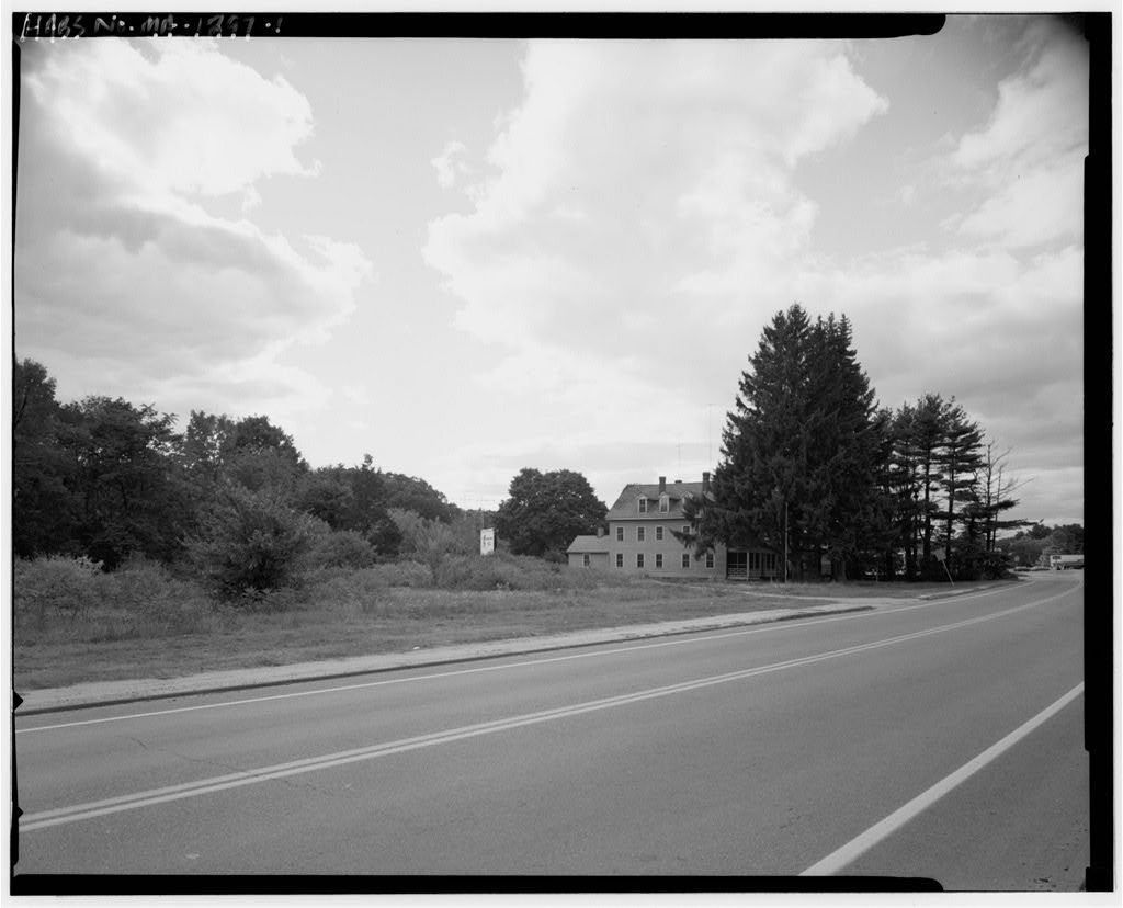
The segment terminates at the south against the filled embankments of the Route 20/Route 146 interchange; at the north, against the filled driveway of a commercial operation located southwesterly of the junction of Ballard and Millbury Streets. The canal, in this segment, still conforms in general outline to its layout as recorded in the Phelps map. However, the results of a major post- canal dumping/filling operation (the so-called "town line dump") now essentially divide the Worcester-Millbury Segment into separate sections on either side of the town line. The long Worcester portion of this segment is relatively intact.
The 19 Stott, Peter, "Reports on Several Sites Along the Blackstone Canal in Northbridge and Uxbridge" (Massachusetts Department of Environmental Management, November, Endnote 2, p. 16, cites Bagg, The Pioneers of Utica (Utica, NY: Curtiss & Childs, pp. and Bagg, ed., Memorial History of Utica, (Syracuse, New York: D. Mason & Co., pp. for biographical information on Hutchinson. Also see Daniel H. Calhoun, The American Civil Engineer, Origins and Conflicts (Cambridge, Mass.: MIT Press, for Hutchinson's work on railroad surveying. BLACKSTONE CANAL WORCESTER-MILLBURY SEGMENT HAER No.
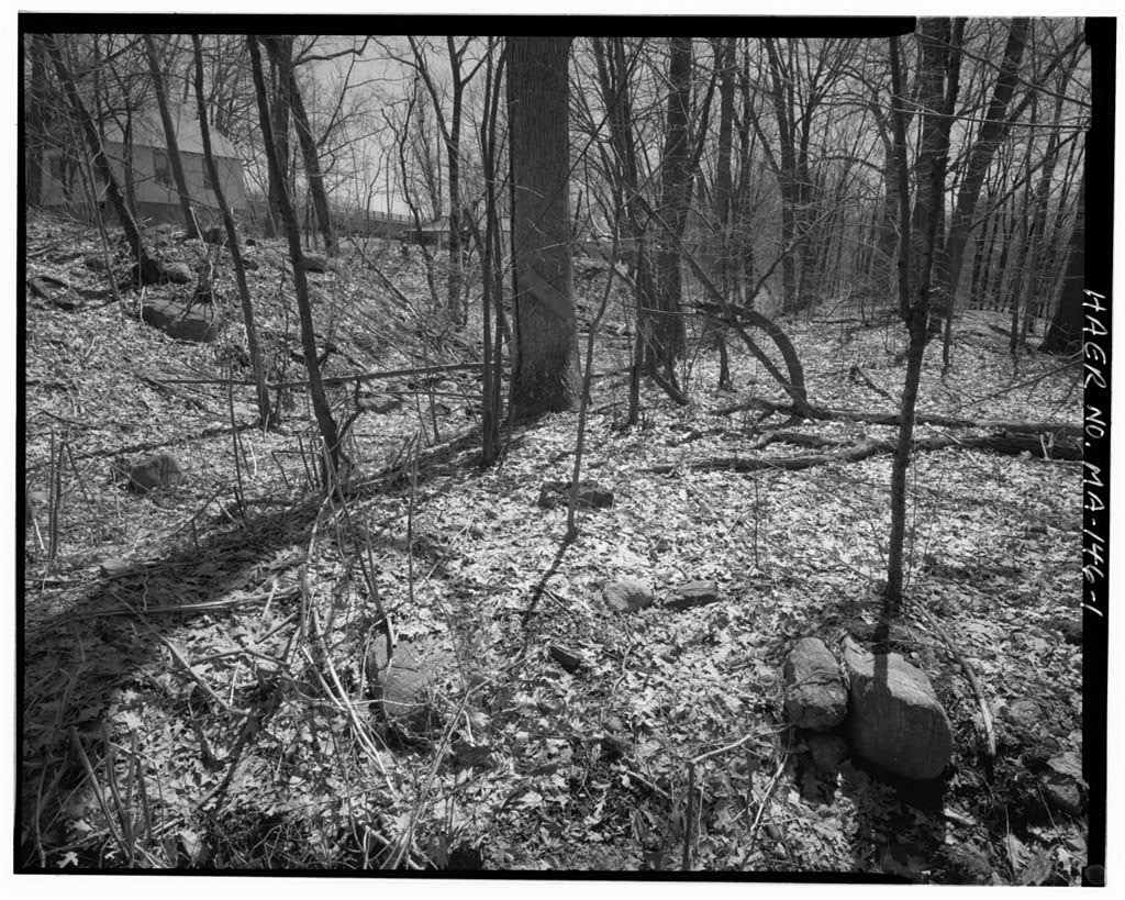
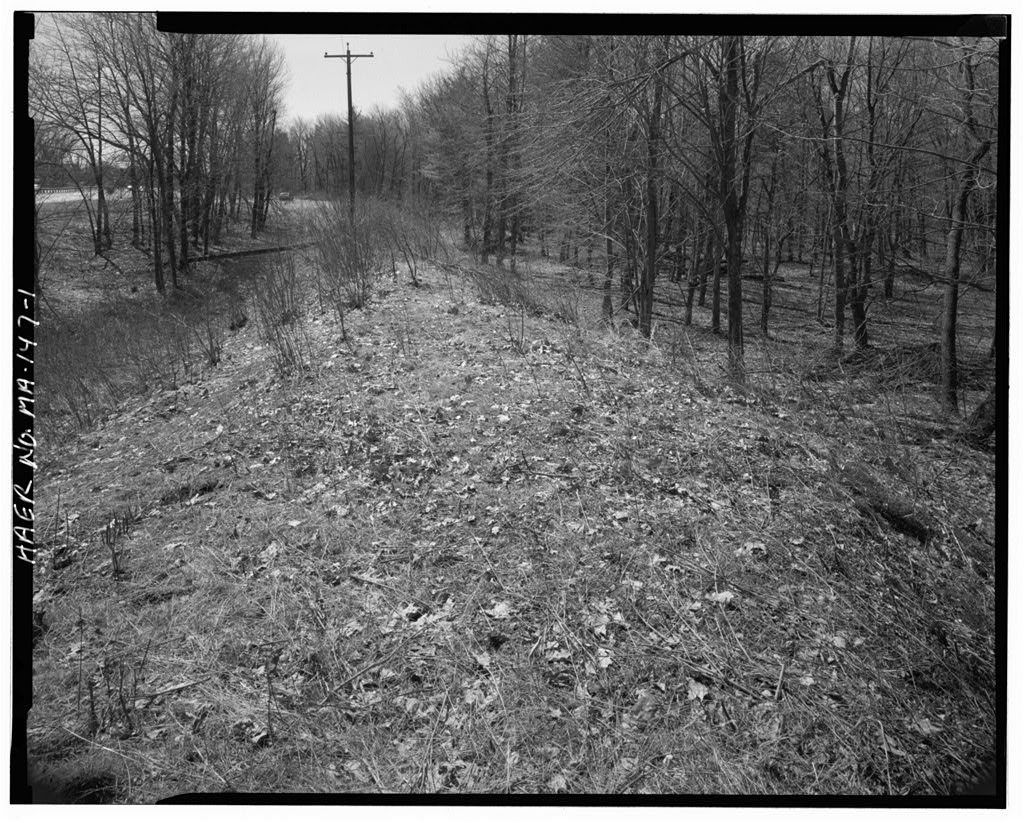
MA-146 (Page 8) 850'-long Millbury portion (the actual subject of this documentation), has been much more heavily disturbed.20 The Millbury portion of the Worcester-Millbury Segment contains two surviving stretches of the canal's towpath, prism, and berm, separated by a filled area (carrying an access road) and an excavated borrow pit. The northerly stretch of the canal, some long, preserves a relatively intact cross-section of the towpath, canal prism, and berm, with some encroaching dump areas from the houselots to the east.
Only a short section of the approximately 325'-long southerly stretch preserves a full-width canal cross-section the northerly end of the towpath has been mined for gravel, and the embankment of the Routes access ramps encroaches upon the eastern berm before terminating the canal prism itself. An intensive (locational) survey conducted by the Public Archaeology Laboratory Inc.
(PAL) as part of the Route 146 improvement project 21 identified these surviving fragments of the canal in In the PAL conducted archaeological site examinations at this location, which provided detailed information on the canal's structure.22 The PAL investigations determined a bottom width for the prism of and a top width of The towpath is wide at the top.23 Both berms are presently covered with volunteer plants and shrubs. The Phase II investigations determined that the earthen towpath berm is built of silty to coarse sand with gravel, apparently deposited from nearby excavation. It is trapezoidal in section, 20 Marsha King, Virginia H.
Adams & Ronald Dalton, "Archaeological Site Examinations of Two Blackstone Canal Segments in Worcester and Millbury, Massachusetts and the Mill Brook Sewer Portal in Worcester, Massachusetts"; PAL, Inc. Report No. (PAL: July Revised November, p. 51. 21 Marsha King, Virginia Fitch, and Ronald Dalton, "Intensive Archaeological Survey of the Route 146 Corridor in Worcester and Millbury" (Public Archaeology Laboratory: October Revised August Revised May 22 M. King, V. H. Adams, and R. Dalton, "Archaeological Site Examinations of Two Blackstone Canal Segments." 23 Ibid, pp. BLACKSTONE CANAL WORCESTER-MILLBURY SEGMENT HAER No.
MA-146 (Page 9) measuring approximately in height above the canal bed, with the inner (canal) slope rising at a 50 degree angle and the outer slope at approximately 40 degrees. These measurements should be considered approximate as erosion and flood deposition have modified the dimensions of the berm. The eastern berm appears to have been created by the excavation of the canal prism, with little if any embankment necessary. The top of the berm is approximately above the historic bed of the canal, with the inner slope rising at an angle of 30 degrees. Phase II investigations within the base of the canal prism identified an upper level of many strata consisting of very thin bands of silt, sandy silt, clayey silt, and gravel extending from the modern ground surface to a depth of 2'.
Beneath these sedimentary layers is a stratum of medium to coarse sand, which appears to be the natural subsoil level at which the canal excavation ceased. The canal bed contained no evidence of "puddling", the constructed clay seal used on other canals. This absence of puddling is consistent with the documentary record and other archaeological investigations on the Blackstone Canal. However, the excavations did locate a natural clay lens some 3' to 4' below the canal bed, which provides some indication why a constructed clay seal was not needed.24 The Phase II investigations found no clear evidence of Lock 43 at the southern end of the segment.
Although there was a stone wall lining the river side of the towpath berm at its southerly termination (perhaps to control erosion), there was no stonework within the trench itself. It is likely that the lock was disassembled for its stone not long after the canal was abandoned. 24 Ibid, pp. BLACKSTONE CANAL WORCESTER-MILLBURY SEGMENT HAER No. MA-146 (Page 10) SOURCES OF INFORMATION A. Engineering Drawings. No engineering drawings for this segment of the canal have been found. B. Historic Views. No historic views of this segment of the canal have been found. C. Bibliography. Manuscripts and Unpublished Documents Blackstone Canal Company Collection, Worcester Historical Museum, Worcester, Massachusetts. Brown Family Papers, John Carter Brown Library, Providence, Rhode Island.
Edward Carrington Papers, Rhode Island Historical Society Library, Providence, Rhode Island. Thomas A. Jenckes Papers, Rhode Island Historical Society Library, Providence, Rhode Island. Worcester County Registry of Deeds, Worcester, Massachusetts. Books and Articles Adams, Charles F., Railroads: Their Origin and Problems (New York: Putnam's Sons, Bayles, Richard, ed., History of Providence County, 2 vols. (New York: Preston & Co., Calhoun, Daniel H., The American Civil Engineer, Origins and Conflicts (Cambridge, Massachusetts: MIT Press, Greenwood, Richard E., "Natural Run and Artificial Falls: Waterpower and the Blackstone Canal," in Rhode Island History, May Vol. 49, No. 2, pp Hurd, D. Hami1ton, History of Worcester County. Massachusetts, 2 vols.
(Philadelphia: Lewis & Co., Lincoln, William, History of Worcester (Worcester: . BLACKSTONE CANAL WORCESTER-MILLBURY SEGMENT HAER No. MA-146 (Page 11) Stockwell, George A., "Millbury" in History of Worcester County, 2 vols. (Boston: Jewett & Co., pp. Washburn, Charles G., Industrial Worcester (Worcester, Massachusetts: Davis Press, Government Documents and Reports Adams, Virginia, "Blackstone Canal Historic District [Massachusetts]" National Register of Historic Places Nomination Form, Greenwood, Richard E., A History of the Blackstone Canal, (Rhode Island Historical Preservation Commission, . King, Marsha, Virginia H.
Adams, and Ronald Dalton, "Archaeological Site Examinations of Two Blackstone Canal Segments in Worcester and Millbury, Massachusetts and the Mill Brook Sewer Portal in Worcester, Massachusetts"; PAL, Inc. Report No. (PAL: July Revised November, King, Marsha, Virginia Fitch, and Ronald Dalton, "Intensive Archaeological Survey of the Route 146 Corridor in Worcester and Millbury" (Public Archaeology Laboratory: October Revised August Revised May Morenon, E. Pierre, and Michael S. Raber, "A Phase I Archaeological Survey of the Blackstone River Bikeway in Rhode Island: Archaeological Properties Between Providence and Woonsocket," Occasional Papers in Archaeology, Number 53, Rhode Island College, Providence, Rhode Island.
Stott, Peter, "Reports on Several Sites Along the Blackstone Canal in Northbridge and Uxbridge" (Massachusetts Department of Environmental Management, November, Haps "Map of the Town of Millbury and Villages of Millbury, West Millbury and Bramanville, Worcester Co., Mass." (New York: New York Publishing House, "Town of Millbury" in New Topographical Atlas of the City of Worcester (Philadelphia: Richards and Company, p. Phelps, Edward N., "A Map of the Blackstone Canal and its Appendages as constructed in the year compiled by actual BLACKSTONE CANAL WORCESTER-MILLBURY SEGMENT HAER No. MA-146 (Page 12) survey by E.N. Phelps, Resident Engineer" (Blackstone Canal Company Collection, Rhode Island Historical Society).
United States Geological Survey, "Worcester South, Massachusetts" Quadrangle Map, editions. Walling, Henry F., "A Map of Worcester County, Massachusetts" {Boston: Wm. E. Baker & Co., I BLACKSTONE CANAL WORCESTER-MILLBURY SEGMENT HAER No. MA-146 (Page 13) Location Map. [USGS Worcester South, Massachusetts Quad.,
 Block
Block