This documentation was initiated as a mitigation measure prior to the federally funded construction of the Route 146/Massachusetts Turnpike Interchange Project by the Massachusetts Highway Department. This documentation was prepared between April and September by: Richard E. Greenwood, Industrial Archaeologist, in association with the University of Massachusetts Archaeological Services, The Environmental Institute, Blaisdell House, University of Massachusetts, Amherst, MA See also "Blackstone Canal Lock No. 24" (HAER No. MA-78) I BLACKSTONE CANAL MILLBURY SEGMENT HAER No.
MA-147 (Page 2) Historical Narrative The Millbury Segment of the Blackstone Canal has, in effect, two histories; the first as a transportation canal and the second as part of the industrial water-power system of the Greenwood Mills/Burling Mills. The first history begins with the construction of this canal between Providence, Rhode Island, and Worcester, Massachusetts, between and and concludes with its abandonment in The second history involves the development and operation of a water-powered mill site on the canal between ca. and ca.
Blackstone Canal Company The Blackstone Canal Company, chartered in in both Massachusetts and Rhode Island, was the enterprise of a consortium of Providence merchants and capitalists interested in expanding Providence's commercial hinterland, and a smaller group of their counterparts in Worcester eager to stimulate local agriculture and industry. The venture, which was inspired by the success of the Erie Canal, benefitted directly from the wealth of training and experience that the nascent American engineering profession had gained during the construction of the New York canal.
The canal promoters hired Benjamin Wright, the chief engineer of the middle section of the Erie Canal, to supervise the initial survey of the Providence to Worcester route in The field survey in was carried out by Holmes Hutchinson of Utica, New York, another Erie Canal engineer. Hutchinson returned to conduct the detailed resurvey in and to oversee construction from to The 45-mile long canal ran most of the way in the Blackstone River valley except for a 5-mile stretch in the Moshassuck River valley at the southern end. It alternated its course between sections of dug trench and stretches of slackwater navigation in the river.
Forty-eight stone locks and one of wood enabled boats to overcome the rise in elevation from tidewater in Providence to the terminal basin in Worcester.2 1 For a complete history of the Blackstone Canal, see Richard E. Greenwood, A History of the Blackstone Canal, (Providence, Rhode Island: Rhode Island Historical Preservation Commission, MS 2 Ibid, pp. The best record of the canal route is "A Map of the Blackstone Canal and its Appendages as constructed in the year compiled by actual survey by E.N. Phelps, Resident Engineer." This hand-drawn and tinted map was prepared by Edward BLACKSTONE CANAL MILLBURY SEGMENT HAER No.
MA-147 (Page 3) The canal trench was designed as a "prism," i.e., with a trapezoidal cross-section, generally measuring 34' wide at the top, tapering to 18' at the bottom and containing 4' of water. The side walls were built on a 1/2 slope, with the banks rising at least 3' above the water. The canal was essentially an earthen structure created by work crews using picks, shovels, and wheelbarrows to excavate and embank. For construction purposes Hutchinson divided the canal into sixty-seven sections which were then let to individual contractors who assembled their small work teams. The construction contracts included general provisions, such as the clause that stipulated only the "most pure, solid and compact and water-tight earth" be used in constructing the canal banks.
"Vegetable mould, leaves, roots, sticks and brush" were expressly prohibited.3 Individual contracts might also include more detailed construction requirements. Millbury Level When Hutchinson laid out the Massachusetts route in he located the canal between Millbury Village and the Worcester town line in a dug trench on the east side of the Blackstone River. The steep slopes of Millbury Hill and Prospect Hill necessitated the construction of six locks at Millbury Village, but these were followed by a level section over 1.5 miles long before the next lock, Lock 43, just south of the Worcester town line. This level subsequently became the Burling Mills Canal.
The canal south of Lock 43 was built at the edge of the river's floodplain by cutting into the hillside on the east and using the excavated earth to build an embankment on the west. The west bank, which carried the towpath, followed a straight course, while the east bank occasionally followed the natural contours of the hillside or widened to provide lay-bys for canal boats.4 Phelps as the resident engineer for the Blackstone Canal Company. Stott suggests the map was produced in based on information in the John W. Lincoln correspondence, Blackstone Canal Company Papers, American Antiquarian Society. The Phelps map is in the library of the Rhode Island Historical Society.
3 Surviving construction contracts, "Articles of Agreement", can be found in the Brown Family Papers, PB 52 (John Carter Brown Library MSS Collection); and the Edward Carrington Papers (Rhode Island Historical Society Library MSS Collection). 4 See the Phelps map. BLACKSTONE CANAL MILLBURY SEGMENT HAER No. MA-147 {Page 4) Hutchinson's "Field Book No.
3" indicates that the Millbury Segment fell within Section 61 and a small portion of Section Jeremiah Gay and Sons were the contractors for Section 62 (as well as Sections and Section but the contractor for Section 61 is unknown.6 Elihu Ewers of Manlius, New York, was the contractor responsible for much of the canal construction on top of Millbury Hill, Sections 58 and 59, and he or the Gays may have completed Section 61 as well.7 Ewers's contract for Sections 58 and 59 calls for the prism to be 30' wide at the top, 18' wide at the bottom, with a water depth of 4'.
He was to be paid 17 cents per cubic yard for excavated earth and 27 cents per cubic yard for the earth to be carted to build the western embankment.8 The Canal's Mixed Legacy The canal was fully operational by the fall of and though the next several years were not without problems, the Company began to see the first returns on its investment. However this period of prosperity was brief, as several factors combined to bring a premature end to the canal's use for water- borne transportation. The canal's problems included the seasonal interruptions caused by winter ice, summer drought, and floods, as well as a water rights dispute with the mill owners on the lower Blackstone River.9 The single greatest cause of the canal's failure, however, was the advent of the railroad.
Jealous of Providence's incursion into Worcester County, Boston's commercial interests turned to the newly matured technology of the steam-powered railroad. The Boston and Worcester Railroad was begun in and completed in 5 "Field Book No. 3"; Blackstone Canal Company Collection, Worcester Historical Museum. 6 Allen, Assistant Engineer, to John Davis, Esq., October PB 52, Brown Family Papers. 7 "Articles of Agreement" with Elihu Ewers, January 15, PB 52, Brown Family Papers. 8 Ibid. 9 A discussion of the controversy over water rights can be found in Richard E. Greenwood, "Natural Run and Artificial Falls: Waterpower and the Blackstone Canal," in Rhode Island History, May Vol. 49, No. 2, pp. BLACKSTONE CANAL MILLBURY SEGMENT HAER No.
MA-147 (Page 5) with a branch line to Millbury opened by The railroad provided faster service throughout the year and its impact was immediate. In revenue from canal tolls dropped by 20 percent and the canal ceased to be a paying venture. It continued to operate on a limited basis, however, until the Providence and Worcester Railroad, chartered in and completed in assumed the canal's role as the primary freight and passenger carrier in the Blackstone Valley.11 The legal history of the Blackstone Canal Company in Massachusetts ended in when the legislature allowed the company to sell off its property in that state. In Rhode Island, the Canal Company's initial attempts to dissolve itself were frustrated by the opposition of the mill owners on the Blackstone River.
Although many of them had initially opposed the canal, they came to rely on its system of dams, reservoirs, and feeder canals for regulating the river's flow.12 After several petitions to the legislature, the Canal Company was finally allowed to liquidate its Rhode Island holdings in The Blackstone Canal proved to be a costly failure for its investors, absorbing and returning approximately in tolls.13 However, as William Lincoln observed in the canal was "more useful to the public than to the owners," as the canal stimulated economic growth along its route. 10 Charles F. Adams, Railroads: Their Origin and Problems {New York: Putnam's Sons, pp. 11 Richard Bayles, ed., History of Providence County (New York: Preston & Co., Vol. I, p. George A.
Stockwell, "Millbury" in History of Worcester County (Boston: Jewett & Co., Vol. II, p. Charles G. Washburn, Industrial Worcester {Worcester, Massachusetts: Davis Press, p. 56. 12 Holmes Hutchinson had initially created this system to satisfy the complaints of these manufacturers; the storage reservoirs were designed to supply the Blackstone River with additional water to offset the water that the canal diverted from the lower Blackstone River into the Moshassuck River in Smithfield, Rhode Island. By storing surplus waters from the rainy months, the reservoirs also reduced the danger of floods and helped alleviate the summer droughts that plagued water-powered industry. 13 Greenwood, A History of the Blackstone Canal, p. 97. BLACKSTONE CANAL MILLBURY SEGMENT HAER No.
MA-147 (Page 6) especially in the upper Blackstone Valley towns such as Millbury.14 Some of this growth was a result of the canal's beneficial effect on water power on the Blackstone River, which was not confined to its storage reservoirs. The artificially elevated waters of the canal also offered new or enhanced opportunities for water-power generation in a number of locations.
Certain manufacturers in Rhode Island (some of whom were officers in the Canal Company) had recognized this prior to canal construction and were able to establish large mills on these artificial mill privileges while the canal was in operation.15 The long stretch of canal north of Millbury Hill was a location with similar manufacturing potential, and not long after the canal was abandoned in Massachusetts local developers acted to take advantage of it. The Canal and Water Power The canal's potential value as a millrace lay in its capacity for receiving water from the river at a higher elevation and carrying that water in its nearly level trench to a point where it was considerably higher than the river.
The water in its fall to the lower elevation could then be used to turn a waterwheel and thereby generate mechanical power. The potential energy represented by the river's drop between the Worcester line and Millbury Village had been present before the canal's construction, but until the Canal Company arrived, no one had undertaken the considerable physical and financial investment needed to harness it. Several modifications were necessary to adapt the canal level below Lock 43 for water-power generation. The complete history of the process is not known, but the basic stages can be established. These included the construction of a feeder dam on the river and a feeder canal to provide a steady flow of water into the canal.
The optimum place to build the dam and feeder was in the vicinity of Lock 43, where the river and canal were at nearly the same elevation. The waterwheel and the mill itself would be placed at the opposite end of the canal, at a point 14 William Lincoln, History of Worcester (Worcester: p. 15 These included the Farnum mill at Waterford, Edward Carrington's Hamlet Mill and Brown and Ives' Lonsdale Mills, all in Smithfield, Rhode Island. See Greenwood, "Natural Run and Artificial Falls: Waterpower and the Blackstone Canal", pp. 59- 62. BLACKSTONE CANAL MILLBURY SEGMENT HAER No. MA-147 (Page 7) where the waterfall, and the potential energy it represented could be maximized, and there was a suitable building location.
Coogan's Hill The earliest historical account of the new mill site at the southerly end of this canal level states that Asa Waters (of the prominent family of manufacturers in Millbury Village) "secured16 the privilege and built the dam" after the canal was abandoned. Waters's connection has not been corroborated. Instead, the land records indicate that James Benchley initiated efforts to establish a dam here in However Benchley's role was a brief one and it was Michael Coogan who was most closely associated with the first mill at this privilege.
Michael Coogan reportedly built this first mill in and he operated it for a time as a woolen mill, producing beaver cloth.18 Coogan was a native of Ireland who left his original 19 profession as a gardener to become a wool manufacturer." The earliest depiction of Coogan's 20 mill is on the Henry Walling map of Worcester County. The Walling map shows the canal terminating at the mill a short distance below McCracken Road. Although it does not appear on the map, the feeder dam had been built across the Blackstone River north of the Worcester town line and a feeder canal connected with the main canal just south of the site of Lock There is no clear 16 Stockwell, p.
This would have been Asa Holman Waters His father, Colonel Asa Waters, who was the founder of the famous small arms manufactory known as Armory Village, died in 17 Worcester County Registry of Deeds Book p. 85. 18 Stockwell, p. 19 See Virginia Adams, "Blackstone Canal Historic District [Massachusetts]" National Register of Historic Places Nomination Form, Item 8, p. 28. 20 Henry F. Walling, "Map of Worcester County, Massachusetts" (Boston: Wm. E. Baker & Co., 21 Book pp. The PAL archaeologists located the site of the feeder dam, which they tentatively identified as a bridge, in their investigations. See Marsha King, Virginia H. Adams, and Ronald Dalton, "Archaeological Site Examinations of BLACKSTONE CANAL MILLBURY SEGMENT HAER No.
MA-147 (Page 8) evidence whether the spillway was a part of the water-power system at this point. However, a spillway or waste weir to carry off excess water in time of flood or when the gates to the waterwheel were closed would have been a likely component in the system.22 The manner in which the canal ran directly into the mill strongly suggests that there was a means to draw off water from the canal upstream from the mill. Otherwise the mill would be in considerable jeopardy in the event of a flood. Greenwood Mills The next figure to become involved in the mill site was Henry H. Chamberlin. Chamberlin was associated with Coogan for a time in wool manufacturing and then, in April purchased several parcels from Coogan and neighboring landowners.
His key purchase from Coogan was the "Greenwood Mills".23 The Greenwood Mills referred to Coogan's mill site and probably took its name from its location on land formerly part of the Greenwood farmstead. One of Chamberlin's deeds makes reference to his acquisition of "Coogan's upper privilege"; judging by the general absence of any documentary references to a lower privilege at this site it is probable that the majority 24 of the water power was concentrated at the upper privilege. Chamberlin paid financing this purchase through two mortgages: one from25Coogan for and the other from Joseph Pratt for Two Blackstone Canal Segments in Worcester and Millbury, Massachusetts and the Mill Brook Sewer Portal in Worcester, Massachusetts"; PAL, Inc. Report No. (PAL: July Revised November, pp.
22 See Peter M. Molloy, "Nineteenth-Century Hydropower: Design and Construction of Lawrence Dam, in Wintherthur Portfolio, Vol. 15, No. 4, Winter pp. 315 ff. for a detailed discussion of the mid-nineteenth century practice of dam design and construction. 23 Book pp. The Greenwood Mills represented the property in question. This was shown through a document recorded in the Worcester County Registry of Deeds by Mr. Dadmun, attorney for Michael Coogan, in Book p. The document referred to "the estate known as the Coogan Mills or Greenwood Mills." 24 Book p. 25 Book p. Book pp. BLACKSTONE CANAL MILLBURY SEGMENT HAER No. MA-147 (Page 9) Chamberlin's acquisitions apparently were in preparation for an expansion at the mill site.
Some expansion had occurred by judging by the increase in the property's value, but by that time the property had passed out of Chamberlin's hands, been briefly held by a New York firm, Turnbull, Slade and Company, and been acquired by William H. Harrington, 26 a Worcester woolen manufacturer, for Burling Mills In the same year that he acquired them Harrington sold the Greenwood Mills for to the Burling Mills Company.27 Harrington apparently formed this Millbury-based corporation just for the Greenwood Mills enterprise, and he served as president.
The company was capitalized at Under Harrington's direction, the Greenwood Mills, now known as the Burling Mills, prospered in the While Coogan's mill building remained, a large new mill had been added to it, and the mill's capacity had increased from the four sets of machinery operated prior to to eight sets. (In woolen mills capacity was measured by "sets" of carding machines, which were arranged in groups of two or three.) In the Company employed 150 workers 29 who produced yards of French beaver-cloth monthly.
The increased production was made possible by the addition of two steam engines, which augmented the power provided by a single waterwheel (presumably a turbine).30 In addition to the complex of factory buildings, the Company's holdings included a number of tenement houses along the new Worcester-Millbury Road. The best picture of the canal and associated development in this period is provided by the map of the town of Millbury 26 Book p. 27 This company apparently took its name from the textile finishing operation, burling, in which burls (small knots or lumps), loose threads, burrs, etc., are removed from the fabric to improve its appearance. 28 Book p. Book p. 29 Stockwell, p. 30 Book p. BLACKSTONE CANAL MILLBURY SEGMENT HAER No.
MA-147 (Page 10) produced by the New York Publishing House.31 In contrast to the open farmland and rudimentary road system shown in the Phelps map of this map shows more than fifteen buildings clustered around the intersection of McCracken Road and the Worcester- Millbury Road. The mill itself is located on the east bank of the Blackstone River, a short distance below McCracken Road. The canal, identified as the "Burling Mills Canal", is depicted running from the Worcester town line and terminating at the mill. Of particular interest, the map also shows a short waterway connecting the canal with the river a short distance above McCracken Road; this is the only graphic evidence of the Burling Mills spillway that has been found.
As noted above, the waste weir and spillway may well have been erected as early as but the present structure was almost certainly in place by The Burling Mills Company suffered a disastrous fire on December 3, which destroyed the factory complex.32 The company, continued to exist, but did not rebuild.
In the Burling Mills estate had twenty taxable assets, and paid By the34Mills owned fourteen taxable assets, and paid only The tax lists continue to indicate a decline in viability until the Burling Mills sold all its real estate holdings to Samuel McLean of Brooklyn, New York, on April 19, Later History By the former Burling Mills properties were owned by the Worcester Consolidated Street Railway Company which had recently extended its line down the Worcester-Millbury Road to Millbury 31 "Map of the Town of Millbury and Villages of Millbury, West Millbury and Bramanville, Worcester Co., Mass." (New York: New York Publishing House, The American Antiquarian Society, Worcester, holds a copy. 32 D. Hamilton Hurd, History of Worcester County, Massachusetts, 2 vols.
(Philadelphia: Lewis & Co., vol. II, p. 33 "Annual Report of the Assessors" in Annual Report of the Town Officers of the Town of Millbury, Year Ending March 1, (Worcester: Press of Chas. Hamilton, p. 54. 34 A Copy of the Valuation and Tax List of the Town of Millbury for the year (Worcester: Sanford & Davis, Printers, p. 11. 35 Book pp. BLACKSTONE CANAL MILLBURY SEGMENT HAER No. MA-147 (Page 11) Village. The street railway company built a powerhouse on the site of the Burling Mills.36 The later history of the Burling Mills Canal is not well known. It is possible that the street railway company built their powerhouse on the mill site so they could use water power to generate electricity here, or, alternatively, to supply water for the steam boilers.
If so, the canal and the associated dam, feeder canal, and spillway could have been utilized into the twentieth century. Otherwise, there would have been little purpose to maintain the system and it might well have been viewed as a liability, subject to flooding. At some point, the feeder dam breached, whether by natural or human agency. However, the Burling Mills Canal south of the Massachusetts Turnpike was largely intact and holding water, presumably runoff from Park Hill, as late as I960, as indicated by the USGS Worcester South, Massachusetts, quadrangle map produced in that year. By improvements to Route including the jughandle intersection at the south end of the Millbury Segment, claimed much of the former canal and left it as an archaeological site.
Holmes Hutchinson Engineer of the Blackstone Canal Holmes Hutchinson obtained his training in canal design and construction on the Erie Canal. At the commencement of the Blackstone Canal enterprise, Hutchinson was a section engineer on the Erie under the direction of Chief Engineer, Benjamin Wright. Hutchinson assisted Wright in the initial survey for the Blackstone Canal and then took over for the final survey and the construction. Hutchinson returned to the Erie Canal, serving as Chief Engineer between and During his tenure there he designed and supervised the construction of the Erie's first enlargement. He was also the chief engineer of the Cumberland and Oxford Canal, a 20-mile long canal running between Sebago Lake and Portland, Maine, which opened in and he worked with James F.
Baldwin in the initial surveys for a railroad route across western Massachusetts.37 36 "Town of Millbury" in New Topographical Atlas of the Citv of Worcester (Philadelphia: Richards and Company, p. 37 Stott, Peter, "Reports on Several Sites Along the Blackstone Canal in Northbridge and Uxbridge" (Massachusetts Department of Environmental Management, November, Endnote 2, p. 16, cites Bagg, The Pioneers of Utica (Utica, New York: Curtiss & Childs, pp. and Bagg, ed., Memorial History of Utica, (Syracuse, New York: D. Mason & Co., BLACKSTONE CANAL MILLBURY SEGMENT HAER No.
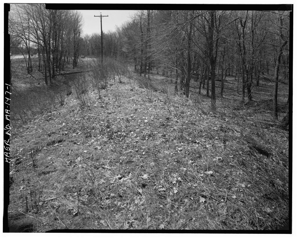
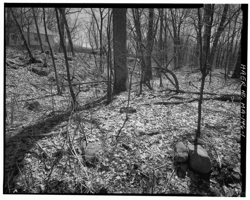
MA-147 (Page 12) Physical Description The Blackstone Canal The Millbury Segment of the Blackstone Canal presently consists of a 722'-long stretch of the towpath (western) berm of the canal and a shorter portion of the western half of the canal prism. At its northern end the towpath berm merges with and disappears into the embankment of Route At its southern end it similarly merges with the grade of the Route 146 jughandle intersection. The canal runs at an angle of 350 to 360 degrees throughout this segment. An intensive (locational) survey conducted by the Public Archaeology Laboratory Inc. (PAL) as part of the Route 146 improvement project identified this surviving segment of the canal in In the 39PAL conducted an archaeological site examination of the segment.
In UMAS undertook a final Phase III study to record the site. The earthen towpath berm, which is presently covered with volunteer plants and shrubs, is built of silty to coarse sand with gravel. The Phase III investigations identified a surface level of soil, 13 cm deep, that contains mixed fill including black sand, silt, gravel and historic artifacts such as glass and coal slag. This fill layer would appear to postdate the canal and may have been associated with the use of the berm as an electrical transmission line easement. The electrical poles, though no longer in service, are still in place along the center line of the berm. Below this surface layer is a dense and compact pp. for biographical information on Hutchinson. Also see Daniel H.
Calhoun, The American Civil Engineer, Origins and Conflicts (Cambridge, Massachusetts: MIT Press, p. 79, for Hutchinson's work on railroad surveying. 38 Marsha King, Virginia Fitch, and Ronald Dalton, "Intensive Archaeological Survey of the Route 146 Corridor in Worcester and Millbury" (Public Archaeology Laboratory: October Revised August Revised May 39 M. King, V. H. Adams, and R. Dalton, "Archaeological Site Examinations of Two Blackstone Canal Segments." BLACKSTONE CANAL MILLBURY SEGMENT HAER No. MA-147 (Page 13) layer of dark yellow-brown sand and gravel fill, presumably local soils obtained from nearby excavation. The towpath berm is trapezoidal in section, measuring approximately 9' in height above the canal bed, 36' wide at the base and from 8' to 12' wide at the top.
These measurements should be considered approximate as erosion has reduced the dimensions of the berm at the upper level and increased them at the base. The surviving section of canal bed is overlain by fill for its entire length. On the eastern side this fill is the highway embankment. The fill layer is thinnest on the west side. Here the Phase III excavations encountered a large number of stratigraphic layers, with most of the strata consisting of very thin bands of sands, silts and gravels with significant iron staining throughout. Beneath these sedimentary bands, at a depth of about 4', is a level of cobbles surrounded by mottled sands and clays with pockets of gravel; this appears to represent the historic canal bed.
There was no evidence of "puddling", the constructed clay seal used on other canals. This absence of puddling is consistent with the documentary record and other archaeological investigations on the Blackstone Canal. The Burling Hills Spillway The Burling Mills spillway appears to have been a waste weir, designed to carry off excess waters from the canal in time of flood. The structure also included a waste gate at its base, which could draw off water and accumulated silt from the bottom of the canal.
Waste weirs and waste gates were integral components of most historic water-power systems.40 With a crest set below the height of the canal embankment or dam in which it was built and a masonry apron to withstand the scouring effect of the water, the waste weir was designed to discharge flood waters at a safe location, before they could damage the mill downstream or overtop and wash away the embankments. The waste gate could be opened to provide an 40 See Peter Molloy, "Nineteenth-Century Hydropower" for a useful discussion of the contemporary sources on dam theory and design.
One source quoted by Molloy of particular value in Blackstone Valley history is "On the Construction of Mill Dams" from Zachariah Allen, The Science of Mechanics as Applied to the Present Improvements in the Useful Arts in Europe, and in the United States of America (Providence, Rhode Island: Hutchens & Cary, pp. BLACKSTONE CANAL MILLBURY SEGMENT HAER No. MA-147 (Page 14) additional outlet for flood prevention or to de-water the canal for maintenance purposes. While spillways and waste gates were commonly incorporated into the primary dam, water-power systems with extensive power canals often had separate structures like the Burling Mills weir.
Unlike the spillways on river dams, waste weirs on canals could be more easily provided with a footbridge "which makes the whole crest of the dam accessible at all41times and from which the flashboards can be readily adjusted." It is likely that the Burling Mills waste weir had such a footbridge to allow adjustments to the height of the weir. James B. Francis's waste gatehouse and waste weir in the Northern Canal in Lowell, Massachusetts is a more substantial (and better-preserved) contemporary example of a waste weir with manually controlled flashboards.42 There are other waste weirs on the Blackstone Canal in Lincoln, Rhode Island, built by the Lonsdale Mills.
These are concrete structures, built during a remodeling of that water-power system, that presumably replaced earlier weirs more like the Burling Mills weir.43 The Burling Mills spillway survives as a mortared stone masonry structure that interrupts the towpath berm of the Blackstone Canal. The structure consists of a mortared rubblestone apron flanked by a pair of abutments of irregularly coursed rubblestone with rough granite ashlar capstones. The abutments have a trapezoidal profile that loosely conforms to the sectional profile of the berm, except that the eastern ends are vertical, not sloped. The abutments are 34' wide, 10' high above the canal bed and high above the apron.44 The apron, which is 41 Daniel W. Mead, Water Power Engineering (New York: McGraw-Hill Book Co., p.
42 Patrick M. Malone, "James B. Francis and the Northern Canal" in Jonathan A. French, ed., Boston's Water Resource Development: Past, Present. and Future (New York: American Society of Civil Engineers, pp. 43 E. Pierre Morenon and Michael S. Raber, "Archaeological Properties Between Providence and Woonsocket: A Phase I Archaeological Survey of the Blackstone River Bikeway in Rhode Island," Occasional Papers in Archaeology, Number 53, Rhode Island College, Providence, p. 87. 44 These measurements are a close approximation of the depth of the canal bed. More extensive fieldwork would be required to BLACKSTONE CANAL MILLBURY SEGMENT HAER No. MA-147 (Page 15) elevated above the bed of the former canal, measures 23' in width and 48' in length.
It has been patched with cement on at least two separate occasions, judging by the presence of both a relatively soft cement and a hard Portland cement. A riveted iron culvert, in diameter and long, runs perpendicularly under the apron at its north end. The major component of the structure that is no longer extant is the timber waste weir or dam, which extended between the abutments, resting on a granite sill on the eastern edge of the apron. While no plans, views, or descriptions of the weir are known to exist, archaeological investigations at the site have provided considerable information on the nature of the missing elements and the manner in which the waste weir and waste gate operated.
The clearest evidence of the structure of the frame weir is provided by beam pockets and shelves in the abutment walls and wrought iron bolts and tie rods anchored in the east sill. A lower pair of beam pockets at either end of the sill contained a timber sill beam, about 16" square, which survives in fragmentary condition. This beam was secured to the stone sill by three wrought iron bolts, 1" in diameter, capped with round washers, in diameter, and 2" square nuts. Four feet above the sill is a second pair of pockets, about 13" wide and 11" high, which carried a somewhat smaller beam. These two beams would have served as the principal horizontal framing elements for the weir.
In both abutments a vertical channel or slot, about 13" wide and about deep, runs between the sill beam pocket and the pocket above. Each of these channels presumably contained a post set into the two horizontal timber beams. At the southern end of the sill, there is a wrought iron tie rod, anchored to the sill and threaded at the upper end, which would have tied these timber framing members together and secured them tightly against the masonry sill. This 1"-diameter rod is intact; there are four more iron rods, in diameter, set along the sill which have been cut or broken off just above the sill. These may also have been tied to the upper beam to provide additional tensile strength to the timber structure and to retain the planks or flashboards that made up the face of the weir.
Abutting the upper pair of beam pockets on the west is a pair of shelves, 9" high and 3' long, and recessed 4" in the masonry. The shelf in the north abutment has a beam pocket, 8" high and 5" determine a precise depth. BLACKSTONE CANAL MILLBURY SEGMENT HAER No. MA-147 (Page 16) wide, at its west end. Most likely these shelves supported the frame for a footbridge above the weir. There is a fourth pair of beam pockets, 18" high and 17" wide, located at the apron's west sill. The west sill has no anchor bolts or tie rods and no evidence of a beam survives here. It is probable that a timber sill beam here would have served as an easily replaceable "wearing edge", protecting the masonry apron from the scouring effects of the discharging water.
Large sections of the stone apron were cleared of the overspreading vegetative mat, but close examination revealed only limited evidence of footings for posts or other supporting members. One cavity which appeared to have been a footing was found, north of the south wall and in the same vertical plane as the western end of the shelves. Measuring 6" x 5" and at least 1' deep, it contained mortar fragments that retained the impression of a vertical wooden post. There are other depressions in the apron in the same vertical plane, but none contained such clear evidence of being intentional.
On the basis of this surviving evidence it appears that the weir was a vertical structure with a rectangular profile that used the eastern sill beam and the beam above as the major framing elements, with iron tie rods and vertical timber posts set between the beams.45 The face of the weir was probably composed46 of flashboards horizontal planks stapled to the iron tie rods. Mill engineers could control the amount of water discharged over the weir by adding or removing flashboards to raise or lower the crest. It is also possible that fixed planks were used up to a set height, and flashboards were then added to raise the crest as needed. The spillway was equipped with a waste gate which controlled flow through the iron culvert located beneath the masonry apron.
There is no evidence of any other gates. At its eastern end, the culvert and the masonry encasing it project beyond the stone sill. The waste gate was installed at this aperture. A large boulder, 5' long and approximately 4' high, and a section of rubble wall, long and 4' high, create a small forebay in 45 Evidence for an exterior post attached to the eastern faces of the beams was found during the Phase III investigations, but it is not certain that this post fragment was in its original position. 46 Mead, pp. BLACKSTONE CANAL MILLBURY SEGMENT HAER No. MA-147 (Page 17) front of the gate and presumably prevented the discharging water from scouring the berm or spillway. Several elements of the gate are still extant.
These include the wooden sill, square, and the two upright posts, which are tenoned into the sill on either side of the culvert. The posts, which are heavily worn, appear to have been 9" square originally. The taller of the two is now truncated at but originally they probably extended the full height of the weir. In front of the sill is the threshold for the actual gate, a 4'-long plank, high and wide, with a central raised tongue running the length of its top face. When the gate was lowered into its closed position, this tongue would have fitted into a corresponding groove in the bottom of the gate to provide a tight seal. In the fill that had accumulated on top of the culvert, the Phase III archaeological survey found a l'-3"-long section of cast iron rack, 3" square, with ten teeth.
This is presumably a section of the rack that was attached to the lift gate and used in conjunction with pinion gears to raise and lower it. The gearing was most likely located directly above the gate. Access to the mechanism would have been by means of a wooden footbridge supported by the upper beams. The culvert is a riveted plate iron pipe structure, long and in diameter. The individual plates each measure 2' wide and long. It appears that the structure was not originally built as a culvert, but was reused here. The presence of a 5"- diameter hole, fitted with a flange, in a section covered by masonry, and empty rivet holes in the circumference of the culvert at either end suggests that this may have originally been a steam boiler that was salvaged and adapted for this use.
The culvert was incorporated into the mid-twentieth century drainage system installed during the widening of Route A concrete culvert now delivers water from under the highway to the iron culvert, which discharges it into the floodplain at its western end. This relatively constant small stream appears to have its origin in the watershed of Park Hill on the east side of the highway. The Phelps map and the Millbury map both show that there was a irregular widening in the canal at this location, which suggests that the canal builders incorporated this natural water source into the canal. A persistent spring or stream here may have been a potential source of erosion, which would have made this a logical place to locate a spillway. BLACKSTONE CANAL MILLBURY SEGMENT HAER No.
MA-147 (Page 18) SOURCES OF INFORMATION A. Engineering Drawings. No engineering drawings for this segment of the canal have been found. B. Historic Views. No historic views of this segment of the canal have been found. C. Bibliography. Manuscripts and Unpublished Documents Blackstone Canal Company Collection, Worcester Historical Museum, Worcester, Massachusetts. Brown Family Papers, John Carter Brown Library, Providence, Rhode Island. Edward Carrington Papers, Rhode Island Historical Society Library, Providence, Rhode Island. Thomas A. Jenckes Papers, Rhode Island Historical Society Library, Providence, Rhode Island. Worcester County Registry of Deeds, Worcester, Massachusetts.
Books and Articles Adams, Charles F., Railroads: Their Origin and Problems (New York: Putnam's Sons, Allen, Zachariah, The Science of Mechanics as Applied to the Present Improvements in the Useful Arts in Europe, and in the United States of America (Providence, Rhode Island: Hutchens & Cary, . Bayles, Richard, ed., History of Providence County, 2 vols. (New York: Preston & Co., Calhoun, Daniel H., The American Civil Engineer, Origins and Conflicts (Cambridge, Massachusetts: MIT Press, BLACKSTONE CANAL MILLBURY SEGMENT HAER No. MA-147 (Page 19) Greenwood, Richard E., "Natural Run and Artificial Falls: Waterpower and the Blackstone Canal," in Rhode Island History, May Vol. 49, No. 2, pp Hurd, D. Hamilton, History of Worcester County, Massachusetts. 2 vols.
(Philadelphia: Lewis & Co., Lincoln, William, History of Worcester (Worcester: Malone, Patrick M., "James B. Francis and the Northern Canal" in Jonathan A. French, ed., Boston's Water Resource Development: Past, Present, and Future (New York: American Society of Civil Engineers, . Mead, Daniel W., Water Power Engineering (New York: McGraw-Hill Book Co., . Molloy, Peter M., "Nineteenth-Century Hydropower: Design and Construction of Lawrence Dam, in Wintherthur Portfolio. Vol. 15, No. 4, Winter pp. Stockwell, George A., "Millbury" in History of Worcester County, 2 vols. (Boston: Jewett & Co., pp.
Washburn, Charles G., Industrial Worcester (Worcester, Massachusetts: Davis Press, Government Documents and Reports A Copy of the Valuation and Tax List of the Town of Millbury for the Year (Worcester: Sanford & Davis, Printers, "Annual Report of the Assessors" in Annual Report of the Town Officers of the Town of Millbury, Year Ending March 1. (Worcester: Press of Chas. Hamilton, Adams, Virginia, "Blackstone Canal Historic District [Massachusetts]," National Register of Historic Places Nomination Form, Greenwood, Richard E., A History of the Blackstone Canal. (Rhode Island Historical Preservation Commission, . King, Marsha, Virginia H.
Adams, and Ronald Dalton, "Archaeological Site Examinations of Two Blackstone Canal Segments in Worcester and Millbury, Massachusetts and the Mill Brook Sewer Portal in Worcester, Massachusetts"; PAL, Inc. Report BLACKSTONE CANAL MILLBURY SEGMENT HAER No. MA-147 (Page 20) No. (Public Archaeology Laboratory: July Revised November, King, Marsha, Virginia Fitch, and Ronald Dalton, "Intensive Archaeological Survey of the Route 146 Corridor in Worcester and Millbury" (Public Archaeology Laboratory: October Revised August Revised May Morenon, E. Pierre, and Michael S. Raber, "A Phase I Archaeological Survey of the Blackstone River Bikeway in Rhode Island: Archaeological Properties Between Providence and Woonsocket," Occasional Papers in Archaeology, No. 53, Rhode Island College, Providence..
Stott, Peter, Reports on Several Sites Along the Blackstone Canal in Northbridae and Uxbridae (Massachusetts Department of Environmental Management, November, Haps "Map of the Town of Millbury and Villages of Millbury, West Millbury and Bramanville, Worcester Co., Mass." (New York: New York Publishing House, "Town of Millbury" in New Topographical Atlas of the Citv of Worcester (Philadelphia: Richards and Company, p. Phelps, Edward N., "A Map of the Blackstone Canal and its Appendages as constructed in the year compiled by actual survey by E.N. Phelps, Resident Engineer" (Blackstone Canal Company Collection, Rhode Island Historical Society). United States Geological Survey, "Worcester South, Mass." Quadrangle Map, editions.
Walling, Henry F., "A Map of Worcester County, Massachusetts" (Boston: Wm. E. Baker & Co., BLACKSTONE CANAL MILLBURY SEGMENT HAER No. MA-147 (Page 21) Location Map. [USGS Worcester South, Massachusetts, Quad., BLACKSTONE CANAL MILLBURY SEGMENT HAER No. MA-147 (Page 22) * -v .- Historic Map, New York Publishing House, "Map of the Town of Millbury and Villages of Millbury, West Millbury and Bramanville, Worcester Co., Mass.", [Collection of the American Antiquarian Society, Worcester, Massachusetts.]
 Block
Block