William Hoelscher Farmstead, 08529 State Route 219, New Knoxville
William Hoelscher Farmstead, 08529 State Route 219, New Knoxville, Auglaize County, OH. Surveyed as HABS OHIO,6-NEWKX,1-, with 1 photograph and a 2,032-word written history.
From the record
“William Hoelscher Farmstead, 08529 State Route 219, New Knoxville, Auglaize County, OH”
Survey record header. Machine-read text.
surveyed by the federal HABS program as HABS OHIO,6-NEWKX,1- · the record runs 2032 words · one of 9 surveyed structures published for this county.
Source document
Quoted word for word from HABS OHIO,6-NEWKX,1-.
Not written, edited or summarised by this site.
The former William Hoelscher farmstead is located State Route approximately 1.5 miles east of New Knoxville, Auglaize County, Ohio. USGS New Knoxville and Moulton Quadrangles Universal Transverse Mercator Coordinates: A: B: C: 0: E: Present ~: County of Auglaize Present Qccuoant: Unoccupied and scheduled for demolition Siqnifjcance: The William Hoelscher farm is historically and architecturally significant because it represents the predominant pattern of settlement in this area as well as traditional architectural forms. Established in the farm remained in the Hoelscher family for 120 years. The Hoelscher farm is typical, in size, production and ownership, of the traditional family farm in the heavily agricultural state of Ohio.
The initial structures-- house, summer kitchen, barn, smokehouse, corncrib and hog barn-- were built during the years Built with heavy timber framing, these structures exemplify vernacular construction techniques employed by settlers of German descent, in an area that was almost exclusively German. William Hoelscher Farmstead HABS No. OH-2343 (Page 2) PART I -
Historical Information
William Hoelscher was 29 when he acquired 105 acres from his father, H. Henry Hoelscher, in Henry, or Heinrich had immigrated from Ladbergen, Germany with his wife, Elizabeth, in Once in this country, they travelled down the Ohio River to Cincinnati, and from there, up the Miami-Erie Canal to New Bremen, the northern terminus of the canal at that time. Henry worked on the canal until its completion in earning enough money to buy his first small tract of land east of New Knoxville, in Washington Township. In he purchased 50 acres and in another 55 acres, all in the southeast quarter of Section 21 on the north side of the present Route New Knoxville was first settled by Shadrack Montgomery, who moved there from Pennsylvania in The first subdivision of 102 lots was made in by James K.
Lytle, the owner of a steam sawmill in the village. The Hoelscher land was originally part of a 160-acre government grant to Nehemiah York in Henry Hoelscher may have chosen a site near New Knoxville because of his affiliation with the German Evangelical Church there, while nearby New Bremen was predominantly German Catholic. Henry Hoelscher was one of many Germans who fled poor economic conditions in their homeland and immigrated to America during the mid-nineteenth century. This part of the state was settled mostly by immigrants from the northwestern part of Germany, who ventured north via the canal in search of fertile farm land. In the inhabitants of the nearby village of New Knoxville were entirely of German descent, and this is still largely true today.
Henry's house (no longer extant) was located south of Route 219 on land that passed to William's younger brother Ernst. During the years to William built a new house on his property north of the road, as well as other farm buildings, including a barn, bake oven, summer kitchen and smokehouse. These structures were built of hand-hewn timbers (taken from woods on the property) and of circular-sawn lumber. The Hoelscher farm is located in an area that is primarily agricultural. At 105 acres, the Hoelscher farm, is the typical size for the State of Ohio. It has been operated as a general farm, producing the leading crops of the area--corn, hay, wheat and oats, as well as chickens, hogs and dairy cows. In the late the Hoelscher farm became a Grade-A dairy farm.
The farm has been under the continuous ownership of the Hoelscher family for 120 years, passed on from father to son for five generations. In it was conveyed to Benjamin Hoelscher and in to Casper Hoelscher ), and his wife Rachel. In Casper and Rachel transferred the house to their son Ted, but retained title to the land. William Hoelscher Farmstead HABS No. OH-2343 (Page 3) PART 2 -
Descriptive Information
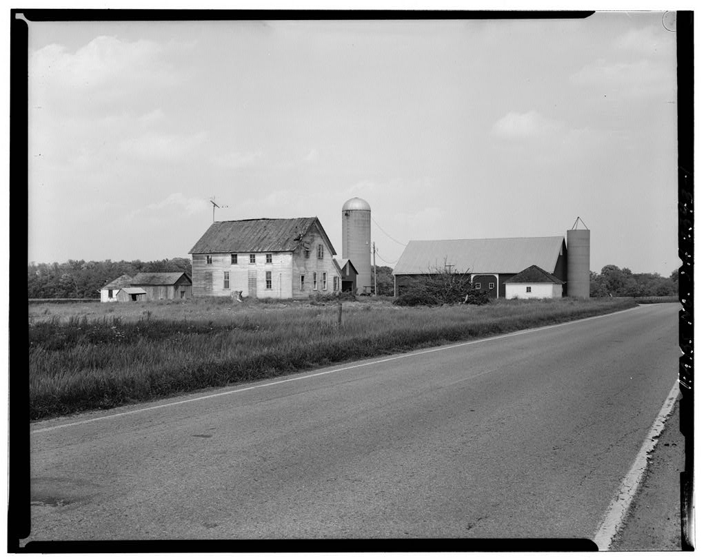
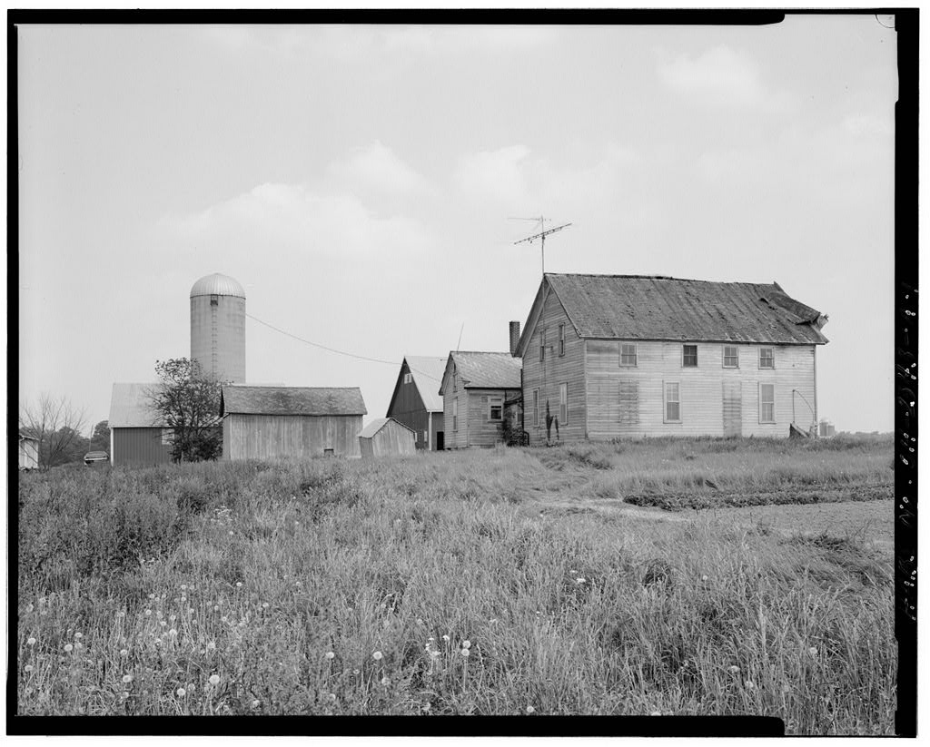
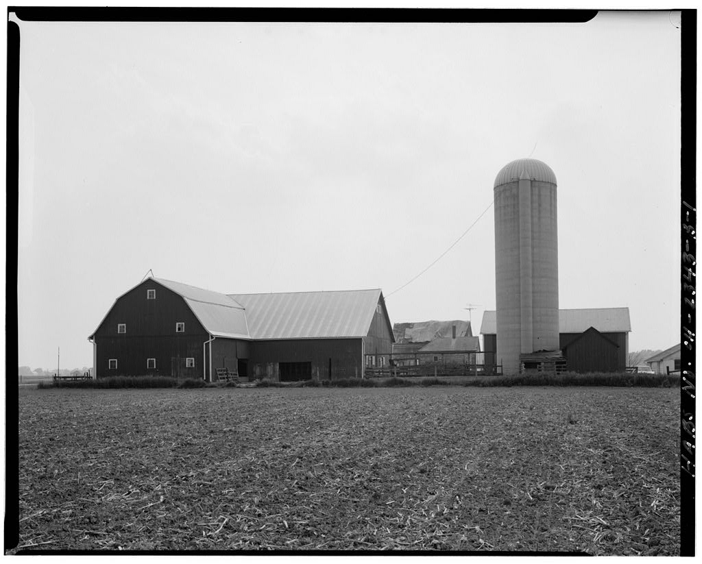
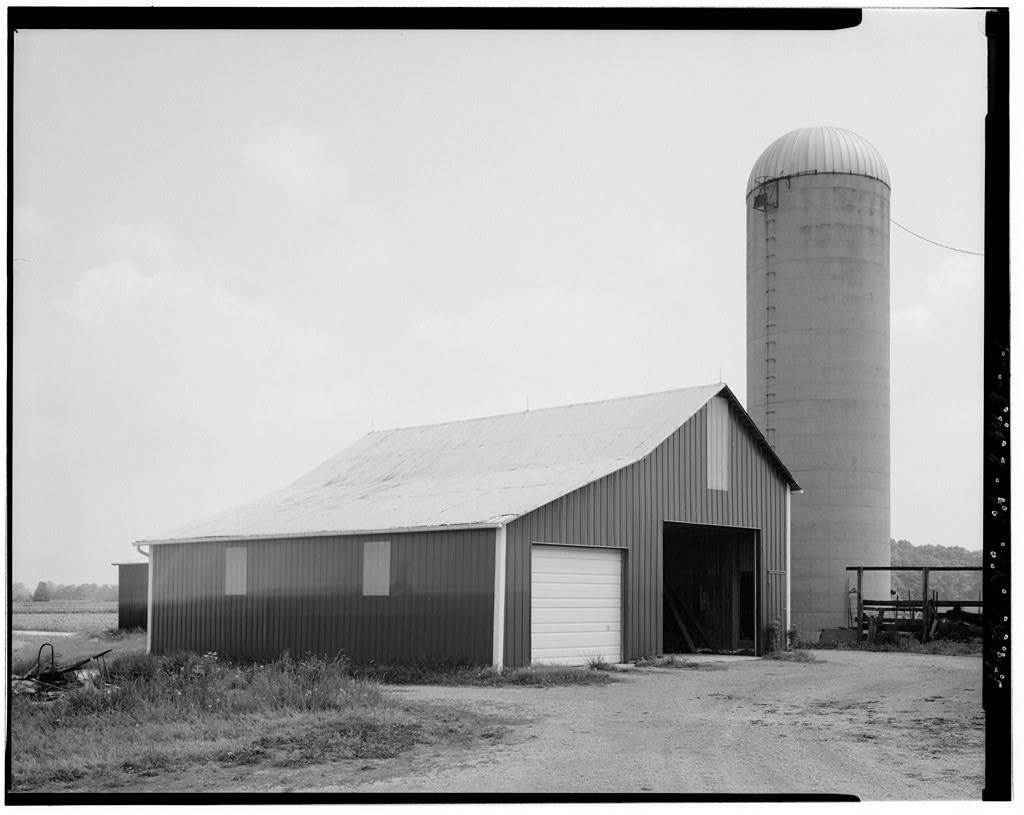
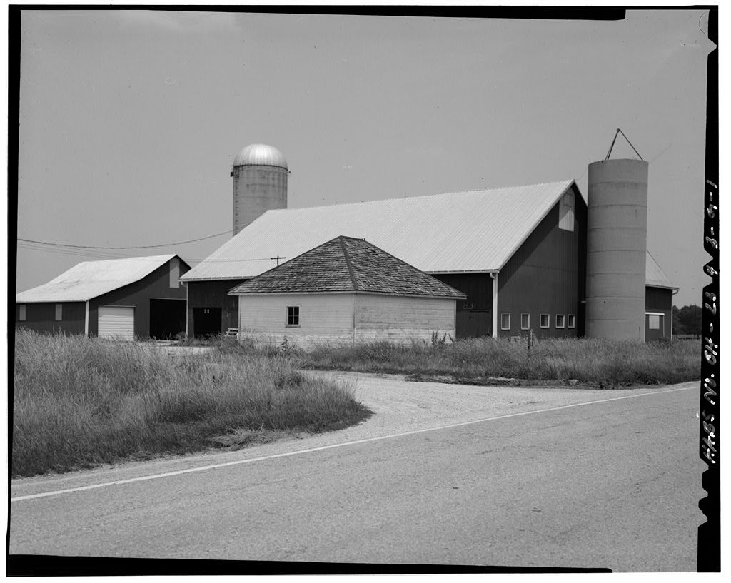
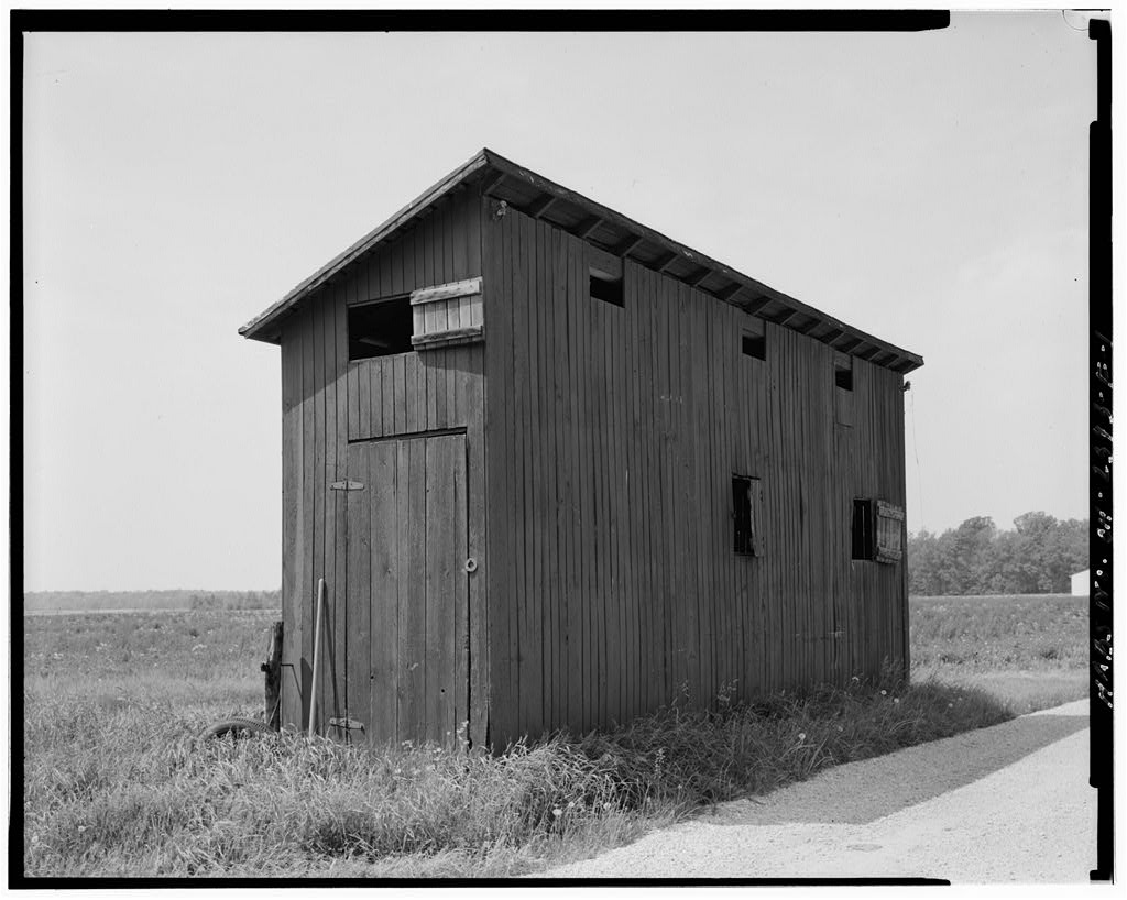
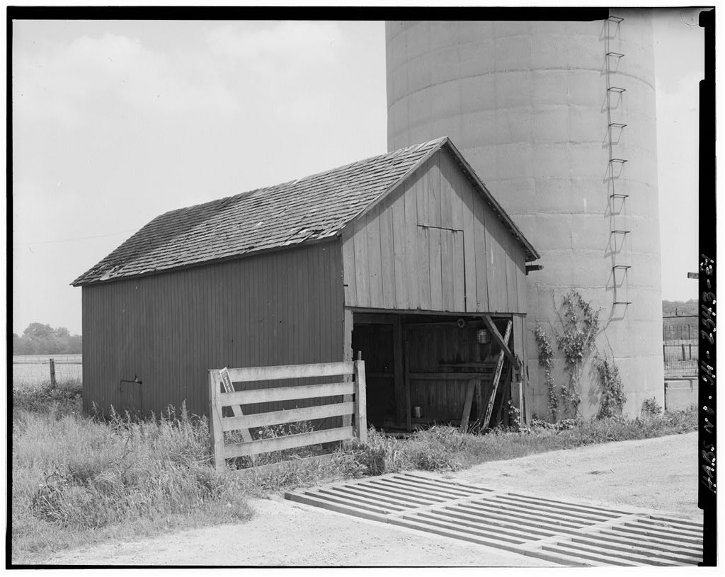
The Hoelscher farmstead consists of a group of buildings clustered on an L-shaped plot near the road. This cluster is surrounded by cultivated fields on a acre parcel. The buildings include the house, barn, smokehouse, and corn crib/storage building--all built during the period 1870-72--a circa hog barn, a garage, corncrib, a silo, a hen house converted into a garage/workshop, and a silo. In addition the remains of a bake oven are located on the north side of the house. A dirt driveway winds from Route 219 through the farm buildings to the north edge of the property, where a new farmstead has been established, including a house and barn. The landscape is relatively flat and open, as the area is predominantly agricultura 1.
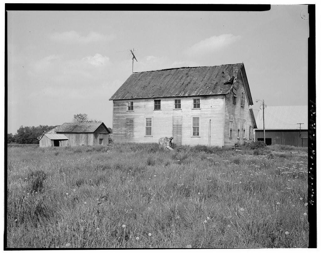
The surroundings are characterized by farms of similar size, age and appearance. The condition of the farm is generally good, except for the house, which is in poor condition because of lack of maintenance. The house has not been painted in many years, and the metal roof has been ripped loose from the west side by the wind. A11 trees and most shrubs have been removed from around the house in preparation for demolition. The farmstead evolved over time as the type and scope of farming changed and as each succeeding generation of Hoelschers took over. Individual buildings were altered, added and demolished. The barn, which originally stabled horses at the north end, was modified in when workhorses were replaced by tractors.
In the late the barn was altered at the south end where a concrete block milkhouse was inserted to meet upgraded health regulations. The addition of a corncrib in implies the expansion of corn production. By a gable- roofed workshop/woodshed had been built just east of the kitchen wing, a square, low, flat-roofed brooder house had been added in the center, and a second hog barn had been added northeast of the barn. These three structures were taken down in the The original outhouse was demolished by In a new concrete-block hen house was built, which was converted into a garage/workshop in the early PART III - SOURCES OF INFORMATION A. Architectural Drawings: none B.
Early Views: There are a number of views in the personal collection of the Hoelscher family, which are provided with accompanying photographs. C. Interviews: Casper and Rachel Hoelscher, June 3, William Hoelscher Farmstead HASS No. OH-2343 (Page 4} D.
Bibliography
942 words
The headings the report itself prints. Each one jumps to where it begins.
Source document
Quoted word for word from HABS OHIO,6-NEWKX,1-.
Not written, edited or summarised by this site.
1. Primary and unpublished sources: Brown, Mary Ann Olding. Marion Mosaic: Faith Farms and Fatback: A Study of Marion Township in Mercer County, Ohio. April Wyatt, Barbara, ed. National Register Bulletin: Surveying and Evaluating Vernacular Architecture (Draft). Prepared by the Midwest Vernacular Architecture Committee, April 2. Secondary and published sources: Arthur, Eric and Dudley Witney. The Barn: A Vanishing Landmark in North America. New York: Arrowood Press, Atlas and History of Auglaize County. Piqua, Ohio: Magee Bros., Frary, I. T. Early Homes of Ohio. New York: Dover Publications, Inc., Howland, H. G. Atlas of Auglaize County. Ohio. Phila.: Sutton, Jordan, Philip D. Ohio Comes of Age: Columbus, Ohio: Ohio State Archeological and Historical Society, Kauffman, Henry J.
The American Farmhouse. New York: Bonanza Books, McMurray, William J. History of Auglaize County, Vol. 2. Indianpolis: Historical Publishing Co., New Bremen Sesguicentennial Reflections. New Bremen, Ohio: Sesquicentennial Committee of New Bremen, Noble, Allen G. Wood Brick and Stone: The North American Settlement Landscape. Vol. 2. Amherst, Mass.: Univ. of Mass., Walsh, John B. Atlas of Auglaize County. Wapakoneta, Ohio: Atlas Publishing Co., Writers Program of the Works Progress Administration in the State of Ohio. The Ohio Guide. New York: Oxford Univ. Press, E. Likely Sources Not Yet Investigated: Additional information may be found in secondary sources on traditional American and German material culture. William Hoelscher Farmstead HABS No. OH-2343 (Page 5) F. Supplemental Material 1.
Location maps 2. Site plans: circa circa PART IV -
Project Information
The farm buildings, acquired through eminent domain by Auglaize County, are required to be removed by the Federal Aviation Administration {FAA) because they obstruct the approach to the Neil Armstrong Airport in Wapakoneta, Ohio. In accordance with a Memorandum of Agreement dated December 27, and signed by the FAA, the Ohio State Historic Preservation Officer and the Commissioners of Auglaize County, the house and farm buildings are being recorded and offered for sale for relocation prior to demolition. Prepared by: Beth Sullebarger Title: Principal Affiliation: Sullebarger Associates Date: June 28, William Hoelscher Farmstead HABS No. OH-2343 (Page 6) VAN WERT COUNTY I I I I AllEN COU!'ITY I , :z II :o IU I I I I :.z I I Auglaize County, Ohio :o :< SALEM ..
Kossuth LOGAN Cr iders vi lie (It's 14 Townships & 20 Towns & Villages) / J: I I I I I Buckland WAYNE DUCHOUQUET UNION z Holden 0 u NOBLE MOULTON J'Glynwood Wapakoncla Uniopoli GOSHEN\'"~-~ - \ St. Johns. , New \ PUSHETA Hampshire \
Clay Washington
Gu Iman New . Knoxville Frey burg ST.MARYS Geyer Son ta Fe GERMAN ~r~o William Hoelscher Farmstead New Bremen I LOGAN I COUNTY JACKSOtl;""" I I I Egyjt I r I I I I I 0 2 4 I e---io----i jiiiMl 1 I I I I 3 5 I I I Scale in Miles ,J I I I >-< I SHELBY I z I :::i: COUNTY I I 0: u, I -- --- --- --- --- --- --- I I ><= ""' <( 'I o: I CHAMPA IN I COUNTY I William Hoelscher Farmstead HABS No. OH-2343 (Page 7) ;; ,_ 19 "' I .. . "' 0 <( 0 I 21 ~ 0 0 v .. 28 . I N .- 4 - : II 0 1;4 119 r 'I O Washington AUGLAIZE COUNTY "' R90 SOUTHLAND R A TR 90 SHELBY COUNTY I/) I I . i I 31 ' I -- William Hoelscher Farmstead HABS No. OH-2343 (Page 8) 5 0 80 80 + ~ .,. I 1 II I - I ; =t~ ~ ~i So 1" 1" .!Jl777.$1l#a9e _}(1ch.:1e/ Jtroh Bo :i:> 17 c+ Sdtro Schroe1 I-' j:I) 80 Bo ?'9 C/l a. ~ 1 n I I ~ 1 ..
0 ;.)Bco/J G. J/tJnde r- ~~. Ii H, 80 .'oe/sch f" :\ 4 +o I tit- ~ ~ :t Jlemy.;I. ,,..,.[.i,,)11 J }is....;.. Y1 0 Kru f e mi11-.,,., E ~ ~u/o'erhd E :;; 60 .So 6o :a: l ~ :c l> -' 'O Fred V) __. :z AJ ~ 1-6 ()) .oa VJ :c 00 Bo :c fl) I __. N (I) .-r I wn JI.( 1 ,. I -v I WfD ', ; 80. 3o - AJ AJ erm1m 40. - /Zo fiod11 .I.pm""" hr 'ti iiCll 120 .fl &o C'+ -tD ' E L y 0 AJ s H a c Q. William Hoelscher Farmstead HABS No. OH-2343 (Page 10) Circa Sl1of<.Eff0f.ISE. SHED lE1 I HOG BARN IllHOUSE !<. E.N f OHIO _ __ - --- --- I -- -- SCALE IN TEET I 0 so 100 William Hoelscher Farmstead HABS No. OH-2343 (Page 11) Circa SHED m1 1111.$_70RAGE 6VIJ...D/./\/G- GBARN HOUSE GARAGE -- R/W f OHIO _ _ __ --- SCALE IN FE ET 0 so I 100 William Hoelscher Farmstead HABS No.
OH-2343 (Page 12) CR 'B S/1of<EHOf.ISE. SHED IE) I woooSHEP II .STORAGE BVIJ..D/./\16- HOUSE f OHIO _ _ __ - --- --- 0 - SCALE IN f'EET I so 100 William Hoelscher Farmstead HABS No. OH-2343 (Page 13) CR 'B HOG BARN 1 S/1(')/t(/iffOl!S~ SHED . mm .SIL.0 HOUSE f OHIO _ _ __ 0 -- - - - I SCAL.E IN FEET so I I 100 William Hoelscher Farmstead HASS No. OH-2343 (Page 14) S/101<EHOVSF .'. .t . .' ._rJ.l_i.. ~ 11li i_J.1.1.1.l.!. SHED mi I STORAGE .SILO 8 RIW OHIO - --- 0 rH -- so SCALE IN FE Er I 100 ADDENDUM TO: HABS OH-2343 WILLIAM HOELSCHER FARMSTEAD HABS OHIO,6-NEWKX,1- State Route 219 New Knoxville Auglaize County Ohio FIELD RECORDS HISTORIC AMERICAN BUILDINGS SURVEY National Park Service U.S. Department of the Interior C Street NW Washington, DC
The original filed report, and the sheets the survey produced. Those published here appear above.
Also surveyed in New Knoxville
7 records
The federal surveyors worked through New Knoxville building by building. These are the other structures
they measured and filed a report on, longest report first.
 Block
Block