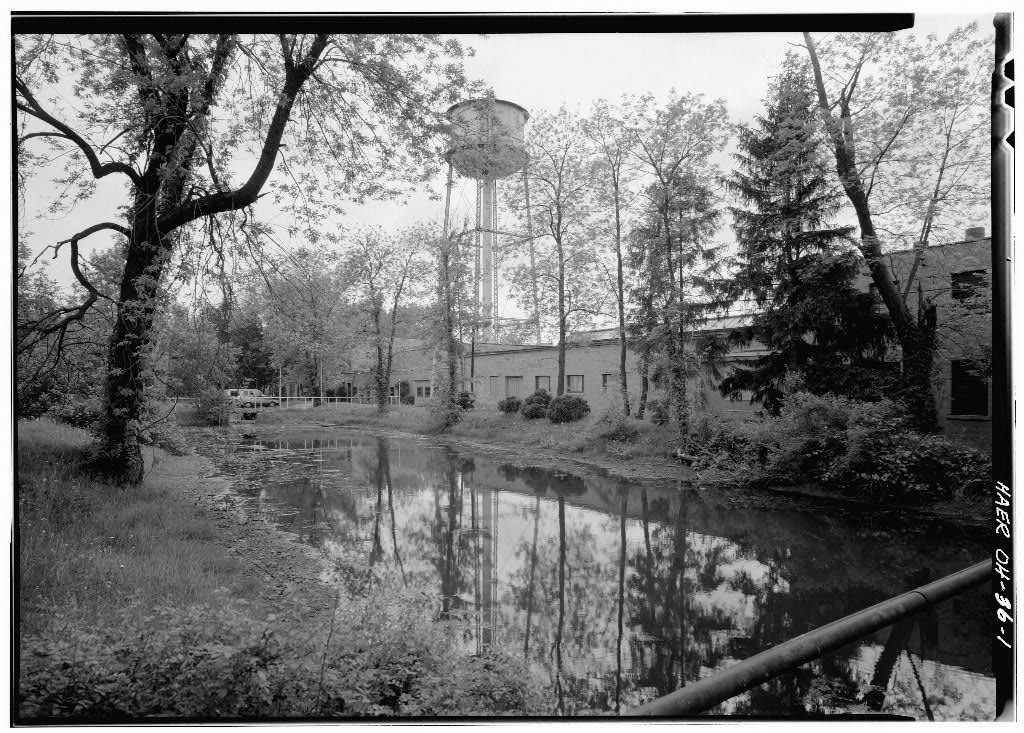
This documentation was undertaken in June as mitigation for the removal of the Brecksville Diversion Dam (HAER No. OH-59-G), part of a larger project to restore the free flow of the Cuyahoga River. The Cuyahoga River Ecosystem Restoration Canal Diversion Dam Project is a partnership among Cuyahoga Valley National Park; Friends of the Crooked River; Ohio Environmental Protection Agency; Ohio Department of Natural Resources; U.S. Army Corps of Engineers; and Northeast Ohio Regional Sewer District. The field team consisted of Scott D. Heberling, Project Historian, Heberling Associates, Inc.; and Andrew Baugnet, Photographer. For additional information, see: Ohio and Erie Canal HAER No. OH-59 Ohio and Erie Canal, Brecksville Diversion Dam HAER No.
OH-59-G Ohio and Erie Canal, Head Gates HAER No. OH-59-I Ohio and Erie Canal, Feeder Channel HAER No. OH-59-J OHIO AND ERIE CANAL, PINERY FEEDER DAM HAER No. OH-59-H (page 2) Part I. Historical Information A. Physical History: 1. Date(s) of construction: 2. Engineer: Not known 3. Builder/Contractor: Henry Burnham; William Brown and Merrick Sawyer 4. Original Plans and construction: The Records of the Ohio Board of Canal Commissioners and the Ohio Board of Public Works contain no construction plans for the Pinery Feeder Dam or any other feeder dams on the northern division of the Ohio and Erie Canal. The Canal Commissioners annual reports do not list standard specifications for the construction of river dams as they did for locks, aqueducts, culverts, and other important structures.
The construction contract states only that the dam was to be formed by timber bolted to the rock at the bottom of the river and that the engineer would furnish the plan to the contractor.1 That plan has not survived. An survey map shows a V-shaped dam pointing upstream; the west section was long and the east section was long, shorter than the present timber-crib dam most of which likely dates to 5. Alterations and Additions: During the canal era the feeder dams were frequently damaged by floods and ice jams. Unspecified improvements were made in In the feeder was repaired after sustaining severe damage from floods during the winter of and the west half of the dam was rebuilt. In half of the dam was rebuilt, the slope was replanked, and one of the stone abutments was reconstructed.
It was repaired again in and and in the height of the dam was raised by The dam was rebuilt in as part of comprehensive improvements to the canal s northern division; the Board of Public Works annual report for states that of the dam was torn out and rebuilt using 12" white oak timbers; the cribs were then filled with concrete and replanked. The work required a temporary cofferdam in the river. Construction probably was similar to that at the Peninsula feeder dam which was repaired with 1 ft. sq. timbers which were 3 timbers high in front, 2 timbers high in back, it was then cross tied with 4 x 12 timbers 12 ft. long.
3 Repairs and alterations may have been made during the period when the American Steel and Wire Company was responsible for routine maintenance but the extent of work is not known. 1 Articles of Agreement between Henry R. Burnam and Alfred Kelley, July 26, Contracts, Records of the Department of Public Works of Ohio, Series Ohio History Center, Columbus, OH. 2 Ohio Board of Public Works, Records of the Board of Public Works, Map of the Ohio Canal, Summit County, Ohio, surveyed by Kennon State Archives Series Ohio History Center, Columbus, OH.
3 Ohio Board of Public Works, Annual Report Ohio Board of Public Works, Annual Report 58, 67; Harlan Unrau and Nick Scrattish, Historic Structure Report, Ohio and Erie Canal, Cuyahoga Valley National Recreation Area, Ohio (Denver, CO: National Park Service, Denver Service Center, OHIO AND ERIE CANAL, PINERY FEEDER DAM HAER No. OH-59-H (page 3) B. Historical Context: The Ohio and Erie Canal, a 308-mile inland waterway, was constructed to link Lake Erie at Cleveland with the Ohio River at Portsmouth.
It was one of the most important of America s nineteenth century canals, operating as a navigation system from to It was conceived as an extension of New York State s Erie Canal, part of a system that connected New York City and the eastern seaboard with the western and southern states via Lake Erie and the Hudson, Ohio, and Mississippi Rivers. It was a key link in the transportation network of northeastern Ohio and served as the major route of travel and communication through the Cuyahoga Valley for several decades.4 The canal system experienced a long period of decline prior to the devastating flood event of March that ended Ohio s canal era once and for all. The Ohio and Erie Canal from Akron north to Brecksville was totally destroyed by the flood.
However the 17-mile segment from Brecksville north to Cleveland was considered salvageable and, although abandoned as a transportation route, was retained as an industrial water supply.5 Dams and feeders were built to ensure an adequate supply of water, particularly along higher sections of the line. By the early there were twelve feeders along its length, including one built in at the head of the Pinery Narrows near Brecksville.
In their rush to complete the canal and open it to navigation at the earliest possible date, the Commissioners postponed the construction of certain components that were esteemed of less pressing importance, including the regulating weirs around locks and also the feeders which would divert water from the Cuyahoga River into the canal.6 These shortcuts interfered with the proper operation of the canal since it was impossible to provide an adequate water supply. It immediately became clear that the flow of water from the small streams that were allowed to flow into the canal would be insufficient to sustain canal operations, particularly during the summer season.
The Commissioners took steps to address this problem very quickly after the canal was opened to navigation on July 4, when they finally had the time to consider matters of less pressing importance. At the Pinery, they ordered construction of a temporary feeder from the Cuyahoga River while plans were developed for a more permanent feeder complex. On July 26 they awarded a contract to Henry R. Burnam of Boston, Ohio to build a permanent dam and feeder. According to the contract Burnam would construct a dam across the Cuyahoga River near the head of the first rapids below the mouth of Chippewa Creek, & a feeder from thence below the Lock [No.
36]...The walls at the head or guardgates to be built of stone masonry in the same manner as to the kind of work as Lock walls are required to be built on the Canal, the dam to be formed by timber bolted to the rock at the bottom of the river. The whole to be done in a good substantial & workmanlike manner agreeably to a plan to be furnished for that purpose 4 Harry N. Scheiber, Ohio Canal Era: A Case Study of Government and the Economy: (Athens: Ohio University Press, Sam Tamburro, The History of the Ohio & Erie Canal, in Canal Fever: The Ohio & Erie Canal from Waterway to Canalway, ed. Metzger and Peg Bobel (Kent, OH: Kent State University Press, 5 Tamburro, The History of the Ohio and Erie Canal, Terry K.
Woods, Ohio s Grand Canal: A Brief History of the Ohio and Erie Canal (Kent, OH: Kent State University Press, 6 John Kilbourne, Public Documents Concerning the Ohio Canals, which are to Connect Lake Erie with the Ohio River (Columbus, OH: I.N. Whiting, OHIO AND ERIE CANAL, PINERY FEEDER DAM HAER No. OH-59-H (page 4) under the inspection of the acting commissioner or any engineer appointed for that purpose...and to be finished by the first day of November next. The feeder was sufficiently complete to be put into use during the fall of but Burnam apparently was unable to finish the work since on December 6 a new contract was awarded to William Brown and Merrick Sawyer to finish the job.
The Pinery Feeder was completed in By it was determined that another feeder was needed to insure an adequate water supply for the Cleveland-to-Akron section of the canal, so the Peninsula Feeder was constructed a few miles upstream. According to the Canal Commissioners, the two feeders would provide a permanent and ample supply of water to the northern section of the canal and replenish in the shortest possible time any loss of water resulting from breaches and other accidental occurrences.
8 Feeders typically consisted of a V-shaped rock filled timber-crib weir across the river which created an impoundment; a set of head gates that diverted water from the river into the feeder and regulated the flow; the feeder channel, a wide ditch that carried water from the impoundment to the canal; and the waste gates, which returned excess water to the river. Following standard practice the dam would have had a triangular profile and been composed of a series of 6' x 6' to 10' x 10' timber cribs filled with rock and gravel and planked on top. In his Design and Construction of Dams Edward Wegmann describes the construction of a timber-crib dam: The foundation course is formed of large logs, placed at right angles to the stream, and carried into the bank on both sides.
These logs, which are generally placed 6 to 8 feet apart, are laid in trenches excavated to such a depth that the tops of the logs project just above the river-bed. If the width of the stream be considerable, two or more logs spliced together will be required for each of these trenches. The second course of logs is laid at right angles to the foundation course. The apron is formed between the two foundation-logs which are furthest downstream by placing planks between the logs of the second course. These planks should project under the third course of logs, with which the dam proper begins. Each course of logs is placed at right angles to the one below it. The logs are not notched where they cross each other, but simply flattened so as to form good bearings.
They are spiked together by iron drift-bolts (usually x in.) at each intersection of logs....The top cross-logs should be securely fastened by iron bolts passing through two or three logs beneath. In building cribs the timbers should be so placed that the pockets of the crib should have vertical sides.... 7 Articles of Agreement between Henry R. Burnam and Alfred Kelley, July 26, Contracts, Records of the Department of Public Works of Ohio, Series Ohio History Center, Columbus, OH); Unrau and Scrattish, Historic Structure Report, 8 Kilbourne, Public Documents, Ohio Board of Canal Commissioners, Annual Report of the Canal Commissioners 9; Unrau and Scrattish, Historic Structure Report, OHIO AND ERIE CANAL, PINERY FEEDER DAM HAER No.
OH-59-H (page 5) ...The downstream face of the dam is made almost vertical. A course of planks (about 4 inches thick and 12 feet long) securely spiked to the logs is placed on the upstream side of the crest of the dam. This course is continued upstream by a slope of gravel or earth. Crib-dams can be used in almost any kind of river bottom. If placed on rock the bottom logs should be fastened to the foundation by iron bolts. For this purpose holes are drilled in the rock. The lower end of each iron anchor-bolt is split from 5 to 6 inches. By placing a wedge in the split end of the bolt and driving the latter down into the drill-hole, the bottom of the bolt is expanded and anchors the log firmly to the rock.
Unless the dam is to have but little height, it will be found most convenient to form it of square cribs, placing a low crib in front of the main dam to form the apron, and a slope of gravel and earth on the up-stream side. This plan is the method usually adopted.9 The Pinery and Peninsula feeders were described in January Immediately below lock no. thirty-six, north of Portage summit, seventeen miles from Cleveland, a copious and constant supply of water is introduced from the Cuyahoga by means of a feeder of twelve chains in length, called the Pinery Feeder.
The surface of the rock which forms the bed of the river having about the same elevation as the water line of the level, into which the feeder is introduced, the dam at its head is required to be of no greater elevation than is necessary to divert the proper quantity of water from the river into the canal, and is formed by bolting timbers to the rock. Besides furnishing water for navigation, this feeder furnishes a large quantity which may be used for hydraulic purposes, both at Cleveland and at the intermediate locks, round which an ample stream constantly flows from one level to another. About half a mile below the aqueduct at the Peninsula, water is also introduced into the canal from the river, through a feeder of about two chains in length, called the Peninsula Feeder.
A low dam of brush and stone across the river diverts the necessary quantity of water into this feeder. Both these feeders are secured from the influx of too great a quantity of water, in times of flood, by head gates, supported by walls of cut stone masonry, founded on rock.10 9 Edward Wegmann, The Design and Construction of Dams, Including Masonry, Earth, Rock-Fill, Timber and Steel Structures, Also the Principal Types of Movable Dams (John Wiley and Sons, New York, 10 Ohio Board of Canal Commissioners, Annual Report 9. OHIO AND ERIE CANAL, PINERY FEEDER DAM HAER No.
OH-59-H (page 6) By the time that the earliest detailed maps of the canal were created by Kennon for the Board of Public Works in the Pinery Feeder Dam and associated structures already had been repaired and rebuilt several times.11 Unspecified repairs were made to secure the Cuyahoga River feeder dams in and again in The Pinery Feeder Dam, already badly deteriorated by was damaged by the devastating floods that year and the west half was completely rebuilt.13 In half of the dam was rebuilt, the slope was replanked, and one of the stone abutments was reconstructed.14 However there is no evidence that the configuration of the feeder complex and the relationships among its structures changed from to The map by Kennon shows a V-shaped dam pointing upstream; the west section was 10" long and the east section was long.
There was a fish chute in the center so that fish could pass the dam. An undated photograph in the Canal Society of Ohio Collection at the University of Akron shows a man sitting on the east abutment with the dam in the background; the end of the abutment consists of stepped stone masonry and the dam is configured as a V pointing upstream and perhaps 4' to 5' high.15 The photograph dates prior to since the stone abutments had not yet been replaced by concrete. The dam was repaired again in and and in the height of the dam was raised by 12" to augment the water supply for the canal.16 In the head gates were rebuilt in concrete and in the dam was completely reconstructed in connection with the state s comprehensive improvements to the northern division of the canal.
About of the dam was torn out and rebuilt using 12" timbers; the cribs were filled with concrete and replanked. The work required construction of a temporary long and 4' high cofferdam in the river. Construction probably was similar to that at the Peninsula feeder dam which was repaired with 1 ft. sq. timbers which were 3 timbers high in front, 2 timbers high in back, it was then cross tied with 4 x 12 timbers 12 ft. long. 17 Paul was the engineer-in-charge. All work was performed by state crews.18 A ca.
photograph taken from the Route 82 Brecksville-Northfield High Level Bridge provides an excellent view of the dam and head gates as they existed during the first half of the twentieth century, including the concrete gate headwall and east abutment of the dam, constructed in After the catastrophic flood the Pinery Feeder and the canal section 11 Ohio Board of Public Works, Map of the Ohio Canal, surveyed by Kennon 12 Ohio Board of Public Works, 5th Annual Report 5; Ohio Board of Public Works, 8th Annual Report 13 Ohio Board of Public Works, Annual Report 14 Ohio Board of Public Works, Annual Report 19. 15 Canal Society of Ohio Collection, RG Series D, Photographs, Box 17, Folder 4, University of Akron University Libraries, Archival Services, Akron, OH.
16 Ohio Board of Public Works, Annual Report Ohio Board of Public Works, Annual Report 58; Ohio Board of Public Works, Annual Report Ohio Board of Public Works, Annual Report Ohio Board of Public Works, Annual Report 17 Ohio Board of Public Works, Annual Report Ohio Board of Public Works, Annual Report 58, 67. 18 Ohio Board of Public Works, Annual Report, 71. 19 Dam and Feeder at Brecksville Station, ca. Photograph OEC_109, Louis Baus Canal Photograph Collection, University of Akron, Archival Services, Akron, OH. OHIO AND ERIE CANAL, PINERY FEEDER DAM HAER No. OH-59-H (page 7) between Brecksville and Cleveland were repaired and continued to operate since they supplied cooling water to the American Steel and Wire Company s Cuyahoga Works.
Since at least that company had utilized water from the canal for its industrial operations, first at the Newburgh Steel Works, then at the Cuyahoga Works in Cuyahoga Heights. The first known lease to AS&W was executed in and was renewed in October and periodically thereafter through even after the state transferred its canal lands within Cuyahoga Valley National Park to the federal government in The company, owned by U.S. Steel in the twentieth century, performed routine maintenance on canal structures along the leased section of canal.
In a new steel fabricating company acquired the Cuyahoga Works together with the rights to the American Steel and Wire Company name and assumed responsibility for maintaining the canal north of Brecksville including the feeder complex.20 In AS&W replaced the feeder head gates with a new concrete head gate structure. Two years later it replaced the old timber-crib dam with a new fixed-crest concrete weir located about downriver. In the lease was amended to include construction of a new concrete dam and abutments at a cost of The work was funded by AS&W but was designed and supervised by the Ohio Department of Public Works. The old dam was left in place but was breached in the center to allow the water to flow through.
The crest of the new dam was about higher than the top of the crib dam which was now submerged beneath the surface of the pool. The structure is known as the Brecksville Diversion Dam.21 The American Steel and Wire Company continued to maintain the Brecksville Diversion Dam and the associated feeder channel and head gates until the late In the National Park Service acquired the Ohio and Erie Canal Lands within Cuyahoga Valley National Park and assumed responsibility for maintenance of the feeder complex although the hydraulic lease continued for a few more years. The State of Ohio continued to own individual structures including the Brecksville Diversion Dam, head gates, and Pinery Feeder Dam remnant.22 20 Carol Poh Miller, Ohio and Erie Canal, HAER No.
OH-59, Historic American Engineering Record (HAER), National Park Service, U.S. Department of the Interior, 8; Board of Public Works, Records of the Board of Public Works, Record of Leases, State Archives Series BV4667and lease between the State of Ohio and American Steel & Wire dated December 22, This lease covers the period and refers to the original lease beginning January 17, Also of interest are lease extensions the State of Ohio and U.S.
Steel Corporation dated November December 8, July 24, and October 26, 21 Sam Tamburro, History of the Brecksville Dam, (Brecksville, OH: National Park Service, 7; American Steel and Wire Company, Map Showing Replacement of Ohio Canal Inlet Gates, Sheet Drawing, February 7, Ohio Department of Public Works, Construction Plans of Brecksville Diversion Dam, Cuyahoga and Summit Counties, Drawings, July 16, 22 Tamburo, History of the Brecksville Dam, 7; Roy Hampton and Heather Kenney, National Register Assessment of the Brecksville Diversion Dam (SUM-3253-1), Cuyahoga Valley National Park, Summit and Cuyahoga Counties, Ohio (Columbus, OH: Hardlines Design Company, Ohio Environmental Protection Agency, National Park Service-Cuyahoga Valley National Park, Ohio Department of Natural Resources, and U.S.
Army Corps of Engineers, Cuyahoga River Ecosystem Restoration Canal Diversion Dam Project Environmental Assessment (Brecksville, OH: Cuyahoga Valley National Park, 38. OHIO AND ERIE CANAL, PINERY FEEDER DAM HAER No. OH-59-H (page 8) Part II. Structural/Design Information A. General Statement: 1. Character: The Pinery Feeder Dam is a timber-crib dam representing standard engineering and construction practices of its era. Its significance is related to its role in supplying water to the Ohio and Erie Canal.
The design conformed to the topography and hydraulics of the site but otherwise the design, materials, and construction are completely typical of small dams constructed throughout Ohio and the United States in the nineteenth and early twentieth century, especially those constructed for the purpose of industrial or municipal water supply. A low-head weir was appropriate for the site since its function was to divert water into the canal rather than to store water. In most respects the present dam is the structure built in when the Pinery Feeder Dam was replaced as part of general improvements to the northern division of the canal. However it is possible that some components including the bottom course of timbers are earlier, perhaps even dating to the original construction of the dam in 2.
Condition of fabric: The dam has been abandoned and submerged since Some components such as the wood planking are missing or badly deteriorated but most of the main timbers remain in good condition. The center of the dam was breached during construction of the Brecksville Diversion Dam to allow a free flow of water. B. Description: During its period of use the Pinery Feeder Dam diverted water from the Cuyahoga River into the Ohio and Erie Canal via a set of three head gates and a feeder channel. As a fixed-crest weir it was designed to allow water to flow over the crest at all times so it has no spillway.
The dam is V -shaped with the V pointing upstream; the east portion is long and the west portion is 90' long.23 The downstream and upstream faces are spaced 4' apart so that the base of the dam has a total width of about 6' including the width of the timbers. Where it is intact the downstream face is constructed of four courses of stacked timbers which rise 44" above the shale bedrock that forms the river bed. The upstream face consists of two courses of stacked timbers which rise 20" above the river bed and intersecting cross-timbers tie the two sets of longitudinal timbers together. In the dam s original form these cross-timbers would have formed gravel-filled cribs but the interior of the structure is now filled with concrete.
The structure of the dam is similar to that described by Edward Wegmann in his Design and Construction of Dams The four courses of stacked timbers that comprise the downstream face of the dam are of variable lengths and dimensions. The bottom sill course consists of 12" x 12" hewn timbers secured to the shale bedrock of the river bed with 1" diameter 23 Ohio Department of Public Works, Construction Plans of Brecksville Diversion Dam, July 16, OHIO AND ERIE CANAL, PINERY FEEDER DAM HAER No. OH-59-H (page 9) iron bolts. Most of these timbers are 30' long but some are shorter; most of the ends have mortises where two timbers were spliced together end-to-end, secured with iron spikes.
The top face of the timbers that comprise the bottom sill plate have 10" wide x 3" deep mortises at 10' intervals where intersecting cross-members were attached with small spikes to form the timber cribs. The cross-members are now missing and concrete fills the void between the downstream and upstream faces of the dam as high as the top of the third course of timbers, or 30" above the bed of the river. The concrete dates to the reconstruction. The presence of the mortises for missing cross-members as well as the larger size of the sill timbers suggest that the timbers in the bottom sill course date prior to the reconstruction, and might even be part of the original construction, while the second and third courses of timbers, which are sawn and lack mortises, date to or later.
The upper three courses of timbers in the downstream face are attached to the bottom course and to each other with long iron spikes set in drilled holes. The timbers vary in length from 23' to 30' and are either 10" x 10" square or 12" wide x 10" high. Only the top plate has mortises and they are widely-spaced, with a few extant cross-members between the third course and top plate, above the concrete fill. The cross-members are attached to the top of the timbers of the upstream face. The hewn timbers that comprise the bottom sill of the upstream course are variable length and 12" wide and beveled to match the triangular profile of the dam: 10" high on the downstream side and 4" high on the upstream side.
Like the downstream sill timbers they are bolted to the river bed and have mortises on their top surface. There are two layers of wood planking. The lower layer consists of 10" wide planks nailed to the top of the third course of the downstream face and the top of the sill plate of the upstream face. Above this planking is a layer of gravel. The upper layer of planking consists of 12" wide planks nailed to the top of the top plates of both the downstream and upstream faces. The dam s triangular profile and wood planking allowed ice and debris to pass over the dam more easily, minimizing damage.
Near the west end of the dam, which is the most intact section, there are three layers of 2" boards above the upper layer of planking and attached with spikes, probably evidence of later repairs or an effort to raise the height of the dam. These boards as well as one or both layers of the planking are missing from most of the dam, where only the longitudinal timbers, concrete fill, and an occasional cross-member have survived due to 70 years of abandonment with no repairs. The west end of the dam is tied into the river bank and there is no visible abutment. The deep rock and earth fill of the Valley Railroad embankment covers this end of the dam. The east end terminates at a concrete abutment and wing wall which may date to the construction of the head gates.
The dam has no apron on the downstream side since the solid bedrock of the river bed made an apron unnecessary for erosion protection. C. Mechanicals/Operation: The Pinery Feeder Dam impounded water and diverted it into the Ohio and Erie Canal. Only a portion of the normal flow of the Cuyahoga River was diverted into the feeder channel and canal, so as a fixed-crest weir, water continually overtops the dam. There are no mechanical systems or machinery. The head gates that control the flow of water into the canal feeder channel are OHIO AND ERIE CANAL, PINERY FEEDER DAM HAER No. OH-59-H (page 10) located adjacent to the dam and were constructed in replacing an earlier set of head gates dating to D.
Site Information: The Pinery Feeder Dam spans the Cuyahoga River at the head of the gorge known as the Pinery Narrows. The center of the river marks the boundary between Summit and Cuyahoga counties. The river bed consists of a shelf of shale bedrock which provides a solid foundation for the dam. The Brecksville Diversion Dam, which replaced the Pinery Feeder Dam in is located downstream from the older timber-crib dam. Water in the pool behind the Brecksville Diversion Dam is diverted into the Ohio and Erie Canal via a set of head gates constructed in and a feeder channel which dates to the original construction of the canal. The head gates are adjacent to the remains of the Pinery Feeder Dam. The terrain on the east side of the river is fairly level and about 12' above the river channel.
The terrain on the west side is very steep except for the grade of the Cuyahoga Valley Scenic Railway (the former Valley Railway) which runs parallel to the river, approximately 14' above the channel. The massive Route 82 Brecksville-Northfield High Level Bridge, built in spans the river, canal, and feeder channel with piers located feet downstream from the dam. Part III. Sources of Information A. Primary
 Block
Block