 Block
Ocana, Tennessee
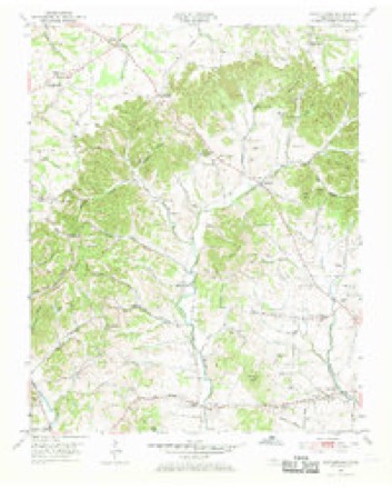
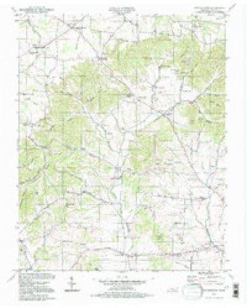
13 topographic sheets cover this place, the earliest surveyed in 1903 and the latest in 1994. It stands in District 12. It lies in ZIP code area 37075. It lies near Kill Buck Knob. The Survey maps it on the Cottontown quadrangle.
On record in Ocana
Buildings and businesses the archive holds for this place. Each opens its own page, with the source record it came from.
On the National Register within a mile 1 record
The National Register names another town for these. They stand within one mile of this settlement's coordinate.
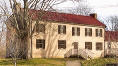 Douglass-Clark Houselisted 2011 · 0.1 miles away
Topographic sheets covering this place
8 surveys from 13 printed sheetsMatched by testing this settlement's coordinate against the published boundary of every sheet in the United States Geological Survey's historical collection. Each opens the scanned sheet at the Survey.
- 1903 USGS Greenbrier quadrangle1:125000, 2 printings
- 1903 USGS Nashville quadrangle1:125000, 2 printings
- 1942 USGS Gallatin quadrangle1:100000
- 1953 USGS Cottontown quadrangle1:24000, 3 printings
- 1956 USGS Nashville quadrangle1:250000, 2 printings
- 1959 USGS Nashville quadrangle1:250000
- 1984 USGS Nashville quadrangle1:100000
- 1994 USGS Cottontown quadrangle1:24000



Fires near this place
14 since 1997Regional context, not property-specific evidence. The federal wildfire occurrence database lists 14 fires within 5 miles of Ocana between 1997 and 2011, burning about 83 acres in total. 1 started naturally. 1 was recorded as arson. Distance is straight-line from the map coordinates, so a fire counted here may appear on a neighbouring settlement's page as well.
| Reported cause | Fires |
|---|---|
| Debris and open burning | 8 |
| Missing data/not specified/undetermined | 2 |
| Natural | 1 |
| Smoking | 1 |
| Misuse of fire by a minor | 1 |
| Arson/incendiarism | 1 |
The most recent of them, most recent first, with the day each was reported and the service that recorded it.
| Date | Cause | Size | Reported by | Name on the report |
|---|---|---|---|---|
| 29 September 2007 | Debris and open burning | 25 acres | Tennessee Division of Forestry | LONG HOLLOW FIRE |
| 24 September 1999 | Smoking | under an acre | Tennessee Division of Forestry | not named |
| 23 September 1999 | Debris and open burning | 30 acres | Tennessee Division of Forestry | not named |
| 7 August 2006 | Natural | under an acre | Tennessee Division of Forestry | not named |
| 9 March 2009 | Missing data/not specified/undetermined | 1.0 acres | Tennessee Division of Forestry | CUMMING FIRE |
| 9 March 2007 | Debris and open burning | under an acre | Tennessee Division of Forestry | GARRISON RD |
| 8 March 2007 | Debris and open burning | 1.0 acres | Tennessee Division of Forestry | MUD HOLLOW RD |
| 8 March 2007 | Missing data/not specified/undetermined | 1.0 acres | Tennessee Division of Forestry | JONES RD |
Settlements close enough to share some of these fires:
Mines and quarries near this place
5 within 5 milesRegional context, not property-specific evidence. The federal mineral resources record lists 5 workings within 5 miles of Ocana: 2 producers, 2 occurrences, 1 past producer. 2 still produce. What was taken out: Stone, Crushed/Broken, Stone, Crushed/Broken, Limestone, General, Uranium, Oil Shale, Uranium. Distance is straight-line from the map coordinates, so a quarry counted here may appear on a neighbouring settlement's page as well.
| Where | Site | Commodity | Status | Recorded |
|---|---|---|---|---|
| Outcrop Sample For Uranium | Uranium, Oil Shale | Occurrence | ||
| Outcrop Sample For Uranium | Uranium, Oil Shale | Occurrence | ||
| Pilot Knob Quarry | Stone, Crushed/Broken, Limestone, General | Producer | Limestone | |
| Gallatin Quarry | Stone, Crushed/Broken | Producer | ||
| Pilot Knob Quarry | Stone, Crushed/Broken | Past Producer |
Storms near this place
4 since 2017Regional context, not property-specific evidence. The National Weather Service names Ocana in 4 storm reports between 2017 and 2025: 3 flash flood, 1 heavy rain. No death or injury is recorded in these reports. Each account below is quoted exactly as the forecast office filed it, from the NOAA Storm Events Database, and each date opens the federal record of that event.
| When | Event | Place named | Harm | What the report says |
|---|---|---|---|---|
| May 2017 | Flash Flood | Ocana | $10,000 | Significant flash flooding affected parts of Sumner County during the morning hours on May 19, mainly in the area from Cottontown to Westmoreland. Several water rescues were performed by emergency personnel in the Cottontown, Rock Bridge, and Liberty areas. A swift water rescue was conducted around 630 AM CDT at Buck Perry Road and Mount Vernon Road involving a school bus stranded in high water with several children on board. Another water rescue was conducted involving a school bus trapped in flood waters at Rouges Fork Road near Hogback Ridge Road. No injuries occurred in either water rescue. Two other water rescues occurred at Rogues Fork Road and Highway 52 East at 823 AM CDT, and at Old Gallatin Road and North Hunter Road at 833 AM CDT. Numerous other reports indicated people were trapped in their homes due to flood waters making roads impassable and covering driveways and yards. Some roads that were flooded and closed included Sumner Drive, Rock Bridge Road, Bugg Hollow Road, and Garrison Branch Road. |
| May 2017 | Flash Flood | Ocana | $5,000 | Flash flooding was reported in parts of Hendersonville and Gallatin. A water rescue was conducted at Notting Hill Drive off Big Station Camp Road at 1040 AM CDT. The Station Camp Greenway along Lower Station Camp Creek Road was submerged by water, as was the Rogers Soccer Field complex on Big Station Camp Road at Nashville Pike. Several other locations in this area also reportedly had high water. |
| February 2025 | Flash Flood | Ocana | - | Heavy rain in Gallatin caused flooding and forced the closure of Lower Station Camp Road in west Gallatin. Damages are unknown. |
| April 2018 | Heavy Rain | Ocana | - | A tSpotter Twitter report indicated 1.57 inches of rain fell in 25 minutes in the Ocana community. |
Nearest settlements
The eight closest, with where each one stands in the county. Distances are straight-line, computed from the Geographic Names Information System coordinates.
| Map | Place | Distance | Sheets |
|---|---|---|---|
| Station Camp (historical) | 1.1 miles | 13 | |
| Peytona | 2.5 miles | 13 | |
| Rival (historical) | 2.8 miles | 13 | |
| Shackle Island | 3.2 miles | 13 | |
| Avondale | 3.5 miles | 13 | |
| Saundersville | 3.9 miles | 13 | |
| Owen Estates | 4.1 miles | 13 | |
| Bluegrass Meadows | 4.2 miles | 13 |
Provenance
This settlement is recorded in the Geographic Names Information System as feature 1311947. The sheet list is computed by point-in-boundary test against the United States Geological Survey's historical topographic inventory. Both are works of the United States government and carry no copyright under 17 U.S.C. 105.
Wildfire. Short, Karen C. 2022. Spatial wildfire occurrence data for the United States, 1992-2020 [FPA_FOD_20221014]. 6th Edition. Fort Collins, CO: Forest Service Research Data Archive. https://doi.org/10.2737/RDS-2013-0009.6 Collected with United States Government funding and usable without additional permissions or fees.
Mines and quarries. USGS Mineral Resources Data System (MRDS) https://mrdata.usgs.gov/mrds/ A work of the United States government, no copyright under 17 U.S.C. 105.
Storms. NOAA National Centers for Environmental Information, Storm Events Database https://www.ncei.noaa.gov/stormevents/ A work of the United States government, no copyright under 17 U.S.C. 105. Narratives are quoted verbatim from the National Weather Service report and are not edited or summarised.