 Block
Block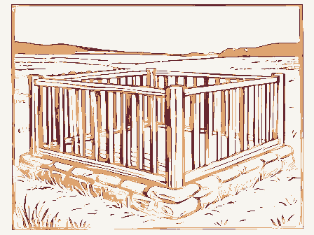
Green Township
The complete chapter on this township from A History of Scioto County, Ohio,, published 1903; History of Scioto County, Ohio, Together with a Pioneer Record of Southern Ohio, published 1903. 7,694 words, covering 6 settlements. Source changes inside the text are labelled at the exact paragraph where the next book begins.
Contents
2 sectionsThe section headings the book prints inside this chapter. Each one jumps to where it begins.
The modern record here
6 settlementsWhat the federal record holds for each settlement inside this township: wildfires and storm reports since the 1950s, mineral workings, and museum specimens collected nearby. These are counted within a few miles of each settlement, so neighbours share them and the columns are deliberately not added up. Every row links to the settlement's own page, where each figure is broken out.
| Settlement | Fires | Storm reports | Mines and quarries | Specimens |
|---|---|---|---|---|
| Franklin Furnace | 131 | 8 | 10 | 156 |
| Haverhill | 101 | 1 | 6 | 104 |
| Highland Park | 126 | - | 9 | 149 |
| Junior Furnace | 108 | 4 | 6 | 114 |
| Ohio Furnace | 136 | - | 6 | 112 |
| Powellsville | 132 | 2 | 4 | 115 |
Settlements in this township
6 placesEvery populated place the Geographic Names Information System records inside this township's Census boundary. 5 of the 6 are named in the chapter; the rest were founded later or were never more than a post office.
The chapter
7,694 wordsReproduced complete and unedited from A History of Scioto County, Ohio,, published 1903; History of Scioto County, Ohio, Together with a Pioneer Record of Southern Ohio, published 1903. The text is machine-read from scans, so expect recognition errors: misspelled names, dropped words, and stray characters. Nothing has been corrected, because correcting a proper name invents one. The headings below are the books' own; source changes are labelled in place.
Green Township
The records of the county from 1803 to 1811 inclusive have been lost. There is uncertainty as to the time of organization of some of the townships organized from 1803 to 1812. From the best data obtainable there had been ten townships organized prior to 1812, viz: Seal, Upper, Lick, Green, Union, Madison, Nile, Jefferson, Franklin and Wayne. Green Township was carved from Upper Township and received its name for Griffin Green one of the Ohio Company associates.
Although its original boundaries are not definitely known, it is certain that its southwestern boundary began at the mouth of the Little Scioto and followed the Ohio river up to a point about a mile below Haverhill, not including all of the French Grant. In 1815, its northwestern end was cut off and made a part of Porter which was formed that year.
It was ordered by the Commissioners, December 6, 1814, "That all that part of Upper Township included in the following bounds be attached to the township of Green, to-wit: Beginning at the upper corner of Green, on the river; thence up the river to the upper corner of French Grant; thence with the upper line of the Grant to the upper back corner; thence with the back line of the Grant to the corner of Green township; thence with the fine of Green to the place of beginning. On August 25, 1812, a portion of Green was
At the meeting of the Commissioners, March 2, 1824, for the purpose of fixing the boundaries of the townships of the county, the lines of Green were established as follows: "Beginning at the mouth of Hale's Creek (now Pine
Creek) on the Ohio river, then up said river to the Lawrence County line, then with said line to where said line leaves the back line of the French Grant; thence westerly to the corner between lots Nos. 58, 59, 71 and 70; thence northwesterly to the corner between lots Nos. 63. 64, 75 and 76; thence southwest with the line of lot No. 64 to the line between lots Nos. 51 and 64; thence northwesterly with the division lines of the lots to the lower line of French Grant; thence to the southeast corner of Section No. 22, in Range 20, Township No. 2; thence north one mile to the northeast corner of said section: thence west to Hale's Creek; thence down said creek to the place of beginning, which boundaries sail constitute Green Township." On March 2, 1832, Green's territory was curtailed to form a part of Harrison organized that year. In 1836, the
In 1841, the boundary was changed so as to include that portion of the French Grant which had been within the boundary of Vernon since 1824. On June 10, 1843, the boundary on the northwest was established as it stands at present with the exception of a farm of forty acres, belonging to L. Benton which has since been transferred to Porter.
Green Township lies in the southeastern corner of the County and borders on Lawrence County and the Ohio river. Porter and Vernon border it on the northwest and northeast respectfully. The Township is sixth in size and contains 24,583 acres. It ranks third among the Townships in the valuation of real and personal property, and also third in the total valuation, having a grapd total of over half a million dollars of property listed for taxa-
On the western side of the township is the broad and fertile Ohio Valley, from a half to two miles wide and extending the whole length of the township. Immediately to the east the river hills slope precipitously to the valley and form, as it were, a sort of wall, with here and there, projecting from the crest great cliffs, some with a perpendicular height of eighty feet and at an altitude of 300 to 400 feet above the valley below, suggesting the towers on the walls of ancient cities. One of these, the "High Rock." is known for miles around and when the weather is favorable, hundreds of people flock to this place to breathe the fresh air and take in the delightful view of the surrounding country. Pine Creek enters the Township towards the southeast corner, from Lawrence County, and winds a tortuous course across the northeastern part, forming a wide valley of productive farm land. The rest of the township is very much broken up into sharp ridges and flat topped hills by the tributaries of Pine Creek and some of the small affluents of the Ohio river. Some of the table lands and the gentler slopes are farmed and are fairly productive.
The whole Township was originally densely wooded with trees indigenous to this section, but all the primitive forest has disappeared before the ax of the charcoaler and has been consumed by the furnaces in the manufacture of iron. The roughest portions of the Township are now covered with a scattered second growth of timber and scrubby undergrowth.
The population along the Ohio Valley is chiefly descended from the early immigrants from New England and the Middle States, though there are still a few descendants of the early French inhabitants. The eastern portion of the Township is inhabited by German families who immigrated after 1830, and were compelled to purchase land in the back portion of the Township, as the choice land on the river had already been occupied.
embraces 23,934 acres in Green Township. It is all of Green Township, except about 120 acres. The act providing for the Grant was approved March 3, to the French inhabitants of Gallipolis. It was to front eight miles on the Ohio river beginning one and one-half miles above the mouth of the Little Sandy River and thence down the river and extending back at right angles to include 24,000 acres. The French settlers of Gallipolis were to be ascertained, males above eighteen years and widows, on November 1, 1795. John
Gabriel Gervais was to have 4,000 acres opposite Little Sandy, but the grant was to be void if he, or his heirs should not personally settle on the tract within three years and remain there .three years.
The Gervais tract extended from the river to the back line of the Grant and was 376.17 chains on the eastern line, 416.17 chains on the west line and 100.11 chains on the back line.
The French settlers, males above eighteen years and widows, were to have each a lot of the 20,000 acres surveyed and set off to them and they were to have patents in severalty, but they were each to settle on the lands within five years and remain five years on the grant or the patents were to be void
This Grant was surveyed on April 9, 1796, by Absalom Martin and 34 lots of 217.39 acres each fronted on the Ohio River. Lots one to four lay southeast of the Gervais tract and lots 5 to 34 northeast of it on the Ohio River. The remaining lots were rectangular, 217.39 acres each. The back lots 38, 42, 55, 67 and 91 lay southeast of the Gervais tract and the remaining square lots up to 92 lay northeast of the Gervais tract.
The assignment of the lots was made in Gallipolis on November 1. 1795, by lot. A list of the 92 persons who drew their lots is given below. Of this number not over ten settled in the Grant.
Soon after the allotment, it was discovered that eight persons who should have received lots, had been left out and on June 25, 1798, an act was passed for their benefit, Vol. 6 General Statutes page 35. This Grant was for 1,200 acres adjoining the southwest corner of the First French Grant, 640 poles on the Ohio River, and thence back from the river to include the quantity. The Grantees of the Second Grant were: Stephen Monot, Louis Anthony Carpenter, Louis Vimont, Francis Valton, Lewis Philip, A. Fishon, Anthony Magnet, Margaret G. C. Champaigne, wife of Peter LaForge and Maria J. Dalliez, wife of Peter Luc. The lots were assigned as follows:
On February 21, 1806, General Statutes, Vol. 2. 350. The fourth section of the Act for the original Grant was repealed. This waived the conditions requiring settlement and residence for a specified time.
As will be seen by reading the sketches of Jean Gabriel Gervais, Samuel Hunt, and Asa Boynton, the French Grant was sold out to New Hampshire Yankees, and what was expected to be a French settlement became a Now England one. Of the names of the original 100 French Emigrants, the only ones now known in this county are: Yalodin, Duduit, Duteil, Chabot and Cadot, five in number. Descendants of LeClercq, LaCroix, Bertrand, Bureau, Vincent, Menager, Devacht, Magnet, Serrol, Sandgram and Le Moyne are known to the editor, but they are descendants in the maternal line. Of the remaining 76 out of 100 not a trace is known to the writer.
Claudius Cadot who has a picture and a sketch herein was the last distinctive survivor of the old French. He was the son of the Claudius in whose name lot 89 was drawn.
In regard to the bill for the French Grant introduced into Congress on March 24, 1794, the Attorney General to whom it had been referred reported on it.
William Bradford was the Attorney General and he filed an exhaustive report over all the facts. He recommended the Grant on April 30, 1794, when the bill was read in the Senate and referred to Senators Brown, Burr. Taylor. King and Potts. On June 13, 1795, Senator Brown laid before the Senate the petition of John Gabriel Gervais for the bill and it was referred. On February 8, 1795, the bill was reported and on February 24 and 25, 1795, it was debated. On motion to strike out the first section, the vote was yeas 9, nays 15. and the names are given. The bill was referred to Messrs. Potts, Burr and King to report. On February 28, it was read the third time, and amended in two particulars. On the passage of the bill the yeas were 14, the nays 8, and the names are given. Burr voted aye. In the House on the same day the bill was read and referred to a committee of three, named. On March 2, 1795, it was reported back and passed and the vote not given. It was approved the next day.
is the site of the first settlement in the township and was the fourth settlement above Cincinnati on the Ohio river. The place was settled by Jean G. Gervais in 1797, as the most favorable spot on his 4,000 acres for a town. He gave it the name of Burrsburg, in honor of Aaron Burr, who was chairman of the Senate Committee to which was referred the report of the Attorney General on the Memorial of the French inhabitants of Gallipolis. Taylor and Ellsworth were the other two members of this committee. The report was referred to the committee March 24, 1794 and on April 29, 1794, Mr. Burr, its Chairman, reported a bill for their relief. He afterwards used his influence for its passage. When the emigrants from New England came they gave the settlement the name of Haverhill for their native town in New Hampshire. No plat of Burrsburg can be found on the records and it is safe to assume that none was ever made as the town was only a cluster of half a dozen cabins for twenty-five or thirty years after settlement. The first plat of the town was made by Thomas Davisson and was recorded April 27. 1848. There were 13 inlots in this plat. It was surveyed again, June 16, 1859, into 25 inlots and the plat was recorded August 24, 1859. Lawson Drury was the first Postmaster and the first ferryman. A Mrs. Naylor, who sold dry goods, was one of the first to carry on business.' The town was once the shipping point for the iron made at Ohio furnace; and charcoal and ore were brought across from Kentucky for this furnace. The population is about a hundred. Haverhill station on the Norfolk & Western Railroad is a mile and a half distant and Greenup, Kentucky, is just across the river. Ironton is nine miles up the river and Portsmouth twenty miles down the river. There is but one church in the place, the Methodist Episcopal. This organization has been in existence since 1815 and the Rev. Thomas Gilruth was its first pastor. The present brick structure was erected in 1870, at a cost of $4,500. The church has a large membership and the Sabbath school numbers 140. One might search the state over and he would not find a more sociable or more religious people than can be found in the membership of this church. Reverend Henry S. Alkire is the present pastor and Malcomb Clay is Superintendent of the Sabbath School. The trustees are: George C. Winkler, Evan Yandervort, Peter Boynton, William Brush and Samuel Crickenberger. In 1892 a parsonage was built near the church.
The Antioch Baptist Church is two miles north of Haverhill on the Haverhill and Portsmouth turnpike and was built in 1878. Its first minister was a Reverend Kirkpatrick and its last minister was V. N. Murphy. It is not used at present.
was a hewed log house, weather boarded. It was forty feet square and the lower story twelve feet square and the upper story ten. A large chimney stood in the center, which had four fire places. One room upstairs was a ballroom, 18x10. The floor was tongued and grooved. It had a single chimney. This house was built by Jean Gabriel Gervais. It was torn down by Asa Boynton, Jr., and the logs used for fire wood. It stood in front, just above where Joe Boynton now lives, between him and the river.
This hamlet is situated on the eastern edge of the township, midway of the boundary between French Grant lots 85 and 86.- Poplar Fork, a small branch of Pine Creek, flows through its edge. Pine Creek is only a mile away. It was laid out by William Powell, John and Washington Irwin and was named for Powell. The business of the town was in its early days conducted by the sons of Powell: William. Peter and Jacob. They conducted a tannery, a shoe shop and a store. The first survey for town plat was made July 31, 1846, and recorded July 15, 1848. This survey was made for Powell' and his associates, and the plat consisted of 21 inlots.
The German Lutheran Church has the largest membership and it is made up from the German population on Pine Creek. The church is about half a mile west of the town and was built in 1875. The congregation has a very large Sabbath School and a day school is conducted two days in the week by the minister, August Busse, in the German language.
The Powellsville Free-Will Baptists hold their meetings and Sabbath school in an old school house in the center of the village. This church was organized August 16, 1841, and a church was built, but since destroyed. William Lane was the last minister.
The Pine Creek Free-Will Baptist Church was organized in 1872. The church is located two and a half miles northwest of Powellsville on the Powellsville Branch turnpike. The last minister was William Lane, but no meetings have been held for several months. All the trustees have died and no successors have been elected.
The Methodist Episcopal Church of this place is the old organization which formerly held its meetings at Empire Furnace, Cartright's Mills and in the Baptist Church and School house. It now has a large edifice, built in 1875, to the southeast of the village one-half mile. It has a Sabbath school, but no minister, and no trustees.
The United Brethern organization holds its meetings in the Pine Creek school house. This organization dates from 1850. William Wagner is the minister.
Franklin Furnace was built in 1826 and went into blast in 1827. It was built by the natives of New Hampshire: Daniel Young, Jesse Y. Whitcomb, Joshia Merrill, John Hurd ' and Martin Ruter on lot 22 of French Grant, about a half mile from the Ohio river. Franklin Furnace Station on the Norfolk & Western railroad is located near the site of the Furnace. The builders operated the furnace for some years and it then passed into the hands of John Young and a Van Horn who either sold or rented it to A. Q. Rogers & Company. Rogers was a man who drank and gambled and soon lost out and the furnace was sold to John Gould. Jacob Hurd and Jesse Hurd. They did well, but Gould and the Hurds did not get on together so Gould bought the Hurds out, and during the Mexican War, when all furnaces flourished he made a small fortune. Not caring for the furnace any farther, he gave it to his brother. O. B. Gould. It blew out in 1860. The site and lands are now owned by O. B. Gould, Jr.
Junior Furnace was built in 1828, by the same Company which built Franklin and it was called "Franklin Junior Furnace" having been built after Franklin. It passed into the hands of John Young who sold it to Jefferson W. Glidden. When it blew out in 1865, it was owned by O. B. Gould, Jesse Young, John J. Glidden and Wells Hutchins. Almost all traces of it are gone. The property is now owned by Charles A. Goddard.
Union Furnace was built in 1826 by a company composed of James Rogers, John Means, John Sparks and Valentine Fear. It went into blast in 1827. When it blew out in 1851 or 2, it was owned by David Sinton and Thomas W. Means. David Sinton became manager of Union, at the age of nineteen. This furnace was located on the eastern border of Green Township, but nothing remains of it now.
Ohio Furnace was located about three miles from the Ohio river, was built in 1824, and went into blast the following year with John T. Woodrow as Superintendent with a force of fourteen men. It was built by Thomas W. Means and David Sinton and it was continued in blast until February 24, 1882, without a break except for repairs. It passed into the hands of Means, Kyle & Company, who still own the grounds and land belonging to the furnace. Some' traces of the furnace remain. A large quantity of coal and iron ore are mined on the furnace lands. The ore is used in Hamilton Furnace at Hanging Rock. The ore is taken to a place near Union landing by means of a tramway and is there loaded on Norfolk & Western cars. The furnace site, and all the land which belonged to Means, Kyle & Company, was sold to Rogers, Brown & Company, in 1900.
The schools of Green Township are among the best in the County. The people pay their teachers liberally and usually have the best teachers to be had. For several years the length of the term has been eight months. It ranges from seven to nine. The first vote for a school tax was taken in 1841, but met with little
Source changes here: from History of Scioto County, Ohio, Together with a Pioneer Record of Southern Ohio, by Nelson W. Evans A.m, published 1903; 4,445 words in this source stream.
Green Township
The records of the county from 1808 to 1811 inclusive have been lost. There is uncertainty as to the time of organization of some of the townships organized from 18038 to 1812. From the best data obtainable there had been ten townships organized prior to 1812, viz: Seal, Upper, Lick, Green, Union, Madison, Nile, Jefferson, Franklin and Wayne. Green Township was carved from Upper Township and received its name for Griffin Green one of the Ohio Company associates.
Although its original boundaries are not definitely known, it is certain that its southwestern boundary began at the mouth of the Little Scioto and followed the Ohio river up to a point about a mile below Haverhill, not including all of the French Grant. In 1815, its northwestern end was cut off and made a part of Porter which was formed that year.
It was ordered by the Commissioners, December 6, 1814, "That all that part of Upper Township included in the following bounds be attached to the township of Green, to-wit: Beginning at the upper corner of Green, on the river; thence up the river to the upper corner of French Grant; thence with the upper line of the Grant to the upper back corner; thence with the back line of the Grant to the corner of Green township; thence with the line of Green to the place of beginning. On August 25, 1812, a portion of Green was taken to form Bloom which was laid out that year.
At the meeting of the Commissioners, March 2, 1824, for the purpose of fixing the boundaries of the townships of the county, the lines of Green were established as follows: "Beginning at the mouth of Hale's Creek (now Pine Creek) on the Ohio river, then up said river to the Lawrence County line, then with said line to where said line leaves the back line of the French Grant; thence westerly to the corner between lots Nos. 58, 59, 71 and 70; thence northwesterly to the corner between lots Nos, 63, 64, 75 and 76; thence southwest with the line of lot No, 64 to the line between lots Nos. 51 and 64; thence northwesterly with the division lines of the lots to the lower line of French Grant; thence to the southeast corner of Section No, 22, in Range 20, Township No. 2: thence north one mile to the northeast corner of said section; thence west to Hale's Creek; thence down said creek to the place of beginning, which boundaries sall constitute Green Township." On March 2, 1882, Green's territory was curtailed to form a part of Harrison organized that year. In 1886, the farm of William Montgomery was taken from Green and included in Porter, In 1841, the boundary was changed so as to include that portion of the French Grant which had been within the boundary of Vernon since 1824. On June 10, 1848, the boundary on the northwest was established as it stands at present with the exception of a farm of forty acres, belonging to L. Benton which has since been transferred to Porter,
Green Township lies in the southeastern corner of the County and borders on Lawrence County and the Ohio river. Porter and Vernon border it on the northwest and northeast respectfully. The Township is sixth in size and contains 24,588 acres. It ranks third among the Townships in the valuation of real and personal property, and also third in the total valuation, haying a grand total of over half a million dollars of property listed for taxa-
DRM AN PROMI TENT Orv oyn ves Oe acesns snocyootnessacenssecernceesse $231,710 $182,445 $414,155 MU RAT SES IRs SY Sos ccvinnarakusbivecosecedscusaves vensssucone 64,250 22,898 87,148 MBE NE Pele cancicc, warewiacsaes'<epees teense 295,960 205,343 501,303
On the western side of the township is the broad and fertile Ohio Valley, from a half to two miles wide and extending the whole length of the township. Immediately to the east the river hills slope precipitously to the valley and form, as it were, a sort of wall, with here and there, projecting from the crest great cliffs, some with a perpendicular height of eighty feet and at an altitude of 300 to 400 feet above the valley below, suggesting the towers on the walls of ancient cities. One of these, the "High Rock,' is known for miles around and when the weather is favorable, hundreds of people flock to this place to breathe the fresh air and take in the delightful view of the surrounding country. Pine Creek enters the Township towards the southeast corner, from Lawrence County, and winds a tortuous course across the northeastern part, forming a wide valley of productive farm land. The rest of the township is very much broken up into sharp ridges and flat topped hills by the tributaries of Pine Creek and some of the small affluents of the Ohio river. Some of the table lands and the gentler slopes are farmed and are fairly productive.
The whole Township was originally densely wooded with trees indigenous to this section, but all the primitive forest has disappeared before the ax of the charcoaler and has been consumed by the furnaces in the manufacture of iron. The roughest portions of the Township are now covered with a Scattered second growth of timber and scrubby undergrowth.
The population along the Ohio Valley is chiefly descended from the early immigrants from New England and the Middle States, though there are still a few descendants of the early French inhabitants. The eastern portion of the Township is inhabited by German families who immigrated after 1830, and were compelled to purchase land in the back portion of the Township, as the choice land on the river had already been occupied.
embraces 23,934 acres in Green Township. It is all of Green Township, except about 120 acres. The act providing for the Grant was approved March 3, 1795. Vol. 1. U. S. Statutes at Large, page 442. It authorizes a grant of land to the French inhabitants of Gallipolis. It was to front eight miles on the Ohio river beginning one and one-half miles above the mouth of the Little Sandy River and thence down the river and extending back at right angles to include 24,000 acres. The French settlers of Gallipolis were to be ascertained, males above eighteen years and widows, on November 1, 1795. John Gabriel Gervais was to have 4,000 acres opposite Little Sandy, but the grant was to be void if he, or his heirs should not personally settle on the tract within three years and remain there three years.
The Gervais tract extended from the river to the back line of the Grant and was 376.17 chains on the eastern line, 416.17 chains on the west line and 100.11 chains on the back line.
The French settlers, males above eighteen years and widows, were to have each a lot of the 20,000 acres surveyed and set off to them and they were to have patents in severalty, but they were each to settle on the lands within five he and remain five years on the grant or the patents were to be void
This Grant was surveyed on April 9, 1796, by Absalom Martin and 34 lots of 217.89 acres each fronted on the Ohio River. Lots one to four lay southeast of the Gervais tract and lots 5 to 84 northeast of it on the Ohio River. The remaining lots were rectangular, 217.39 acres each. The back lots 88, 42, 55, 67 and 91 lay southeast of the Gervais tract and the remaining square lots up to 92 lay northeast of the Gervais tract.
The assignment of the lots was, made in Gallipolis on November 1, 1795, by lot. A list of the 92 persons who drew their lots is given below. Of this number not over ten settled in the Grant.
Soon after the allotment, it was discovered that eight persons who should have received lots, had been left out and on June 25, 1798, an act was passed for their benefit, Vol. 6 General Statutes page 85. This Grant was for 1,200 acres adjoining the southwest corner of the First French Grant, 640 poles on the Ohio River, and thence back from the river to include the quantity. The Grantees of the Second Grant were: Stephen Monot, Louis Anthony Carpenter, Louis Vimont, Francis Valton, Lewis Philip, A. Fishon, Anthony Magnet, Margaret G. C, Champaigne, wife of Peter LaForge and Maria J. Dalliez, wife
On February 21, 1806, General Statutes, Vol. 2. 350. The fourth section of the Act for the original Grant was repealed. This waived the conditions requiring settlement and residence for a specified time.
As will be seen by reading the sketches of Jean Gabriel Gervais, Samuel Hunt, and Asa Boynton, the French Grant was sold out to New Hampshire Yankees, and what was expected to be a French settlement became a New England one. Of the names of the original 100 French Emigrants, the only ones now known in this county are: Valodin, Duduit, Duteil, Chabot and Cadot, five in number. Descendants of LeClercq, LaCroix, Bertrand, Bureau, Vincent, Menager, Devacht, Magnet, Serrol, Sandgram and Le Moyne are known to the editor, but they are descendants in the maternal line. Of the remaining 76 out of 100 not .a trace is known to the writer.
Claudius Cadot who has a picture and a sketch herein was the last distinctive survivor of the old French. He was the son of the Claudius in whose name lot 89 was drawn.
In regard to the bill for the French Grant introduced into Congress on March 24, 1794, the Attorney General to whom it had been referred reported on it.
William Bradford was the Attorney General and he filed an exhaustive report over all the facts. He recommended the Grant on April 30, 1794, when the bill was read in the Senate and referred to Senators Brown, Burr, Taylor, King and Potts. On June 13, 1795, Senator Brown laid before the Senate the petition of John Gabriel Gervais for the bill and it was referred. On February 8, 1795, the bill was reported and on February 24 and 25, 1795, it was debated. On motion to strike out the first section, the vote was yeas 9, nays 15, and the names are given. The bill was referred to Messrs. Potts, Burr and King to report. On February 28, it was read the third time, and amended in two particwars. On the passage of the bill the yeas were 14, the nays 8, and the names are given. Burr voted aye: In the House on the same day the bill was read and referred to a committee of three, named. On March 2, 1795, it was reported back and passed and the vote not given. It was approved the next day.
is the site of the first settlement in the township and was the fourth settlement above Cincinnati on the Ohio river. The place was settled by Jean G. Gervais in 1797, as the most favorable spot on his 4,000 acres for a town. He gave it the name of Burrsburg, in honor of Aaron Burr, who was chairman of the Senate Committee to which was referred the report of the Attorney General on the Memorial of the French inhabitants of Gallipolis. Taylor and Ellsworth were the other two members of this committee. The report was referred to the committee March 24, 1794 and on April 29, 1794, Mr. Burr, its Chairman, reported a bill for their relief. He afterwards used his influence for its passage. When the emigrants from New Hngland came they gave the settlement the name of Haverhill for their native town in New Hampshire. No plat of Burrsburg can be found on the records and it is safe to assume that none was ever made as the town was only a cluster of half a dozen cabins for twenty-five or thirty years after settlement. The first plat of the town was made by Thomas Davisson and was recorded April 27, 1848. There were 13 inlots in this plat. It was surveyed again, June 16, 1859, into 25 inlots and the plat was recorded August 24, 1859. Lawson Drury was the first Postmaster and the first ferryman. A Mrs. Naylor, who sold dry goods, was one of the first to carry on business. The town was once the shipping point for the iron made at Ohio furnace; and charcoal and ore were brought across from Kentucky for this furnace. The population is about a hundred. Haverhill station on the Norfolk & Western Railroad is a mile and a half distant and Greenup, Kentucky, is just across the river. Ironton is nine miles up the river and Portsmouth twenty miles down the river. There is put one church in the place, the Methodist Episcopal. This organization has been in existence since 1815 and the Rev. Thomas Gilruth was its first pastor. The present brick structure was erected in 1870, at a cost of $4,500. The church has a large membership and the Sabbath school numbers 140. One might search the state over and he would not find a more sociable or more religious people than can be found in the membership of this church. Reverend Henry S. Alkire is the present pastor and Malcomb Clay is Superintendent of the Sabbath School. The trustees are: George C. Winkler, Evan Vandervort, Peter Boynton, William Brush and Samuel Crickenberger. In 1892 a parsonage was built near the church.
The Antioch Baptist Church is two miles north of Haverhill on the Hayerhill and Portsmouth turnpike and was built in 1878. Its first minister was a Reverend Kirkpatrick and its last minister was V. N. Murphy. It is not used at present.
was a hewed log house, weather boarded. It was forty feet square and the lower story twelve feet square and the upper story ten. A large chimney stood in the center, which had four fire places. One room upstairs was a ballroom, 18x10. The floor was tongued and grooved. It had a single chimney. This house was built by Jean Gabriel Gervais. It was torn down by Asa Boynton, Jr.,; and. the logs used for fire wood. It stood in front, just above where Joe Boynton now lives, between him and the river.
This hamlet is situated on the eastern edge of the township, midway of the boundary between French Grant lots 85 and 86. Poplar Fork, a small branch of Pine Creek, flows through its edge. Pine Creek is only a mile away. It was laid out by William Powell, John and Washington Irwin and was named for Powell. The business of the town was in its early days conducted by the sons of Powell: William, Peter and Jacob. They conducted a tannery, a shoe shop and a store. The first survey for town plat was made July 31, 1846, and recorded July 15, 1848. This survey was made for Powell and his associates, and the plat consisted of 21 inlots.
The German Lutheran Church has the largest membership and it is made up from the German population on Pine Creek. The church is about half a mile west of the town and was built in 1875. The congregation has a very large Sabbath School and a day school is conducted two days in the week by the minister, August Busse, in the German language.
The Powellsville Free-Will Baptists hold their meetings and Sabha school in an old school house in the center of the village. This church was organized August 16, 1841, and a church was built, but since destroyed. William Lane was the last minister.
The Pine Creek Free-Will Baptist Church was organized in 1872. The church is located two and a half miles northwest of Powellsville on the Powellsville Branch turnpike. The last minister was William Lane, but no meetings have been held for several months. All the trustees have died and no successors have been elected.
The Methodist Episcopal Church of this place is- the old organization which formerly held its meetings at Empire Furnace, Cartright's Mills and in the Baptist Church and School house. It now has a large edifice, built in 1875, to the southeast of the village one-half mile. It has a Sabbath school, but no minister, and no trustees.
The United Brethern organization holds its meetings in the Pine Creek school house. This organization dates from 1850. William Wagner is the minister.
Franklin Furnace was built in 1826 and went into blast in 1827. It was built by the natives of New Hampshire: Daniel Young, Jesse Y. Whitcomb, Joshia Merrill, John Hurd and Martin Ruter on lot 22 of French Grant, about a half mile from the Ohio river. Franklin Furnace Station on the Norfolk & Western railroad is located near the site of the Furnace. The builders operated the .furnace for some years and it then passed into the hands of John Young and a Van Horn who either sold or rented it to A. Q. Rogers & Company. Rogers was a man who drank and gambled and soon lost out and the furnace was sold to John Gould, Jacob Hurd and Jesse Hurd. They did well, but Gould andthe Hurds did not get on together so Gould bought the Hurds out, and during the Mexican War, when all furnaces flourished he made a small fortune. Not caring for the furnace any farther, he gave it to his brother, O. B. Gould. It blew out in 1860. The site and lands are now owned by O. B. Gould, Jr.
Junior Furnace was built in 1828, by the same Company which built Franklin and it was called "Franklin Junicr Furnace" having been built after Franklin. It passed into the hands of John Young who sold it to Jefferson W. Glidden. When it blew out in 1865, it was owned by O. B. Gould, Jesse Young, John J. Glidden and Wells Hutchins. Almost all traces of it are gone. The property is now owned by Charles A. Goddard.
Union Furnace was built in 1826 by a company composed of James Rogers, John Means, John Sparks and Valentine Fear. It went into blast in 1827. When it blew out in 1851 or 2, it was owned by David Sinton and Thomas W. Means. David Sinton became manager of Union, at the age of nineteen. This furnace was located on the eastern border of Green Township, but nothing remains of it now.
Ohio Furnace was located about three miles from the Ohio river, was built in 1824, and went into blast the following year with John T. Woodrow as Superintendent with a force of fourteen men. It was built by Thomas W. Means and David Sinton and it was continued in blast until February 24, 1882, without a break except for repairs. It passed into the hands of Means, Kyle & Company, who still own the grounds and land belonging to the furnace. Some traces of the furnace remain. A large quantity of coal and iron ore are mined' on the furnace lands. The ore is used in Hamilton Furnace at Hanging Rock, The ore is taken to a place near Union landing by means of a tramway and is there loaded on Norfolk & Western cars. The furnace site and all the land which belonged to Means, Kyle & Company, was sold to Rogers, Brown & Company, in 1900.
The schools of Green Township are among the best in the County. The people pay their teachers liberally and usually have the best teachers to be had. For several years the length of the term has been eight months. It ranges from seven to nine. The first vote for a school tax was taken in 1841, but met with little encouragement. The next year the vote stood 20 for and 64 against. - In 1848, the vote was 59 for and 76 against. In 1844 for the first time a special levy was made for school purposes, by a vote of 94 to 40. In 1829, there were four districts in the Township. On March 1, 1829, the trustees re-districted the Township adding District No. 5. On June 12, 1830, District No. 6 was added. On March 2, 1840, No. 7 was added. On March 7, 1842, No. 8 was added, also No. 9, which was taken from Vernon Township. Since then there have been three more added, No. 10, No, 11, and No. 12.
District No. 1 is now the Haverhill Special District. The first school building was a frame one and stood opposite where the Methodist Church now stands. About 1850, the brick building, which is now used, was erected. The township built the lower rooms and the Sons of Temperance, the upper. Both are now owned by the Special School District and the upper is used for a hall. This school was formerly large and two teachers were employed, but _only one teacher is employed now. John Warren has taught this school for thirteen years. The district is the wealthiest in the Township.
District No. 2, has a two room modern style building which cost $1,800, built in 1894. This was intended for high school purposes but as yet no high school has been established. A brick school house which*stood on the same site, was burned in 1898. It was built in 1873 and Ruby Feurt was the first teacher. Wilber Stout is the present teacher at a salary of $45.00 per month.
District No. 8, or the Franklin Furnace School has a new frame building put up in 1890. There was an older one which stood just across the road from the new one on O. B. Gould's land. This was built in 1853 and the first teacher was James Palmer. There was an old school house and church built by the Furnace Company in 1827. A Mr. Taylor was the first teacher.
District No. 4, commonly called the 'Ball school house" is located on the Portsmouth pike about a mile and a half north of Franklin Furnace. This house was built in 1846.
District No. 5, or the "Buckeye Grove School" is situated about a mile and a half from Haverhill and a quarter of a mile from Haverhill station on the Norkolk & Western Railroad.
District No. 6 is located at Ohio Furnace. The building was erected in 1845. This school occupied two departments when the furnace was in blast and also for several years after.
District No. 7. This school had its beginning in 1829 and was cut off from District No. 2 in 1840 and made a separate district. The school is about the smallest in the township. *
District No. 9, or the Powellsville school was inaugurated in the winter of 1858-9. The old building has been abandoned and a new one was built in 1886, seats and all costing $672.95. It is in the center of the village.
District No. 10, was instituted in 1881. It is a very large district and has the largest enrollment in the Township. John Lee was the first teacher.
District No. 11 is known as the "Dark Lick' school. There was an old house which was given up for a new one in 1878. The new house was built on the hill near where it now stands, but was moved to its present site in 1895. It enumerates under forty pupils of school age. It is sometimes called the Hubbard school. j
In the spring of 1899 a vote was taken in the township on the question of establishing a Township High School. The measure was defeated, with the result that four of the more progressive citizens, anxious for a more complete education for their children, took it upon themselves to institute a school of this character at their own expense and employed Mr. Charles E. Davis, of Rio Grande, Ohio, to take charge of it. The school has flourished, notwithstanding there was a great amount of opposition, and has so far won in popularity, that the Haverhill Special School District, is at present bearing half the expense while the other half is paid by private subscriptions. Miss Mayme Batterson is at present teacher. The originators of the school were: James H. Yingling, Henry Folsom, Joshua Oakes and Charles A. Goddard. Much credit is due them both for the public spirit and the sacrifice incidental to it.
was chartered March, 1873. There were thirty-five charter mémbers. The organization lapsed twice, but was reorganized each time, the last time, in May, 1888. Since then it has been in existence continuously. For some years the Grange met in the hall in the school house at Haverhill, but in the last three or four years its meetings have been held at the homes of the members. Its membership now numbers about forty. This is the only Grange in the County.
There are numerous private burial grounds in this Township, besides four Township Cemeteries. The oldest burial found is that of Samuel Hunt, who died July 27, 1807, and was buried in the edge of Haverhill near the bank of the river. The next oldest is the Boynton burial ground, located north of Haverhill. This is private, but others may use it with the consent of the owner, Malcom Clay.
Another is the old Feurt graveyard, located a mile south of Franklin near the old Feurt homestead. .Peter Feurt, one of the first inhabitants of Scioto County, is buried here.
The Pine Creek Cemetery is located about two and a half miles northwest of Powellsville near the Pine Creek Baptist Church. It was originally a private burial ground, but is now a Township Cemetery.
The Lamb or Franklin Furnace Cemetery, is located about one and one half miles north of Franklin Furnace on the Portsmouth Turnpike, and it contains two acres, only, one of which is fenced in. The Township purchased this cemetery from Horace and Ira Lamb in 1875. It was originally a private burial ground.
The Powellsville Cemetery is located near the edge of Powellsville, and was a private burial ground until 1860, when it was given to the Township by Joseph Hudson. It contains an acre of ground.
The Ohio Furnace Cemetery is located about halfway between Haverhill Station and Ohio Furnace. It was formerly a private burial ground, but was transferred to the Township about 1880.
The German Lutheran Cemetery is near Powellsville, about a half mile to the west. .In it stands the Lutheran Church. It was opened in 1875, and it is the neatest cemetery in the Township.
Provenance
Text from A History of Scioto County, Ohio,, published 1903; History of Scioto County, Ohio, Together with a Pioneer Record of Southern Ohio, published 1903, in the public domain in the United States and digitised by the Internet Archive. The settlements listed against this township are matched by point-in-polygon test of each Geographic Names Information System coordinate against the Census Bureau's county subdivision boundary, not by name.