 Block
BlockAnton, Texas
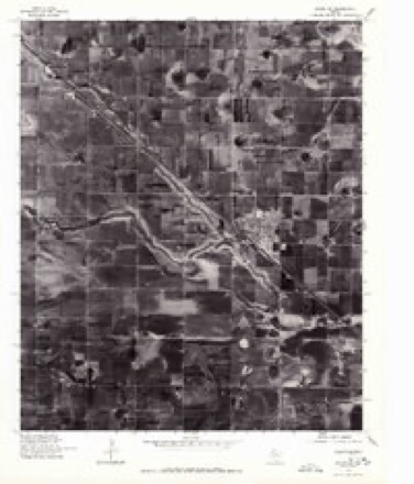
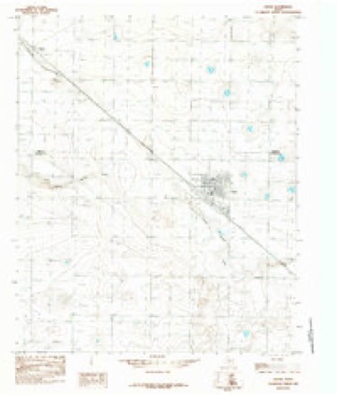
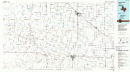
9 topographic sheets cover this place, the earliest surveyed in 1954 and the latest in 1985. It stands in the Anton census division. It lies in ZIP code area 79313. The Survey maps it on the Anton quadrangle. 907 people lived here at the 2020 count. It stands 3,389 feet above sea level.
Population over time
2 figuresAnton fell from 1,126 to 907 between 2010 and 2020. These are the recorded population figures Wikidata holds for this place, reached through the Geographic Names Information System number this page is keyed on rather than by name, so they belong to this place and not to another of the same name. Most are census counts, but not all are: an early figure may be a founding or settlement estimate, and an estimate published within five years of a census is left out. The change column is computed, and is left blank where more than 20 years separate a figure from the one before it, because a gap that long is not a change between two counts.
| Year | People | Change |
|---|---|---|
| 2010 | 1,126 | |
| 2020 | 907 | -219 (-19%) |
Topographic sheets covering this place
7 surveys from 9 printed sheetsMatched by testing this settlement's coordinate against the published boundary of every sheet in the United States Geological Survey's historical collection. Each opens the scanned sheet at the Survey.
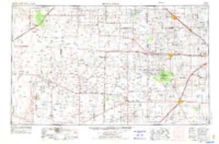
- 1954 USGS Brownfield quadrangle1:250000, 2 printings
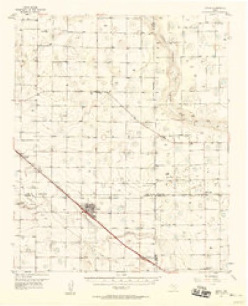
- 1957 USGS Anton quadrangle1:62500
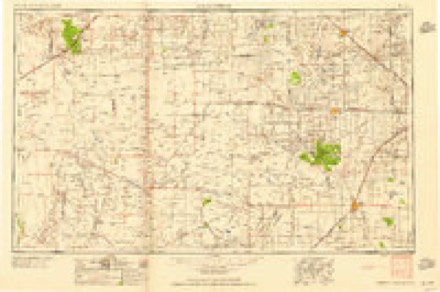
- 1958 USGS Brownfield quadrangle1:250000
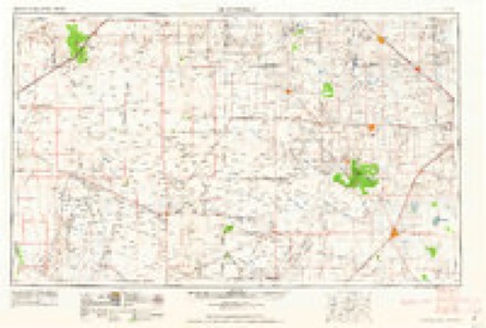
- 1962 USGS Brownfield quadrangle1:250000
- 1976 USGS Anton SW quadrangle1:24000
- 1985 USGS Anton quadrangle1:24000
- 1985 USGS Levelland quadrangle1:100000, 2 printings
Fires near this place
11 since 2007Regional context, not property-specific evidence. The federal wildfire occurrence database lists 11 fires within 5 miles of Anton between 2007 and 2018, burning about 1,176 acres in total. None started naturally. None was recorded as arson. Distance is straight-line from the map coordinates, so a fire counted here may appear on a neighbouring settlement's page as well.
| Reported cause | Fires |
|---|---|
| Equipment and vehicle use | 6 |
| Missing data/not specified/undetermined | 2 |
| Power generation/transmission/distribution | 1 |
| Smoking | 1 |
| Debris and open burning | 1 |
The most recent of them, most recent first, with the day each was reported and the service that recorded it.
| Date | Cause | Size | Reported by | Name on the report |
|---|---|---|---|---|
| 19 June 2011 | Smoking | 450 acres | Texas A & M Forest Service | 11-06191 |
| 8 May 2018 | Missing data/not specified/undetermined | 10 acres | Texas A & M Forest Service | 2018097 |
| 11 May 2018 | Equipment and vehicle use | 45 acres | Texas A & M Forest Service | BOAZ |
| 31 March 2009 | Equipment and vehicle use | 25 acres | Texas A & M Forest Service | 2009-34 |
| 26 March 2010 | Power generation/transmission/distribution | 150 acres | Texas A & M Forest Service | 2010-33 |
| 13 March 2014 | Equipment and vehicle use | 25 acres | Texas A & M Forest Service | GRASS14-9 |
| 18 February 2014 | Equipment and vehicle use | under an acre | Texas A & M Forest Service | GRASS14-3 |
| 13 February 2010 | Equipment and vehicle use | 20 acres | Texas A & M Forest Service | 2010-17 |
Settlements close enough to share some of these fires:
Storms near this place
60 of 71 shownRegional context, not property-specific evidence. The National Weather Service names Anton in 71 storm reports between 1995 and 2025: 37 thunderstorm wind, 24 hail, 4 flash flood, 2 lightning. The reports record 2 injuries. Each account below is quoted exactly as the forecast office filed it, from the NOAA Storm Events Database, and each date opens the federal record of that event.
| When | Event | Place named | Harm | What the report says |
|---|---|---|---|---|
| June 2017 | Hail | Anton | 1 hurt, $3,000,000 | This is the continuation path of the devastating supercell that moved slowly southeast along U.S. Highway 84 from Lamb County. Wind-driven hail as large as baseballs shattered home windows, destroyed siding, punctured roofs, heavily damaged vehicles, wiped out crops, and stripped trees across far northeast Hockley County. The mayor of Anton described the hail damage as the worst he had ever seen in decades of living on the Texas South Plains and declared a state of disaster. The American Red Cross said 100% of the roughly 400 homes in Anton sustained serious damage, with each home requiring on average $6,000 of repairs. One resident of Anton was bruised by the large hail and cut by broken glass as he attempted to cover up shattered windows during the storm. About 8,000 acres of crops in extreme northeast Hockley County were a total loss from the hail, torrential rainfall and flooding that ensued. |
| June 2025 | Lightning | Anton | 1 hurt | An emergency management official for Hockley County reported an injury to a motorist in Anton on US Highway 84 due to a lightning strike. |
| March 2019 | Tornado (EF1) | Anton | $500,000 | A fast-moving tornado developed within a line of thunderstorms and moved north-northeast at 40 to 45 mph. Based on the NWS storm survey and radar data, the total track was determined to be 3.4 miles from extreme northeast Hockley County into far southeast Lamb County (the tornado's length in Hockley County was about 1.8 miles). This tornado caused EF1 damage to a well-built home located about one mile east-southeast of Anton and destroyed a large sheet metal building on the same property. In addition to downing large tree limbs, six power poles were snapped and two large center pivots were heavily damaged. Data from the Lubbock WSR-88D radar confirmed a tornadic debris signature that extended to just over 5000 feet at times. The owner of the house was inside at the time the tornado struck and was not injured, but moments before she had walked outside to see why her satellite TV signal deteriorated. The tornado caused sufficient damage to deem the house a complete loss by her insurance company. Preliminary damage estimates for all structures, personal property, utility poles, and the large center pivots were approximately $500,000. |
| May 2006 | Thunderstorm Wind | Anton | $400,000 | A complex of severe thunderstorms resulted in a locally intense swath of damaging winds near Anton. Damage was confined to a three mile radius in and around the city, but was fairly widespread within the city limits. Several trees, utility poles, and structures sustained damaged. Numerous roofs sustained at least minor damage, with a few peeled back or completely torn off. Several 1,000 pound "round" hay bales were rolled across Business 84 and over the adjacent railroad tracks. Local officials reported that the railroad tracks were obscured by debris at multiple locations through the city. Many highway signs also were blown toward the east. A large storage shed collapsed as severe winds penetrated the structure, and a nearby chute to a grain bin silo was snapped from its concrete foundation. A grain trailer was toppled and a storage facility experienced roof and window damage on the east side of Anton. In addition, a center-pivot irrigation system was heavily damaged three miles southeast of Anton off of U.S. Highway 84. The West Texas Mesonet site located six miles south of Anton recorded a peak gust of 71 MPH at 18:00 CST. No injuries were reported. |
| June 2017 | Flash Flood | Anton | $250,000 | The Sheriff's Office reported that Anton was inaccessible due to flood waters up to three feet deep in locations. Several homes sustained flood damage from water inundation. |
| June 2008 | Lightning | Anton | $100,000 | Around 21:30 CST, lightning struck a home near Anton and sparked a fire in the structure's attic. Within minutes the fire spread and despite the efforts of local firefighters, the home was destroyed. A family inside the home was able to escape without injury. |
| June 2008 | Thunderstorm Wind | Anton | $20,000 | A swath of damaging winds accompanied thunderstorms over northeastern Hockley County between roughly 20:30 CST and 21:15 CST. Initial reports from the public estimated wind gusts up to 60 mph just northwest of Anton. A Texas Tech University West Texas Mesonet site south of the city recorded a peak gust of 74 mph at 20:45 CST. The ten minute average wind speed measured by the automated site between 20:45 CST and 20:55 CST was 50 mph. The Texas Department of Transportation reported that many road signs along U.S. Highway 84 in the Anton vicinity were blown down. Additional damage occurred around 21:15 CST, when a roof was blown of a barn near Texas Highway 114 west of Smyer as the thunderstorm complex continued propagating southeastward. |
| April 2008 | Thunderstorm Wind | Anton | $15,000 | A Texas Tech University West Texas Mesonet site southwest of Anton recorded a severe thunderstorm wind gust of 67 mph at 10:45 CST. Meteorologists from Texas Tech and the National Weather Service later surveyed the area, and discovered minor wind damage to the mesonet station and its instrumentation. Additionally, two wooden utility poles were blown down and snapped near their base approximately one mile north of the damaged mesonet station near Texas Highway 168. A center pivot irrigation system also sustained minor damage. |
| September 2006 | Thunderstorm Wind | Anton | $10,000 | Local officials reported that severe thunderstorm winds downed utility poles in Anton. No structural damage was reported. |
| July 2004 | Thunderstorm Wind | Anton | $10,000 | The Texas Tech West Texas Mesonet station measured a 68 mph thunderstorm wind gust. Power poles were snapped by the strong wind. |
| September 2007 | Hail | Anton | $5,000 | A severe thunderstorm produced large hail that damaged property and cotton crops in the Anton vicinity during the afternoon hours of the 26th. Hail initially caused minor damage to crops northwest of Anton, but more intense damage south of the city was noted by farmers quoted in newspaper articles, where up to seventy-five percent of the crops were heavily damaged. In addition, hailstones up to the size of golf balls reportedly broke windows at a Hockley County maintenance barn just south of Anton. Measurements from the Texas Tech University West Texas Mesonet indicate that the hail also was periodically associated with severe wind gusts. |
| June 2003 | Thunderstorm Wind | Anton | $5,000 | Strong thunderstorm wind blew down power lines. |
| June 2000 | Thunderstorm Wind | Anton | $2,000 | A storm chaser reported that a tractor trailer had been blown over on Highway 84 near Anton. |
| April 2025 | Thunderstorm Wind | Anton | - | A Texas Tech University West Texas mesonet site near Anton measured severe wind gusts from 2050 CST through 2057 CST. A peak wind gust of 64 mph was measured at 2057 CST. |
| April 2025 | Flash Flood | Anton | - | A nearly stationary supercell thunderstorm dropped torrential rainfall in northeastern Hockley County. A West Texas Mesonet station six miles south of Anton recorded 5.83 inches of rain, with WSR-88D MRMS rainfall estimates of six to eight inches. Numerous roads in this area were flooded and impassible for several days with vehicles reported stranded. |
| June 2025 | Hail | Anton | - | A photograph on social media depicted a hailstone 40 minutes after falling south of Anton. The hailstone was still five inches in diameter at the time of retrieval. |
| May 2024 | Hail | Anton | - | A report from the public was received of quarter size hail in Anton. |
| May 2024 | Thunderstorm Wind | Anton | - | A Texas Tech University West Texas mesonet site near Anton measured a severe wind gust of 58 mph. |
| May 2024 | Thunderstorm Wind | Anton | - | A storm chaser's vehicle mounted observing equipment measured a wind gust to 76 mph at 2028 CST west of Anton. A few minutes later at 2033 CST, a Texas Tech University West Texas mesonet site south of Anton begin to measure wind gusts lasting through 2051 CST. A peak wind gust of 91 mph was measured at 2039 CST. The severe winds continued to move south affecting another Texas Tech University West Texas mesonet site near Smyer from 2052 CST through 2108 CST. The site near Smyer measured a peak wind gust of 81 mph at 2052 CST. |
| July 2023 | Thunderstorm Wind | Anton | - | A Texas Tech University West Texas mesonet site near Anton measured severe wind gusts from 2007 CST through 2010 CST. A peak gust of 70 mph was measured at 2007 CST. |
| July 2023 | Thunderstorm Wind | Anton | - | A Texas Tech University West Texas mesonet site near Anton measured severe wind gusts from 1626 CST through 1627 CST. A peak wind gust of 64 mph was measured at 1626 CST. |
| September 2023 | Thunderstorm Wind | Anton | - | A report was received of several structures damaged by severe wind gusts. A roof was blown off of an outbuilding and into a nearby house. Additionally, a fence supported by steel posts was blown down and debris was found approximately 200 yards away. |
| June 2023 | Thunderstorm Wind | Anton | - | A Texas Tech University West Texas mesonet site near Anton measured severe wind gusts from 1619 CST through 1620 CST. A peak wind gust of 65 mph was measured at 1620 CST. |
| August 2022 | Thunderstorm Wind | Anton | - | A Texas Tech University West Texas mesonet site near Anton measured severe wind gusts from 1646 CST through 1659 CST. A peak wind gust of 73 mph was measured at 1652 CST. |
| June 2021 | Thunderstorm Wind | Anton | - | A Texas Tech University West Texas mesonet site near Anton measured a wind gust to 64 mph. |
| May 2021 | Thunderstorm Wind | Anton | - | A Texas Tech University West Texas mesonet site near Anton measured a wind gust of 67 mph. |
| May 2021 | Thunderstorm Wind | Anton | - | A Texas Tech University West Texas mesonet measured a severe wind gust to 71 mph from 2115 CST through 2120 CST. |
| May 2020 | Funnel Cloud | Anton | - | Several funnel clouds were reported just south of Anton. |
| June 2019 | Thunderstorm Wind | Anton | - | A Texas Tech University West Texas mesonet site near Anton measured a wind gust to 59 mph. |
| September 2019 | Thunderstorm Wind | Anton | - | A Texas Tech University West Texas mesonet site near Anton measured a wind gust to 61 mph. |
| June 2017 | Thunderstorm Wind | Anton | - | Intense straight line winds accompanied hail as great as baseball size. |
| July 2017 | Flash Flood | Anton | - | Flash flooding in Anton that began late in the night on June 30th continued for a few additional hours into July 1st. Multiple homes received water inundation damage and the city was marooned by high water for much of the overnight. Monetary damage from this event is not repeated here, but is available in the June 30th entry. |
| July 2017 | Thunderstorm Wind | Anton | - | Measured by a Texas Tech University West Texas mesonet station southwest of Anton. |
| June 2016 | Thunderstorm Wind | Anton | - | A Texas Tech University West Texas mesonet site near Anton measured a wind gust to 66 mph. |
| September 2016 | Thunderstorm Wind | Anton | - | A wind gust to 59 mph was measured at a Texas Tech University West Texas mesonet site near Anton. |
| May 2015 | Hail | Anton | - | An off-duty weather observer reported copious amounts of small hail covering his lawn with a few hailstones estimated up to baseball size. Damage was not known. |
| July 2014 | Thunderstorm Wind | Anton | - | A Texas Tech University West Texas Mesonet station southwest of Anton measured severe winds for a 10 minute period, peaking at 64 mph. |
| July 2014 | Flood | Anton | - | Fire department officials observed flooding near and around Anton, including Farm to Market Road 1294 to 168 as 3 to 5 inches of rain fell over the area. Areas east of Levelland to Opdyke West also reported minor flooding on area roadways, including Highway 114. |
| June 2013 | Thunderstorm Wind | Anton | - | A Texas Tech University West Texas mesonet site and the fire department in Anton recorded wind gusts up to 70 mph. |
| June 2013 | Thunderstorm Wind | Anton | - | A Texas Tech University West Texas mesonet site near Anton measured several severe wind gusts, peaking at 75 mph. |
| February 2009 | Thunderstorm Wind | Anton | - | The Texas Tech University West Texas Mesonet site southwest of Anton recorded a severe thunderstorm wind gust of 58 mph at 20:35 CST. No damage was reported. |
| April 2009 | Hail | Anton | - | An Anton city employee reported that penny to nickel size hail briefly fell in Anton shortly after 19:00 CST. |
| July 2009 | Thunderstorm Wind | Anton | - | The Texas Tech University West Texas Mesonet site southwest of Anton initially measured a thunderstorm wind gust of 70 mph at 22:15 CST on the 29th. Subsequent gusts of 60 mph and 62 mph were recorded at 22:20 CST and 22:25 CST respectively. No damage was reported. |
| April 2008 | Heavy Rain | Anton | - | Very heavy rainfall rates accompanied a wet downburst just south of Anton around 11:00 CST. The Texas Tech University West Texas Mesonet site south of the city recorded a short duration burst of rainfall and damaging thunderstorm winds. The site recorded 1.24 inches of precipitation, however, local news reports suggest that portions of Anton proper picked up between 2.70 and 3.00 inches of rainfall. Storm surveys conducted by National Weather Service meteorologists the following day concluded that water spilled from a swollen playa lake and covered portions of Farm to Market Road 168 south of Anton. |
| May 2008 | Thunderstorm Wind | Anton | - | A linear complex of severe thunderstorms produced widespread damaging winds over eastern Hockley County shortly after 01:00 CST. The Texas Tech University West Texas Mesonet site south of Anton initially recorded 62 mph winds at 01:05 CST. By 01:10 CST, multiple reports of minor tree damage were received from both the Smyer and Ropesville areas. |
| March 2007 | Thunderstorm Wind | Anton | - | Public reports indicated that severe thunderstorm winds downed large tree limbs in Anton and restricted visibilities in blowing dust. |
| September 2007 | Thunderstorm Wind | Anton | - | The Texas Tech University West Texas Mesonet site near Anton recorded a 58 mph wind gust as a severe thunderstorm impacted northeastern Hockley County. No damage was reported. |
| May 2006 | Hail | Anton | - | Multiple reports of penny to quarter size hail were received from locations along a swath just south of Anton. |
| May 2006 | Hail | Anton | - | Storm spotters reported nickel size hail on U.S. Highway 84 along the Hockley and Lubbock County line between Anton and Shallowater. |
| September 2006 | Hail | Anton | - | A severe thunderstorm occurred over central Hockley County during the 18:00 CST hour. Skywarn Spotters reported nickel size hail along U.S. Highway 84 just southeast of Anton as the left-moving (anticyclonic) member of a storm-split moved north-northeastward. |
| September 2006 | Hail | Anton | - | A storm chaser reported quarter size hail along U.S. Highway 84. No damage was reported. |
| June 2005 | Hail | Anton | - | Quarter sized hail indentation marks measured at the Texas Tech/West Texas mesonet station by Texas Tech Mesonet meteorologist. |
| July 2005 | Thunderstorm Wind | Anton | - | Several large tree limbs snapped with a manufactured home roof blown off by thunderstorm wind gusts. |
| May 2003 | Thunderstorm Wind | Anton | - | The West Texas Mesonet station south of Anton measured a 68 mph thunderstorm wind gust. |
| June 2003 | Thunderstorm Wind | Anton | - | The West Texas Mesonet station south of town measured a 58 mph thunderstorm wind gust. |
| June 2002 | Thunderstorm Wind | Anton | - | The West Texas Mesonet station south of town measured 86 mph thunderstorm wind gusts. Wind-driven hail and rain destroyed around 20,000 acres of cotton. |
| March 2001 | Thunderstorm Wind | Anton | - | Strong thunderstorm wind blew a vehicle off the road south of town. |
| May 2001 | Hail | Anton | - | An amateur radio storm spotter reported quarter size hail southwest of town. |
| May 2001 | Hail | Anton | - | Storm spotters reported golfball size hail. The wind-driven hail devastated crops. |
| May 2001 | Hail | Anton | - | Wind-driven hail devastated crops. |
Nearest settlements
The eight closest, with where each one stands in the county. Distances are straight-line, computed from the Geographic Names Information System coordinates.
| Map | Place | Distance | Sheets |
|---|---|---|---|
| Roundup | 4.9 miles | 10 | |
| Whitharral | 10.0 miles | 7 | |
| Oklahoma Flat | 12.7 miles | 8 | |
| Smyer | 15.7 miles | 9 | |
| Opdyke | 16.2 miles | 8 | |
| Opdyke West | 16.8 miles | 8 | |
| Levelland | 19.2 miles | 7 | |
| Pettit | 20.7 miles | 8 |
Elsewhere
Matched on this settlement's Geographic Names Information System number rather than its name, so it cannot be a different place of the same name in another state.
| Wikipedia article on Anton | An encyclopaedic summary. Its text is share-alike, so it is linked here rather than copied. |
| Wikidata item Q975193 | The structured record the population and elevation above come from. Public domain (CC0). |
Provenance
This settlement is recorded in the Geographic Names Information System as feature 1351209. The sheet list is computed by point-in-boundary test against the United States Geological Survey's historical topographic inventory. Both are works of the United States government and carry no copyright under 17 U.S.C. 105.
Wildfire. Short, Karen C. 2022. Spatial wildfire occurrence data for the United States, 1992-2020 [FPA_FOD_20221014]. 6th Edition. Fort Collins, CO: Forest Service Research Data Archive. https://doi.org/10.2737/RDS-2013-0009.6 Collected with United States Government funding and usable without additional permissions or fees.
Storms. NOAA National Centers for Environmental Information, Storm Events Database https://www.ncei.noaa.gov/stormevents/ A work of the United States government, no copyright under 17 U.S.C. 105. Narratives are quoted verbatim from the National Weather Service report and are not edited or summarised.