 Block
BlockLevelland, Texas
7 topographic sheets cover this place, the earliest surveyed in 1954 and the latest in 1985. It stands in the Levelland census division. It lies in ZIP code area 79336. The Survey maps it on the Levelland West quadrangle. 12,652 people lived here at the 2020 count. It stands 3,520 feet above sea level.
Population over time
2 figuresLevelland fell from 13,542 to 12,652 between 2010 and 2020. These are the recorded population figures Wikidata holds for this place, reached through the Geographic Names Information System number this page is keyed on rather than by name, so they belong to this place and not to another of the same name. Most are census counts, but not all are: an early figure may be a founding or settlement estimate, and an estimate published within five years of a census is left out. The change column is computed, and is left blank where more than 20 years separate a figure from the one before it, because a gap that long is not a change between two counts.
| Year | People | Change |
|---|---|---|
| 2010 | 13,542 | |
| 2020 | 12,652 | -890 (-7%) |
Topographic sheets covering this place
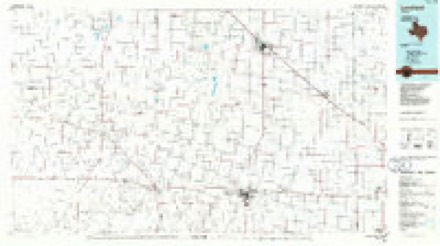
5 surveys from 7 printed sheetsMatched by testing this settlement's coordinate against the published boundary of every sheet in the United States Geological Survey's historical collection. Each opens the scanned sheet at the Survey.
- 1954 USGS Brownfield quadrangle1:250000, 2 printings
- 1958 USGS Brownfield quadrangle1:250000
- 1962 USGS Brownfield quadrangle1:250000
- 1965 USGS Levelland West quadrangle1:24000
- 1985 USGS Levelland quadrangle1:100000, 2 printings
Fires near this place
10 since 2006Regional context, not property-specific evidence. The federal wildfire occurrence database lists 10 fires within 5 miles of Levelland between 2006 and 2016, burning about 1,398 acres in total. None started naturally. 1 was recorded as arson. Distance is straight-line from the map coordinates, so a fire counted here may appear on a neighbouring settlement's page as well.
| Reported cause | Fires |
|---|---|
| Missing data/not specified/undetermined | 4 |
| Smoking | 3 |
| Arson/incendiarism | 1 |
| Power generation/transmission/distribution | 1 |
| Equipment and vehicle use | 1 |
The most recent of them, most recent first, with the day each was reported and the service that recorded it.
| Date | Cause | Size | Reported by | Name on the report |
|---|---|---|---|---|
| 29 April 2011 | Smoking | 50 acres | Texas A & M Forest Service | 1490 |
| 25 April 2011 | Smoking | 1.0 acres | Texas A & M Forest Service | N HWY 385 |
| 19 April 2011 | Smoking | 1.0 acres | Texas A & M Forest Service | HWY 114 DITCH |
| 15 April 2006 | Missing data/not specified/undetermined | 1,300 acres | Texas A & M Forest Service | GUSHER |
| 26 February 2011 | Missing data/not specified/undetermined | 1.0 acres | Texas A & M Forest Service | 108 BUTCH |
| 16 February 2011 | Equipment and vehicle use | 3.0 acres | Texas A & M Forest Service | 2300 ELLIS |
| 31 January 2016 | Power generation/transmission/distribution | 40 acres | Texas A & M Forest Service | ELPASO RD/SUNRISE LN |
| 31 January 2016 | Missing data/not specified/undetermined | 1.0 acres | Texas A & M Forest Service | 204 LOBO |
Settlements close enough to share some of these fires:
Storms near this place
60 of 137 shownRegional context, not property-specific evidence. The National Weather Service names Levelland in 137 storm reports between 1993 and 2025: 62 hail, 54 thunderstorm wind, 10 flash flood, 6 heavy rain. The reports record 14 injuries. Each account below is quoted exactly as the forecast office filed it, from the NOAA Storm Events Database, and each date opens the federal record of that event.
| When | Event | Place named | Harm | What the report says |
|---|---|---|---|---|
| May 2024 | Thunderstorm Wind | Levelland | 13 hurt, $35,000,000 | An NWS storm survey team observed damage to utility poles, trees, and center pivots in and around Levelland. Damage escalated in both coverage and intensity east of US Highway 385 with a concentrated area of damage noted in and around Kauffman Park. Here, winds of 90 mph to 120 mph caused partial failures to some roofs and completely destroyed several wooden outbuildings. Many homes and vehicles|suffered broken windows with roughly one dozen trees uprooted. One home lost roughly 30 percent of its roof and insulation while a wooden framed workshop in its backyard was completely destroyed and|blown two homes away. Numerous wooden and metal fences were also heavily damaged or destroyed. The Penny Newman cotton gin on the east side of Levelland suffered total destruction from winds estimated around 110 mph. |
| July 2017 | Thunderstorm Wind | Levelland | 1 hurt, $1,000,000 | A significant downburst with winds estimated as high as 110 mph struck the northern half of the city of Levelland causing widespread damage to buildings, trees, utility poles, and even rolling two cars from the road. An NWS damage survey team determined the most intense winds were focused about 2.5 miles east of downtown Levelland. It was in this area that a pole barn's metal support beams were ripped from their anchors and a car along State Highway 114 was blown off the road and flipped over. The driver of the car was shaken, but not injured. Damage elsewhere was consistent with winds of 70 to 90 mph and was comprised of peeled back roofs on some buildings and mobile homes, some street signs bent flat to the ground, many large trees snapped at their base, and even a trampoline wrapped around a power pole. Three industrial buildings sustained substantial damage. Sections of streets were so cluttered with structural debris that front-end loaders were required to clear a safe path for travel. One man was injured as the awning he was grilling under collapsed and dragged him a short distance. Approximately 40 power poles were damaged leading to some residents being without power for 11 hours. |
| May 1999 | Hail | Levelland | $20,000,000 | Golfball- to baseball-size hail fell across Levelland, and caused millions of dollars in damages to roofs, vehicles, and windows all across the city. This same storm would later go on to cause damage in Wolfforth and far southwest Lubbock. |
| June 2007 | Thunderstorm Wind | Levelland | $250,000 | A severe thunderstorm produced a swath of damaging winds, accompanied by large hail, from the Levelland vicinity to near Ropesville. A meteorologist initially estimated winds gusting up to 60 mph west of Levelland along Texas Highway 114 at 20:23 CST. By 20:30 CST, the Texas Tech University West Texas Mesonet site south of Levelland recorded a peak gust of 74 mph. The winds downed numerous power lines and utility poles. A roof was blown off of an apartment complex in Levelland, where a storm chaser measured a peak gust of 63 mph. No injuries occurred, but the American Red Cross assisted several families that became homeless due to the damage at the Lone Star Town Homes. All four families, a total of seventeen people, required assistance. In addition, a local AM radio station sustained damage. A Texas Tech University West Texas Mesonet meteorologist later estimated winds up to 65 mph near Ropesville. |
| September 2007 | Thunderstorm Wind | Levelland | $250,000 | Local law enforcement officials and the public reported wind gusts to 60 mph across Hockley county. The swath of winds downed several power poles from west of Levelland along Texas Highway 114 to Whitharral. Additionally, a 300 pound diesel fuel tank also was blown over just east of the Hockley and Cochran county line along Texas Highway 114. |
| June 2002 | Hail | Levelland | $250,000 | The Hockley County Sheriff's office reported baseball size hail. Automobiles and the roofs of homes were damaged. |
| June 2002 | Hail | Levelland | $250,000 | Large hail broke car windshields, cracked skylights, broke windows, and damaged the roofs of homes. |
| August 2001 | Lightning | Levelland | $250,000 | Lightning struck a house and ignited a fire that consumed the entire structure. |
| May 2003 | Thunderstorm Wind | Levelland | $120,000 | Strong thunderstorm wind destroyed several center pivot irrigation systems. |
| July 2010 | Flood | Levelland | $100,000 | Heavy rainfall over portions of southern Hockley County, particularly during the evening hours of the 3rd and the very early morning hours of the 4th, resulted in flooding of many low-lying areas. Local officials reported that several unpaved rural roads retained upwards of a foot of water over their driving surfaces through the 6th. Also, flood waters additionally inundated a number of cotton crops. Local farmers, however, estimated that crop damages across the county were light. |
| June 2007 | Hail | Levelland | $100,000 | A swath of large hail impacted Hockley County as a complex evolution of supercell mergers occurred over the county. Initial reports indicated large hail, including giant tennis ball size hail, near the city of Levelland. A majority of the reports indicated quarter to golf ball size hail between Levelland and Ropesville. The hail was briefly accompanied by severe thunderstorm winds estimated at 70 mph northwest of Ropesville. Windows and skylights were broken in parts of Levelland, and numerous vehicles received hail damage. |
| September 2006 | Thunderstorm Wind | Levelland | $100,000 | Law enforcement officials reported that severe thunderstorm winds destroyed a 20 x 40 foot horse barn east of Levelland. No injuries were reported. |
| April 2001 | Hail | Levelland | $100,000 | Golfball size hail was reported in town. |
| May 2001 | Hail | Levelland | $75,000 | Law enforcement officials reported golfball size hail. |
| August 2013 | Thunderstorm Wind | Levelland | $60,000 | Local emergency management officials reported power poles blown down on the west side of Levelland as a thunderstorm moved through. A mobile home under development was also knocked down by strong winds nearby. |
| May 2008 | Thunderstorm Wind | Levelland | $60,000 | Damaging winds and blinding blowing dust associated with well-organized thunderstorm outflow spread northeastward over parts of Hockley County during the early evening of the 25th. Severe wind gusts up to 61 mph were initially recorded by the Texas Tech University West Texas Mesonet south of Levelland at 17:25 CST. By 17:55 CST, however, gusts at the same site had intensified to a peak speed of 69 mph. Similar wind speeds, up to 65 mph, were estimated by a Texas Tech University West Texas Mesonet meteorologist near Ropesville at 17:50 CST. More than thirty wood utility poles were broken by the winds along Texas Highway 114 just east of Levelland. |
| September 2006 | Flash Flood | Levelland | $50,000 | Widespread rains affected much of the South Plains region of west Texas during the Labor Day weekend, when elevated moisture streamed northeastward from the remnants of Hurricane "John" in the Eastern Pacific. A cold front also pushed south across the region, and provided for prolonged rains in a moist upglide regime. Storm total rainfall amounts through the weekend over Hockley County ranged from 6.75 inches at Anton, 8.00 inches at Whitharral, and 3.80 inches at Ropesville. Although most of the rainfall was light to moderate, runoff was aggravated by a swath of locally heavy rainfall that resulted in flash flooding over portions of central and northern Hockley County early on the 2nd. The Levelland & Hockley County News-Press reported that the Texas Department of Transportation closed numerous roadways across the northern half of the county during the early morning hours of the 2nd. Barricades were erected along stretches of U.S. Highway 385 south of Levelland due to flowing flood waters. In addition, portions of Texas Highway 114, and Farm to Market Roads 2130, 168, and 1490 were inundated by flood waters. Reports indicated that no motorists were threatened by the flooding, but several secondary roadways were washed out by flowing water. |
| May 2001 | Hail | Levelland | $50,000 | Law enforcement officials reported golfball size hail. |
| May 2000 | Hail | Levelland | $50,000 | no account filed |
| June 1994 | Thunderstorm Wind | Levelland | $50,000 | no account filed |
| December 1993 | Thunderstorm Wind | Levelland | $50,000 | no account filed |
| April 2001 | Hail | Levelland | $30,000 | A storm chaser reported half dollar to golfball size hail on Highway 114. |
| June 2007 | Hail | Levelland | $25,000 | A rapidly developing supercell produced tennis ball size hail along U.S. Highway 385 just north of Levelland. Some damage to vehicles was reported. |
| June 2017 | Thunderstorm Wind | Levelland | $22,000 | Multiple downbursts within a high-based supercell produced damage from Levelland southeast towards Ropesville. A Texas Tech University West Texas mesonet south of Levelland measured a gust to 69 mph at 1530 CST. These winds blew a large bay door off a welding shop in Levelland, downed several utility poles and broke many tree limbs as the storm moved southeast toward Ropesville. |
| December 2010 | Thunderstorm Wind | Levelland | $20,000 | Thunderstorm winds snapped four wooden utility poles west of Levelland along Texas Highway 114. The resultant downed power lines sparked a large wind-driven grassland wildfire. |
| June 2008 | Thunderstorm Wind | Levelland | $20,000 | Another round of thunderstorms brought severe wind gusts to portions of central and eastern Hockley County during the 21:00 CST hour. A Texas Tech University West Texas Mesonet meteorologist estimated gusts to 65 mph northwest of Ropesville. Later measurements by the Texas Tech University West Texas Mesonet site near Levelland recorded a peak gust of 71 mph at 21:55 CST. Local newspapers reported a number of downed utility lines and poles across the area. |
| June 2007 | Hail | Levelland | $20,000 | Multiple reports were received of nickel to quarter size hail in and around Levelland. The hail was accompanied by destructive winds. Newspaper reports indicated that hail across the area destroyed more than one thousand acres of cotton. In addition, a total of forty-seven windows were broken by the wind-blown hail in Levelland. |
| June 2007 | Tornado (EF0) | Levelland | $15,000 | Newspaper articles indicated that local law enforcement officials and the public witnessed a tornado just west of Levelland around 22:00 CST. Radar imagery depicted strong evidence of a tornado at the time of the sightings. Fire department officials reported downed power lines in the area of the tornado's path. |
| April 2001 | Hail | Levelland | $15,000 | Amateur radio SKYWARN spotters reported walnut size hail on Highway 114 west of town. |
| September 1999 | Thunderstorm Wind | Levelland | $15,000 | Strong thunderstorm wind destroyed a carport, snapped power poles and blew down power lines. |
| April 2015 | Thunderstorm Wind | Levelland | $10,000 | Downburst winds were measured up to 76 mph on two occasions by a Texas Tech University West Texas Mesonet located four miles south of Levelland. Similar wind gusts damaged a porch and roof of a mobile home near Levelland. Also, one power pole was toppled on the south side of Levelland. |
| May 2015 | Thunderstorm Wind | Levelland | $10,000 | The Levelland fire department estimated wind gusts to 70 mph. A few power lines were downed in the area. |
| June 1999 | Thunderstorm Wind | Levelland | $10,000 | Strong wind snapped several power poles. |
| June 1997 | Thunderstorm Wind | Levelland | $10,000 | no account filed |
| June 2007 | Flash Flood | Levelland | $5,000 | |The Texas Department of Transportation used road graders to clear mud flow debris of more than one foot in depth that resulted from flash flooding over a number of southeast Hockley County roadways. The worst flooding occurred along Farm to Market Roads 2646, 3261, and 1585. |
| April 1999 | Thunderstorm Wind | Levelland | $5,000 | Strong wind blew the doors out of a shop and blew a window out of a truck. |
| October 1998 | Thunderstorm Wind | Levelland | $5,000 | no account filed |
| April 1994 | Hail | Levelland | $5,000 | no account filed |
| June 1994 | Thunderstorm Wind | Levelland | $5,000 | no account filed |
| April 2012 | Thunderstorm Wind | Levelland | $3,000 | Off-duty NWS employees estimated winds around 50 knots in the rear flank downdraft of a supercell. These winds snapped a power pole 2E Levelland along Highway 114. |
| June 2014 | Thunderstorm Wind | Levelland | $2,000 | A storm spotter reported a downed power pole on Highway 114. |
| June 2002 | Thunderstorm Wind | Levelland | $2,000 | Strong thunderstorm winds snapped power poles just west of town. |
| June 1999 | Thunderstorm Wind | Levelland | $2,000 | Strong wind snapped several power poles. |
| March 1993 | Hail | Levelland | $50 | Golfball-size and larger hail was reported by the Hockley County Sheriff's Office in northern Hockley County. Only minor damage resulted. |
| August 2025 | Hail | Levelland | - | Local broadcast media relayed a report of ping pong ball size hail near Levelland. |
| August 2025 | Thunderstorm Wind | Levelland | - | A Texas Tech University West Texas mesonet site near Levelland measured a wind gust of 63 mph. |
| June 2025 | Thunderstorm Wind | Levelland | - | A Texas Tech University West Texas mesonet site near Levelland measured severe wind gusts from 1842 CST through 1850 CST. A peak wind gust of 59 mph was measured at 1850 CST. |
| June 2025 | Thunderstorm Wind | Levelland | - | A Texas Tech University West Texas mesonet site near Levelland measured intermittent severe wind gusts from 1950 CST through 2108 CST. A peak wind gust of 67 mph was measured at 2050 CST. |
| November 2025 | Thunderstorm Wind | Levelland | - | A Texas Tech University West Texas mesonet site near Levelland measured a severe wind gust of 60 mph. |
| July 2024 | Thunderstorm Wind | Levelland | - | A swath of severe thunderstorm winds were observed south of Levelland to north of Ropesville. A Texas Tech University West Texas mesonet site near Levelland measured severe wind gusts from 1624 CST through 1648 CST. A peak wind gust of 80 mph was measured at 1638 CST. Additionally, a trained spotter estimated 80 mph wind gusts north of Ropesville. |
| June 2024 | Thunderstorm Wind | Levelland | - | A Texas Tech University West Texas mesonet site near Levelland measured a severe wind gust of 62 mph. |
| May 2024 | Thunderstorm Wind | Levelland | - | A Texas Tech University West Texas mesonet site near Levelland measured severe wind gusts from 2102 CST through 2109 CST. A peak wind gust of 64 mph was measured at 2102 CST. |
| May 2024 | Thunderstorm Wind | Levelland | - | An emergency management official in Hockley County measured a wind gust of 61 mph. |
| July 2023 | Thunderstorm Wind | Levelland | - | At 1754 CST, a Texas Tech University West Texas mesonet site near Levelland measured a wind gust of 59 mph. The AWOS at the Levelland Municipal Airport measured a wind gust of 64 mph at 1755 CST. |
| October 2023 | Hail | Levelland | - | An emergency management official from Levelland reported quarter size hail on the north side of Levelland. |
| June 2023 | Flash Flood | Levelland | - | Torrential rainfall led to near zero visibilities along US Highway 84 in northeastern Hockley County as reported by local law enforcement and from public reports. Storms slowly trained over the area from central Hockley County from north of Levelland to near Anton. Water was reportedly over the roadway along US Highway 385 between Whitharral and Levelland. |
| May 2022 | Hail | Levelland | - | Numerous reports were received of hail ranging from ping pong ball size to baseball size in and around Levelland. Extensive damage occurred in Levelland from this hail, primarily from shattered glass. |
| May 2022 | Thunderstorm Wind | Levelland | - | A Texas Tech University West Texas mesonet site near Levelland measured a wind gust of 61 mph at 1917 CST. |
| May 2022 | Thunderstorm Wind | Levelland | - | A Texas Tech University West Texas mesonet site near Levelland measured a wind gust of 65 mph. |
| May 2022 | Hail | Levelland | - | A trained spotter reported golf ball size hail just to the northeast of Levelland. |
Nearest settlements
The eight closest, with where each one stands in the county. Distances are straight-line, computed from the Geographic Names Information System coordinates.
| Map | Place | Distance | Sheets |
|---|---|---|---|
| Opdyke West | 4.0 miles | 8 | |
| Opdyke | 5.4 miles | 8 | |
| Coble | 6.6 miles | 7 | |
| Arnett | 8.0 miles | 7 | |
| Clauene | 8.7 miles | 7 | |
| Whitharral | 10.7 miles | 7 | |
| Sundown | 10.8 miles | 7 | |
| Pettit | 10.9 miles | 8 |
Elsewhere
Matched on this settlement's Geographic Names Information System number rather than its name, so it cannot be a different place of the same name in another state.
| Wikipedia article on Levelland | An encyclopaedic summary. Its text is share-alike, so it is linked here rather than copied. |
| Wikidata item Q970608 | The structured record the population and elevation above come from. Public domain (CC0). |
Provenance
This settlement is recorded in the Geographic Names Information System as feature 1361113. The sheet list is computed by point-in-boundary test against the United States Geological Survey's historical topographic inventory. Both are works of the United States government and carry no copyright under 17 U.S.C. 105.
Wildfire. Short, Karen C. 2022. Spatial wildfire occurrence data for the United States, 1992-2020 [FPA_FOD_20221014]. 6th Edition. Fort Collins, CO: Forest Service Research Data Archive. https://doi.org/10.2737/RDS-2013-0009.6 Collected with United States Government funding and usable without additional permissions or fees.
Storms. NOAA National Centers for Environmental Information, Storm Events Database https://www.ncei.noaa.gov/stormevents/ A work of the United States government, no copyright under 17 U.S.C. 105. Narratives are quoted verbatim from the National Weather Service report and are not edited or summarised.