 Block
BlockClarendon, Texas
8 topographic sheets cover this place, the earliest surveyed in 1954 and the latest in 1986. It stands in the Clarendon census division. It lies in ZIP code area 79226. The Survey maps it on the Clarendon quadrangle. 1,877 people lived here at the 2020 count. It stands 2,733 feet above sea level.
Research this city
On record in Clarendon
Buildings and businesses the archive holds for this place. Each opens its own page, with the source record it came from.
On the National Register 3 records
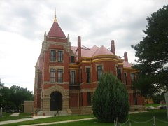 Donley County Courthouse and Jaillisted 1978
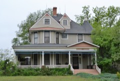 Martin-Lowe Houselisted 1985
- Clarendon Motor Company Buildinglisted 1994
Population over time
2 figuresClarendon fell from 2,026 to 1,877 between 2010 and 2020. These are the recorded population figures Wikidata holds for this place, reached through the Geographic Names Information System number this page is keyed on rather than by name, so they belong to this place and not to another of the same name. Most are census counts, but not all are: an early figure may be a founding or settlement estimate, and an estimate published within five years of a census is left out. The change column is computed, and is left blank where more than 20 years separate a figure from the one before it, because a gap that long is not a change between two counts.
| Year | People | Change |
|---|---|---|
| 2010 | 2,026 | |
| 2020 | 1,877 | -149 (-7%) |
Topographic sheets covering this place
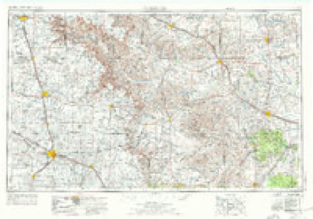
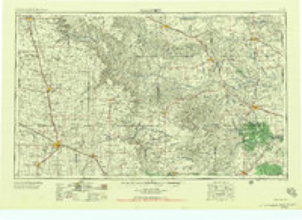
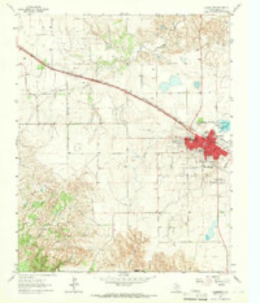
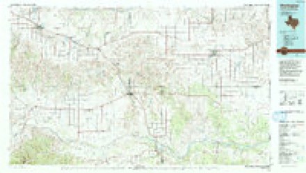
4 surveys from 8 printed sheetsMatched by testing this settlement's coordinate against the published boundary of every sheet in the United States Geological Survey's historical collection. Each opens the scanned sheet at the Survey.
- 1954 USGS Plainview quadrangle1:250000, 3 printings
- 1958 USGS Plainview quadrangle1:250000
- 1963 USGS Clarendon quadrangle1:24000, 2 printings
- 1986 USGS Wellington quadrangle1:100000, 2 printings
Fires near this place
109 since 2006Regional context, not property-specific evidence. The federal wildfire occurrence database lists 109 fires within 5 miles of Clarendon between 2006 and 2019, burning about 3,104 acres in total. 13 started naturally. 5 were recorded as arson. Distance is straight-line from the map coordinates, so a fire counted here may appear on a neighbouring settlement's page as well.
| Reported cause | Fires |
|---|---|
| Equipment and vehicle use | 29 |
| Missing data/not specified/undetermined | 24 |
| Debris and open burning | 17 |
| Power generation/transmission/distribution | 14 |
| Natural | 13 |
| Arson/incendiarism | 5 |
| Misuse of fire by a minor | 4 |
| Smoking | 3 |
The most recent of them, most recent first, with the day each was reported and the service that recorded it.
| Date | Cause | Size | Reported by | Name on the report |
|---|---|---|---|---|
| 4 September 2009 | Equipment and vehicle use | under an acre | Texas A & M Forest Service | 287 WEST |
| 3 September 2011 | Natural | 1.0 acres | Texas A & M Forest Service | GREENBELT LAKE |
| 29 September 2014 | Missing data/not specified/undetermined | 5.0 acres | Texas A & M Forest Service | COOK STREET |
| 27 September 2014 | Equipment and vehicle use | 60 acres | Texas A & M Forest Service | SALAZAR - CR 13 |
| 24 September 2015 | Power generation/transmission/distribution | 1.0 acres | Texas A & M Forest Service | US 287 - WEST OF TXDOT |
| 20 September 2016 | Equipment and vehicle use | 1.0 acres | Texas A & M Forest Service | FM 2162 - RIGHT OF WAY |
| 1 September 2010 | Missing data/not specified/undetermined | 1.0 acres | Texas A & M Forest Service | SHALLER FIRE |
| 8 August 2011 | Natural | 45 acres | Texas A & M Forest Service | SHALLER FIRE |
Settlements close enough to share some of these fires:
Storms near this place
60 of 235 shownRegional context, not property-specific evidence. The National Weather Service names Clarendon in 235 storm reports between 1993 and 2025: 143 hail, 49 thunderstorm wind, 17 flash flood, 15 tornado. No death or injury is recorded in these reports. Each account below is quoted exactly as the forecast office filed it, from the NOAA Storm Events Database, and each date opens the federal record of that event.
| When | Event | Place named | Harm | What the report says |
|---|---|---|---|---|
| March 2021 | Tornado (EF2) | Clarendon | $250,000 | A tornado touched down on the southwest side of Clarendon, continuing through Greenbelt Reservoir before dissipating northeast of Howardwick. Minor damage to homes and Clarendon College was observed on the west side of Clarendon. The tornado took on a wider path and strengthened as it progressed toward Greenbelt Reservoir causing considerable damage to mobile homes, recreational vehicles, and boating facilities. In addition, several power poles of varying sizes were downed and many trees were snapped in the area. |
| May 2001 | Flash Flood | Clarendon | $250,000 | Flash flooding was first reported by a National Weather Service Cooperative Observer in Clarendon with U.S. Highway 287 closed. Water was reported three feet deep on U.S. Highway 287 in Clarendon and water was covering the road on State Highway 70 with both highways being shut down. Vehicles were reported to have been washed away and people had to be rescued. The Texas Department of Public Safety lost three patrol cars in the flood. By late evening...there was one foot of water covering U.S. Highway 287 and everyone had been rescued. By the early morning hours...eight Government apartments had four inches of water in them and four feet of water was found around a house with six inches of water inside. Major damage was done to the house. A peanut field was destroyed just north of Clarendon as the water stripped the top soil away along with the peanut seeds. There was extensive county road damage across Donley county. |
| April 2003 | Tornado (F1) | Clarendon | $150,000 | Roof partially blown off a house...two second story rooms and the front porch of a vacant house were ripped apart...a doublewide trailer house had damage to the roof and windows...two unattached garages destroyed...trees uprooted...other roofs and barns were reported damaged. |
| September 2013 | Thunderstorm Wind | Clarendon | $50,000 | A broken line of thunderstorms moved across the southern Texas Panhandle during the evening hours of the 27th. As this line moved over the city of Clarendon (Donley County), a member of the public reported that 3 power poles had been blown down along State Highway 70 by a downburst. There was also heavy damage to two large storage units, and two center pivot irrigation systems were turned. This line continued to move eastward across the southern Texas Panhandle after producing this damage. |
| August 2001 | Thunderstorm Wind | Clarendon | $40,000 | High winds at Clarendon High School knocked over the top two-thirds of one of the light poles at Bronco Stadium. The steel pole snapped electric lines and disrupted power in the city for half an hour. The pole fell on top of the south wall of the stadium but did not damage the historic rock wall. |
| March 2007 | Thunderstorm Wind | Clarendon | $34,000 | Tractor trailer truck was reported overturned by the high winds. No injuries were reported. |
| May 2024 | Hail | Clarendon | $30,000 | A swath of large hail occurred across Clarendon, resulting from a supercell that formed just to the west of the city. Hail ranged from 1.5 inches up to 4 inches. The 4 inch hailstone occurred 4 miles west northwest of Clarendon just south of Highway 287. |
| March 2021 | Tornado (EF0) | Clarendon | $30,000 | A brief tornado occurred on the western side of the city of Clarendon. This tornado was rain wrapped, but was observed by several chasers in the area. The tornado produced damage consistent with 80 to 85 mph winds, damaging several homes, trees, and sheds. Approximately 10 homes suffered shingle damage to roofs, while multiple trees were downed. Near the narrow path of this tornado, straight line winds caused damage to a scoreboard at a nearby baseball field. |
| May 2024 | Tornado (EF0) | Clarendon | $20,000 | This tornado touched down briefly in ranch land to the west southwest of Clarendon. The damage appeared to be mostly from damaged mesquite brush and perhaps some fencing material. Survey information was obtained from local officials as access was hard due to private land and terrain. The tornado was also documented on chaser/spotter footage and appeared to not be on the ground but for a couple of minutes before lifting. The maximum estimated winds were 80mph. |
| September 2023 | Thunderstorm Wind | Clarendon | $20,000 | A well-built carport, along with the vehicles in it had wind damage. Also, part of the roof on the home was damaged as well. |
| March 2021 | Flood | Clarendon | $20,000 | no account filed |
| February 2007 | Thunderstorm Wind | Clarendon | $6,000 | Power lines reported blown down along U.S. Highway 287 southeast of Giles Texas in Donley County. No injuries were reported. |
| June 2005 | Tornado (F0) | Clarendon | $6,000 | Rope tornado verified by broadcast media video. Several power lines were knocked down...but otherwise no other damage and no injuries. The tornado occurred over open country and the path length and path width were estimated. |
| March 2007 | Tornado (EF1) | Clarendon | $5,000 | This tornado crossed Highway 287, damaging a home along the south side of the highway. |
| April 2025 | Hail | Clarendon | - | One inch hail fell across Clarendon, from about 4 miles west of town along Highway 287 to the east southeast of town. |
| April 2025 | Flood | Clarendon | - | Many dry creeks had fast flowing water in them along Texas Highway 70 between Brice and Clarendon. |
| March 2024 | Thunderstorm Wind | Clarendon | - | The mesonet station located two miles west of Clarendon measured a 67mph wind gust. |
| May 2020 | Hail | Clarendon | - | This hail was observed 1 mile east-southeast of Clarendon. |
| May 2020 | Hail | Clarendon | - | This hail was observed 4 miles southwest of Greenbelt Lake. |
| May 2020 | Flood | Clarendon | - | Street flooding occurred in Clarendon. |
| May 2020 | Funnel Cloud | Clarendon | - | A funnel cloud was observed over Clarendon. |
| May 2020 | Hail | Clarendon | - | This hail was observed 3 miles north of Clarendon. |
| May 2019 | Hail | Clarendon | - | Late report of dime to quarter size hail, time estimated from radar. |
| May 2019 | Hail | Clarendon | - | Late report of quarter size hail while traveling along U.S. Highway 287. Time estimated from radar. |
| May 2019 | Hail | Clarendon | - | Late report of quarter size hail while traveling along U.S. Highway 287. Time estimated from radar. |
| July 2018 | Thunderstorm Wind | Clarendon | - | Tree knocked down on powerline. |
| July 2018 | Thunderstorm Wind | Clarendon | - | One car flipped over 4 miles west of Clarendon on Highway 287. |
| July 2018 | Thunderstorm Wind | Clarendon | - | Estimated by the public who called in for the report. |
| May 2018 | Hail | Clarendon | - | Nickel to quarter sized hail reported at Clarendon College. |
| December 2018 | Tornado (EF0) | Clarendon | - | Storm survey showed damage was relatively minor and consisted of many small and some large broken tree limbs along with a few peeled up shingles and sheet metal damage. The more significant damage occurred along a 50-100 yard wide and 1/2 mile long path which extended from southwest to northeast across the southeast side of Clarendon. The presence of a relatively narrow damage path was consistent with a weak tornado embedded within a line of storms. |
| June 2017 | Hail | Clarendon | - | Tennis ball size hail south of Clarendon, on HWY 70. |
| May 2016 | Hail | Clarendon | - | Penny size hail was reported 4 miles southwest of Greenbelt Lake. |
| May 2016 | Hail | Clarendon | - | Dime to half dollar size hailstones were reported along Highway 287 3 miles northwest of Clarendon. |
| May 2016 | Thunderstorm Wind | Clarendon | - | A 60 mph wind gust was measured by the West Texas Mesonet located 2 miles west-southwest of Clarendon. |
| May 2016 | Hail | Clarendon | - | Quarter size hail was reported in Clarendon. |
| May 2016 | Hail | Clarendon | - | Penny size hail was reported 3 miles south-southeast of Greenbelt Lake. |
| April 2016 | Hail | Clarendon | - | Quarter size hail was reported 5 miles south of Clarendon. |
| April 2016 | Hail | Clarendon | - | Nickel size hail was reported in Clarendon. |
| May 2016 | Hail | Clarendon | - | Tennis ball size hail was reported in Clarendon. |
| April 2016 | Hail | Clarendon | - | Up to quarter size hail fell 5 miles south of Clarendon along Highway 70. |
| May 2016 | Hail | Clarendon | - | Half dollar size hail was reported in Clarendon. |
| May 2016 | Hail | Clarendon | - | Quarter size hail fell 2 miles east-southeast of Clarendon. This was the first of two storms that brought large hail to the Clarendon area. |
| April 2016 | Hail | Clarendon | - | Hail to near golf ball size was reported along Highway 70 approximately 11 miles south of Clarendon. |
| August 2015 | Thunderstorm Wind | Clarendon | - | Tree limbs 3 to 4 inches in diamter were reported down. |
| July 2015 | Flash Flood | Clarendon | - | A deputy reported 5 inches of water flowing quickly across Highway 70 about 5 miles north of Brice. |
| May 2015 | Hail | Clarendon | - | Quarter size hail was reported 5 miles south of Claude. |
| May 2015 | Hail | Clarendon | - | Hail was reported by the public in Clarendon. The size of the hailstones ranged from pea to half dollar. |
| May 2015 | Hail | Clarendon | - | Ping pong ball size hail was reported one mile northeast of Clarendon. |
| August 2014 | Flash Flood | Clarendon | - | A cluster of thunderstorms developed over Donley County during the afternoon hours of the 28th. These thunderstorms produced intense rainfall which led to the development of flash flooding in rural areas northwest of the town of Clarendon (Donley County). A local law enforcement officer reported that a foot of flowing water was covering a low water crossing 3 miles northwest of Clarendon (Donley County). This flooding diminished quickly once precipitation moved east of the area. |
| August 2014 | Hail | Clarendon | - | A cluster of thunderstorms developed over Donley County during the afternoon hours of the 28th. As these storms neared Greenbelt Lake (Donley County), a member of the public reported hen egg size hail (2.00 inches) four miles north of the town of Clarendon (Donley County). After producing this hail, the storms continued to move to the northeast across the county. |
| August 2014 | Hail | Clarendon | - | A cluster of thunderstorms developed over Donley County during the afternoon hours of the 28th. As these storms neared Clarendon (Donley County), a law enforcement officer reported half ping pong ball size hail (1.50 inches) two miles west of Clarendon (Donley County). After producing this hail, the storms continued to move to the northeast across the county. |
| August 2014 | Funnel Cloud | Clarendon | - | A cluster of thunderstorms developed over Donley County during the afternoon hours of the 28th. As the storms moved over the town of Clarendon (Donley County), local law enforcement and many member of the public reported a funnel cloud and possible brief tornado in town. Numerous photos were provided and the local newspaper reported on the funnel cloud however, no damage was reported. As a result, the existence of a tornado was not confirmed. The funnel dissipated as the storm moved northeast of town. |
| May 2014 | Hail | Clarendon | - | A line of thunderstorms developed in response to a cold front moving through the southeastern Texas Panhandle during the late evening hours of the 11th. As the line moved toward the town of Clarendon (Donley County), a law enforcement official reported golf ball size hail (1.75 inches) 1 mile south of Clarendon. After producing this hail the line continued to slowly move to the east. |
| May 2014 | Hail | Clarendon | - | A line of thunderstorms developed in response to a cold front moving through the southeastern Texas Panhandle during the late evening hours of the 11th. As the line moved over the town of Clarendon (Donley County), a member of the public reported quarter size hail (1.00 inch). After producing this hail the line continued to slowly move to the east. |
| May 2014 | Hail | Clarendon | - | A line of thunderstorms developed in response to a cold front moving through the southeastern Texas Panhandle during the late evening hours of the 11th. As the line moved over the town of Clarendon (Donley County), a law enforcement official reported quarter size hail (1.00 inch). After producing this hail the line continued to slowly move to the east. |
| May 2014 | Hail | Clarendon | - | A line of thunderstorms developed in response to a cold front moving through the southeastern Texas Panhandle during the late evening hours of the 11th. As the line moved over the town of Clarendon (Donley County), a member of the public reported ping pong ball size hail (1.50 inches). After producing this hail the line continued to slowly move to the east. |
| June 2014 | Thunderstorm Wind | Clarendon | - | A cluster of discrete thunderstorms moving across the Texas Panhandle transitioned into a broken linear structure during the late evening hours of the 6th. As this broken line of storms where near the town of Clarendon (Donley County), the West Texas Mesonet site 2 miles west-southwest of Clarendon (Donley County) reported a 58 mph downburst gust. After producing this gust the line of thunderstorms continued moving eastward across the Panhandle. |
| June 2014 | Thunderstorm Wind | Clarendon | - | A cluster of discrete thunderstorms moving across the Texas Panhandle transitioned into a broken linear structure during the late evening hours of the 6th. As this broken line of storms where near the town of Clarendon (Donley County), the KVII Schoolnet site in Clarendon (Donley County) reported a 59 mph downburst gust. After producing this gust the line of thunderstorms continued moving eastward across the Panhandle. |
| June 2014 | Thunderstorm Wind | Clarendon | - | A line of thunderstorms moved out of the Oklahoma Panhandle and into the Texas Panhandle during the late night hours of the 22nd. As the line neared the town of Clarendon (Donley County), the West Texas Mesonet site 2 miles west-southwest of Clarendon (Donley County) reported a 60 mph thunderstorm downburst gust. After producing this downburst gust the line continued to move to the south-southeast across the Texas Panhandle. |
| June 2013 | Hail | Clarendon | - | Discrete thunderstorms developed over the southern Texas Panhandle during the evening hours of the 16th and moved to the south-southeast across the Texas Panhandle. One of these thunderstorms moved over the city of Clarendon (Donley County). While over the city, a memeber of the public reported quarter size hail (1.00 inches). The thunderstorm continued to move to the south-southeast across the county after producing this hail. |
Nearest settlements
The eight closest, with where each one stands in the county. Distances are straight-line, computed from the Geographic Names Information System coordinates.
| Map | Place | Distance | Sheets |
|---|---|---|---|
| Lelia Lake | 6.7 miles | 8 | |
| Howardwick | 6.9 miles | 7 | |
| Ashtola | 9.5 miles | 7 | |
| Hedley | 13.0 miles | 8 | |
| Jericho | 16.3 miles | 6 | |
| Rockledge | 16.8 miles | 6 | |
| McKnight | 17.7 miles | 8 | |
| Giles | 18.0 miles | 8 |
Elsewhere
Matched on this settlement's Geographic Names Information System number rather than its name, so it cannot be a different place of the same name in another state.
| Wikipedia article on Clarendon | An encyclopaedic summary. Its text is share-alike, so it is linked here rather than copied. |
| Wikidata item Q979382 | The structured record the population and elevation above come from. Public domain (CC0). |
Provenance
This settlement is recorded in the Geographic Names Information System as feature 1354555. The sheet list is computed by point-in-boundary test against the United States Geological Survey's historical topographic inventory. Both are works of the United States government and carry no copyright under 17 U.S.C. 105.
Wildfire. Short, Karen C. 2022. Spatial wildfire occurrence data for the United States, 1992-2020 [FPA_FOD_20221014]. 6th Edition. Fort Collins, CO: Forest Service Research Data Archive. https://doi.org/10.2737/RDS-2013-0009.6 Collected with United States Government funding and usable without additional permissions or fees.
Storms. NOAA National Centers for Environmental Information, Storm Events Database https://www.ncei.noaa.gov/stormevents/ A work of the United States government, no copyright under 17 U.S.C. 105. Narratives are quoted verbatim from the National Weather Service report and are not edited or summarised.