 Block
BlockJericho, Texas
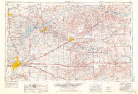
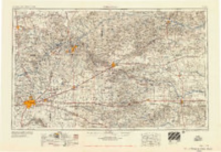
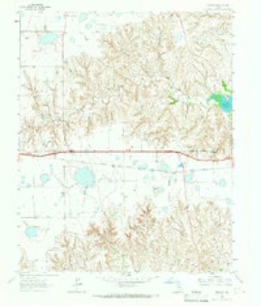
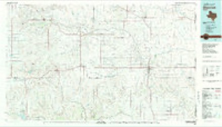
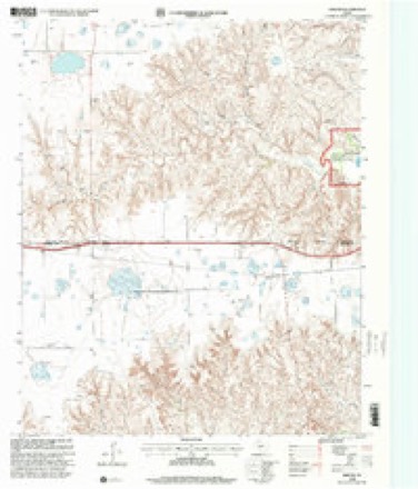
6 topographic sheets cover this place, the earliest surveyed in 1954 and the latest in 1998. It stands in the Clarendon census division. It lies in ZIP code area 79226. The Survey maps it on the Jericho quadrangle.
Topographic sheets covering this place
5 surveys from 6 printed sheetsMatched by testing this settlement's coordinate against the published boundary of every sheet in the United States Geological Survey's historical collection. Each opens the scanned sheet at the Survey.
- 1954 USGS Amarillo quadrangle1:250000, 2 printings
- 1958 USGS Amarillo quadrangle1:250000
- 1964 USGS Jericho quadrangle1:24000
- 1983 USGS Shamrock quadrangle1:100000
- 1998 USGS Jericho quadrangle1:24000
Fires near this place
42 since 2002Regional context, not property-specific evidence. The federal wildfire occurrence database lists 42 fires within 5 miles of Jericho between 2002 and 2020, burning about 451,987 acres in total. 3 started naturally. 1 was recorded as arson. Distance is straight-line from the map coordinates, so a fire counted here may appear on a neighbouring settlement's page as well.
| Reported cause | Fires |
|---|---|
| Equipment and vehicle use | 17 |
| Power generation/transmission/distribution | 8 |
| Missing data/not specified/undetermined | 7 |
| Natural | 3 |
| Recreation and ceremony | 3 |
| Smoking | 2 |
| Debris and open burning | 1 |
| Arson/incendiarism | 1 |
The most recent of them, most recent first, with the day each was reported and the service that recorded it.
| Date | Cause | Size | Reported by | Name on the report |
|---|---|---|---|---|
| 27 September 2007 | Debris and open burning | under an acre | Texas A & M Forest Service | not named |
| 14 September 2017 | Natural | 30 acres | Texas A & M Forest Service | TL ROACH RANCH |
| 3 August 2013 | Equipment and vehicle use | 1.0 acres | Texas A & M Forest Service | MM 124 INTERSTATE 40 |
| 13 August 2011 | Equipment and vehicle use | 1.0 acres | Texas A & M Forest Service | HWY 70 & INTERSTATE 40 |
| 30 July 2016 | Equipment and vehicle use | 1.0 acres | Texas A & M Forest Service | INTERSTATE 40 MM 125 |
| 26 July 2014 | Smoking | 7.5 acres | Cibola National Forest | MCCLELLAN LAKE |
| 26 July 2002 | Power generation/transmission/distribution | 10 acres | Cibola National Forest | MCCLELLAN CREEK |
| 25 July 2018 | Equipment and vehicle use | 1.0 acres | Texas A & M Forest Service | INTERSTATE 40 MM 126 |
Settlements close enough to share some of these fires:
Storms near this place
46 since 1997Regional context, not property-specific evidence. The National Weather Service names Jericho in 46 storm reports between 1997 and 2021: 34 hail, 8 tornado, 3 thunderstorm wind, 1 flash flood. The reports record 2 injuries. Each account below is quoted exactly as the forecast office filed it, from the NOAA Storm Events Database, and each date opens the federal record of that event.
| When | Event | Place named | Harm | What the report says |
|---|---|---|---|---|
| March 2007 | Tornado (EF3) | Jericho | 2 hurt, $180,000 | The tornado formed in the northwest part of Donley county at 1839 CST three miles south southwest of Jericho and tracked north northwest for about three miles before exiting Donley county one and a half miles west northwest of Jericho at 1848 CST.The tornado continued in Gray county for about another three miles before dissipating at 1854 CST.|Damage was first noted two miles south of Interstate 40 along County Road 9 in northwest Donley County. The roof of a horse barn was completely destroyed...as was the rear room addition. Beside the barn...welded steel fencing was bent or mildly twisted. A refrigerated boxcar that had contained tools and horse feed was rolled northward eleven times and found on its side almost one hundred yards north of its original location. A feeding trough originally near the boxcar was carried one hundred yards northwest of its previous location. Three hundred yards away...the mobile home of the property owner suffered only minor damage.|One mile north northwest of this location...a large home apparently lost a substantial portion of its roof. An irrigation pivot was overturned in a field just northwest of the home.|The most significant damage from this tornado occurred to three semi trucks that were caught and badly damaged in the tornado on Interstate 40 on the Donley county and Gray county line. In this area...power poles were snapped near their bases. The cab of one of the semi trucks was reportedly lifted and deposited atop its trailer. The driver and his wife were sucked out of the cab. The driver was completely disrobed some distance away from the truck. His clothing was found tangled in the engine of the truck. The driver and his wife were reported to be in critical and serious condition...respectively. Additionally the cab was crushed to the steering column. The trailer roof appeared to have been pried up and twisted...and at least one of the side walls failed. The contents of the truck were scattered downstream into a field for nearly a mile. In this field...irrigation pivots were overturned. The property owner also reported that irrigation pivot tires weighing three hundred pounds were relocated and a fifteen hundred gallon fertilizer tank that was one quarter full was gone. |
| March 2007 | Tornado (EF2) | Jericho | $170,000 | This tornado developed in northern Donley County near where Farm to Market Road 291 ends and then traveled northeast to near the Donley County and Gray County line and dissipated at 1924 CST about eleven miles east of Jericho. The tornado developed over ranch land initially causing sporadic damage to trees and fences. The first continuous track of damage encountered was to a newly constructed home...which sustained total roof loss as the roof was lifted...destroyed...and scattered over a mile northward. The house walls were constructed of reinforced concrete and were left intact...suffering only windblown hail damage to their stucco exterior. A few power poles were also snapped in the vicinity of the home. On a ranch to the north of the home...significant damage to hardwood trees was encountered ranging from snapped large branches to snapped trunks. Power poles were also snapped on the property and fencing was destroyed in several locations. The worst damage on this ranch was sustained in an area of dense tree coverage...where treetops were sheared off...intact trees were defoliated and large trunks were snapped. Two hundred yards of barbed wire fencing had been rolled into a ball. No injuries were reported. |
| April 1997 | Hail | Jericho | $75,000 | Flooding also. 100 head of cattle killed. |
| August 2001 | Thunderstorm Wind | Jericho | $70,000 | High winds blew over a cattle truck. |
| March 2007 | Thunderstorm Wind | Jericho | $25,000 | Straight line wind damage reported to a horse trailer and other structures. No injuries were reported. |
| May 2017 | Tornado (EF0) | Jericho | - | Tornado on the ground observed by NWS Employee. |
| May 2016 | Hail | Jericho | - | Two inch diameter hail was found by storm chasers at the Interstate 40 Rest Stop, 4 miles southeast of Lake McClellan. |
| May 2016 | Hail | Jericho | - | Quarter size hail fell 3 miles south-southeast of Lake McClellan. |
| May 2016 | Hail | Jericho | - | Penny size hail fell 4 miles southeast of Lake McClellan. |
| July 2016 | Hail | Jericho | - | Reported between Groom and Highway 70 going north. Quarter size increased to ping pong ball size. |
| April 2015 | Hail | Jericho | - | Hail up to golf ball size was reported at the Gray County rest area. |
| May 2015 | Hail | Jericho | - | Quarter size hail was reported 6 miles east-southeast of Groom. |
| June 2014 | Hail | Jericho | - | Another discrete supercell moving northeastward entered southern Donley County around 10 PM CST. As this supercell moved north of the town of Hedley (Donley County), a trained storm spotter reported quarter size hail (1.00 inch) 19 miles north of Hedley (Donley County). After producing this hail, the supercell continued to move northeastward across the county. |
| June 2014 | Hail | Jericho | - | A discrete supercell moving northeastward entered southern Donley County around 8 PM CST. As this supercell moved north of the town of Clarendon (Donley County), a storm chaser reported golf ball size hail (1.75 inches) at the intersection of Interstate 40 and US Highway 70 (Donley County). After producing this hail, the supercell continued to move northeastward across the county. |
| May 2013 | Hail | Jericho | - | A group of people traveling east on Interstate 40 encountered a decaying thunderstorm. At the US Highway 70 exit the group witnessed the thunderstorm producing golf ball size hail. No information as to whether there was damage to their vehicle or if any other damage was caused by this hail was given. |
| April 2010 | Hail | Jericho | - | The trained spotter reported the hail near the intersection of Interstate 40 and Texas State Highway 70. |
| April 2010 | Tornado (EF0) | Jericho | - | The tornado touched down four miles southeast of Groom in Donley County at 1610 CST and lifted at 1626 CST two miles east southeast of Jericho. The tornado was on the ground for about eight miles with a maximum path width of one hundred yards. No damage or injuries were reported. |
| April 2010 | Tornado (EF0) | Jericho | - | The tornado touched down eight miles east southeast of Groom in Donley County at 1707 CST and then lifted at 1709 CST. The tornado was on the ground for one half mile with a maximum path width of twenty-five yards. No damage or injuries were reported. |
| April 2010 | Hail | Jericho | - | The Groom Fire Department reported the hail near Boydston Road and west of Texas State Highway 70. |
| May 2008 | Hail | Jericho | - | A few golf ball size hailstones reported mixed in with slightly smaller stones. |
| March 2007 | Tornado (EF0) | Jericho | - | This tornado occurred over open country and the path length and path width were estimated. No damage or injuries were reported. |
| June 2005 | Thunderstorm Wind | Jericho | - | Reported on the Gray county and Donley county line. |
| May 2003 | Tornado (F0) | Jericho | - | The tornado remained over open country. No damage or injuries were reported. |
| June 1997 | Tornado (F1) | Jericho | - | Tornado remained over open country and track was estimated. |
| April 1997 | Flash Flood | Jericho | - | Water is up to Highway 291 bridge on White Fish creek. |
| July 2021 | Hail | Jericho | - | no account filed |
| June 2019 | Hail | Jericho | - | no account filed |
| April 2019 | Hail | Jericho | - | no account filed |
| April 2019 | Hail | Jericho | - | no account filed |
| June 2018 | Hail | Jericho | - | no account filed |
| March 2017 | Hail | Jericho | - | no account filed |
| May 2017 | Hail | Jericho | - | no account filed |
| May 2012 | Hail | Jericho | - | no account filed |
| April 2012 | Hail | Jericho | - | no account filed |
| April 2012 | Hail | Jericho | - | no account filed |
| April 2012 | Hail | Jericho | - | no account filed |
| May 2010 | Hail | Jericho | - | no account filed |
| April 2009 | Hail | Jericho | - | no account filed |
| June 2008 | Hail | Jericho | - | no account filed |
| May 2008 | Hail | Jericho | - | no account filed |
| May 2008 | Hail | Jericho | - | no account filed |
| May 2008 | Hail | Jericho | - | no account filed |
| May 2003 | Hail | Jericho | - | no account filed |
| August 2001 | Hail | Jericho | - | no account filed |
| April 1997 | Hail | Jericho | - | no account filed |
| May 1997 | Hail | Jericho | - | no account filed |
Nearest settlements
The eight closest, with where each one stands in the county. Distances are straight-line, computed from the Geographic Names Information System coordinates.
| Map | Place | Distance | Sheets |
|---|---|---|---|
| Rockledge | 4.7 miles | 6 | |
| Howardwick | 9.4 miles | 7 | |
| Ashtola | 13.6 miles | 7 | |
| Clarendon | 16.3 miles | 8 | |
| Lelia Lake | 20.1 miles | 8 | |
| Hedley | 24.9 miles | 8 | |
| McKnight | 26.1 miles | 8 | |
| Giles | 29.8 miles | 8 |
Provenance
This settlement is recorded in the Geographic Names Information System as feature 1382077. The sheet list is computed by point-in-boundary test against the United States Geological Survey's historical topographic inventory. Both are works of the United States government and carry no copyright under 17 U.S.C. 105.
Wildfire. Short, Karen C. 2022. Spatial wildfire occurrence data for the United States, 1992-2020 [FPA_FOD_20221014]. 6th Edition. Fort Collins, CO: Forest Service Research Data Archive. https://doi.org/10.2737/RDS-2013-0009.6 Collected with United States Government funding and usable without additional permissions or fees.
Storms. NOAA National Centers for Environmental Information, Storm Events Database https://www.ncei.noaa.gov/stormevents/ A work of the United States government, no copyright under 17 U.S.C. 105. Narratives are quoted verbatim from the National Weather Service report and are not edited or summarised.