 Block
BlockCoppell, Texas
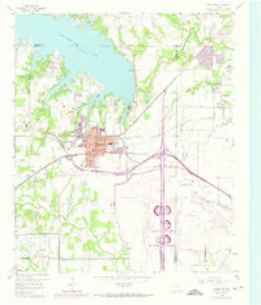
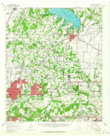
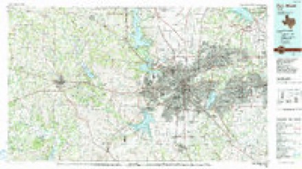
18 topographic sheets cover this place, the earliest surveyed in 1894 and the latest in 1985. It stands in the Southwest Dallas census division. It lies in ZIP code area 75019. The Survey maps it on the Grapevine quadrangle. 42,983 people lived here at the 2020 count.
Population over time
2 figuresCoppell grew from 38,659 to 42,983 between 2010 and 2020. These are the recorded population figures Wikidata holds for this place, reached through the Geographic Names Information System number this page is keyed on rather than by name, so they belong to this place and not to another of the same name. Most are census counts, but not all are: an early figure may be a founding or settlement estimate, and an estimate published within five years of a census is left out. The change column is computed, and is left blank where more than 20 years separate a figure from the one before it, because a gap that long is not a change between two counts.
| Year | People | Change |
|---|---|---|
| 2010 | 38,659 | |
| 2020 | 42,983 | +4,324 (+11%) |
Topographic sheets covering this place
7 surveys from 18 printed sheetsMatched by testing this settlement's coordinate against the published boundary of every sheet in the United States Geological Survey's historical collection. Each opens the scanned sheet at the Survey.
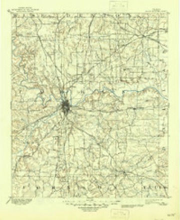
- 1894 USGS Fort Worth quadrangle1:125000, 3 printings
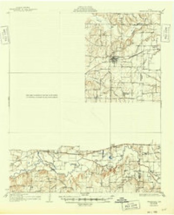
- 1931 USGS Grapevine quadrangle1:62500, 2 printings
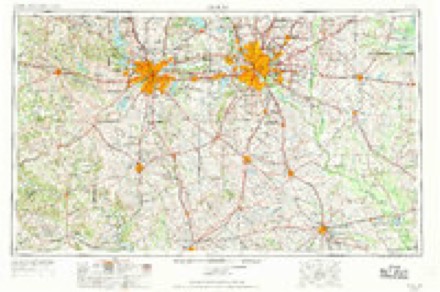
- 1954 USGS Dallas quadrangle1:250000, 4 printings
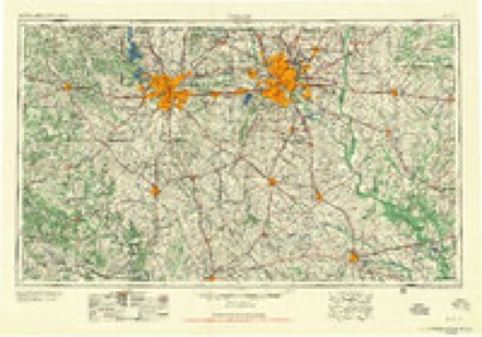
- 1958 USGS Dallas quadrangle1:250000
- 1959 USGS Grapevine quadrangle1:24000, 5 printings
- 1959 USGS Grapevine quadrangle1:62500
- 1985 USGS Fort Worth quadrangle1:100000, 2 printings
Fires near this place
16 since 2005Regional context, not property-specific evidence. The federal wildfire occurrence database lists 16 fires within 5 miles of Coppell between 2005 and 2017, burning about 37 acres in total. None started naturally. 1 was recorded as arson. Distance is straight-line from the map coordinates, so a fire counted here may appear on a neighbouring settlement's page as well.
| Reported cause | Fires |
|---|---|
| Missing data/not specified/undetermined | 10 |
| Misuse of fire by a minor | 2 |
| Equipment and vehicle use | 1 |
| Arson/incendiarism | 1 |
| Power generation/transmission/distribution | 1 |
| Smoking | 1 |
The most recent of them, most recent first, with the day each was reported and the service that recorded it.
| Date | Cause | Size | Reported by | Name on the report |
|---|---|---|---|---|
| 8 September 2009 | Equipment and vehicle use | 2.0 acres | Texas A & M Forest Service | 4900 LONG PRAIRIE |
| 5 July 2013 | Missing data/not specified/undetermined | under an acre | Texas A & M Forest Service | GRASS FIRE |
| 29 April 2017 | Misuse of fire by a minor | 1.0 acres | Texas A & M Forest Service | NONE |
| 9 February 2017 | Misuse of fire by a minor | 1.0 acres | Texas A & M Forest Service | NONE |
| 6 February 2006 | Missing data/not specified/undetermined | 3.0 acres | Texas A & M Forest Service | not named |
| 4 February 2008 | Missing data/not specified/undetermined | 2.0 acres | Texas A & M Forest Service | not named |
| 26 February 2006 | Missing data/not specified/undetermined | 2.0 acres | Texas A & M Forest Service | not named |
| 24 February 2011 | Power generation/transmission/distribution | 1.0 acres | Texas A & M Forest Service | 1500 LONG PRAIRIE |
Settlements close enough to share some of these fires:
Mines and quarries near this place
6 within 5 milesRegional context, not property-specific evidence. The federal mineral resources record lists 6 workings within 5 miles of Coppell: 5 producers, 1 unknown. 5 still produce. What was taken out: Sand and Gravel, Construction. Distance is straight-line from the map coordinates, so a quarry counted here may appear on a neighbouring settlement's page as well.
| Where | Site | Commodity | Status | Recorded |
|---|---|---|---|---|
| Farrow Brothers Sand and Gravel | Sand and Gravel, Construction | Producer | ||
| Fred Lueck Excavating Operation | Sand and Gravel, Construction | Producer | ||
| Fred Lueck Pit & Plant | Sand and Gravel, Construction | Producer | ||
| H S Jackson S & G Operations-Plant | Sand and Gravel, Construction | Unknown | ||
| Ten Hagen Pit | Sand and Gravel, Construction | Producer | ||
| Tom Conley and Associates Operation | Sand and Gravel, Construction | Producer |
Storms near this place
53 since 1993Regional context, not property-specific evidence. The National Weather Service names Coppell in 53 storm reports between 1993 and 2025: 29 hail, 13 thunderstorm wind, 4 flash flood, 3 lightning. The reports record 1 death. Each account below is quoted exactly as the forecast office filed it, from the NOAA Storm Events Database, and each date opens the federal record of that event.
| When | Event | Place named | Harm | What the report says |
|---|---|---|---|---|
| November 2015 | Flood | Coppell | 1 killed, $50,000 | Several high water crossings remained closed and barricaded per the Dallas Alert Gage Network after several inches of rain fell in the county. A social media report indicated that the intersections of Brand/Campbell roads and Pleasant Valley/Miles Roads were closed due to high water. Multiple news media sources reported that a 29 year old man drowned when his car was overcome by floodwaters after either driving around a barricade, or not knowing a barricade was in place to indicate closure of Campbell Road near Brand Road due to flooding. This area was flooded due to the Rowlett Creek rising into major flood stage. Another high water rescue was performed near Highway 190 and Brand Road in northeast Garland, TX. |
| April 2012 | Hail | Coppell | $7,000,000 | Baseball sized hail was reported near Duncan Drive in Irving. |
| April 2012 | Hail | Coppell | $5,000,000 | Hail stones ranging from the size of quarters up to teacup size was reported in Coppell. The hail fell for nearly 20 minutes with 2-3 hail falling for at least 10 minutes in some areas of the city. |
| April 2012 | Hail | Coppell | $1,500,000 | Hen egg to tennis ball sized hail was reported in the area just northeast of Dallas-Fort Worth International Airport; around the intersections of Interstate 635 & Royal Lane and Interstate 635 & Belt Line Rd. Many cars were dented and many car windshields were broken. |
| May 2024 | Thunderstorm Wind | Coppell | $350,000 | A 71 mph wind gust was measured in Irving. Widespread tree damage and roof damage was reported in the city by the emergency manager. Small metal structures were also damaged. |
| June 2018 | Hail | Coppell | $300,000 | A social media report indicated three-inch diameter hail in the city of Coppell, TX. |
| September 2010 | Flash Flood | Coppell | $250,000 | Several low water crossings in the city of Dallas were closed shortly after sunrise due to several feet of water covering the roadways. As the rain continued, additional flooding was reported. The entrance and exit ramps along Interstate 35 at Royal Lane were closed due to high water. Several high water rescues were conducted in the cities of Lancaster and Grand Prairie. A creek in Irving threatened numerous homes and 90 people were evacuated by dump trucks. |
| April 2012 | Tornado (EF0) | Coppell | $150,000 | An EF-0 tornado with maximum estimated winds around 80 mph produced damage in the city of Coppell. The tornado began near the intersection of E Belt Line Rd and S Denton Tap Rd. The awning at a gas station was damaged at this intersection. The tornado moved to the northeast through a residential area causing minor damage to some roofs of homes and businesses and also damaging trees. The total path of the tornado was 2 miles long, but the damage path was non-continuous. The damage path was also narrow at about 75 yards wide. |
| September 2006 | Lightning | Coppell | $60,000 | Lightning struck a house on the 300 block of Still Forest. The lightning destroyed all the wiring in the house, also damaging the roof, insulation, sheetrock, and carpet. The Fire Marshall estimated damages at $60,000. |
| June 2018 | Hail | Coppell | $50,000 | A social media report indicated baseball sized hail near the intersection of Denton Tap Road and Sandy Lake Rd in the city of Coppell, TX. |
| January 2012 | Flood | Coppell | $50,000 | Nearly 17 hours of continuous rain resulted in widespread nuisance and low-lying flooding across the county. The county received an average of 3-5 of rain during this event. Several creeks and streams overflowed their banks, flooding the surrounding lands and roads. In addition, several low water crossings filled with water resulting in temporary road closures. One person had to be rescued after a car was swept into a swift moving creek near South Story Street and Ruby Street in Irving. High water was also reported at Loop 635 and Park Central in Dallas, and the frontage road had to be closed. One person had to be rescued from this location after she drove into the flooded intersection. In northwest Dallas, flooding was also reported at Northwest Highway and Webb Chapel Road, and at Highway 360 and Abrams Road. The city of Dallas reported 8 high water rescues on this day. |
| June 2009 | Flash Flood | Coppell | $50,000 | Widespread street and creek flooding was reported around Irving. The river walk at Centennial Park in Irving was flooded, and several other parks were flooded and closed. A few motorists had to be rescued from their cars and in at least one case the water was 3-4 feet deep. Some major highways had to be closed down. |
| May 1995 | Thunderstorm Wind | Coppell | $50,000 | There was widespread damage to roofs, fences, and trees. Four utility poles were blown down, resulting in power outages. |
| November 1993 | Thunderstorm Wind | Coppell | $50,000 | Thunderstorm winds blew over two tractor-semitrailers. Trees were blown down, damaging the Pinkerton Elementary School. |
| May 2011 | Hail | Coppell | $30,000 | no account filed |
| April 2012 | Hail | Coppell | $10,000 | Quarter sized hail was reported at Interstate 635 and Beltline Road near Coppell. |
| April 2012 | Thunderstorm Wind | Coppell | $8,000 | RFD winds associated with a tornadic supercell ripped shingles off a church near E Belt Line Rd and Ingle Way in Coppell. Some letters from the church sign were also removed. |
| April 2012 | Thunderstorm Wind | Coppell | $7,000 | Small tree branches were broken by RFD winds associated with a tornadic supercell near the intersection of Airline Dr and Executive Dr in Coppell. |
| June 2009 | Thunderstorm Wind | Coppell | $6,000 | Numerous trees were uprooted or knocked down in Coppell. Tree limbs were also knocked down. Many of the trees that were knocked over were bradford pears. Power outages also occurred. |
| September 2006 | Lightning | Coppell | $5,000 | Lightning struck near a residential pool on the 400 block of Chelsea Bay. Firefighters found smoking breakers and the pool equipment inoperable. |
| February 1999 | Thunderstorm Wind | Coppell | $2,000 | Power lines were blown down by thunderstorm winds. Trees were blown down and a storage building was destroyed. |
| June 1996 | Thunderstorm Wind | Coppell | $2,000 | no account filed |
| June 2019 | Thunderstorm Wind | Coppell | $1,000 | A trained spotter reported a wind gust of 60 MPH approximately 1 mile south of the city of Coppell, TX. |
| June 2025 | Thunderstorm Wind | Coppell | $500 | A public report indicated that a few trees were blown down near Denton Tap Road at Hwy 121 between Coppell and Lewisville. |
| September 2009 | Lightning | Coppell | $500 | Lightning struck a home on the 900 block of Condor Drive in Coppell. The brick chimney was damaged but no other information was available. |
| April 2022 | Hail | Coppell | - | A public report indicated quarter sized hail in Coppell, TX. |
| March 2019 | Hail | Coppell | - | Penny to nickel sized hail was reported on Pheasant Lane in Coppell. The hail fell for 4 minutes. |
| October 2019 | Thunderstorm Wind | Coppell | - | A trained spotter estimated a wind gust of 60 MPH in the city of Coppell, TX. |
| October 2019 | Hail | Coppell | - | A social media report indicated quarter-sized hail approximately one mile east of the city of Coppell, TX. |
| March 2016 | Hail | Coppell | - | Quarter sized hail on Auburn Way in Coppell. |
| July 2016 | Thunderstorm Wind | Coppell | - | Amateur radio reported a wind gust of 56 knots/65 mph near the intersection of Moore Rd and Sandy Lake Blvd in Coppell, TX. |
| November 2016 | Flash Flood | Coppell | - | Emergency management reported multiple stranded vehicles in the Sandy Lake and Highway 121 areas of Coppell. |
| November 2015 | Flash Flood | Coppell | - | The Dallas Alert Gage Network indicated several locations had been closed due to water over the roads in those locations. In addition, the right lanes of Interstate 35E northbound and southbound near Belt Line Road in Carrollton were closed due to water. The northbound frontage road at Crosby Road was closed and also the northbound exit at Belt Line Road. |
| September 2010 | Flood | Coppell | - | Numerous roads and creeks remained flooded for many hours after the heavy rain had ended. Up to 8 inches of rain fell across the county. |
| March 2009 | Hail | Coppell | - | Penny size hail fell in Coppell. |
| May 2009 | Hail | Coppell | - | Penny size hail was reported in Coppell. |
| May 2007 | Hail | Coppell | - | Penny size hail was reported. |
| October 1994 | Hail | Coppell | - | A brief tornado touchdown occurred just south of downtown Dallas near Interstate 35 between Highway 180 and Highway 342. |
| March 2021 | Hail | Coppell | - | no account filed |
| May 2011 | Hail | Coppell | - | no account filed |
| May 2011 | Hail | Coppell | - | no account filed |
| April 2007 | Hail | Coppell | - | no account filed |
| September 2005 | Hail | Coppell | - | no account filed |
| October 2004 | Hail | Coppell | - | no account filed |
| June 1997 | Hail | Coppell | - | no account filed |
| June 1997 | Thunderstorm Wind | Coppell | - | no account filed |
| March 1996 | Hail | Coppell | - | no account filed |
| March 1996 | Hail | Coppell | - | no account filed |
| March 1996 | Hail | Coppell | - | no account filed |
| June 1996 | Hail | Coppell | - | no account filed |
| October 1996 | Hail | Coppell | - | no account filed |
| October 1996 | Hail | Coppell | - | no account filed |
| April 1995 | Hail | Coppell | - | no account filed |
Nearest settlements
The eight closest, with where each one stands in the county. Distances are straight-line, computed from the Geographic Names Information System coordinates.
| Map | Place | Distance | Sheets |
|---|---|---|---|
| Bethel | 2.1 miles | 27 | |
| Trinity Mills | 5.0 miles | 27 | |
| Estelle | 6.1 miles | 21 | |
| Farmers Branch | 6.6 miles | 27 | |
| Carrollton | 6.6 miles | 27 | |
| Gribble | 6.7 miles | 27 | |
| Highland | 7.5 miles | 27 | |
| Sowers | 8.8 miles | 24 |
Elsewhere
Matched on this settlement's Geographic Names Information System number rather than its name, so it cannot be a different place of the same name in another state.
| Wikipedia article on Coppell | An encyclopaedic summary. Its text is share-alike, so it is linked here rather than copied. |
| Wikidata item Q982554 | The structured record the population and elevation above come from. Public domain (CC0). |
Provenance
This settlement is recorded in the Geographic Names Information System as feature 1373209. The sheet list is computed by point-in-boundary test against the United States Geological Survey's historical topographic inventory. Both are works of the United States government and carry no copyright under 17 U.S.C. 105.
Wildfire. Short, Karen C. 2022. Spatial wildfire occurrence data for the United States, 1992-2020 [FPA_FOD_20221014]. 6th Edition. Fort Collins, CO: Forest Service Research Data Archive. https://doi.org/10.2737/RDS-2013-0009.6 Collected with United States Government funding and usable without additional permissions or fees.
Mines and quarries. USGS Mineral Resources Data System (MRDS) https://mrdata.usgs.gov/mrds/ A work of the United States government, no copyright under 17 U.S.C. 105.
Storms. NOAA National Centers for Environmental Information, Storm Events Database https://www.ncei.noaa.gov/stormevents/ A work of the United States government, no copyright under 17 U.S.C. 105. Narratives are quoted verbatim from the National Weather Service report and are not edited or summarised.