 Block
BlockHappy, Texas
7 topographic sheets cover this place, the earliest surveyed in 1954 and the latest in 1985. It stands in the Happy census division. It lies in ZIP code area 79042. The Survey maps it on the Happy quadrangle. 602 people lived here at the 2020 count. It stands 3,615 feet above sea level.
Population over time
3 figuresHappy fell from 648 to 602 between 2000 and 2020. These are the recorded population figures Wikidata holds for this place, reached through the Geographic Names Information System number this page is keyed on rather than by name, so they belong to this place and not to another of the same name. Most are census counts, but not all are: an early figure may be a founding or settlement estimate, and an estimate published within five years of a census is left out. The change column is computed, and is left blank where more than 20 years separate a figure from the one before it, because a gap that long is not a change between two counts.
| Year | People | Change |
|---|---|---|
| 2000 | 648 | |
| 2010 | 678 | +30 (+5%) |
| 2020 | 602 | -76 (-11%) |
Topographic sheets covering this place
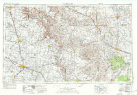
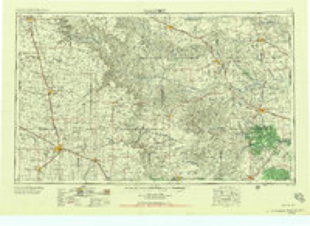
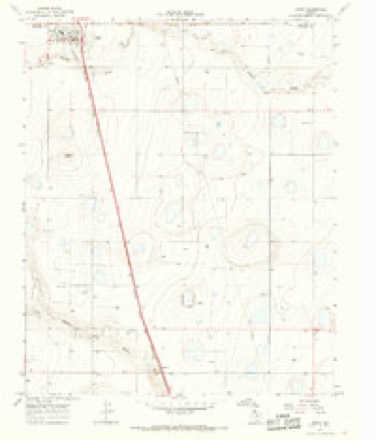
4 surveys from 7 printed sheetsMatched by testing this settlement's coordinate against the published boundary of every sheet in the United States Geological Survey's historical collection. Each opens the scanned sheet at the Survey.
- 1954 USGS Plainview quadrangle1:250000, 3 printings
- 1958 USGS Plainview quadrangle1:250000
- 1965 USGS Happy quadrangle1:24000
- 1985 USGS Tulia quadrangle1:100000, 2 printings

Fires near this place
106 since 2006Regional context, not property-specific evidence. The federal wildfire occurrence database lists 106 fires within 5 miles of Happy between 2006 and 2020, burning about 5,160 acres in total. 11 started naturally. 2 were recorded as arson. Distance is straight-line from the map coordinates, so a fire counted here may appear on a neighbouring settlement's page as well.
| Reported cause | Fires |
|---|---|
| Equipment and vehicle use | 35 |
| Missing data/not specified/undetermined | 33 |
| Smoking | 14 |
| Natural | 11 |
| Debris and open burning | 5 |
| Power generation/transmission/distribution | 4 |
| Arson/incendiarism | 2 |
| Other causes | 1 |
| Recreation and ceremony | 1 |
The most recent of them, most recent first, with the day each was reported and the service that recorded it.
| Date | Cause | Size | Reported by | Name on the report |
|---|---|---|---|---|
| 30 September 2010 | Equipment and vehicle use | 1.0 acres | Texas A & M Forest Service | I 27 AND WAYSIDE HWY |
| 3 September 2020 | Other causes | under an acre | Texas A & M Forest Service | ROPER |
| 3 September 2010 | Equipment and vehicle use | 1.0 acres | Texas A & M Forest Service | 85 MM ON I 27 |
| 29 September 2016 | Smoking | 1.0 acres | Texas A & M Forest Service | HALEY RD & I 27 |
| 29 September 2015 | Equipment and vehicle use | 2.0 acres | Texas A & M Forest Service | RANDY SMITH SHREDDER FIRE |
| 27 September 2009 | Equipment and vehicle use | 10 acres | Texas A & M Forest Service | GRASS FIRE WEST ON FM 1075 |
| 17 September 2017 | Natural | 300 acres | Texas A & M Forest Service | DENNIS BRYAN |
| 12 September 2019 | Missing data/not specified/undetermined | 1.0 acres | Texas A & M Forest Service | I 27 &88 MM |
Settlements close enough to share some of these fires:
Storms near this place
60 of 70 shownRegional context, not property-specific evidence. The National Weather Service names Happy in 70 storm reports between 1994 and 2025: 33 hail, 26 thunderstorm wind, 7 tornado, 2 heavy rain. The reports record 2 deaths and 4 injuries. Each account below is quoted exactly as the forecast office filed it, from the NOAA Storm Events Database, and each date opens the federal record of that event.
| When | Event | Place named | Harm | What the report says |
|---|---|---|---|---|
| May 2002 | Tornado (F2) | Happy | 2 killed, 4 hurt, $4,000,000 | Storm chaser video indicated that shortly after the large tornado dissipated, another tornado developed just west of town. This tornado tore a 150-yard wide path across the southern part of town. Fifteen homes were destroyed, including at least ten mobile homes, another seventeen received major damage, and eighteen others received minor damage. The storm survey team estimated wind speeds associated with the damage to be in the 115 to 130 mph range. Two fatalities occurred in a mobile home on the southeast side of town; the mobile home was rolled about 50 yards and destroyed. Four injuries also occurred in mobile homes that were in the same area. The church on the west side of town lost 120 feet of its roof and 30 vehicles, including two tractor trailers, were damaged or destroyed. Seventy five utility and telephone poles were snapped. The tornado crossed I-27 and continued to produce significant damage east of town as it struck a home two miles east of Happy on Farm-to-Market Road 1075. Before crossing into southern Randall County about three miles east of Happy, the tornado produced major damage to a second home on Farm-to-Market Road 1075. |
| April 2015 | Hail | Happy | $1,500,000 | A slow-moving high precipitation supercell produced copious amounts of damaging hail across northern Swisher County with some hailstones as large as baseball size in Happy. A 12-mile stretch of Interstate 27 from Happy to north of Tulia was covered in hail up to six inches deep. In addition to damaging roofs of homes and businesses, intense straight line winds in the rear flank downdraft of the supercell carried hail sideways which shattered many north and west facing windows. Countless vehicles along Interstate 27 suffered broken windows and significant hail dents. It is estimated that 500 acres of winter wheat were flattened by this barrage of hail, wind and torrential rains with 40 percent of the winter wheat crop suffering lesser degrees of damage. Preliminary combined monetary losses are estimated at $4M. |
| April 2001 | Thunderstorm Wind | Happy | $100,000 | Strong thunderstorm wind destroyed two trailer homes, partially removed the roof of a church, blew over two tractor trailers, and produced major damage to a building. An NWS survey suggested wind speeds associated with this damage were about 100 mph. A veteran storm chaser suggested that some of this damage may have been the result of a strong gustnado that briefly spun up on the leading edge of the thunderstorm outflow wind. |
| July 2015 | Hail | Happy | $50,000 | Hail up to golf ball size fell in the town of Happy. Some vehicles and roof shingles were damaged. |
| July 2015 | Hail | Happy | $50,000 | Storm spotters estimated hail of golf ball to baseball size along the Swisher and Randall County line near Happy. Around a dozen vehicles that stopped on Interstate 27 were heavily damaged by the hail. This hail swath continued southeast of Happy where it heavily damaged an estimated 1000 acres of corn. |
| July 2007 | Hail | Happy | $50,000 | The public reported large hail up to the size of pennies in Happy. The hail was particularly hard, and reports indicated that some minor damage to vehicles did occur. |
| June 2004 | Hail | Happy | $25,000 | Tulia police department reported golfball size hail. |
| June 2009 | Thunderstorm Wind | Happy | $20,000 | The KVII-TV Schoolnet recorded a thunderstorm wind gust of 59 mph at 18:41 CST. No damage was reported. The parent complex of thunderstorms continued to intermittently produce damaging winds as it propagated south-southeastward over Swisher County. A post-storm survey by Texas Tech University West Texas Mesonet meteorologists discovered several snapped wooden power poles along U.S. Highway 87 north of Kress. |
| April 2015 | Thunderstorm Wind | Happy | $10,000 | Along with very large hail, damaging rear flank downdraft winds from a high precipitation supercell struck many areas in northern Swisher County. A Texas Tech University West Texas mesonet northeast of Tulia measured a wind gust to 67 mph at 1755 CST. Much of the monetary damage to buildings, vehicles and winter wheat was from the combination of wind and very large hail, although some power lines were downed in the town of Happy as reported by Fire Department officials. The majority of property losses are included in the hail event entry for Swisher County. |
| August 2007 | Thunderstorm Wind | Happy | $10,000 | Fire department officials reported that thunderstorm winds downed large tree limbs up to three inches in diameter and damaged fences. The winds were accompanied by large hail up to the size of quarters. No structural damage was reported. |
| June 2004 | Thunderstorm Wind | Happy | $5,000 | Fire department reported power lines down. |
| May 2002 | Tornado (F0) | Happy | $2,000 | The tornado that went through Happy dissipated over southern Randall County. Shortly after this dissipation, the same supercell produced another tornado just to the south of the previous tornado's track. This tornado was reported by a storm chaser. An NWS storm survey team found snapped power poles and downed power lines on county roads just south of Farm-to-Market Road 1075, consistent with this report. |
| June 2013 | Thunderstorm Wind | Happy | $1,000 | A citizen reported a carport blown off from a residence and into a neighboring yard. |
| April 2025 | Flash Flood | Happy | - | Intense rainfall from a slow moving storm occurred in and around Happy. A Texas Tech University West Texas mesonet site near Happy measured 1.62 inches of rainfall in less than one hour. An mPing report was received of flooded roads in Happy. |
| June 2025 | Thunderstorm Wind | Happy | - | A Texas Tech University West Texas mesonet site near Happy measured a wind gust of 59 mph. |
| September 2025 | Thunderstorm Wind | Happy | - | A Texas Tech University West Texas mesonet site near Happy measured intermittent severe wind gusts from 2106 CST through 2113 CST. A peak wind gust of 61 mph was measured at 2106 CST. |
| June 2024 | Thunderstorm Wind | Happy | - | A Texas Tech University West Texas mesonet site near Happy measured a severe wind gust of 59 mph. Additionally, tree limbs one inch in diameter were reportedly broken off. |
| June 2024 | Hail | Happy | - | Multiple public reports were received of hail ranging in size from pennies to quarters. |
| August 2024 | Thunderstorm Wind | Happy | - | A Texas Tech University West Texas mesonet site near Happy measured severe wind gusts from 1737 CST through 1739 CST. A peak wind gust of 65 mph was measured at 1737 CST. |
| May 2023 | Thunderstorm Wind | Happy | - | A Texas Tech University West Texas mesonet site near Happy measured a wind gust of 59 mph. |
| July 2023 | Thunderstorm Wind | Happy | - | A Texas Tech University West Texas mesonet site near Happy measured severe wind gusts from 2330 CST through 2331 CST. A peak wind gust of 61 mph was measured at 2331 CST. |
| June 2023 | Thunderstorm Wind | Happy | - | A Texas Tech University West Texas mesonet site near Happy measured a wind gust of 60 mph. |
| June 2023 | Hail | Happy | - | Several reports were received of a swath of hail from just southwest of Happy into the town of Happy. The size of the hail ranged from half dollar to baseball size. There were reports of damaged windshields. |
| June 2023 | Thunderstorm Wind | Happy | - | A Texas Tech University West Texas mesonet site near Happy measured a severe wind gust of 66 mph. |
| May 2022 | Thunderstorm Wind | Happy | - | A Texas Tech University West Texas mesonet site in Happy measured severe wind gusts from 1735 CST through 1739 CST. A peak wind gust of 59 mph was measured at 1739 CST. |
| May 2022 | Thunderstorm Wind | Happy | - | A Texas Tech University West Texas mesonet site in Happy measured severe wind gusts from 1802 CST through 1823 CST. A peak wind gust of 67 mph was measured at 1804 CST. |
| April 2022 | Hail | Happy | - | A storm chaser reported hail up to two inch diameter size along the Swisher/Armstrong County line along Farm to Market Road 1075 approximately five miles east of Happy (Swisher County). No reports of damage were received. |
| August 2022 | Thunderstorm Wind | Happy | - | A Texas Tech University West Texas mesonet site near Happy measured several severe wind gusts between 1553 CST and 1619 CST. The peak gust measured during this time was 69 mph at 1618 CST. |
| June 2022 | Thunderstorm Wind | Happy | - | A Texas Tech University West Texas mesonet site near Happy measured severe wind gusts from 0631 CST through 0633 CST. A peak wind gust of 63 mph was measured at 0631 CST. |
| May 2021 | Hail | Happy | - | A report of quarter size hail was received from the public just south of Happy. |
| March 2021 | Tornado (EF0) | Happy | - | This EF-0 tornado was video recorded by storm chasers over rural areas of Swisher County east of Happy. The only damage observed were two broken power poles near the intersection of County Road B and County Road 16. This tornado crossed into Randall|County, where it was surveyed by WFO Amarillo. |
| March 2021 | Tornado (EF1) | Happy | - | This is the beginning of an eventual wide and long tracked tornado that eventually moved into Randall County (WFO Amarillo). The tornado began on ranch land west-southwest of Happy and damaged mainly power poles and a few structures as it moved northeast. |
| June 2018 | Thunderstorm Wind | Happy | - | A Texas Tech University West Texas mesonet site near Happy measured a wind gust to 64 mph. |
| June 2016 | Hail | Happy | - | The public estimated golf ball size hail in Happy. No reports of damage were available. |
| August 2016 | Hail | Happy | - | The public reported quarter size hail in Happy. No damage accompanied the hail. |
| April 2012 | Hail | Happy | - | The public reported quarter size hail about one mile south of Happy with golfball size hail later reported by a trained spotter two miles east of Happy. No damage was reported. |
| April 2012 | Thunderstorm Wind | Happy | - | A trained spotter estimated 70 mph winds about two miles east of Happy. No damage was reported. |
| August 2010 | Hail | Happy | - | The public initially reported quarter size hail in Happy at 16:13 CST. The Happy Fire Department additionally reported quarter size hail along Interstate 27 south of Happy as the storm continued to move southward at 16:19 CST. |
| June 2010 | Thunderstorm Wind | Happy | - | A KVII-TV Schoolnet site in Happy measured a wind gust of 59 mph. No damage was reported. |
| May 2009 | Hail | Happy | - | Local law enforcement officials and storm chasers reported quarter to half dollar size hail along Interstate 27 near Happy. |
| May 2008 | Thunderstorm Wind | Happy | - | The KVII-TV schoolnet in Happy recorded intermittent severe thunderstorm wind gusts up to 65 mph in Happy between 18:43 and 19:20 CST. |
| June 2008 | Hail | Happy | - | A trained storm spotter reported half dollar size hail that was accompanied by strong thunderstorm wind gusts. No damages, however, were reported and a broadcast media schoolnet weather station in Happy did not record severe gusts. |
| June 2008 | Heavy Rain | Happy | - | A trained storm spotter reported up to two and a half inches of rainfall in association with a severe thunderstorm over Happy during the very early morning hours of the 21st. Many city streets were reported to be flooded with ponding water. No damage was reported. |
| June 2008 | Hail | Happy | - | Penny size hail was reported in Happy by local law enforcement officials and the public. |
| August 2008 | Thunderstorm Wind | Happy | - | A Skywarn storm spotter estimated that thunderstorm wind gusts approached 65 mph in Happy. The winds were accompanied by small hail. No damage was reported. |
| August 2008 | Heavy Rain | Happy | - | Minor street flooding was reported in Happy following up to two inches of rain that accompanied a strong thunderstorm shortly after midnight CST on the 16th. |
| April 2007 | Tornado (EF0) | Happy | - | Storm chasers, including a meteorologist from the National Weather Service Warning Decision Training Branch, observed a large tornado that moved east-northeast just south of the Swisher and Armstrong County line approximately fifteen miles east of Happy. The tornado remained over open country and no damage was reported. |
| June 2007 | Thunderstorm Wind | Happy | - | A 58 mph thunderstorm wind gust was measured by a local broadcast media schoolnet in Happy. No damage was reported. |
| August 2007 | Hail | Happy | - | Fire department officials reported large hail that ranged between penny and quarter size in Happy. The hail was accompanied by damaging thunderstorm winds. |
| July 2007 | Hail | Happy | - | Motorists traveling along Interstate 27 encountered quarter size hail just south of Happy. |
| October 2007 | Hail | Happy | - | A member of the Happy Fire Department reported quarter size hail immediately east of the city. |
| April 2006 | Hail | Happy | - | Half dollar size hail was reported in rural areas east of Happy. |
| May 2006 | Thunderstorm Wind | Happy | - | The Swisher County Sheriff's Office estimated that thunderstorm wind gusts exceeded 70 MPH along Interstate 27 just south of Happy. No damage was reported. |
| August 2006 | Tornado (F0) | Happy | - | Residents of Happy observed a landspout tornado just southwest of the city around 17:20 CST on the afternoon of the 20th. The tornado was associated with otherwise non-severe convection over the extreme southern Texas Panhandle. No damage occurred as the tornado remained over open farm land. |
| May 2002 | Tornado (F2) | Happy | - | A large tornado developed west of town. It moved eastward across open country and thus the storm survey team, made up of both NWS personnel and a Texas Tech University wind engineer, could only find damage to power poles and to fence posts. Based on storm chaser video, the large tornado weakened and finally dissipated just west of Happy. |
| June 2002 | Thunderstorm Wind | Happy | - | An off-duty NWS employee estimated 60 mph thunderstorm wind gusts. |
| September 1995 | Hail | Happy | - | Thunderstorms across the southcentral Texas Panhandle produced hail to one inch in size. The hail was reported by local police and spotter groups. |
| June 1994 | Hail | Happy | - | A line of thunderstorms moved through the area causing a great deal of damage from winds. Powerlines, trees, aircraft hangers, and aircraft were damaged in the Hartley/Moore County region. As the storms moved through Amarillo a peak wind gust of 68 mph was recorded at the National Weather Service. East of the weather office Texas State Technical College received $300-400K damage to the roofs on campus. A man building a fireworks stand was killed south of Amarillo when the stand blow over onto him. (M51O) |
| October 2018 | Flood | Happy | - | no account filed |
| June 2004 | Hail | Happy | - | no account filed |
Nearest settlements
The eight closest, with where each one stands in the county. Distances are straight-line, computed from the Geographic Names Information System coordinates.
| Map | Place | Distance | Sheets |
|---|---|---|---|
| Kaffir | 7.8 miles | 7 | |
| Lakeview | 15.2 miles | 7 | |
| Tulia | 15.2 miles | 8 | |
| Eunice | 19.4 miles | 7 | |
| Vigo Park | 20.0 miles | 7 | |
| Center Plains | 25.6 miles | 7 | |
| Kress | 26.6 miles | 7 | |
| Claytonville | 29.4 miles | 7 |
Elsewhere
Matched on this settlement's Geographic Names Information System number rather than its name, so it cannot be a different place of the same name in another state.
| Wikipedia article on Happy | An encyclopaedic summary. Its text is share-alike, so it is linked here rather than copied. |
| Wikidata item Q1015984 | The structured record the population and elevation above come from. Public domain (CC0). |
Provenance
This settlement is recorded in the Geographic Names Information System as feature 1358748. The sheet list is computed by point-in-boundary test against the United States Geological Survey's historical topographic inventory. Both are works of the United States government and carry no copyright under 17 U.S.C. 105.
Wildfire. Short, Karen C. 2022. Spatial wildfire occurrence data for the United States, 1992-2020 [FPA_FOD_20221014]. 6th Edition. Fort Collins, CO: Forest Service Research Data Archive. https://doi.org/10.2737/RDS-2013-0009.6 Collected with United States Government funding and usable without additional permissions or fees.
Storms. NOAA National Centers for Environmental Information, Storm Events Database https://www.ncei.noaa.gov/stormevents/ A work of the United States government, no copyright under 17 U.S.C. 105. Narratives are quoted verbatim from the National Weather Service report and are not edited or summarised.