 Block
BlockKress, Texas
7 topographic sheets cover this place, the earliest surveyed in 1954 and the latest in 1985. It stands in the Kress census division. It lies in ZIP code area 79052. The Survey maps it on the Kress East quadrangle. 596 people lived here at the 2020 count. It stands 3,471 feet above sea level.
Research this city
Population over time
2 figuresKress fell from 715 to 596 between 2010 and 2020. These are the recorded population figures Wikidata holds for this place, reached through the Geographic Names Information System number this page is keyed on rather than by name, so they belong to this place and not to another of the same name. Most are census counts, but not all are: an early figure may be a founding or settlement estimate, and an estimate published within five years of a census is left out. The change column is computed, and is left blank where more than 20 years separate a figure from the one before it, because a gap that long is not a change between two counts.
| Year | People | Change |
|---|---|---|
| 2010 | 715 | |
| 2020 | 596 | -119 (-17%) |
Topographic sheets covering this place
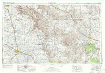
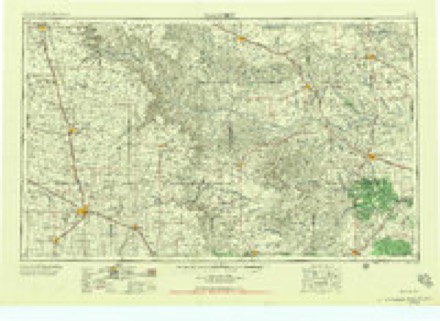
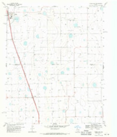
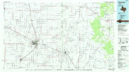
4 surveys from 7 printed sheetsMatched by testing this settlement's coordinate against the published boundary of every sheet in the United States Geological Survey's historical collection. Each opens the scanned sheet at the Survey.
- 1954 USGS Plainview quadrangle1:250000, 3 printings
- 1958 USGS Plainview quadrangle1:250000
- 1969 USGS Kress East quadrangle1:24000
- 1985 USGS Plainview quadrangle1:100000, 2 printings
Fires near this place
82 since 2006Regional context, not property-specific evidence. The federal wildfire occurrence database lists 82 fires within 5 miles of Kress between 2006 and 2020, burning about 3,348 acres in total. 2 started naturally. 2 were recorded as arson. Distance is straight-line from the map coordinates, so a fire counted here may appear on a neighbouring settlement's page as well.
| Reported cause | Fires |
|---|---|
| Missing data/not specified/undetermined | 56 |
| Debris and open burning | 12 |
| Equipment and vehicle use | 8 |
| Natural | 2 |
| Arson/incendiarism | 2 |
| Power generation/transmission/distribution | 2 |
The most recent of them, most recent first, with the day each was reported and the service that recorded it.
| Date | Cause | Size | Reported by | Name on the report |
|---|---|---|---|---|
| 8 September 2011 | Equipment and vehicle use | 140 acres | Texas A & M Forest Service | 2011-113 |
| 4 September 2013 | Equipment and vehicle use | 1.0 acres | Texas A & M Forest Service | 2013-42 |
| 24 September 2012 | Missing data/not specified/undetermined | under an acre | Texas A & M Forest Service | 2012-47 |
| 20 September 2015 | Missing data/not specified/undetermined | 68 acres | Texas A & M Forest Service | 2015-47 |
| 7 August 2006 | Natural | 25 acres | Texas A & M Forest Service | not named |
| 5 August 2018 | Missing data/not specified/undetermined | 1.0 acres | Texas A & M Forest Service | 201896MA |
| 5 August 2014 | Power generation/transmission/distribution | 50 acres | Texas A & M Forest Service | 2014-40 |
| 5 August 2014 | Missing data/not specified/undetermined | 4.0 acres | Texas A & M Forest Service | 2014-48 |
Settlements close enough to share some of these fires:
Storms near this place
60 of 65 shownRegional context, not property-specific evidence. The National Weather Service names Kress in 65 storm reports between 1994 and 2023: 40 hail, 10 thunderstorm wind, 7 tornado, 3 flash flood. No death or injury is recorded in these reports. Each account below is quoted exactly as the forecast office filed it, from the NOAA Storm Events Database, and each date opens the federal record of that event.
| When | Event | Place named | Harm | What the report says |
|---|---|---|---|---|
| April 2009 | Flood | Kress | $500,000 | Thunderstorms began to impact portions of Swisher County just before 13:00 CST on the 16th. These storms quickly became severe and displayed occasional supercellular characteristics as they effectively trained over the Interstate 27 corridor. ||A combination of heavy rainfall and accumulating hail resulted in a prolonged closure of Interstate 27 during the afternoon and overnight hours of the 16th and into the morning of the 17th. The most significant impacts occurred between Kress and Tulia. Up to 50 vehicles became stranded on the interstate as high water and hail covered the driving surface. Some motorists were rescued from their stalled automobiles with the use of boats and fire engines. Up to 5.27 inches of rainfall was measured by the Texas Tech University West Texas Mesonet site near Tulia, and 5.90 inches was measured by the Tulia National Weather Service cooperative observer. Ponded water receded sufficiently from the highway by 07:00 CST on the 17th, and the interstate was re-opened. No serious injuries were reported, but combined damages from hail and floods were estimated near $1 million. |
| April 2009 | Hail | Kress | $500,000 | A supercell thunderstorm which developed over portions of northern Hale and southern Swisher Counties evolved into a small convective complex which effectively trained over Interstate 27. As a result, vast amounts of large hail and very heavy rainfall resulted in dangerous travel conditions.||Hail up to the size of half dollars accumulated to depths greater than half a foot in places along Interstate 27 between Kress and Tulia. The hail combined with nearly six inches of rainfall produced significant flooding. A local law enforcement official was quoted as saying that it was just like an ice jam...it looked like North Dakota, referring to recent national headlines concerning historic ice jam flooding in that state. Newspaper reports indicate that more than 50 vehicles were stranded by hail and high water. Several motorists were rescued from stalled vehicles by boat and fire engines. As a result, local officials were forced to close portions of Interstate 27 until hail and flood waters receded sufficiently around 07:00 CST on the 17th. Combined damages from hail and flood were estimated near $1 million. |
| May 2009 | Thunderstorm Wind | Kress | $50,000 | Downburst activity was associated with both a hail producing severe storm near Happy and with high-based and weaker convection that extended southward along the Interstate 27 corridor to near Kress. Strong winds and blinding dust reportedly contributed to at least one automobile accident along Interstate 27 near Kress at 16:59 CST. Although two vehicles were involved in the collision, no injuries were reported. The Texas Tech University West Texas Mesonet site near Tulia recorded a 59 mph thunderstorm wind gust at 17:20 CST. In addition, a delayed report was received from a VORTEX II field research project participant who reported that severe thunderstorm winds had downed utility lines along Farm to Market Road 2698 west of Vigo Park. |
| June 2003 | Thunderstorm Wind | Kress | $50,000 | Strong thunderstorm wind blew down power poles, damaged buildings. Strong wind and hail also destroyed crops. |
| June 2012 | Thunderstorm Wind | Kress | $40,000 | The public reported four center pivots overturned in south-central Swisher County. |
| April 2007 | Tornado (EF2) | Kress | $30,000 | A large and long-tracked tornado cut a path of damage twenty-nine miles in length and at times nearly three-quarters of a mile wide across portions of Lamb, Hale, Castro and Swisher Counties between 17:57 and 18:36 CST on the 21st. Total damages from the tornado were estimated to exceed $1.2 million, and one person was injured.|The tornado was in the final stages of its life cycle as it crossed into extreme southwestern Swisher County at 18:33 CST. Storm chasers documented an extended rope-out phase before the tornado finally dissipated over cotton fields in southwestern Swisher County at 18:36 CST. |Reports in local newspapers indicated that at least one center pivot irrigation system was heavily damaged west of Kress.|Damage caused by the tornado east of Olton (Lamb County) supported an EF-2 rating with winds estimated between 110 and 120 mph. |
| May 1999 | Thunderstorm Wind | Kress | $25,000 | Strong thunderstorm wind blew down several poles and damaged six barns. |
| May 2001 | Hail | Kress | $20,000 | Tennis ball size hail was reported by a television weathercaster. |
| May 2015 | Hail | Kress | $12,000 | A NWS COOP reported wind-driven hail to 1.25 inches in diameter. The hail broke four large windows in the observer's home. |
| September 2007 | Thunderstorm Wind | Kress | $10,000 | A farmer reported that thunderstorm winds damaged a cotton trailer shortly before 14:25 CST on the 6th when it was blown over near Claytonville. |
| July 1998 | Thunderstorm Wind | Kress | $10,000 | no account filed |
| May 2011 | Thunderstorm Wind | Kress | $5,000 | The public reported that a barn was destroyed by thunderstorm outflow winds near Claytonville. |
| May 2023 | Hail | Kress | - | An NWS cooperative weather observer reported golf ball size hail northeast of Kress. |
| October 2018 | Hail | Kress | - | Damage information was not available. |
| October 2018 | Hail | Kress | - | Damage information was unavailable. |
| April 2017 | Tornado (EFU) | Kress | - | A storm chaser recorded a tornado at night northwest of Edmonson. The tornado was backlit by frequent lightning. No damage was reported from this tornado. Radar indicated the parent circulation to this tornado behaved very erratically; initially moving northeast, then stalling for several minutes, then moving slowly southeast while dissipating. |
| April 2016 | Hail | Kress | - | Broadcast media relayed a report of 2-inch hail near Kress. Damage was not known. |
| April 2016 | Hail | Kress | - | Penny size hail was estimated in Claytonville with no damage reported. |
| October 2012 | Thunderstorm Wind | Kress | - | Broadcast media estimated wind gusts to 75 mph along with golf ball size hail. Although damages likely occurred to area property and crops, no specific information was available. |
| October 2012 | Hail | Kress | - | Broadcast media estimated golf ball size hail along with wind gusts estimated to 75 mph. Although damages likely occurred to area property and crops, no specific information was available. |
| June 2012 | Flood | Kress | - | The public observed widespread flooding in southwest Swisher County. An estimated 700 acres of crops, mostly young grain crops, were heavily damaged or completely washed out. |
| June 2010 | Hail | Kress | - | A swath of golfball size hail accompanied a storm northeastward from the Halfway community in northwestern Hale County over portions of southwestern Swisher County. Golfball size hail was reported west-southwest of Kress at 15:50 CST. The report was relayed by the National Severe Storms Laboratory SHAVE project. |
| June 2009 | Hail | Kress | - | Pea to penny size hail combined with 40 to 45 mph winds to cause extensive damage to young cotton crops along a swath from just west of Kress to near Claytonville along Farm to Market Road 145. Local farmers reported that the wind-driven hail completely destroyed several fields. |
| April 2009 | Tornado (EF0) | Kress | - | Storm chasers witnessed a tornado north of Kress at 14:45 CST. The brief tornado remained in open fields just east of Interstate 27, near the intersection of County Roads Z and 16. Local officials reported that the tornado caused no damage. |
| June 2008 | Hail | Kress | - | Reports of large hail that ranged in size from half dollars to golf balls were relayed by the broadcast media. The hail reportedly fell north of the Claytonville community, near the intersection of Farm to Market Road 2301 and Texas Highway 86. No damage was reported. |
| August 2008 | Heavy Rain | Kress | - | Local newspapers printed photographs which showed ponding of water that inundated sections of Farm to Market Road 145 east of Kress. The water covered that highway following locally heavy rainfall during the afternoon hours. Event time is estimated. |
| March 2007 | Thunderstorm Wind | Kress | - | Law enforcement officials reported that severe thunderstorm winds blew down two utility poles in the Kress vicinity. |
| March 2007 | Tornado (EF0) | Kress | - | Skywarn spotters and the public observed a tornado southeast of Claytonville. The tornado developed beneath a rapidly developing supercell storm, and remained over open fields in extreme southeastern Swisher County before moving northeastward into Briscoe County. No damage was reported. |
| May 2007 | Hail | Kress | - | The local broadcast media relayed a report of nickel size hail along Interstate 27 on the Hale and Swisher County line south of Kress. Delayed reports in newspaper clipping from the area suggested that some minor crop damage may have occurred, but no details were included. Therefore a small amount of agricultural damage is reported here. |
| May 2006 | Hail | Kress | - | Large hail that ranged in size from pennies to golfballs fell over Kress, and portions of Interstate 27 near Kress, for more than half an hour during the afternoon of the 30th. Penny size hail was initially reported by the Kress Police Department in the city at 15:49 CST. By 16:15 CST the hailstones had grown to measure more than one inch in diameter. Golfball size hail was reported by numerous storm spotters three miles north of Kress at 16:27 CST. Reports indicated that hail accumulated and contributed to the ponding of water on several highways. The Texas Department of Transportation was forced the temporarily close a section of Interstate 27 and Farm to Market Road 145. |
| June 2003 | Flash Flood | Kress | - | Roads were reported flooded in and around Kress. |
| October 2003 | Tornado (F0) | Kress | - | A brief tornado touchdown was reported by a storm chaser. |
| April 2002 | Hail | Kress | - | Amateur radio storm spotters reported golfball size hail. |
| May 2001 | Flash Flood | Kress | - | Farm-to-Market Road 145 and Farm-to-Market Road 2301 were reported flooded in the southeastern portion of the county. |
| April 1999 | Flash Flood | Kress | - | Interstate 27 was reported flooded near Kress and several Farm-to-Market roads were also flooded. |
| March 1998 | Tornado (F0) | Kress | - | A brief weak tornado was reported east of Kress at 1600CST by Amarillo TV station chase team. |
| June 1995 | Hail | Kress | - | Swisher County Deputy reported dime-size hail on Interstate 27. |
| July 2015 | Flood | Kress | - | no account filed |
| May 2010 | Hail | Kress | - | no account filed |
| April 2007 | Hail | Kress | - | no account filed |
| May 2005 | Hail | Kress | - | no account filed |
| May 2005 | Hail | Kress | - | no account filed |
| June 2005 | Hail | Kress | - | no account filed |
| June 2005 | Hail | Kress | - | no account filed |
| June 2005 | Hail | Kress | - | no account filed |
| May 2004 | Hail | Kress | - | no account filed |
| May 2004 | Hail | Kress | - | no account filed |
| June 2004 | Hail | Kress | - | no account filed |
| June 2003 | Hail | Kress | - | no account filed |
| June 2003 | Hail | Kress | - | no account filed |
| May 2002 | Hail | Kress | - | no account filed |
| May 2002 | Hail | Kress | - | no account filed |
| May 2001 | Hail | Kress | - | no account filed |
| May 1999 | Hail | Kress | - | no account filed |
| May 1997 | Funnel Cloud | Kress | - | no account filed |
| May 1997 | Tornado (F0) | Kress | - | no account filed |
| May 1997 | Hail | Kress | - | no account filed |
| June 1996 | Hail | Kress | - | no account filed |
| May 1996 | Hail | Kress | - | no account filed |
| May 1996 | Hail | Kress | - | no account filed |
Nearest settlements
The eight closest, with where each one stands in the county. Distances are straight-line, computed from the Geographic Names Information System coordinates.
| Map | Place | Distance | Sheets |
|---|---|---|---|
| Eunice | 7.3 miles | 7 | |
| Center Plains | 7.3 miles | 7 | |
| Claytonville | 9.2 miles | 7 | |
| Tulia | 11.7 miles | 8 | |
| Lakeview | 14.5 miles | 7 | |
| Kaffir | 18.8 miles | 7 | |
| Vigo Park | 23.8 miles | 7 | |
| Happy | 26.6 miles | 7 |
Elsewhere
Matched on this settlement's Geographic Names Information System number rather than its name, so it cannot be a different place of the same name in another state.
| Wikipedia article on Kress | An encyclopaedic summary. Its text is share-alike, so it is linked here rather than copied. |
| Wikidata item Q970226 | The structured record the population and elevation above come from. Public domain (CC0). |
Provenance
This settlement is recorded in the Geographic Names Information System as feature 1360768. The sheet list is computed by point-in-boundary test against the United States Geological Survey's historical topographic inventory. Both are works of the United States government and carry no copyright under 17 U.S.C. 105.
Wildfire. Short, Karen C. 2022. Spatial wildfire occurrence data for the United States, 1992-2020 [FPA_FOD_20221014]. 6th Edition. Fort Collins, CO: Forest Service Research Data Archive. https://doi.org/10.2737/RDS-2013-0009.6 Collected with United States Government funding and usable without additional permissions or fees.
Storms. NOAA National Centers for Environmental Information, Storm Events Database https://www.ncei.noaa.gov/stormevents/ A work of the United States government, no copyright under 17 U.S.C. 105. Narratives are quoted verbatim from the National Weather Service report and are not edited or summarised.