 Block
BlockIdalou, Texas
8 topographic sheets cover this place, the earliest surveyed in 1954 and the latest in 1986. It stands in the Idalou census division. It lies in ZIP code area 79329. The Survey maps it on the Idalou quadrangle. 2,193 people lived here at the 2020 count. It stands 3,192 feet above sea level.
Population over time
2 figuresIdalou fell from 2,250 to 2,193 between 2010 and 2020. These are the recorded population figures Wikidata holds for this place, reached through the Geographic Names Information System number this page is keyed on rather than by name, so they belong to this place and not to another of the same name. Most are census counts, but not all are: an early figure may be a founding or settlement estimate, and an estimate published within five years of a census is left out. The change column is computed, and is left blank where more than 20 years separate a figure from the one before it, because a gap that long is not a change between two counts.
| Year | People | Change |
|---|---|---|
| 2010 | 2,250 | |
| 2020 | 2,193 | -57 (-3%) |
Topographic sheets covering this place
3 surveys from 8 printed sheetsMatched by testing this settlement's coordinate against the published boundary of every sheet in the United States Geological Survey's historical collection. Each opens the scanned sheet at the Survey.
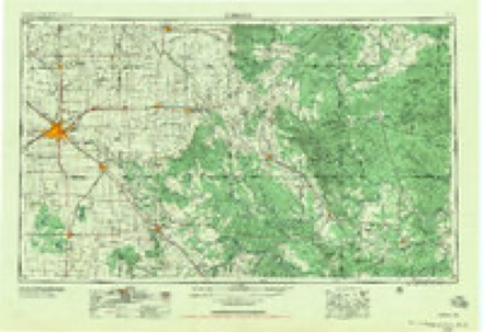
- 1954 USGS Lubbock quadrangle1:250000, 4 printings
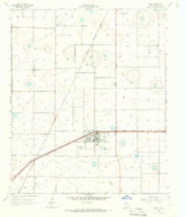
- 1965 USGS Idalou quadrangle1:24000, 2 printings
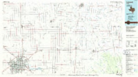
- 1986 USGS Lubbock quadrangle1:100000, 2 printings
Fires near this place
46 since 2006Regional context, not property-specific evidence. The federal wildfire occurrence database lists 46 fires within 5 miles of Idalou between 2006 and 2016, burning about 910 acres in total. 1 started naturally. None was recorded as arson. Distance is straight-line from the map coordinates, so a fire counted here may appear on a neighbouring settlement's page as well.
| Reported cause | Fires |
|---|---|
| Missing data/not specified/undetermined | 28 |
| Debris and open burning | 16 |
| Equipment and vehicle use | 1 |
| Natural | 1 |
The most recent of them, most recent first, with the day each was reported and the service that recorded it.
| Date | Cause | Size | Reported by | Name on the report |
|---|---|---|---|---|
| 7 September 2011 | Missing data/not specified/undetermined | 1.0 acres | Texas A & M Forest Service | BRUSH/GRASS FIRE |
| 10 August 2008 | Natural | 25 acres | Texas A & M Forest Service | not named |
| 2 July 2016 | Debris and open burning | 1.0 acres | Texas A & M Forest Service | GRASS FIRE |
| 2 July 2016 | Debris and open burning | 1.0 acres | Texas A & M Forest Service | GRASS FIRE |
| 17 July 2009 | Debris and open burning | 1.0 acres | Texas A & M Forest Service | GRASS FIRE |
| 24 June 2011 | Missing data/not specified/undetermined | 1.0 acres | Texas A & M Forest Service | GRASS FIRE |
| 23 June 2016 | Debris and open burning | 1.0 acres | Texas A & M Forest Service | GRASS FIRE |
| 6 May 2010 | Missing data/not specified/undetermined | 1.0 acres | Texas A & M Forest Service | GRASS FIRE |
Settlements close enough to share some of these fires:
Storms near this place
32 since 1995Regional context, not property-specific evidence. The National Weather Service names Idalou in 32 storm reports between 1995 and 2025: 20 hail, 8 thunderstorm wind, 2 tornado, 1 flood. No death or injury is recorded in these reports. Each account below is quoted exactly as the forecast office filed it, from the NOAA Storm Events Database, and each date opens the federal record of that event.
| When | Event | Place named | Harm | What the report says |
|---|---|---|---|---|
| May 2006 | Thunderstorm Wind | Idalou | $275,000 | A National Weather Service damage survey and post-event analysis indicated that damaging thunderstorm microbursts resulted in a second round of severe winds in the Idalou vicinity just before 17:30 CST. Winds estimated to exceed 75 MPH destroyed a central pivot unit used for agricultural irrigation. A large barn also sustained extensive roof damage, and at least 10 utility poles were blown down. |
| June 2006 | Thunderstorm Wind | Idalou | $50,000 | Severe thunderstorm winds caused damage at the Lubbock Children's Home near Idalou. This occurred less than twenty-four hours after the facility suffered extensive damage from high winds during the late evening hours of the 21st. Several additional large trees were uprooted, and an outbuilding was destroyed. The administrators at the Lubbock Children's Home reported that all of the resident children and staff were sent to underground storm shelters before the storm struck. No injuries were reported. A severe wind gust up to 60 MPH was recorded by a West Texas Mesonet site in northern Lubbock County as the storms continued to propagate west-southwestward. |
| June 1996 | Hail | Idalou | $10,000 | no account filed |
| June 2012 | Thunderstorm Wind | Idalou | $2,000 | An off-duty NWS employee observed one power pole blown down along the north side of Highway 82. |
| April 2009 | Tornado (EF0) | Idalou | $1,000 | The next tornado associated with the eastern Lubbock County supercell developed immediately south of U.S. Highway 82 and quickly crossed the highway about four miles east of Idalou. This tornado, filmed by veteran storm chasers, was briefly ongoing simultaneously to the first tornado. A business sustained minor damage when tin panels were raised on the structures roof as the tornado crossed U.S. Highway 82. The tornado then continued north-northwestward as the parent mesocyclone occluded, intermittently touching down and at times taking on a multi-vortex structure. No significant damage was found by local officials or during a post-storm National Weather Service survey. |
| April 2025 | Hail | Idalou | - | A storm chaser reported quarter size hail in Idalou. |
| June 2025 | Thunderstorm Wind | Idalou | - | A local government official reported damage to trees and roofs in the city of Idalou from thunderstorm winds. |
| June 2025 | Thunderstorm Wind | Idalou | - | An emergency management official reported that a tractor trailer had been blown over on US Highway 62/82. |
| June 2012 | Flood | Idalou | - | Law enforcement reported that Highway 62/82 was closed for about two hours due to a swollen playa lake from heavy rains. |
| June 2011 | Thunderstorm Wind | Idalou | - | A city official from the city of Idalou reported an estimated wind gust of 60 mph. No damage was reported. |
| August 2010 | Thunderstorm Wind | Idalou | - | A thunderstorm produced a swath of damaging winds from just northwest of Idalou along Farm to Market Road 1729 to Idalou. A large tree was reportedly blown down along that highway at 16:42 CST. Around 16:50 CST local authorities and the public estimated thunderstorm winds in excess of 60 mph in Idalou. Numerous large tree limbs were downed in the city. |
| April 2009 | Hail | Idalou | - | Skywarn storm spotters reported nickel size hail at the intersection of Texas Farm to Market Roads 40 and 400 between Roosevelt and Acuff. A tornado additionally impacted the area during the time of the hail. |
| April 2009 | Hail | Idalou | - | Law enforcement officials and Skywarn storm spotters reported large hail that ranged in size from quarters to half dollars along a swath from Ransom Canyon to Idalou as a cluster of severe thunderstorms impacted northeastern Lubbock County. |
| May 2009 | Hail | Idalou | - | Broadcast media relayed reports of large hail up to the size of quarters in Idalou. The hail was preceded by severe thunderstorm wind gusts up to 62 mph. |
| May 2008 | Hail | Idalou | - | Storm spotters reported nickel size hail covering the ground along Farm to Market Road 40 east of that road's intersection with Farm to Market Road 400. |
| May 2008 | Hail | Idalou | - | Agricultural officials reported golf ball size hail at the Acuff Gin. No damage was reported. |
| April 2007 | Hail | Idalou | - | The Idalou Fire Department reported ping pong ball size hail in Idalou as a second severe storm impacted northeastern Lubbock County. |
| May 2005 | Tornado (F0) | Idalou | - | F0 tornado 7 miles northeast of Idalou. |
| June 2003 | Hail | Idalou | - | Amateur radio storm spotters reported golfball size hail. |
| June 2003 | Hail | Idalou | - | Amateur radio storm spotters reported golfball size hail. |
| June 2003 | Hail | Idalou | - | Storm spotters reported golfball size hail. |
| June 2003 | Hail | Idalou | - | Amateur radio storm spotters reported golfball size hail. |
| July 2000 | Hail | Idalou | - | Dime size hail was reported on Highway 62/82. |
| June 1995 | Hail | Idalou | - | Numerous severe thunderstorms affected the South Plains on the 4th. There were many reports of dime- to golf ball-size hail, but hail as large as softballs fell near Wellman and north of Lubbock (where several cars were damaged). Spotters reporteda brief tornado in southeast Hockley County. Also, some flooding occurred in northwest Lubbock County and in southwest Hale County (where FM 37 was flooded between Interstate 27 and Cotton Center). |
| June 2024 | Hail | Idalou | - | no account filed |
| April 2016 | Dust Devil | Idalou | - | no account filed |
| March 2005 | Hail | Idalou | - | no account filed |
| June 2002 | Hail | Idalou | - | no account filed |
| May 1999 | Hail | Idalou | - | no account filed |
| June 1997 | Thunderstorm Wind | Idalou | - | no account filed |
| June 1996 | Hail | Idalou | - | no account filed |
| June 1995 | Hail | Idalou | - | no account filed |
Nearest settlements
The eight closest, with where each one stands in the county. Distances are straight-line, computed from the Geographic Names Information System coordinates.
Elsewhere
Matched on this settlement's Geographic Names Information System number rather than its name, so it cannot be a different place of the same name in another state.
| Wikipedia article on Idalou | An encyclopaedic summary. Its text is share-alike, so it is linked here rather than copied. |
| Wikidata item Q930801 | The structured record the population and elevation above come from. Public domain (CC0). |
Provenance
This settlement is recorded in the Geographic Names Information System as feature 1359882. The sheet list is computed by point-in-boundary test against the United States Geological Survey's historical topographic inventory. Both are works of the United States government and carry no copyright under 17 U.S.C. 105.
Wildfire. Short, Karen C. 2022. Spatial wildfire occurrence data for the United States, 1992-2020 [FPA_FOD_20221014]. 6th Edition. Fort Collins, CO: Forest Service Research Data Archive. https://doi.org/10.2737/RDS-2013-0009.6 Collected with United States Government funding and usable without additional permissions or fees.
Storms. NOAA National Centers for Environmental Information, Storm Events Database https://www.ncei.noaa.gov/stormevents/ A work of the United States government, no copyright under 17 U.S.C. 105. Narratives are quoted verbatim from the National Weather Service report and are not edited or summarised.