 Block
BlockSundown, Texas
7 topographic sheets cover this place, the earliest surveyed in 1954 and the latest in 1985. It stands in the Sundown census division. It lies in ZIP code area 79372. The Survey maps it on the Sundown quadrangle. 1,283 people lived here at the 2020 count. It stands 3,540 feet above sea level.
Population over time
2 figuresSundown fell from 1,397 to 1,283 between 2010 and 2020. These are the recorded population figures Wikidata holds for this place, reached through the Geographic Names Information System number this page is keyed on rather than by name, so they belong to this place and not to another of the same name. Most are census counts, but not all are: an early figure may be a founding or settlement estimate, and an estimate published within five years of a census is left out. The change column is computed, and is left blank where more than 20 years separate a figure from the one before it, because a gap that long is not a change between two counts.
| Year | People | Change |
|---|---|---|
| 2010 | 1,397 | |
| 2020 | 1,283 | -114 (-8%) |
Topographic sheets covering this place
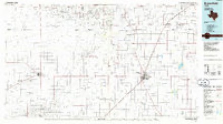
5 surveys from 7 printed sheetsMatched by testing this settlement's coordinate against the published boundary of every sheet in the United States Geological Survey's historical collection. Each opens the scanned sheet at the Survey.
- 1954 USGS Brownfield quadrangle1:250000, 2 printings
- 1958 USGS Brownfield quadrangle1:250000
- 1962 USGS Brownfield quadrangle1:250000
- 1965 USGS Sundown quadrangle1:24000
- 1985 USGS Brownfield quadrangle1:100000, 2 printings
Fires near this place
3 since 2011Regional context, not property-specific evidence. The federal wildfire occurrence database lists 3 fires within 5 miles of Sundown between 2011 and 2019, burning about 10,089 acres in total. None started naturally. None was recorded as arson. Distance is straight-line from the map coordinates, so a fire counted here may appear on a neighbouring settlement's page as well.
| Reported cause | Fires |
|---|---|
| Equipment and vehicle use | 1 |
| Missing data/not specified/undetermined | 1 |
| Power generation/transmission/distribution | 1 |
The most recent of them, most recent first, with the day each was reported and the service that recorded it.
| Date | Cause | Size | Reported by | Name on the report |
|---|---|---|---|---|
| 20 April 2011 | Power generation/transmission/distribution | 640 acres | Texas A & M Forest Service | SAGEBRUSH |
| 28 February 2017 | Equipment and vehicle use | 9,299 acres | Texas A & M Forest Service | 303 |
| 16 January 2019 | Missing data/not specified/undetermined | 150 acres | Texas A & M Forest Service | 19020 |
Mines and quarries near this place
1 within 5 milesRegional context, not property-specific evidence. The federal mineral resources record lists 1 working within 5 miles of Sundown: 1 producer. All of them still produce. What was taken out: Sulfur. Distance is straight-line from the map coordinates, so a quarry counted here may appear on a neighbouring settlement's page as well.
| Where | Site | Commodity | Status | Recorded |
|---|---|---|---|---|
| Slaughter Sulfur Plant | Sulfur | Producer |
Storms near this place
33 since 1997Regional context, not property-specific evidence. The National Weather Service names Sundown in 33 storm reports between 1997 and 2025: 22 hail, 6 thunderstorm wind, 3 tornado, 2 flash flood. No death or injury is recorded in these reports. Each account below is quoted exactly as the forecast office filed it, from the NOAA Storm Events Database, and each date opens the federal record of that event.
| When | Event | Place named | Harm | What the report says |
|---|---|---|---|---|
| June 2014 | Hail | Sundown | $10,000,000 | A left-moving supercell produced a swath of large hail generally from near Sundown northeast to Levelland. Trained spotters estimated the hail ranged in size from ping pong balls to as large as tennis balls. The worst hail damage was noted in Levelland where many vehicles suffered cracked or shattered windows, particularly at the Covenant hospital. Several homes in Levelland also sustained varying degrees of roof damage including some broken windows. |
| September 2003 | Thunderstorm Wind | Sundown | $200,000 | Strong thunderstorm wind estimated at around 80 mph caused major damage to the roof of a petroleum plant. |
| June 2014 | Hail | Sundown | $50,000 | Following hail damage from a left-moving supercell less than one hour prior, a second left split supercell tracked from Sundown northeast to Levelland and Anton accompanied by a hail swath ranging in size from 1.25 inches in diameter to 2 inches. The extent of additional hail damage is estimated to be less than the first supercell. |
| June 2013 | Tornado (EF2) | Sundown | $50,000 | A supercell thunderstorm spawned an EF-2 tornado in far southwest Hockley County resulting in damage to oil field equipment, outbuildings, power poles, and storage tanks. Although the parent storm moved very slowly east throughout the tornado's life, a strong rear flank downdraft and occluding mesocyclone caused the tornado to veer sharply northward early in its life. This tornado began about 4 miles west-northwest of Sundown and moved northward for just over 5 miles in length before ending about 4.2 miles southeast of Whiteface. Photos and video from a storm chaser captured the evolution of this tornado. The tornado began as a compact debris cloud that became weak and diffuse just minutes before a narrow, fully condensed tornado emerged within wrapping rain curtains. At this point, a satellite funnel was observed along the periphery of the tornado, but this funnel is not believed to have become tornadic. After being largely obscured in rain for nearly five minutes, the tornado re-emerged as a fully condensed cone shape just before crossing FM Road 1585 and finally dissipating north of the road. The end time of the tornado was approximated from NWS Lubbock radar data. A NWS storm survey discovered scattered damage throughout portions of the tornado's track - the most intense of which was rated EF-2 over the southern portion of its path. Specifically, in excess of one dozen power poles were snapped at their base and a free-standing metal tower at a well site was bent. In a surrounding field, a wide swath of mesquite trees with branches of 1 to 3 inches in diameter were sheared off. This damage suggested maximum wind speeds were likely around 115 mph. Farther north at the abandoned Oxy facility located on FM 1585 west of Sampson Post Road, a large portion of a metal roof was removed and a nearby metal building was shifted off its foundation. Also, a large tree on the property was uprooted. This portion of damage was rated EF-0. North of the Oxy facility, EF-0 damage was noted to two fiberglass tank batteries with the top of one completely removed. The NWS in Lubbock would like to thank Hockley County emergency management for assisting with this storm survey. |
| May 2001 | Hail | Sundown | $50,000 | Golfball size hail was reported by the public. |
| May 2001 | Hail | Sundown | $30,000 | Law enforcement officials reported golfball size hail. |
| June 2013 | Hail | Sundown | $25,000 | A NWS employee and storm chaser observed hail of tennis ball size to just over three inches in diameter. The most destructive hailswath occurred from about five miles northwest of Sundown to four miles north-northeast of Sundown. Video indicated the very large hail fell for nearly six minutes at one location. Vehicles and buildings throughout the hailswath sustained various degrees of damage. |
| September 2003 | Thunderstorm Wind | Sundown | $25,000 | Strong thunderstorm wind blew down power lines and snapped power poles on Farm-to-Market Road 301 near town. A roof of a building at the golf course was damaged. |
| April 2002 | Hail | Sundown | $20,000 | The Hockley County Sheriff's Office reported golfball size hail. |
| July 2010 | Thunderstorm Wind | Sundown | $15,000 | Local newspapers reported that thunderstorm winds downed several utility lines and caused moderate damage to cotton crops northwest and north of Sundown. A number of area residences experienced power outages as a result. Agriculture experts said that 30 percent of the crops were damaged along the storm's path and that winds stripped leaves from the cotton plants. |
| May 2000 | Hail | Sundown | $5,000 | no account filed |
| June 2025 | Tornado (EFU) | Sundown | - | A storm chaser reported a brief tornado in an open field north of Sundown. |
| June 2025 | Tornado (EFU) | Sundown | - | A storm chaser reported a brief tornado in an open field east of Sundown. |
| May 2024 | Hail | Sundown | - | A storm chaser reported half dollar size hail south of Sundown along Farm to Market Road 303. |
| May 2021 | Flash Flood | Sundown | - | Widespread thunderstorms over the western and southwestern South Plains produced heavy rainfall over a large area. Numerous reports of flooding were received in Hockley County with multiple roads underwater. Widespread rain totals of up to three inches were common over the flooded areas. |
| May 2021 | Hail | Sundown | - | A trained spotter reported quarter size hail in Sundown. |
| June 2015 | Hail | Sundown | - | No damage was noted. |
| June 2015 | Hail | Sundown | - | A storm spotter estimated ping pong ball size hail. Damage was unknown. |
| May 2013 | Thunderstorm Wind | Sundown | - | A storm chaser estimated a wind gust to 65 mph three miles east of Anton. No damage was reported. |
| June 2008 | Thunderstorm Wind | Sundown | - | A small complex of thunderstorms produced a swath of severe winds over portions of Hockley County during the evening hours of the 7th. At 20:37 CST the public estimated gusts up to 60 mph at Sundown. This estimate was consistent with measurements from a nearby Texas Tech University West Texas Mesonet site which recorded gusts of 57 mph. By 20:50 CST, gusts of 58 mph were additionally recorded by a Texas Tech University West Texas Mesonet site just south of Levelland. Media reports suggested that utility outages near the community of Pettit were related to the wind's, but no specific reports of damage were received. |
| May 2006 | Hail | Sundown | - | Hail ranging in size from nickels to golfballs reportedly fell along a swath from Sundown to Levelland. No damage was reported. |
| May 2005 | Hail | Sundown | - | Reported by KCBD/NBC News Channel 11 Storm Chaser. |
| June 2005 | Thunderstorm Wind | Sundown | - | Measured by the Texas Tech/West Texas Mesonet. |
| September 2003 | Hail | Sundown | - | Hail up to tennis ball size severely damaged nearly 8000 acres of cotton and 1000 acres of peanuts. |
| June 2003 | Hail | Sundown | - | At least 5000 acres of cotton were destroyed. |
| May 2002 | Hail | Sundown | - | Storm spotters reported golfball size hail. |
| June 2000 | Hail | Sundown | - | Large hail destroyed hundreds of acres of cotton crops across the southern portion of the county. |
| June 2000 | Flash Flood | Sundown | - | Several roads were flooded and closed in town with two to three feet of water covering them. |
| June 2002 | Hail | Sundown | - | no account filed |
| May 2001 | Hail | Sundown | - | no account filed |
| May 2001 | Hail | Sundown | - | no account filed |
| May 1998 | Hail | Sundown | - | no account filed |
| June 1997 | Hail | Sundown | - | no account filed |
Nearest settlements
The eight closest, with where each one stands in the county. Distances are straight-line, computed from the Geographic Names Information System coordinates.
| Map | Place | Distance | Sheets |
|---|---|---|---|
| Clauene | 6.0 miles | 7 | |
| Coble | 9.6 miles | 7 | |
| Lockettville | 10.1 miles | 7 | |
| Arnett | 10.8 miles | 7 | |
| Levelland | 10.8 miles | 7 | |
| Opdyke West | 13.7 miles | 8 | |
| Opdyke | 14.8 miles | 8 | |
| Pettit | 16.7 miles | 8 |
Elsewhere
Matched on this settlement's Geographic Names Information System number rather than its name, so it cannot be a different place of the same name in another state.
| Wikipedia article on Sundown | An encyclopaedic summary. Its text is share-alike, so it is linked here rather than copied. |
| Wikidata item Q977960 | The structured record the population and elevation above come from. Public domain (CC0). |
Provenance
This settlement is recorded in the Geographic Names Information System as feature 1369397. The sheet list is computed by point-in-boundary test against the United States Geological Survey's historical topographic inventory. Both are works of the United States government and carry no copyright under 17 U.S.C. 105.
Wildfire. Short, Karen C. 2022. Spatial wildfire occurrence data for the United States, 1992-2020 [FPA_FOD_20221014]. 6th Edition. Fort Collins, CO: Forest Service Research Data Archive. https://doi.org/10.2737/RDS-2013-0009.6 Collected with United States Government funding and usable without additional permissions or fees.
Mines and quarries. USGS Mineral Resources Data System (MRDS) https://mrdata.usgs.gov/mrds/ A work of the United States government, no copyright under 17 U.S.C. 105.
Storms. NOAA National Centers for Environmental Information, Storm Events Database https://www.ncei.noaa.gov/stormevents/ A work of the United States government, no copyright under 17 U.S.C. 105. Narratives are quoted verbatim from the National Weather Service report and are not edited or summarised.