 Block
BlockTurkey, Texas
8 topographic sheets cover this place, the earliest surveyed in 1954 and the latest in 1986. It stands in the Turkey census division. It lies in ZIP code area 79261. The Survey maps it on the Turkey quadrangle. 317 people lived here at the 2020 count. It stands 2,333 feet above sea level.
On record in Turkey
Buildings and businesses the archive holds for this place. Each opens its own page, with the source record it came from.
On the National Register 1 record
 Hotel Turkeylisted 1991
Population over time
2 figuresTurkey fell from 421 to 317 between 2010 and 2020. These are the recorded population figures Wikidata holds for this place, reached through the Geographic Names Information System number this page is keyed on rather than by name, so they belong to this place and not to another of the same name. Most are census counts, but not all are: an early figure may be a founding or settlement estimate, and an estimate published within five years of a census is left out. The change column is computed, and is left blank where more than 20 years separate a figure from the one before it, because a gap that long is not a change between two counts.
| Year | People | Change |
|---|---|---|
| 2010 | 421 | |
| 2020 | 317 | -104 (-25%) |
Topographic sheets covering this place
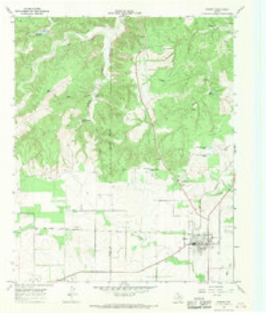
4 surveys from 8 printed sheetsMatched by testing this settlement's coordinate against the published boundary of every sheet in the United States Geological Survey's historical collection. Each opens the scanned sheet at the Survey.
- 1954 USGS Plainview quadrangle1:250000, 3 printings
- 1958 USGS Plainview quadrangle1:250000
- 1967 USGS Turkey quadrangle1:24000, 2 printings
- 1986 USGS Childress quadrangle1:100000, 2 printings
Fires near this place
51 since 2006Regional context, not property-specific evidence. The federal wildfire occurrence database lists 51 fires within 5 miles of Turkey between 2006 and 2020, burning about 1,468 acres in total. 17 started naturally. 1 was recorded as arson. Distance is straight-line from the map coordinates, so a fire counted here may appear on a neighbouring settlement's page as well.
| Reported cause | Fires |
|---|---|
| Natural | 17 |
| Power generation/transmission/distribution | 9 |
| Missing data/not specified/undetermined | 8 |
| Debris and open burning | 7 |
| Equipment and vehicle use | 6 |
| Smoking | 2 |
| Recreation and ceremony | 1 |
| Arson/incendiarism | 1 |
The most recent of them, most recent first, with the day each was reported and the service that recorded it.
| Date | Cause | Size | Reported by | Name on the report |
|---|---|---|---|---|
| 6 September 2019 | Equipment and vehicle use | 132 acres | Texas A & M Forest Service | BOOTH |
| 25 September 2019 | Power generation/transmission/distribution | 3.0 acres | Texas A & M Forest Service | GUEST FARMS |
| 13 September 2013 | Natural | 1.0 acres | Texas A & M Forest Service | MULLIN FARMS |
| 27 August 2015 | Missing data/not specified/undetermined | under an acre | Texas A & M Forest Service | COOPER FARM |
| 21 August 2010 | Natural | 5.0 acres | Texas A & M Forest Service | ADAMS PLACE |
| 14 August 2017 | Power generation/transmission/distribution | under an acre | Texas A & M Forest Service | BOB WILL |
| 11 August 2018 | Natural | 5.0 acres | Texas A & M Forest Service | HAMLTON |
| 11 August 2006 | Natural | 85 acres | Texas A & M Forest Service | not named |
Storms near this place
60 of 104 shownRegional context, not property-specific evidence. The National Weather Service names Turkey in 104 storm reports between 1993 and 2026: 44 hail, 44 thunderstorm wind, 8 tornado, 3 flash flood. No death or injury is recorded in these reports. Each account below is quoted exactly as the forecast office filed it, from the NOAA Storm Events Database, and each date opens the federal record of that event.
| When | Event | Place named | Harm | What the report says |
|---|---|---|---|---|
| August 2017 | Thunderstorm Wind | Turkey | $2,500,000 | For approximately 15 minutes, a barrage of northerly winds of 60 mph to as great as 120 mph inflicted heavy damage in the city of Turkey, located in far southwest Hall County. NWS Lubbock meteorologists conducted a ground and aerial damage survey at Turkey the following afternoon. All available evidence including radar, damage patterns, eyewitness accounts, and most notably a 15-minute duration of high winds indicated that a series of wet microbursts moved from north to south across Turkey. Several homes and businesses suffered damage, most notably the Turkey Compress which was totally destroyed. At least two homes suffered major damage and were deemed uninhabitable. Numerous large trees and power poles were snapped, building and car windows broken, garage doors collapsed, and other extensive damage occurred to car ports and canopies. Power in the city was not restored until nearly 12 hours later. Despite a large amount of airborne debris that affected the city, no fatalities or injuries occurred. Peak wind speeds were estimated to be in the 100-120 mph range based on the degree of damage. It is important to note that the most severely damaged structures were particularly old and not well maintained, including one home built in 1927. Homes that suffered roof damage or even broken windows also sustained extensive water damage from torrential rains that followed the series of microbursts. |
| May 1995 | Hail | Turkey | $200,000 | no account filed |
| May 2016 | Tornado (EF3) | Turkey | $150,000 | This is the continuation path of the tornado that began in northern Motley County. A significant tornado tracked northwest across rural southwest Hall County before narrowing and later dissipating about 1.5 miles east of Turkey at 2106 CST. Storm spotters indicated this large tornado was rain wrapped as it approached Turkey.||A NWS storm damage survey rated this tornado as EF-3. Although damage indicators were sparse in this part of Hall County, the wind estimate was derived from several steel pylons supporting electrical lines that were bent to the ground from winds estimated in the range of 135 to 140 mph. Additionally, there were trees blown over and uprooted as viewed from a distance along the nearest roadway. However, the survey team was unable to survey this damage due to flooded roads and a limited road network.||The development of this tornado and its unusual northwest motion were likely the result of a northward-moving outflow boundary tied to a left moving supercell that earlier impacted Matador (Motley County). Radar data indicate tornadogenesis occurred shortly after this outflow boundary impinged on the supercell. |
| June 2010 | Thunderstorm Wind | Turkey | $125,000 | An intense downburst occurred over portions of southwestern Hall County near Turkey around 23:30 CST on the 13th. The Texas Tech University West Texas Mesonet site just west-southwest of Turkey measured a 71 mph wind gust at 23:25 CST. An extreme gust of 101 mph was observed at 23:30 CST. The winds also were accompanied by intense rain bursts. ||A post-storm survey by Texas Tech University West Texas Mesonet meteorologists revealed that damage consistent with the measured wind speeds occurred along Texas Highway 86 from near the Briscoe and Hall County line to just west of Turkey. A trailer house was rolled by the winds and destroyed, and a large metal barn sustained severe damage with metal cross-beams blown some distance down wind. A number of utility poles also were snapped. No injuries were reported. |
| July 2010 | Heavy Rain | Turkey | $100,000 | Scattered showers and thunderstorms initially began to produce rainfall around midday on the 1st. This activity gradually evolved toward heavy tropical downpours, especially during the evening hours of the 3rd through the morning hours of the 4th.||The Texas Tech University West Texas Mesonet site near Turkey measured 4.07 inches of rainfall throughout the event. Local newspaper articles reported approximated unofficial totals across the county that measured between 3.00 and 8.00 inches.||Standing water was observed in a number of low-lying areas, including within crop lands and across several unpaved rural roadways which sustained minor damages. Otherwise, no significant flash flooding or flooding was reported. |
| June 2001 | Hail | Turkey | $100,000 | Law enforcement officials reported golfball size hail. |
| May 2006 | Hail | Turkey | $50,000 | Hail up to the size of golfballs broke windows and caused minor roof and vehicle damage in Turkey. The hail was accompanied by damaging winds. |
| July 2016 | Thunderstorm Wind | Turkey | $35,000 | Law enforcement in Turkey reported several power lines downed by high winds as well as a portion of a roof blown off of a house. Several minutes later, the Texas Tech University West Texas mesonet station observed a wind gust to 60 mph. |
| May 2016 | Thunderstorm Wind | Turkey | $10,000 | A Texas Tech University West Texas mesonet near Turkey measured a wind gust to 72 mph. Additionally, an NWS cooperative weather observer reported that a roof was blown off of a barn south of Turkey. |
| April 2016 | Hail | Turkey | $10,000 | An NWS cooperative weather observer in Turkey, and a few citizens of Turkey, reported hail up to the size of golf balls. This hail persisted for almost 20 minutes. Damage to windows and car windshields was reported. |
| May 2006 | Thunderstorm Wind | Turkey | $10,000 | Severe thunderstorm winds combined with large hail to break windows and down large tree limbs in Turkey. |
| June 2002 | Thunderstorm Wind | Turkey | $10,000 | Strong thunderstorm winds estimated at 60 to 80 mph blew down a number of power poles, power lines, and trees. |
| June 1996 | Hail | Turkey | $10,000 | no account filed |
| June 1994 | Hail | Turkey | $5,000 | no account filed |
| May 2016 | Thunderstorm Wind | Turkey | $3,000 | A storm chaser reported a telephone pole downed by high winds three miles south of Turkey. |
| August 1997 | Thunderstorm Wind | Turkey | $3,000 | no account filed |
| October 2013 | Flood | Turkey | $500 | The public reported standing water of unknown depth covering all of Highway 86 in and around Turkey. |
| March 2026 | Thunderstorm Wind | Turkey | - | A Texas Tech University West Texas mesonet site near Turkey measured a wind gust of 58 mph. |
| April 2025 | Flash Flood | Turkey | - | Several slow moving thunderstorms trained over Hall and Childress Counties early in the morning on the 26th. WSR-88D MRMS rainfall was estimated between two to four inches over a widespread area with localized areas between four and five inches in northeastern Hall County. Numerous roads were closed or impassable in Hall and Childress Counties including US Highway 287 between Memphis and Estelline and Texas State Highway 256 between Memphis and Lakeview. One vehicle accident was reported on Texas State Highway 86 northeast of Turkey. The Prairie Dog Town Fork of the Red River filled its|banks between Estelline and Childress briefly reaching minor flood stage at the Childress 10N river gage. |
| August 2025 | Thunderstorm Wind | Turkey | - | A Texas Tech University West Texas mesonet site near Turkey measured a wind gust of 61 mph at 1623 CST. A few minutes later at 1639 CST, an emergency manager reported numerous trees and fences blown over in the town of Turkey. |
| May 2024 | Tornado (EFU) | Turkey | - | Several storm chasers photographed a brief tornado near Texas State Highway 70 north of Turkey. |
| May 2024 | Tornado (EFU) | Turkey | - | Numerous storm chasers photographed a tornado northeast of Turkey and to the south of the intersection of Texas State Highway 86 and County Road 8. The tornado remained over open country and caused no known damage. |
| May 2024 | Hail | Turkey | - | A State of Texas Park Service employee reported hail up to golf ball size north of Turkey along Texas State Highway 70. |
| May 2024 | Thunderstorm Wind | Turkey | - | A Texas Tech University West Texas mesonet site near Turkey measured severe wind gusts from 1905 CST through 1922 CST. A peak wind gust of 62 mph was measured at 1922 CST. |
| June 2023 | Thunderstorm Wind | Turkey | - | A Texas Tech University West Texas mesonet site near Turkey measured a severe wind gust of 64 mph. |
| February 2023 | Thunderstorm Wind | Turkey | - | A swath of severe wind gusts occurred from near Turkey to near Estelline. Texas Tech University West Texas mesonet sites near Turkey and Estelline measured severe wind gusts from 1824 CST through 1850 CST. A peak wind gust of 59 mph was measured near Turkey at 1824 and 1825 CST. A peak wind gust of 62 mph was measured near Estelline at 1850 CST. |
| July 2023 | Thunderstorm Wind | Turkey | - | A Texas Tech University West Texas mesonet site near Turkey measured severe wind gusts from 0008 CST through 0009 CST. A peak wind gust of 60 mph was measured at 0008 CST. |
| August 2023 | Thunderstorm Wind | Turkey | - | A Texas Tech University West Texas mesonet site near Turkey measured severe wind gusts from 1927 CST through 1929 CST. A peak wind gust of 66 mph was measured at 1928 CST. |
| June 2023 | Hail | Turkey | - | Law enforcement reported hail up to two inches in diameter northeast of Turkey along State Highway 86. No damage was reported. |
| May 2022 | Thunderstorm Wind | Turkey | - | A Texas Tech University West Texas mesonet site near Turkey measured severe wind gusts from 2140 CST through 2141 CST. A peak wind gust of 62 mph was measured at 2140 CST. |
| May 2022 | Hail | Turkey | - | The fire department in Turkey reported hail up to quarter size. |
| August 2022 | Thunderstorm Wind | Turkey | - | A Texas Tech University West Texas mesonet site near Turkey measured a wind gust of 60 mph. |
| July 2022 | Thunderstorm Wind | Turkey | - | A Texas Tech University West Texas mesonet site near Turkey measured a severe wind gust of 59 mph. |
| June 2022 | Hail | Turkey | - | The fire department in Turkey reported quarter size hail in town. |
| June 2022 | Thunderstorm Wind | Turkey | - | A Texas Tech University West Texas mesonet site near Turkey measured severe wind gusts from 2155 CST through 2156 CST. A peak wind gust of 64 mph was measured at 2156 CST. |
| June 2022 | Thunderstorm Wind | Turkey | - | A Texas Tech University West Texas mesonet site near Turkey measured severe wind gusts from 0710 CST through 0721 CST. A peak wind gust of 82 mph was measured at 0712 CST. |
| April 2021 | Tornado (EFU) | Turkey | - | The fire department in Turkey observed a tornado over open land just north of Turkey. Additionally, a local storm chaser viewed a tornado on his game camera while hunting. The only damage noted was minor damage to trees and deer blinds. |
| May 2021 | Hail | Turkey | - | Several reports were received of a swath of severe hail up to golf ball size from just north of Turkey to just south of Turkey. |
| May 2021 | Hail | Turkey | - | A storm chaser reported hail up to two inches in diameter along Texas Highway 70 just northwest of Turkey. No damage was reported. |
| July 2020 | Thunderstorm Wind | Turkey | - | A Texas Tech University West Texas mesonet near Turkey measured a wind gust to 64 mph. |
| July 2020 | Thunderstorm Wind | Turkey | - | A Texas Tech University West Texas mesonet site near Turkey measured a wind gust to 62 mph. |
| August 2020 | Thunderstorm Wind | Turkey | - | A Texas Tech University West Texas mesonet site near Turkey measured a wind gust to 58 mph. |
| August 2020 | Thunderstorm Wind | Turkey | - | A Texas Tech University West Texas mesonet site near Turkey measured a wind gust to 59 mph. |
| March 2019 | Thunderstorm Wind | Turkey | - | A sustained wind speed of 53 mph preceded this gust to 80 mph. Measured by a Texas Tech University West Texas mesonet. |
| August 2019 | Thunderstorm Wind | Turkey | - | A Texas Tech University West Texas mesonet site near Turkey first measured a wind gust to 66 mph at 1900 CST. Severe wind gusts were then intermittently measured until 1930 CST with a peak gust of 68 mph. Furthermore, law enforcement in Turkey reported tree damage and that dumpsters had been blown over in town. |
| May 2019 | Hail | Turkey | - | An NWS cooperative weather observer reported quarter size hail in Turkey. No damage was reported. |
| May 2018 | Thunderstorm Wind | Turkey | - | A Texas Tech University West Texas mesonet near Turkey measured a wind gust to 66 mph. |
| June 2017 | Hail | Turkey | - | No reports of damage accompanied the hail. |
| August 2017 | Flood | Turkey | - | Law enforcement reported flash flooding in Turkey, TX, primarily along State Highway 86. |
| August 2017 | Thunderstorm Wind | Turkey | - | Severe winds of 58 mph to 68 mph were measured for 10 consecutive minutes by a Texas Tech University West Texas mesonet southwest of Turkey. |
| August 2017 | Heavy Rain | Turkey | - | Torrential rain of 3.02 inches was measured by a NWS Cooperative Observer at the Valley Peanut Growers in Turkey. |
| April 2016 | Tornado (EF0) | Turkey | - | A storm chaser captured video of a very brief landspout tornado in Hall County. |
| April 2016 | Hail | Turkey | - | A storm spotter in Turkey estimated hail as large as golf balls. No damage was reported. |
| June 2016 | Thunderstorm Wind | Turkey | - | A Texas Tech University West Texas mesonet site near Turkey measured a wind gust to 62 mph. Additionally, a storm chaser along Texas State Highway 70 north of Turkey estimated wind gusts to 65 mph. |
| May 2016 | Hail | Turkey | - | A storm chaser reported quarter size hail north of Turkey. No damage was reported. |
| May 2016 | Hail | Turkey | - | A storm chaser reported hail to the size of golf balls seven miles southeast of Turkey. No damage was reported. |
| July 2016 | Thunderstorm Wind | Turkey | - | Measured by a Texas Tech University West Texas mesonet station. |
| July 2016 | Hail | Turkey | - | A NWS cooperative weather observer reported a swath of wind blown hail that damaged a 12 mile long stretch of cotton in Motley and Hall Counties between Northfield and Turkey. |
| May 2015 | Hail | Turkey | - | A Caprock Canyon State Park employee estimated quarter size hail in Turkey. Damage was not known. |
| May 2015 | Hail | Turkey | - | A local observer reported hail to the size of quarters in Turkey. |
Nearest settlements
The eight closest, with where each one stands in the county. Distances are straight-line, computed from the Geographic Names Information System coordinates.
Elsewhere
Matched on this settlement's Geographic Names Information System number rather than its name, so it cannot be a different place of the same name in another state.
| Wikipedia article on Turkey | An encyclopaedic summary. Its text is share-alike, so it is linked here rather than copied. |
| Wikidata item Q975535 | The structured record the population and elevation above come from. Public domain (CC0). |
Provenance
This settlement is recorded in the Geographic Names Information System as feature 1370215. The sheet list is computed by point-in-boundary test against the United States Geological Survey's historical topographic inventory. Both are works of the United States government and carry no copyright under 17 U.S.C. 105.
Wildfire. Short, Karen C. 2022. Spatial wildfire occurrence data for the United States, 1992-2020 [FPA_FOD_20221014]. 6th Edition. Fort Collins, CO: Forest Service Research Data Archive. https://doi.org/10.2737/RDS-2013-0009.6 Collected with United States Government funding and usable without additional permissions or fees.
Storms. NOAA National Centers for Environmental Information, Storm Events Database https://www.ncei.noaa.gov/stormevents/ A work of the United States government, no copyright under 17 U.S.C. 105. Narratives are quoted verbatim from the National Weather Service report and are not edited or summarised.