 Block
Alto, Wisconsin
8 topographic sheets cover this place, the earliest surveyed in 1955 and the latest in 1980. It stands in Alto town. It lies in ZIP code area 53919. The Survey maps it on the Brandon quadrangle.
On record in Alto
Buildings and businesses the archive holds for this place. Each opens its own page, with the source record it came from.
On the National Register 1 record
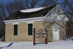 Zion Congregational Churchlisted 2006
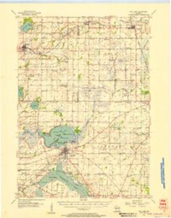
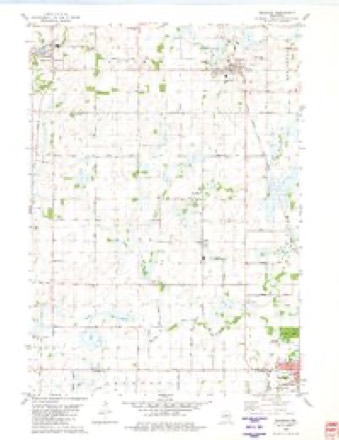
Topographic sheets covering this place
5 surveys from 8 printed sheetsMatched by testing this settlement's coordinate against the published boundary of every sheet in the United States Geological Survey's historical collection. Each opens the scanned sheet at the Survey.
- 1955 USGS Fox Lake quadrangle1:62500
- 1957 USGS Madison quadrangle1:250000, 3 printings
- 1960 USGS Madison quadrangle1:250000, 2 printings
- 1980 USGS Brandon quadrangle1:24000
- 1980 USGS Fond Du Lac quadrangle1:100000



In the county-history sources
9,647 words on this townshipThe History of Fond Du Lac County, Wisconsin, published 1880 names this settlement in its chapter on Alto Town. These are the passages that mention it, exactly as the scans read.
Alto is the southwestern township in Fond du Lac County. It is bounded north by JMetomen, east by Waupun, south by Trenton, in Dodge County, and west by Mackford, in Green Lake County. It is Township 14 north, in Range 14 east. It contains 2.3,153.'31 acres, wliich is 93.31 acres more than thirty-six full sections. It was subdivided by John Brink in November, 1834, and in his field notes he wrote: "This township is second rate, and rolling, save its marshes. It is thinly timbered with burr oak, white oak, yellow and black oak, except its prairies and marshes, where trees are wholly wanting. The soil is of a yellow, ashy color, of clay loam and sand. The streams are sluggish and have a muddy channel." Fully one-fourth of its area is marsh, most of which yields valuable hay product. Nearly one-half was openings and timber land, which is highly prized by wheat-raisers. The remainder is prairie, rolling, warm and rich. The South Fork of the Rock River passes through the entire width of the town in its southern part, having two principal branches coming in from the north. Tliese, with brooks and springs, give abundant supply of water. Notwithstanding the United States Surveyor marked tbe soil of the town "second rate," it is, in fact, rich and highly productive. Wheat and woo'd are the chief exports. Waupun and Brandon afford convenient markets.
Passage source: The History of Fond Du Lac County, Wisconsin, published 1880.
Frances D. Bowman, formerly of Rochester, N. Y., was the first settler in Alto, having located on Section 36 late in 1841, and for more than two years, was the "monarch of all he surveyed" in the town. His daughter, born in 1842, was the first birth, and his son, born in 1844, was the second child ia the town. After spending a season there, he went to Ohio and bought a flock of sheep and drove them to Alto, while he was still the " Robinson Crusoe" of the town. William Talcott was probably the second settler, and came early in 1844. Silas JMiller, a lay preacher of the Methodist Episcopal Church, came the same year; he named "Alto." Marcus Thwing, Dr. Green, iMr. Ilillyer and perhaps a few others came with their families in 1844. Martin Grider is undoulttedly the earliest settler who still lives in the town ; he moved his family into Alto in May, 1845, but he had entered land and sowed wheat in the fall of 1844. Mr. Bowman sold his claim in 1845 to F. F. Davis. Mr. Davis was afterward Sheriff of the county. His daughter, Cornelia C, died of consumption on the 7th of December, 1845. In the summer of 1846, Miss An^reline Booth taught the first school in Alto in the house of Mr. Davis, and the first i-cli(rious mcctinii; in the town was also at his house - preaching by Silas Miller, the father of Rev. W. G. Miller, who is now so favorably known in Wisconsin., Silas Midler built a saw-mill on a branch of Rock River, in the southeast part of the town, in 1845. /The first advent of a Hollander (said to have been a JSIr. Mcenk') into Alto was in 1845, and now threfiJiiiiutlis of the population are of that nationality"^ I'olitically, Alto is the banner Republican town of the county. In 1875 the inhabitants numbered 1,430. The Chicago, JMilwaukcc & St. Paul Railway passes through the noi-theast corner of this town, but the nearest station is, on the north, Brandon, and on the south, Waupun.
Passage source: The History of Fond Du Lac County, Wisconsin, published 1880.
The first school district wa^. organized March 18, 1850, at a meeting, of which George W. Sexmith was Chairman and Z. Miller Secretary, held for that purpose. The first oflicers were: George AV. Sexmith, Director; A. McMasters, Clerk, and John L. Sargent, Treasurer. The first schoolhouse, a frame building, 24x18 feet, was erected, that season, on Section 23, and Clara F. Pierce taught the first school in it, during three months, at $5 per month. The tax first raised amounted to $85 for all purposes. In 1877, a building costing $1,400 was erected. Alto now has nine schools, of which three are in union districts.
Passage source: The History of Fond Du Lac County, Wisconsin, published 1880.
Machine-read from a century-old scan, so expect the errors a machine makes: misspelled names, dropped words, stray characters.
Read the whole chapter on Alto Town - it names this place 45 more 45 times.
Fires near this place
4 since 1998Regional context, not property-specific evidence. The federal wildfire occurrence database lists 4 fires within 5 miles of Alto between 1998 and 2018, burning about 1,459 acres in total. None started naturally. None was recorded as arson. Distance is straight-line from the map coordinates, so a fire counted here may appear on a neighbouring settlement's page as well.
| Reported cause | Fires |
|---|---|
| Missing data/not specified/undetermined | 2 |
| Debris and open burning | 1 |
| Equipment and vehicle use | 1 |
The most recent of them, most recent first, with the day each was reported and the service that recorded it.
| Date | Cause | Size | Reported by | Name on the report |
|---|---|---|---|---|
| 18 May 2018 | Missing data/not specified/undetermined | under an acre | Wisconsin Department of Natural Resources | F180545 |
| 25 April 2018 | Missing data/not specified/undetermined | under an acre | Wisconsin Department of Natural Resources | F180451 |
| 11 April 2014 | Debris and open burning | 829 acres | Wisconsin Department of Natural Resources | DODGEVILLE CO-OP 5 |
| 24 October 1998 | Equipment and vehicle use | 630 acres | Wisconsin Department of Natural Resources | not named |
Settlements close enough to share some of these fires:
Mines and quarries near this place
5 within 5 milesRegional context, not property-specific evidence. The federal mineral resources record lists 5 workings within 5 miles of Alto: 3 past producers, 2 producers. 2 still produce. What was taken out: Stone, Crushed/Broken, Limestone, Dimension. Distance is straight-line from the map coordinates, so a quarry counted here may appear on a neighbouring settlement's page as well.
| Where | Site | Commodity | Status | Recorded |
|---|---|---|---|---|
| Waupun Stone Quarry | Limestone, Dimension | Past Producer | ||
| Howard Quarry | Stone, Crushed/Broken | Past Producer | ||
| Larson Quarry | Stone, Crushed/Broken | Past Producer | ||
| Linck Waupun Quarries | Stone, Crushed/Broken | Producer | ||
| Waupun Ready Mix Quarry | Stone, Crushed/Broken | Producer |
Storms near this place
17 since 2001Regional context, not property-specific evidence. The National Weather Service names Alto in 17 storm reports between 2001 and 2024: 6 hail, 5 tornado, 2 thunderstorm wind, 1 lightning. No death or injury is recorded in these reports. Each account below is quoted exactly as the forecast office filed it, from the NOAA Storm Events Database, and each date opens the federal record of that event.
| When | Event | Place named | Harm | What the report says |
|---|---|---|---|---|
| June 2004 | Tornado (F3) | Alto | $6,000,000 | This tornado was a continuation of the tornado that moved through the southern part of the city of Markesan (Green Lake Co.). It entered Fond du Lac County just south of Lake Maria Road, about 4.7 miles SW of Alto. It moved east-southeast on a line toward Waupun at F3 strength (estimated 175-200 mph), and actually merged with the Lake Maria tornado that moved east out of extreme southeastern Green Lake County. The merger took place just east of a dogleg/bend of Oak Grove Rd., about 2.2 miles SSW of Alto. The civil Town of Alto reported that 19 residential homes had major damage and 1 was destroyed. One business had major damage. Fourteen farms were affected with a tally of 8 ag-buildings/homes with minor damage, 19 with major damage, and 16 destroyed. Crop damage was severe. Public sector damage (roads/bridges) was about $225K. In the city of Waupun (Fond du Lac side), 4 homes had major damage, and roughly 150 had minor roof/siding damage due to severe tree damage. Average path width was about 300 yards. |
| June 2004 | Tornado (F3) | Alto | $1,610,000 | This tornado was a continuation of the tornado that moved east from the Lake Maria area of extreme southeastern Green Lake County. It maintained its F3 strength (175-200 mph) and moved east along Marshview Rd, only to merge with the F3 tornado moving east/southeast out of the Markesan area of southeast Green Lake County. The merger took place just east of a dogleg/bend of Oak Grove Rd., about 2.2 miles SSW of Alto. The civil Town of Alto reported that 8 residential homes had major damage. Four farms were affected with a tally of 8 ag-buildings/homes with minor damage, 19 with major damage, and 16 destroyed. Crop damage was severe. Public sector damage (roads/bridges) was about $100K. Average path width was about 275 yards. |
| June 2024 | Flash Flood | Alto | $30,000 | Street and road flooding in southern and eastern Fond du Lac County with some road closures needed. This included the communities of Eden, Byron, Oakfield, and Alto. Some road washouts have occurred. Basement flooding as well. Flooding at a campground in the Kettle Moraine. Lowland flooding throughout the area. |
| June 2011 | Tornado (EF1) | Alto | $30,000 | This EF1 tornado touched down about 4.4 miles west-southwest of the town of Alto in Fond Du Lac County, on Marshview Road, about one-third of a mile north of Lake Maria Road, and tracked about 2.6 miles to the north-northwest before crossing into Green Lake County, about 3.7 miles south-southwest of Fairwater, at County Road S approximately 1/4 mile east of Schure Road. This tornado exhibited three separate damage tracks within the path, suggesting three separate vortices formed and dissipated during the life span of the tornado. The average path width was 75 yards, with a maximum path width of 105 yards. The tornado blew over trees and flattened a pole shed. The EF1 rating was determined by using DI 21(MBS) DOD5 LB to EXP with estimated winds speeds of 105 mph. The exact starting point was 43.77112/-88.88480 and the exact ending point was 43.78370/-88.88558. |
| April 2013 | Lightning | Alto | $10,000 | A house fire occurred in Waupun when lightning hit near the home and traveled down a metal line to a gas fireplace in the residence, blowing a hole in the fireplace liner and igniting gas fumes. |
| June 2004 | Hail | Alto | $3,000 | no account filed |
| March 2022 | Flood | Alto | $1,000 | Heavy rainfall on a frozen ground lead to scattered reports of water over the roads in rural and urban areas. |
| March 2022 | Heavy Rain | Alto | $1,000 | Heavy rainfall on a frozen ground lead to scattered reports of water over the roads in rural and urban areas. |
| August 2018 | Tornado (EF1) | Alto | - | Tornado was 1 of 19 tornadoes that occurred across central to east central Wisconsin on the afternoon of August 28th. This tornado went just north of the Town of Alto and crossed Hwy 49. Large farm buildings and sheds damaged with one of them destroyed. | Power poles leaning to the south along Hemp Rd. Widespread straight line winds caused significant tree and crop damage across the county as well. |
| July 2006 | Tornado (F0) | Alto | - | A very brief tornado spun up 0.7 miles west of Alto and tracked a tenth of a mile before dissipating. No damage was reported from this F0 tornado. This tornado was most likely of the landspout variety and the result of vertical stretching of a low-level circulation into the updraft of a towering cumulus cloud that formed on a weak atmospheric boundary that was moving south through Fond du Lac County. No precipitation was observed on the WSR-88D Doppler radar, and only very weak rotation was noted on only one volume scan with a +6 kt/-6 kt speed differential in the 0.5 degree scan. |
| October 2006 | Thunderstorm Wind | Alto | - | Powerful thunderstorm winds knocked down large trees. |
| September 2021 | Hail | Alto | - | no account filed |
| June 2016 | Hail | Alto | - | no account filed |
| August 2015 | Hail | Alto | - | no account filed |
| March 2006 | Hail | Alto | - | no account filed |
| June 2004 | Hail | Alto | - | no account filed |
| June 2001 | Thunderstorm Wind | Alto | - | no account filed |
Nearest settlements
The eight closest, with where each one stands in the county. Distances are straight-line, computed from the Geographic Names Information System coordinates.
| Map | Place | Distance | Sheets |
|---|---|---|---|
| Brandon | 4.1 miles | 8 | |
| Waupun | 4.6 miles | 10 | |
| Fairwater | 6.0 miles | 8 | |
| Ladoga | 7.1 miles | 10 | |
| Rogersville | 10.0 miles | 10 | |
| Oak Center | 10.4 miles | 10 | |
| West Rosendale | 10.7 miles | 9 | |
| Rosendale | 11.1 miles | 9 |
Provenance
This settlement is recorded in the Geographic Names Information System as feature 1560805. The sheet list is computed by point-in-boundary test against the United States Geological Survey's historical topographic inventory. Both are works of the United States government and carry no copyright under 17 U.S.C. 105.
Wildfire. Short, Karen C. 2022. Spatial wildfire occurrence data for the United States, 1992-2020 [FPA_FOD_20221014]. 6th Edition. Fort Collins, CO: Forest Service Research Data Archive. https://doi.org/10.2737/RDS-2013-0009.6 Collected with United States Government funding and usable without additional permissions or fees.
Mines and quarries. USGS Mineral Resources Data System (MRDS) https://mrdata.usgs.gov/mrds/ A work of the United States government, no copyright under 17 U.S.C. 105.
Storms. NOAA National Centers for Environmental Information, Storm Events Database https://www.ncei.noaa.gov/stormevents/ A work of the United States government, no copyright under 17 U.S.C. 105. Narratives are quoted verbatim from the National Weather Service report and are not edited or summarised.