 Block
Fairwater, Wisconsin
8 topographic sheets cover this place, the earliest surveyed in 1955 and the latest in 1980. It stands in Metomen town. It lies in ZIP code area 53931. The Survey maps it on the Brandon quadrangle. 346 people lived here at the 2020 count. It stands 948 feet above sea level.
Population over time
2 figuresFairwater fell from 371 to 346 between 2010 and 2020. These are the recorded population figures Wikidata holds for this place, reached through the Geographic Names Information System number this page is keyed on rather than by name, so they belong to this place and not to another of the same name. Most are census counts, but not all are: an early figure may be a founding or settlement estimate, and an estimate published within five years of a census is left out. The change column is computed, and is left blank where more than 20 years separate a figure from the one before it, because a gap that long is not a change between two counts.
| Year | People | Change |
|---|---|---|
| 2010 | 371 | |
| 2020 | 346 | -25 (-7%) |
Topographic sheets covering this place
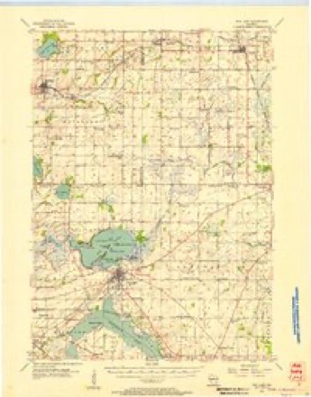
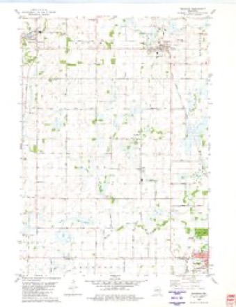
5 surveys from 8 printed sheetsMatched by testing this settlement's coordinate against the published boundary of every sheet in the United States Geological Survey's historical collection. Each opens the scanned sheet at the Survey.
- 1955 USGS Fox Lake quadrangle1:62500
- 1957 USGS Madison quadrangle1:250000, 3 printings
- 1960 USGS Madison quadrangle1:250000, 2 printings
- 1980 USGS Brandon quadrangle1:24000
- 1980 USGS Fond Du Lac quadrangle1:100000



In the county-history sources
21,695 words on this townshipThe History of Fond Du Lac County, Wisconsin, published 1880 names this settlement in its chapter on Metomen Town. These are the passages that mention it, exactly as the scans read.
This fine agricultural town lies on the west line of Fond du Lac County, immediately south of Ripon and northwest of Waupun. This is called the richest town in Fond du Lac county, cities not included. This reputation is sustained by the taxes paid in 1879 by Metomen, which were about $300 in excess of those of any other town. It is Township 15 north, of Range 14 east, containing 36 full sections of arable land. The town as a whole is a rich, undulating prairie, scarcely one-twentieth of its area being timber. The most uneven portions have a soil of sandy loam, with a subsoil of gravel, and with an occasional outcrop of limestone, which can be profitably workeil. In the lowlands are found the vegetable mold - the choice alluvium of the marshy meadows. These, when thoroughly drained, constitute a mine of agricultural wealth. " Round Prairie," comprising several thousand acres northwest of Brandon is justly celebrated for its beauty and fertility. Much of Metomen is similar to Ripon, which has been called the "Eden of the West." Its elevation its gradually rolling surface and deep, warm soil combine to render it attractive and productive. Other portions of the township claim equal fertility. Much of the land is higher than any of the surrounding country - is, in fact, a watershed from which the streams flow southeasterly, northerly and westerly. The East Branch of the Rock River rises in Metomen. The Grand River, in the southwest corner, affords mill privileges at Fairwater. Wells upon the high prairie are not deep, but furnish exhaustless water supply. Creeks and brooklets are found, except upon the uplands. For a prairie country, Metomen contains some i-emarkable springs and streams. The spring on Almon Osborn's farm. Section 2, is the largest in the county, being tlie principal source of Silver Creek, which flows into Green Lake. Caraboo Spring, on the old Col. Mansfield farm, is twenty-five feet across and discharges an astonishing volume of water. This is the head of Grand River. The land has been well adapted to wheat-raising, but, lately, attention has been profitably turned to stockraising, particularly of sheep; and wool is becoming a leading export. For general farming purposes, Metomen is excelled by few in the State.
Passage source: The History of Fond Du Lac County, Wisconsin, published 1880.
A. M. dinner. In 1848, Mr. Carter built what was called for years the best dwelling in the township. By 1850, Fairwater was quite a little village, schoolhouses and churches were being erected, and the new country had many of the essentials of New England civilization ; Mr. Carter now has five improved farms, aggregating 460 acres, of which fully 400 are now under the plow. Mr. and Mrs. Carter have added to the census eight sons and four daughters, of whom five sons and one daughter are living - Mary A. deceased), Sarah E. (deceased) ; George W. (the present Warden of the Wisconsin State Prison at Waupun), James W., Harrison D. (deceased), Charles S., Alvin H. (deceased), Eliza B., Edward B., Henrietta L. ( deceased ), Louis E., and Herbert K. (deceased) ; three of the sons served through the rebellion, as soldiers iu Wisconsin regiments, and a fourth one was four years in the army as clerk in the Commissary and Paymaster's departments ; Mr. Carter's family were the second settlers in Metomen Township. Mrs. Carter is a motherly matron, whom many in that region regard as indispensable in sickness. Mr. Carter was the first Postmaster in Metomen Township ; has been Assessor and Town Chairman, and held other local oiEces ; he is- a "true-blue " Republican, and is actively interested in local and general politics. Himself and wife are not connected with any church, but they are in sympathy with all institutions designed to benefit mankind, and their faith looks to the ultimate happiness of all humanity ; they are a genial, hospitable and highly respected family.
Passage source: The History of Fond Du Lac County, Wisconsin, published 1880.
F.COLLIKS, farmer, Sec. 32; P.O. Fairwater; born in Warsaw, Wyoming Co., N. Y., on the 9th of May, 1822; has always been a farmer. Was married, Oct. 16, 1842, to Miss Louisa A. Norman, of Wyoming Co., N. Y.; removed to Michigan in 1844, and remained four years; his father, in 1845, preempted eighty acres, which constitutes a part of the farm now owned by himself; he came to this town.ship in 1848, and has not moved from the old homestead ; has 105 acres, of which sixty have been plowed ; twenty-five is timber, and twenty is pasture and meadow. Have had seven children - Amy L., born in 1843, married in 1865 ; Calvin D., born in 1846; Anna L., born in 1849, married in 1877 ; Alva N., born in 1853, married in 1878 ; Joseph T., born in 1857 ; William H., born in 1860 ; A. De Esten, born in 1866. Himself and wife are Methodists; has been a Republican since the formation of the party. Mr. Collins has declined all ofSce, but his neighbors speak of him as a very reliable and useful citizen.
Passage source: The History of Fond Du Lac County, Wisconsin, published 1880.
Machine-read from a century-old scan, so expect the errors a machine makes: misspelled names, dropped words, stray characters.
Read the whole chapter on Metomen Town - it names this place 11 more 11 times.
Fires near this place
29 since 1992Regional context, not property-specific evidence. The federal wildfire occurrence database lists 29 fires within 5 miles of Fairwater between 1992 and 2020, burning about 152 acres in total. None started naturally. 2 were recorded as arson. Distance is straight-line from the map coordinates, so a fire counted here may appear on a neighbouring settlement's page as well.
| Reported cause | Fires |
|---|---|
| Debris and open burning | 14 |
| Equipment and vehicle use | 5 |
| Missing data/not specified/undetermined | 5 |
| Arson/incendiarism | 2 |
| Other causes | 1 |
| Power generation/transmission/distribution | 1 |
| Recreation and ceremony | 1 |
The most recent of them, most recent first, with the day each was reported and the service that recorded it.
| Date | Cause | Size | Reported by | Name on the report |
|---|---|---|---|---|
| 18 July 1998 | Debris and open burning | under an acre | Wisconsin Department of Natural Resources | not named |
| 14 July 2000 | Debris and open burning | 8.0 acres | Wisconsin Department of Natural Resources | not named |
| 7 May 2004 | Debris and open burning | 3.0 acres | Wisconsin Department of Natural Resources | not named |
| 4 May 1999 | Debris and open burning | 7.5 acres | Wisconsin Department of Natural Resources | not named |
| 18 May 2007 | Recreation and ceremony | under an acre | Wisconsin Department of Natural Resources | not named |
| 14 May 1992 | Arson/incendiarism | under an acre | Wisconsin Department of Natural Resources | not named |
| 28 April 2004 | Debris and open burning | 58 acres | Wisconsin Department of Natural Resources | not named |
| 27 April 2003 | Debris and open burning | under an acre | Wisconsin Department of Natural Resources | not named |
Mines and quarries near this place
4 within 5 milesRegional context, not property-specific evidence. The federal mineral resources record lists 4 workings within 5 miles of Fairwater: 3 past producers, 1 producer. 1 still produces. What was taken out: Stone, Crushed/Broken, Limestone, Dimension, Sand and Gravel, Construction. Distance is straight-line from the map coordinates, so a quarry counted here may appear on a neighbouring settlement's page as well.
| Where | Site | Commodity | Status | Recorded |
|---|---|---|---|---|
| Fairwater Pit | Sand and Gravel, Construction | Producer | ||
| Waupun Stone Quarry | Limestone, Dimension | Past Producer | ||
| Chier Quarry | Stone, Crushed/Broken | Past Producer | ||
| Leahman Quarry | Stone, Crushed/Broken | Past Producer |
Storms near this place
4 since 2007Regional context, not property-specific evidence. The National Weather Service names Fairwater in 4 storm reports between 2007 and 2015: 3 thunderstorm wind, 1 tornado. No death or injury is recorded in these reports. Each account below is quoted exactly as the forecast office filed it, from the NOAA Storm Events Database, and each date opens the federal record of that event.
| When | Event | Place named | Harm | What the report says |
|---|---|---|---|---|
| June 2011 | Tornado (EF1) | Fairwater | $15,000 | This EF1 tornado touched down approximately 2.3 miles of northwest of Fairwater, about 200 feet southeast of the intersection of Watson Road and Searl Road/County Line Road, and traveled nearly parallel to County Line Road for almost a mile to the north-northwest before crossing County Line Road about 2000 feet north of Carter Road into Green Lake County. The average path width was 60 yards, with a maximum path width of 100 yards. The tornado uprooted trees and tore away a wall and part of the roof of a barn. The EF1 rating was determined by using DI 1(SBO) DOD4 EXP toward UB with estimated winds speeds of 95 mph. The exact starting point was 43.66761/-88.86583 and the exact ending point was 43.70275/-88.88517. |
| July 2015 | Thunderstorm Wind | Fairwater | $5,000 | Numerous reports of trees and powerlines down across the southern portion of the county. |
| July 2015 | Thunderstorm Wind | Fairwater | $2,000 | A large tree down on a power line. |
| August 2007 | Thunderstorm Wind | Fairwater | $2,000 | Powerful thunderstorm wind gusts to around 52 knots (60 mph) toppled saeveral large trees and branches. A power-line was damaged. |
Nearest settlements
The eight closest, with where each one stands in the county. Distances are straight-line, computed from the Geographic Names Information System coordinates.
| Map | Place | Distance | Sheets |
|---|---|---|---|
| Brandon | 4.6 miles | 8 | |
| Alto | 6.0 miles | 8 | |
| Ripon | 7.0 miles | 10 | |
| Arcade Acres | 7.9 miles | 10 | |
| West Rosendale | 9.3 miles | 9 | |
| Ladoga | 10.3 miles | 10 | |
| Wilmoore Heights | 10.5 miles | 10 | |
| Waupun | 10.5 miles | 10 |
Elsewhere
Matched on this settlement's Geographic Names Information System number rather than its name, so it cannot be a different place of the same name in another state.
| Wikipedia article on Fairwater | An encyclopaedic summary. Its text is share-alike, so it is linked here rather than copied. |
| Wikidata item Q2088145 | The structured record the population and elevation above come from. Public domain (CC0). |
Provenance
This settlement is recorded in the Geographic Names Information System as feature 1564827. The sheet list is computed by point-in-boundary test against the United States Geological Survey's historical topographic inventory. Both are works of the United States government and carry no copyright under 17 U.S.C. 105.
Wildfire. Short, Karen C. 2022. Spatial wildfire occurrence data for the United States, 1992-2020 [FPA_FOD_20221014]. 6th Edition. Fort Collins, CO: Forest Service Research Data Archive. https://doi.org/10.2737/RDS-2013-0009.6 Collected with United States Government funding and usable without additional permissions or fees.
Mines and quarries. USGS Mineral Resources Data System (MRDS) https://mrdata.usgs.gov/mrds/ A work of the United States government, no copyright under 17 U.S.C. 105.
Storms. NOAA National Centers for Environmental Information, Storm Events Database https://www.ncei.noaa.gov/stormevents/ A work of the United States government, no copyright under 17 U.S.C. 105. Narratives are quoted verbatim from the National Weather Service report and are not edited or summarised.