 Block
Anderson, Wisconsin
17 topographic sheets cover this place, the earliest surveyed in 1891 and the latest in 1981. It stands in Janesville City. It lies in ZIP code area 53545. The Survey maps it on the Janesville West quadrangle.
On record in Anderson
Buildings and businesses the archive holds for this place. Each opens its own page, with the source record it came from.
On the National Register within a mile 1 record
The National Register names another town for these. They stand within one mile of this settlement's coordinate.
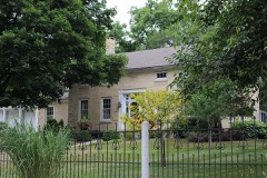 John and Eleanor Strunk Houselisted 2008 · 0.9 miles away
Topographic sheets covering this place
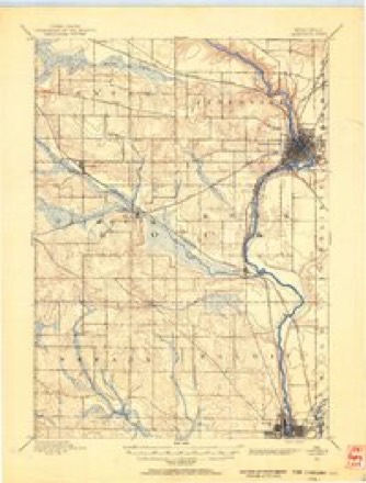
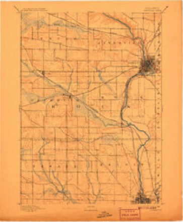
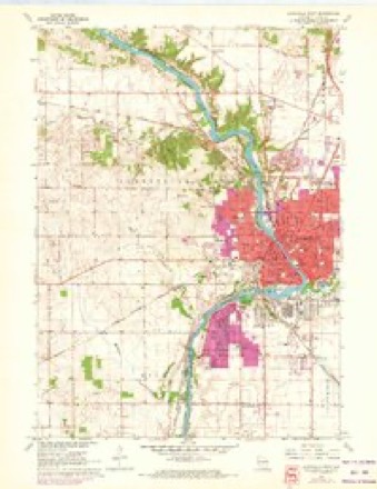
9 surveys from 17 printed sheetsMatched by testing this settlement's coordinate against the published boundary of every sheet in the United States Geological Survey's historical collection. Each opens the scanned sheet at the Survey.
- 1891 USGS Janesville quadrangle1:62500
- 1893 USGS Janesville quadrangle1:62500, 4 printings
- 1954 USGS Rockford quadrangle1:250000
- 1955 USGS Rockford quadrangle1:250000
- 1958 USGS Rockford quadrangle1:250000, 4 printings
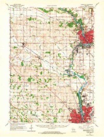
- 1961 USGS Janesville West quadrangle1:24000, 3 printings
- 1962 USGS Janesville quadrangle1:62500
- 1963 USGS Rockford quadrangle1:250000
- 1981 USGS Monroe quadrangle1:100000





In the county-history sources
70,689 words on this townshipThe History of Rock County, Wisconsin; Its Early Settlement, Growth, Development, Resources, Etc., published 1879 names this settlement in its chapter on Janesville City. These are the passages that mention it, exactly as the scans read.
Fresh arrivals became of frequent occurrence. Rock River Valley was known far and wide, and it soon became evident that the settlement, at no distant period, would develop into a thriving frontier village. Judge Holmes foresaw this. The vision of a great city flitted before his «yes. Where would it be located? Who should own it? These were the questions which puzzled the brain of the Judge. It was not a problem of jurisprudence. Had it been a point of common law, he could have decided it instanter. But before him was the prospect that, within his day, an important city must grow upon the banks of Rock River. By skillful management he might own half the lots within its limits, and leave to his heirs a legacy of untold value. There was no time to lose. People were arriving from every direction. Log houses were being thrown together every day. The Judge could hear his neighbors' chickens crow, so populous had the settlement become. Tn the opinion of the Judge, the land on the north side of the river embraced in the Big Bend, presented the greatest attractions for a village site. Accordingly, he determined to secure the services of a surveyor and lay it out in lots at once. The Judge's remarkable foresight prompted him, in order to forever set at rest any dispute as to title which might arise in the future, to have all documents pertaining to his embryo village drawn in the names of his sons, Thomas and Joshua. Upon reflection, however, it occurred to him that the idea of two men owning an entire city might, when the property became valuable, appear so preposterous that his sons would be dispossessed. So he concluded to let a few of his rmost intimate friends into the scheme, as will appear from the following description of the property taken from a copy of the record now on file in the Recorder's ofiice of this county.
Passage source: The History of Rock County, Wisconsin; Its Early Settlement, Growth, Development, Resources, Etc., published 1879.
Rockport contained about one hundred and fifty-eight acres within its limit lines. It included the water front on the west side of the river, from the Big Rock to a point opposite the present winter quarters of Burr Bobbins' menagerie, extending north about the same distance. A few lots were disposed of to new settlers soon after the survey was made, and a year later.
Passage source: The History of Rock County, Wisconsin; Its Early Settlement, Growth, Development, Resources, Etc., published 1879.
The establishment of village sites became a mania in the settlement about this time, and every man believed his claim afforded unparalleled advantages in this regard. John Inman had located on the west side of the river, about three-quarters of a mile below the present Monterey bridge. The apparent success which attended the progress of Rockport induced him to sacrifice what might have been made a good farm, to the purposes of a village site. A copy of the plat, taken from the records of Milwaukee County, is now on fife in the Recorder's oflSce in Rock County. On the back of the instrument is the description of Wisconsin City, and signed thereto are the following names : John Inman, Jeremiah Price, Josiah S. Erase, James S. Seymour, John H. Hardenburg, George C. Seelye and Edward Shepard. The site was surveyed by Samuel Morris, on April 26, 1836. The instrument is acknowledged before Edward W. Casey, a Justice of the Peace of Chicago, and Richard [. Hamilton, Clerk of the Cook County (111.) Commissioners' Court, on May 17 of the same year. Mr. Inman was very happy in his selection of names for the streets of his village. Many cities founded at a more recent period, which have grown to large proportions, have not been more fortunate in this regard. We find the name of the immortal Washington inscribed on the plat as marking one of the thoroughfares of Wisconsin City. Van Buren, Webster, Seymour, Chatham, Inman (in honor of the founder), Prescott and a host of other famous men, were the unconscious possessors of similar monuments in Wisconsin City. Crossing these diagonally were Indiana, Illinois, Grand and (what appears to have been a great boulevard) Broadway streets. Inman took his plat - about all there was of Wisconsin City - and went to Chicago for the purpose of interesting speculators in what was designed to be " the leading city in the great Northwest." He met Sydney Breeze, then a land speculator, and afterward Chief Justice of the Supreme Court of Illinois. Mr. Breeze was not in a very speculative mood, it seems, as he only purchased half the village. The price he paid is not known, but Inman came back in new clothes,' bringing a fresh supply of provisions, and was thereafter spoken of by the settlers as " a sort of lucky dog, anyway." A few months later, Mr. Breeze sold his interest to Knowles Taylor, a New York silk importer, for $20,000, tiiking his pay in the Gotham merchant's fabrics, and disposing of them to Chicago dealers at a sacrifice for cash.
Passage source: The History of Rock County, Wisconsin; Its Early Settlement, Growth, Development, Resources, Etc., published 1879.
Machine-read from a century-old scan, so expect the errors a machine makes: misspelled names, dropped words, stray characters.
Read the whole chapter on Janesville City - it names this place 5 more 5 times.
Fires near this place
14 since 2018Regional context, not property-specific evidence. The federal wildfire occurrence database lists 14 fires within 5 miles of Anderson between 2018 and 2020, burning about 57 acres in total. None started naturally. None was recorded as arson. Distance is straight-line from the map coordinates, so a fire counted here may appear on a neighbouring settlement's page as well.
| Reported cause | Fires |
|---|---|
| Missing data/not specified/undetermined | 6 |
| Debris and open burning | 6 |
| Smoking | 1 |
| Equipment and vehicle use | 1 |
The most recent of them, most recent first, with the day each was reported and the service that recorded it.
| Date | Cause | Size | Reported by | Name on the report |
|---|---|---|---|---|
| 7 August 2018 | Missing data/not specified/undetermined | under an acre | Wisconsin Department of Natural Resources | 6330 |
| 8 July 2019 | Debris and open burning | under an acre | Wisconsin Department of Natural Resources | 5344 |
| 7 July 2018 | Missing data/not specified/undetermined | under an acre | Wisconsin Department of Natural Resources | 5449 |
| 5 June 2018 | Missing data/not specified/undetermined | under an acre | Wisconsin Department of Natural Resources | 4517 |
| 29 April 2018 | Smoking | 1.0 acres | Wisconsin Department of Natural Resources | 3368 |
| 29 April 2018 | Missing data/not specified/undetermined | under an acre | Wisconsin Department of Natural Resources | 3363 |
| 26 April 2018 | Debris and open burning | 5.0 acres | Wisconsin Department of Natural Resources | 287 |
| 23 April 2018 | Debris and open burning | under an acre | Wisconsin Department of Natural Resources | 279 |
Settlements close enough to share some of these fires:
Mines and quarries near this place
9 within 5 milesRegional context, not property-specific evidence. The federal mineral resources record lists 9 workings within 5 miles of Anderson: 5 past producers, 3 producers, 1 unknown. 3 still produce. What was taken out: Sand and Gravel, Construction, Stone, Crushed/Broken, Stone. Distance is straight-line from the map coordinates, so a quarry counted here may appear on a neighbouring settlement's page as well.
| Where | Site | Commodity | Status | Recorded |
|---|---|---|---|---|
| Bass Quarry | Stone | Unknown | ||
| Austin Quarry | Stone, Crushed/Broken | Past Producer | ||
| Beaudin Quarry | Stone, Crushed/Broken | Producer | ||
| County Shop Quarry | Stone, Crushed/Broken | Past Producer | ||
| Edgerton | Sand and Gravel, Construction | Past Producer | ||
| Frank Brothers | Sand and Gravel, Construction | Past Producer | ||
| Janesville Pit & Mill | Sand and Gravel, Construction | Producer | ||
| Rock County Pioneer Crusher 493 | Sand and Gravel, Construction | Producer | ||
| Wheeler Pit | Sand and Gravel, Construction | Past Producer |
Nearest settlements
The eight closest, with where each one stands in the county. Distances are straight-line, computed from the Geographic Names Information System coordinates.
| Map | Place | Distance | Sheets |
|---|---|---|---|
| Janesville | 2.4 miles | 17 | |
| Milton Junction | 5.3 miles | 19 | |
| Milton | 5.6 miles | 19 | |
| Leyden | 6.0 miles | 16 | |
| Indianford | 7.2 miles | 18 | |
| Newville | 7.7 miles | 18 | |
| Coopers Shores | 8.0 miles | 18 | |
| Hans Addition | 8.1 miles | 18 |
Provenance
This settlement is recorded in the Geographic Names Information System as feature 1577492. The sheet list is computed by point-in-boundary test against the United States Geological Survey's historical topographic inventory. Both are works of the United States government and carry no copyright under 17 U.S.C. 105.
Wildfire. Short, Karen C. 2022. Spatial wildfire occurrence data for the United States, 1992-2020 [FPA_FOD_20221014]. 6th Edition. Fort Collins, CO: Forest Service Research Data Archive. https://doi.org/10.2737/RDS-2013-0009.6 Collected with United States Government funding and usable without additional permissions or fees.
Mines and quarries. USGS Mineral Resources Data System (MRDS) https://mrdata.usgs.gov/mrds/ A work of the United States government, no copyright under 17 U.S.C. 105.