 Block
Twin Grove, Wisconsin
15 topographic sheets cover this place, the earliest surveyed in 1920 and the latest in 1981. It stands in Jefferson town. It lies in ZIP code area 53566. The Survey maps it on the Juda quadrangle. It stands 948 feet above sea level.
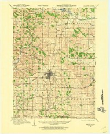
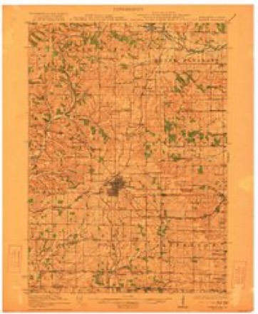
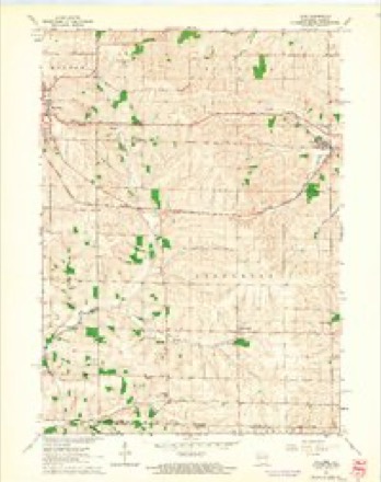
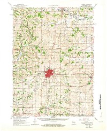
Topographic sheets covering this place
9 surveys from 15 printed sheetsMatched by testing this settlement's coordinate against the published boundary of every sheet in the United States Geological Survey's historical collection. Each opens the scanned sheet at the Survey.
- 1920 USGS Monroe quadrangle1:62500
- 1922 USGS Monroe quadrangle1:62500
- 1954 USGS Rockford quadrangle1:250000
- 1955 USGS Rockford quadrangle1:250000
- 1958 USGS Rockford quadrangle1:250000, 4 printings
- 1962 USGS Juda quadrangle1:24000, 3 printings
- 1962 USGS Monroe quadrangle1:62500, 2 printings
- 1963 USGS Rockford quadrangle1:250000
- 1981 USGS Monroe quadrangle1:100000





In the county-history sources
12,002 words on this townshipHistory of Green County, Wisconsin, published 1877 names this settlement in its chapter on Jefferson Town. These are the passages that mention it, exactly as the scans read.
The villages of Jefferson are two - Juda, in the northeast corner, and Twin Grove, almost in the centre of the township. Jehu Chadwick entered, sold, and bought back again the land on which Juda is built, after which he sold several lots and gave lots for a cemeterv and Baptist church. The first building there was a log school house, called, for the old home of the settlers, the Pennsylvania school house. The first person buried in the cemetery was James Chadwick, who died in September, 1846. People who had moved their dead from farm to farm, as their own homes had changed, now brought the precious remains to the new cemetery; so that when, a few years later, the growth of the unexpected village necessitated the removal of the cemetery, some coffins were taken up for the third time. The church was b'uilt in 184S by the society which was organized by Elder Wm. Stilwell, September 19, 1840. This was the first Baptist society organized in the county, and it numbered thirteen members. Elder Stilwell lived in Illinois, but for four years preached to the society once in two months. As he was not willing to give up his other churches, and as .all were anxious to have preaching every week, Deacon Davis went to Pennsylvania in 1845, t° ^n<^ a minister. Elder G. R. Patton, who had charge of five churches, -was induced to give them up, sell his home, and come to Wisconsin. While he was selling his property Deacon Davis came home, and found that during his absence the people had engaged another minister, Elder Lewis. Deacon Davis remonstrated, but the desire to have Elder Lewis was by that time so great that remonstrance would have been in vain, had not the Elder himself been touched by the injustice to his brother minister., and refused to stay. Elder Patton arrived in October, 1845, and is still the pastor of the church. In 1S64 it was necessary to build a larger church. Since then, letters have been given to a great many who were going west, or who wanted to form other churches. The number of members is now two hundred and fifty-one. The first dwelling house in Juda was that of George Debolt, who built a dwelling and a blacksmith shop about the time the first church was built. The next comer -was Garrett Clawson, who built a wagon shop. The third dwelling was Edward Tenney's, and through his efforts a postoffice named Juda was established there in 1849. Soon after this, Robe'rt Hanna came from Pennsylvania, bringing with him a few groceries and dry goods, which he kept for sale in his house. A little village. Two hotels, kept respectively by Robert Hanna and John Overton, sprung into existence and into rivalry with each other; and when the coming of the railroad was foretold, Barney Taylor and John Overton platted the place as Springfield, a name now used only by lawyers and scribes, for, as the postoffice department refused to change the name of the office to Springfield, the people have refused to call the village anything but Juda. Soon after Springfield, or Juda, was platted, a number of enterprising business men were numbered among those interested in her improvement. Prominent among these were Messrs. Axtell, Sherman, J. C. Chadwick, and S. and D. Witmer, and few, if any, have done more to promote the welfare of the village than was done bv the gentleman last named. Being the only point of shipment in Jefferson - a town which has some of the best land, best farms, and best stock in the county - the growth of Juda is necessarily sure. The Judsean, a diminutive but spicy paper recently started by Witmer and Stair, will hereafter be likely to keep before the people of the surrounding country the good points of the village, chief among which are West & Reed's flour mill, Christian Karlen's American cheese factory (one of the largest in the state), the stores of Mess re. Byrne, Newman and Stair, and the large stock business of J. C. Chadwick.
Passage source: History of Green County, Wisconsin, published 1877.
The first voting place in Jefferson was the house of A. Sanborn, near Twin Grove, which is a village of two streets, where the neighboring farmers have their children started on the road to learning and their horses shod, where they hear the gospel Sundays, and get their mail and all the treasures of a country store on weekdays, and where the only butter factory in the county in which the churning is done by horse power may be seen. The factory belongs to J. M. Chadwick, and is under the direction of Robert Start.
Passage source: History of Green County, Wisconsin, published 1877.
The first house at the corners, as Twin Grove is sometimes called, was the house of Jonathan Hill, built about 1S45. It was a good place for a blacksmith shop, Jonathan Cabel, who made the second home there, kept a wagon and blacksmith shop. Among the farmers who lived near was Isaac Sanborn, who about 1850 started a pottery there, where jugs and crocks have since been made almost every year; and about the close of the war Harrison Clevenstein opened a store there. Since then there has always been one store there. Rightsell & Co., E. L. Walker, and George Wells have done a large business there. The postofhee at the corners was first christened Montezuma. It was then moved southwest and named successively Hope, Josephine, and Newkirk, with which name it went back to the village about 1S60. Not being very profitable it was discontinued for a time, and when it was established again it was named Twin Grove.
Passage source: History of Green County, Wisconsin, published 1877.
Machine-read from a century-old scan, so expect the errors a machine makes: misspelled names, dropped words, stray characters.
Read the whole chapter on Jefferson Town - it names this place 4 more 4 times.
Fires near this place
11 since 2006Regional context, not property-specific evidence. The federal wildfire occurrence database lists 11 fires within 5 miles of Twin Grove between 2006 and 2020, burning about 12 acres in total. None started naturally. 1 was recorded as arson. Distance is straight-line from the map coordinates, so a fire counted here may appear on a neighbouring settlement's page as well.
| Reported cause | Fires |
|---|---|
| Debris and open burning | 6 |
| Missing data/not specified/undetermined | 2 |
| Equipment and vehicle use | 1 |
| Smoking | 1 |
| Arson/incendiarism | 1 |
The most recent of them, most recent first, with the day each was reported and the service that recorded it.
| Date | Cause | Size | Reported by | Name on the report |
|---|---|---|---|---|
| 11 July 2018 | Equipment and vehicle use | 2.0 acres | Wisconsin Department of Natural Resources | 18067 |
| 11 May 2020 | Missing data/not specified/undetermined | 1.0 acres | Wisconsin Department of Natural Resources | 20029 |
| 30 April 2018 | Debris and open burning | under an acre | Wisconsin Department of Natural Resources | 18046 |
| 3 April 2019 | Smoking | under an acre | Wisconsin Department of Natural Resources | 19030 |
| 21 April 2019 | Debris and open burning | under an acre | Wisconsin Department of Natural Resources | 19038 |
| 11 April 2018 | Debris and open burning | 3.0 acres | Wisconsin Department of Natural Resources | 61 |
| 26 March 2019 | Debris and open burning | 5.0 acres | Wisconsin Department of Natural Resources | 19026 |
| 3 February 2018 | Missing data/not specified/undetermined | under an acre | Wisconsin Department of Natural Resources | 18012 |
Settlements close enough to share some of these fires:
Mines and quarries near this place
5 within 5 milesRegional context, not property-specific evidence. The federal mineral resources record lists 5 workings within 5 miles of Twin Grove: 4 past producers, 1 producer. 1 still produces. What was taken out: Stone, Crushed/Broken. Distance is straight-line from the map coordinates, so a quarry counted here may appear on a neighbouring settlement's page as well.
| Where | Site | Commodity | Status | Recorded |
|---|---|---|---|---|
| Bauman Quarry | Stone, Crushed/Broken | Past Producer | ||
| Clark Quarry | Stone, Crushed/Broken | Producer | ||
| Schmidt Quarry | Stone, Crushed/Broken | Past Producer | ||
| Unnamed Limestone Quarry | Stone, Crushed/Broken | Past Producer | ||
| Waelti Quarry | Stone, Crushed/Broken | Past Producer |
Storms near this place
1 since 2023Regional context, not property-specific evidence. The National Weather Service names Twin Grove in 1 storm report in 2023: 1 tornado. No death or injury is recorded in these reports. Each account below is quoted exactly as the forecast office filed it, from the NOAA Storm Events Database, and each date opens the federal record of that event.
| When | Event | Place named | Harm | What the report says |
|---|---|---|---|---|
| March 2023 | Tornado (EF0) | Twin Grove | $400,000 | Tornado tracked through mainly rural areas and did damage to some barns with a roofing structure severely damaged near Brunkow Road. |
Nearest settlements
The eight closest, with where each one stands in the county. Distances are straight-line, computed from the Geographic Names Information System coordinates.
| Map | Place | Distance | Sheets |
|---|---|---|---|
| Oakley | 4.0 miles | 18 | |
| Juda | 4.5 miles | 15 | |
| Schneyville | 5.2 miles | 14 | |
| Clarno | 5.6 miles | 14 | |
| Monroe | 7.0 miles | 14 | |
| Monroe Estates | 7.5 miles | 14 | |
| Clarence (historical) | 8.7 miles | 18 | |
| Stearns | 9.3 miles | 15 |
Elsewhere
Matched on this settlement's Geographic Names Information System number rather than its name, so it cannot be a different place of the same name in another state.
| Wikipedia article on Twin Grove | An encyclopaedic summary. Its text is share-alike, so it is linked here rather than copied. |
| Wikidata item Q7858173 | The structured record the population and elevation above come from. Public domain (CC0). |
Provenance
This settlement is recorded in the Geographic Names Information System as feature 1575778. The sheet list is computed by point-in-boundary test against the United States Geological Survey's historical topographic inventory. Both are works of the United States government and carry no copyright under 17 U.S.C. 105.
Wildfire. Short, Karen C. 2022. Spatial wildfire occurrence data for the United States, 1992-2020 [FPA_FOD_20221014]. 6th Edition. Fort Collins, CO: Forest Service Research Data Archive. https://doi.org/10.2737/RDS-2013-0009.6 Collected with United States Government funding and usable without additional permissions or fees.
Mines and quarries. USGS Mineral Resources Data System (MRDS) https://mrdata.usgs.gov/mrds/ A work of the United States government, no copyright under 17 U.S.C. 105.
Storms. NOAA National Centers for Environmental Information, Storm Events Database https://www.ncei.noaa.gov/stormevents/ A work of the United States government, no copyright under 17 U.S.C. 105. Narratives are quoted verbatim from the National Weather Service report and are not edited or summarised.