 Block
Oakley, Wisconsin
18 topographic sheets cover this place, the earliest surveyed in 1893 and the latest in 1981. It stands in Spring Grove town. It lies in ZIP code area 53550. The Survey maps it on the Brodhead West quadrangle. It stands 837 feet above sea level.
Topographic sheets covering this place
8 surveys from 18 printed sheetsMatched by testing this settlement's coordinate against the published boundary of every sheet in the United States Geological Survey's historical collection. Each opens the scanned sheet at the Survey.
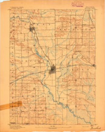
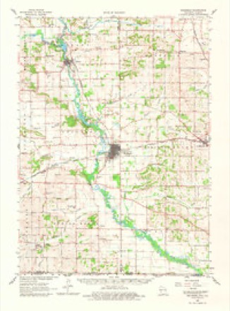
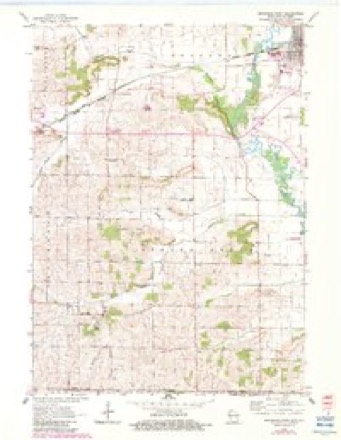
- 1893 USGS Brodhead quadrangle1:62500, 5 printings
- 1954 USGS Rockford quadrangle1:250000
- 1955 USGS Rockford quadrangle1:250000
- 1958 USGS Rockford quadrangle1:250000, 4 printings
- 1962 USGS Brodhead quadrangle1:62500, 2 printings
- 1962 USGS Brodhead West quadrangle1:24000, 3 printings
- 1963 USGS Rockford quadrangle1:250000
- 1981 USGS Monroe quadrangle1:100000





In the county-history sources
28,363 words on this townshipHistory of Green County, Wisconsin, published 1877; History of Green County, Wisconsin, published 1884 names this settlement in its chapter on Spring Grove Town. These are the passages that mention it, exactly as the scans read.
The higfh rank of the countv as an agricultural county, is due in part to the influence of the Green County Agricultural Society. This society was organized July 4, 1853, with the following officers: E. T. Gardner, President; J. V. Richardson, Secretary; John A. Bingham, Corresponding Secretary; A. Ludlow, Treasurer; and six vice-presidents. A fair was held in November of that year, at the court house, at which time one hundred dollars were paid for premiums. The next fair was held in October, 1854, in a new fair ground, just north of the village of Monroe. The money to fence the fair ground and erect the necessary buildings, was raised by selling life memberships at ten dollars each. At this fair the premiums amounted to twro hundred dollars. The fair ground was paid for in 1S55 by selling life memberships. It included seven and one-half acres, and cost fifty dollars per acre. On the seventh of July, 1857, the society was reorganized under a state law for the encouragement of agriculture, which was passed in 1856. The fair ground now used is a little east of the village, and, with the buildings, is worth from eight to ten thousand dollars.
Passage source: History of Green County, Wisconsin, published 1877.
E. and Thomas J. He bought a farm in the town of Jefferson in 1859 called the "Cliryst" place. He also owned a farm on section 8 of the same town. He removed from the "Chryst farm," to .Juda, in November, 1878, living in that town until March, 1883, when he moved to his present home. He was married again, Dec. 23, 1870, to Mrs Jane Clemmer, formerly Jane Roderick. Mrs. Blackford has one daughter by her former marriage - Lucinda L., wife of B. B, Bowell. Mrs Blackford is a member of the Baptist Church, Mr, Blackford is a democrat, politically, and has been town clerk of Jefferson, also chairman of the town board two years; assessor, one year, and is at present, justice of the peace.
Passage source: History of Green County, Wisconsin, published 1884.
James W. Roderick has been a resident of Green county since 1846, when he came here witli his parents, who located at that time on section 3, in the town of Jefferson. He was born in Fayette Co., Penn., April 5, 1843. He, at present, owns a farm of 200 acres, a part of which is the homestead formerly owned by his father. He has good improvements and is desirably located. He was married Dec. 22, 1870, to Hannah LaBoard, a daughter of Peter La-
Passage source: History of Green County, Wisconsin, published 1884.
Machine-read from a century-old scan, so expect the errors a machine makes: misspelled names, dropped words, stray characters.
Read the whole chapter on Spring Grove Town - it names this place 1 more 1 time.
Fires near this place
8 since 2018Regional context, not property-specific evidence. The federal wildfire occurrence database lists 8 fires within 5 miles of Oakley between 2018 and 2020, burning about 8 acres in total. None started naturally. None was recorded as arson. Distance is straight-line from the map coordinates, so a fire counted here may appear on a neighbouring settlement's page as well.
| Reported cause | Fires |
|---|---|
| Debris and open burning | 4 |
| Smoking | 2 |
| Missing data/not specified/undetermined | 1 |
| Equipment and vehicle use | 1 |
The most recent of them, most recent first, with the day each was reported and the service that recorded it.
| Date | Cause | Size | Reported by | Name on the report |
|---|---|---|---|---|
| 11 July 2018 | Equipment and vehicle use | 2.0 acres | Wisconsin Department of Natural Resources | 18067 |
| 11 May 2020 | Missing data/not specified/undetermined | 1.0 acres | Wisconsin Department of Natural Resources | 20029 |
| 30 April 2018 | Debris and open burning | under an acre | Wisconsin Department of Natural Resources | 18046 |
| 3 April 2019 | Smoking | under an acre | Wisconsin Department of Natural Resources | 19030 |
| 21 April 2019 | Debris and open burning | under an acre | Wisconsin Department of Natural Resources | 19038 |
| 26 March 2019 | Smoking | under an acre | Wisconsin Department of Natural Resources | 41 |
| 26 March 2019 | Debris and open burning | 5.0 acres | Wisconsin Department of Natural Resources | 19026 |
| 20 November 2020 | Debris and open burning | under an acre | Wisconsin Department of Natural Resources | 20088 |
Settlements close enough to share some of these fires:
Mines and quarries near this place
4 within 5 milesRegional context, not property-specific evidence. The federal mineral resources record lists 4 workings within 5 miles of Oakley: 3 past producers, 1 producer. 1 still produces. What was taken out: Stone, Crushed/Broken. Distance is straight-line from the map coordinates, so a quarry counted here may appear on a neighbouring settlement's page as well.
| Where | Site | Commodity | Status | Recorded |
|---|---|---|---|---|
| Rees Quarry | Stone, Crushed/Broken | Producer | ||
| Schmidt Quarry | Stone, Crushed/Broken | Past Producer | ||
| State Right of Way Quarry | Stone, Crushed/Broken | Past Producer | ||
| Unnamed Limestone Quarry | Stone, Crushed/Broken | Past Producer |
Storms near this place
2 since 2003Regional context, not property-specific evidence. The National Weather Service names Oakley in 2 storm reports between 2003 and 2023: 2 tornado. No death or injury is recorded in these reports. Each account below is quoted exactly as the forecast office filed it, from the NOAA Storm Events Database, and each date opens the federal record of that event.
| When | Event | Place named | Harm | What the report says |
|---|---|---|---|---|
| March 2023 | Tornado (EF1) | Oakley | $600,000 | Tornado started south of Juda and tracked to the east of the city before going to the west of Decatur Lake. Most of the damage was along County Road F where a number of farm outbuildings were damaged, particularly to roofs. Some areas had power lines that were snapped due to the wind. |
| May 2003 | Tornado (F1) | Oakley | - | A supercell spawned a rain-wrapped tornado that tracked southeast through a rural portion of Green County about 6 miles southwest and south of Brodhead. One home sustained minor damage to its siding and shutters, and minor damage was noted to a storage shed; otherwise, only tree damage was reported. It is estimated that winds speeds with this tornado were about 70 knots (80 mph). This tornado continued east-southeast out of Green County at a location 6.0 miles east of Oakley (where County Trunk T doglegs west in Green County) and into the southwest corner of Rock County. |
Nearest settlements
The eight closest, with where each one stands in the county. Distances are straight-line, computed from the Geographic Names Information System coordinates.
| Map | Place | Distance | Sheets |
|---|---|---|---|
| Twin Grove | 4.0 miles | 15 | |
| Juda | 4.8 miles | 15 | |
| Clarence (historical) | 5.7 miles | 18 | |
| Cardinal Crest | 7.5 miles | 18 | |
| Brodhead | 8.0 miles | 18 | |
| Decatur | 8.0 miles | 17 | |
| Schneyville | 9.1 miles | 14 | |
| Clarno | 9.6 miles | 14 |
Elsewhere
Matched on this settlement's Geographic Names Information System number rather than its name, so it cannot be a different place of the same name in another state.
| Wikipedia article on Oakley | An encyclopaedic summary. Its text is share-alike, so it is linked here rather than copied. |
| Wikidata item Q7074132 | The structured record the population and elevation above come from. Public domain (CC0). |
Provenance
This settlement is recorded in the Geographic Names Information System as feature 1570710. The sheet list is computed by point-in-boundary test against the United States Geological Survey's historical topographic inventory. Both are works of the United States government and carry no copyright under 17 U.S.C. 105.
Wildfire. Short, Karen C. 2022. Spatial wildfire occurrence data for the United States, 1992-2020 [FPA_FOD_20221014]. 6th Edition. Fort Collins, CO: Forest Service Research Data Archive. https://doi.org/10.2737/RDS-2013-0009.6 Collected with United States Government funding and usable without additional permissions or fees.
Mines and quarries. USGS Mineral Resources Data System (MRDS) https://mrdata.usgs.gov/mrds/ A work of the United States government, no copyright under 17 U.S.C. 105.
Storms. NOAA National Centers for Environmental Information, Storm Events Database https://www.ncei.noaa.gov/stormevents/ A work of the United States government, no copyright under 17 U.S.C. 105. Narratives are quoted verbatim from the National Weather Service report and are not edited or summarised.