 Block
Ephraim, Wisconsin
8 topographic sheets cover this place, the earliest surveyed in 1954 and the latest in 1982. It stands in Ephraim Village. It lies in ZIP code area 54211. It stands on Hidden Springs Creek. The Survey maps it on the Ephraim quadrangle. 345 people lived here at the 2020 count. It stands 663 feet above sea level.
On record in Ephraim
Buildings and businesses the archive holds for this place. Each opens its own page, with the source record it came from.
On the National Register 7 records
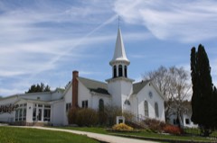 Ephraim Moravian Churchlisted 1985
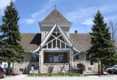 Ephraim Village Halllisted 1985
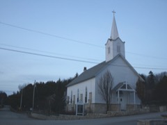 Free Evangelical Lutheran Church-Bethania Scandinavian Evangelical Lutheran Congregationlisted 1985
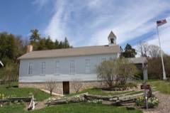 Gibraltar District School No. 2listed 1985
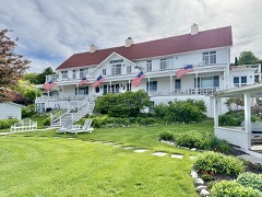 Hillside Hotellisted 1985
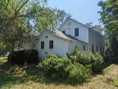 Peter Peterson Houselisted 1985
- Anderson Dock Historic Districtlisted 1985
Population over time
2 figuresEphraim grew from 288 to 345 between 2010 and 2020. These are the recorded population figures Wikidata holds for this place, reached through the Geographic Names Information System number this page is keyed on rather than by name, so they belong to this place and not to another of the same name. Most are census counts, but not all are: an early figure may be a founding or settlement estimate, and an estimate published within five years of a census is left out. The change column is computed, and is left blank where more than 20 years separate a figure from the one before it, because a gap that long is not a change between two counts.
| Year | People | Change |
|---|---|---|
| 2010 | 288 | |
| 2020 | 345 | +57 (+20%) |
Topographic sheets covering this place
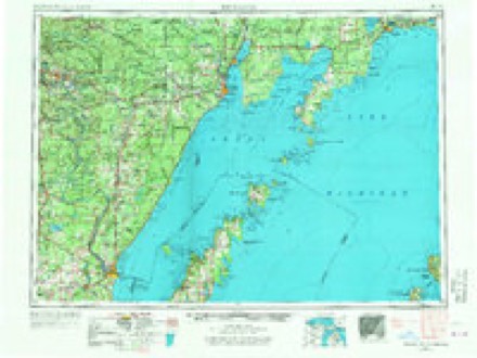
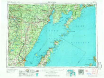
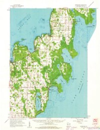
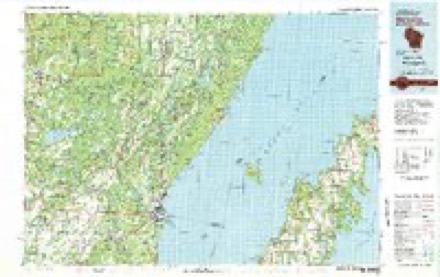
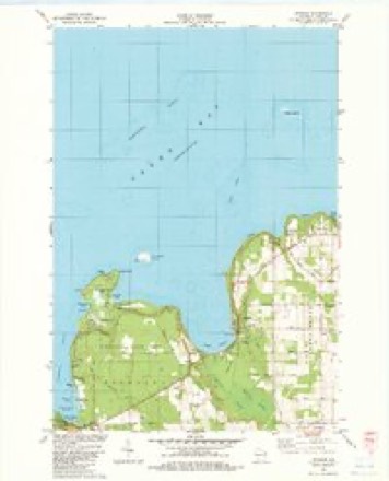
6 surveys from 8 printed sheetsMatched by testing this settlement's coordinate against the published boundary of every sheet in the United States Geological Survey's historical collection. Each opens the scanned sheet at the Survey.
- 1954 USGS Escanaba quadrangle1:250000, 2 printings
- 1957 USGS Escanaba quadrangle1:250000
- 1958 USGS Escanaba quadrangle1:250000
- 1960 USGS Sister Bay quadrangle1:62500, 2 printings
- 1981 USGS Marinette quadrangle1:100000
- 1982 USGS Ephraim quadrangle1:24000
In the county-history sources
8,722 words on this townshipHistory Of Door County Wisconsin The County Beautiful, published 1917 names this settlement in its chapter on Ephraim Village. These are the passages that mention it, exactly as the scans read.
The history of the Ephraim community starts down in Milwaukee in the yea 1849. At that time there was a man by the name of M. Olson from Farsund, Norway, who lived there. There was at that time no Scandinavian congregation in Milwaukee, but this Olson was a splendid singer and used to gather his countrymen together in their homes for common worship. As Mr. Olson was in sympathy with the faith and practices of the Unitas Fratrum - the United Brethren, or Moravians, as they are commonly called, he wrote to the Moravian organization in Norway to see if a minister of that faith could be found who would come to Milwaukee and take charge of the work which he had started.
Passage source: History Of Door County Wisconsin The County Beautiful, published 1917.
The organization of this first Moravian congregation in the West was solemnly effected Monday, October 22, 1849. As this is the organization of the Moravian congregation now at Ephraim a list of the original members is given below, most of whom later moved to Ephraim:
Passage source: History Of Door County Wisconsin The County Beautiful, published 1917.
On his return from his ordination Mr. Iverson in New York met a man who was to most powerfully influence the little congregation in Milwaukee and later shape the history of Ephraim. This man was Nils Otto Tank, a capitalist and retired missionary of the Moravian Church, a man of powerful physique, dignified and benign of countenance.
Passage source: History Of Door County Wisconsin The County Beautiful, published 1917.
Machine-read from a century-old scan, so expect the errors a machine makes: misspelled names, dropped words, stray characters.
Read the whole chapter on Ephraim Village - it names this place 18 more 18 times.
Fires near this place
11 since 1998Regional context, not property-specific evidence. The federal wildfire occurrence database lists 11 fires within 5 miles of Ephraim between 1998 and 2020, burning about 97 acres in total. None started naturally. 1 was recorded as arson. Distance is straight-line from the map coordinates, so a fire counted here may appear on a neighbouring settlement's page as well.
| Reported cause | Fires |
|---|---|
| Debris and open burning | 5 |
| Missing data/not specified/undetermined | 5 |
| Arson/incendiarism | 1 |
The most recent of them, most recent first, with the day each was reported and the service that recorded it.
| Date | Cause | Size | Reported by | Name on the report |
|---|---|---|---|---|
| 7 July 2018 | Missing data/not specified/undetermined | 1.0 acres | Wisconsin Department of Natural Resources | 324 |
| 4 July 2020 | Missing data/not specified/undetermined | 1.0 acres | Wisconsin Department of Natural Resources | 81 |
| 23 June 1998 | Debris and open burning | 88 acres | Wisconsin Department of Natural Resources | not named |
| 7 May 2019 | Debris and open burning | 1.0 acres | Wisconsin Department of Natural Resources | 61 |
| 6 May 2018 | Debris and open burning | 1.0 acres | Wisconsin Department of Natural Resources | 170 |
| 13 May 2020 | Missing data/not specified/undetermined | 1.0 acres | Wisconsin Department of Natural Resources | 42 |
| 22 April 2019 | Debris and open burning | 1.0 acres | Wisconsin Department of Natural Resources | 51 |
| 15 April 2019 | Debris and open burning | 2.0 acres | Wisconsin Department of Natural Resources | 132 |
Settlements close enough to share some of these fires:
Mines and quarries near this place
3 within 5 milesRegional context, not property-specific evidence. The federal mineral resources record lists 3 workings within 5 miles of Ephraim: 3 producers. All of them still produce. What was taken out: Stone, Crushed/Broken, Sand and Gravel, Construction. Distance is straight-line from the map coordinates, so a quarry counted here may appear on a neighbouring settlement's page as well.
| Where | Site | Commodity | Status | Recorded |
|---|---|---|---|---|
| Door County Quarries | Stone, Crushed/Broken | Producer | ||
| Jarman Quarry | Stone, Crushed/Broken, Sand and Gravel, Construction | Producer | ||
| Josephs Pit | Sand and Gravel, Construction | Producer |
Storms near this place
8 since 1997Regional context, not property-specific evidence. The National Weather Service names Ephraim in 8 storm reports between 1997 and 2025: 2 hail, 2 thunderstorm wind, 1 lightning, 1 funnel cloud. No death or injury is recorded in these reports. Each account below is quoted exactly as the forecast office filed it, from the NOAA Storm Events Database, and each date opens the federal record of that event.
| When | Event | Place named | Harm | What the report says |
|---|---|---|---|---|
| August 2025 | Thunderstorm Wind | Ephraim | $431,000 | Thunderstorm winds downed and uprooted multiple trees in Ephraim. The time of this report is an estimate based on radar data. The thunderstorms produced $431,938 worth of damage and debris clean up across central and northern parts of Door County. |
| September 2014 | Flash Flood | Ephraim | $75,000 | Heavy rainfall flooded basements, resorts, and campgrounds, and damaged roads in the Sister Bay, Fish Creek, and Baileys Harbor areas. In excess of 6 inches of rain in Baileys Harbor caused nearly every home there to sustain a backup from the sewage disposal plant. Flood waters damaged documents at the Ephraim Historical Society. The flooding also washed out shoulders of several roads in the area. |
| August 2025 | Tornado (EF0) | Ephraim | - | A tornado briefly touched down near Ephraim in Peninsula State Park at 3:54 PM CDT. The most significant damage was an uprooted tree with the NWS on the low end of the damage scale due to saturated ground. The tornado crossed into Eagle Harbor as a waterspout at 3:55 pm CDT. Total path length is estimated to be 0.25 miles long, with a width of 32 yards. Peak wind estimated to be around 73 mph. |
| August 2025 | Thunderstorm Wind | Ephraim | - | Thunderstorm winds downed trees and power lines on highway 42 from Fish Creek to Ephraim, making the road impassable. The time of this report is an estimate based on radar. |
| October 1997 | Lightning | Ephraim | - | A second storm produced a lightning strike later in the evening, striking a 40-foot pine tree. The bolt worked its way to a nearby cottage, causing a fire which damaged the kitchen and roof. Damage amount unknown. |
| July 2009 | Funnel Cloud | Ephraim | - | no account filed |
| July 2006 | Hail | Ephraim | - | no account filed |
| July 1999 | Hail | Ephraim | - | no account filed |
Nearest settlements
The eight closest, with where each one stands in the county. Distances are straight-line, computed from the Geographic Names Information System coordinates.
| Map | Place | Distance | Sheets |
|---|---|---|---|
| Sister Bay | 3.3 miles | 8 | |
| North Bay | 4.6 miles | 8 | |
| Fish Creek | 4.6 miles | 8 | |
| Baileys Harbor | 6.7 miles | 8 | |
| Rowleys Bay | 8.3 miles | 8 | |
| Ellison Bay | 8.5 miles | 8 | |
| Egg Harbor | 10.2 miles | 8 | |
| Gills Rock | 12.0 miles | 8 |
Elsewhere
Matched on this settlement's Geographic Names Information System number rather than its name, so it cannot be a different place of the same name in another state.
| Wikipedia article on Ephraim | An encyclopaedic summary. Its text is share-alike, so it is linked here rather than copied. |
| Wikidata item Q3166222 | The structured record the population and elevation above come from. Public domain (CC0). |
Provenance
This settlement is recorded in the Geographic Names Information System as feature 1564680. The sheet list is computed by point-in-boundary test against the United States Geological Survey's historical topographic inventory. Both are works of the United States government and carry no copyright under 17 U.S.C. 105.
Wildfire. Short, Karen C. 2022. Spatial wildfire occurrence data for the United States, 1992-2020 [FPA_FOD_20221014]. 6th Edition. Fort Collins, CO: Forest Service Research Data Archive. https://doi.org/10.2737/RDS-2013-0009.6 Collected with United States Government funding and usable without additional permissions or fees.
Mines and quarries. USGS Mineral Resources Data System (MRDS) https://mrdata.usgs.gov/mrds/ A work of the United States government, no copyright under 17 U.S.C. 105.
Storms. NOAA National Centers for Environmental Information, Storm Events Database https://www.ncei.noaa.gov/stormevents/ A work of the United States government, no copyright under 17 U.S.C. 105. Narratives are quoted verbatim from the National Weather Service report and are not edited or summarised.