 Block
Fond du Lac, Wisconsin
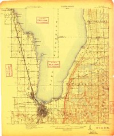
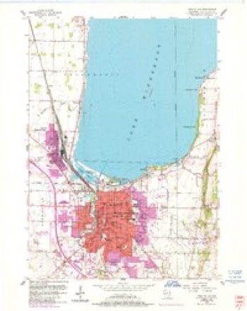
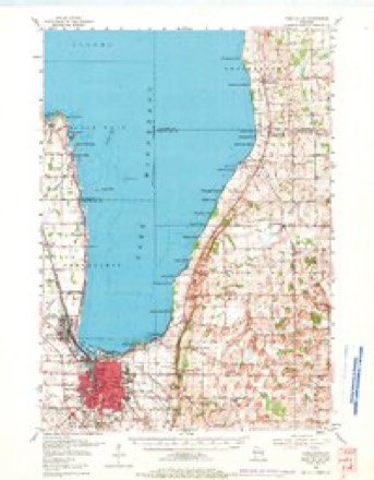
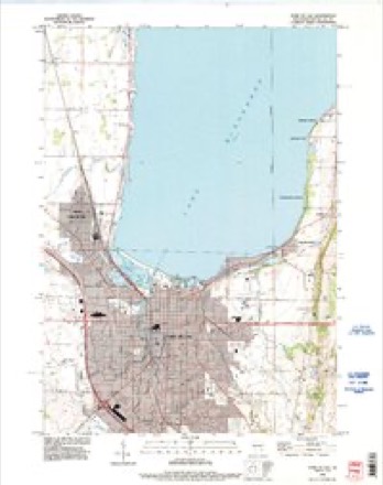
13 topographic sheets cover this place, the earliest surveyed in 1910 and the latest in 1992. It stands in Fond du Lac City. It lies in ZIP code area 54935. It stands on East Branch Fond Du Lac River. The Survey maps it on the Fond du Lac quadrangle. 44,678 people lived here at the 2020 count. It stands 761 feet above sea level.
Research this city
On record in Fond du Lac
Buildings and businesses the archive holds for this place. Each opens its own page, with the source record it came from.
On the National Register 12 of 24 shown
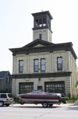 Aetna Station No. 5listed 1976
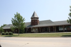 Chicago and Northwestern Railroad Depotlisted 1990
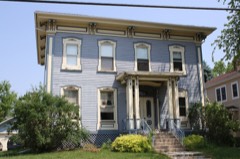 Cole, William I, Houselisted 2002
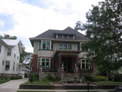 George and Mary Agnes Dana Houselisted 2002
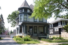 East Division Street-Sheboygan Street Historic Districtlisted 2010
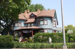 Rudolph and Louise Ebert Houselisted 2002
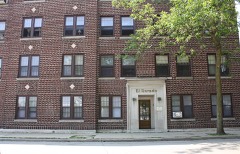 El Dorado Apartmentslisted 1992
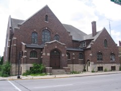 First Baptist Church of Fond du Laclisted 1986
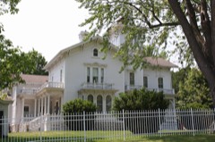 Edwin H. Galloway Houselisted 1976
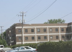 Hotel Calumetlisted 1992
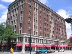 Hotel Retlawlisted 1984
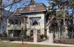 Kendall-Blankenburg Houselisted 2002
Population over time
2 figuresFond du Lac grew from 43,021 to 44,678 between 2010 and 2020. These are the recorded population figures Wikidata holds for this place, reached through the Geographic Names Information System number this page is keyed on rather than by name, so they belong to this place and not to another of the same name. Most are census counts, but not all are: an early figure may be a founding or settlement estimate, and an estimate published within five years of a census is left out. The change column is computed, and is left blank where more than 20 years separate a figure from the one before it, because a gap that long is not a change between two counts.
| Year | People | Change |
|---|---|---|
| 2010 | 43,021 | |
| 2020 | 44,678 | +1,657 (+4%) |
Topographic sheets covering this place
7 surveys from 13 printed sheetsMatched by testing this settlement's coordinate against the published boundary of every sheet in the United States Geological Survey's historical collection. Each opens the scanned sheet at the Survey.
- 1910 USGS Fond du Lac quadrangle1:62500, 2 printings
- 1955 USGS Fond Du Lac quadrangle1:24000, 2 printings
- 1955 USGS Fond Du Lac quadrangle1:62500, 2 printings
- 1957 USGS Madison quadrangle1:250000, 3 printings
- 1960 USGS Madison quadrangle1:250000, 2 printings
- 1980 USGS Fond Du Lac quadrangle1:100000
- 1992 USGS Fond Du Lac quadrangle1:24000



In the county-history sources
29,042 words on this townshipThe History of Fond Du Lac County, Wisconsin, published 1880 names this settlement in its chapter on Fond Du Lac City. These are the passages that mention it, exactly as the scans read.
FRED W. DE QITINE was bom in Calumet Village,\his county, Oct. 30, 1853; in September, 1854, his father, Louis De Quine, died, and he came with his mother to Fond du Lao in 1855; she resides at No. 27 Doty street ; Mr. D. attended school until April 4, 1870, when he served three years' apprentice.ship as a machinist, and has worked ever since at that trade in Fond du Lac; he is foreman of the TTnion Iron Works ; is a Turner, and a member of the I, 0. 0. F. Lodge.
Passage source: The History of Fond Du Lac County, Wisconsin, published 1880.
JOHN W. DIIiLiON, photographer; was born in London, England, Oct. 27. 1847, and came to America when 12 years of age, living in New York City until July 27, 18G4, when he enlisted in Battery B, 5th U. S. A., for three years, as a musician or bugler ; at the expiration of his term of service in 1807, he went to Chicago, thence to Bloomington and Lincoln, finally, coming to Fond du Lac the same year, and engaging in his present business, that of a photographer. He was married in Fond du Lac Feb. 25, 1873, to Ella M., a native of Ma'nitowoc Co., daughter of Evander Soper, one of the earliest settlers of Wisconsin ; they have two children - -Frank Earle and Harry Walton. Mr. D. belongs to the Masonic, Odd Fellows and Knights of Pythias Lodges of Fond du Lac, and has been Alderman from the Eighth Ward since the spring of 187i*.
Passage source: The History of Fond Du Lac County, Wisconsin, published 1880.
HENRY W. DURAND was bom at North East, Erie Co., Penn., Feb. 2, 1843; came to Racine, Wis., in 1855, to town of Fond du Lao the same year, and to Fond du Lac City in 1859 ; he attended school until the rebellion, and then enlisted in Co. I, 1st W. V. I, in April, 1861 ; after serving three months, he re-enlisted, in Co. A, 14th W. V. I., in which he served till the close of the war, being mustered out as First Lieutenant ; he was in all the battles in which his regiment engaged, except the Red River expedition, being at home recruiting, in which he secured fifty-two men ; the principal engagements in which he served were Shiloh, Pittsburg Landing, Corinth, Vicksburg, Spanish Fort, Mobile, Tupelo and Nashville ; after leaving the army, he engaged for four years in the fruit and confectionery business, since which he has dealt in hay and grain. He was married, March 20, 1866, at Fond du Lac, to Mary M. Heth, who was born at Silver Creek, Chautauqua Co., N. 1'^., July 12, 1844 ; they have one child - Ella M.,born March 10, 1867.
Passage source: The History of Fond Du Lac County, Wisconsin, published 1880.
Machine-read from a century-old scan, so expect the errors a machine makes: misspelled names, dropped words, stray characters.
Read the whole chapter on Fond Du Lac City - it names this place 135 more 135 times.
Fires near this place
17 since 1993Regional context, not property-specific evidence. The federal wildfire occurrence database lists 17 fires within 5 miles of Fond du Lac between 1993 and 2020, burning about 515 acres in total. None started naturally. 1 was recorded as arson. Distance is straight-line from the map coordinates, so a fire counted here may appear on a neighbouring settlement's page as well.
| Reported cause | Fires |
|---|---|
| Missing data/not specified/undetermined | 9 |
| Debris and open burning | 3 |
| Arson/incendiarism | 1 |
| Smoking | 1 |
| Power generation/transmission/distribution | 1 |
| Misuse of fire by a minor | 1 |
| Equipment and vehicle use | 1 |
The most recent of them, most recent first, with the day each was reported and the service that recorded it.
| Date | Cause | Size | Reported by | Name on the report |
|---|---|---|---|---|
| 20 September 2018 | Debris and open burning | under an acre | Wisconsin Department of Natural Resources | 63 |
| 6 July 2018 | Power generation/transmission/distribution | 1.0 acres | Wisconsin Department of Natural Resources | 184343 |
| 30 June 2020 | Missing data/not specified/undetermined | under an acre | Wisconsin Department of Natural Resources | 74 |
| 4 May 2019 | Arson/incendiarism | under an acre | Wisconsin Department of Natural Resources | 23 |
| 10 May 2018 | Missing data/not specified/undetermined | 1.0 acres | Wisconsin Department of Natural Resources | 183034 |
| 5 April 1993 | Equipment and vehicle use | under an acre | Wisconsin Department of Natural Resources | not named |
| 28 April 2018 | Debris and open burning | under an acre | Wisconsin Department of Natural Resources | 37 |
| 28 April 2003 | Missing data/not specified/undetermined | 508 acres | Wisconsin Department of Natural Resources | MULLET CREEK |
Settlements close enough to share some of these fires:
Mines and quarries near this place
4 within 5 milesRegional context, not property-specific evidence. The federal mineral resources record lists 4 workings within 5 miles of Fond du Lac: 3 unknowns, 1 producer. 1 still produces. What was taken out: Sand and Gravel, Construction, Stone, Crushed/Broken, Stone. Distance is straight-line from the map coordinates, so a quarry counted here may appear on a neighbouring settlement's page as well.
| Where | Site | Commodity | Status | Recorded |
|---|---|---|---|---|
| Own Crews | Stone | Unknown | ||
| Rodeinger Quarry | Stone, Crushed/Broken | Producer | ||
| Fond Du Lac Pit | Sand and Gravel, Construction | Unknown | ||
| Fuhrmann Pit | Sand and Gravel, Construction | Unknown |
Storms near this place
60 of 71 shownRegional context, not property-specific evidence. The National Weather Service names Fond du Lac in 71 storm reports between 1994 and 2025: 24 thunderstorm wind, 20 hail, 13 lightning, 6 flash flood. The reports record 1 injury. Each account below is quoted exactly as the forecast office filed it, from the NOAA Storm Events Database, and each date opens the federal record of that event.
| When | Event | Place named | Harm | What the report says |
|---|---|---|---|---|
| June 1999 | Lightning | Fond Du Lac | 1 hurt | no account filed |
| June 1997 | Flash Flood | Fond Du Lac | $300,000 | no account filed |
| July 1999 | Thunderstorm Wind | Fond Du Lac | $155,000 | no account filed |
| July 1996 | Tornado (F0) | North Fond Du Lac | $100,000 | no account filed |
| September 2000 | Lightning | Fond Du Lac | $75,000 | no account filed |
| June 2007 | Flash Flood | Fond Du Lac | $50,000 | A flash flood occurred across the city of Fond du Lac that resulted in widespread basement flooding, and minor road damage consisting of gravel and shoulder washouts. Water depths on some streets reached 2 to 4 feet. A coop observer in the city measured 3.9 inches of rain while the storms were rolling through the city. |
| August 1996 | Thunderstorm Wind | Fond Du Lac | $50,000 | no account filed |
| July 1999 | Lightning | Fond Du Lac | $40,000 | no account filed |
| May 2004 | Flash Flood | Fond Du Lac | $25,000 | Some water damage to homes and businesses. Gravel washouts and some roads closed due to water depths of 1 foot. |
| June 2001 | Lightning | Fond Du Lac | $25,000 | no account filed |
| June 2020 | Flash Flood | North Fond Du Lac | $20,000 | Some flash flooding of streets in Fond du Lac and rural roads with some road closures. |I-41 lanes closed due to flooding between Military Rd. and Highway 151. A few cars stranded in floodwaters in a low spot in the city of Fond du Lac. |
| July 1997 | Thunderstorm Wind | Fond Du Lac | $20,000 | no account filed |
| July 2013 | Thunderstorm Wind | Fond Du Lac | $18,000 | Thunderstorm wind gusts measured at 58 mph (50 knots) blew a tree down on a garage on the east side of Fond Du Lac, and also brought down a few power lines. |
| August 2000 | Lightning | Fond Du Lac | $15,000 | no account filed |
| June 2019 | Thunderstorm Wind | Fond Du Lac | $12,000 | Numerous branches and trees down in the city of Fond du Lac. 62 mph wind gust measured at the Fond du Lac airport. |
| July 2018 | Lightning | Fond Du Lac | $10,000 | A lightning strike caused a fire in the attic of a home that was quickly extinguished by firefighters. There was severe damage to the home's electrical system. |
| March 2007 | Lightning | Fond Du Lac | $10,000 | Lightning struck a city of Fond du Lac home. There was no fire, but the home's electrical wiring was damaged, and a hole was punched in the roof of a porch. |
| July 2002 | Flash Flood | Fond Du Lac | $10,000 | Flash flooding closed some roads and washed out some gravel shoulders on the south side of the city of Fond du Lac. Rainfall amounts of 3 to 5 inches were noted, based on WSR-88D estimates and spotter reports. Water depths on US Hwy 41 between 151 and 175 reached 4 to 5 feet. |
| June 1996 | Thunderstorm Wind | North Fond Du Lac | $10,000 | no account filed |
| September 2022 | Thunderstorm Wind | Fond Du Lac | $7,000 | Numerous trees and branches down in Fond du Lac. |
| August 2018 | Flash Flood | North Fond Du Lac | $5,000 | Flash flooding of streets in sections of Fond du Lac after 2 to 3 inches of rain. Some roads with a depth of 3 feet of water. Intersections of National Ave. and Division St. and National Ave. and Scott St. were closed due to the flood waters. |
| July 2012 | Thunderstorm Wind | Fond Du Lac | $5,000 | The ASOS at Fond Du Lac County Airport recorded a wind gust of 62 mph (54 knots). |
| October 2006 | Hail | Fond Du Lac | $5,000 | Several vehicles were dented by the large hail. |
| July 1994 | Thunderstorm Wind | Fond du Lac | $5,000 | Isolated severe thunderstorms produced damaging winds affecting trees and power lines and dropped hail up to 1.5 inches in diameter over southwest and east-central Wisconsin. |
| August 2000 | Thunderstorm Wind | Fond Du Lac | $5,000 | no account filed |
| February 1999 | Thunderstorm Wind | Fond Du Lac | $4,000 | no account filed |
| September 1997 | Lightning | Fond Du Lac | $4,000 | no account filed |
| May 2006 | Lightning | Fond Du Lac | $3,000 | Lightning struck a house and started the roof on fire. |
| June 2000 | Flood | Fond Du Lac | $3,000 | no account filed |
| June 1999 | Thunderstorm Wind | Fond Du Lac | $3,000 | no account filed |
| July 1999 | Thunderstorm Wind | Fond Du Lac | $3,000 | no account filed |
| May 1998 | Thunderstorm Wind | Fond Du Lac | $3,000 | no account filed |
| September 1997 | Lightning | Fond Du Lac | $3,000 | no account filed |
| September 1997 | Lightning | Fond Du Lac | $3,000 | no account filed |
| July 1999 | Thunderstorm Wind | Fond Du Lac | $2,000 | no account filed |
| September 1997 | Lightning | Fond Du Lac | $2,000 | no account filed |
| July 2025 | Flood | Fond Du Lac | $1,000 | Street flooding in Fond du Lac. |
| August 2000 | Thunderstorm Wind | North Fond Du Lac | $1,000 | no account filed |
| September 1997 | Lightning | Fond Du Lac | $1,000 | no account filed |
| July 2012 | Thunderstorm Wind | Fond Du Lac | - | A trained spotter reported trees blown down by severe thunderstorm wind gusst estimated at 65 mph (56 knots). |
| July 2012 | Hail | Fond Du Lac | - | The Fond Du Lac Emergency Manager reported large hail, estimated to be 1.50 inches in diameter, fell 2 miles southeast of the city of Fond Du Lac. |
| July 2011 | Thunderstorm Wind | Fond Du Lac | - | Fond Du Lac County sheriff deputies reported large tree limbs and power lines blown down by damaging thunderstorm winds estimated at 50 knots (58 mph). |
| September 2011 | Thunderstorm Wind | Fond Du Lac | - | Severe thunderstorms with strong wind gusts produced damage across central Fond Du Lac County. The damaging winds downed power lines and trees, knocking out power to businesses and homes on the west side of the city of Fond Du Lac. |
| June 2006 | Thunderstorm Wind | Fond Du Lac | - | Trees down near Highway 41 in Fond du Lac. |
| October 2006 | Thunderstorm Wind | Fond Du Lac | - | Powerful thunderstorm winds knocked down large trees. |
| July 2023 | Hail | Fond Du Lac | - | no account filed |
| July 2023 | Hail | Fond Du Lac | - | no account filed |
| September 2021 | Hail | Fond Du Lac | - | no account filed |
| September 2021 | Hail | Fond Du Lac | - | no account filed |
| September 2021 | Hail | Fond Du Lac | - | no account filed |
| September 2021 | Hail | North Fond Du Lac | - | no account filed |
| September 2021 | Hail | Fond Du Lac | - | no account filed |
| August 2017 | Hail | Fond Du Lac | - | no account filed |
| August 2015 | Hail | Fond Du Lac | - | no account filed |
| August 2015 | Hail | Fond Du Lac | - | no account filed |
| June 2011 | Hail | Fond Du Lac | - | no account filed |
| June 2008 | Funnel Cloud | Fond Du Lac | - | no account filed |
| July 2008 | Hail | Fond Du Lac | - | no account filed |
| October 2006 | Hail | Fond Du Lac | - | no account filed |
| May 2005 | Hail | Fond Du Lac | - | no account filed |
Nearest settlements
The eight closest, with where each one stands in the county. Distances are straight-line, computed from the Geographic Names Information System coordinates.
| Map | Place | Distance | Sheets |
|---|---|---|---|
| Luco | 2.4 miles | 13 | |
| North Fond du Lac | 3.3 miles | 13 | |
| Taycheedah | 3.7 miles | 13 | |
| Hopokoekau Beach | 4.6 miles | 13 | |
| Peebles | 4.8 miles | 13 | |
| Hamilton (historical) | 5.2 miles | 9 | |
| Marblehead | 5.8 miles | 9 | |
| Minawa Beach | 6.1 miles | 13 |
Elsewhere
Matched on this settlement's Geographic Names Information System number rather than its name, so it cannot be a different place of the same name in another state.
| Wikipedia article on Fond du Lac | An encyclopaedic summary. Its text is share-alike, so it is linked here rather than copied. |
| Wikidata item Q985584 | The structured record the population and elevation above come from. Public domain (CC0). |
Provenance
This settlement is recorded in the Geographic Names Information System as feature 1565098. The sheet list is computed by point-in-boundary test against the United States Geological Survey's historical topographic inventory. Both are works of the United States government and carry no copyright under 17 U.S.C. 105.
Wildfire. Short, Karen C. 2022. Spatial wildfire occurrence data for the United States, 1992-2020 [FPA_FOD_20221014]. 6th Edition. Fort Collins, CO: Forest Service Research Data Archive. https://doi.org/10.2737/RDS-2013-0009.6 Collected with United States Government funding and usable without additional permissions or fees.
Mines and quarries. USGS Mineral Resources Data System (MRDS) https://mrdata.usgs.gov/mrds/ A work of the United States government, no copyright under 17 U.S.C. 105.
Storms. NOAA National Centers for Environmental Information, Storm Events Database https://www.ncei.noaa.gov/stormevents/ A work of the United States government, no copyright under 17 U.S.C. 105. Narratives are quoted verbatim from the National Weather Service report and are not edited or summarised.