 Block
Lake Geneva, Wisconsin
19 topographic sheets cover this place, the earliest surveyed in 1893 and the latest in 1980. It stands in Lake Geneva City. It lies in ZIP code area 53147. The Survey maps it on the Lake Geneva quadrangle. 8,277 people lived here at the 2020 count. It stands 879 feet above sea level.
On record in Lake Geneva
Buildings and businesses the archive holds for this place. Each opens its own page, with the source record it came from.
On the National Register 11 records
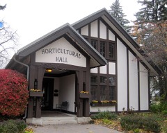 Horticultural Halllisted 1999
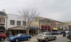 Main Street Historic Districtlisted 2002
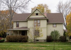 Maple Park Historic Districtlisted 2005
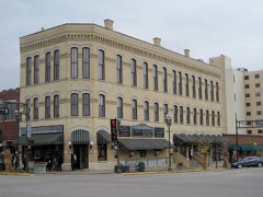 Metropolitan Blocklisted 1990
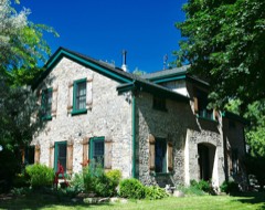 Meyerhofer Cobblestone Houselisted 1980
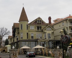 Redwood Cottagelisted 1984
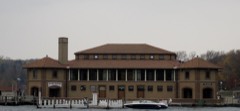 Riviera, Thelisted 1986
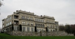 Younglandslisted 1979
- Davidson Halllisted 1987
- Oak Hill Cemeterylisted 2021
- T. C. Smith Houselisted 1982
Population over time
2 figuresLake Geneva grew from 7,651 to 8,277 between 2010 and 2020. These are the recorded population figures Wikidata holds for this place, reached through the Geographic Names Information System number this page is keyed on rather than by name, so they belong to this place and not to another of the same name. Most are census counts, but not all are: an early figure may be a founding or settlement estimate, and an estimate published within five years of a census is left out. The change column is computed, and is left blank where more than 20 years separate a figure from the one before it, because a gap that long is not a change between two counts.
| Year | People | Change |
|---|---|---|
| 2010 | 7,651 | |
| 2020 | 8,277 | +626 (+8%) |
Topographic sheets covering this place
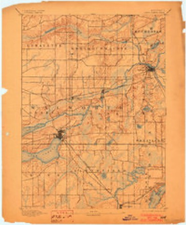
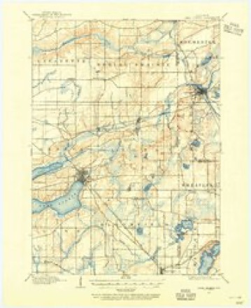
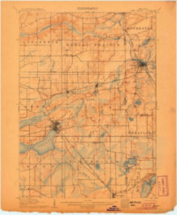
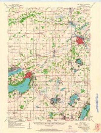
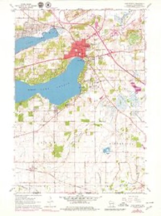
10 surveys from 19 printed sheetsMatched by testing this settlement's coordinate against the published boundary of every sheet in the United States Geological Survey's historical collection. Each opens the scanned sheet at the Survey.
- 1893 USGS Geneva quadrangle1:62500, 2 printings
- 1904 USGS Lake Geneva quadrangle1:62500
- 1906 USGS Lake Geneva quadrangle1:62500, 4 printings
- 1954 USGS Rockford quadrangle1:250000
- 1955 USGS Rockford quadrangle1:250000
- 1958 USGS Rockford quadrangle1:250000, 4 printings
- 1960 USGS Lake Geneva quadrangle1:62500
- 1960 USGS Lake Geneva quadrangle1:24000, 3 printings
- 1963 USGS Rockford quadrangle1:250000
- 1980 USGS Lake Geneva quadrangle1:100000





In the county-history sources
9,371 words on this townshipHistory of Walworth County, Wisconsin .., published 1912 names this settlement in its chapter on Lake Geneva City. These are the passages that mention it, exactly as the scans read.
Three weeks after the battle a new party came 'from Chicago by way of Marengo. While the late contention was in progress Mosher and Van Slyke had slipped away and. representing themselves as sole claimants at Lake Geneva, had tried to induce Lewis B. Goodsell, George L. Campbell and Andrew Ferguson to buy their rights, which they offered at a low rating. Goodsell had known Van Slyke at Cooperstown, and did not fully trust him; but he risked and lost four hundred dollars. Mosher then went out into the vastness of Illinois, and Walworth knew him no more. Payne heard of this sale and, as he was unable to renew war. he went to Chicago and thus Goodsell learned some useful truth. Hodgson, too, was sent for, and came from Waukesha. He first offered to sell to Noyes and Coe a half-interest in the mill section, if Ostrander and Henry would sell their shares; but these men saw some larger advantage in holding them. Hodgson then offered to give his quarter-interest if his past expenses were paid. But Noyes had now some larger plans. The Goodsell party had found R. Wells Warren at St. Charles and had taken him into their partnership, and to these men Hodgson sold his own and Brink's rights - without the latter's knowledge or approval. Payment of two thousand dollars left the Goodsell-Warren party in possession and the settlement of Lake Geneva went peaceably forward unto this day.
Passage source: History of Walworth County, Wisconsin .., published 1912.
Mr. Simmons, in his "Annals," mentioned other manufacturing enterprises - among them the Crawford reaper works in 1875. Most of these began with reasonable hope of success and some of them flourished for a few years, bringing to the village increase of population and general trade, and some of that good remains. But the conditions which now for long have brought the smaller factories throughout the country quite generally to naught have been felt here. If water power is of yet further use to man as, no doubt, it is. that at Lake Geneva will not forever flow uselessly, or but for minor uses, on its tortuous way to the gulf.
Passage source: History of Walworth County, Wisconsin .., published 1912.
As early as 1842 Rev. Thomas Morrissey came from Milwaukee periodically to minister to Catholic families about Lake Geneva. Vicar-general Kundig organized the parish of St. Francis de Sales in 1847, and its members have since built two or three churches. The last is a well-built and well-furnished building, near the east end of Main street, a well-chosen site. It was built within the period of Father Reilly's pastorate, at a cost of eighteen thousand dollars. Its fine organ was the gift of Patrick J. Healy, of Chicago. A suitable rectory, a convenient hall for social and other entertainments and a cemetery are included in the now valuable church property.
Passage source: History of Walworth County, Wisconsin .., published 1912.
Machine-read from a century-old scan, so expect the errors a machine makes: misspelled names, dropped words, stray characters.
Read the whole chapter on Lake Geneva City - it names this place 9 more 9 times.
Fires near this place
19 since 2012Regional context, not property-specific evidence. The federal wildfire occurrence database lists 19 fires within 5 miles of Lake Geneva between 2012 and 2020, burning about 64 acres in total. None started naturally. 2 were recorded as arson. Distance is straight-line from the map coordinates, so a fire counted here may appear on a neighbouring settlement's page as well.
| Reported cause | Fires |
|---|---|
| Debris and open burning | 11 |
| Missing data/not specified/undetermined | 5 |
| Arson/incendiarism | 2 |
| Power generation/transmission/distribution | 1 |
The most recent of them, most recent first, with the day each was reported and the service that recorded it.
| Date | Cause | Size | Reported by | Name on the report |
|---|---|---|---|---|
| 15 July 2019 | Debris and open burning | 1.0 acres | Wisconsin Department of Natural Resources | 297 |
| 3 June 2018 | Missing data/not specified/undetermined | 1.0 acres | Wisconsin Department of Natural Resources | 222 |
| 8 May 2018 | Missing data/not specified/undetermined | under an acre | Wisconsin Department of Natural Resources | 1800429 |
| 30 April 2018 | Missing data/not specified/undetermined | under an acre | Wisconsin Department of Natural Resources | 1800394 |
| 30 April 2018 | Debris and open burning | under an acre | Wisconsin Department of Natural Resources | 128 |
| 30 April 2018 | Debris and open burning | 5.0 acres | Wisconsin Department of Natural Resources | 175 |
| 25 April 2018 | Debris and open burning | 5.0 acres | Wisconsin Department of Natural Resources | 115 |
| 23 April 2019 | Debris and open burning | under an acre | Wisconsin Department of Natural Resources | 125 |
Settlements close enough to share some of these fires:
Mines and quarries near this place
4 within 5 milesRegional context, not property-specific evidence. The federal mineral resources record lists 4 workings within 5 miles of Lake Geneva: 3 producers, 1 past producer. 3 still produce. What was taken out: Sand and Gravel, Construction. Distance is straight-line from the map coordinates, so a quarry counted here may appear on a neighbouring settlement's page as well.
| Where | Site | Commodity | Status | Recorded |
|---|---|---|---|---|
| Casey Pit | Sand and Gravel, Construction | Past Producer | ||
| Devil's Hill Pit | Sand and Gravel, Construction | Producer | ||
| Home Pit | Sand and Gravel, Construction | Producer | ||
| Ryan Pit | Sand and Gravel, Construction | Producer |
Storms near this place
39 since 1995Regional context, not property-specific evidence. The National Weather Service names Lake Geneva in 39 storm reports between 1995 and 2023: 21 thunderstorm wind, 10 hail, 3 lightning, 2 tornado. The reports record 6 injuries. Each account below is quoted exactly as the forecast office filed it, from the NOAA Storm Events Database, and each date opens the federal record of that event.
| When | Event | Place named | Harm | What the report says |
|---|---|---|---|---|
| June 2000 | Flash Flood | Lake Geneva | 4 hurt, $350,000 | no account filed |
| July 1998 | Thunderstorm Wind | Lake Geneva | 2 hurt, $1,500,000 | no account filed |
| August 2015 | Tornado (EF1) | Lake Geneva | $100,000 | An EF1 tornado caused a sporadic path of damage. The most severe damage was significant roof damage to 4 buildings that were warehouse buildings and metal building systems. One of those buildings sustained a collapsed wall. There was minor damage to a mobile home and a barn. A couple large retail signs were destroyed. There were many trees uprooted and snapped. |
| May 2004 | Thunderstorm Wind | Lake Geneva | $50,000 | no account filed |
| September 1997 | Lightning | Lake Geneva | $50,000 | no account filed |
| June 2010 | Thunderstorm Wind | Lake Geneva | $25,000 | Public reported trees and power lines down. A house was damaged resulting in approximatley $2,000 worth of damage. |
| October 1996 | Thunderstorm Wind | Lake Geneva | $20,000 | no account filed |
| August 2009 | Thunderstorm Wind | Lake Geneva | $15,000 | Numerous public reports were made of trees blown down and power lines down in the city of Lake Geneva. |
| May 2008 | Lightning | Lake Geneva | $10,000 | A lightning strike caused a house fire to the roof area. |
| August 2006 | Lightning | Lake Geneva | $10,000 | A home's roof antenna was struck by lightning, resulting in a minor roof fire. |
| July 2011 | Thunderstorm Wind | Lake Geneva | $8,000 | Law enforcement officials reported trees down in a 6-mile wide swath from west of Lake Geneva to east of Lake Geneva due to damaging thunderstorm wind gusts estimated at 56 knots (64 mph). A car was damaged when a tree fell on it. |
| April 2023 | Tornado (EF0) | Lake Geneva | $6,000 | EF0 tornado uprooted numerous trees and caused minor shingle and soffit damage to a home in the Cobble Creek neighborhood. A fire pit was lofted from one property to an adjacent one. |
| July 2006 | Thunderstorm Wind | Lake Geneva | $5,000 | Trees and power lines down. |
| June 1997 | Thunderstorm Wind | Lake Geneva | $4,000 | no account filed |
| June 1997 | Heavy Rain | Lake Geneva | $3,500 | A downpour of 1.41 inches of rain washed a gravel driveway out, allowing a parked van to slide down a slope into the White River. |
| May 1998 | Thunderstorm Wind | Lake Geneva | $3,000 | no account filed |
| June 1998 | Thunderstorm Wind | Lake Geneva | $3,000 | no account filed |
| June 1999 | Thunderstorm Wind | Lake Geneva | $1,000 | no account filed |
| June 1999 | Thunderstorm Wind | Lake Geneva | $1,000 | no account filed |
| May 1998 | Thunderstorm Wind | Lake Geneva | $1,000 | no account filed |
| July 1997 | Thunderstorm Wind | Lake Geneva | $1,000 | no account filed |
| July 2012 | Thunderstorm Wind | Lake Geneva | - | Law enforcement officials reported scattered trees and a power pole were blown down by severe thunderstorm wind gusts estimated at 56 knots (65 mph) in a swath from 3 miles southwest of Lake Geneva to Lake Geneva. |
| June 2011 | Thunderstorm Wind | Lake Geneva | - | Powerful thunderstorm winds pushed over several large trees. |
| June 2008 | Hail | Lake Geneva | - | Hail fell at Lake Como. |
| March 2006 | Hail | Lake Geneva | - | Two vehicle accidents occurred during hail storm due to hail accumulations creating slippery road surfaces. |
| June 2006 | Thunderstorm Wind | Lake Geneva | - | Trees down. |
| April 2023 | Hail | Lake Geneva | - | no account filed |
| September 2021 | Hail | Lake Geneva | - | no account filed |
| May 2017 | Hail | Lake Geneva | - | no account filed |
| July 2017 | Hail | Lake Geneva | - | no account filed |
| April 2015 | Hail | Lake Geneva | - | no account filed |
| June 2010 | Thunderstorm Wind | Lake Geneva | - | no account filed |
| May 2006 | Hail | Lake Geneva | - | no account filed |
| September 2005 | Hail | Lake Geneva | - | no account filed |
| March 2000 | Hail | Lake Geneva | - | no account filed |
| July 1997 | Funnel Cloud | Lake Geneva | - | no account filed |
| June 1995 | Thunderstorm Wind | Lake Geneva | - | no account filed |
| August 1995 | Thunderstorm Wind | Lake Geneva | - | no account filed |
| August 1995 | Thunderstorm Wind | Lake Geneva | - | no account filed |
Nearest settlements
The eight closest, with where each one stands in the county. Distances are straight-line, computed from the Geographic Names Information System coordinates.
| Map | Place | Distance | Sheets |
|---|---|---|---|
| Shady Side (historical) | 1.9 miles | 19 | |
| Como | 3.0 miles | 19 | |
| Springfield | 3.6 miles | 19 | |
| Lake Como | 3.6 miles | 19 | |
| North Bloomfield | 4.3 miles | 18 | |
| Linton | 5.4 miles | 19 | |
| Lyons | 5.7 miles | 19 | |
| Pell Lake | 5.7 miles | 18 |
Elsewhere
Matched on this settlement's Geographic Names Information System number rather than its name, so it cannot be a different place of the same name in another state.
| Wikipedia article on Lake Geneva | An encyclopaedic summary. Its text is share-alike, so it is linked here rather than copied. |
| Wikidata item Q82230 | The structured record the population and elevation above come from. Public domain (CC0). |
Provenance
This settlement is recorded in the Geographic Names Information System as feature 1581223. The sheet list is computed by point-in-boundary test against the United States Geological Survey's historical topographic inventory. Both are works of the United States government and carry no copyright under 17 U.S.C. 105.
Wildfire. Short, Karen C. 2022. Spatial wildfire occurrence data for the United States, 1992-2020 [FPA_FOD_20221014]. 6th Edition. Fort Collins, CO: Forest Service Research Data Archive. https://doi.org/10.2737/RDS-2013-0009.6 Collected with United States Government funding and usable without additional permissions or fees.
Mines and quarries. USGS Mineral Resources Data System (MRDS) https://mrdata.usgs.gov/mrds/ A work of the United States government, no copyright under 17 U.S.C. 105.
Storms. NOAA National Centers for Environmental Information, Storm Events Database https://www.ncei.noaa.gov/stormevents/ A work of the United States government, no copyright under 17 U.S.C. 105. Narratives are quoted verbatim from the National Weather Service report and are not edited or summarised.