 Block
Lancaster, Wisconsin
15 topographic sheets cover this place, the earliest surveyed in 1900 and the latest in 1984. It stands in Lancaster City. It lies in ZIP code area 53813. The Survey maps it on the Lancaster quadrangle. 3,907 people lived here at the 2020 count. It stands 1,099 feet above sea level.
On record in Lancaster
Buildings and businesses the archive holds for this place. Each opens its own page, with the source record it came from.
On the National Register 6 records
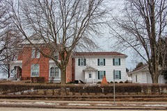 L. J. Arthur Houselisted 1985
 Grant County Courthouselisted 1978
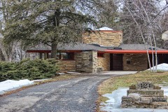 Patrick and Margaret Kinney Houselisted 2008
 Lancaster Municipal Buildinglisted 1983
 Lancaster Post Officelisted 2000
- Courthouse Square Historic Districtlisted 2006
Population over time
3 figuresLancaster grew from 1,069 to 3,907 between 1880 and 2020. These are the recorded population figures Wikidata holds for this place, reached through the Geographic Names Information System number this page is keyed on rather than by name, so they belong to this place and not to another of the same name. Most are census counts, but not all are: an early figure may be a founding or settlement estimate, and an estimate published within five years of a census is left out. The change column is computed, and is left blank where more than 20 years separate a figure from the one before it, because a gap that long is not a change between two counts.
| Year | People | Change |
|---|---|---|
| 1880 | 1,069 | |
| 2010 | 3,868 | |
| 2020 | 3,907 | +39 (+1%) |
Topographic sheets covering this place
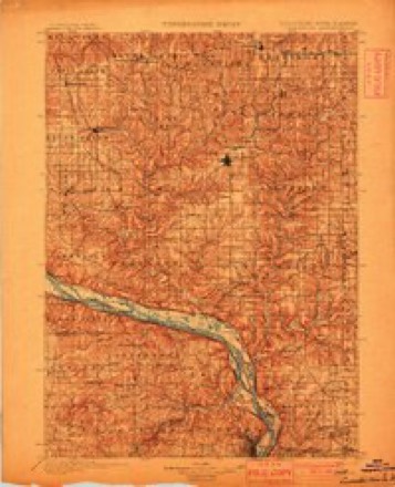
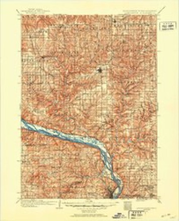
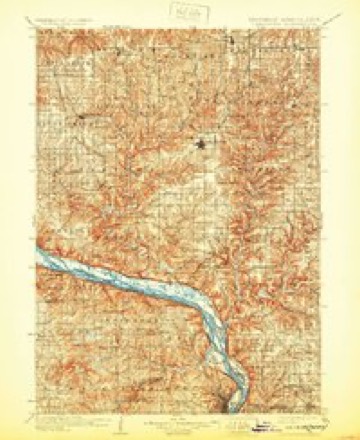
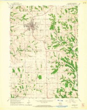
9 surveys from 15 printed sheetsMatched by testing this settlement's coordinate against the published boundary of every sheet in the United States Geological Survey's historical collection. Each opens the scanned sheet at the Survey.
- 1900 USGS Lancaster quadrangle1:125000
- 1904 USGS Lancaster quadrangle1:125000
- 1908 USGS Lancaster quadrangle1:125000, 5 printings
- 1959 USGS Dubuque quadrangle1:250000
- 1961 USGS Dubuque quadrangle1:250000
- 1962 USGS Dubuque quadrangle1:250000, 2 printings
- 1962 USGS Lancaster quadrangle1:24000
- 1976 USGS Dubuque quadrangle1:250000
- 1984 USGS Dubuque North quadrangle1:100000, 2 printings
In the county-history sources
34,102 words on this townshipHistory of Grant County, Wisconsin, published 1881 names this settlement in its chapter on Lancaster City. These are the passages that mention it, exactly as the scans read.
Within the confines of Lancaster are embraced Townships 4 and 5 north, of Range 3 west of the Fourth Principal Meridian. It is bounded on the north by the west half of Fennimore town, which, with Lancaster, forms the only double town in the county; on the east by Liberty and Ellenboro; on the south by Potosi, and on the west by Beetown and Little Grant. It includes within its borders some of the best farming land in the county, the wealth of the town being rather on the surface than beneath, as has been the case in many other towns.
Passage source: History of Grant County, Wisconsin, published 1881.
The site of the present city of Lancaster was originally, before the advent of the white man, a beautifully-rounded knoll, covered with low brush at intervals, through which forest trees, singly or in groves, spread their sheltering branches. At the foot of this knoll bubbled forth a limpid spring, clear as tlie purest crystal, into whose sandy depths, in all probability, many a dusky face had looked, and upon its glittering surface had reflected back the swarthy countenance, hideous with war paint, or stained with the dust and heat of the chase. Past this spring poured a brawling brook, fed by this and lesser neighboring fountains.
Passage source: History of Grant County, Wisconsin, published 1881.
These new-comers were Nahem Dudley, Tom Sogar and Ben Stout, who, in thus locating, became unconsciously the firs^ settlers of Lancaster. There is no evidence to show that Segar and Stout remained longer than to assist their comrade in the erection of his cabin, or perhaps a short time thereafter, and then departed for other sections where "mineral," then the "particular vanity" of early settlers, was to be discovered in better quantity than there were any signs of its being found here. Dudley remained a year or two and sold out to Aaron Boice. He then went to mining in different sections, finally settling near Beetown, where he gave his name to a cave, supposably discovered by him, and thence to the " Dudley Cave Range," a range wellknown to miners. Dudley died in 1815 at Muscalunge. In this same year, namely, 1828, William L. Morrison moved into the township and located on what afterward became the northwest quarter of the northeast quarter of Section 36, where he tesided for many years. Henry C. jJUshnell and family also came to the hollow now known by his name and located near the upper spring on the site occupied by Mr. Weaver. Here he erected a modest cabin of rough, unhewn ^gs, chinked and mud plastered, a portion of which remained until a late date. During the ^lack Hawk troubles, these settlers took refuge in the block-houses at Cassville and Prairie du Uien, but upon the settlement of the diflBculty and defeat of Black Hawk, they returned to oeir deserted homes, and again took up their work of reducing the wilderness to subjection, and placing it under the dominion of man.
Passage source: History of Grant County, Wisconsin, published 1881.
Machine-read from a century-old scan, so expect the errors a machine makes: misspelled names, dropped words, stray characters.
Read the whole chapter on Lancaster City - it names this place 149 more 149 times.
Fires near this place
2 since 2018Regional context, not property-specific evidence. The federal wildfire occurrence database lists 2 fires within 5 miles of Lancaster in 2018, burning about 5 acres in total. None started naturally. None was recorded as arson. Distance is straight-line from the map coordinates, so a fire counted here may appear on a neighbouring settlement's page as well.
| Reported cause | Fires |
|---|---|
| Missing data/not specified/undetermined | 1 |
| Equipment and vehicle use | 1 |
The most recent of them, most recent first, with the day each was reported and the service that recorded it.
| Date | Cause | Size | Reported by | Name on the report |
|---|---|---|---|---|
| 27 April 2018 | Equipment and vehicle use | under an acre | Wisconsin Department of Natural Resources | 16A2018 |
| 26 April 2018 | Missing data/not specified/undetermined | 5.0 acres | Wisconsin Department of Natural Resources | 100050 |
Settlements close enough to share some of these fires:
Mines and quarries near this place
3 within 5 milesRegional context, not property-specific evidence. The federal mineral resources record lists 3 workings within 5 miles of Lancaster: 2 past producers, 1 producer. 1 still produces. What was taken out: Stone, Crushed/Broken. Distance is straight-line from the map coordinates, so a quarry counted here may appear on a neighbouring settlement's page as well.
| Where | Site | Commodity | Status | Recorded |
|---|---|---|---|---|
| Becker and Tuckwood Griswold Quarry | Stone, Crushed/Broken | Producer | ||
| Mcman Quarry | Stone, Crushed/Broken | Past Producer | ||
| Stanton Quarry | Stone, Crushed/Broken | Past Producer |
Storms near this place
51 since 1995Regional context, not property-specific evidence. The National Weather Service names Lancaster in 51 storm reports between 1995 and 2026: 27 thunderstorm wind, 16 hail, 3 flash flood, 2 flood. The reports record 1 injury. Each account below is quoted exactly as the forecast office filed it, from the NOAA Storm Events Database, and each date opens the federal record of that event.
| When | Event | Place named | Harm | What the report says |
|---|---|---|---|---|
| June 1998 | Tornado (F0) | Lancaster | 1 hurt, $200,000 | no account filed |
| July 2009 | Hail | Lancaster | $1,100,000 | Large hail was reported on Borah Ridge Road. |
| June 2015 | Thunderstorm Wind | Lancaster | $400,000 | Numerous trees and power lines were blown down from Lancaster to Platteville along State Highway 133. Farm buildings were also severely damaged and homes sustained roof damage from the strong winds. |
| June 1998 | Thunderstorm Wind | Lancaster | $200,000 | no account filed |
| May 2017 | Thunderstorm Wind | Lancaster | $175,000 | An estimated 70 mph wind gust occurred in Lancaster. Several barns and outbuildings were blown down and destroyed across the southwest half of Grant County as the line storms moved across. Lots of power lines were also down. |
| June 1998 | Thunderstorm Wind | Lancaster | $150,000 | no account filed |
| August 2025 | Flash Flood | Lancaster | $75,000 | Emergency management reported street flooding in addition to flooding in basements of some residences in Lancaster. |
| May 2000 | Hail | Lancaster | $75,000 | no account filed |
| June 2024 | Thunderstorm Wind | Lancaster | $60,000 | Trees were reported down on power lines in Lancaster and Boscobel. |
| June 2002 | Thunderstorm Wind | Lancaster | $45,000 | no account filed |
| May 2000 | Hail | Lancaster | $30,000 | no account filed |
| July 2025 | Flash Flood | Lancaster | $25,000 | Emergency management reported Morningview Road underwater in Lancaster as well as some water flowing into homes. |
| May 2000 | Hail | Lancaster | $25,000 | no account filed |
| August 2010 | Thunderstorm Wind | Lancaster | $20,000 | A large tree was uprooted by strong thunderstorm winds. The tree fell on and damaged an outbuilding, while also causing damage to utility lines that were pulled from the ground. |
| June 1997 | Thunderstorm Wind | Lancaster | $18,000 | no account filed |
| July 2009 | Hail | Lancaster | $15,000 | no account filed |
| May 2000 | Hail | Lancaster | $10,000 | no account filed |
| July 2017 | Thunderstorm Wind | Lancaster | $6,000 | Significant tree and power line damage occurred in Lancaster from an estimated 70 mph wind gust. |
| July 2025 | Thunderstorm Wind | Lancaster | $5,000 | Emergency management reported a tree branch down on a garage in Lancaster. |
| August 2025 | Flash Flood | Lancaster | $5,000 | Emergency management reported numerous streets and intersections were closed due to flash flooding in Lancaster. |
| September 2018 | Thunderstorm Wind | Lancaster | $5,000 | Several trees and some power lines were blown down near and just west of Lancaster. |
| July 2017 | Lightning | Lancaster | $5,000 | A house was struck by lightning in Lancaster. |
| August 2020 | Thunderstorm Wind | Lancaster | $4,000 | An estimated 60 mph wind gust occurred in Lancaster causing power outages. |
| September 2010 | Thunderstorm Wind | Lancaster | $4,000 | Numerous trees were blown down around the city of Lancaster and one of the trees fell onto a house. |
| August 1996 | Thunderstorm Wind | Lancaster | $4,000 | no account filed |
| June 2017 | Thunderstorm Wind | Lancaster | $3,000 | A 64 mph wind gust occurred northeast of Lancaster. |
| July 2012 | Thunderstorm Wind | Lancaster | $3,000 | Several trees were blown down across Lancaster. |
| July 2020 | Thunderstorm Wind | Lancaster | $2,000 | Power lines were blown down northwest of Lancaster. |
| May 2013 | Thunderstorm Wind | Lancaster | $2,000 | Trees were blown down in Lancaster. |
| July 2008 | Thunderstorm Wind | Lancaster | $2,000 | Amateur radio reported power lines down in the town of Lancaster. |
| June 2008 | Hail | Lancaster | $1,500 | no account filed |
| June 2008 | Hail | Lancaster | $1,500 | no account filed |
| September 2001 | Thunderstorm Wind | Lancaster | $1,250 | no account filed |
| July 2018 | Thunderstorm Wind | Lancaster | $1,000 | Tree limbs were blown down in Lancaster. |
| June 2001 | Hail | Lancaster | $1,000 | no account filed |
| July 2008 | Thunderstorm Wind | Lancaster | $500 | Large trees were knocked down. |
| June 1998 | Thunderstorm Wind | Lancaster | $200 | The county Emergency Manager reported large trees down. |
| April 2026 | Hail | Lancaster | - | Emergency management reported nickel sized hail at the Sheriff's office southeast of Lancaster. |
| June 2017 | Thunderstorm Wind | Lancaster | - | A 58 mph wind gust was measured just north of Lancaster. |
| June 2014 | Thunderstorm Wind | Lancaster | - | A wind gust of 78 mph was measured north of Lancaster. |
| June 2014 | Flood | Lancaster | - | Heavy rain caused street flooding to occur in Lancaster. |
| May 2013 | Thunderstorm Wind | Lancaster | - | A wind gust of 70 mph occurred just south of Lancaster. |
| September 2012 | Heavy Rain | Lancaster | - | Just over 3 inches of rain fell in Lancaster during the evening of the 4th into the early morning of the 5th. |
| April 2008 | Flood | Lancaster | - | An embankment failure occurred on Highway 35, just west of Highway 81. A substancial amount of debris was reported on the road, with several vehicles stuck in the debris. |
| June 2008 | Hail | Lancaster | - | no account filed |
| April 2006 | Hail | Lancaster | - | no account filed |
| May 2000 | Hail | Lancaster | - | no account filed |
| May 2000 | Hail | Lancaster | - | no account filed |
| March 1998 | Hail | Lancaster | - | no account filed |
| February 1996 | Hail | Lancaster | - | no account filed |
| July 1995 | Thunderstorm Wind | Lancaster | - | no account filed |
Nearest settlements
The eight closest, with where each one stands in the county. Distances are straight-line, computed from the Geographic Names Information System coordinates.
| Map | Place | Distance | Sheets |
|---|---|---|---|
| Hurricane | 5.4 miles | 16 | |
| Five Points | 5.6 miles | 16 | |
| Ellenboro | 6.8 miles | 16 | |
| Flora Fountain | 6.9 miles | 16 | |
| Stitzer | 7.2 miles | 15 | |
| Rockville | 8.4 miles | 16 | |
| Shady Dell | 8.8 miles | 15 | |
| Mount Ida | 9.0 miles | 15 |
Elsewhere
Matched on this settlement's Geographic Names Information System number rather than its name, so it cannot be a different place of the same name in another state.
| Wikipedia article on Lancaster | An encyclopaedic summary. Its text is share-alike, so it is linked here rather than copied. |
| Wikidata item Q1013953 | The structured record the population and elevation above come from. Public domain (CC0). |
Provenance
This settlement is recorded in the Geographic Names Information System as feature 1567823. The sheet list is computed by point-in-boundary test against the United States Geological Survey's historical topographic inventory. Both are works of the United States government and carry no copyright under 17 U.S.C. 105.
Wildfire. Short, Karen C. 2022. Spatial wildfire occurrence data for the United States, 1992-2020 [FPA_FOD_20221014]. 6th Edition. Fort Collins, CO: Forest Service Research Data Archive. https://doi.org/10.2737/RDS-2013-0009.6 Collected with United States Government funding and usable without additional permissions or fees.
Mines and quarries. USGS Mineral Resources Data System (MRDS) https://mrdata.usgs.gov/mrds/ A work of the United States government, no copyright under 17 U.S.C. 105.
Storms. NOAA National Centers for Environmental Information, Storm Events Database https://www.ncei.noaa.gov/stormevents/ A work of the United States government, no copyright under 17 U.S.C. 105. Narratives are quoted verbatim from the National Weather Service report and are not edited or summarised.