 Block
Leon, Wisconsin
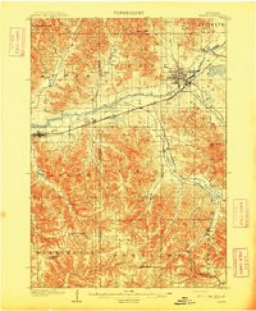
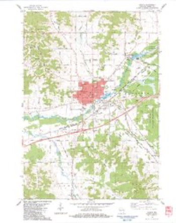
14 topographic sheets cover this place, the earliest surveyed in 1909 and the latest in 1985. It stands in Leon town. It lies in ZIP code area 54656. It lies near Link Coulee. The Survey maps it on the Sparta quadrangle. It stands 781 feet above sea level.
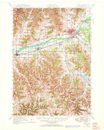
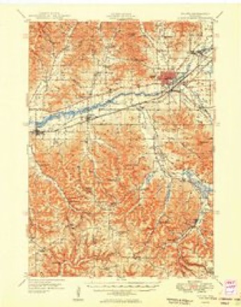
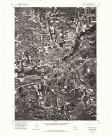
Topographic sheets covering this place
10 surveys from 14 printed sheetsMatched by testing this settlement's coordinate against the published boundary of every sheet in the United States Geological Survey's historical collection. Each opens the scanned sheet at the Survey.
- 1909 USGS Sparta quadrangle1:62500, 3 printings
- 1947 USGS Sparta quadrangle1:62500
- 1949 USGS Sparta quadrangle1:62500
- 1958 USGS La Crosse quadrangle1:250000, 2 printings
- 1961 USGS La Crosse quadrangle1:250000
- 1965 USGS La Crosse quadrangle1:250000
- 1976 USGS La Crosse quadrangle1:250000
- 1976 USGS Sparta NE quadrangle1:24000
- 1983 USGS Sparta quadrangle1:24000
- 1985 USGS Sparta quadrangle1:100000, 2 printings




Fires near this place
16 since 1996Regional context, not property-specific evidence. The federal wildfire occurrence database lists 16 fires within 5 miles of Leon between 1996 and 2020, burning about 14 acres in total. None started naturally. None was recorded as arson. Distance is straight-line from the map coordinates, so a fire counted here may appear on a neighbouring settlement's page as well.
| Reported cause | Fires |
|---|---|
| Equipment and vehicle use | 6 |
| Missing data/not specified/undetermined | 5 |
| Debris and open burning | 4 |
| Power generation/transmission/distribution | 1 |
The most recent of them, most recent first, with the day each was reported and the service that recorded it.
| Date | Cause | Size | Reported by | Name on the report |
|---|---|---|---|---|
| 17 August 2003 | Debris and open burning | under an acre | Wisconsin Department of Natural Resources | not named |
| 2 July 2012 | Equipment and vehicle use | under an acre | Wisconsin Department of Natural Resources | FERRIES FIRE |
| 19 June 2005 | Missing data/not specified/undetermined | under an acre | Wisconsin Department of Natural Resources | not named |
| 8 May 2005 | Missing data/not specified/undetermined | 1.5 acres | Wisconsin Department of Natural Resources | not named |
| 8 April 1996 | Missing data/not specified/undetermined | 4.0 acres | Wisconsin Department of Natural Resources | not named |
| 6 April 1996 | Equipment and vehicle use | 1.4 acres | Wisconsin Department of Natural Resources | not named |
| 6 April 1996 | Equipment and vehicle use | under an acre | Wisconsin Department of Natural Resources | not named |
| 6 April 1996 | Equipment and vehicle use | under an acre | Wisconsin Department of Natural Resources | not named |
Settlements close enough to share some of these fires:
Mines and quarries near this place
1 within 5 milesRegional context, not property-specific evidence. The federal mineral resources record lists 1 working within 5 miles of Leon: 1 producer. All of them still produce. What was taken out: Stone, Crushed/Broken. Distance is straight-line from the map coordinates, so a quarry counted here may appear on a neighbouring settlement's page as well.
| Where | Site | Commodity | Status | Recorded |
|---|---|---|---|---|
| Linton Quarry | Stone, Crushed/Broken | Producer |
Storms near this place
17 since 1996Regional context, not property-specific evidence. The National Weather Service names Leon in 17 storm reports between 1996 and 2024: 7 hail, 3 thunderstorm wind, 3 flash flood, 2 tornado. No death or injury is recorded in these reports. Each account below is quoted exactly as the forecast office filed it, from the NOAA Storm Events Database, and each date opens the federal record of that event.
| When | Event | Place named | Harm | What the report says |
|---|---|---|---|---|
| August 2018 | Flash Flood | Leon | $26,500,000 | Runoff from heavy rain caused flash flooding to occur across the southern sections of Monroe County. Near Melvina, a resident had to be rescued from a home surrounded by flood waters. Flooding was extreme along the Little La Crosse River along and just east of Highway 27 between Cashton and Sparta where numerous homes were flooded, rescues were needed, and roads were damaged. Flooding along Moore Creek in Norwalk damaged some ballfields and the village office. In Kendall, a park along the Baraboo River was destroyed and a newly installed road to the village's wastewater treatment plant was washed out. Most of the flood damaged homes and business were along Glen Street. Across the county, 75 people had to be evacuated. At the Skogdalen cemetery, 90% of the gravestones markers were toppled, debris was up to 5 feet deep in places and ripped apart the road in front of the church. Numerous roads were closed, with most of these in the far southern part of the county in Portland, Jefferson, Sheldon, Wellington and Glendale Townships. Some of the impacted roads included: County Highway N, County Highway Z south of Wilton, County Highway P near Kendall, County Highway F south of Norwalk, County Highway D near Cashton, County Highway CM near Tomah, State Highway 33 east of Cashton, County Highway W north of Kendall, County Highway ET east of Tomah and County Highway F east of Melvina. The heavy rain and flooding caused three earthen flood control dams to fail and damaged three others. |
| May 2011 | Tornado (EF1) | Leon | $915,000 | This tornado passed into Monroe county just east of Rockland (La Crosse County) and continued to the east-northeast before dissipating in the southeast portion of Sparta. Along its path, the tornado destroyed one home east of Rockland, demolished 4 mobile homes and created damage to at least 50 homes in Sparta. At a car dealership on the south side of Sparta, a car was tossed 40 feet and flipped upside down and a billboard sign was knocked over on to a truck. Total damages from this tornado are estimated to be around $900 thousand. An estimated 200 customers lost power in Sparta as a result of this tornado. |
| May 2022 | Tornado (EF0) | Leon | $90,000 | A brief EF0 tornado touched down east of Leon and was only on the ground for about a quarter-mile before dissipating. The tornado tossed and destroyed a camper along with damaging an outbuilding, house, farm machinery and trees. Some of the downed trees were along the Elroy-Sparta state bike trail. |
| July 2024 | Flash Flood | Leon | $20,000 | Emergency management reported rock slides along County 27 between Sparta and Cashton. |
| June 2008 | Flood | Leon | $20,000 | Water was reported over Highway 27 at Jackpot Avenue. |
| August 2021 | Flash Flood | Leon | $5,000 | Runoff from heavy rains caused flash flooding to occur near Melvina. A creek out of its banks sent water over both lanes of County Road J, a mud and rock slide covered a portion of County Road X and the Little La Crosse River went out its banks spreading water and debris across State Highway 27. |
| June 2015 | Thunderstorm Wind | Leon | $5,000 | Around a half dozen large and healthy trees were snapped off by the winds from a thunderstorm. A trailer was also moved by the winds and sustained damage when a tree fell on it. |
| July 2011 | Thunderstorm Wind | Leon | $2,000 | A few 18 inch diameter trees were blown down in Leon. |
| July 2014 | Hail | Leon | $500 | Quarter sized hail fell in a path from Leon to a couple miles southeast of Leon. The hail broke some lights on a garage. |
| April 2015 | Hail | Leon | - | Quarter to half dollar sized hail was reported in Leon. |
| August 2012 | Thunderstorm Wind | Leon | - | A 60 mph wind gust along with one inch hail occurred in Leon. |
| September 2010 | Heavy Rain | Leon | - | The storm total rainfall amounted to 6.18 inches. Elsewhere across the county rainfall totals 3.90 inches at Sparta and 3.77 inches at Kendall. |
| August 2008 | Hail | Leon | - | In addition to the hail, 1.15 inches of rain was received in 35 minutes. |
| August 2020 | Hail | Leon | - | no account filed |
| April 2014 | Hail | Leon | - | no account filed |
| June 2008 | Hail | Leon | - | no account filed |
| May 1996 | Hail | Leon | - | no account filed |
Nearest settlements
The eight closest, with where each one stands in the county. Distances are straight-line, computed from the Geographic Names Information System coordinates.
| Map | Place | Distance | Sheets |
|---|---|---|---|
| Farmers Valley | 4.6 miles | 12 | |
| Sparta | 4.7 miles | 14 | |
| Melvina | 5.8 miles | 13 | |
| Angelo | 7.0 miles | 14 | |
| Portland | 7.6 miles | 13 | |
| Saint Marys | 9.3 miles | 11 | |
| Cashton | 9.7 miles | 14 | |
| Scotts Junction (historical) | 10.4 miles | 12 |
Elsewhere
Matched on this settlement's Geographic Names Information System number rather than its name, so it cannot be a different place of the same name in another state.
| Wikipedia article on Leon | An encyclopaedic summary. Its text is share-alike, so it is linked here rather than copied. |
| Wikidata item Q6524474 | The structured record the population and elevation above come from. Public domain (CC0). |
Provenance
This settlement is recorded in the Geographic Names Information System as feature 1567978. The sheet list is computed by point-in-boundary test against the United States Geological Survey's historical topographic inventory. Both are works of the United States government and carry no copyright under 17 U.S.C. 105.
Wildfire. Short, Karen C. 2022. Spatial wildfire occurrence data for the United States, 1992-2020 [FPA_FOD_20221014]. 6th Edition. Fort Collins, CO: Forest Service Research Data Archive. https://doi.org/10.2737/RDS-2013-0009.6 Collected with United States Government funding and usable without additional permissions or fees.
Mines and quarries. USGS Mineral Resources Data System (MRDS) https://mrdata.usgs.gov/mrds/ A work of the United States government, no copyright under 17 U.S.C. 105.
Storms. NOAA National Centers for Environmental Information, Storm Events Database https://www.ncei.noaa.gov/stormevents/ A work of the United States government, no copyright under 17 U.S.C. 105. Narratives are quoted verbatim from the National Weather Service report and are not edited or summarised.