 Block
Sparta, Wisconsin
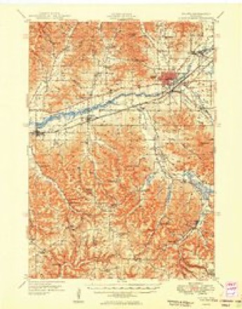
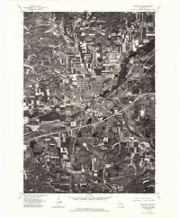
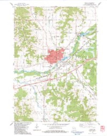
14 topographic sheets cover this place, the earliest surveyed in 1909 and the latest in 1985. It stands in Sparta City. It lies in ZIP code area 54656. It stands on Beaver Creek. The Survey maps it on the Sparta quadrangle. 10,025 people lived here at the 2020 count.
Research this city
On record in Sparta
Buildings and businesses the archive holds for this place. Each opens its own page, with the source record it came from.
On the National Register 7 records
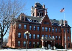 Monroe County Courthouselisted 1982
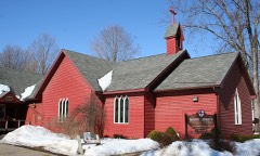 St. John's Episcopal Churchlisted 1983
 William G. and Anne Williams Houselisted 2005
- Sparta Free Librarylisted 1981
- Sparta High Schoollisted 2021
- Sparta Masonic Templelisted 1987
- Water Street Commercial Historic Districtlisted 1992
Population over time
2 figuresSparta grew from 9,522 to 10,025 between 2010 and 2020. These are the recorded population figures Wikidata holds for this place, reached through the Geographic Names Information System number this page is keyed on rather than by name, so they belong to this place and not to another of the same name. Most are census counts, but not all are: an early figure may be a founding or settlement estimate, and an estimate published within five years of a census is left out. The change column is computed, and is left blank where more than 20 years separate a figure from the one before it, because a gap that long is not a change between two counts.
| Year | People | Change |
|---|---|---|
| 2010 | 9,522 | |
| 2020 | 10,025 | +503 (+5%) |
Topographic sheets covering this place
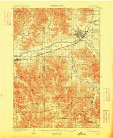
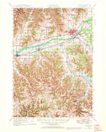
10 surveys from 14 printed sheetsMatched by testing this settlement's coordinate against the published boundary of every sheet in the United States Geological Survey's historical collection. Each opens the scanned sheet at the Survey.
- 1909 USGS Sparta quadrangle1:62500, 3 printings
- 1947 USGS Sparta quadrangle1:62500
- 1949 USGS Sparta quadrangle1:62500
- 1958 USGS La Crosse quadrangle1:250000, 2 printings
- 1961 USGS La Crosse quadrangle1:250000
- 1965 USGS La Crosse quadrangle1:250000
- 1976 USGS La Crosse quadrangle1:250000
- 1976 USGS Sparta NE quadrangle1:24000
- 1983 USGS Sparta quadrangle1:24000
- 1985 USGS Sparta quadrangle1:100000, 2 printings




What happened here
An account from the chapter on Sparta city. The inset identifies its exact source book and publication year.
The City Of Sparta 267
Janesville, Wisconsin, where it was mustered into service. The regiment left the state and went via Chicago to St. Louis, IMarch 26, 1862. "While on the Northwestern railroad, near Chicago, it met with a very serious accident, which resulted in the loss of twelve men. Company A alone having seven men killed and several were severely injured.
In the county-history sources
18,875 words on this townshipHistory of Monroe County, Wisconsin, Past and Present : Including an Account of the Cities, Towns and Villages of the County [microform], published 1912 names this settlement in its chapter on Sparta City. These are the passages that mention it, exactly as the scans read.
Here the travelers took a rest for two days and began their return homeward. At the point where the two crossed the river they determined to ascertain what description the land bore and they marked the southwest quarter of section twentyfour in township seventeen, range four west, Avhicli is now included in the site of the city of Sparta.
Passage source: History of Monroe County, Wisconsin, Past and Present : Including an Account of the Cities, Towns and Villages of the County [microform], published 1912.
Having discovered a chance for a Avater power at this point, ^Ir. Searle at once went to Baraboo and applied for a warrant for the land. On his return he took teams loaded with lumber and a few men to help him and came to a road over a big ridge on his land, but on his way hither he discovered that the real mill site was above that point, and leaving his lumber he immediately set out for Baraboo, and applied for another warrant, but one of his men had betrayed his intention to Dr. Angle at Baraboo who promised the man a half interest for the description of the land having on it the mill site. These two immediately set out for Mineral Point in order to go through the usual form necessary to make an entry and to entitle them to full possession of the land. Searle took the stage and Angle Avent on horseback
Passage source: History of Monroe County, Wisconsin, Past and Present : Including an Account of the Cities, Towns and Villages of the County [microform], published 1912.
Mild tlnis lijid tile advantage of speed and beat Scarlc by one hour, tlius beeoiuing the owner of the hind. So had the question been settled otherwise, "Angelo" wouhl probably have been called "Searlo" or something of the kind. Mr. Kearle having lost tile luiddle site and not knowing that a city was to spring up on that forty acres took no farther interest in this claim and sold it for ^30.00. He also states that upon looking for iiis lumber he found that Petit had followed the rule that necessity knows of no hiw. and had used it in building a house for himself near Castle Kock. William Petit houglit a claim of 160 acres of land near the crossing of these two state roads, and Avhere the site of the city now is; he built a log cabin on the bank of Beaver creek at the point about where the library is located ; when his cabin Avas completed on the 5th day of July, 1851, it was the first building of any kind erected in Sparta.
Passage source: History of Monroe County, Wisconsin, Past and Present : Including an Account of the Cities, Towns and Villages of the County [microform], published 1912.
Machine-read from a century-old scan, so expect the errors a machine makes: misspelled names, dropped words, stray characters.
Read the whole chapter on Sparta City - it names this place 98 more 98 times.
Fires near this place
89 since 1992Regional context, not property-specific evidence. The federal wildfire occurrence database lists 89 fires within 5 miles of Sparta between 1992 and 2020, burning about 191 acres in total. None started naturally. None was recorded as arson. Distance is straight-line from the map coordinates, so a fire counted here may appear on a neighbouring settlement's page as well.
| Reported cause | Fires |
|---|---|
| Equipment and vehicle use | 24 |
| Debris and open burning | 21 |
| Railroad operations and maintenance | 20 |
| Missing data/not specified/undetermined | 15 |
| Power generation/transmission/distribution | 3 |
| Misuse of fire by a minor | 2 |
| Other causes | 2 |
| Smoking | 1 |
| Fireworks | 1 |
The most recent of them, most recent first, with the day each was reported and the service that recorded it.
| Date | Cause | Size | Reported by | Name on the report |
|---|---|---|---|---|
| 29 September 1997 | Power generation/transmission/distribution | under an acre | Wisconsin Department of Natural Resources | not named |
| 12 September 2013 | Smoking | under an acre | Wisconsin Department of Natural Resources | ZIGGY FIRE |
| 17 August 2003 | Debris and open burning | under an acre | Wisconsin Department of Natural Resources | not named |
| 23 July 2001 | Missing data/not specified/undetermined | under an acre | Wisconsin Department of Natural Resources | not named |
| 2 July 2012 | Equipment and vehicle use | under an acre | Wisconsin Department of Natural Resources | FERRIES FIRE |
| 12 July 2013 | Equipment and vehicle use | under an acre | Wisconsin Department of Natural Resources | HAZELWOOD FIRE |
| 10 July 2020 | Equipment and vehicle use | under an acre | Wisconsin Department of Natural Resources | MEDIAN 1 |
| 10 July 2020 | Equipment and vehicle use | under an acre | Wisconsin Department of Natural Resources | MEDIAN 2 |
Settlements close enough to share some of these fires:
Mines and quarries near this place
1 within 5 milesRegional context, not property-specific evidence. The federal mineral resources record lists 1 working within 5 miles of Sparta: 1 producer. All of them still produce. What was taken out: Stone, Crushed/Broken. Distance is straight-line from the map coordinates, so a quarry counted here may appear on a neighbouring settlement's page as well.
| Where | Site | Commodity | Status | Recorded |
|---|---|---|---|---|
| Linton Quarry | Stone, Crushed/Broken | Producer |
Storms near this place
60 of 74 shownRegional context, not property-specific evidence. The National Weather Service names Sparta in 74 storm reports between 1996 and 2026: 37 thunderstorm wind, 25 hail, 6 flood, 4 lightning. No death or injury is recorded in these reports. Each account below is quoted exactly as the forecast office filed it, from the NOAA Storm Events Database, and each date opens the federal record of that event.
| When | Event | Place named | Harm | What the report says |
|---|---|---|---|---|
| May 2024 | Thunderstorm Wind | Sparta | $200,000 | Emergency management reported several trees and power lines down in the city of Sparta. |
| June 2008 | Flood | Sparta | $200,000 | Ponding of water was reported just south of Sparta, about one mile south of Interstate 90. Across the county about 10 percent of the corn crop was damaged or destroyed. |
| June 2007 | Hail | Sparta | $50,000 | no account filed |
| June 1998 | Thunderstorm Wind | Sparta | $35,000 | no account filed |
| June 2020 | Lightning | Sparta | $30,000 | Lightning struck a garage just southwest of Sparta. The resulting fire destroyed the garage. The fire spread to a nearby house along a downed tree with the house suffering moderate fire and smoke damage. |
| August 2018 | Thunderstorm Wind | Sparta | $25,000 | Numerous trees were blown down in Sparta and several of these landed on houses. Part of a roof was blown off and several power lines were also blown down. |
| August 2014 | Thunderstorm Wind | Sparta | $25,000 | Trees and a large business sign were blown down in Sparta. A business sustained roof damage when the winds blew the shingles off the building. Around 1,600 customers lost power from downed power lines. |
| June 1998 | Thunderstorm Wind | Sparta | $25,000 | no account filed |
| April 2026 | Thunderstorm Wind | Sparta | $15,000 | A trained spotter reported a few outbuildings blown down which included a barn that had already sustained damage prior to storms moving through. |
| March 2007 | Lightning | Sparta | $15,000 | Lightning struck for the second time in Sparta, this time hitting the Land Conservation Building. Extensive damage occurred to the phone system, computers, printers and copiers. |
| June 1999 | Thunderstorm Wind | Sparta | $15,000 | no account filed |
| August 1996 | Thunderstorm Wind | Sparta | $15,000 | no account filed |
| June 1998 | Thunderstorm Wind | Sparta | $14,000 | no account filed |
| May 1998 | Thunderstorm Wind | Sparta | $12,000 | no account filed |
| May 1998 | Thunderstorm Wind | Sparta | $12,000 | no account filed |
| June 2020 | Thunderstorm Wind | Sparta | $10,000 | Numerous trees and power lines were blown down across mainly the northwest part of Monroe County. |
| June 2016 | Thunderstorm Wind | Sparta | $10,000 | Numerous trees were blown down on the south side of Sparta. The winds also blew soffit and siding off of some houses. |
| July 2011 | Thunderstorm Wind | Sparta | $10,000 | Power lines and tree limbs were blown down and the high winds created some roof damage to a few buildings in Sparta. Also, a tree was blown down on top of garage causing damage to the roof. |
| September 2000 | Hail | Sparta | $7,500 | no account filed |
| June 2019 | Thunderstorm Wind | Sparta | $5,000 | Trees were blown down in and just north of Sparta, which caused some power outages. |
| March 2007 | Lightning | Sparta | $5,000 | Lightning struck the roof of the Museum Complex Building in Sparta, which damaged some electrical equipment inside. |
| December 2021 | Thunderstorm Wind | Sparta | $3,000 | Door overhangs were damaged by winds in Sparta. |
| May 2017 | Thunderstorm Wind | Sparta | $2,000 | Several large trees were blown down in Sparta. |
| July 2015 | Thunderstorm Wind | Sparta | $2,000 | A tree was blown down onto a powerline in Sparta. |
| April 2015 | Lightning | Sparta | $2,000 | Lightning hit the Monroe County law enforcement building damaging some of the communication equipment inside the building. |
| September 2015 | Thunderstorm Wind | Sparta | $2,000 | Wind gusts to around 45 mph knocked down several small trees on the north side of Sparta. |
| June 2001 | Thunderstorm Wind | Sparta | $1,500 | no account filed |
| June 2001 | Thunderstorm Wind | Sparta | $1,500 | no account filed |
| September 2007 | Thunderstorm Wind | Sparta | $1,000 | no account filed |
| June 2001 | Thunderstorm Wind | Sparta | $800 | no account filed |
| May 1996 | Thunderstorm Wind | Sparta | $800 | no account filed |
| September 2005 | Thunderstorm Wind | Sparta | $750 | no account filed |
| August 2003 | Thunderstorm Wind | Sparta | $750 | no account filed |
| August 2005 | Thunderstorm Wind | Sparta | $600 | no account filed |
| July 2005 | Thunderstorm Wind | Sparta | $500 | no account filed |
| June 2003 | Thunderstorm Wind | Sparta | $500 | no account filed |
| July 2003 | Thunderstorm Wind | Sparta | $500 | no account filed |
| July 2003 | Thunderstorm Wind | Sparta | $500 | no account filed |
| July 2003 | Thunderstorm Wind | Sparta | $500 | no account filed |
| June 2001 | Thunderstorm Wind | Sparta | $400 | no account filed |
| August 2010 | Thunderstorm Wind | Sparta | $200 | Damage was reported to a rural street sign along Garden Avenue on the county line between Monroe and La Crosse Counties. |
| May 2025 | Hail | Sparta | - | The public reported quarter sized hail 1 mile north-northeast of Sparta. |
| June 2025 | Flood | Sparta | - | Repeated rounds of heavy rain during the month of June contributed to the La Crosse River at Sparta to rise into flood stage during the evening hours on June 26th, cresting in minor flood stage at a height of 8.99 ft the morning of June 27th. The river then fell below flood stage later that morning on June 27th. |
| May 2024 | Thunderstorm Wind | Sparta | - | The public reported large tree branches down in Sparta. |
| August 2021 | Hail | Sparta | - | Quarter sized hail fell just south of Sparta. |
| May 2020 | Heavy Rain | Sparta | - | A total of 3.80 rain was reported from just south of Sparta. |
| March 2019 | Flood | Sparta | - | Runoff from rain and melting snow pushed the La Crosse River out of its banks in Sparta. The river crested around a half foot above the flood stage at 9.09 feet on March 14th. |
| August 2018 | Flood | Sparta | - | Runoff from heavy caused flooding to occur along the La Crosse River in Sparta. The river crested just over two feet above the flood stage at 10.71 feet. |
| July 2017 | Flood | Sparta | - | Runoff from heavy rains pushed the La Crosse River out of its banks in Sparta. The river crested almost four feet above the flood state at 12.26 feet. This was a crest of record for this site. |
| September 2016 | Flood | Sparta | - | Flood waters along the La Crosse River and Beaver Creek caused two city parks to be closed in Sparta along with some city streets. |
| June 2015 | Heavy Rain | Sparta | - | The automated weather observing equipment at the Sparta airport measured 2.8 inches of rain. |
| July 2015 | Hail | Sparta | - | Quarter sized hail fell just southwest of Sparta. |
| July 2014 | Hail | Sparta | - | Nickel to quarter sized hail fell in Sparta. |
| August 2012 | Hail | Sparta | - | Dime to quarter sized hail fell and was accompanied by wind gusts of 45 to 50 mph just south of Sparta along Interstate 90 at Exit 25 for State Highway 27. |
| May 2009 | Hail | Sparta | - | A storm spotter reported pea to dime size hail. |
| July 2008 | Thunderstorm Wind | Sparta | - | An estimated wind gust of 60 mph was reported from the intersection of Interstate 90 and Highway 27. |
| June 2022 | Hail | Sparta | - | no account filed |
| June 2018 | Hail | Sparta | - | no account filed |
| May 2017 | Hail | Sparta | - | no account filed |
| July 2015 | Hail | Sparta | - | no account filed |
Nearest settlements
The eight closest, with where each one stands in the county. Distances are straight-line, computed from the Geographic Names Information System coordinates.
| Map | Place | Distance | Sheets |
|---|---|---|---|
| Angelo | 2.6 miles | 14 | |
| Farmers Valley | 4.6 miles | 12 | |
| Leon | 4.7 miles | 14 | |
| Scotts Junction (historical) | 7.7 miles | 12 | |
| Melvina | 9.8 miles | 13 | |
| Cataract | 10.0 miles | 11 | |
| Four Corners | 10.5 miles | 11 | |
| Spring Bank Park | 11.0 miles | 14 |
Elsewhere
Matched on this settlement's Geographic Names Information System number rather than its name, so it cannot be a different place of the same name in another state.
| Wikipedia article on Sparta | An encyclopaedic summary. Its text is share-alike, so it is linked here rather than copied. |
| Wikidata item Q1569582 | The structured record the population and elevation above come from. Public domain (CC0). |
Provenance
This settlement is recorded in the Geographic Names Information System as feature 1574514. The sheet list is computed by point-in-boundary test against the United States Geological Survey's historical topographic inventory. Both are works of the United States government and carry no copyright under 17 U.S.C. 105.
Wildfire. Short, Karen C. 2022. Spatial wildfire occurrence data for the United States, 1992-2020 [FPA_FOD_20221014]. 6th Edition. Fort Collins, CO: Forest Service Research Data Archive. https://doi.org/10.2737/RDS-2013-0009.6 Collected with United States Government funding and usable without additional permissions or fees.
Mines and quarries. USGS Mineral Resources Data System (MRDS) https://mrdata.usgs.gov/mrds/ A work of the United States government, no copyright under 17 U.S.C. 105.
Storms. NOAA National Centers for Environmental Information, Storm Events Database https://www.ncei.noaa.gov/stormevents/ A work of the United States government, no copyright under 17 U.S.C. 105. Narratives are quoted verbatim from the National Weather Service report and are not edited or summarised.