 Block
Viroqua, Wisconsin
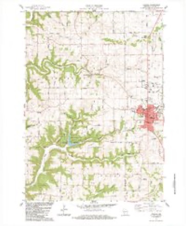
14 topographic sheets cover this place, the earliest surveyed in 1923 and the latest in 1985. It stands in Viroqua City. It lies in ZIP code area 54665. The Survey maps it on the Viroqua quadrangle. 4,504 people lived here at the 2020 count.
Research this city
On record in Viroqua
Buildings and businesses the archive holds for this place. Each opens its own page, with the source record it came from.
On the National Register 5 records
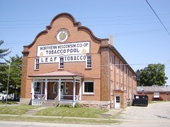 Bekkedal Leaf Tobacco Warehouselisted 2003
- Bert and Mary Cunningham Round Barnlisted 2014
- Vernon County Courthouselisted 1980
- Vernon County Normal Schoollisted 2011
- Viroqua Downtown Historic Districtlisted 2003
Population over time
2 figuresViroqua grew from 4,362 to 4,504 between 2010 and 2020. These are the recorded population figures Wikidata holds for this place, reached through the Geographic Names Information System number this page is keyed on rather than by name, so they belong to this place and not to another of the same name. Most are census counts, but not all are: an early figure may be a founding or settlement estimate, and an estimate published within five years of a census is left out. The change column is computed, and is left blank where more than 20 years separate a figure from the one before it, because a gap that long is not a change between two counts.
| Year | People | Change |
|---|---|---|
| 2010 | 4,362 | |
| 2020 | 4,504 | +142 (+3%) |
Topographic sheets covering this place
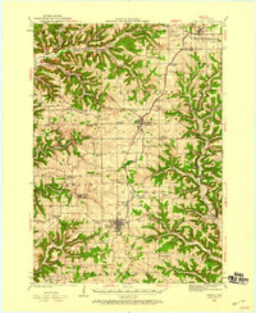
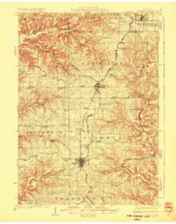
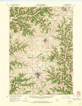
9 surveys from 14 printed sheetsMatched by testing this settlement's coordinate against the published boundary of every sheet in the United States Geological Survey's historical collection. Each opens the scanned sheet at the Survey.
- 1923 USGS Viroqua quadrangle1:62500
- 1926 USGS Viroqua quadrangle1:62500, 2 printings
- 1958 USGS La Crosse quadrangle1:250000, 2 printings
- 1961 USGS La Crosse quadrangle1:250000
- 1965 USGS La Crosse quadrangle1:250000
- 1965 USGS Viroqua quadrangle1:62500, 2 printings
- 1976 USGS La Crosse quadrangle1:250000
- 1983 USGS Viroqua quadrangle1:24000, 2 printings
- 1985 USGS Sparta quadrangle1:100000, 2 printings




In the county-history sources
15,470 words on this townshipHistory of Vernon County, Wisconsin .., published 1884 names this settlement in its chapter on Viroqua City. These are the passages that mention it, exactly as the scans read.
The town of Viroqua embraces all of congressional township 13, range 4 west, the two northern tiers of sections, and sections 13,14, 23 and 24 of township 12, range 4 west. It is bounded on the north by the town of Christiana; on the east by Webster and Liberty ; on the south by Kickapoo and Franklin ; and on the west by Franklin and Jefferson. The surface of this town is generally broken and hilly yet it contains some of the finest agricultural lands in the county. The eastern and northeastern parts of the town are made up of rolling prairie, interspersed, here and there, with small gi'oves. The balance of the town was originally covered with heavy timber; but much, if not the greater part of this, has been cleared away by the thrifty and enterprising settlers, and there are now valuable farms in all parts of the town.
Passage source: History of Vernon County, Wisconsin .., published 1884.
Clemmetson, C. A. Morterud, Anders Jenson Peder Halvorson, Edward Theige, Nils T. Nilson, Lars Hovde and Ole G. Hanson, trustees. The Metliodist Episcopal society was organized in 1854, by the Reverend Bishop, with twenty-two members. Philip Adams was class leader. The memhersliip was afterwards increased to sixty. A log church was erected in 1860, on section 22, which is still in use. The Church is not at present in a very flourishing condition, as many of the members have gone elsewhere, while others attend Church at Viroqua. The following are among the pastors who have filled the pulpit for the society at different times: Revs. Bishop, Purdun, Cooley, Fitch and Hartshorn.
Passage source: History of Vernon County, Wisconsin .., published 1884.
The name of the town of Viroqua was formerly Farwell. As a general chapter is devoted to the creation and changes of name and boundaries of towns, it is unnecessary to here refer to the various changes through which the town of Viroqua has passed in assuming its present limits.
Passage source: History of Vernon County, Wisconsin .., published 1884.
Machine-read from a century-old scan, so expect the errors a machine makes: misspelled names, dropped words, stray characters.
Read the whole chapter on Viroqua City - it names this place 76 more 76 times.
Fires near this place
11 since 2018Regional context, not property-specific evidence. The federal wildfire occurrence database lists 11 fires within 5 miles of Viroqua between 2018 and 2020, burning about 4 acres in total. None started naturally. None was recorded as arson. Distance is straight-line from the map coordinates, so a fire counted here may appear on a neighbouring settlement's page as well.
| Reported cause | Fires |
|---|---|
| Missing data/not specified/undetermined | 10 |
| Debris and open burning | 1 |
The most recent of them, most recent first, with the day each was reported and the service that recorded it.
| Date | Cause | Size | Reported by | Name on the report |
|---|---|---|---|---|
| 24 September 2018 | Missing data/not specified/undetermined | under an acre | Wisconsin Department of Natural Resources | 18180 |
| 5 July 2019 | Missing data/not specified/undetermined | 1.0 acres | Wisconsin Department of Natural Resources | 19144 |
| 13 May 2020 | Missing data/not specified/undetermined | under an acre | Wisconsin Department of Natural Resources | 20079 |
| 12 May 2020 | Missing data/not specified/undetermined | under an acre | Wisconsin Department of Natural Resources | 20073 |
| 26 April 2018 | Debris and open burning | under an acre | Wisconsin Department of Natural Resources | 18053 |
| 30 March 2019 | Missing data/not specified/undetermined | under an acre | Wisconsin Department of Natural Resources | 19063 |
| 17 March 2020 | Missing data/not specified/undetermined | 2.0 acres | Wisconsin Department of Natural Resources | 20041 |
| 17 March 2020 | Missing data/not specified/undetermined | under an acre | Wisconsin Department of Natural Resources | 20042 |
Settlements close enough to share some of these fires:
Mines and quarries near this place
7 within 5 milesRegional context, not property-specific evidence. The federal mineral resources record lists 7 workings within 5 miles of Viroqua: 3 producers, 3 past producers, 1 unknown. 3 still produce. What was taken out: Stone, Crushed/Broken, Stone. Distance is straight-line from the map coordinates, so a quarry counted here may appear on a neighbouring settlement's page as well.
| Where | Site | Commodity | Status | Recorded |
|---|---|---|---|---|
| Own Crews | Stone | Unknown | ||
| Brooksville Quarry | Stone, Crushed/Broken | Past Producer | ||
| Cook Quarry | Stone, Crushed/Broken | Producer | ||
| Ellefson Brothers Quarry | Stone, Crushed/Broken | Producer | ||
| Liberty Quarry | Stone, Crushed/Broken | Producer | ||
| Newton Quarry | Stone, Crushed/Broken | Past Producer | ||
| Rumdee Quarry | Stone, Crushed/Broken | Past Producer |
Storms near this place
52 since 1995Regional context, not property-specific evidence. The National Weather Service names Viroqua in 52 storm reports between 1995 and 2021: 27 thunderstorm wind, 15 hail, 6 heavy rain, 2 flash flood. No death or injury is recorded in these reports. Each account below is quoted exactly as the forecast office filed it, from the NOAA Storm Events Database, and each date opens the federal record of that event.
| When | Event | Place named | Harm | What the report says |
|---|---|---|---|---|
| August 2007 | Flood | Viroqua | $3,500,000 | Flooding continued along many creeks, streams and rivers. Law enforcement officials reported numerous roads and bridges were either washed out or still under water. All or portions of highways still closed included Highway 35 from Stoddard northward, as well as Highway 131 from Viola to La Farge and from the intersection of Highway 56 and 82 to Viola. |
| June 1998 | Hail | Viroqua | $40,000 | no account filed |
| August 1997 | Hail | Viroqua | $40,000 | no account filed |
| June 1998 | Thunderstorm Wind | Viroqua | $35,000 | no account filed |
| May 1998 | Thunderstorm Wind | Viroqua | $30,000 | no account filed |
| June 1995 | Thunderstorm Wind | Viroqua | $25,000 | no account filed |
| June 1995 | Thunderstorm Wind | Viroqua | $15,000 | no account filed |
| June 1998 | Flash Flood | Viroqua | $12,000 | no account filed |
| July 1999 | Thunderstorm Wind | Viroqua | $10,000 | no account filed |
| July 1997 | Thunderstorm Wind | Viroqua | $10,000 | no account filed |
| July 2006 | Thunderstorm Wind | Viroqua | $7,500 | no account filed |
| July 2017 | Thunderstorm Wind | Viroqua | $5,000 | The roof of a metal building was damaged from wind gusts. |
| March 2017 | Thunderstorm Wind | Viroqua | $5,000 | Several trees were blown down in and around Viroqua. Numerous power lines were also downed. |
| May 1998 | Thunderstorm Wind | Viroqua | $5,000 | no account filed |
| May 2013 | Thunderstorm Wind | Viroqua | $4,000 | Buildings and trees were damaged along County Road SS southeast of Viroqua. Another shed near Viroqua was also damaged. |
| June 2016 | Thunderstorm Wind | Viroqua | $3,000 | Trees and power lines were blown down in Viroqua. The automated weather observing equipment at the airport on the north side of town, measured a wind gust of 54 mph. However, radar data indicates a small corridor of stronger winds went across the western sections of the city. |
| July 2010 | Thunderstorm Wind | Viroqua | $2,500 | Law enforcement reported trees blown down from Viroqua to near Hillsboro. |
| August 2007 | Thunderstorm Wind | Viroqua | $2,500 | Trees and power lines blown down. |
| July 2006 | Thunderstorm Wind | Viroqua | $2,500 | no account filed |
| July 2005 | Thunderstorm Wind | Viroqua | $2,000 | no account filed |
| July 2003 | Thunderstorm Wind | Viroqua | $2,000 | no account filed |
| July 2008 | Thunderstorm Wind | Viroqua | $1,500 | Power lines were knocked down by thunderstorm wind gusts. |
| July 2006 | Hail | Viroqua | $1,500 | no account filed |
| August 2006 | Hail | Viroqua | $1,500 | no account filed |
| May 2004 | Hail | Viroqua | $1,250 | no account filed |
| June 2019 | Thunderstorm Wind | Viroqua | $1,000 | A large tree was blown down in Viroqua. |
| August 2018 | Thunderstorm Wind | Viroqua | $1,000 | A couple of trees were blown down in Viroqua. |
| June 2011 | Flash Flood | Viroqua | $1,000 | State Highway 56 was closed east of Viroqua due to flash flooding along Cook Creek. The flooding turned parts of the road into a lake and moved a log onto the road. |
| July 2006 | Hail | Viroqua | $1,000 | no account filed |
| June 2001 | Thunderstorm Wind | Viroqua | $1,000 | no account filed |
| June 2005 | Thunderstorm Wind | Viroqua | $500 | no account filed |
| December 2021 | Thunderstorm Wind | Viroqua | - | The automated weather observing equipment at the Viroqua airport measured a 69 mph wind gust. |
| September 2018 | Heavy Rain | Viroqua | - | The COOP observer in Viroqua measured 2.81 inches of rain. |
| September 2016 | Heavy Rain | Viroqua | - | Just southeast of Viroqua, 5.6 inches of rain fell. |
| December 2015 | Heavy Rain | Viroqua | - | Over a two day period, 6.27 inches of rain fell. Other totals from around the county included 6.14 inches in Viroqua, 4.27 inches near Westby, and 4.26 inches at Readstown. |
| April 2015 | Hail | Viroqua | - | Quarter sized hail fell in Viroqua. |
| June 2014 | Heavy Rain | Viroqua | - | The automated weather observing equipment at the Viroqua airport measured 3.72 inches of rain. |
| April 2014 | Hail | Viroqua | - | Up to quarter sized hail was reported in Viroqua. |
| April 2014 | Hail | Viroqua | - | Golf ball sized hail fell just south of Viroqua along U.S. Highway 14. |
| April 2013 | Heavy Rain | Viroqua | - | The COOP observer near Viroqua reported 2.76 inches of rain. |
| June 2011 | Flood | Viroqua | - | Slow moving thunderstorms produced locally heavy rain that created some flooded intersections in Viroqua. |
| June 2011 | Heavy Rain | Viroqua | - | A total of 5.32 inches of rain fell in the 24 hour period. |
| July 2013 | Hail | Viroqua | - | no account filed |
| July 2006 | Hail | Viroqua | - | no account filed |
| July 2006 | Hail | Viroqua | - | no account filed |
| July 2005 | Thunderstorm Wind | Viroqua | - | no account filed |
| April 2001 | Hail | Viroqua | - | no account filed |
| June 1998 | Thunderstorm Wind | Viroqua | - | no account filed |
| August 1998 | Hail | Viroqua | - | no account filed |
| June 1998 | Thunderstorm Wind | Viroqua | - | no account filed |
| July 1997 | Hail | Viroqua | - | no account filed |
| July 1995 | Thunderstorm Wind | Viroqua | - | no account filed |
Nearest settlements
The eight closest, with where each one stands in the county. Distances are straight-line, computed from the Geographic Names Information System coordinates.
| Map | Place | Distance | Sheets |
|---|---|---|---|
| Springville | 3.3 miles | 14 | |
| Brookville | 3.8 miles | 14 | |
| Liberty Pole | 4.7 miles | 10 | |
| Bud | 5.3 miles | 14 | |
| Esofea | 6.5 miles | 14 | |
| Avalanche | 6.5 miles | 14 | |
| Westby | 7.1 miles | 14 | |
| Ross | 7.3 miles | 14 |
Elsewhere
Matched on this settlement's Geographic Names Information System number rather than its name, so it cannot be a different place of the same name in another state.
| Wikipedia article on Viroqua | An encyclopaedic summary. Its text is share-alike, so it is linked here rather than copied. |
| Wikidata item Q1569775 | The structured record the population and elevation above come from. Public domain (CC0). |
Provenance
This settlement is recorded in the Geographic Names Information System as feature 1576119. The sheet list is computed by point-in-boundary test against the United States Geological Survey's historical topographic inventory. Both are works of the United States government and carry no copyright under 17 U.S.C. 105.
Wildfire. Short, Karen C. 2022. Spatial wildfire occurrence data for the United States, 1992-2020 [FPA_FOD_20221014]. 6th Edition. Fort Collins, CO: Forest Service Research Data Archive. https://doi.org/10.2737/RDS-2013-0009.6 Collected with United States Government funding and usable without additional permissions or fees.
Mines and quarries. USGS Mineral Resources Data System (MRDS) https://mrdata.usgs.gov/mrds/ A work of the United States government, no copyright under 17 U.S.C. 105.
Storms. NOAA National Centers for Environmental Information, Storm Events Database https://www.ncei.noaa.gov/stormevents/ A work of the United States government, no copyright under 17 U.S.C. 105. Narratives are quoted verbatim from the National Weather Service report and are not edited or summarised.