 Block
Owen, Wisconsin
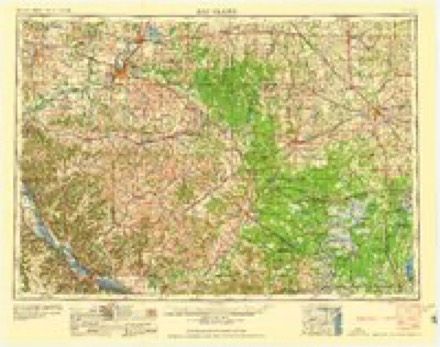
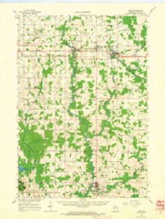
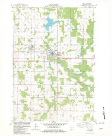
11 topographic sheets cover this place, the earliest surveyed in 1953 and the latest in 1984. It stands in Owen City. It lies in ZIP code area 54460. It stands on Brick Creek. The Survey maps it on the Owen quadrangle. 916 people lived here at the 2020 count. It stands 1,243 feet above sea level.
On record in Owen
Buildings and businesses the archive holds for this place. Each opens its own page, with the source record it came from.
On the National Register 2 records
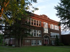 Owen High Schoollisted 2004
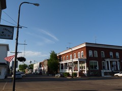 Woodland Hotellisted 2016
Population over time
2 figuresOwen fell from 940 to 916 between 2010 and 2020. These are the recorded population figures Wikidata holds for this place, reached through the Geographic Names Information System number this page is keyed on rather than by name, so they belong to this place and not to another of the same name. Most are census counts, but not all are: an early figure may be a founding or settlement estimate, and an estimate published within five years of a census is left out. The change column is computed, and is left blank where more than 20 years separate a figure from the one before it, because a gap that long is not a change between two counts.
| Year | People | Change |
|---|---|---|
| 2010 | 940 | |
| 2020 | 916 | -24 (-3%) |
Topographic sheets covering this place
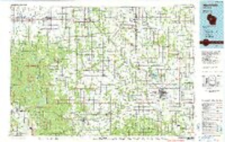
7 surveys from 11 printed sheetsMatched by testing this settlement's coordinate against the published boundary of every sheet in the United States Geological Survey's historical collection. Each opens the scanned sheet at the Survey.
- 1953 USGS Eau Claire quadrangle1:250000, 4 printings
- 1953 USGS Owen quadrangle1:48000
- 1958 USGS Eau Claire quadrangle1:250000
- 1963 USGS Owen quadrangle1:62500
- 1964 USGS Eau Claire quadrangle1:250000
- 1982 USGS Owen quadrangle1:24000
- 1984 USGS Marshfield quadrangle1:100000, 2 printings
In the county-history sources
1,587 words on this townshipHistory of Clark County Wisconsin, published 1918 names this settlement in its chapter on Owen City. These are the passages that mention it, exactly as the scans read.
Owen is one of the newer villages in Clark County, but is one of the most thriving, and as the center of extensive logging operations being carried on in the counties to the north has wonderful possibilities of future development and prosperity. It is an important railroad junction point, as the Fairchild & Northeastern has its terminal here, and the "Soo" line extends in four different directions, Three or four hundred square miles of the richest farming country are tributary to the village, and it is noted as a shipping point for stock and farm produce, as well as for its lumbering interests.
Passage source: History of Clark County Wisconsin, published 1918.
There has been a steady and conservative growth, the demand for houses always exceeding the supply, although the company and private individuals have kept busy building ever since the town was started. The village has an electric light plant (operated by the J. S. Owen Lumber Company) and water works and a sewer system. Besides the sawmill and box factory, which employ about 300 men, there is a large pea canning factory, with a capacity of 30,000 cases, a potato warehouse and elevator and teed mill, four hotels, four general stores, a bakery, butcher shop, tailor shop, jewelry store, two hardware stores, three barber shops, a shoe store and harness shop, one moving picture theatre, a bottling works, a thriving bank and a newspaper, besides several saloons, and a local telephone. The Woodland Hotel, owned by the Owen Company, is probably one of the best hotels in Wisconsin for a town the size of Owen, being built of stone and brick, with twenty-four transient rooms and all modern equipment. A Commercial Club, officered by some of the leading citizens, is active in advancing the general interests of the community.
Passage source: History of Clark County Wisconsin, published 1918.
Owen was named after the family of that name which first, as a part of the Rust-Owen Lumber Company, and later as the J. S. Owen Lumber Co., have operated extensively as loggers and lumbermen throughout the west and in Wisconsin. The site was selected on account of the wealth of timber, the Popple River, the unusual favorable lay of the land and the extremely rich fertile soil, the intention of the promoters not being to strip the timber from the ground and leave nothing but piles of slashings as a menace to the future, as the early loggers had done a generation before, but rather to cut what they could use each season, and bring in settlers to clear this newly cutover land and develop fertile farms where the timber had stood only a few years ago. And in this they have been very successful, an average of 200 families a year locating around Owen and taking up small tracts to make farms. They are a hardworking, thrifty lot and the success with which they change the aspect of the country from that of a stumpy wilderness to that of smiling farmsteads and the evidences of prosperity which follow almost immediately after they start in, is a revelation even to those who know this country best.
Passage source: History of Clark County Wisconsin, published 1918.
Machine-read from a century-old scan, so expect the errors a machine makes: misspelled names, dropped words, stray characters.
Read the whole chapter on Owen City - it names this place 6 more 6 times.
Fires near this place
4 since 2010Regional context, not property-specific evidence. The federal wildfire occurrence database lists 4 fires within 5 miles of Owen between 2010 and 2020, burning about 16 acres in total. None started naturally. None was recorded as arson. Distance is straight-line from the map coordinates, so a fire counted here may appear on a neighbouring settlement's page as well.
| Reported cause | Fires |
|---|---|
| Missing data/not specified/undetermined | 3 |
| Equipment and vehicle use | 1 |
The most recent of them, most recent first, with the day each was reported and the service that recorded it.
| Date | Cause | Size | Reported by | Name on the report |
|---|---|---|---|---|
| 23 June 2018 | Missing data/not specified/undetermined | under an acre | Wisconsin Department of Natural Resources | 2018037 |
| 30 April 2018 | Missing data/not specified/undetermined | under an acre | Wisconsin Department of Natural Resources | 2018024 |
| 11 December 2020 | Missing data/not specified/undetermined | 1.0 acres | Wisconsin Department of Natural Resources | 2020085 |
| 14 October 2010 | Equipment and vehicle use | 15 acres | Wisconsin Department of Natural Resources | not named |
Settlements close enough to share some of these fires:
Mines and quarries near this place
1 within 5 milesRegional context, not property-specific evidence. The federal mineral resources record lists 1 working within 5 miles of Owen: 1 past producer. None of them still produces. What was taken out: Sand and Gravel, Construction. Distance is straight-line from the map coordinates, so a quarry counted here may appear on a neighbouring settlement's page as well.
| Where | Site | Commodity | Status | Recorded |
|---|---|---|---|---|
| Plautz Bros Inc Withee & Roder Pits | Sand and Gravel, Construction | Past Producer |
Storms near this place
31 since 1995Regional context, not property-specific evidence. The National Weather Service names Owen in 31 storm reports between 1995 and 2023: 15 thunderstorm wind, 13 hail, 2 heavy rain, 1 funnel cloud. No death or injury is recorded in these reports. Each account below is quoted exactly as the forecast office filed it, from the NOAA Storm Events Database, and each date opens the federal record of that event.
| When | Event | Place named | Harm | What the report says |
|---|---|---|---|---|
| May 2020 | Thunderstorm Wind | Owen | $30,000 | Trees and power lines were blown down in and near Owen. One tree landed on a house and over 1,100 customers were without power after the storms moved through. |
| July 1999 | Thunderstorm Wind | Owen | $10,000 | no account filed |
| July 2002 | Thunderstorm Wind | Owen | $7,500 | no account filed |
| August 2021 | Thunderstorm Wind | Owen | $5,000 | Trees and power lines were blown down near Owen. |
| May 2001 | Hail | Owen | $5,000 | no account filed |
| September 2000 | Thunderstorm Wind | Owen | $5,000 | no account filed |
| July 2002 | Thunderstorm Wind | Owen | $4,000 | no account filed |
| May 2001 | Hail | Owen | $4,000 | no account filed |
| June 2002 | Thunderstorm Wind | Owen | $3,500 | no account filed |
| August 2000 | Thunderstorm Wind | Owen | $3,000 | no account filed |
| July 1999 | Thunderstorm Wind | Owen | $2,000 | no account filed |
| May 2001 | Hail | Owen | $1,500 | no account filed |
| September 2019 | Thunderstorm Wind | Owen | $1,000 | A tree was blown down across a road in the vicinity of Owen. |
| August 2013 | Thunderstorm Wind | Owen | $1,000 | Trees were blown down west of Curtiss along County Road P. |
| July 2010 | Thunderstorm Wind | Owen | $1,000 | The fire department reported trees down in the city of Owen. |
| July 2008 | Thunderstorm Wind | Owen | $1,000 | A newspaper article reported an old willow tree down in the city of Owen. |
| June 2014 | Thunderstorm Wind | Owen | $500 | A few trees and large branches were blown down in Owen that required a fire truck to be used to clear roadways. |
| October 2023 | Heavy Rain | Owen | - | A volunteer observer reported 4.02 inches of rainfall in Owen. |
| March 2016 | Heavy Rain | Owen | - | A total of 2.26 inches of rain fell near Owen. |
| September 2013 | Hail | Owen | - | Hail ranged in size from three-quarters of an inch to one inch in Owen. |
| May 2020 | Hail | Owen | - | no account filed |
| April 2017 | Hail | Owen | - | no account filed |
| October 2012 | Hail | Owen | - | no account filed |
| July 2011 | Funnel Cloud | Owen | - | no account filed |
| April 2002 | Hail | Owen | - | no account filed |
| September 2002 | Hail | Owen | - | no account filed |
| May 2001 | Thunderstorm Wind | Owen | - | no account filed |
| June 2001 | Hail | Owen | - | no account filed |
| August 2000 | Hail | Owen | - | no account filed |
| June 1997 | Hail | Owen | - | no account filed |
| July 1995 | Hail | Owen | - | no account filed |
Nearest settlements
The eight closest, with where each one stands in the county. Distances are straight-line, computed from the Geographic Names Information System coordinates.
Elsewhere
Matched on this settlement's Geographic Names Information System number rather than its name, so it cannot be a different place of the same name in another state.
| Wikipedia article on Owen | An encyclopaedic summary. Its text is share-alike, so it is linked here rather than copied. |
| Wikidata item Q1569456 | The structured record the population and elevation above come from. Public domain (CC0). |
Provenance
This settlement is recorded in the Geographic Names Information System as feature 1577195. The sheet list is computed by point-in-boundary test against the United States Geological Survey's historical topographic inventory. Both are works of the United States government and carry no copyright under 17 U.S.C. 105.
Wildfire. Short, Karen C. 2022. Spatial wildfire occurrence data for the United States, 1992-2020 [FPA_FOD_20221014]. 6th Edition. Fort Collins, CO: Forest Service Research Data Archive. https://doi.org/10.2737/RDS-2013-0009.6 Collected with United States Government funding and usable without additional permissions or fees.
Mines and quarries. USGS Mineral Resources Data System (MRDS) https://mrdata.usgs.gov/mrds/ A work of the United States government, no copyright under 17 U.S.C. 105.
Storms. NOAA National Centers for Environmental Information, Storm Events Database https://www.ncei.noaa.gov/stormevents/ A work of the United States government, no copyright under 17 U.S.C. 105. Narratives are quoted verbatim from the National Weather Service report and are not edited or summarised.