 Block
Patch Grove, Wisconsin
16 topographic sheets cover this place, the earliest surveyed in 1900 and the latest in 1984. It stands in Patch Grove Village. It lies in ZIP code area 53817. The Survey maps it on the Bloomington quadrangle. 201 people lived here at the 2020 count. It stands 1,112 feet above sea level.
Population over time
2 figuresPatch Grove grew from 198 to 201 between 2010 and 2020. These are the recorded population figures Wikidata holds for this place, reached through the Geographic Names Information System number this page is keyed on rather than by name, so they belong to this place and not to another of the same name. Most are census counts, but not all are: an early figure may be a founding or settlement estimate, and an estimate published within five years of a census is left out. The change column is computed, and is left blank where more than 20 years separate a figure from the one before it, because a gap that long is not a change between two counts.
| Year | People | Change |
|---|---|---|
| 2010 | 198 | |
| 2020 | 201 | +3 (+2%) |
Topographic sheets covering this place
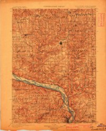
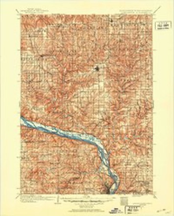
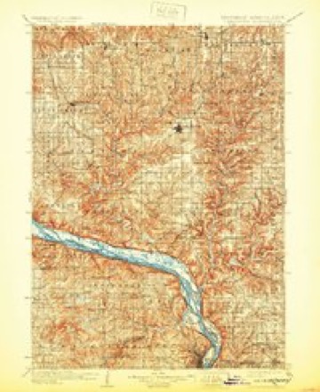
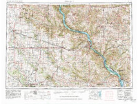
9 surveys from 16 printed sheetsMatched by testing this settlement's coordinate against the published boundary of every sheet in the United States Geological Survey's historical collection. Each opens the scanned sheet at the Survey.
- 1900 USGS Lancaster quadrangle1:125000
- 1904 USGS Lancaster quadrangle1:125000
- 1908 USGS Lancaster quadrangle1:125000, 5 printings
- 1959 USGS Dubuque quadrangle1:250000
- 1961 USGS Dubuque quadrangle1:250000
- 1962 USGS Bloomington quadrangle1:24000, 2 printings
- 1962 USGS Dubuque quadrangle1:250000, 2 printings
- 1976 USGS Dubuque quadrangle1:250000
- 1984 USGS Dubuque North quadrangle1:100000, 2 printings
In the county-history sources
4,315 words on this townshipHistory of Grant County, Wisconsin, published 1881 names this settlement in its chapter on Patch Grove Village. These are the passages that mention it, exactly as the scans read.
This town, as at present constituted, embraces portions of Townships 5 and 6, Range 5 west, and is in area somewhat less than a Congressional township. It is surrounded by the towns of Miilville, Mt. Hope, Little Grant. Bloomington and Wyalusing. Patch Grove, when first apportioned off as a township, contained much more territory, as will be seen by the following taken from the records of the Board of Supervisors for the extra session of 1848, when it was enacted that " all that district of country in Grant County embraced in Townships 6 and 7 north, of Range 4 west ; also Townships 5, 6 and 7 north, of Range 5 west ; also Townships 5 and 6 north, of Range 6; also fractional Townships 5 and 6 north, of Range 7 west of the Fourth Principal Meridian, shall constitute a separate township, to be called Patch Grove." This territory has since been changed and divided, until it has assumed its present shape and proportions.
Passage source: History of Grant County, Wisconsin, published 1881.
The first settler in the original township of Patch Grove was Page Blake, from whom the prairie stretching away to the north and west took its name, and mention of whom has been made in the Bloomington history, as well as other places in this work. The first settlers in the present township were Moses Hicklin and John Thompson. The former had been living at Cassville, and at the termination of the Black Hawk war moved out onto the prairie, where he located a claim, on which he resided up to the time of his death. John Thompson was formerly a soldier stationed at Prairie du Chien. He left the army at the close of tbis struggle, and came to settle upon this broad, fertile prairie. In 1835, Charles Blunt came, and afterward settled on Section 17. At that time the only houses between Blunt and Wingville were Hicklin's, Thompson's and the cabin of Ben Forbes, who was located on the farm at present occupied by James Davis.
Passage source: History of Grant County, Wisconsin, published 1881.
The first house built in the present village of Patch Grove was erected by Mr. Enos P. Finn in 1843. It was a frame structure afterward used as a tavern by James Forshay, and kept as such by him for many years. It is still standing in the south part of the village, west of the Wisconsin House, a well-worn relic whose sunken lines and weather-beaten walls carry the memory back through the long vista, to the time when the present populous prairies were an abode for wolves and foxes. The land on which the west half of the village stands was entered by Robert C. Orr, and by him was sold to Enos P. Finn ; this was the east half of the northeast quarter of Section 4 ; among the articles of dicker in the trade is mentioned an " old gray mare," which was transferred to Mr. Orr; whether she proved afterward " the better horse," is not stated. This land was laid out into village lots by Mr. Finn, but the plot was never recorded. The first shop in the new village was a smithy built by Francis Brady, who started in business on the ground now occupied by the Wisconsin House, soon after the laying out of the town
Passage source: History of Grant County, Wisconsin, published 1881.
Machine-read from a century-old scan, so expect the errors a machine makes: misspelled names, dropped words, stray characters.
Read the whole chapter on Patch Grove Village - it names this place 7 more 7 times.
Fires near this place
14 since 1994Regional context, not property-specific evidence. The federal wildfire occurrence database lists 14 fires within 5 miles of Patch Grove between 1994 and 2020, burning about 26 acres in total. None started naturally. 1 was recorded as arson. Distance is straight-line from the map coordinates, so a fire counted here may appear on a neighbouring settlement's page as well.
| Reported cause | Fires |
|---|---|
| Debris and open burning | 5 |
| Equipment and vehicle use | 4 |
| Missing data/not specified/undetermined | 2 |
| Smoking | 2 |
| Arson/incendiarism | 1 |
The most recent of them, most recent first, with the day each was reported and the service that recorded it.
| Date | Cause | Size | Reported by | Name on the report |
|---|---|---|---|---|
| 16 August 2015 | Equipment and vehicle use | under an acre | Wisconsin Department of Natural Resources | DRY HOLLOW FIRE |
| 18 June 2020 | Missing data/not specified/undetermined | under an acre | Wisconsin Department of Natural Resources | 12A2020 |
| 3 May 2003 | Debris and open burning | 1.1 acres | Wisconsin Department of Natural Resources | not named |
| 8 April 2001 | Smoking | under an acre | Wisconsin Department of Natural Resources | not named |
| 26 April 2013 | Debris and open burning | under an acre | Wisconsin Department of Natural Resources | MILLVILLE HOLLOW |
| 23 April 2018 | Equipment and vehicle use | 19 acres | Wisconsin Department of Natural Resources | COTTONWOOD |
| 2 April 1994 | Equipment and vehicle use | under an acre | Wisconsin Department of Natural Resources | not named |
| 2 April 1994 | Equipment and vehicle use | 2.4 acres | Wisconsin Department of Natural Resources | not named |
Settlements close enough to share some of these fires:
Mines and quarries near this place
4 within 5 milesRegional context, not property-specific evidence. The federal mineral resources record lists 4 workings within 5 miles of Patch Grove: 2 unknowns, 2 producers. 2 still produce. What was taken out: Stone, Stone, Crushed/Broken. Distance is straight-line from the map coordinates, so a quarry counted here may appear on a neighbouring settlement's page as well.
| Where | Site | Commodity | Status | Recorded |
|---|---|---|---|---|
| Charlie White Quarry | Stone, Crushed/Broken | Producer | ||
| Finn Quarry | Stone | Unknown | ||
| Finn Quarry | Stone, Crushed/Broken | Producer | ||
| Kirschbaum Quarry | Stone | Unknown |
Storms near this place
19 since 1999Regional context, not property-specific evidence. The National Weather Service names Patch Grove in 19 storm reports between 1999 and 2026: 10 thunderstorm wind, 7 hail, 1 flash flood, 1 tornado. No death or injury is recorded in these reports. Each account below is quoted exactly as the forecast office filed it, from the NOAA Storm Events Database, and each date opens the federal record of that event.
| When | Event | Place named | Harm | What the report says |
|---|---|---|---|---|
| June 2008 | Flash Flood | Patch Grove | $1,200,000 | Highways 35 and 18 were closed due to mudslides and debris. Trees were even being knocked down by the slides. |
| September 2012 | Tornado (EF2) | Patch Grove | $420,000 | A slow moving tornado formed on the edge of a passing severe thunderstorm between Patch Grove and Bloomington. The tornado was mainly confined to one landowner near Hickory and Maine Roads in rural Grant County. Several outbuildings, a barn, and the home were demolished or heavily damaged. Trees on the property were also sheared off or blown over. Considering the roof was torn off and several walls were down or damaged, the tornado was rated an EF2 but it's possible the slow movement allowed the tornado to remain nearly stationary long enough to cause worse damage. Interviews by local residents and video evidence suggests the tornado may have moved to the northwest at times as well. |
| July 2017 | Thunderstorm Wind | Patch Grove | $20,000 | A barn was blown down near Bloomington. |
| August 2003 | Thunderstorm Wind | Patch Grove | $15,000 | no account filed |
| September 2012 | Hail | Patch Grove | $5,000 | Half dollar sized hail fell southeast of Patch Grove causing damage to a vehicle. |
| August 2021 | Thunderstorm Wind | Patch Grove | $2,000 | Power lines were blown down in Patch Grove. |
| June 2014 | Thunderstorm Wind | Patch Grove | $2,000 | Trees were blown down in Patch Grove. |
| August 2003 | Thunderstorm Wind | Patch Grove | $1,500 | no account filed |
| September 2001 | Thunderstorm Wind | Patch Grove | $500 | no account filed |
| April 2026 | Hail | Patch Grove | - | A trained spotter reported quarter sized hail in Patch Grove. |
| June 2022 | Thunderstorm Wind | Patch Grove | - | A 65 mph gust occurred in Patch Grove. |
| August 2020 | Thunderstorm Wind | Patch Grove | - | A 63 mph wind gust occurred in Patch Grove. |
| May 2017 | Thunderstorm Wind | Patch Grove | - | An 80 mph wind gust occurred in Patch Grove. |
| July 2017 | Thunderstorm Wind | Patch Grove | - | An estimated 70 mph wind gust occurred in Patch Grove. |
| May 2014 | Hail | Patch Grove | - | Quarter sized hail was reported in Patch Grove. |
| June 2006 | Hail | Patch Grove | - | no account filed |
| June 2006 | Hail | Patch Grove | - | no account filed |
| May 2000 | Hail | Patch Grove | - | no account filed |
| May 1999 | Hail | Patch Grove | - | no account filed |
Nearest settlements
The eight closest, with where each one stands in the county. Distances are straight-line, computed from the Geographic Names Information System coordinates.
| Map | Place | Distance | Sheets |
|---|---|---|---|
| Brodtville | 4.0 miles | 12 | |
| Bloomington | 4.6 miles | 16 | |
| Mount Hope | 6.3 miles | 15 | |
| Millville | 6.8 miles | 10 | |
| Bagley | 7.3 miles | 12 | |
| North Andover | 8.6 miles | 16 | |
| Wyalusing | 9.0 miles | 14 | |
| Glen Haven | 9.4 miles | 13 |
Elsewhere
Matched on this settlement's Geographic Names Information System number rather than its name, so it cannot be a different place of the same name in another state.
| Wikipedia article on Patch Grove | An encyclopaedic summary. Its text is share-alike, so it is linked here rather than copied. |
| Wikidata item Q593657 | The structured record the population and elevation above come from. Public domain (CC0). |
Provenance
This settlement is recorded in the Geographic Names Information System as feature 1571075. The sheet list is computed by point-in-boundary test against the United States Geological Survey's historical topographic inventory. Both are works of the United States government and carry no copyright under 17 U.S.C. 105.
Wildfire. Short, Karen C. 2022. Spatial wildfire occurrence data for the United States, 1992-2020 [FPA_FOD_20221014]. 6th Edition. Fort Collins, CO: Forest Service Research Data Archive. https://doi.org/10.2737/RDS-2013-0009.6 Collected with United States Government funding and usable without additional permissions or fees.
Mines and quarries. USGS Mineral Resources Data System (MRDS) https://mrdata.usgs.gov/mrds/ A work of the United States government, no copyright under 17 U.S.C. 105.
Storms. NOAA National Centers for Environmental Information, Storm Events Database https://www.ncei.noaa.gov/stormevents/ A work of the United States government, no copyright under 17 U.S.C. 105. Narratives are quoted verbatim from the National Weather Service report and are not edited or summarised.