 Block
Pipe, Wisconsin
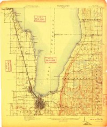
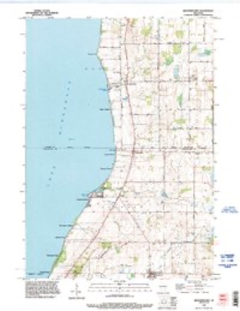
12 topographic sheets cover this place, the earliest surveyed in 1910 and the latest in 1992. It stands in Calumet town. It lies in ZIP code area 53049. It stands on Pipe Creek. The Survey maps it on the Brothertown quadrangle.
On record in Pipe
Buildings and businesses the archive holds for this place. Each opens its own page, with the source record it came from.
On the National Register 1 record
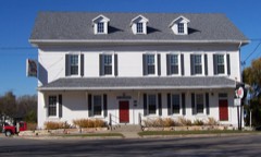 Club Harborlisted 1980
Topographic sheets covering this place
7 surveys from 12 printed sheetsMatched by testing this settlement's coordinate against the published boundary of every sheet in the United States Geological Survey's historical collection. Each opens the scanned sheet at the Survey.
- 1910 USGS Fond du Lac quadrangle1:62500, 2 printings
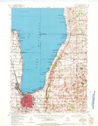
- 1955 USGS Fond Du Lac quadrangle1:62500, 2 printings
- 1957 USGS Madison quadrangle1:250000, 3 printings
- 1960 USGS Madison quadrangle1:250000, 2 printings
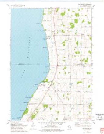
- 1974 USGS Brothertown quadrangle1:24000
- 1980 USGS Fond Du Lac quadrangle1:100000
- 1992 USGS Brothertown quadrangle1:24000



In the county-history sources
5,392 words on this townshipThe History of Fond Du Lac County, Wisconsin, published 1880 names this settlement in its chapter on Calumet Town. These are the passages that mention it, exactly as the scans read.
The town of Calumet, so called from the Menomonee Indian village ("Pipe") of the same name, formerly located on the northeast quarter of Section 27, is the northeast town of Fond du Lac County, and contains 19,146.91 acres of land, as follows : In Township 16 north, of Range 18 east, 2,307.56 acres ; in Township 17 north, of Range 18 east, 4,742.13 acres ; in Township 17 north, of Range 19 east, 12,097.22 acres ; total 19,146.91 acres. It is bounded on the north by Calumet County ; on the east by the same county and the town of Marshfield in Fond du Lac County ; on the south by the towns of Marshfield and Taycheedah, and on the west by Winnebago Lake.
Passage source: The History of Fond Du Lac County, Wisconsin, published 1880.
Deputy Surveyor A. G. Ellis, in speaking of the northwestei'n portion of what is now the town of Calumet (fractional Township 17 north, in Range 18 east), says : " This fractional township must be considered as first-rate and valuable land. It consists almost wholly of extensive oak openings and dry and wet prairies. The soil is first rate - a mixture of red loam and black sand. Its position (east side and above the center of Winnebago Lake) gives it an additional value. The stream entering [the lake] at [a little distance southwest of] ' Pipe Village,' though small and barred at the mouth, is nevertheless larjie enough for a harbor for boats ; and a small pier at the mouth would deepen the water so that it might be entered. The banks are high and beautiful, and ' Pipe Village ' is a beautiful site." This was written upon the spot over a year before there was a white settler in Fond du Lac County.
Passage source: The History of Fond Du Lac County, Wisconsin, published 1880.
The same writer, in November, 1834, in speaking of what is now the eastern portion of the town of Calumet (south half of Township 17 nortii. Range 19 east), says: '' That part of this fractional township lying east of the stream (Manitowoc River) is rather low, though on the whole it may be considered first rate land. The soil is very deep and rich, with fewer stones than are found farther east. The stream is sluggish and muddy. No wild animals ford it. The marsh has on it deep water, and the grass is very thin. West of the stream the land is higli and mostly openings, with a suitable quantity of good timber, and water in small prairies. Numerous trees were observed to have been cut here, by Indians, for honey-bees." Seeing this region before any portion of it was cultivated, such were his impressions.
Passage source: The History of Fond Du Lac County, Wisconsin, published 1880.
Machine-read from a century-old scan, so expect the errors a machine makes: misspelled names, dropped words, stray characters.
Read the whole chapter on Calumet Town - it names this place 3 more 3 times.
Fires near this place
4 since 2018Regional context, not property-specific evidence. The federal wildfire occurrence database lists 4 fires within 5 miles of Pipe in 2018, burning about 15 acres in total. None started naturally. None was recorded as arson. Distance is straight-line from the map coordinates, so a fire counted here may appear on a neighbouring settlement's page as well.
| Reported cause | Fires |
|---|---|
| Missing data/not specified/undetermined | 2 |
| Debris and open burning | 1 |
| Equipment and vehicle use | 1 |
The most recent of them, most recent first, with the day each was reported and the service that recorded it.
| Date | Cause | Size | Reported by | Name on the report |
|---|---|---|---|---|
| 5 July 2018 | Missing data/not specified/undetermined | under an acre | Wisconsin Department of Natural Resources | 2018053 |
| 24 July 2018 | Equipment and vehicle use | 15 acres | Wisconsin Department of Natural Resources | 2018057 |
| 30 April 2018 | Missing data/not specified/undetermined | under an acre | Wisconsin Department of Natural Resources | 2018036 |
| 25 April 2018 | Debris and open burning | under an acre | Wisconsin Department of Natural Resources | 2018035 |
Settlements close enough to share some of these fires:
Mines and quarries near this place
1 within 5 milesRegional context, not property-specific evidence. The federal mineral resources record lists 1 working within 5 miles of Pipe: 1 past producer. None of them still produces. What was taken out: Stone, Crushed/Broken. Distance is straight-line from the map coordinates, so a quarry counted here may appear on a neighbouring settlement's page as well.
| Where | Site | Commodity | Status | Recorded |
|---|---|---|---|---|
| Silica Quarry | Stone, Crushed/Broken | Past Producer |
Storms near this place
4 since 1999Regional context, not property-specific evidence. The National Weather Service names Pipe in 4 storm reports between 1999 and 2008: 1 funnel cloud, 1 hail, 1 tornado, 1 thunderstorm wind. No death or injury is recorded in these reports. Each account below is quoted exactly as the forecast office filed it, from the NOAA Storm Events Database, and each date opens the federal record of that event.
| When | Event | Place named | Harm | What the report says |
|---|---|---|---|---|
| July 2008 | Thunderstorm Wind | Pipe | - | Powerful thunderstorm wind gusts toppled large trees. |
| May 2005 | Tornado (F0) | Pipe | - | A brief, weak tornado was spotted about 3.2 to 3.0 miles northwest of Pipe (Fond du Lac Co.) just inside the county line over Lake Winnebago. There were no reports of damage. This tornado was a continuation of a tornado that spun up over Lake Winnebago about 7.8 miles east-southeast of Oshkosh in Winnebago County at 1324CST and moved to a point 3.7 miles southwest of Brothertown at 1329CST in extreme southwest Calumet County. This tornado was seen by a severe weather spotter from Calumet County. The surface position is and F-scale rating are estimated and based on the spotter's report. |
| June 1999 | Funnel Cloud | Pipe | - | no account filed |
| June 1999 | Hail | Pipe | - | no account filed |
Nearest settlements
The eight closest, with where each one stands in the county. Distances are straight-line, computed from the Geographic Names Information System coordinates.
| Map | Place | Distance | Sheets |
|---|---|---|---|
| Pukwana Beach | 1.0 miles | 12 | |
| Calumet Harbor | 1.0 miles | 12 | |
| Artesia Beach | 1.4 miles | 12 | |
| Calumetville | 1.6 miles | 12 | |
| Winnebago Heights | 1.9 miles | 12 | |
| Highland Park | 2.3 miles | 12 | |
| Johnsburg | 2.8 miles | 12 | |
| Winnebago Park | 2.9 miles | 12 |
Provenance
This settlement is recorded in the Geographic Names Information System as feature 1571550. The sheet list is computed by point-in-boundary test against the United States Geological Survey's historical topographic inventory. Both are works of the United States government and carry no copyright under 17 U.S.C. 105.
Wildfire. Short, Karen C. 2022. Spatial wildfire occurrence data for the United States, 1992-2020 [FPA_FOD_20221014]. 6th Edition. Fort Collins, CO: Forest Service Research Data Archive. https://doi.org/10.2737/RDS-2013-0009.6 Collected with United States Government funding and usable without additional permissions or fees.
Mines and quarries. USGS Mineral Resources Data System (MRDS) https://mrdata.usgs.gov/mrds/ A work of the United States government, no copyright under 17 U.S.C. 105.
Storms. NOAA National Centers for Environmental Information, Storm Events Database https://www.ncei.noaa.gov/stormevents/ A work of the United States government, no copyright under 17 U.S.C. 105. Narratives are quoted verbatim from the National Weather Service report and are not edited or summarised.