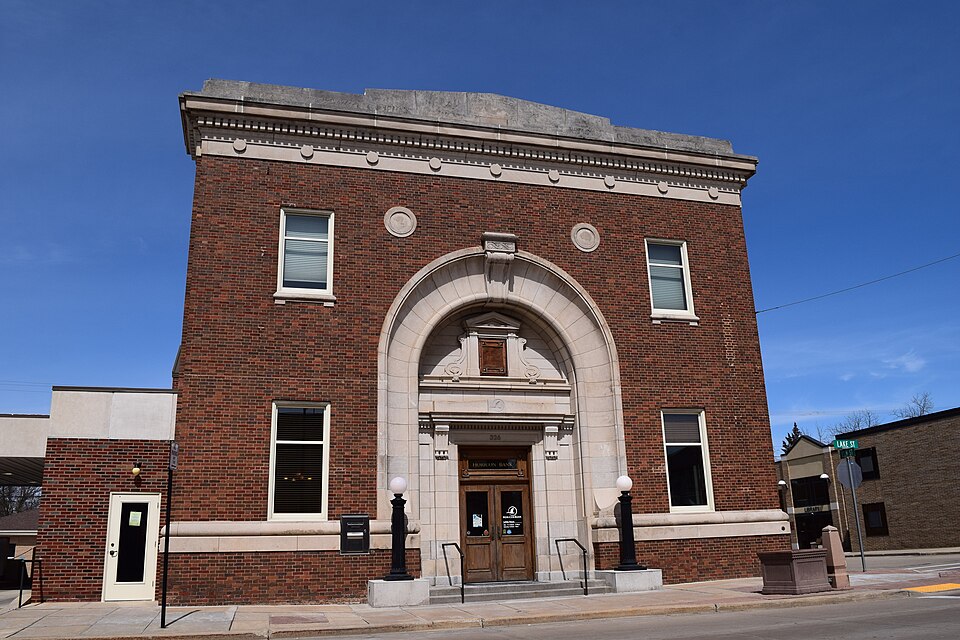
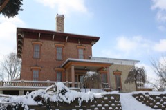
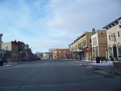
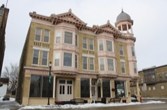
Listed on the National Register of Historic Places in 2018.
From the record
“The Horicon State Bank is located in Horicon, Wisconsin. In 2004, the bank was renamed Horicon Bank and the building is still used as the bank's main office today.”
Wikipedia article Horicon State Bank, CC BY-SA 4.0.
One of 36 National Register listings published here for Dodge County · listed in 2018 · category: Building.
While Horicon Lake was a navigable body of water, two appalling calamities occurred upon it, recollections of which will ever remain fresh in the minds of the people of Dodge County. The firsi of these took place about four or five miles from the village of Horicon in July, 1857, a scow, containing a crew of seventeen men engaged in rafting logs from Chester bridge, being struck by lightning during a terrible hurricane.
No more appropriate place could be selected within this work for a brief recital of an ugly transaction, still fresh in the minds of every one in Dodge County. At a special meetmg of the Board of Supervisors held May, 8, 1878 - eight months after the destructioji of the County Building by fire, and three days after the burning of the Treasurer's temporary office, south of the old Court House - called "for the transaction of business of a pressing nature," the following resolution was submitted by the Hon. Sat. Clark, of Horicon, and adopted :
The first fair of the Society was held at Juneau, probably the same year of its organization, although the record left shows that it was " on Thursday of last year." Among those receiving premiums were G. C. Gunn, Dr. Atwood, Joel Rich, David Barber, S. H. Coleman, George R. Clapp, F. H. Roper and S. J. Glover, for different kinds of stock ; J. C. Brown for poultry and boots ; A. Olson, for buggy ; S. Sti'eeter, for best thrashing machine ; Paul Juneau, C. Billinghurst, G. C. Gunn, N. E. Allen, Herman Grube and S. W. Lyman, for vegetables ; and in the ladies' department, Mrs. George R. Clapp, Mrs. Atwater, Mrs. W. H. Lander, Mrs. S. H. Allen, Mrs. J. C. Brown, and others, received premiums for specimens of their handiwork. On miscellaneous articles, a premium of $1 was awarded to " Rich & Grout, Horicon, for one bar of wrought iron, manufactured this forenoon from the Iron Ridge ore in this county, which is the first of the kind ever made in the county, and the Committee consider it equal to the best Swedes."
Regional context, not property-specific
evidence. The
federal wildfire occurrence database
lists 10 fires within 5 miles of Horicon State Bank
between 1994 and 2012, burning about 709 acres in total. 1 started naturally. 3 were recorded as arson.
Distance is straight-line from the map coordinates, so a fire counted
here may appear on a neighbouring settlement's page as well.
Reported cause
Fires
Arson/incendiarism
3
Debris and open burning
2
Missing data/not specified/undetermined
2
Equipment and vehicle use
2
Natural
1
The most recent of
them, most recent first, with the day each was reported and the service
that recorded it.
Regional context, not property-specific
evidence. The federal mineral resources record lists
7 workings within 5 miles of Horicon State Bank: 4 past producers, 2 producers, 1 unknown.
2 still produce. What was taken out: Sand and Gravel, Construction, Calcium. Distance is straight-line from the
map coordinates, so a quarry counted here may appear on a neighbouring
settlement's page as well.
Regional context, not property-specific
evidence. The National Weather Service names
Horicon, the town this property stands in, in 21 storm reports between 1994 and 2026: 7 hail, 7 thunderstorm wind, 3 tornado, 2 funnel cloud.
No death or injury is recorded in these reports. Each account below is quoted exactly as the forecast office
filed it, from the NOAA Storm Events Database, and each date
opens the federal record of that event.
Tornado began southwest of Mayville just west of Highway 28 which was also captured on video as a potential multi-vortex tornado. Some of the more intense damage occurred shortly after the tornado developed and crossed County Rd TW on into southwest Mayville in an industrial area. A farmhouse on Cty RW lost a portion of its roof and some farm sheds. The tornado then moved through the industrial area in southwest Mayville. The Mayville Engineering Company was hit on its northwest corner. The winds from the tornado breached a large garage door on the west side which then pushed the large north end wall down. The tornado then went through the Gleason Reel Corporation and destroyed the southern portion of the building. It then went through a neighborhood near the St. John/Graceland cemetary before crossing Main St/Rock River. The tornado then went through the east side of Mayville near the Mayville Golf Course. It then continued to the northeast through mainly rural areas before ending NW of Theresa.
Severe thunderstorms deposited hail up to the size of golf balls over parts of Dodge County. About 100 vehicles received hail damage in Beaver Dam, nearly 50 of them on one auto dealer's lot.
No historic map-sheet match is published
for this property yet. That does not mean no map exists. This record needs
a coordinate-quality review before it can be joined to a sheet boundary.
Browse the county's mapped places while that work is
pending.
Listed places nearby
6 within 8 miles
Other National Register properties close
enough to walk or drive between, ordered by distance from this one. Both
positions come from the same geocoding pass that matched these properties
to their map sheets.
Listing record. National Park Service National Register of Historic Places, listed-properties dataset, current to 2026-05-22.
Map join. Address geocoded through the United States Census geocoder, then tested against the published boundary of every sheet in the USGS Historical Topographic Map Collection.
How this page is made. Listing fields come from federal records; map-sheet coverage is a labelled coordinate-to-boundary calculation, not a source-field claim.
Wildfire. Short, Karen C. 2022. Spatial wildfire occurrence data for the United States, 1992-2020 [FPA_FOD_20221014]. 6th Edition. Fort Collins, CO: Forest Service Research Data Archive. https://doi.org/10.2737/RDS-2013-0009.6 Collected with United States Government funding and usable without additional permissions or fees.
Mines and quarries. USGS Mineral Resources Data System (MRDS) https://mrdata.usgs.gov/mrds/ A work of the United States government, no copyright under 17 U.S.C. 105.
Storms. NOAA National Centers for Environmental Information, Storm Events Database https://www.ncei.noaa.gov/stormevents/ A work of the United States government, no copyright under 17 U.S.C. 105. Narratives are quoted verbatim from the National Weather Service report and are not edited or summarised.
 Block