 Block
From the record
One of 50 National Register listings published here for Walworth County · listed in 2023 · category: Building.
Sources: the National Register database, National Park Service
Listed on the National Register of Historic Places in 2023.
One of 50 National Register listings published here for Walworth County · listed in 2023 · category: Building.
Sources: the National Register database, National Park Service
The chapter on Richmond Town in History of Walworth County, Wisconsin .., published 1912 names Richmond. This is what it says, exactly as the scans read.
Town 3 north, range 15 east, was at first included in largest Elkhorn. At an extra session of the territorial Legislature by an act dated August 18, 1840, this town was made a part of Whitewater. Five months later, January 12, 1841, it was set off as the town of Richmond. Among the first-comers to the town were Thomas and T. Perry James and Robert Sherman, from Richmond, Washington county, Rhode Island, and their influence, just then, was sufficient to place another Richmond in the field of American geography.
Passage source: History of Walworth County, Wisconsin .., published 1912.
Glacial action left the town of uneven surface, but not more so than other towns. The high ground of eastern Whitewater is continued through northeastern Richmond and thence irregularly southeastward to the state line in Bloomfield ; but it nowhere becomes hills. A large part of Rock Prairie, its elevation eight hundred and ninety-four feet above sea-level, lies in the southwestern part of the town. Turtle lake, its greatest length about one mile and average width about one-third of a mile, lies at the meeting of sections 11, 12, 13, 14. There are small glacial lakes, or large pot-holes, one each in sections 4, 9, 10. Turtle creek, the only noticeable stream in the town, flows from its lake southwardly with double curvature to Delavan. where it turns west ward and with another sigmoid flexure crosses Darien and thence to the Rock. In its course through Richmond it crosses sections 14, 23, 26, 35. 36. It is bordered by a large marsh, now about to be reclaimed.
Passage source: History of Walworth County, Wisconsin .., published 1912.
Machine-read from a century-old scan, so expect the errors a machine makes: misspelled names, dropped words, stray characters.
Read the whole chapter on Richmond Town - 1,522 words on its settlement, mills, schools and churches.
Regional context, not property-specific evidence. The federal wildfire occurrence database lists 6 fires within 5 miles of Heart Prairie Norwegian Methodist Episcopal Church between 2018 and 2020, burning about 11 acres in total. None started naturally. None was recorded as arson. Distance is straight-line from the map coordinates, so a fire counted here may appear on a neighbouring settlement's page as well.
| Reported cause | Fires |
|---|---|
| Debris and open burning | 3 |
| Recreation and ceremony | 1 |
| Missing data/not specified/undetermined | 1 |
| Equipment and vehicle use | 1 |
The most recent of them, most recent first, with the day each was reported and the service that recorded it.
| Date | Cause | Size | Reported by | Name on the report |
|---|---|---|---|---|
| 14 June 2020 | Equipment and vehicle use | under an acre | Wisconsin Department of Natural Resources | 20028 |
| 9 April 2019 | Debris and open burning | under an acre | Wisconsin Department of Natural Resources | 19012 |
| 7 April 2018 | Debris and open burning | 10 acres | Wisconsin Department of Natural Resources | 137 |
| 6 April 2019 | Debris and open burning | under an acre | Wisconsin Department of Natural Resources | 19011 |
| 20 April 2020 | Missing data/not specified/undetermined | under an acre | Wisconsin Department of Natural Resources | 20015 |
| 8 March 2020 | Recreation and ceremony | under an acre | Wisconsin Department of Natural Resources | 20008 |
Regional context, not property-specific evidence. The federal mineral resources record lists 3 workings within 5 miles of Heart Prairie Norwegian Methodist Episcopal Church: 3 past producers. None of them still produces. What was taken out: Sand and Gravel, Construction. Distance is straight-line from the map coordinates, so a quarry counted here may appear on a neighbouring settlement's page as well.
| Where | Site | Commodity | Status | Recorded |
|---|---|---|---|---|
| Nelson Pit | Sand and Gravel, Construction | Past Producer | ||
| Richmond Pit | Sand and Gravel, Construction | Past Producer | ||
| Triebold Pit | Sand and Gravel, Construction | Past Producer |
Regional context, not property-specific evidence. The National Weather Service names Richmond, the town this property stands in, in 17 storm reports between 1999 and 2026: 8 thunderstorm wind, 4 hail, 3 tornado, 2 flood. No death or injury is recorded in these reports. Each account below is quoted exactly as the forecast office filed it, from the NOAA Storm Events Database, and each date opens the federal record of that event.
| When | Event | Place named | Harm | What the report says |
|---|---|---|---|---|
| April 2026 | Tornado (EF1) | Richmond | $124,000 | Multivortex tornado documented southwest of Richmond. Multiple sheds with sheet metal damage along County Highway M before entering Walworth County. |
| July 2015 | Tornado (EF1) | Richmond | $80,000 | A machine shed was completely destroyed. A roof of a modern pole barn was removed. Visible damage to a shed. A 2 by 4 lodged inside a vehicle with the windows blown out. Trees snapped and fields of corn partially blown over. |
| March 2023 | Tornado (EF0) | Richmond | $50,000 | Several trees toppled and uprooted. Minor fascia damage. Sheet metal roof damage. |
| April 2020 | Flood | Richmond | $50,000 | Portions of Swift Lake, Lake Lorraine, Lake Wandawega, and the village of Walworth flooded after 2-3 inches of rain and resultant runoff into already high lake levels from last autumn. This flooded a small number of homes and other structures. |
| October 2022 | Thunderstorm Wind | Richmond | $6,000 | An uprooted tree on a house and a pier on Turtle Lake ripped up. |
| June 2014 | Thunderstorm Wind | Richmond | $5,000 | Trees down in the vicinity of Northland Park. |
| May 2015 | Thunderstorm Wind | Richmond | $1,000 | Boats and docks damaged and one dead tree knocked over at Whitewater Lake. |
| March 2025 | Thunderstorm Wind | Richmond | - | Report of wind damage to a farm: shingles off roof, horse shed blown over and pushed into field, fencing damage, and multiple trees down. |
| June 2008 | Thunderstorm Wind | Richmond | - | Powerful thunderstorms winds knocked down large trees. |
| July 2008 | Thunderstorm Wind | Richmond | - | Powerful thunderstorm wind gusts toppled large trees. |
| August 2013 | Hail | Richmond | - | no account filed |
| May 2011 | Hail | Richmond | - | no account filed |
| August 2002 | Thunderstorm Wind | Richmond | - | no account filed |
| August 2001 | Thunderstorm Wind | Richmond | - | no account filed |
| May 2000 | Hail | Richmond | - | no account filed |
| July 2000 | Flood | Richmond | - | no account filed |
| June 1999 | Hail | Richmond | - | no account filed |
No historic map-sheet match is published for this property yet. That does not mean no map exists. This record needs a coordinate-quality review before it can be joined to a sheet boundary. Browse the county's mapped places while that work is pending.
Other National Register properties close enough to walk or drive between, ordered by distance from this one. Both positions come from the same geocoding pass that matched these properties to their map sheets.
| Photograph | Property | Distance | Listed |
|---|---|---|---|
 | Heart Prairie Lutheran Church | 1.4 miles | 1974 |
 | Wandawega Inn | 5.4 miles | 2015 |
 | Whitewater Passenger Depot | 6.4 miles | 2013 |
 | Whitewater Post Office | 6.4 miles | 2000 |
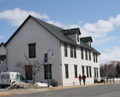 | Whitewater Hotel | 6.5 miles | 2010 |
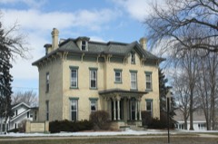 | Main Street Historic District | 6.6 miles | 1989 |
| National Archives record | The nomination case file for reference 100008810 in Record Group 79. |
| Walworth County | All 50 listed properties in this county. |