 Block
Montgomery, Alabama
21 topographic sheets cover this place, the earliest surveyed in 1927 and the latest in 1986. It stands in the Montgomery census division. It lies in ZIP code area 36104. The Survey maps it on the Montgomery South quadrangle. 200,603 people lived here at the 2020 count. It stands 240 feet above sea level.
Research this city
On record in Montgomery
Buildings and businesses the archive holds for this place. Each opens its own page, with the source record it came from.
On the National Register 12 of 68 shown
 Alabama State CapitolNational Historic Landmark · listed 1966
 Dexter Avenue Baptist ChurchNational Historic Landmark · listed 1974
 Montgomery Union Station and TrainshedNational Historic Landmark · listed 1973
 United States Post Office and Courthouse-MontgomeryNational Historic Landmark · listed 1998
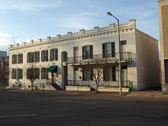 William Lowndes Yancey Law OfficeNational Historic Landmark · listed 1973
 Bell Buildinglisted 1981
 Bricklayers Halllisted 2020
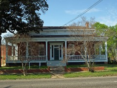 Patrick Henry Brittan Houselisted 1979
 Building 800-Austin Halllisted 1988
 Building 836-Community College of the Air Force Buildinglisted 1988
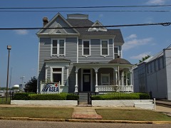 Cassimus Houselisted 1976
 City of St. Jude Historic Districtlisted 1990
Every listing in Montgomery County
Surveyed buildings and structures 12 of 36 shown
- Alabama State Capitol, Dexter Avenue, Montgomeryfederal building survey, 11 photographs
- Atlantic Ice & Coal Company, 135 Prince Street, Montgomeryfederal building survey, 23 photographs
- Ben Moore Hotel, 902 High Street, Montgomeryfederal building survey, 1 photograph
- Bibb-Goldthwaithe-Arrington House, 203 Church Street, Montgomeryfederal building survey, 25 photographs
- Colonel Charles Teed Pollard House (Mansion), 117 Jefferson Street, Montgomeryfederal building survey, 24 photographs
- Concert Hall, 61 & 67 Dexter Avenue, Montgomeryfederal building survey, 16 photographs
- Dexter Avenue King Memorial Baptist Church Parsonage, 309 South Jackson Street, Montgomeryfederal building survey, 1 photograph
- Dexter Avenue King Memorial Baptist Church, 454 Dexter Avenue, Montgomeryfederal building survey, 32 photographs
- Figh-Pickett House, 14 Clayton Street, Montgomeryfederal building survey, 7 photographs
- First White House of the Confederacy, 625 Washington Street (moved from Bibb & Lee Streets), Montgomeryfederal building survey, 8 photographs
- Fitzpatrick-Saffold House, 442 South McDonough Street, Montgomeryfederal building survey, 12 photographs
- Garrett-Hatchett House, 313 Catoma Street, Montgomeryfederal building survey, 7 photographs
Population over time
2 figuresMontgomery fell from 205,764 to 200,603 between 2010 and 2020. These are the recorded population figures Wikidata holds for this place, reached through the Geographic Names Information System number this page is keyed on rather than by name, so they belong to this place and not to another of the same name. Most are census counts, but not all are: an early figure may be a founding or settlement estimate, and an estimate published within five years of a census is left out. The change column is computed, and is left blank where more than 20 years separate a figure from the one before it, because a gap that long is not a change between two counts.
| Year | People | Change |
|---|---|---|
| 2010 | 205,764 | |
| 2020 | 200,603 | -5,161 (-3%) |
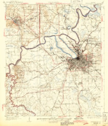
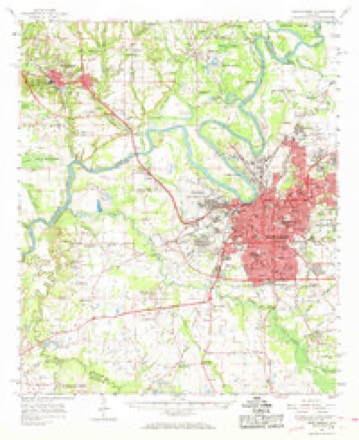
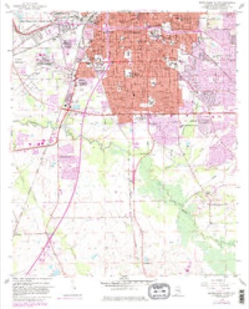
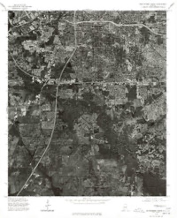
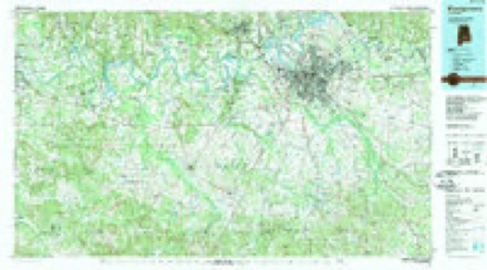
Topographic sheets covering this place
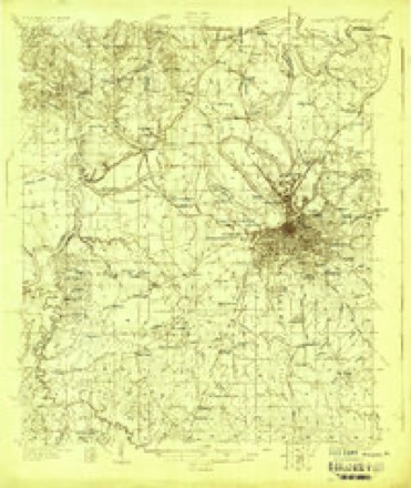
9 surveys from 21 printed sheetsMatched by testing this settlement's coordinate against the published boundary of every sheet in the United States Geological Survey's historical collection. Each opens the scanned sheet at the Survey.
- 1927 USGS Montgomery quadrangle1:48000
- 1930 USGS Montgomery quadrangle1:62500, 4 printings
- 1953 USGS Montgomery quadrangle1:250000, 4 printings
- 1956 USGS Montgomery quadrangle1:250000
- 1957 USGS Montgomery quadrangle1:250000
- 1958 USGS Montgomery quadrangle1:62500, 2 printings
- 1958 USGS Montgomery South quadrangle1:24000, 5 printings
- 1975 USGS Montgomery South quadrangle1:24000
- 1986 USGS Montgomery quadrangle1:100000, 2 printings
What the histories say of this town
12,433 words1 chapter about Montgomery from the published histories of the county, public domain and reproduced complete.
| Chapter | From | Length |
|---|---|---|
| Official Guide to the City of Montgomery, Alabama, 1920 | Official Guide to the City of Montgomery, Alabama, 1920 (1920) | 12,433 words |
Photographs
8 of 48 photographs shown, 1937 to 1943Taken for the Office of War Information and the Farm Security Administration, who photographed the country between 1935 and 1944. Works of United States government photographers, with no known restriction on use. Each opens its catalogue record.
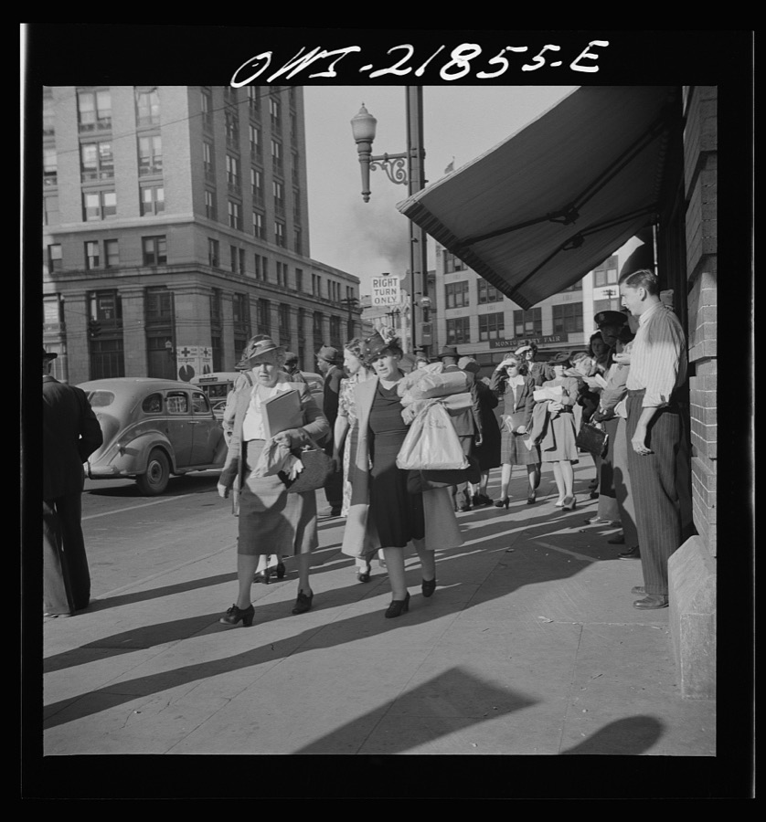
Vachon, John, 1943. Library of Congress

Vachon, John, 1943. Library of Congress

Vachon, John, 1943. Library of Congress
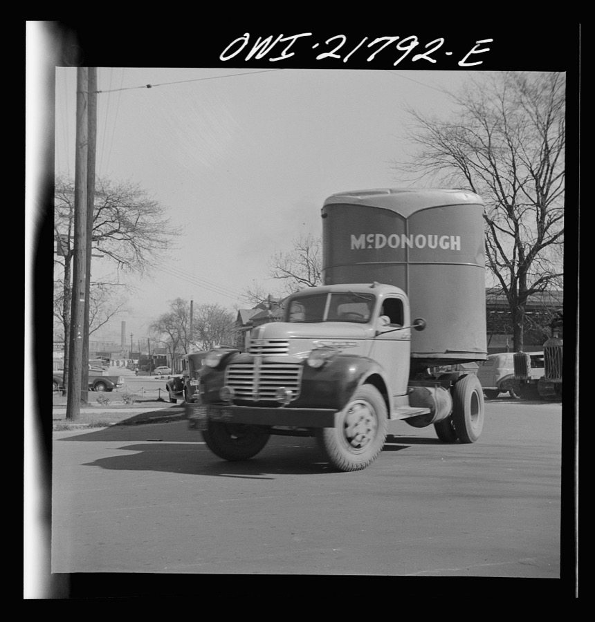
Vachon, John, 1943. Library of Congress

Rothstein, Arthur, 1937. Library of Congress
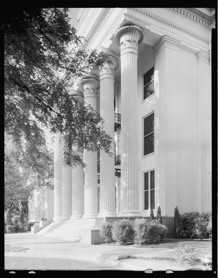
Johnston, Frances Benjamin, 1939. Library of Congress
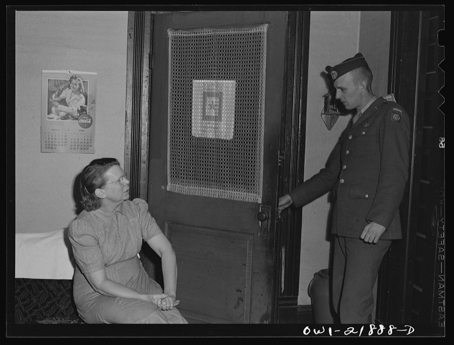
Vachon, John, 1943. Library of Congress
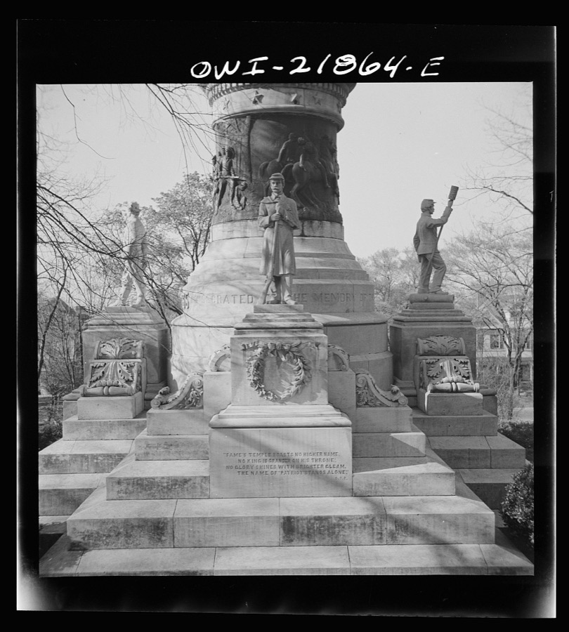
Vachon, John, 1943. Library of Congress
Every photograph of Montgomery County
Fires near this place
24 since 1995Regional context, not property-specific evidence. The federal wildfire occurrence database lists 24 fires within 5 miles of Montgomery between 1995 and 2018, burning about 148 acres in total. 1 started naturally. 3 were recorded as arson. Distance is straight-line from the map coordinates, so a fire counted here may appear on a neighbouring settlement's page as well.
| Reported cause | Fires |
|---|---|
| Debris and open burning | 11 |
| Missing data/not specified/undetermined | 4 |
| Arson/incendiarism | 3 |
| Misuse of fire by a minor | 2 |
| Power generation/transmission/distribution | 1 |
| Natural | 1 |
| Equipment and vehicle use | 1 |
| Railroad operations and maintenance | 1 |
The most recent of them, most recent first, with the day each was reported and the service that recorded it.
| Date | Cause | Size | Reported by | Name on the report |
|---|---|---|---|---|
| 23 September 2010 | Equipment and vehicle use | 15 acres | Alabama Forestry Commission | not named |
| 11 September 2002 | Debris and open burning | 4.0 acres | Alabama Forestry Commission | not named |
| 1 September 2011 | Debris and open burning | under an acre | Alabama Forestry Commission | 188 MONROE STREET, AL |
| 24 August 1995 | Debris and open burning | 5.5 acres | Alabama Forestry Commission | not named |
| 17 August 1995 | Debris and open burning | 3.5 acres | Alabama Forestry Commission | not named |
| 9 June 2011 | Natural | 3.0 acres | Alabama Forestry Commission | 1045 JACKSON FERRY ROAD , AL |
| 7 June 2000 | Railroad operations and maintenance | 2.0 acres | Alabama Forestry Commission | not named |
| 26 June 2011 | Power generation/transmission/distribution | 1.0 acres | Alabama Forestry Commission | BRENTWOOD, AL |
Settlements close enough to share some of these fires:
Mines and quarries near this place
10 of 13 shownRegional context, not property-specific evidence. The federal mineral resources record lists 13 workings within 5 miles of Montgomery: 12 producers, 1 past producer. 12 still produce. What was taken out: Sand and Gravel, Construction, Clay, Titanium, Metal, Zirconium, Kyanite, REE, Titanium, Metal, Zirconium, Kyanite. Distance is straight-line from the map coordinates, so a quarry counted here may appear on a neighbouring settlement's page as well.
| Where | Site | Commodity | Status | Recorded |
|---|---|---|---|---|
| Alabama River | Sand and Gravel, Construction, Titanium, Metal, Zirconium, Kyanite | Producer | Quartz | |
| Dixie Sand & Gravel - Maxwell Pit | Sand and Gravel, Construction, Titanium, Metal, Zirconium, Kyanite, REE | Producer | Quartz | |
| French Street Brick Plant | Fire Clay (Refractory) | Past Producer | ||
| Browder Pit | Clay | Producer | ||
| Excelsior Mine | Clay | Producer | ||
| Jenkins Brick Co., Inc. Pit | Clay | Producer | ||
| Cossada Ferry Pit | Sand and Gravel, Construction | Producer | ||
| Dozier Pit | Sand and Gravel, Construction | Producer | ||
| Montgomery River Plant & Quarry | Sand and Gravel, Construction | Producer | ||
| Old Alabama Pit | Sand and Gravel, Construction | Producer |
Storms near this place
60 of 134 shownRegional context, not property-specific evidence. The National Weather Service names Montgomery in 134 storm reports between 1994 and 2026: 64 thunderstorm wind, 36 hail, 14 flash flood, 10 lightning. The reports record 4 deaths and 50 injuries. Each account below is quoted exactly as the forecast office filed it, from the NOAA Storm Events Database, and each date opens the federal record of that event.
| When | Event | Place named | Harm | What the report says |
|---|---|---|---|---|
| March 1996 | Tornado (F2) | Montgomery | 2 killed, 17 hurt, $1,500,000 | no account filed |
| June 2002 | Lightning | Montgomery | 1 killed, 2 hurt | An 8-year-old girl, her mother, and another woman were struck by lightning on the east side of Montgomery near the intersection of Vaughn Road and Eastern Blvd. The victims had just left a restaurant according to newspaper reports and were about to get in their car when the lightning strike occurred. Rain was not occurring at the time. The 8-year-old went into cardiac arrest, but EMS people were able to resuscitate her and transport her to the hospital. The 44-year-old mother of the child was knocked unconscious and was also taken to a local hospital. The third person, a 33-year-old woman, was treated for minor injuries. |
| May 2009 | Flash Flood | Montgomery | 1 killed, $1,800,000 | The city of Montgomery experienced extensive flash flooding due to a period of very heavy rainfall. An estimated 10+ inches of rain fell in portions of Montgomery County in about a six hour time frame. The downtown area, including the capitol district, was hit especially hard. At least three feet of water flowed into the basement of the Statehouse building, and state legislators temporarily moved to backup chambers in the old Capitol. Numerous streets downtown were closed, and numerous cars became stranded in the high water. One 67 year old man drowned when his car was swept away by flood waters in Montgomery. |
| February 1996 | Thunderstorm Wind | Montgomery | 15 hurt, $500,000 | no account filed |
| June 1998 | Thunderstorm Wind | Montgomery | 5 hurt, $10,000 | no account filed |
| January 2001 | Tornado (F0) | Montgomery | 4 hurt, $450,000 | A tornado from a bow echo configuration first touched down just west of Greenwood Cemetery on Three Mile Branch in eastern Montgomery (city). The tornado was moving northeastward at approximately 50 mph and moved through the Forest Hills area downing trees and causing minor structural damage to some homes. The tornado crossed the Atlanta Highway and continued to down trees in the Johnstown area of eastern Montgomery. Much of the damage here occurred when trees fell onto structures. The tornado appeared to end on the south edge of Gunter Industrial Park. Several minor injuries were reported. |
| May 1996 | Thunderstorm Wind | Montgomery | 2 hurt, $25,000 | no account filed |
| January 2000 | Tornado (F0) | Montgomery | 1 hurt, $20,000 | A weak tornado briefly touched down just south of exit 167 on I-65. One motorists, traveling northbound, had his car spun around and overturned. The car was totaled and the driver sustained minor injuries. |
| July 1996 | Lightning | Montgomery | 1 hurt, $15,000 | no account filed |
| April 1997 | Thunderstorm Wind | Montgomery | 1 hurt, $9,000 | Trees were blown down and signs along I-65 were blown down. One child was injured when a tree fell on him. |
| June 2002 | Lightning | Montgomery | 1 hurt, $1,000 | A woman was struck by lightning while cooking on her electric range top. She sustained minor injuries. |
| June 2002 | Lightning | Montgomery | 1 hurt, $1,000 | A woman was apparently struck by lightning in her home on Amesberg Drive while cooking on an electric stove. |
| March 1996 | Tornado (F1) | Montgomery | $1,250,000 | no account filed |
| March 1996 | Thunderstorm Wind | Montgomery | $1,200,000 | no account filed |
| March 1996 | Tornado (F1) | Montgomery | $800,000 | no account filed |
| March 1996 | Tornado (F1) | Montgomery | $700,000 | no account filed |
| May 2008 | Thunderstorm Wind | Montgomery | $500,000 | The area of damage began around the Rosemont Estates area of Montgomery and extended about seven miles southeastward along US Highway 231. The most concentrated area of damage was near the Montgomery Mall, at the intersection of US-80 and US-231. In this area, wind speeds were estimated at near 100 mph. Damage included an automotive shop section within a small strip mall that was destroyed due to a collapsed wall, partially removed roofs from several units at an apartment complex, downed power poles, minor damage to an elementary school building, and several extensively damaged billboards. Elsewhere along the path, winds were estimated to be between 60 and 80 mph, and caused numerous trees to be snapped or uprooted, including at least 4 that fell onto homes. The area of damage was approximately 3 miles wide at its widest point. No injuries were reported. |
| December 1996 | Thunderstorm Wind | Montgomery | $200,000 | no account filed |
| January 2001 | Thunderstorm Wind | Montgomery | $150,000 | A second path of damage occurred slightly north of the tornado path. Damage occurred from the north side of Gunter Air Force Station along Congressman Dickinson Drive through the Eastern Boulevard/Congressman Dickinson Interchange and into a residential area of Madison Park. One mobile home was de-roofed and one other house suffered signficant roof damage in this area. Other damage was primarily in the form of downed trees and power lines and minor roof damage (shingles removed). This damage path was about 3 miles long and about 200 yards wide. This event was produced by a strong thunderstorm that exhibited a bowing characteristic which is frequently accompanied by weak tornadoes and strong straight-line wind. Wind gusts with the thunderstorms were measured at 48 mph at 9:15 AM at Dannelly Field and 61 mph at Maxwell Air Force base at 9:19 AM. |
| March 2001 | Tornado (F1) | Montgomery | $125,000 | The tornado began in the Woodmere area where a number of houses sustained roof damage primarily in the form of lost shingles, fences were downed, and small trees were uprooted. The tornado moved northeast and tracked through the Beauvoir Lake subdivision where one house under construction was flattened and another house was partially deroofed with serious damage to the upper level. From Beauvoir Lake subdivision the tornado downed trees and removed shingles from house roofs in the Halcyon area. The tornado crossed Interstate 85 just west of the Taylor Road exit snapping off numerous pine trees in the interstate median. The tornado apparently ended at Taylor Road on the north side of the interstate. The tornado was rated at F1 based on structural damage in the Beauvoir Lake area. Much of the damage along the track was in the F0 category. The tornado track was 2.2 miles in length and estimated to be about 100 yards wide at it's widest point. The tornado began at 6:29 PM and ended at 6:33 PM. No injuries or deaths were reported with this storm. |
| April 2003 | Hail | Montgomery | $100,000 | The storm continued moving east southeast and crossed northern Montgomery County. A swath of hail fell from northern Montgomery to near Mathews. Hail was reported up to baseball size along the path. A three story building along Interstate 85 received minor roof damage. A few trees were also blown down. |
| March 2001 | Lightning | Montgomery | $85,000 | Lightning struck a home on Plum Street during the early morning hours. The house caught fire and was completely destroyed. Two adults and three children were killed as a result of the fire. |
| June 2002 | Lightning | Montgomery | $60,000 | Lightning struck a building in Montgomery that housed four radio stations. Significant electric damage occurred, and the stations were off the air for several hours. No injuries were reported. |
| March 2006 | Thunderstorm Wind | Montgomery | $50,000 | Trees and tree limbs were downed across many areas of the city, with winds estimated at 60 mph. |
| March 1996 | Hail | Montgomery | $40,000 | no account filed |
| August 2002 | Thunderstorm Wind | Montgomery | $35,000 | Several trees and power lines were blown down in Montgomery. One pickup truck was destroyed by a falling tree. The roof of Harris Furniture Reproductions was torn off. One tree fell on a home and caused some damage. |
| April 2003 | Thunderstorm Wind | Montgomery | $35,000 | no account filed |
| June 2003 | Flash Flood | Montgomery | $30,000 | Several inches of rain in a short period of time caused flooding on the east side of Montgomery. Several roads were temporarily impassable and a few automobiles were stranded in the high water. |
| March 1996 | Thunderstorm Wind | Montgomery | $30,000 | no account filed |
| July 1999 | Flash Flood | Montgomery | $25,000 | Radar estimated that two to four inches of rain fell in just over one hour in northern Montgomery County. Numerous roads in the city of Montgomery were flooded and several homes in the Southlawn Subdivision were also flooded. |
| February 2000 | Hail | Montgomery | $25,000 | no account filed |
| July 1997 | Lightning | Montgomery | $25,000 | no account filed |
| July 1997 | Lightning | Montgomery | $25,000 | no account filed |
| August 2003 | Flash Flood | Montgomery | $22,000 | Very heavy rain in a short period of time caused flooding in and around Montgomery. Several roads were flooded and were temporarily impassable. The fire department pulled several stranded motorists to safety. A few homes were damaged by the flood water. |
| June 2009 | Thunderstorm Wind | Montgomery | $20,000 | A large metal sign was blown down onto a restaurant building, and the metal roofing was peeled off an office building, in the city of Montgomery. |
| August 2007 | Thunderstorm Wind | Montgomery | $20,000 | Three power poles and 7 trees were blown down, with one of the trees falling onto a house. |
| June 1996 | Thunderstorm Wind | Montgomery | $20,000 | no account filed |
| December 1996 | Thunderstorm Wind | Montgomery | $20,000 | no account filed |
| July 2005 | Flash Flood | Montgomery | $18,000 | Heavy rains from Tropical Storm Cindy produced flooding in Montgomery. Several roadways across the city were flooded and were temporarily impassable. At least one business sustained water damage. |
| July 1995 | Thunderstorm Wind | Montgomery | $18,000 | A tree was blown down by thunderstorm wind and fell on a mobile home. |
| May 2005 | Thunderstorm Wind | Montgomery | $16,000 | Numerous trees and power lines were knocked down around the Montgomery metropolitan area. |
| July 2002 | Lightning | Montgomery | $15,000 | Thunderstorms produced frequent lightning across the city of Montgomery. Lightning strikes caused power outages and several power lines were knocked down. |
| April 2000 | Hail | Montgomery | $15,000 | One to two inch diameter hail was reported in and around the city of Montgomery. |
| May 1999 | Lightning | Montgomery | $15,000 | Lightning struck the historic Union Station in downtown Montgomery and caused structural damage to the building. Bricks that fell from the building damaged two automobiles underneath, some air conditioning units, and broke a few windows. No reports of injuries were received. |
| February 2000 | Thunderstorm Wind | Montgomery | $15,000 | no account filed |
| March 1996 | Hail | Montgomery | $15,000 | no account filed |
| March 1999 | Thunderstorm Wind | Montgomery | $12,000 | Several trees were knocked down, and a tin roof was blown off one house in Montgomery. |
| January 1996 | Thunderstorm Wind | Montgomery | $12,000 | no account filed |
| April 2005 | Hail | Montgomery | $11,000 | Golf ball size hail was observed from the Montgomery metropolitan area eastward to the county line nearMathews. |
| July 2004 | Thunderstorm Wind | Montgomery | $10,000 | Several trees and power lines were blown down in an around Montgomery. One home and one outbuildingwere damaged by fallen trees. |
| June 2002 | Thunderstorm Wind | Montgomery | $10,000 | Several trees and power lines were blown down in and around the city of Montgomery. Lightning also caused some damage by striking several trees and knocking down power lines. The lightning caused over 5000 customers to lose power temporarily. Some of the falling trees landed on automobiles. No injuries were reported. |
| July 1998 | Thunderstorm Wind | Montgomery | $10,000 | Trees and power lines were down in Montgomery. One tree fell on a home and damaged part of the roof. Also 13,000 residents were without power. |
| May 1998 | Hail | Montgomery | $10,000 | Golf ball size hail was reported east of Montgomery. |
| February 1997 | Thunderstorm Wind | Montgomery | $10,000 | no account filed |
| May 1996 | Thunderstorm Wind | Montgomery | $10,000 | no account filed |
| August 1995 | Thunderstorm Wind | Montgomery | $8,000 | Trees were blown down and numerous roofs damaged along Selma Highway in the area of the Montgomery Airport. Several trees were reported down at Davenport in the southwest part of Montgomery County. |
| March 1997 | Thunderstorm Wind | Montgomery | $7,000 | no account filed |
| January 1997 | Thunderstorm Wind | Montgomery | $6,000 | no account filed |
| June 1994 | Thunderstorm Wind | Montgomery | $5,000 | Golf ball-size hail was reported in eastern Montgomery. Two power poles were downed and bleachers at a school were moved by thunderstorm wind. |
| March 1997 | Thunderstorm Wind | Montgomery | $5,000 | no account filed |
Newspapers printed here
165,995 digitised pages2 papers published in this town, digitised by the Library of Congress and free to read: 17,649 issues, 165,995 pages. Every page is searchable, so a name or a street can be looked for directly in what the town printed about itself at the time.
| Newspaper | Published |
|---|---|
| The Montgomery Enterprise | 1898 to 1??? |
| The Montgomery Advertiser | 1885 to 1982 |
What the paper printed
31,943 wordsFront pages of the local paper, read from the Library of Congress scans: 6 issues spread across its run from 1900 to 1927, 31,943 words in total. Each is reproduced on its own page, exactly as the recogniser returned it.
These pages read less well than anything else here, and the number is worth stating: about three words in four come through cleanly, against nine in ten for the building records. An 1896 broadsheet sets eight-point type in seven columns on microfilm, which is the hardest thing in this archive to read by machine. We tested our own recognisers against the Library's and they were not better, so the Library's text is what appears, with the wholly unreadable columns removed. Read it as a guide to what the paper covered, and follow the link to the scan before quoting anything.
| Issue | Paper | Length |
|---|---|---|
| 1900-01-26 | The Montgomery Enterprise | 2,086 words |
| 1901-06-18 | The Montgomery Advertiser | 5,974 words |
| 1901-08-06 | The Montgomery Advertiser | 4,861 words |
| 1901-09-25 | The Montgomery Advertiser | 8,604 words |
| 1901-11-13 | The Montgomery Advertiser | 5,428 words |
| 1927-12-31 | The Montgomery Advertiser | 4,990 words |
Nearest settlements
The eight closest, with where each one stands in the county. Distances are straight-line, computed from the Geographic Names Information System coordinates.
| Map | Place | Distance | Sheets |
|---|---|---|---|
| Oak Park | 1.1 miles | 21 | |
| Cloverdale | 1.2 miles | 21 | |
| Washington Park | 1.3 miles | 21 | |
| Hillwood West | 1.4 miles | 21 | |
| Clisby Park | 1.4 miles | 20 | |
| Hillcrest | 1.5 miles | 20 | |
| Capitol Heights | 1.7 miles | 20 | |
| Western Hills | 1.7 miles | 21 |
Elsewhere
Matched on this settlement's Geographic Names Information System number rather than its name, so it cannot be a different place of the same name in another state.
| Wikipedia article on Montgomery | An encyclopaedic summary. Its text is share-alike, so it is linked here rather than copied. |
| Wikidata item Q29364 | The structured record the population and elevation above come from. Public domain (CC0). |
Provenance
This settlement is recorded in the Geographic Names Information System as feature 165344. The sheet list is computed by point-in-boundary test against the United States Geological Survey's historical topographic inventory. Both are works of the United States government and carry no copyright under 17 U.S.C. 105.
Wildfire. Short, Karen C. 2022. Spatial wildfire occurrence data for the United States, 1992-2020 [FPA_FOD_20221014]. 6th Edition. Fort Collins, CO: Forest Service Research Data Archive. https://doi.org/10.2737/RDS-2013-0009.6 Collected with United States Government funding and usable without additional permissions or fees.
Mines and quarries. USGS Mineral Resources Data System (MRDS) https://mrdata.usgs.gov/mrds/ A work of the United States government, no copyright under 17 U.S.C. 105.
Storms. NOAA National Centers for Environmental Information, Storm Events Database https://www.ncei.noaa.gov/stormevents/ A work of the United States government, no copyright under 17 U.S.C. 105. Narratives are quoted verbatim from the National Weather Service report and are not edited or summarised.