Block
From the record
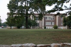
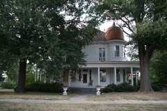
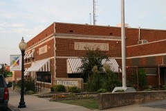
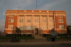
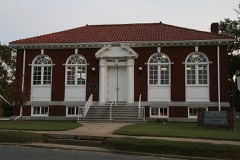
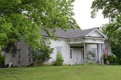
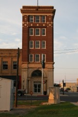
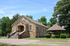
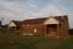
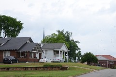
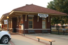
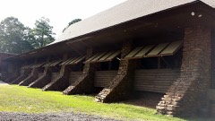
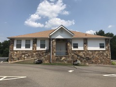
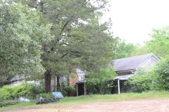
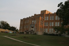
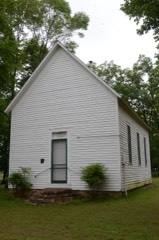
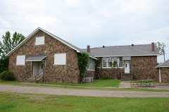
50 National Register listings published here.
Sources: the National Register database, National Park Service
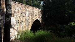
75 topographic sheets cover 58 settlements here, and 50 properties are on the National Register of Historic Places.
50 National Register listings published here.
Sources: the National Register database, National Park Service
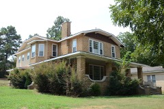
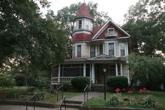
Every property in this county listed on the National Register of Historic Places, with the year it was listed and the federal nomination document.
Every wildfire the federal occurrence database records inside this county: 693 of them, burning about 11,523 acres. 24 started naturally and 274 were recorded as arson. Each settlement page carries the fires within five miles of it.
| Reported cause | Fires |
|---|---|
| Arson/incendiarism | 274 |
| Missing data/not specified/undetermined | 186 |
| Debris and open burning | 172 |
| Equipment and vehicle use | 25 |
| Natural | 24 |
| Recreation and ceremony | 6 |
| Smoking | 3 |
| Misuse of fire by a minor | 2 |
| Railroad operations and maintenance | 1 |
The five largest, by the area the report gives. One of them was set deliberately.
| Date | Cause | Size | Reported by | Name on the report |
|---|---|---|---|---|
| 30 August 2000 | Arson/incendiarism | 1,401 acres | Arkansas Forestry Commission | not named |
| 24 September 1999 | Equipment and vehicle use | 224 acres | Arkansas Forestry Commission | not named |
| 29 February 2020 | Missing data/not specified/undetermined | 220 acres | Arkansas Forestry Commission | not named |
| 19 March 2019 | Missing data/not specified/undetermined | 200 acres | Arkansas Forestry Commission | not named |
| 17 February 2017 | Missing data/not specified/undetermined | 167 acres | Arkansas Forestry Commission | not named |
| 19 March 2010 | Debris and open burning | 158 acres | Arkansas Forestry Commission | not named |
| 8 July 2012 | Natural | 148 acres | Arkansas Forestry Commission | not named |
| 10 December 2020 | Missing data/not specified/undetermined | 137 acres | Arkansas Forestry Commission | not named |
Every settlement page carries the fires within five miles of it - see the settlement index below.
The NOAA Storm Events Database holds 550 reports for this county, causing 8 deaths, 54 injuries and about $43,192,000 in recorded property damage. Each settlement page carries the reports that name it.
| Kind of event | Reports |
|---|---|
| Thunderstorm Wind | 223 |
| Hail | 189 |
| Tornado | 42 |
| Flash Flood | 33 |
| Flood | 29 |
| Heavy Rain | 16 |
| Lightning | 12 |
| Funnel Cloud | 5 |
| Heavy Snow | 1 |
The most serious of them, by death, then injury, then recorded damage. The accounts are quoted exactly as the forecast office filed them.
| When | Event | Place named | Harm | What the report says |
|---|---|---|---|---|
| May 2008 | Tornado (EF2) | Birdtown | 2 killed, 6 hurt, $5,000,000 | Fifteen homes, three chicken houses, kennels, at least six vehicles, and at least six outbuildings were destroyed. There was major damage to nine houses, at least four chicken houses, five outbuildings, vehicles, and farm equipment. Minor damage occurred to multiple houses and roofs, vehicles, a cemetery, community building, ball field, and multiple outbuildings and barns. A man and his teen-aged son were killed when their mobile home was destroyed on M&M Rd. The tornado exited Conway County, east of Center Ridge, and entered Van Buren County, west-southwest of Damascus. |
| February 2008 | Tornado (EF3) | Hattieville | 2 killed, 5 hurt, $14,500,000 | The tornado moved out of Pope County, northeast of Atkins, into Conway County, west of Hattieville. According to the Federal Emergency Management Agency, 56 residences (both houses and mobile homes) suffered damage. Altogether, 32 residences were destroyed, 6 had major damage, and 18 had minor damage. Several chicken houses were destroyed, and approximately 80,000 chickens were killed. Numerous trees, power lines, and power poles were blown down. An elderly couple was killed about 3.2 miles south-southwest of Cleveland when their mobile home was destroyed. The tornado then moved into Van Buren County, south-southeast of Beverage Town. |
| May 1960 | Tornado (F3) | not stated | 1 killed, 24 hurt, $2,500,000 | no account filed |
| November 2005 | Tornado (F3) | Morrilton | 1 killed, 8 hurt | A strong tornado was spawned in southern Conway County about 2.5 miles southeast of Morrilton. The tornado tracked northeast across Interstate 40 and overturned several vehicles. In one of the vehicles, a person was killed and seven people were injured roughly 1 mile west of Plumerville. In the same area, a lumber company was badly damaged. The tornado also destroyed a large barn that contained several bass boats and vehicles. Homes and businesses were heavily damaged or destroyed. A fire station, numerous barns, outbuildings and chicken houses were damaged. Mobile homes were overturned. There were hundreds of trees, power lines and power poles downed. The tornado dissipated 1 mile east of Springfield. |
| February 1956 | Tornado (F3) | not stated | 1 killed, 3 hurt, $250,000 | no account filed |
| May 1982 | Tornado (F2) | not stated | 1 killed, $250,000 | no account filed |
| May 1971 | Tornado (F3) | not stated | 4 hurt, $25,000 | no account filed |
| January 2008 | Tornado (EF2) | Jerusalem | 1 hurt, $1,750,000 | The tornado from Pope County moved into northwestern Conway County. According to the Conway County Office of Emergency Management, three homes were destroyed, and 12 others suffered damage ranging from light to heavy. One woman was injured in a mobile home. Ten other structures, such as chicken houses and barns, were destroyed; 13 such structures were damaged. A church, which had stood for more than 100 years, was destroyed and an adjacent cemetery was damaged. Three natural gas well sites were damaged but there was no release of gas. The tornado moved into the Ozark National Forest, where hundreds of trees were blown down. Arkansas Governor Mike Beebe declared Conway County a state disaster area. The tornado continued into Van Buren County. |
| March 1997 | Tornado (F2) | Jerusalem | 1 hurt, $500,000 | no account filed |
| March 2012 | Thunderstorm Wind | Lewisburg | 1 hurt, $400,000 | A severe thunderstorm moved through the east side of Morrilton. The roof of a packaging company was badly damaged. At the Conway County Fairgrounds, the concession stand was destroyed, one end of an exhibition building was blown in, and the restroom building and some of the sports fields were damaged. There was some damage at the Morrilton High School football field. Numerous trees and power lines were blown down. About 50 homes suffered damage, primarily from shingles being blown off. However, several homes were damaged more severely when trees fell into them. One person was injured in a house when a tree fell into it. |
| August 2011 | Lightning | Morrilton | 1 hurt | A man was injured by lightning on the campus of the University of Arkansas Community College at Morrilton. His injuries were not believed to be serious. |
| November 1988 | Tornado (F3) | not stated | $2,500,000 | no account filed |
| April 2010 | Tornado (EF2) | Lick Mtn | $1,850,000 | A Red Cross survey found the following damage from this EF2 tornado: 12 houses and 2 mobile homes destroyed, 8 houses with major damage, 5 houses and 2 mobile homes with minor damage, and 8 houses affected. Other damage included: roof damage to two churches, a silo thrown against one church, a number of barns and outbuildings damaged, and numerous trees and power lines blown down. The tornado exited Conway County east of Austin and entered Van Buren County north-northwest of Whipple. |
| June 2009 | Thunderstorm Wind | Old Hickory | $1,750,000 | Approximately 30 homes were damaged, along with a dozen rural farm buildings. Three chicken houses were destroyed and more than 100,000 chickens were killed. Hundreds of trees were blown down, as were many power lines. |
| May 2011 | Flood | Jerusalem | $1,500,000 | Parts of Arkansas Highways 95, 113, 124, and 247 were closed due to flooding. |
| June 2019 | Flood | Point Remove | $1,000,000 | Heavy rain and upstream reservoir releases led to flooding on the Arkansas River at Morrilton. The record crest was 43.03 feet on 6/04/19. |
| May 2019 | Flood | Point Remove | $1,000,000 | River flooding began on the Arkansas River at Morrilton May 24 and continued through the end of the month. The river had a record crest in June. |
| April 2008 | Flash Flood | Morrilton | $1,000,000 | Flash flooding damaged downtown buildings in Morrilton. Water reached about 5 feet at a furniture store's loading dock and warehouse at the bottom of a hill on Harding Street. Nearly a foot of water entered the rear of the building. Numerous county streets were flooded. A Dumpster was carried more than a block from its original location by moving water. |
| April 2011 | Flood | Jerusalem | $500,000 | Widespread areal flooding occurred. |
| June 2008 | Thunderstorm Wind | Center Ridge | $500,000 | At least five houses had roof damage and at least fifteen homes had some form of minor damage. Much of a chicken house that was under construction was blown down. This particular chicken house was being rebuilt after having been blown down by a tornado on May 2nd. Two additional chicken houses were missing roofs. Trees and power lines were down, with one tree through a house. Arkansas Highway 9 was closed for a time due to a gas leak. The leak was caused when part of a pump house blew down onto a gas pipeline. |
| November 1993 | Thunderstorm Wind | Plumerville | $500,000 | Thunderstorm winds destroyed a frame house and two mobile homes. |
| February 2009 | Thunderstorm Wind | Birdtown | $300,000 | Several residences were damaged with most damage occurring to roofs. A sawmill was destroyed. A church had minor damage. Two barns were destroyed. |
| October 2009 | Flash Flood | Jerusalem | $300,000 | Arkansas Highway 92 near the Hill Creek community was flooded. Many county roads suffered damage. |
| May 2009 | Flash Flood | Center Ridge | $250,000 | Flooding occurred on Arkansas Highway 124 in Jerusalem. A family was trapped inside a mobile home due to high water. Several streets in Morrilton were closed due to flooding. A fishing pier on Lake Overcup was partially submerged. |
| November 1988 | Tornado (F1) | not stated | $250,000 | no account filed |
| April 1980 | Tornado (F1) | not stated | $250,000 | no account filed |
| April 1979 | Tornado (F2) | not stated | $250,000 | no account filed |
| July 1972 | Tornado (F1) | not stated | $250,000 | no account filed |
| June 2023 | Lightning | Plumerville | $200,000 | A house in Plummerville was struck by lightning and burned to the ground. |
| June 2009 | Tornado (EF1) | Possum Trot | $200,000 | Trees were blown down or snapped off, shingle damage occurred to several houses, and power lines were blown down. |
| August 2009 | Lightning | Morrilton | $175,000 | Lightning struck a home on Woody Drive causing the home to catch on fire. |
| September 2008 | Flash Flood | Menifee | $150,000 | Flooding occurred across the county. Arkansas Highways 9, 92 and 95 had water over them. Arkansas Highway 124 north of Arkansas Highway 95, Friar Bridge Road, Union Chapel Road, Bostain Loop, Turkey Pond Loop, Bald Knob Road, Solgohachia Road, and Shaw Bridge Road were all closed. Arkansas Highway 287 two miles south of Arkansas Highway 95 was closed due to high water. |
| May 1998 | Lightning | Hattieville | $150,000 | Lightning struck several chicken houses near Hattieville, resulting in a fire. The fire destroyed one chicken house and damaged three others. |
| September 2020 | Tornado (EF1) | Mt Olive | $100,000 | This tornado started along Carney Valley Road northeast of|Plumerville and moved northeast to near the intersection of Mt.|Olive and Chapel roads before lifting shortly thereafter. Damage|consisted of mainly tree damage, along with damage to|outbuildings and minor damage to a couple homes.||Trees and power lines were blown down and trees were down on several roofs. Several outbuildings were damaged or destroyed. |
| April 2010 | Tornado (EF1) | Gobblers Pt | $100,000 | An EF1 tornado blew down hundreds of trees and took the roof off a cabin. Three large culverts, 7 feet in diameter and nearly 30 feet long, alongside the road awaiting installation were picked up and tossed by the tornado. Two culverts went 80 yards in one direction, while the other went 300 yards in a different direction. The tornado exited Conway County north of Cleveland and entered Van Buren County south-southeast of Liberty Springs. |
| June 2009 | Thunderstorm Wind | Morrilton | $100,000 | A part of the roof was blown off a building at the University of Arkansas Community College. Trees and power lines were down across the area. |
| June 2008 | Thunderstorm Wind | Morrilton | $100,000 | Tree limbs were broken and trees were uprooted. Some streets in Morrilton were blocked by fallen trees. Two houses were damaged when trees fell on their roofs. |
| May 2019 | Thunderstorm Wind | Blackwell | $90,000 | Trees were down county-wide and about 10 homes were damaged. |
| May 2008 | Lightning | Petit Jean State Park | $90,000 | Lightning struck the Arkansas Sky Observatory on Petit Jean Mountain. All the electronics in two telescopes were destroyed, as were some cameras, computers, and other electronic equipment. |
| April 2010 | Lightning | Lewisburg | $75,000 | Lightning struck a house, starting a fire. |
| December 2009 | Flood | Menifee | $75,000 | Heavy rain caused some low-lying areas to be flooded. Some roads were closed temporarily. |
| June 2009 | Thunderstorm Wind | Petit Jean State Park | $75,000 | Trees were down from Petit Jean Mountain to St. Vincent. |
| June 2009 | Thunderstorm Wind | Center Ridge | $75,000 | A roof was blown off a house, a barn was damaged, and trees and power lines were blown down. |
| September 2009 | Flash Flood | Morrilton | $75,000 | Approximately 20 county roads were closed due to high water. Fryer Bridge Road and Shaw Bridge Road were closed due to flooding. |
| March 2008 | Flash Flood | Lewisburg | $75,000 | Water was over the streets in Morrilton. Ditches along Harding Street, St. Joseph Street, and U.S. Highway 64 were at capacity. Arkansas Highway 95 at Overcup was blocked due to flooding. One home in Morrilton received water damage. Chapel Road and Caney Valley Road were under water. |
| June 2009 | Thunderstorm Wind | Mallet Town | $60,000 | Trees were down and homes were damaged on Mallettown Road. |
| June 2008 | Thunderstorm Wind | Catholic Point | $60,000 | There was heavy damage to the roofs of the rectory and youth building at the Catholic church. There was minor damage to a pavilion, and trees were blown down in the church cemetery. The same church property had been damaged by a tornado on May 2nd. |
| April 2020 | Thunderstorm Wind | Morrilton | $50,000 | Multiple gas pumps were reported with wind damage. |
| April 2015 | Tornado (EF1) | Overcup | $50,000 | The tornado touched down on the east side of Arkansas State Hwy 9 at Overcup (Conway County). Damage mainly consisted of snapped and blown down trees. There was also minor damage to outbuildings and chicken houses. |
| July 2014 | Thunderstorm Wind | Morrilton | $50,000 | Trees and power lines were blown down. Awnings were blown off some downtown businesses. |
| February 2013 | Thunderstorm Wind | Morrilton | $50,000 | Trees and power lines were blown down. About a third of Morrilton lost power. |
| April 2010 | Thunderstorm Wind | Oppelo | $50,000 | Two irrigation pivots were overturned between Oppelo and the Arkansas River. |
| July 2010 | Thunderstorm Wind | Morrilton | $50,000 | A large tree fell, crushing a pickup truck, and causing damage to a second vehicle and the roof of a house. |
| June 2009 | Thunderstorm Wind | Ada | $50,000 | Trees were blown down, a few of which landed on houses. At the Ada Valley cemetery, some of the falling trees damaged headstones. Power lines were blown down. |
| October 2009 | Flood | Springfield | $50,000 | Three vehicles were swept off the road, necessitating swift water rescues. Six adults and two children were rescued. |
| June 2008 | Thunderstorm Wind | Oppelo | $50,000 | Trees and limbs were down. Some homes were damaged in the Oppelo area. |
| January 2007 | Flash Flood | Mallet Town | $50,000 | Heavy rains flooded Springfield Road. Two people were rescued from a stalled vehicle. |
| April 1994 | Thunderstorm Wind | Center Ridge | $50,000 | Thunderstorm winds blew the roofs off several barns and utility buildings. |
| June 1994 | Thunderstorm Wind | Solgohachia | $50,000 | Thunderstorm winds downed trees and power lines. |
| June 1994 | Thunderstorm Wind | Morrilton | $50,000 | Some trees and power lines were blown down. |
The Survey's mineral resources record lists 23 workings inside this county. 3 still produce and 20 are closed or unrecorded. Each settlement page carries the workings within five miles of it.
| Commodity | Workings |
|---|---|
| Sand and Gravel, Construction | 13 |
| Clay | 4 |
| Stone, Crushed/Broken | 3 |
| Stone | 3 |
The least common of them first, because a county's hundredth gravel pit says nothing its first ten did not.
| Where | Site | Commodity | Status | Recorded |
|---|---|---|---|---|
| Parks Quarry | Stone, Crushed/Broken | Past Producer | ||
| Sardis Quarry | Stone, Crushed/Broken | Producer | ||
| Stell Pit & Plant | Stone, Crushed/Broken | Producer | ||
| Unk | Stone | Past Producer | ||
| Unk | Stone | Past Producer | ||
| Unk | Stone | Past Producer | ||
| Unk | Clay | Past Producer | ||
| Unk | Clay | Past Producer | ||
| Unk | Clay | Past Producer | ||
| Unk | Clay | Producer | ||
| Conway County Quarry | Sand and Gravel, Construction | Past Producer | ||
| Unk | Sand and Gravel, Construction | Past Producer | ||
| Unk | Sand and Gravel, Construction | Past Producer | ||
| Unk | Sand and Gravel, Construction | Past Producer | ||
| Unk | Sand and Gravel, Construction | Past Producer | ||
| Unk | Sand and Gravel, Construction | Past Producer | ||
| Unk | Sand and Gravel, Construction | Past Producer | ||
| Unk | Sand and Gravel, Construction | Past Producer | ||
| Unk | Sand and Gravel, Construction | Past Producer | ||
| Unk | Sand and Gravel, Construction | Past Producer | ||
| Unk | Sand and Gravel, Construction | Past Producer | ||
| Unk | Sand and Gravel, Construction | Past Producer | ||
| Unk | Sand and Gravel, Construction | Past Producer |
Named settlements recorded in the Geographic Names Information System, each with the topographic sheets covering it. Villages, hamlets and abandoned places alike. Each is shown with the nearest named watercourse or landform and the survey quadrangle it falls on.
Austin township · 72031 · Near Woolverton Mountain · Formosa quadrangle
16 sheets, 1892 to 1992
Petit Jean township · 72025 · Near Bryant Cove · Casa quadrangle
18 sheets, 1888 to 1992
Catholic Point township · 72027 · Near Cole Mountain · Springfield quadrangle
16 sheets, 1892 to 1992
Howard township · 72127 · On Gap Creek · Menifee quadrangle
17 sheets, 1892 to 1992
No longer a settlement
Bird township · 72157 · On Stratton Creek · Solgohachia quadrangle
17 sheets, 1892 to 1992
Welborn township · 72110 · Near Burrow Mountain · Morrilton East quadrangle
17 sheets, 1892 to 1992
White Eagle township · 72025 · Adona quadrangle
18 sheets, 1889 to 1992
No longer a settlement
Catholic Point township · 72027 · On Buck Branch · Formosa quadrangle
16 sheets, 1892 to 1992
Griffin township · 72080 · On Rock Creek · Jerusalem quadrangle
18 sheets, 1892 to 1992
Lick Mountain township · 72027 · Near Lost Mountain · Springfield quadrangle
16 sheets, 1892 to 1992
Union township · 72157 · Near Berry Hollow · Springfield quadrangle
16 sheets, 1892 to 1992
Cedar Falls township · 72110 · By Stouts Point · Morrilton West quadrangle
18 sheets, 1889 to 1992
No longer a settlement
Welborn township · 72110 · Near Burrow Mountain · Morrilton East quadrangle
17 sheets, 1892 to 1992
Lick Mountain township · 72027 · Near Dutton Mountain · Solgohachia quadrangle
17 sheets, 1892 to 1992
St. Vincent township · 72063 · On Hall Branch · Solgohachia quadrangle
17 sheets, 1892 to 1992
Lick Mountain township · 72030 · Near Money Mountain · Cleveland quadrangle
16 sheets, 1892 to 1992
McLaren township · 72063 · On Miller Branch · Solgohachia quadrangle
17 sheets, 1892 to 1992
Bird township · 72027 · Near Dutton Mountain · Solgohachia quadrangle
17 sheets, 1892 to 1992
Welborn township · 72110 · Near Burrow Mountain · Morrilton East quadrangle
17 sheets, 1892 to 1992
Old Hickory township · 72063 · Near Pigeon Roost Mountain · Hattieville quadrangle
16 sheets, 1892 to 1992
Washington township · 72110 · On Cooks Branch · Morrilton East quadrangle
17 sheets, 1892 to 1992
Lick Mountain township · 72027 · Near Lost Mountain · Formosa quadrangle
16 sheets, 1892 to 1992
Welborn township · 72110 · On Sandtown Bottoms · Houston quadrangle
17 sheets, 1892 to 1992
No longer a settlement
Washington township · 72157 · Near Jenkins Mountain · Solgohachia quadrangle
17 sheets, 1892 to 1992
Welborn township · 72110 · Near Burrow Mountain · Morrilton West quadrangle
18 sheets, 1889 to 1992
Union township · 72157 · Near Buck Ridge · Springfield quadrangle
16 sheets, 1892 to 1992
Lick Mountain township · 72027 · Near Phillips Mountain · Solgohachia quadrangle
17 sheets, 1892 to 1992
St. Vincent township · 72063 · Near Bull Mountain · Solgohachia quadrangle
17 sheets, 1892 to 1992
Austin township · 72031 · On Woolverton Mountain · Formosa quadrangle
16 sheets, 1892 to 1992
No longer a settlement
The vanished settlements of Conway County: the places named above that are no longer on the map.