Block
From the record
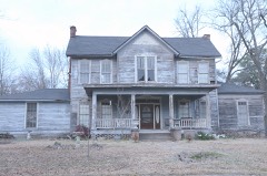
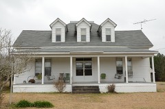
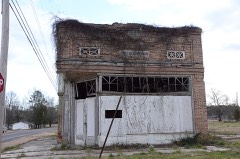
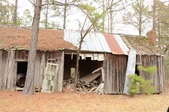
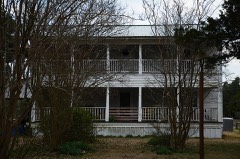
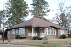
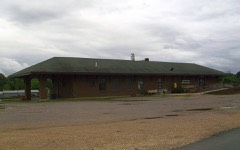
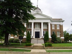
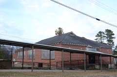
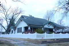
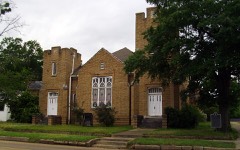
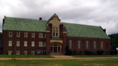
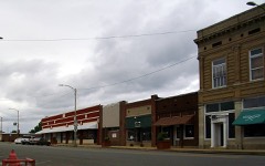
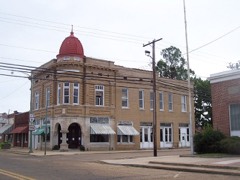
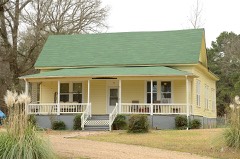
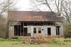
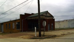
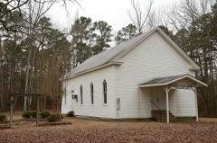
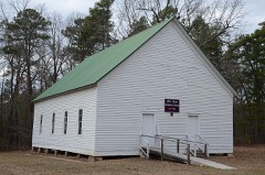
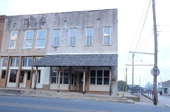
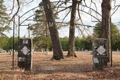
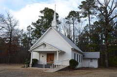
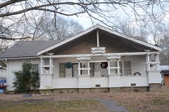
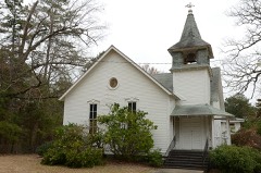
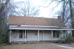
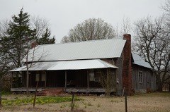
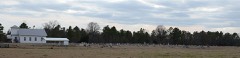
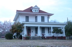
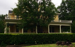
41 National Register listings published here.
Sources: the National Register database, National Park Service
56 topographic sheets cover 34 settlements here, and 41 properties are on the National Register of Historic Places.
41 National Register listings published here.
Sources: the National Register database, National Park Service
Every property in this county listed on the National Register of Historic Places, with the year it was listed and the federal nomination document.
Every wildfire the federal occurrence database records inside this county: 498 of them, burning about 5,610 acres. 58 started naturally and 134 were recorded as arson. Each settlement page carries the fires within five miles of it.
| Reported cause | Fires |
|---|---|
| Arson/incendiarism | 134 |
| Missing data/not specified/undetermined | 129 |
| Debris and open burning | 126 |
| Natural | 58 |
| Equipment and vehicle use | 40 |
| Misuse of fire by a minor | 3 |
| Smoking | 3 |
| Recreation and ceremony | 3 |
| Railroad operations and maintenance | 2 |
The five largest, by the area the report gives. One of them was set deliberately.
| Date | Cause | Size | Reported by | Name on the report |
|---|---|---|---|---|
| 5 September 2011 | Missing data/not specified/undetermined | 282 acres | Arkansas Forestry Commission | SPARKMAN |
| 23 January 2014 | Arson/incendiarism | 210 acres | Arkansas Forestry Commission | DAL3329277 |
| 23 March 2017 | Missing data/not specified/undetermined | 200 acres | Arkansas Forestry Commission | not named |
| 22 April 2005 | Natural | 153 acres | Arkansas Forestry Commission | DALLAS 109 |
| 4 July 2012 | Missing data/not specified/undetermined | 120 acres | Arkansas Forestry Commission | DALLAS 330 |
| 8 August 2011 | Natural | 108 acres | Arkansas Forestry Commission | SPARKMAN |
| 7 August 2011 | Natural | 99 acres | Arkansas Forestry Commission | not named |
| 17 December 2019 | Missing data/not specified/undetermined | 94 acres | Arkansas Forestry Commission | not named |
Every settlement page carries the fires within five miles of it - see the settlement index below.
The NOAA Storm Events Database holds 323 reports for this county, causing 1 death, 10 injuries and about $10,310,530 in recorded property damage. Each settlement page carries the reports that name it.
| Kind of event | Reports |
|---|---|
| Thunderstorm Wind | 180 |
| Hail | 74 |
| Tornado | 28 |
| Flash Flood | 28 |
| Heavy Rain | 5 |
| Flood | 5 |
| Lightning | 2 |
| Funnel Cloud | 1 |
The most serious of them, by death, then injury, then recorded damage. The accounts are quoted exactly as the forecast office filed them.
| When | Event | Place named | Harm | What the report says |
|---|---|---|---|---|
| March 1990 | Tornado (F2) | not stated | 1 killed, 6 hurt, $250,000 | no account filed |
| May 2000 | Thunderstorm Wind | Fordyce | 2 hurt | no account filed |
| October 2008 | Flash Flood | Round Hill | 1 hurt, $200,000 | Rainfall amounts, estimated at 6 to 9 inches, caused flash flooding along Arkansas Highway 229. Three vehicles drove into the high water. One of the vehicles washed off the highway at Grice Creek, west of Ivan, and became stuck in a hole. Its driver was able to get out safely. The other two vehicles were washed off the highway south of Carthage and became lodged in trees at the edge of the woods. A woman and her granddaughter were in one car, and another woman was in the second car. These three people had to be rescued by a swift-water rescue team. The woman who was driving by herself had to be hospitalized, apparently due to hypothermia and shock. A bridge was washed out on Dallas County 113 in the Eaglette Community, and another bridge was washed out on Dallas County 326 between Willow and Round Hill. Water from Moro Creek flooded U.S. Highway 167 north of Ivan, closing the highway. |
| July 1989 | Thunderstorm Wind | not stated | 1 hurt | no account filed |
| January 2012 | Tornado (EF2) | Beech Grove | $4,000,000 | This tornado exited Calhoun County north-northwest of Thornton and entered Dallas County west-southwest of Beech Grove. Soon after entering the county, the tornado increased to EF2 intensity. The clubhouse at the Fordyce Country Club was badly damaged and the bathhouse was blown into the swimming pool. The tornado then knocked down two large, steel power transmission towers, causing the transmission lines to fall across Arkansas 273, where a motorist ran into them. Next, the tornado tracked through the northern side of Fordyce, where the damage was the most extensive. A damage survey by the American Red Cross indicated 11 single family dwellings (including 3 mobile homes) were destroyed, 6 had major damage, and 5 had minor damage. In addition to the structural damage, hundreds of trees and many power lines were blown down. The tornado exited Dallas County north of the Fordyce airport and entered Cleveland County west-northwest of Kingsland. |
| December 2009 | Flood | Round Hill | $1,500,000 | Widespread areal flooding occurred in Dallas County. Arkansas Highway 8 was closed between Princeton and Dalark. Arkansas Highway 48 was closed between Farindale and Carthage, and Arkansas Highway 229 was closed near Carthage. Arkansas Highway 273 was also closed. A bridge was washed out on Dallas County 302 at Wave. Many roads around Sparkman were heavily damaged. Many other county roads had washouts around culverts. |
| May 2011 | Flood | Carthage | $750,000 | no account filed |
| September 2008 | Flash Flood | Fordyce Muni Arpt | $550,000 | Several roads were blocked due to flooding. Arkansas Highway 7 near section 5A was closed due to high water. County Road 101 had a bridge washed out. Also, County Road 201 suffered damage. |
| October 2009 | Flash Flood | Round Hill | $500,000 | Arkansas Highway 9 was closed west of Princeton, as was Arkansas Highway 48 between Carthage and Tulip. Arkansas Highway 8 was flooded west of Fordyce. Numerous county roads were flooded. Quite a few roads and culverts were washed out. Some roads were also impassable around Willow, Round Hill, and Pine Grove. The worst of the damage was in the western half of the county, according to the county judge. The Fordyce schools were closed on October 30th because of flooded bus routes. |
| April 2011 | Flood | Carthage | $250,000 | Widespread areal flooding occurred. |
| December 1982 | Tornado (F2) | not stated | $250,000 | no account filed |
| December 1978 | Tornado (F2) | not stated | $250,000 | no account filed |
| May 1967 | Tornado (F2) | not stated | $250,000 | no account filed |
| April 2014 | Thunderstorm Wind | Dalark | $175,000 | A bow echo caused a swath of wind damage. Hundreds of trees were snapped off or uprooted and many utility lines were knocked down. A vacant house in Manning was crushed by a falling tree and the roofs of two mobile homes were damaged. Southeast of Tulip, the roof of a house was damaged. In Carthage, a falling tree knocked some windows out of a house and crushed a pickup truck, and a metal building had part of its roof removed. At the Fairview community north of Sparkman, a house caught fire after an accident with candles, which were being used to light the house after power lines were knocked down. The house burned to the ground. Boys 2 and 3 years old were killed in the fire and their father suffered burns while trying to rescue them. Power was knocked out to the entire county. |
| October 2009 | Thunderstorm Wind | Dalark | $175,000 | Dozens of trees were blown down in Dalark, blocking virtually every road in the small town. Several of the trees fell on houses and storage sheds, and one crushed a travel trailer. One mobile home was destroyed by a falling tree and another had its roof blown off. |
| July 2010 | Thunderstorm Wind | Fordyce | $150,000 | Trees and power lines were blown down in Fordyce, causing numerous power outages. Awnings were blown down on some downtown businesses, and several businesses and residences suffered roof damage. |
| October 2009 | Flash Flood | Fordyce | $150,000 | Arkansas Highway 229 north of Fordyce was closed. Many other roads in Dallas County were closed. Impassable Dallas County roads included 124 near Ramsey, 113 at Eaglette, and 139 at Holly Springs. Arkansas Highway 8 west of Fordyce had several inches of water over it. A few cars washed off roads. The basement of the county courthouse in Fordyce had water in it. |
| May 1996 | Tornado (F3) | Dalark | $130,000 | no account filed |
| August 2012 | Flash Flood | Beech Grove | $100,000 | Torrential rains caused flash flooding in Fordyce. Water on streets ranged from several inches to several feet deep. |
| May 2009 | Flash Flood | Willow | $100,000 | Flooding occurred across the county. |
| October 2009 | Tornado (EF1) | Holly Spgs | $100,000 | This tornado exited Ouachita County about 3 1/3 miles east-northeast of Smead and entered Dallas County about 3 2/3 miles west-southwest of Holly Springs. Thousands of trees were blown down, a few outbuildings were destroyed, and a house had roof damage and a window blown out. |
| April 2014 | Thunderstorm Wind | Sparkman | $50,000 | Thunderstorm winds blew down trees and power lines. |
| October 2009 | Tornado (EF1) | Forrest Bonner | $50,000 | The tornado knocked down hundreds of trees, along with some power lines and poles. Metal roofing was torn off a barn. |
| June 1994 | Thunderstorm Wind | Fordyce | $50,000 | Thunderstorm winds knocked down several trees and damaged some roofs. |
| November 1994 | Thunderstorm Wind | Fordyce | $50,000 | Thunderstorm winds blew down some trees and power lines. |
| April 2010 | Tornado (EF1) | Carthage | $40,000 | A mobile home was blown off its foundation and had part of its roof blown off, windows blown out, and limbs thrown through its roof. Power lines, power poles, and trees were blown down. |
| July 2014 | Thunderstorm Wind | Fordyce | $30,000 | Several trees were blown down. Two houses were damaged by the falling trees. |
| May 2012 | Thunderstorm Wind | Fordyce | $15,000 | Trees were blown down in the Fordyce area. |
| April 2011 | Thunderstorm Wind | Manning | $15,000 | Power lines were blown down on Arkansas Highway 8 at Manning. |
| August 2011 | Thunderstorm Wind | Fordyce | $15,000 | Trees and power lines were blown down. |
| July 2009 | Tornado (EF1) | Mt Olive | $15,000 | Dozens of trees were snapped off or blown down. A few of the falling trees knocked down power lines. No damage to structures was found. The majority of the tree damage was in areas close to Arkansas Highway 9. |
| October 2009 | Thunderstorm Wind | Fordyce | $15,000 | Trees and power lines were blown down. |
| July 2011 | Thunderstorm Wind | Carthage | $10,000 | A tree fell across a road. Power outages occurred in Carthage. |
| April 2011 | Thunderstorm Wind | Manning | $10,000 | Trees and power lines were blown down. |
| October 2009 | Thunderstorm Wind | Holly Spgs | $10,000 | Trees and power lines were blown down. |
| October 2014 | Thunderstorm Wind | Ouachita | $5,000 | Trees were blown down. |
| February 2013 | Thunderstorm Wind | Sparkman | $5,000 | Several trees were blown down. |
| April 2011 | Thunderstorm Wind | Dalark | $5,000 | A few trees were blown down. |
| April 2011 | Thunderstorm Wind | Fordyce | $5,000 | Trees were blown down. |
| April 2010 | Thunderstorm Wind | Princeton | $5,000 | Trees and power lines were reported down east of Manning on Arkansas Highway 8. |
| May 2009 | Lightning | Sparkman | $5,000 | Lightning struck a house, damaging electronic and electrical items in the residence. |
| July 2009 | Thunderstorm Wind | Sparkman | $5,000 | A few trees were down. |
| July 2009 | Thunderstorm Wind | Sparkman | $5,000 | Trees were down in Sparkman. |
| July 2009 | Thunderstorm Wind | Manning | $5,000 | Trees were down in Manning. |
| July 2009 | Thunderstorm Wind | Manning | $5,000 | Trees were down west of Manning. |
| July 2009 | Flash Flood | Ramsey | $5,000 | Dallas County Roads 101 and 103 east of Arkansas Highway 8 were under water. |
| October 2009 | Thunderstorm Wind | Tulip | $5,000 | Trees were down. |
| October 2009 | Thunderstorm Wind | Carthage | $5,000 | Some trees were down. |
| October 2009 | Thunderstorm Wind | Fordyce Muni Arpt | $5,000 | Strong thunderstorm winds blew down some large trees. |
| April 2007 | Thunderstorm Wind | Manning | $5,000 | A few trees were blown down. |
| April 2011 | Thunderstorm Wind | Dalark | $3,000 | Trees were blown down. |
| April 2011 | Thunderstorm Wind | Manning | $3,000 | Trees were blown down. |
| April 2011 | Thunderstorm Wind | Manning | $3,000 | Trees were blown down. |
| April 2011 | Thunderstorm Wind | Manning | $3,000 | Trees were blown down. |
| April 2011 | Thunderstorm Wind | Tulip | $3,000 | Trees were blown down. |
| April 2011 | Thunderstorm Wind | Tulip | $3,000 | Trees were blown down. |
| January 2007 | Flash Flood | Fordyce | $3,000 | Several secondary roads across Dallas County were flooded due to heavy rainfall. |
| July 2010 | Flash Flood | Beech Grove | $2,000 | Numerous streets were flooded in Fordyce. |
| October 2009 | Thunderstorm Wind | Ouachita | $2,000 | A porch roof was torn off and the siding of a church suffered minor damage. |
| July 2007 | Flash Flood | Ivan | $2,000 | Arkansas State Police Troop F reported the northbound lane on U.S. Highway 167 was closed to repair a large pothole caused by flooding. |
The Survey's mineral resources record lists 76 workings inside this county. 1 still produces and 75 are closed or unrecorded. Each settlement page carries the workings within five miles of it.
| Commodity | Workings |
|---|---|
| Sand and Gravel, Construction | 69 |
| Clay | 5 |
| Silica | 2 |
The least common of them first, because a county's hundredth gravel pit says nothing its first ten did not.
| Where | Site | Commodity | Status | Recorded |
|---|---|---|---|---|
| Unk | Silica | Past Producer | ||
| Unk | Silica | Unknown | ||
| Manning Pit | Clay | Past Producer | ||
| Unk | Clay | Past Producer | ||
| Unk | Clay | Past Producer | ||
| Unk | Clay | Past Producer | ||
| Unk | Clay | Past Producer | ||
| Dallas County Pit | Sand and Gravel, Construction | Producer | ||
| St. Francis Material Co., Inc. | Sand and Gravel, Construction | Past Producer | ||
| Unk | Sand and Gravel, Construction | Unknown | ||
| Unk | Sand and Gravel, Construction | Unknown | ||
| Unk | Sand and Gravel, Construction | Unknown | ||
| Unk | Sand and Gravel, Construction | Unknown | ||
| Unk | Sand and Gravel, Construction | Unknown | ||
| Unk | Sand and Gravel, Construction | Unknown | ||
| Unk | Sand and Gravel, Construction | Unknown | ||
| Unk | Sand and Gravel, Construction | Unknown | ||
| Unk | Sand and Gravel, Construction | Unknown | ||
| Unk | Sand and Gravel, Construction | Unknown | ||
| Unk | Sand and Gravel, Construction | Unknown | ||
| Unk | Sand and Gravel, Construction | Unknown | ||
| Unk | Sand and Gravel, Construction | Unknown | ||
| Unk | Sand and Gravel, Construction | Unknown | ||
| Unk | Sand and Gravel, Construction | Unknown | ||
| Unk | Sand and Gravel, Construction | Unknown | ||
| Unk | Sand and Gravel, Construction | Unknown | ||
| Unk | Sand and Gravel, Construction | Unknown | ||
| Unk | Sand and Gravel, Construction | Unknown | ||
| Unk | Sand and Gravel, Construction | Unknown | ||
| Unk | Sand and Gravel, Construction | Unknown | ||
| Unk | Sand and Gravel, Construction | Unknown | ||
| Unk | Sand and Gravel, Construction | Unknown | ||
| Unk | Sand and Gravel, Construction | Unknown | ||
| Unk | Sand and Gravel, Construction | Unknown | ||
| Unk | Sand and Gravel, Construction | Unknown | ||
| Unk | Sand and Gravel, Construction | Unknown | ||
| Unk | Sand and Gravel, Construction | Unknown | ||
| Unk | Sand and Gravel, Construction | Unknown | ||
| Unk | Sand and Gravel, Construction | Unknown | ||
| Unk | Sand and Gravel, Construction | Unknown | ||
| Unk | Sand and Gravel, Construction | Unknown | ||
| Unk | Sand and Gravel, Construction | Unknown | ||
| Unk | Sand and Gravel, Construction | Unknown | ||
| Unk | Sand and Gravel, Construction | Unknown | ||
| Unk | Sand and Gravel, Construction | Unknown | ||
| Unk | Sand and Gravel, Construction | Unknown | ||
| Unk | Sand and Gravel, Construction | Unknown | ||
| Unk | Sand and Gravel, Construction | Unknown | ||
| Unk | Sand and Gravel, Construction | Unknown | ||
| Unk | Sand and Gravel, Construction | Unknown | ||
| Unk | Sand and Gravel, Construction | Unknown | ||
| Unk | Sand and Gravel, Construction | Unknown | ||
| Unk | Sand and Gravel, Construction | Unknown | ||
| Unk | Sand and Gravel, Construction | Unknown | ||
| Unk | Sand and Gravel, Construction | Unknown | ||
| Unk | Sand and Gravel, Construction | Unknown | ||
| Unk | Sand and Gravel, Construction | Unknown | ||
| Unk | Sand and Gravel, Construction | Unknown | ||
| Unk | Sand and Gravel, Construction | Unknown | ||
| Unk | Sand and Gravel, Construction | Unknown | ||
| Unk | Sand and Gravel, Construction | Unknown | ||
| Unk | Sand and Gravel, Construction | Unknown | ||
| Unk | Sand and Gravel, Construction | Unknown | ||
| Unk | Sand and Gravel, Construction | Unknown | ||
| Unk | Sand and Gravel, Construction | Unknown | ||
| Unk | Sand and Gravel, Construction | Unknown | ||
| Unk | Sand and Gravel, Construction | Unknown | ||
| Unk | Sand and Gravel, Construction | Unknown | ||
| Unk | Sand and Gravel, Construction | Unknown | ||
| Unk | Sand and Gravel, Construction | Unknown | ||
| Unk | Sand and Gravel, Construction | Unknown | ||
| Unk | Sand and Gravel, Construction | Unknown | ||
| Unk | Sand and Gravel, Construction | Unknown | ||
| Unk | Sand and Gravel, Construction | Unknown | ||
| Unk | Sand and Gravel, Construction | Unknown | ||
| Unk | Sand and Gravel, Construction | Unknown |
Named settlements recorded in the Geographic Names Information System, each with the topographic sheets covering it. Villages, hamlets and abandoned places alike. Each is shown with the nearest named watercourse or landform and the survey quadrangle it falls on.
Princeton township · 71725 · On Red Branch · Princeton West quadrangle
16 sheets, 1903 to 1989
No longer a settlement
Holly Springs township · 71720 · On Mitchell Branch · Princeton East quadrangle
16 sheets, 1903 to 1989
Princeton township · 71720 · On Mitchell Branch · Princeton West quadrangle
16 sheets, 1903 to 1989
Manchester township · 71763 · Sparkman NW quadrangle
15 sheets, 1903 to 1989
No longer a settlement
Nix township · 71763 · On Hall Creek · Princeton West quadrangle
16 sheets, 1903 to 1989
No longer a settlement
Holly Springs township · 71763 · On White Oak Creek · Princeton West quadrangle
16 sheets, 1903 to 1989
No longer a settlement
Princeton township · 71725 · On Dry Creek · Princeton East quadrangle
16 sheets, 1903 to 1989
The vanished settlements of Dallas County: the places named above that are no longer on the map.