Block
From the record
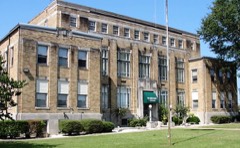
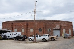
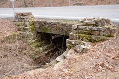
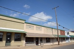
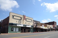
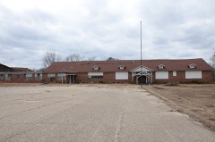
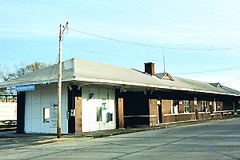
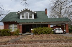
27 National Register listings published here.
Sources: the National Register database, National Park Service
51 topographic sheets cover 49 settlements here, and 27 properties are on the National Register of Historic Places.
27 National Register listings published here.
Sources: the National Register database, National Park Service
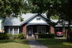
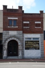
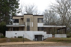
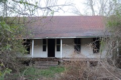
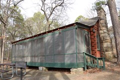
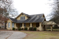
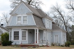
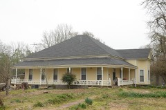
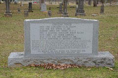
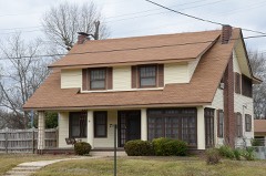
Every property in this county listed on the National Register of Historic Places, with the year it was listed and the federal nomination document.
Every wildfire the federal occurrence database records inside this county: 1,502 of them, burning about 8,046 acres. 57 started naturally and 371 were recorded as arson. Each settlement page carries the fires within five miles of it.
| Reported cause | Fires |
|---|---|
| Debris and open burning | 571 |
| Arson/incendiarism | 371 |
| Missing data/not specified/undetermined | 317 |
| Equipment and vehicle use | 91 |
| Natural | 57 |
| Smoking | 50 |
| Misuse of fire by a minor | 23 |
| Recreation and ceremony | 11 |
| Railroad operations and maintenance | 11 |
The five largest, by the area the report gives. Three of them were set deliberately.
| Date | Cause | Size | Reported by | Name on the report |
|---|---|---|---|---|
| 30 July 2012 | Missing data/not specified/undetermined | 274 acres | Arkansas Forestry Commission | MARZARN ROAD |
| 18 August 2007 | Arson/incendiarism | 231 acres | Arkansas Forestry Commission | WHIPPLE |
| 13 February 2011 | Arson/incendiarism | 181 acres | Arkansas Forestry Commission | PUMP STATION |
| 1 July 2012 | Arson/incendiarism | 145 acres | Arkansas Forestry Commission | SOCIAL HILL |
| 19 August 1999 | Equipment and vehicle use | 135 acres | Arkansas Forestry Commission | not named |
| 31 July 2011 | Natural | 121 acres | Arkansas Forestry Commission | SUNFLOWER |
| 11 February 2017 | Missing data/not specified/undetermined | 111 acres | Arkansas Forestry Commission | not named |
| 7 April 2017 | Missing data/not specified/undetermined | 100 acres | Arkansas Forestry Commission | not named |
Every settlement page carries the fires within five miles of it - see the settlement index below.
The NOAA Storm Events Database holds 613 reports for this county, causing 1 death, 69 injuries and about $39,464,500 in recorded property damage. Each settlement page carries the reports that name it.
| Kind of event | Reports |
|---|---|
| Thunderstorm Wind | 301 |
| Hail | 194 |
| Flash Flood | 55 |
| Tornado | 40 |
| Flood | 9 |
| Lightning | 6 |
| Heavy Rain | 5 |
| Funnel Cloud | 3 |
The most serious of them, by death, then injury, then recorded damage. The accounts are quoted exactly as the forecast office filed them.
| When | Event | Place named | Harm | What the report says |
|---|---|---|---|---|
| October 2014 | Thunderstorm Wind | Malvern | 1 killed, 1 hurt, $50,000 | A large tree, which had a considerable amount of internal rot, fell onto a house. A 28-year-old man was killed and a 15-month-old girl was injured. |
| December 1982 | Tornado (F3) | not stated | 29 hurt, $25,000,000 | no account filed |
| September 1996 | Tornado (F2) | Malvern | 15 hurt, $2,100,000 | no account filed |
| March 1997 | Tornado (F4) | Friendship | 11 hurt, $2,000,000 | no account filed |
| November 1988 | Tornado (F2) | not stated | 4 hurt, $2,500,000 | no account filed |
| February 2013 | Thunderstorm Wind | Bismarck | 4 hurt, $175,000 | A house was destroyed when it slid off its foundation. Three vehicles were moved and one was overturned. Four people inside the house suffered injuries. One of the people ended up in the front yard. A small pool house, located only about 20 feet behind the destroyed house, had virtually no damage to it. |
| May 2002 | Tornado (F1) | Malvern | 2 hurt | An F1 tornado touched down briefly near the Glen Rose community and was on the ground for only one mile. At the beginning of the path, several large tree limbs were blown down. Farther along the path, several large trees were knocked down. However, most of the damage occurred at the school in Glen Rose. Roofing material was peeled off several of the school buildings, with shingles from the roofs scattered in various directions around the school campus area. The false ceiling in one of the buildings collapsed, with water damage noted in several of the other buildings that sustained roof damage. Two large ventilators were blown over on the roof of the band hall, with several large trees knocked down on the school campus. Several cars were also damaged by flying debris. A teacher was injured when one of the ceilings fell. Another teacher, who was outside when the storm struck, suffered a cut on her leg and bruises when she was blown into a chain-link fence on the playground. |
| December 1982 | Tornado (F1) | not stated | 1 hurt, $250,000 | no account filed |
| May 2006 | Lightning | Malvern | 1 hurt | Lightning struck a tree, with a branch from the tree falling on a person attending a biker festival. The person was injured. |
| May 2006 | Lightning | Malvern | 1 hurt | Lightning struck a 20 foot high watchtower and the local state prison in Malvern. One guard in the tower suffered minor burns to her face and chest and was hospitalized for a short period of time. |
| April 1998 | Lightning | Malvern | $2,250,000 | Lightning struck the county library building in Malvern, resulting in a fire. The fire initially started in the roof and then spread to the rest of the structure. Most of the building and the contents were destroyed. Initial estimates placed the damage at $2.25 million. |
| May 2011 | Flood | Jones Mill | $500,000 | no account filed |
| September 2008 | Flash Flood | Jones Mill | $260,000 | Several homes flooded and had to be evacuated. Some roads and bridges flooded. A bridge on Military Road was under water. Many people were stranded at their homes in the Glen Rose community due to high water. |
| December 2009 | Flood | Butterfield | $250,000 | Flash flooding, which developed on the evening of the 23rd, became widespread areal flooding on the morning on the 24th and continued into Christmas morning. Many county roads were flooded. Some residents living off U.S. Highway 67 had to park on the shoulder of the highway and wade to their houses. |
| December 2009 | Flash Flood | Butterfield | $250,000 | Heavy rain led to the development of flash flooding on the evening of the 23rd. Numerous county roads were flooded. One swift water rescue was necessary in Malvern. One lane of Arkansas Highway 7 was partially blocked at the intersection with Arkansas Highway 84. |
| April 1982 | Tornado (F3) | not stated | $250,000 | no account filed |
| December 1982 | Tornado (F2) | not stated | $250,000 | no account filed |
| May 1957 | Tornado (F3) | not stated | $250,000 | no account filed |
| March 1996 | Thunderstorm Wind | Antioch | $200,000 | no account filed |
| August 2024 | Thunderstorm Wind | Caney | $100,000 | Corrected for time. The person reported multiple trees down between Bismarck and Deroche especially on Hwy 84. There were reportedly trees on some homes as well. The person measured 50 mph winds on his personal weather station. |
| July 2022 | Thunderstorm Wind | Bismarck | $100,000 | Delayed report...The press box was blown off of the bleachers at the Bismarck High School Football Field. Additional damage was done to a gas station awning off of Hwy. 84 and Hwy. 7. The time was estimated by radar. |
| April 2011 | Flood | Jones Mill | $100,000 | Widespread areal flooding occurred. |
| November 2010 | Thunderstorm Wind | Reyburn | $100,000 | A severe thunderstorm in the Glen Rose area blew down a power transmission line, about six power poles, and some power lines. Power was knocked out to more than 2500 electric customers, some of whom had not finished cooking Thanksgiving dinner when the power failed. U.S. Highway 67 was blocked by fallen power lines near Gifford Rd. for a number of hours. Trees were also blown down, and one of the trees fell through the roof of a mobile home. |
| April 2008 | Tornado (EF1) | Diamondhead | $100,000 | This tornado exited Garland County and moved into Hot Spring County in the Diamondhead area. The tornado blew down hundreds of trees. |
| April 2008 | Flood | Jones Mill | $100,000 | Heavy rainfall produced rising lake levels on Lake Catherine, which prompted Entergy Corporation to open gates on the Remmel Dam. The discharge crested at approximately 90,000 cubic feet per second. A flow rate of 30,000 cubic feet per second causes minor flooding along the Ouachita River. Moderate flooding resulted in Hot Spring County with damages to county roads and low lying pastures. Some homes near Friendship were threatened but none were reported to have been flooded. This was the seventh highest release rate from the dam in its history, and the highest since May, 1990. |
| September 2008 | Flash Flood | Rockport | $100,000 | Many streets were flooded around Malvern. |
| March 1996 | Thunderstorm Wind | Malvern | $100,000 | no account filed |
| May 2014 | Flash Flood | Magnet Cove | $75,000 | Multiple roads in Malvern and eastern Hot Spring County became impassable. Some vehicles were stranded in the high water, and water entered at least two houses. |
| February 2013 | Thunderstorm Wind | Bismarck | $75,000 | Barns and sheds were damaged or destroyed, a carport was blown away, shingles were blown off roofs, and trees and power lines were blown down. |
| July 2013 | Thunderstorm Wind | Malvern | $75,000 | Power lines, electrical poles, and trees were blown down. A radio tower was knocked down, falling onto a fire station. |
| April 2011 | Tornado (EF1) | Bonnerdale | $75,000 | This tornado moved out of Montgomery County east-northeast of Welsh and entered Hot Spring County west-southwest of Bonnerdale. In Hot Spring County, the tornado blew down trees and damaged outbuildings. The tornado exited Hot Spring County north-northwest of Bonnerdale and entered Garland County south-southwest of Meyers. |
| June 2014 | Thunderstorm Wind | Glen Rose | $50,000 | Trees were blown down. A couple of trees landed on houses. |
| May 2012 | Thunderstorm Wind | Malvern | $50,000 | Many trees were blown down in Malvern, according to the sheriff's office. |
| April 2011 | Thunderstorm Wind | Glen Rose | $50,000 | Several houses and barns were damaged. |
| May 2009 | Flood | Rockport | $50,000 | Heavy rainfall caused the need to open Remmel Dam and make extraordinary releases. Some county roads in Hot Spring County were impacted. |
| June 1994 | Thunderstorm Wind | DeRoche | $50,000 | Thunderstorm winds tore the carport off a house, blew the roof off a barn and downed some trees. |
| June 1994 | Thunderstorm Wind | Malvern | $50,000 | Thunderstorm winds downed trees and power lines. |
| November 1994 | Thunderstorm Wind | Malvern | $50,000 | Thunderstorm winds knocked down several trees and power lines. |
| April 1994 | Thunderstorm Wind | Bismarck | $50,000 | Thunderstorm winds knocked down trees and power lines and blew several cars off of the road. |
| April 1994 | Thunderstorm Wind | Lake DeGray | $50,000 | Thunderstorm winds downed some trees and power lines. |
| March 1996 | Thunderstorm Wind | Donaldson | $50,000 | no account filed |
| April 2011 | Thunderstorm Wind | Friendship | $40,000 | Some houses were damaged in the Friendship area. |
| June 2009 | Thunderstorm Wind | Glen Rose | $40,000 | One house was damaged by a falling tree. Two more houses had roof damage. |
| April 2011 | Thunderstorm Wind | Malvern | $30,000 | Power lines were blown down, leaving part of Malvern without power. |
| June 2009 | Thunderstorm Wind | Butterfield | $30,000 | A farm had a barn with its roof completely off and another barn had its roof peeled back on Long Drive off of Sand Road. Trees were down on Williams Road. |
| September 2008 | Tornado (EF1) | Glen Rose | $30,000 | This tornado was spawned by Tropical Storm Ike. Many trees were blown down, as was a power line. The tornado exited Hot Spring County, east-northeast of Glen Rose, and moved into Saline County, northwest of Traskwood. |
| March 2007 | Thunderstorm Wind | Bonnerdale | $30,000 | A roof was blown off a barn and shingles were blown off two houses. A TV antenna was blown down at a house. A number of trees were snapped off. |
| July 2013 | Thunderstorm Wind | Glen Rose | $25,000 | Numerous trees and power lines were blown down around Glen Rose. |
| June 2013 | Flash Flood | Jones Mill | $25,000 | Releases from Remmel Dam reached 50,700 cubic feet per second, flooding areas adjacent to the Ouachita River downstream. |
| July 2013 | Thunderstorm Wind | Malvern | $25,000 | Trees and power lines were blown down, and the sign at an auto parts store was destroyed. |
| April 2011 | Flash Flood | Jones Mill | $25,000 | As a result of heavy rains, releases from Remmel Dam were periodically increased from the evening of the 25th into the morning of the 26th. Flows from the dam eventually exceeded 56,000 cubic feet per second. Lowland flooding resulted. Some roads flooded as well. |
| May 2011 | Flash Flood | Jones Mill | $25,000 | As a result of heavy rains, releases from Remmel Dam were periodically increased from the afternoon of the 1st into the morning of the 2nd. Flows from the dam eventually reached 55,000 cubic feet per second. Lowland flooding and some flooding of roads resulted. |
| May 2011 | Tornado (EF0) | Ebenezer | $25,000 | Many large limbs and a few trees were blown down. At an apartment complex, shingles were blown off most of the roofs. Several houses also had shingles taken off. |
| December 2009 | Flash Flood | Magnet Cove | $25,000 | Flash flooding occurred on the Ouachita River when releases from Remmel Dam were necessary. The flow from the dam reached approximately 67,700 cubic feet per second. |
| April 2008 | Flash Flood | Lono | $25,000 | Street flooding occurred in Malvern. Road flooding occurred across the county. |
| March 2008 | Flash Flood | Malvern | $25,000 | The Bismarck School District was closed due to flooding. Hickory Grove Road and Raven Road were under water. |
| June 2008 | Thunderstorm Wind | Malvern | $25,000 | Three trees were down near the water treatment plant. Tree limbs were broken and there was some damage to the building. |
| June 2008 | Lightning | Glen Rose | $25,000 | Lightning is believed to have set fire to a mobile home on Eiler Loop. A 48 year-old man in the home died in the fire. Just a few weeks previously, lightning had struck and burned out the water well on the same property, which is located on top of a hill. |
| March 1976 | Tornado (F1) | not stated | $25,000 | no account filed |
| July 1975 | Tornado (F1) | not stated | $25,000 | no account filed |
The Survey's mineral resources record lists 84 workings inside this county. 26 still produce and 58 are closed or unrecorded. Each settlement page carries the workings within five miles of it.
| Commodity | Workings |
|---|---|
| Sand and Gravel, Construction | 26 |
| Barium-Barite | 16 |
| Clay | 11 |
| Titanium | 6 |
| Stone | 3 |
| Aluminum | 3 |
| Iron | 3 |
| Stone, Crushed/Broken | 2 |
| Silica | 2 |
| Molybdenum, Titanium, Metal, Niobium (Columbium), Vanadium | 1 |
| Vanadium, Titanium, Metal | 1 |
| Titanium, Metal, Niobium (Columbium) | 1 |
| Titanium, Metal | 1 |
| Niobium (Columbium), Molybdenum | 1 |
The least common of them first, because a county's hundredth gravel pit says nothing its first ten did not.
| Where | Site | Commodity | Status | Recorded |
|---|---|---|---|---|
| Christy Brookite Deposit | Titanium, Metal | Occurrence | Brookite | |
| Christy Deposit. | Vanadium, Titanium, Niobium (Columbium) | Prospect | 1890, 1976 | |
| Christy Property | Molybdenum, Titanium, Metal, Niobium (Columbium), Vanadium | Producer | Molybdenite, Rutile | |
| Christy Property | Vanadium, Titanium, Metal | Prospect | 1943, 1984, 1985 | |
| Golden-Estes Property | Molybdenum | Past Producer | ||
| Kimsey Prospect | Niobium (Columbium), Molybdenum | Producer | Brookite, Molybdenite | |
| Magnet Cove | Iron, Vanadium | Past Producer | ||
| Magnet Cove Mica Deposit | Mica | Unknown | ||
| Magnet Cove Rutile Mine | Titanium, Metal, Niobium (Columbium) | Producer | Rutile | |
| Magnet Cove Titanium Corp Deposit | Titanium, Niobium (Columbium) | Past Producer | 1890, 1932 | |
| Price-Williams Lead-Zinc Mine | Lead, Zinc | Past Producer | ||
| Southern Acid & Sulphur Co. Prospec | Sulfur | Prospect | ||
| Wilcox Group Kaolin | Aluminum, Iron, Silica, Titanium | Occurrence | ||
| Caddo Quarry | Stone, Crushed/Broken | Producer | ||
| Malvern Quarry & Mill | Stone, Crushed/Broken | Producer | ||
| Unk | Silica | Unknown | ||
| Unk | Silica | Unknown | ||
| (Facility) Jones Mills Smelter | Aluminum | Plant | ||
| Dresser Mine | Aluminum | Unknown | ||
| Magnet Cove Area | Iron | Past Producer | ||
| Malvern Mine | Aluminum | Unknown | ||
| McElwaine's Diggings | Iron | Prospect | ||
| Rock Island Quarry | Stone | Past Producer | ||
| Unk | Stone | Unknown | ||
| Unk | Stone | Unknown | ||
| Arkansas | Titanium | Producer | ||
| Hardy-Walsh Brookite Deposit. | Titanium | Prospect | ||
| Nichols & Campbell Prospect | Titanium | Prospect | ||
| Richardson Prospect | Titanium | Prospect | ||
| The Hardy Lease | Titanium | Prospect | ||
| Titanium Alloy Co. | Titanium | Past Producer | ||
| Acme Brick Co. | Clay | Producer | ||
| Malvern Brick & Tile | Clay | Producer | ||
| Malvern Pit | Clay | Past Producer | ||
| Malvern Pit | Clay | Producer | ||
| Malvern Pit & Plant | Clay | Producer | ||
| Malvern Pit & Plant | Clay | Producer | ||
| P D Holder | Clay | Past Producer | ||
| Perla Plant | Clay | Producer | ||
| Unk | Clay | Unknown | ||
| Unk | Clay | Unknown | ||
| Unk | Clay | Unknown | ||
| Baroid Sales Div. | Barium-Barite | Past Producer | ||
| Chamberlain Creek | Barium-Barite | Producer | ||
| Chamberlin Creek Syncline | Barium-Barite | Past Producer | ||
| Chamberlin Creek Syncline | Barium-Barite | Past Producer | ||
| Cove Creek | Barium-Barite | Past Producer | ||
| Cove Creek Syncline | Barium-Barite | Unknown | ||
| Lucinda Creek Syncline | Barium-Barite | Past Producer | ||
| Magnet Cove Barite Corp. | Barium-Barite | Past Producer | ||
| Magnet Cove Barite Mine | Barium-Barite | Producer | Stratabound | |
| Magnet Cove Barium Corp. | Barium-Barite | Past Producer | ||
| Magnet Cove Mill | Barium-Barite | Producer | ||
| Magnet Cove Mine | Barium-Barite | Producer | ||
| National Lead Co. Mine | Barium-Barite | Producer | ||
| Otts Lease | Barium-Barite | Producer | ||
| Rayburn | Barium-Barite | Producer | ||
| Stone Quarry Creek Syncline | Barium-Barite | Past Producer | ||
| Clark Pit & Plant | Sand and Gravel, Construction | Producer | ||
| Cook Brothers Pit & Plant | Sand and Gravel, Construction | Producer | ||
| Malvern Gravel Co. | Sand and Gravel, Construction | Unknown | ||
| Malvern Mill | Sand and Gravel, Construction | Producer | ||
| Ouachita Gravel Washer | Sand and Gravel, Construction | Producer | ||
| Ouchita Plant No 1 | Sand and Gravel, Construction | Past Producer | ||
| Steve Hedges Pit | Sand and Gravel, Construction | Producer | ||
| Tidwell Pit | Sand and Gravel, Construction | Producer | ||
| Unk | Sand and Gravel, Construction | Unknown | ||
| Unk | Sand and Gravel, Construction | Unknown | ||
| Unk | Sand and Gravel, Construction | Unknown | ||
| Unk | Sand and Gravel, Construction | Unknown | ||
| Unk | Sand and Gravel, Construction | Unknown | ||
| Unk | Sand and Gravel, Construction | Unknown | ||
| Unk | Sand and Gravel, Construction | Unknown | ||
| Unk | Sand and Gravel, Construction | Unknown | ||
| Unk | Sand and Gravel, Construction | Unknown | ||
| Unk | Sand and Gravel, Construction | Unknown | ||
| Unk | Sand and Gravel, Construction | Unknown | ||
| Unk | Sand and Gravel, Construction | Unknown | ||
| Unk | Sand and Gravel, Construction | Unknown | ||
| Unk | Sand and Gravel, Construction | Unknown | ||
| Unk | Sand and Gravel, Construction | Unknown | ||
| Unk | Sand and Gravel, Construction | Unknown | ||
| Unk | Sand and Gravel, Construction | Unknown | ||
| Unk | Sand and Gravel, Construction | Unknown |
Named settlements recorded in the Geographic Names Information System, each with the topographic sheets covering it. Villages, hamlets and abandoned places alike. Each is shown with the nearest named watercourse or landform and the survey quadrangle it falls on.
Antioch township · 71941 · On Antioch Creek · Social Hill quadrangle
11 sheets, 1948 to 1985
Valley township · 71929 · On Point Cedar Creek · Point Cedar quadrangle
8 sheets, 1955 to 1986
Magnet township · 72104 · On Stony Creek · Lake Catherine quadrangle
12 sheets, 1948 to 1985
No longer a settlement
Fenter township · 71913 · On Slunger Creek · Lake Catherine quadrangle
12 sheets, 1948 to 1985
Montgomery township · 71929 · On Holly Creek · Bismarck quadrangle
8 sheets, 1955 to 1986
No longer a settlement
Dover township · 72104 · Malvern South quadrangle
12 sheets, 1948 to 2000
No longer a settlement
Midway township · 72104 · Malvern South quadrangle
12 sheets, 1948 to 2000
No longer a settlement
Midway township · 72104 · Social Hill quadrangle
11 sheets, 1948 to 1985
No longer a settlement
Dover township · 72104 · Malvern South quadrangle
12 sheets, 1948 to 2000
No longer a settlement
Prairie township · 71942 · On DeLisle Creek · Caddo Valley quadrangle
9 sheets, 1955 to 1986
Magnet township · 72104 · On Cove Creek · Lake Catherine quadrangle
12 sheets, 1948 to 1985
Magnet township · 72104 · On Chamberlain Creek · Malvern North quadrangle
13 sheets, 1948 to 2000
Prairie township · 71941 · On West Fork DeLisle Creek · Social Hill quadrangle
11 sheets, 1948 to 1985
Lone Hill township · 72104 · On North Fork Blakely Creek · Social Hill quadrangle
11 sheets, 1948 to 1985
Montgomery township · 71929 · On Holly Creek · Bismarck quadrangle
8 sheets, 1955 to 1986
Valley township · 71929 · On Point Cedar Mountains · Point Cedar quadrangle
8 sheets, 1955 to 1986
Fenter township · 72104 · Near Steep Hollow · Malvern North quadrangle
13 sheets, 1948 to 2000
Lone Hill township · 71941 · On Prairie Bayou · Social Hill quadrangle
11 sheets, 1948 to 1985
De Roche township · 71929 · On Sanders Creek · De Roche quadrangle
7 sheets, 1955 to 1986
No longer a settlement
Magnet township · 72104 · On Falls Creek · Lake Catherine quadrangle
12 sheets, 1948 to 1985
Lone Hill township · 72104 · On Blakely Creek · Social Hill quadrangle
11 sheets, 1948 to 1985
Dover township · 72104 · Malvern South quadrangle
12 sheets, 1948 to 2000
No longer a settlement
Fenter township · 72104 · Malvern South quadrangle
12 sheets, 1948 to 2000
No longer a settlement
Valley township · 71929 · Near Point Cedar Mountains · Point Cedar quadrangle
8 sheets, 1955 to 1986
No longer a settlement
Gifford township · 72104 · On Ninemile Creek · Traskwood quadrangle
10 sheets, 1955 to 1985
No longer a settlement
The vanished settlements of Hot Spring County: the places named above that are no longer on the map.