 Block
Tonopah, Arizona
16 topographic sheets cover this place, the earliest surveyed in 1954 and the latest in 1984. It stands in the Buckeye census division. It lies in ZIP code area 85354. The Survey maps it on the Tonopah quadrangle. 23 people lived here at the 2020 count. It stands 1,490 feet above sea level.
Population over time
2 figuresTonopah fell from 60 to 23 between 2010 and 2020. These are the recorded population figures Wikidata holds for this place, reached through the Geographic Names Information System number this page is keyed on rather than by name, so they belong to this place and not to another of the same name. Most are census counts, but not all are: an early figure may be a founding or settlement estimate, and an estimate published within five years of a census is left out. The change column is computed, and is left blank where more than 20 years separate a figure from the one before it, because a gap that long is not a change between two counts.
| Year | People | Change |
|---|---|---|
| 2010 | 60 | |
| 2020 | 23 | -37 (-62%) |
Topographic sheets covering this place
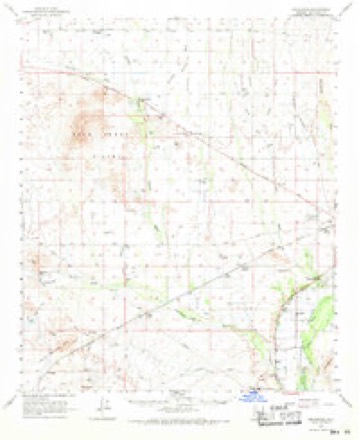
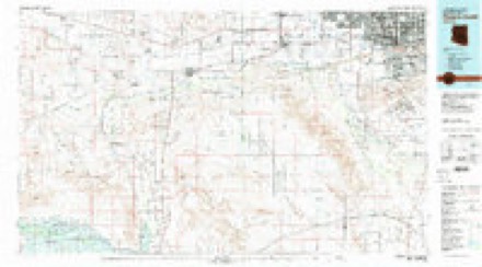
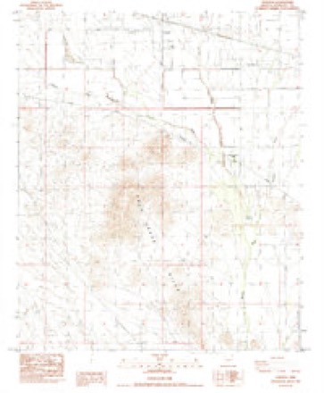
9 surveys from 16 printed sheetsMatched by testing this settlement's coordinate against the published boundary of every sheet in the United States Geological Survey's historical collection. Each opens the scanned sheet at the Survey.
- 1954 USGS Phoenix quadrangle1:250000, 5 printings
- 1957 USGS Phoenix quadrangle1:250000
- 1958 USGS Phoenix quadrangle1:250000
- 1960 USGS Phoenix quadrangle1:250000
- 1962 USGS Arlington quadrangle1:62500, 2 printings
- 1969 USGS Phoenix quadrangle1:250000, 2 printings
- 1971 USGS Phoenix quadrangle1:250000
- 1981 USGS Phoenix South quadrangle1:100000, 2 printings
- 1984 USGS Tonopah quadrangle1:24000






Fires near this place
66 since 1992Regional context, not property-specific evidence. The federal wildfire occurrence database lists 66 fires within 5 miles of Tonopah between 1992 and 2020, burning about 475 acres in total. 1 started naturally. None was recorded as arson. Distance is straight-line from the map coordinates, so a fire counted here may appear on a neighbouring settlement's page as well.
| Reported cause | Fires |
|---|---|
| Missing data/not specified/undetermined | 43 |
| Smoking | 11 |
| Debris and open burning | 6 |
| Equipment and vehicle use | 4 |
| Natural | 1 |
| Recreation and ceremony | 1 |
The most recent of them, most recent first, with the day each was reported and the service that recorded it.
| Date | Cause | Size | Reported by | Name on the report |
|---|---|---|---|---|
| 25 September 1993 | Debris and open burning | 6.0 acres | Arizona Department of Forestry and Fire Management - State Office | not named |
| 18 September 2014 | Missing data/not specified/undetermined | under an acre | Arizona Department of Forestry and Fire Management - State Office | BROADWAY |
| 16 September 1993 | Debris and open burning | 1.0 acres | Arizona Department of Forestry and Fire Management - State Office | not named |
| 15 September 2011 | Missing data/not specified/undetermined | under an acre | Arizona Department of Forestry and Fire Management - State Office | AZ-112046 |
| 13 September 1994 | Debris and open burning | under an acre | Arizona Department of Forestry and Fire Management - State Office | not named |
| 6 August 1993 | Natural | 15 acres | Arizona Department of Forestry and Fire Management - State Office | not named |
| 6 August 1992 | Equipment and vehicle use | under an acre | Arizona Department of Forestry and Fire Management - State Office | not named |
| 3 August 1992 | Missing data/not specified/undetermined | under an acre | Arizona Department of Forestry and Fire Management - State Office | not named |
Settlements close enough to share some of these fires:
Mines and quarries near this place
3 within 5 milesRegional context, not property-specific evidence. The federal mineral resources record lists 3 workings within 5 miles of Tonopah: 3 unknowns. None of them still produces. What was taken out: Sand and Gravel, Construction. Distance is straight-line from the map coordinates, so a quarry counted here may appear on a neighbouring settlement's page as well.
| Where | Site | Commodity | Status | Recorded |
|---|---|---|---|---|
| Gravel Pit | Sand and Gravel, Construction | Unknown | ||
| Gravel Pit | Sand and Gravel, Construction | Unknown | ||
| Gravel Pit | Sand and Gravel, Construction | Unknown |
Storms near this place
39 since 2000Regional context, not property-specific evidence. The National Weather Service names Tonopah in 39 storm reports between 2000 and 2025: 17 thunderstorm wind, 17 flash flood, 2 funnel cloud, 1 lightning. The reports record 1 death and 3 injuries. Each account below is quoted exactly as the forecast office filed it, from the NOAA Storm Events Database, and each date opens the federal record of that event.
| When | Event | Place named | Harm | What the report says |
|---|---|---|---|---|
| September 2019 | Thunderstorm Wind | Tonopah | 1 killed, 1 hurt, $75,000 | Isolated monsoon thunderstorms developed across the central deserts to the west of Phoenix during the early evening hours on September 4th. One of the more powerful storms produced a strong micro burst with wind speeds estimated to be as high as 70 mph. Local law enforcement reported that downburst winds blew over 6 semi-trailer trucks on Interstate 10 west of the town of Tohopah and 11 miles east of Centennial. As a result, there was one person injured as well as one fatality. The trucks were blown over at about 1936MST. |
| June 2000 | Lightning | Tonopah | 2 hurt | Two men riding their motorcycles westbound on I-10 were caught in a thunderstorm. They pulled off the road and got off their bikes. While standing around the bikes, lightning struck very close, and knocked the two men unconcious. They were treated and released at a nearby hospital. |
| October 2022 | Thunderstorm Wind | Tonopah | $200,000 | Severe wind damage occurred from a thunderstorm microburst in the Tonopah area from the second of two storms that passed through the area. Some of the damages included: two mobile homes destroyed; damage to some of the structures at the Belmont Dairy Farm (specifically a milking barn), which had some damage to some of the cow enclosures as well; 3 destroyed AC unit condensers; creosote bushes being fully defoliated in a field; and several large downed trees. Downed power poles affecting 121 customers were reported by the utility company in an area between 379th Avenue and 355th Avenue and between Missouri Avenue and I-10. There was also loss of livestock (unknown how many or type). Winds were estimated at around 80 mph. Timing estimated from radar. |
| July 2021 | Thunderstorm Wind | Tonopah | $60,000 | The Arizona Department of Public Safety reported that four tractor trailers were blown over on I-10 west of Tonopah due to strong winds from severe thunderstorms in the area. Injuries associated with this event are unknown. |
| September 2008 | Thunderstorm Wind | Tonopah | $50,000 | Numerous power poles down near 424th and Indian School, or about 2 miles west of Tonopah. |
| August 2017 | Thunderstorm Wind | Tonopah | $45,000 | Scattered thunderstorms developed across the western portion of the greater Phoenix area during the afternoon hours and some of them affected the town of Tonopah. The stronger storms produced damaging microburst winds estimated to be as high as 70 mph. According to APS, the local utility company, gusty winds blew down 6 power poles in the town of Tonopah. No injuries were reported. A Severe Thunderstorm Warning was in effect for the area at the time of the damage; it was issued at 1520MST. |
| November 2025 | Flash Flood | Tonopah | $30,000 | A water rescue was reported near 377th Ave and Orange Dr in Tonopah. Two people were found stuck in their truck with water halfway up the windows before being safely rescued. Timing estimated from radar. |
| January 2010 | Flood | Tonopah | $20,000 | Five people were rescued from flood waters at 389th and Orangewood. |
| September 2008 | Thunderstorm Wind | Tonopah | $20,000 | Winds were estimated to reach as high as 60 mph along with visibility to less than 1/4 mile in blowing dust. |
| October 2022 | Thunderstorm Wind | Tonopah | $10,000 | A trained spotter in Tonopah measured a 68 mph gust using a handheld anemometer. Spotter also reported pea-sized hail. There was wind damage to roof of nearby shed. 20-30 feet of roof beams and tin sheets were laying in the driveway as well as awning damage on a bus. No injuries were reported. |
| October 2022 | Thunderstorm Wind | Tonopah | $10,000 | Downed power poles in Tonapah affecting 96 customers were reported in an area between 425th Drive to 411th Ave and between Glendale Avenue and I-10. Winds were estimated at around 70 mph. No injuries were reported. |
| September 2013 | Flash Flood | Tonopah | $10,000 | Showers and embedded thunderstorms developed and moved into northwestern Maricopa county during the afternoon hours on September 9th, and they produced moderate to heavy rainfall with rainfall rates in excess of 2 inches per hour at times. Flash flooding resulted and affected the Interstate 10 corridor from Tonopah westward into La Paz county. According to local law enforcement, at 1500MST Salome Road was closed from Tonopah westward into La Paz county due to numerous areas under water. Three Flash Flood Warnings were issued due to the flooding, the first began at 1223MST and the final warning expired at 1745MST. Despite the fact that the heavy rains had ended by late afternoon, Salome Road remained closed through at least 1900MST. |
| July 2006 | Thunderstorm Wind | Tonopah | $10,000 | Microburst winds damaged windows and doors. Camper damaged at a truck stop along Interstate 10. |
| August 2022 | Thunderstorm Wind | Tonopah | $5,000 | Downed powerlines along Harquahala Valley Rd near I-10. Timing estimated from radar. No injuries were reported. |
| July 2022 | Thunderstorm Wind | Tonopah | $5,000 | Images taken from storm chaser passing through the area showed power lines down as well as a destroyed metal shed on Harquahala Valley Road just north of West Bethany Home Road west of Tonopah. Winds were estimated at 60 mph. Timing was estimated from radar. No injuries were reported. |
| August 2022 | Thunderstorm Wind | Tonopah | $5,000 | Downed powerlines along Harquahala Valley Rd near I-10. Timing estimated from radar. No injuries were reported. |
| July 2022 | Thunderstorm Wind | Tonopah | $5,000 | Images from social media showed a house with a damaged garage door and fence at 387th Avenue near Cameback Road in Tonopah. Winds were estimated near 60 mph. Timing estimated from radar. No injuries were reported. |
| July 2017 | Flash Flood | Tonopah | $5,000 | Scattered to numerous showers and thunderstorms developed across much of the greater Phoenix area during the morning hours on July 24th, and some of the heavier rainfall affected the far western portions including the towns of Tonopah and Wintersburg. During the late morning hours, rain gauges in the area reported amounts of up to around two inches and this resulted in episodes of flash flooding as area washes ran heavily and flowed across area roads making them impassible. As of 1150MST, stream gages reported significant flow in both the Waterman Wash and the Delaney Wash. At 1228MST flash flooding was observed 3 miles south of Tonopah; according to a Maricopa County Flood Control stream gage the Delaney Wash at 411th Avenue was impassible due to flood waters. At about 1300MST another stream gage reported that the Delaney Wash 3 miles northwest of Wintersburg was flooding and impassible at the Salome Highway. A Flash Flood Warning was in effect for the area at the time of the flooding; it was issued at 1152MST and remained in effect through 1445MST. Due to continued flow in the area washes, the Flash Flood Warning was re-issued for the same area and remained in effect through 1745MST. |
| August 2020 | Flash Flood | Tonopah | $2,000 | Thunderstorms with heavy rain developed across the central deserts well to the northwest of Phoenix during the evening hours on August 30th. Heavy rain, with peak rain rates in excess of one inch per hour, led to episodes of flash flooding about 12 miles to the northeast of Tonopah. According to data from a Maricopa County Flood Control District rain gage, Jackrabbit Wash crested at the 3.1 foot stage with a flow of 784 cubic feet per second. The resulting flood wave resulted in Wickenburg/Aguila road becoming flooded as 1.5 feet of water flowed through the wash and across the road. The flooding took place at about 2200MST. A flash flood watch was in effect at the time of the flooding. There were no reports of accidents or injury due to the flooded road. |
| July 2025 | Thunderstorm Wind | Tonopah | - | A RAWS station located along the Belmont Mountain measured a peak wind gust of 85 mph. |
| November 2025 | Flash Flood | Tonopah | - | Wintersburg Road between Indian School Road and Osborn Road in Tonopah closed due to approximately 3-4 feet of water over the roadway from excessive runoff along Fourmile Wash. Timing estimated from radar. No damages or injuries reported. |
| November 2025 | Flash Flood | Tonopah | - | A Maricopa County Flood Control District Stream Gauge along Jackrabbit Wash near Vulture Mine Road measured water levels rising above the alarm stage level of 2.9 feet, with flows peaking at 4.45 feet (2681cfs). Water flow this high made Vulture Mine Road as well Wickenburg Road, located approximately 5.1 miles downstream of the gauge, impassable with several feet of water likely overtopping the road. Timing was estimated based on radar and the nearby stream gauge. No damages or injuries reported. |
| September 2025 | Flash Flood | Tonopah | - | A Maricopa County Flood Control District streamflow gauge along Jackrabbit Wash recorded a water level above the alarm stage level of 2.9 feet, with a peak stage of 3.78 feet. Exceeding alarm stage corresponds to likely flooding of Wickenburg Road located approximately 5.1 miles downstream of the gauge. There was an extended period of greater than 900 cfs with flow peaking at 1560 cfs, resulting in likely greater than 1.5 feet of flowing water over the road. Timing estimated based on the period when water levels exceeded and then receded below the alarm stage level as well as travel time for the water to reach Wickenburg Road. No damages or injuries reported. |
| September 2025 | Tornado (EFU) | Tonopah | - | A video showed a landspout in an open desert area of Maricopa County, as viewed from the Tonopah area. The timing and location of the landspout was unknown. Thus the location and timing was entered based primarily on radar and a best guess on the background terrain features. No damages or injuries were reported. |
| August 2022 | Flash Flood | Tonopah | - | Stream gauge at Delaney Wash reached above action stage at 1.90 feet at 1859 MST. No damages or injuries were reported. |
| October 2022 | Flash Flood | Tonopah | - | A Maricopa County Flood Control District Streamflow Gauge along Winters Wash in Tonopah showed flow going above alarm stage (1.28 feet) between 18:06 and 18:08 MST, with the flow going above the bankfull stage (3.32 feet) at 18:38 MST and peaking at 4.27 feet (1400 cfs) at 19:18 MST. The flow went below bankfull at 22:49 MST and below alarm stage at 01:43 MST on the 16th. Roads intersecting the wash that were affected from the flow along Winters Wash included Indian School Road, located 1.1 miles downstream of the gauge, and along Salome Highway south of I-10 located 4.6 miles downstream of the gauge. Along Indian School Road, there were reports at around 19:37 MST from a trained spotter of many cars stranded and it is unknown whether or not any of the vehicles sustained damage. No injuries were reported. |
| August 2022 | Flash Flood | Tonopah | - | A FCDMC streamflow gage along Delaney Wash exceeded alarm stage, impacting a downstream low water crossing along 411th Avenue. At 2139MST, the gage peaked at a depth of 2.94 feet and a flow of 426 CFS. No damage or injuries were reported. |
| August 2022 | Flash Flood | Tonopah | - | Flood Control District of Maricopa County stream gage along Jackrabbit Wash exceeded alarm stage at 2236 MST, making the Vulture Mine Road low water crossing impassable and mostly likely Wickenburg Road, located 5 miles downstream. Flow peaked at 3.35 feet and 1034 CFS at 2305 MST and dropped below alarm stage at 2340 MST. No damages or injuries were reported. |
| August 2022 | Flash Flood | Tonopah | - | The Flood Control District of Maricopa County Gauge along Jackrabbit Wash just downstream of North Vulture Mine Road indicated water levels rising above the alarm stage of 2.9 feet at 1800 MST. The flow peaked at 5.70 feet (6000 cfs) at around 1910 MST. Impacted area included Wickenburg Road, located about 5 miles downstream of the gauge. No damages or injuries were reported. |
| August 2022 | Flash Flood | Tonopah | - | MCDOT reported that Centennial Road between 517th Avenue and 555th Avenue was closed due to flooding in Centennial Wash. Timing estimated from radar. No damage or injuries were reported. |
| August 2020 | Flash Flood | Tonopah | - | Thunderstorms with heavy rain developed across the central deserts and well to the northwest of Phoenix during the evening hours on August 30th. Peak rain rates in excess of 1 inch per hour led to flash flooding and one such episode occurred near the Maricopa and La Paz County line. According to the Arizona Department of Highways, flash flooding just east of the county line resulted in the closure of Eagle Eye road from Salome Road to US Highway 60 in Aguila. The road was reported closed as of 2200MST although heavy rain and flooding most likely were occurring earlier than that. There was a flash flood watch in effect at the time of the flash flooding. |
| November 2019 | Funnel Cloud | Tonopah | - | A strong thunderstorm developed across the far western portion of Maricopa County during the early afternoon hours on November 21st. In addition to the typical thunderstorm hazards including wind and heavy rain, the storm managed to produce a funnel cloud at about 1305MST. The funnel cloud was observed by a motorist on Interstate 10 about 10 miles to the west of the town of Tonopah; the motorist also took video of the funnel which was located just north of the interstate. The storm had a history of producing funnel clouds; about one half hour earlier the storm generated another funnel along the interstate and just west of the county line in far eastern La Paz County. Although no damage was produced by the funnel, it was still noteworthy as funnel clouds are rare across the deserts of southern Arizona. |
| September 2019 | Flash Flood | Tonopah | - | Scattered to numerous showers and thunderstorms continued to develop across the central deserts to the west of Phoenix during the afternoon and early evening hours on September 23rd, and the stronger storms produced very heavy rain with peak rain rates well in excess of one inch per hour. The heavy rain led to an episode of flash flooding west of Phoenix near the town of Tonopah; at 2010MST mesonet data from a Maricopa County Flood Control District stream gauge indicated that flood waters rapidly climbed above alarm and bank full stages in the Delaney Wash. The gauge was located roughly 3 miles south of Tonopah. The flash flooding resulted in the road closures of the Salome Highway and the 411th Avenue Road crossing. A Flash Flood Warning was issued for the area prior to the report; no injuries were reported due to the flash flooding. |
| July 2018 | Flash Flood | Tonopah | - | Late night thunderstorms west of Phoenix generated heavy rain that caused washes to flow over open deserts of Maricopa County; some of the washes had significant flow which resulted in flash flooding. At 0030MST, a mesonet gauge from the Maricopa County Flood Control District network indicated that the Jackrabbit Wash at Wickenburg Road had one and one half foot of water flowing over it. Water flowing across a road is evidence of flash flooding, and a Flash Flood Warning was issued at 0009MST for the area including the Jackrabbit Wash channel. No accidents were reported due to the flash flooding. The wash was well north of the town of Tonopah and west of the greater Phoenix area. |
| October 2010 | Thunderstorm Wind | Tonopah | - | A trained weather spotter 3 miles south of Tonopah reported a wind gust estimated at 60 mph. The strong wind caused areas of low visibility in blowing dust. |
| August 2005 | Flash Flood | Tonopah | - | Many roads closed in area due to rapid flooding from strong thunderstorms with heavy rainfall. Local rain gauge networks indicated that a rainfall between 3 and 4 1/2 inches fell during the late afternoon and early evening. |
| August 2001 | Thunderstorm Wind | Tonopah | - | Severe thunderstorm wind gust damages Interstate 10 exit 103 signs. |
| August 2001 | Thunderstorm Wind | Tonopah | - | Severe thunderstorm wind gusts blew down 16 electric power poles. |
| February 2005 | Funnel Cloud | Tonopah | - | no account filed |
Nearest settlements
The eight closest, with where each one stands in the county. Distances are straight-line, computed from the Geographic Names Information System coordinates.
| Map | Place | Distance | Sheets |
|---|---|---|---|
| Wintersburg | 6.0 miles | 17 | |
| Dixie | 13.3 miles | 17 | |
| Crag | 13.4 miles | 16 | |
| Arlington | 14.8 miles | 17 | |
| Hassayampa | 15.0 miles | 19 | |
| Gillespie | 16.2 miles | 16 | |
| Conger | 17.0 miles | 19 | |
| Palo Verde | 17.0 miles | 19 |
Elsewhere
Matched on this settlement's Geographic Names Information System number rather than its name, so it cannot be a different place of the same name in another state.
| Wikipedia article on Tonopah | An encyclopaedic summary. Its text is share-alike, so it is linked here rather than copied. |
| Wikidata item Q6644472 | The structured record the population and elevation above come from. Public domain (CC0). |
Provenance
This settlement is recorded in the Geographic Names Information System as feature 12604. The sheet list is computed by point-in-boundary test against the United States Geological Survey's historical topographic inventory. Both are works of the United States government and carry no copyright under 17 U.S.C. 105.
Wildfire. Short, Karen C. 2022. Spatial wildfire occurrence data for the United States, 1992-2020 [FPA_FOD_20221014]. 6th Edition. Fort Collins, CO: Forest Service Research Data Archive. https://doi.org/10.2737/RDS-2013-0009.6 Collected with United States Government funding and usable without additional permissions or fees.
Mines and quarries. USGS Mineral Resources Data System (MRDS) https://mrdata.usgs.gov/mrds/ A work of the United States government, no copyright under 17 U.S.C. 105.
Storms. NOAA National Centers for Environmental Information, Storm Events Database https://www.ncei.noaa.gov/stormevents/ A work of the United States government, no copyright under 17 U.S.C. 105. Narratives are quoted verbatim from the National Weather Service report and are not edited or summarised.