 Block
Douglas, Arizona
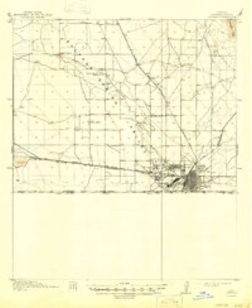
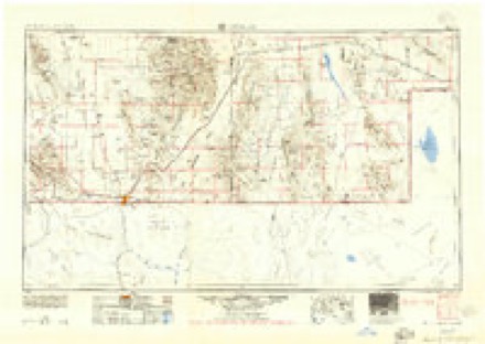
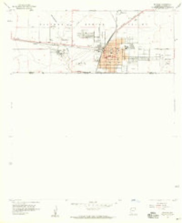
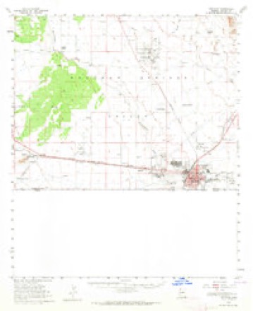
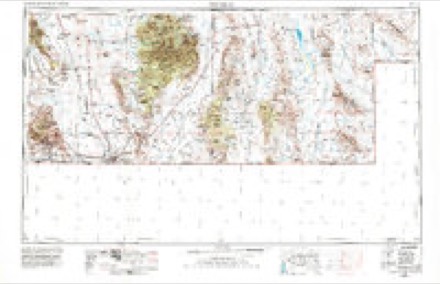
23 topographic sheets cover this place, the earliest surveyed in 1914 and the latest in 1994. It stands in the Douglas census division. It lies in ZIP code area 85607. The Survey maps it on the Douglas quadrangle. 16,534 people lived here at the 2020 count. It stands 4,006 feet above sea level.
On record in Douglas
Buildings and businesses the archive holds for this place. Each opens its own page, with the source record it came from.
On the National Register 12 of 15 shown
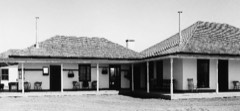 San Bernardino RanchNational Historic Landmark · listed 1966
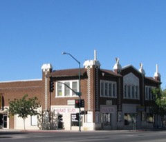 Douglas Historic Districtlisted 1985
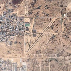 Douglas Municipal Airport Runwaylisted 1975
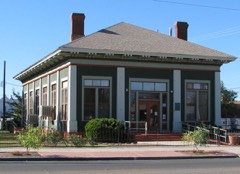 Douglas Residential Historic Districtlisted 1986
 El Paso and Southwestern Railroad Passenger Depot-Douglaslisted 1986
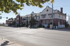 El Paso and Southwestern Railroad YMCAlisted 1984
 Gadsden Hotellisted 1976
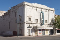 Grand Theatrelisted 1976
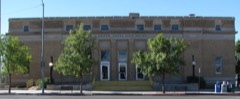 US Post Office and Customs House-Douglas Mainlisted 1985
- Cima Park Fire Guard Stationlisted 1993
- Douglas Sonoran Historic Districtlisted 1987
- Douglas Underpasslisted 1988
Population over time
2 figuresDouglas fell from 17,378 to 16,534 between 2010 and 2020. These are the recorded population figures Wikidata holds for this place, reached through the Geographic Names Information System number this page is keyed on rather than by name, so they belong to this place and not to another of the same name. Most are census counts, but not all are: an early figure may be a founding or settlement estimate, and an estimate published within five years of a census is left out. The change column is computed, and is left blank where more than 20 years separate a figure from the one before it, because a gap that long is not a change between two counts.
| Year | People | Change |
|---|---|---|
| 2010 | 17,378 | |
| 2020 | 16,534 | -844 (-5%) |
Topographic sheets covering this place
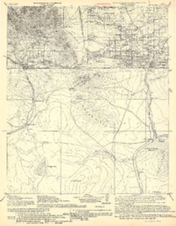
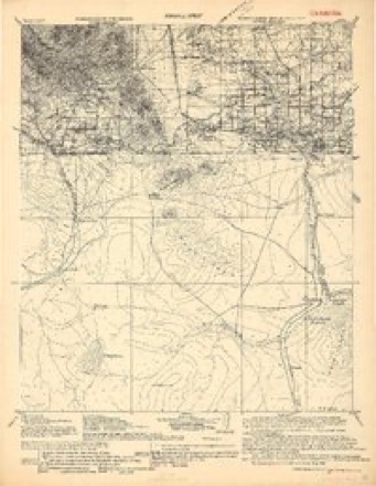
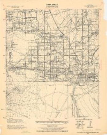
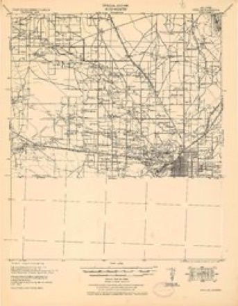
12 surveys from 23 printed sheetsMatched by testing this settlement's coordinate against the published boundary of every sheet in the United States Geological Survey's historical collection. Each opens the scanned sheet at the Survey.
- 1914 USGS Douglas quadrangle1:62500, 3 printings
- 1916 USGS Douglas quadrangle1:125000
- 1919 USGS Douglas quadrangle1:125000
- 1925 USGS Douglas quadrangle1:62500
- 1933 USGS Douglas quadrangle1:62500
- 1955 USGS Douglas quadrangle1:250000, 2 printings
- 1958 USGS Douglas quadrangle1:24000, 4 printings
- 1958 USGS Douglas quadrangle1:62500, 2 printings
- 1959 USGS Douglas quadrangle1:250000, 4 printings
- 1961 USGS Douglas quadrangle1:250000
- 1964 USGS Douglas quadrangle1:250000
- 1994 USGS Douglas quadrangle1:100000, 2 printings
Fires near this place
51 since 1992Regional context, not property-specific evidence. The federal wildfire occurrence database lists 51 fires within 5 miles of Douglas between 1992 and 2019, burning about 263 acres in total. 8 started naturally. 4 were recorded as arson. Distance is straight-line from the map coordinates, so a fire counted here may appear on a neighbouring settlement's page as well.
| Reported cause | Fires |
|---|---|
| Missing data/not specified/undetermined | 27 |
| Natural | 8 |
| Equipment and vehicle use | 5 |
| Arson/incendiarism | 4 |
| Smoking | 3 |
| Debris and open burning | 2 |
| Misuse of fire by a minor | 1 |
| Recreation and ceremony | 1 |
The most recent of them, most recent first, with the day each was reported and the service that recorded it.
| Date | Cause | Size | Reported by | Name on the report |
|---|---|---|---|---|
| 15 September 1994 | Arson/incendiarism | under an acre | Arizona Department of Forestry and Fire Management - State Office | not named |
| 10 September 1996 | Natural | 1.0 acres | Arizona Department of Forestry and Fire Management - State Office | not named |
| 4 August 2004 | Natural | under an acre | Arizona Department of Forestry and Fire Management - State Office | COUNTY |
| 22 August 2019 | Missing data/not specified/undetermined | 10 acres | Elfrida Fire District | NOT NAMED |
| 10 August 1993 | Natural | 1.5 acres | Arizona Department of Forestry and Fire Management - State Office | not named |
| 4 July 2004 | Missing data/not specified/undetermined | under an acre | Arizona Department of Forestry and Fire Management - State Office | INDEPENDENCE |
| 28 July 2009 | Missing data/not specified/undetermined | under an acre | Arizona Department of Forestry and Fire Management - State Office | GLENN |
| 26 July 1992 | Natural | under an acre | Arizona Department of Forestry and Fire Management - State Office | not named |
Settlements close enough to share some of these fires:
Mines and quarries near this place
7 within 5 milesRegional context, not property-specific evidence. The federal mineral resources record lists 7 workings within 5 miles of Douglas: 3 plants, 3 past producers, 1 producer. 4 still produce. What was taken out: Copper, Sand and Gravel, Construction, Gold, Tungsten. Distance is straight-line from the map coordinates, so a quarry counted here may appear on a neighbouring settlement's page as well.
| Where | Site | Commodity | Status | Recorded |
|---|---|---|---|---|
| (Facility) Copper Queen Smelter | Copper, Gold, Silver | Plant | ||
| Douglas Area Gypsum | Gypsum-Anhydrite | Past Producer | Gypsum | |
| Mineral Reserves Mill | Tungsten | Past Producer | ||
| Paisano Hydromet | Gold | Plant | ||
| (Facility) Douglas Copper Smelter | Copper | Plant | ||
| Cowan Pit No.1 | Sand and Gravel, Construction | Producer | ||
| Old English Pit | Sand and Gravel, Construction | Past Producer |
Storms near this place
39 since 1993Regional context, not property-specific evidence. The National Weather Service names Douglas in 39 storm reports between 1993 and 2025: 15 flash flood, 10 thunderstorm wind, 8 hail, 3 lightning. The reports record 6 deaths and 4 injuries. Each account below is quoted exactly as the forecast office filed it, from the NOAA Storm Events Database, and each date opens the federal record of that event.
| When | Event | Place named | Harm | What the report says |
|---|---|---|---|---|
| August 1997 | Flash Flood | Douglas | 6 killed | Six illegal aliens attempting to cross into the United States from Mexico were drowned when they tried to cross a flooded drainage ditch. |
| June 2008 | Lightning | Douglas | 2 hurt | Two children were struck by lightning in Douglas. |
| July 2000 | Lightning | Douglas | 2 hurt | 2 boys, age 13 years, injured by lightning strike. |
| June 1994 | Thunderstorm Wind | Douglas | $500,000 | Roofs were blown off, fences and trees were blown down, sheds were destroyed, and power lines were downed by thunderstorm winds gusting to 63 mph. Also, a large board was driven through a masonry wall, and three inmate structures at a prison site were damaged. |
| July 2001 | Flash Flood | Douglas | $120,000 | no account filed |
| August 2016 | Flash Flood | Douglas | $50,000 | Two homes on Camino del Rancho were flooded, displacing 9 people. The Red Cross provided temporary housing the the families. Numerous roads were closed around town. Over 1 inch of rain fell, and culverts were damaged along SR-80. Effects were exacerbated from heavy rain which also fell the previous day. |
| July 2010 | Thunderstorm Wind | Douglas | $50,000 | The ASOS at the Bisbee-Douglas Airport measured a wind gust of 68 mph at 556 pm MST. Law enforcement reported that thunderstorm winds blew a roof off a residence on Double Adobe Road, approximately 7 miles west of the Bisbee-Douglas Airport. The Bisbee sheriff reported thunderstorm winds blew a roof completely off a large barn along Burnt Adobe Road, and snapped four power poles. A tree was uprooted and fell on a building at the Douglas Municipal Airport. |
| August 2005 | Flash Flood | Douglas | $40,000 | Heavy rain caused State Route 80 near the City of Douglas to be flooded and impassable in three locations. There was one swift water rescue performed. The Bay Acres Mobile Home Subdivision was also flooded causing damage to some homes. |
| July 2021 | Thunderstorm Wind | Douglas | $20,000 | Thunderstorm winds downed several trees and blew a metal roof off a hardware store in Douglas. |
| June 2012 | Lightning | Douglas | $15,000 | Lightning struck a two-story house at 11th Street and C Avenue in Douglas causing the house to catch fire. Firefighters extinguished the fire in 20 minutes. Smoke damage was confined to the second story. |
| July 2010 | Flash Flood | Douglas | $10,000 | Thunderstorms produced heavy rainfall that resulted in flash flooding across portions of Cochise County. An automated rain gauge 3 miles southeast of Dragoon reported 2.6 inches of rain in less than 50 minutes. A vehicle stranded in Terry's Wash was pulled out of the wash by a trained spotter. Two people stranded in Prude Wash from their vehicle were assisted by the Cochise County sheriff. Prude Wash, which is normally dry, was running about 3 feet deep. |
| August 2007 | Flash Flood | Douglas | $10,000 | Flash flooding from thunderstorms in the City of Douglas caused damage to several city buildings and facilities. |
| August 2005 | Flash Flood | Douglas | $10,000 | Widespread street flooding occurred in the City of Douglas. Water depth at Washington Avenue and Golf Course Road was reported to be 1.5 feet deep. State Highway 80, 2 miles northeast of Douglas, was closed due to flooding. Two swift water rescues were performed. 2.50 inches of rainfall were reported within about 30 minutes in Douglas. |
| August 2019 | Thunderstorm Wind | Douglas | $7,000 | Numerous trees uprooted in Douglas. One shed was moved off its foundation, a cooler was blown off of a roof, and a stop sign was uprooted. |
| June 2025 | Thunderstorm Wind | Douglas | $5,000 | Sulphur Springs Valley Electric Company reported outages for roughly 1,400 people in Whetstone, Benson, and Wilcox due to multiple thunderstorm hazards including lightning, fallen branches, and heavy rain that arched power lines. |
| July 2001 | Thunderstorm Wind | Douglas | $5,000 | Strong winds from a severe thunderstorm lifted a utility shed from a backyard and dropped it on a neighboring fence. Trees and power poles were also knocked down by the damaging winds. |
| July 2025 | Flood | Douglas | $1,000 | Heavy rainfall from thunderstorms resulted in street flooding along 8th street in Douglas. Nearby rain gauge reported 0.66 inches of rainfall. |
| August 2024 | Flash Flood | Douglas | $1,000 | Reports of flash flooding on roadways and stranded vehicles near Washington Ave and Golf Course Road in Douglas. There was also a car stuck in flooded roadway at Primrose St and Washington Ave in Douglas. |
| July 2014 | Hail | Douglas | - | Penny size hail was reported north of Douglas. |
| July 2014 | Thunderstorm Wind | Douglas | - | Thunderstorm winds downed large tree limbs north of Douglas. |
| July 2014 | Flash Flood | Douglas | - | Over 1.5 inches of rain in less than 30 minutes caused flash flooding along Leslie Canyon Road on the northwest side of Douglas. |
| May 2012 | Hail | Douglas | - | Hail up to the size of pennies covered the ground in Douglas. Heavy rain and minor street flooding accompanied the hail. |
| November 2009 | Tornado (EF0) | Douglas | - | A trained spotter reported a funnel cloud from a thunderstorm between Douglas and McNeal in Cochise County. After obtaining pictures of this funnel cloud from the broadcast media, it was determined that this funnel was briefly in contact with the ground. Therefore, the funnel was classified as a brief tornado touchdown. There was no apparent damage from this EF-0 tornado. |
| July 2007 | Flash Flood | Douglas | - | Two people were rescued from rising floodwater on Border road west of Douglas after their car overheated. |
| July 2007 | Thunderstorm Wind | Douglas | - | The automated surface observing system at Douglas/Bisbee International airport reported a wind gust to 63 MPH. |
| August 2007 | Flash Flood | Douglas | - | The Douglas Police Department reported that several areas of the city experienced flash flooding. |
| January 2006 | Hail | Douglas | - | A low pressure system off the west coast of Baja California brought moisture north from the Gulf of Mexico into Southeastern Arizona. This moisture allowed for isolated showers and thunderstorms to develop in Cochise County. Several trained spotters reported that a severe thunderstorm produced three quarter inch hail. |
| July 2006 | Flash Flood | Douglas | - | Several roads were flooded in the City of Douglas. Lots of ponding of water on streets and street flooding due to heavy rainfall. |
| August 2005 | Hail | Douglas | - | A trained weather spotter in the Town of Douglas reported nickle size hail. |
| July 2005 | Thunderstorm Wind | Douglas | - | A strong thunderstorm near the Douglas / Bisbee International Airport caused a 68 mph ( 59 knot) wind gust which was observed by the ASOS as this location. |
| August 2005 | Flash Flood | Douglas | - | Washington Avenue and Highway 80 were closed due to flooding. |
| July 1998 | Funnel Cloud | Douglas | - | A funnel cloud was observed from Cochise college. |
| May 1993 | Thunderstorm Wind | Douglas | - | Severe thunderstorm winds shook buildings at Douglas-Bisbee International Airport, and tore limbs from trees. ~ ARKANSAS Miller County Brightstar,02,1830CST,,,0,0,0,0,Hail (0.88) |
| September 2021 | Hail | Douglas | - | no account filed |
| June 2020 | Hail | Douglas | - | no account filed |
| September 2003 | Flash Flood | Douglas | - | no account filed |
| September 2002 | Hail | Douglas | - | no account filed |
| September 2002 | Flash Flood | Douglas | - | no account filed |
| September 1997 | Hail | Douglas | - | no account filed |
Newspapers printed here
34,746 digitised pages2 papers published in this town, digitised by the Library of Congress and free to read: 3,562 issues, 34,746 pages. Every page is searchable, so a name or a street can be looked for directly in what the town printed about itself at the time.
| Newspaper | Published |
|---|---|
| Douglas Daily Dispatch | 1903 to 1961 |
| Douglas Daily International | 1913 to 1925 |
Nearest settlements
The eight closest, with where each one stands in the county. Distances are straight-line, computed from the Geographic Names Information System coordinates.
| Map | Place | Distance | Sheets |
|---|---|---|---|
| Pirtleville | 1.2 miles | 23 | |
| Calumet | 3.4 miles | 23 | |
| Forrest | 9.8 miles | 22 | |
| Paul Spur | 10.1 miles | 22 | |
| Double Adobe | 11.4 miles | 23 | |
| Cazador | 12.1 miles | 20 | |
| Bernardino (historical) | 16.8 miles | 19 | |
| Bisbee Junction | 18.1 miles | 22 |
Elsewhere
Matched on this settlement's Geographic Names Information System number rather than its name, so it cannot be a different place of the same name in another state.
| Wikipedia article on Douglas | An encyclopaedic summary. Its text is share-alike, so it is linked here rather than copied. |
| Wikidata item Q79878 | The structured record the population and elevation above come from. Public domain (CC0). |
Provenance
This settlement is recorded in the Geographic Names Information System as feature 4069. The sheet list is computed by point-in-boundary test against the United States Geological Survey's historical topographic inventory. Both are works of the United States government and carry no copyright under 17 U.S.C. 105.
Wildfire. Short, Karen C. 2022. Spatial wildfire occurrence data for the United States, 1992-2020 [FPA_FOD_20221014]. 6th Edition. Fort Collins, CO: Forest Service Research Data Archive. https://doi.org/10.2737/RDS-2013-0009.6 Collected with United States Government funding and usable without additional permissions or fees.
Mines and quarries. USGS Mineral Resources Data System (MRDS) https://mrdata.usgs.gov/mrds/ A work of the United States government, no copyright under 17 U.S.C. 105.
Storms. NOAA National Centers for Environmental Information, Storm Events Database https://www.ncei.noaa.gov/stormevents/ A work of the United States government, no copyright under 17 U.S.C. 105. Narratives are quoted verbatim from the National Weather Service report and are not edited or summarised.