 Block
Liberty, Arizona
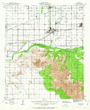
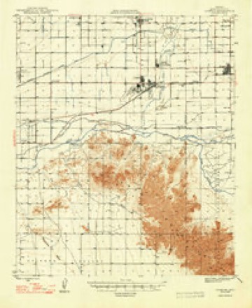
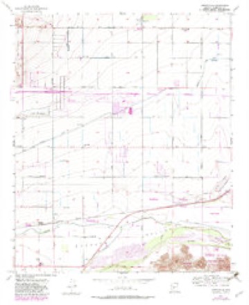
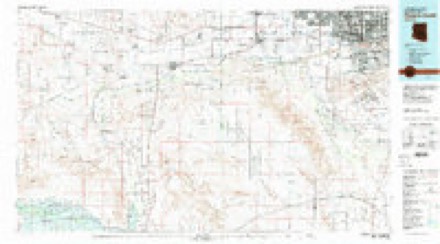
23 topographic sheets cover this place, the earliest surveyed in 1946 and the latest in 1981. It stands in the Buckeye census division. It lies in ZIP code area 85326. The Survey maps it on the Perryville quadrangle.
Topographic sheets covering this place
11 surveys from 23 printed sheetsMatched by testing this settlement's coordinate against the published boundary of every sheet in the United States Geological Survey's historical collection. Each opens the scanned sheet at the Survey.
- 1946 USGS Avondale quadrangle1:62500, 2 printings
- 1948 USGS Cashion quadrangle1:62500, 2 printings
- 1954 USGS Phoenix quadrangle1:250000, 5 printings
- 1957 USGS Perryville quadrangle1:24000, 5 printings
- 1957 USGS Phoenix quadrangle1:250000
- 1958 USGS Phoenix quadrangle1:250000
- 1960 USGS Phoenix quadrangle1:250000
- 1969 USGS Phoenix quadrangle1:250000, 2 printings
- 1971 USGS Perryville quadrangle1:24000
- 1971 USGS Phoenix quadrangle1:250000
- 1981 USGS Phoenix South quadrangle1:100000, 2 printings







Fires near this place
306 since 1993Regional context, not property-specific evidence. The federal wildfire occurrence database lists 306 fires within 5 miles of Liberty between 1993 and 2020, burning about 840 acres in total. 11 started naturally. 11 were recorded as arson. Distance is straight-line from the map coordinates, so a fire counted here may appear on a neighbouring settlement's page as well.
| Reported cause | Fires |
|---|---|
| Missing data/not specified/undetermined | 274 |
| Arson/incendiarism | 11 |
| Natural | 11 |
| Power generation/transmission/distribution | 3 |
| Debris and open burning | 3 |
| Equipment and vehicle use | 3 |
| Smoking | 1 |
The most recent of them, most recent first, with the day each was reported and the service that recorded it.
| Date | Cause | Size | Reported by | Name on the report |
|---|---|---|---|---|
| 8 September 2015 | Missing data/not specified/undetermined | under an acre | Arizona Department of Forestry and Fire Management - State Office | 154014 |
| 7 September 2010 | Missing data/not specified/undetermined | under an acre | Arizona Department of Forestry and Fire Management - State Office | AZ-101018 |
| 4 September 2012 | Missing data/not specified/undetermined | under an acre | Arizona Department of Forestry and Fire Management - State Office | AZ-121872 |
| 30 September 2015 | Missing data/not specified/undetermined | under an acre | Arizona Department of Forestry and Fire Management - State Office | 153858 |
| 30 September 2011 | Missing data/not specified/undetermined | under an acre | Arizona Department of Forestry and Fire Management - State Office | AZ-110709 |
| 26 September 2015 | Missing data/not specified/undetermined | under an acre | Arizona Department of Forestry and Fire Management - State Office | 153890 |
| 25 September 2010 | Missing data/not specified/undetermined | under an acre | Arizona Department of Forestry and Fire Management - State Office | AZ-100999 |
| 24 September 2018 | Natural | under an acre | Buckeye Fire Department | 354310 |
Settlements close enough to share some of these fires:
Mines and quarries near this place
5 within 5 milesRegional context, not property-specific evidence. The federal mineral resources record lists 5 workings within 5 miles of Liberty: 2 past producers, 2 unknowns, 1 producer. 1 still produces. What was taken out: Sand and Gravel, Construction. Distance is straight-line from the map coordinates, so a quarry counted here may appear on a neighbouring settlement's page as well.
| Where | Site | Commodity | Status | Recorded |
|---|---|---|---|---|
| Cotton Lane Pit | Sand and Gravel, Construction | Unknown | ||
| Portable Crusher, King Material | Sand and Gravel, Construction | Past Producer | ||
| Sand and Gravel Quarry | Sand and Gravel, Construction | Past Producer | Sand and Gravel | |
| State of Ariz.-Gravel Pit | Sand and Gravel, Construction | Unknown | ||
| Western Sand & Rock | Sand and Gravel, Construction | Producer |
Storms near this place
31 since 2012Regional context, not property-specific evidence. The National Weather Service names Liberty in 31 storm reports between 2012 and 2025: 18 flash flood, 9 thunderstorm wind, 1 funnel cloud, 1 tornado. The reports record 1 death. Each account below is quoted exactly as the forecast office filed it, from the NOAA Storm Events Database, and each date opens the federal record of that event.
| When | Event | Place named | Harm | What the report says |
|---|---|---|---|---|
| October 2025 | Flash Flood | Liberty | 1 killed, $50,000 | A Maricopa County Flood Control District Stream Gauge along Waterman Wash at Rainbow Valley Road south of Buckeye reported water levels rising above the alarm stage level of 3.1 feet, with water levels peaking at 4.9 feet (1133 cfs). A couple of water rescues were performed near the vicinity of the wash, one near Narramore Road and another near Tuthill Road. One of the flood incidents along the wash turned deadly as a man was found deceased after the pickup truck he was driving was washed away from the floodwaters. The pickup truck was found less than a mile downstream with the man not found, requiring a search and rescue operation to be activated. The body the man was eventually found by the search and rescue team approximately 34 hours after the reported incident. Timing was estimated based on radar and the nearby stream gauge. |
| August 2018 | Thunderstorm Wind | Liberty | $250,000 | A large cluster of intense thunderstorms moved north and across the Rainbow Valley community during the early evening hours on August 2nd. The stronger storms produced strong and damaging microburst winds estimated to be in excess of 70 mph. The strong winds damaged numerous homes in the area. According to the Buckeye Valley Fire Department, between 1800MST and 1830MST strong winds damaged between 10 and 15 homes in the Rainbow Valley area, west of Estrella Mountain Ranch and southeast of Buckeye. At least one home was completely destroyed; fortunately no one was in the home at the time of the damage. Some of the damaged homes appeared to be under construction and not completed structures. Fire department personnel also reported homes with major roof damage near 190th Avenue and Arlington Road, about 8 miles southwest of Goodyear. High tension power lines were also downed in the area. A Severe Thunderstorm Warning was issued for the area at 1812MST and it continued through 1845MST. |
| August 2018 | Thunderstorm Wind | Liberty | $200,000 | A large cluster of thunderstorms moved steadily north and through the southwest and western portion of the greater Phoenix area during the early evening hours on August 2nd. Some of the stronger storms produced gusty, damaging microburst winds that impacted the Estrella Mountain Ranch area to the south of Goodyear. City of Goodyear officials, as well as SRP personnel, reported that around 1830MST, damaging winds blew down 3 large metal transmission towers in a one mile stretch in the Estrella Mountain Ranch community. High tension power lines were downed as well; some of the lines as well as debris from collapsing towers fell on and damaged at least one home in the area. Wind gusts were estimated to be at least 80 mph to cause this damage; the SRP spokesman indicated that the large metal transmission towers should be able to withstand winds upwards of 100 mph, so the actual winds may have been even greater than 80 mph. Fortunately there were no reports of injuries. A Severe Thunderstorm Warning was issued for the area at 1812MST and it was in effect through 1845MST. |
| September 2022 | Thunderstorm Wind | Liberty | $40,000 | Social media pictures showed mobile home and metal shed destroyed in Rainbow Valley from damaging thunderstorm winds. Timing estimated from radar. No injuries were reported. |
| August 2020 | Flash Flood | Liberty | $40,000 | Thunderstorms with heavy rain developed across western portions of the greater Phoenix area during the evening hours on August 29; some of the stronger storms affected the areas around the community of Buckeye. According to the Buckeye Valley fire department and rescue units, at 2003MST deputies responded to a SUV with a family of five that was stuck in a flooded wash in the Buckeye Valley. The SUV was stuck near the intersection of Tuthill and Carla Vista Roads. Fortunately, the family was removed by bystanders. A Flash Flood Watch was in effect at the time of the rescue. |
| August 2018 | Thunderstorm Wind | Liberty | $30,000 | Thunderstorms with gusty and damaging winds moved north and across the southwest portion of the greater Phoenix area during the early evening hours on August 2nd. Some of the stronger storms affected the Estrella Mountain Ranch community. According to a public report, as well as an on-line article on azfamily.com, at about 1830MST gusty outflow winds damaged homes in the Estrella Mountain Ranch subdivision; several trees were downed and some garage doors were caved in due to the gusty winds. Roof tiles were also blown off of at least one roof. Wind gusts were estimated as high as 65 mph. No injuries were reported due to the wind damage. |
| September 2012 | Flash Flood | Liberty | $30,000 | Scattered to numerous showers and thunderstorms developed across the greater Phoenix area during the morning hours on September 7th, and they continued into the afternoon hours over portions of the west valley. Peak rainfall rates at the height of the morning thunderstorms exceeded 2 inches per hour. The heavy rain caused some of the washes in the west valley to fill quickly and to run heavily during the afternoon hours. According to an on-line article and taped interview on ABC15.com, a Century Link employee became stuck on top of his vehicle in the Waterman wash near the intersection of 155th Avenue and Riggs Road in Goodyear. The man drove his truck into the muddy wash in the early afternoon and became stuck in the mud. Shortly afterwards, flash flooding occurred in the wash and the vehicle became submerged nearly to its roof. He was trapped on the roof for 2 to 3 hours before being rescued. Goodyear firefighters used an inflatable raft to reach the man, and the rescue was considered to be very dangerous due to the swiftly flowing water. The man was not injured and he told paramedics that he did not need to go to a hospital. |
| October 2025 | Flash Flood | Liberty | $20,000 | Water rescue performed along Estrella Parkway near Lum Wash. No injuries reported. |
| July 2022 | Thunderstorm Wind | Liberty | $20,000 | Video showed roof torn off of the Bales Hay Farm and Ranch Feed Store located on West Beloat Road in Buckeye. Winds were estimated at 60 mph. Timing estimated from radar. No injuries were reported. |
| July 2017 | Thunderstorm Wind | Liberty | $15,000 | Strong thunderstorms developed across the western portion of the greater Phoenix area during the late afternoon hours on July 18th, and some of them affected the area around the town of Goodyear. At 1715MST, a trained weather spotter located 7 miles southwest of Goodyear reported numerous Palo Verde trees blown down by wind gusts estimated to be as high as 65 mph. Pea sized hail and heavy rain accompanied the strong gusty winds. |
| August 2020 | Thunderstorm Wind | Liberty | $10,000 | Thunderstorms, some with gusty and damaging wind, developed across western portions of the greater Phoenix area during the evening hours on August 29. Some of the stronger storms affected the community of Goodyear. According to a trained weather spotter located 8 miles south of Goodyear, at 1930MST winds estimated to be as high as 60 mph downed about 6 trees with diameters of up to 6 inches. Dozens of smaller branches around 1 inch across were also downed. Shortly after that, at 1945MST, the spotter indicated that some concrete roof tiles were stripped off of a section of a house rooftop. Additionally, a large Palo Verde tree was heavily damaged. There were no reports of injuries due to the strong wind. |
| July 2015 | Thunderstorm Wind | Liberty | $10,000 | Scattered thunderstorms developed across the greater Phoenix metropolitan area during the evening hours on July 6th, and some of them produced gusty and damaging microburst winds estimated to be at least 60 knots in strength. According to a trained weather spotter in the southwest portion of the Phoenix area and to the south of the community of Goodyear, at 1900MST gusty outflow winds downed one wooden power pole along Rainbow Valley Road north of Queen Creek Road. Additionally, an adjacent power pole had it's top snapped off by the high winds. |
| October 2022 | Flash Flood | Liberty | $5,000 | A Maricopa County Flood Control District Streamflow Gauge along Waterman Wash at Rainbow Valley Road showed flow going above alarm stage (3.3 feet) between 19:28 and 20:07 MST and continuing to rise for several hours more to reach a peak flow of 7.25 feet (1700 cfs) at 23:38 MST. Flooding along the wash likely occurred along Tuthill Road, located 3.2 miles downstream and Narramore Road, located 6.4 miles downstream. Flow fell below alarm stage at 07:03 MST on the 16th. A truck was swept off Narramore Road due to the strong current from the wash. There was no information received about the occupants that were inside the truck. |
| October 2018 | Flash Flood | Liberty | $5,000 | Copious amounts of tropical moisture spread north into the greater Phoenix area during the morning hours on October 2nd; the moisture was associated with former hurricane Rosa. The deep moisture resulted in widespread moderate to heavy showers as well as episodes of flash flooding to the southwest of Phoenix. According to a report from the general public, at 1300MST water from the Waterman Wash could be seen inundating Narramore Road. This was clearly evident from drone footage supplied by the public. No injuries or accidents were reported due to the flash flooding. A Flash Flood Warning was issued for the area at 1100MST and the warning remained in effect through 1430MST. |
| October 2018 | Flash Flood | Liberty | $5,000 | Copious amounts of tropical moisture spread north and into the greater Phoenix area during the morning hours on October 2nd; the moisture was associated with the remnants of former hurricane Rosa. The deep moisture resulted in widespread moderate to heavy showers and resulted in episodes of flash flooding to the southwest of Phoenix. According to Maricopa County officials, at 0800MST the Rainbow Valley Elementary School was closed due to flash flooding. The school was located about 8 miles southeast of the town of Buckeye. Fortunately no injuries were reported at the school. |
| August 2017 | Flash Flood | Liberty | $5,000 | Thunderstorms developed across the central and southwest portions of the greater Phoenix area during the morning hours on August 12th, and some of them produced locally heavy rains which impacted areas to the southeast of Buckeye. Intense rain rates in excess of one inch per hour led to episodes of flash flooding during the late morning and early afternoon hours. At 1221MST the Maricopa County Department of Transportation reported that Tuthill Road was closed between Fairview and Ray Roads due to a wash flowing over the road. This was about 8 miles southeast of the town of Buckeye, and west of the Estrella Mountain Regional Park. Shortly after that, at 1242MST, the Department of Transportation reported flash flooding about 6 miles southeast of Buckeye. They reported that Narramore Road was closed between 214th and 218th Avenue due to a wash that was flowing over a road. No injuries were reported due to the flash flooding. A Flash Flood Warning had been issued hours before the flooding, at 0845MST and the warning remained in effect through 1445MST. |
| August 2018 | Flash Flood | Liberty | $3,000 | Scattered thunderstorms moved across the southwest portion of the greater Phoenix area during the evening hours on August 2nd and some of the stronger storms produced locally heavy rainfall; peak rainfall rates were measured in excess of 2 inches per hour at times. The heavy rain led to some flooding and flash flooding southwest of central Phoenix and in the Little Rainbow Valley northeast of the Maricopa Mountains. According to a report by the City of Goodyear Police, at 2200MST Rainbow Valley Road was closed about 2 miles south of Willis Road. The road was not passable due to significant amounts of water rushing across the road. The flooded road was located about 14 miles southeast of Buckeye. A Flash Flood Warning was not in effect at the time but a Flood Advisory had been issued earlier in the evening which expired at 2200MST. |
| September 2025 | Thunderstorm Wind | Liberty | $2,000 | Power lines down in the area of Chandler Heights Road to Komatke Road, between Hays Road and 189th Avenue in Buckeye. No injuries reported. |
| September 2025 | Flash Flood | Liberty | - | A Maricopa County Flood Control District streamflow gauge along Waterman Wash at Rainbow Valley Road in Buckeye had water levels rise above the alarm stage level of 3.1 feet, with the stage peaking at 5.54 feet, and made low-water crossings downstream of the gauge impassable, including Tuthill and Narramore Roads. Timing was estimated based on the period water levels exceeded and then receded below the alarm stage and time it took to reach the aforementioned road crossings. No damages or injuries reported. |
| July 2022 | Flash Flood | Liberty | - | Public videos showed Waterman Wash flowing with several feet of water, making Riggs Rd impassable. A water rescue was also reported in this area. Further downstream, ADOT reported that Tuthill Rd between Fairview St and Pecos Rd as well as Narramore Rd between Airport Rd and Dean Rd were closed due to flooding. These roads are unbridged crossings through Waterman Wash. |
| September 2022 | Flash Flood | Liberty | - | Several roads that intersect Waterman Wash in the Rainbow Valley/Buckeye area were impassable/closed due to flooding. This included Riggs Road, Tuthill Road between between Pecos Road and Fairview Street, and Narramore Road between Dean Road and Airport Road. A Flood Control District of Maricopa County Gauge of Waterman Wash at Rainbow Valley Road reported a peak flow of 6.12 feet (1151 cfs), which was 2.82 feet above alarm stage. No damages or injuries were reported. |
| October 2021 | Hail | Liberty | - | Chaser estimated golf ball sized hail fell near Riggs Road and Bullard Avenue in Rainbow Valley. No damages reported. Time estimated from radar. |
| July 2021 | Flash Flood | Liberty | - | A Maricopa County Flood Control District streamflow gage at Waterman Wash exceeded alarm stage, peaking at 4.66 feet and impacting downstream unbridged crossings along Tuthill Road and Narramore Road. Roads in this area along the wash were closed with social media videos showing swift moving water impacting these roads. No damage or injuries were reported. |
| August 2021 | Flash Flood | Liberty | - | Increased flow in Waterman Wash led to flash flooding at a low water crossing on Narramore Road, resulting in a closure of the road. A nearby Maricopa County Flood Control District stream gage along Waterman Wash at Rainbow Valley Road recorded a peak flow of 2.51 feet. Timing was estimated using the nearby stream gage. |
| July 2018 | Flash Flood | Liberty | - | Thunderstorms developed over the southwest portions of the greater Phoenix area during the afternoon hours on July 14th. Some of the strongest storms produced intense rainfall with peak rain rates in excess of 2 inches per hour. The very heavy rain led to flash flooding in the Little Rainbow Valley, just northeast of the Maricopa Mountains. According to a trained spotter located about 14 miles southeast of the town of Buckeye, a storm produced 0.73 inches of rain within a 20 minute period ending at 1635MST. The intense rain caused Riggs Road and Rainbow Valley Road to become impassable. No Flash Flood Warning was issued, instead a Significant Weather Advisory was issued at 1547MST and it remained in effect through 1630MST. |
| October 2018 | Flash Flood | Liberty | - | Widespread moderate to heavy showers developed over the western portions of the greater Phoenix metropolitan area during the morning and early afternoon hours on October 13th. Peak rain rates with the heavier showers were in excess of one inch per hour and resulted in episodes of flash flooding that affected communities such as Buckeye. According to the Maricopa County Department of Transportation, at 1311MST flash flooding resulted in the closure of Narramore Road to the west of Airport Road. This was approximately 6 miles to the southeast of Buckeye. A Flash Flood Warning was in effect at the time of the flooding. There were no accidents reported due to the flooded roads and hazardous driving conditions. |
| October 2018 | Flash Flood | Liberty | - | Copious amounts of tropical moisture spread north and into the greater Phoenix area during the morning hours on October 2nd; the moisture was associated with the remnants of former hurricane Rosa. The moisture led to widespread moderate to heavy showers as well as episodes of flash flooding. According to a report from a local emergency manager, at 0930MST flash flooding resulted in the closure of Tuthill Road, about 8 miles to the southeast of the town of Buckeye. The report was based on social media as well as flood control district data. A Flash Flood Warning was issued for the area beginning at 0809MST and the warning was in effect through 1115MST. No accidents were reported due to the flooded roads. |
| July 2017 | Heavy Rain | Liberty | - | Scattered thunderstorms developed over portions of the greater Phoenix area during the late afternoon and evening hours and some of them produced locally heavy rainfall with rain rates in excess of one inch per hour. The heavy rain was more than sufficient to cause urban flooding. Locally heavy rain affected the area around and to the south of Goodyear, near Estrella Mountain Ranch. According to a report from the public, at 1930MST heavy rain 10 miles southwest of Goodyear resulted in the the road being under water at the intersection of Willis Road and Rainbow Valley Road. |
| October 2015 | Funnel Cloud | Liberty | - | Scattered thunderstorms developed across the greater Phoenix metropolitan area during the afternoon hours on October 6th; due to stronger than normal wind fields aloft and elevated instability some of the stronger storms produced funnel clouds. According to a trained weather spotter located just to the west of Estrella Mountain Regional Park, a funnel cloud developed in the Rainbow Valley area at about 1210MST. Almost one half hour later, another trained spotter 3 miles north of Perryville reported a funnel cloud just to the north of the Papago Freeway. The funnel clouds were short lived and they never reached the ground. |
| October 2015 | Tornado (EF0) | Liberty | - | Scattered thunderstorms developed across the greater Phoenix metropolitan area during the afternoon hours on October 6th; due to stronger than normal wind fields aloft and elevated instability some of the stronger storms initially produced funnel clouds. However, according to a trained weather spotter and emergency responders located just to the west of Estrella Mountain Regional Park, one of the funnel clouds continued to develop until it touched the ground, forming a land spout tornado. The tornado, which formed in the Rainbow Valley area, was very short lived with a path length less than one mile; no damage was reported. |
| October 2015 | Flash Flood | Liberty | - | Scattered thunderstorms developed across the greater Phoenix metropolitan area during the early afternoon hours on October 6th. Some of the stronger storms produced locally heavy rainfall with rain rates in excess of one inch per hour. The heavy rain led to episodes of flooding and flash flooding to the west of Estrella Mountain Regional Park and to the south of the Gila River. According to a report from the public, flash flooding caused the Waterman Wash to overflow the road at 215th Drive and Narramore Road at approximately 1345MST. The flooding occurred about 3 miles southwest of the town of Liberty. No injuries were reported due to the flooding. Although a Flash Flood Warning was not in effect at the time, there was an Urban and Small Stream Flood Advisory issued for the area starting at 1230MST and running through 1530MST. |
Nearest settlements
The eight closest, with where each one stands in the county. Distances are straight-line, computed from the Geographic Names Information System coordinates.
| Map | Place | Distance | Sheets |
|---|---|---|---|
| Perryville | 2.9 miles | 23 | |
| Valencia | 5.4 miles | 21 | |
| Buckeye | 5.6 miles | 19 | |
| Allenville | 6.3 miles | 19 | |
| Litchfield Junction | 6.7 miles | 23 | |
| Estrella Camp | 6.8 miles | 23 | |
| Litchfield | 7.1 miles | 23 | |
| Goodyear | 7.2 miles | 23 |
Provenance
This settlement is recorded in the Geographic Names Information System as feature 6993. The sheet list is computed by point-in-boundary test against the United States Geological Survey's historical topographic inventory. Both are works of the United States government and carry no copyright under 17 U.S.C. 105.
Wildfire. Short, Karen C. 2022. Spatial wildfire occurrence data for the United States, 1992-2020 [FPA_FOD_20221014]. 6th Edition. Fort Collins, CO: Forest Service Research Data Archive. https://doi.org/10.2737/RDS-2013-0009.6 Collected with United States Government funding and usable without additional permissions or fees.
Mines and quarries. USGS Mineral Resources Data System (MRDS) https://mrdata.usgs.gov/mrds/ A work of the United States government, no copyright under 17 U.S.C. 105.
Storms. NOAA National Centers for Environmental Information, Storm Events Database https://www.ncei.noaa.gov/stormevents/ A work of the United States government, no copyright under 17 U.S.C. 105. Narratives are quoted verbatim from the National Weather Service report and are not edited or summarised.