 Block
Valencia, Arizona
21 topographic sheets cover this place, the earliest surveyed in 1954 and the latest in 1981. It stands in the Buckeye census division. It lies in ZIP code area 85326. The Survey maps it on the Valencia quadrangle.
On record in Valencia
Buildings and businesses the archive holds for this place. Each opens its own page, with the source record it came from.
On the National Register within a mile 2 records
The National Register names another town for these. They stand within one mile of this settlement's coordinate.
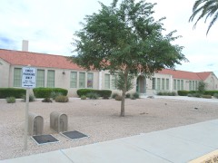 Buckeye Union High School School A-Winglisted 2009 · 0.4 miles away
- Buckeye Woman's Clublisted 2021 · 0.7 miles away
Topographic sheets covering this place
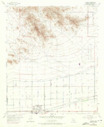
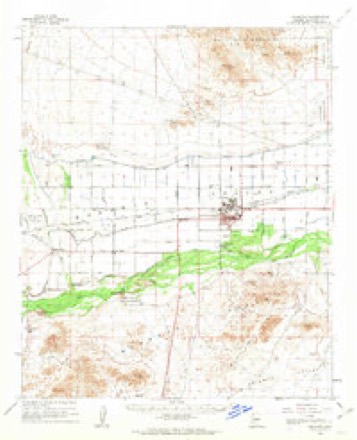
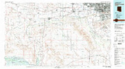
9 surveys from 21 printed sheetsMatched by testing this settlement's coordinate against the published boundary of every sheet in the United States Geological Survey's historical collection. Each opens the scanned sheet at the Survey.
- 1954 USGS Phoenix quadrangle1:250000, 5 printings
- 1957 USGS Phoenix quadrangle1:250000
- 1957 USGS Valencia quadrangle1:24000, 6 printings
- 1958 USGS Buckeye quadrangle1:62500, 2 printings
- 1958 USGS Phoenix quadrangle1:250000
- 1960 USGS Phoenix quadrangle1:250000
- 1969 USGS Phoenix quadrangle1:250000, 2 printings
- 1971 USGS Phoenix quadrangle1:250000
- 1981 USGS Phoenix South quadrangle1:100000, 2 printings






Fires near this place
359 since 1993Regional context, not property-specific evidence. The federal wildfire occurrence database lists 359 fires within 5 miles of Valencia between 1993 and 2020, burning about 1,425 acres in total. 11 started naturally. 25 were recorded as arson. Distance is straight-line from the map coordinates, so a fire counted here may appear on a neighbouring settlement's page as well.
| Reported cause | Fires |
|---|---|
| Missing data/not specified/undetermined | 316 |
| Arson/incendiarism | 25 |
| Natural | 11 |
| Equipment and vehicle use | 2 |
| Power generation/transmission/distribution | 2 |
| Smoking | 1 |
| Misuse of fire by a minor | 1 |
| Debris and open burning | 1 |
The most recent of them, most recent first, with the day each was reported and the service that recorded it.
| Date | Cause | Size | Reported by | Name on the report |
|---|---|---|---|---|
| 9 September 2018 | Arson/incendiarism | under an acre | Buckeye Fire Department | 334632 |
| 8 September 2018 | Missing data/not specified/undetermined | under an acre | Buckeye Fire Department | 334250 |
| 8 September 2012 | Missing data/not specified/undetermined | under an acre | Arizona Department of Forestry and Fire Management - State Office | AZ-121646 |
| 6 September 2018 | Missing data/not specified/undetermined | under an acre | Buckeye Fire Department | 331360 |
| 30 September 2020 | Missing data/not specified/undetermined | under an acre | Arizona Department of Forestry and Fire Management - State Office | not named |
| 30 September 2018 | Arson/incendiarism | under an acre | Buckeye Valley Fire District | 362314 |
| 28 September 2020 | Missing data/not specified/undetermined | under an acre | Arizona Department of Forestry and Fire Management - State Office | not named |
| 25 September 2018 | Arson/incendiarism | under an acre | Buckeye Fire Department | 356467 |
Settlements close enough to share some of these fires:
Mines and quarries near this place
9 within 5 milesRegional context, not property-specific evidence. The federal mineral resources record lists 9 workings within 5 miles of Valencia: 3 unknowns, 2 past producers, 2 producers, 1 prospect. 2 still produce. What was taken out: Mica, Sand and Gravel, Construction, Gold, Copper, Silver, Gold. Distance is straight-line from the map coordinates, so a quarry counted here may appear on a neighbouring settlement's page as well.
| Where | Site | Commodity | Status | Recorded |
|---|---|---|---|---|
| Golden Eagle Mine | Copper, Silver, Gold | Occurrence | Gold | |
| Goldspot#1&2 Pat Claim | Gold | Unknown | ||
| Gravel Pit | Sand and Gravel, Construction | Unknown | ||
| Holder Claims | Gold | Prospect | ||
| United Metro Plant #10, Buckeye, Az | Sand and Gravel, Construction | Producer | ||
| Buckeye Hills Mica | Mica | Past Producer | 1914 | |
| Buckeye Hills Mica | Mica | Unknown | ||
| Buckeye Mica Mill | Mica | Producer | ||
| Elder | Mica | Past Producer |
Storms near this place
19 since 2008Regional context, not property-specific evidence. The National Weather Service names Valencia in 19 storm reports between 2008 and 2023: 15 thunderstorm wind, 4 flash flood. The reports record 5 injuries. Each account below is quoted exactly as the forecast office filed it, from the NOAA Storm Events Database, and each date opens the federal record of that event.
| When | Event | Place named | Harm | What the report says |
|---|---|---|---|---|
| July 2014 | Thunderstorm Wind | Valencia | 5 hurt, $250,000 | Strong thunderstorms developed across portions of the greater Phoenix area, including the town of Buckeye, during the evening hours on July 31st. Due to hot and dry atmospheric conditions, the storms were able to generate strong and damaging microburst winds estimated to be in excess of 70 mph. According to the Buckeye Police and Fire Department, damaging microburst winds overturned 10 RV trailers at 1500 South Apache Road in Buckeye. Local media reported that there were some injuries involved. |
| July 2011 | Thunderstorm Wind | Valencia | $600,000 | Thunderstorms with damaging microburst winds moved across the town of Buckeye during the evening hours on July 5th. Wind gusts estimated to be at least 60 knots ripped away a 5 foot wide section of the roof of Youngker high school in Buckeye. According to Jeff Simmons, Buckeye Union High School District business manager, falling debris shattered at least 2 windows on the adjacent administrative building. After the roof was damaged, rain damaged 10 classrooms at the school. Further to the south, the microburst winds toppled the Buckeye Police Department's 60 foot communications tower, crushing a shaded parking structure near the police offices. Finally, 30 trees near the Youngker campus were damaged by the thunderstorms. The school district's insurance company estimate roof repairs could reach 500 thousand dollars. A new communications tower will cost approximately 100 thousand dollars. |
| August 2008 | Thunderstorm Wind | Valencia | $70,000 | Power poles and lines reported blown down. As many as 70 poles were down in the Buckeye area alone. |
| August 2013 | Thunderstorm Wind | Valencia | $60,000 | Scattered strong thunderstorms affected the greater Phoenix area during the evening hours on August 26th, and they affected the towns of Buckeye, Goodyear and Litchfield Park. The Buckeye airport mesonet sensor measured a sustained wind at 43 mph as well as a peak gust of 68 mph. In addition, a trained weather spotter located 2 miles northeast of Goodyear reported trees uprooted by the strong winds. According to a report from local broadcast media, several trees were uprooted near Litchfield park. Finally, another broadcast media report indicated that a large tree was blown down. When the tree fell it heavily damaged a home in Litchfield Park. A Severe Thunderstorm Warning was in effect for the affected communities; it was issued at 1908MST and it ran through 1945MST. |
| September 2019 | Thunderstorm Wind | Valencia | $25,000 | Scattered thunderstorms developed across the western portions of the greater Phoenix area during the evening hours on September 16th. Some of the stronger storms generated damaging outflow winds that impacted the community of Buckeye. According to a local utility company, at 1936MST gusty winds estimated to be at least 60 mph in strength downed a number of power poles, about 2 miles northeast of Buckeye and near the intersection of Broadway Road and Miller Road. As a result, power outages were reported. No injuries were reported as a result of the falling poles or downed lines. |
| July 2018 | Thunderstorm Wind | Valencia | $25,000 | Isolated high based thunderstorms developed over the central deserts west of Phoenix during the middle of the evening on July 8th, and one of the stronger storms generated gusty outflow winds estimated to be as high as 60 mph. According to a trained weather spotter, at 2100MST strong and gusty crosswinds overturned two semi trailer trucks on Interstate 10 between Verrado Road and Highway 85. This was approximately 4 miles north of the town of Buckeye. The time is estimated based on radar information. No injuries were reported to either of the drivers. |
| August 2014 | Thunderstorm Wind | Valencia | $25,000 | Scattered thunderstorms developed across portions of the greater Phoenix metropolitan area during the evening hours on August 25th, and some of the storms affected the town of Buckeye. The stronger storms produced gusty and damaging outflow winds with peak gusts estimated to be nearly 60 mph at times. According to a report from the Buckeye Police Department, strong thunderstorm winds knocked down multiple power poles about one mile east of town. The downed power poles caused local traffic to be shut down or diverted. No injuries were reported due to the fallen power poles. |
| August 2013 | Thunderstorm Wind | Valencia | $25,000 | Isolated thunderstorms developed across portions of south central Arizona during the evening hours on September 17th. Due to the excessive heat and relatively dry conditions, the storms generated strong and gusty outflow winds, estimated to be in excess of 40 mph. The winds caused areas of blowing dust which affected the community of Buckeye. In addition to the blowing dust, the gusty winds were sufficient in strength to blow down a number of small trees. According to a trained weather spotter in Buckeye, evening thunderstorm winds blew down a number of small trees and large cactus, leaving the roots completely exposed. The damage was near the Sundance Towne Center and in the surrounding neighborhoods. |
| July 2016 | Thunderstorm Wind | Valencia | $20,000 | Strong thunderstorms moved southwestward across the western portion of the greater Phoenix metropolitan area during the evening hours on July 29th. Some of the stronger storms produced gusty and damaging outflow winds well in excess of 60 mph. According to local law enforcement, at about 2050MST gusty winds downed multiple power lines in Buckeye and also overturned a horse trailer. The damage occurred near the intersection of Interstate 10 and North Miller Road. |
| July 2022 | Thunderstorm Wind | Valencia | $10,000 | Report from spotter of solar panels peeled off roofs and large trees 1-2 feet downed near the intersection of West Southern Avenue and South Miller Road in Buckeye. Winds were estimated at 60 mph. Timing estimated from radar. No injuries were reported. |
| July 2016 | Thunderstorm Wind | Valencia | $6,000 | Scattered thunderstorms moved south across the western portion of the greater Phoenix metropolitan area during the evening hours on July 29th and some of them affected the area around the community of Buckeye. The stronger storms produced gusty and damaging winds well in excess of 60 mph. According to a trained weather spotter northeast of Buckeye, gusty winds estimated to be around 60 knots blew down a few Palo Verde trees at about 2040MST. The downed trees were near the intersection of Yuma and Watson roads. |
| August 2023 | Thunderstorm Wind | Valencia | $5,000 | Downed powerlines were reported along the area of Yuma Road to Broadway Road and 231st Avenue to Airport Road in Buckeye. Wind gusts were estimated at around 60 mph. No injuries were reported. |
| July 2018 | Thunderstorm Wind | Valencia | $5,000 | Isolated thunderstorms developed in the central deserts west of Phoenix during the late evening hours on July 8th and some of the stronger storms affected the town of Buckeye. Gusty outflow winds in the area downed trees as well as power lines. According to a trained weather spotter located 2 miles northeast of Buckeye, at 2100MST gusty winds estimated to be as high as 60 mph uprooted two Palo Verde trees with bases around 8 inches in diameter. The downed trees were near the intersection of Baseline Road and Miller Road. Thirty minutes later, local broadcast media reported that gusty winds downed power lines about 3 miles west of Buckeye. The downed lines resulted in power being lost to about 14,000 people. No injuries were reported due to the downed power lines. |
| October 2022 | Flash Flood | Valencia | $2,000 | Social media videos showed water entering homes from backyards being flooded in the area of roadway MC 85 and East Baseline Road. No injuries were reported. |
| October 2018 | Flash Flood | Valencia | $2,000 | Widespread moderate to heavy showers developed across the western portion of the greater Phoenix metropolitan area during the morning and early afternoon hours on October 13th. The heavy showers affected the area around the town of Buckeye. Peak rain rates were in excess of one inch per hour and resulted in episodes of flash flooding. According to the Buckeye Police Department, at 1210MST flash flooding resulted in the closure of Miller Road and Lower Buckeye Road, about 3 miles to the north of Buckeye. A Flash Flood Warning was in effect at the time of the flooding but there were no reports of accidents due to the flooded roads and hazardous driving conditions. |
| August 2021 | Thunderstorm Wind | Valencia | $500 | Large shallow-rooted tree uprooted and fell into the street near Miller Road and Southern Avenue. Wind speeds estimated between 45 to 55 mph. Timing estimated from radar. No injuries were reported. |
| July 2021 | Flash Flood | Valencia | - | Emergency management reported multiple road closures in Buckeye due to flooding. Roads that were closed after experiencing flooding include Dean Road and Broadway Road, Lower Buckeye Road between Watson Road and Rainbow Road, Verrado Way and Broadway Road, and Verrado Way and Yuma Road. No damage or injuries were reported. |
| March 2020 | Flash Flood | Valencia | - | An exiting but still potent upper level disturbance acted upon a still wet and unstable air mass to produce scattered afternoon thunderstorms across portions of the greater Phoenix metropolitan area on March 13th. Some of the stronger storms generated locally heavy rain with peak rain rates well in excess of one inch per hour. Portions of the heavy rain fell in the community of Buckeye resulting in an episode of flash flooding. According to a trained weather spotter located about 3 miles north of the town of Buckeye, at 1605MST flash flooding resulted in flowing water 6 inches deep covering a 20 foot wide swath across Miller Road, just south of lower Buckeye Road. Despite the quickly flowing water there were no reports of any accidents due to the flash flooding. |
| September 2008 | Thunderstorm Wind | Valencia | - | Flood control district sensor measured a gust to 60 mph. |
Nearest settlements
The eight closest, with where each one stands in the county. Distances are straight-line, computed from the Geographic Names Information System coordinates.
| Map | Place | Distance | Sheets |
|---|---|---|---|
| Buckeye | 0.6 miles | 19 | |
| Allenville | 1.9 miles | 19 | |
| Conger | 4.0 miles | 19 | |
| Palo Verde | 5.4 miles | 19 | |
| Liberty | 5.4 miles | 23 | |
| Perryville | 7.6 miles | 23 | |
| Hassayampa | 7.8 miles | 19 | |
| Dixie | 9.3 miles | 17 |
Provenance
This settlement is recorded in the Geographic Names Information System as feature 13156. The sheet list is computed by point-in-boundary test against the United States Geological Survey's historical topographic inventory. Both are works of the United States government and carry no copyright under 17 U.S.C. 105.
Wildfire. Short, Karen C. 2022. Spatial wildfire occurrence data for the United States, 1992-2020 [FPA_FOD_20221014]. 6th Edition. Fort Collins, CO: Forest Service Research Data Archive. https://doi.org/10.2737/RDS-2013-0009.6 Collected with United States Government funding and usable without additional permissions or fees.
Mines and quarries. USGS Mineral Resources Data System (MRDS) https://mrdata.usgs.gov/mrds/ A work of the United States government, no copyright under 17 U.S.C. 105.
Storms. NOAA National Centers for Environmental Information, Storm Events Database https://www.ncei.noaa.gov/stormevents/ A work of the United States government, no copyright under 17 U.S.C. 105. Narratives are quoted verbatim from the National Weather Service report and are not edited or summarised.