 Block
Perryville, Arizona
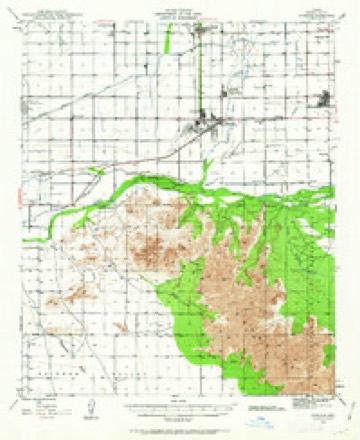
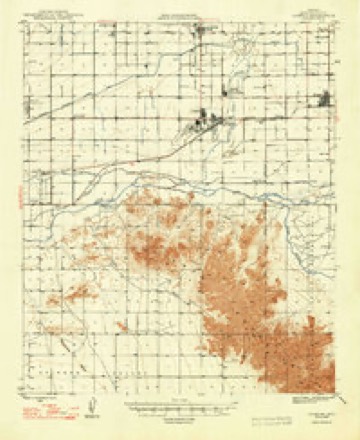
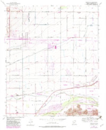
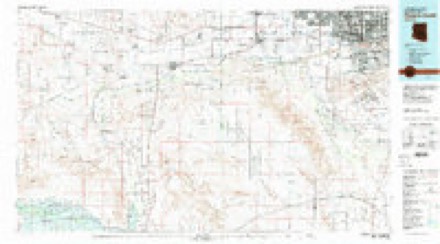
23 topographic sheets cover this place, the earliest surveyed in 1946 and the latest in 1981. It stands in the Phoenix census division. It lies in ZIP code area 85338. The Survey maps it on the Perryville quadrangle.
Topographic sheets covering this place
11 surveys from 23 printed sheetsMatched by testing this settlement's coordinate against the published boundary of every sheet in the United States Geological Survey's historical collection. Each opens the scanned sheet at the Survey.
- 1946 USGS Avondale quadrangle1:62500, 2 printings
- 1948 USGS Cashion quadrangle1:62500, 2 printings
- 1954 USGS Phoenix quadrangle1:250000, 5 printings
- 1957 USGS Perryville quadrangle1:24000, 5 printings
- 1957 USGS Phoenix quadrangle1:250000
- 1958 USGS Phoenix quadrangle1:250000
- 1960 USGS Phoenix quadrangle1:250000
- 1969 USGS Phoenix quadrangle1:250000, 2 printings
- 1971 USGS Perryville quadrangle1:24000
- 1971 USGS Phoenix quadrangle1:250000
- 1981 USGS Phoenix South quadrangle1:100000, 2 printings







Fires near this place
308 since 1992Regional context, not property-specific evidence. The federal wildfire occurrence database lists 308 fires within 5 miles of Perryville between 1992 and 2020, burning about 484 acres in total. 8 started naturally. 9 were recorded as arson. Distance is straight-line from the map coordinates, so a fire counted here may appear on a neighbouring settlement's page as well.
| Reported cause | Fires |
|---|---|
| Missing data/not specified/undetermined | 283 |
| Arson/incendiarism | 9 |
| Natural | 8 |
| Equipment and vehicle use | 3 |
| Debris and open burning | 2 |
| Smoking | 2 |
| Power generation/transmission/distribution | 1 |
The most recent of them, most recent first, with the day each was reported and the service that recorded it.
| Date | Cause | Size | Reported by | Name on the report |
|---|---|---|---|---|
| 4 September 2012 | Missing data/not specified/undetermined | under an acre | Arizona Department of Forestry and Fire Management - State Office | AZ-121872 |
| 30 September 2015 | Missing data/not specified/undetermined | under an acre | Arizona Department of Forestry and Fire Management - State Office | 153858 |
| 30 September 2011 | Missing data/not specified/undetermined | under an acre | Arizona Department of Forestry and Fire Management - State Office | AZ-110709 |
| 26 September 2015 | Missing data/not specified/undetermined | under an acre | Arizona Department of Forestry and Fire Management - State Office | 153890 |
| 25 September 2013 | Missing data/not specified/undetermined | under an acre | Arizona Department of Forestry and Fire Management - State Office | AZ-131975 |
| 25 September 2010 | Missing data/not specified/undetermined | under an acre | Arizona Department of Forestry and Fire Management - State Office | AZ-100999 |
| 23 September 2018 | Arson/incendiarism | under an acre | Buckeye Fire Department | 353927 |
| 20 September 2010 | Missing data/not specified/undetermined | under an acre | Arizona Department of Forestry and Fire Management - State Office | AZ-100998 |
Settlements close enough to share some of these fires:
Mines and quarries near this place
4 within 5 milesRegional context, not property-specific evidence. The federal mineral resources record lists 4 workings within 5 miles of Perryville: 2 past producers, 2 unknowns. None of them still produces. What was taken out: Sand and Gravel, Construction. Distance is straight-line from the map coordinates, so a quarry counted here may appear on a neighbouring settlement's page as well.
| Where | Site | Commodity | Status | Recorded |
|---|---|---|---|---|
| Cotton Lane Pit | Sand and Gravel, Construction | Unknown | ||
| Portable Crusher, King Material | Sand and Gravel, Construction | Past Producer | ||
| Sand and Gravel Quarry | Sand and Gravel, Construction | Past Producer | Sand and Gravel | |
| State of Ariz.-Gravel Pit | Sand and Gravel, Construction | Unknown |
Storms near this place
10 since 2017Regional context, not property-specific evidence. The National Weather Service names Perryville in 10 storm reports between 2017 and 2022: 6 flash flood, 2 hail, 2 thunderstorm wind. No death or injury is recorded in these reports. Each account below is quoted exactly as the forecast office filed it, from the NOAA Storm Events Database, and each date opens the federal record of that event.
| When | Event | Place named | Harm | What the report says |
|---|---|---|---|---|
| July 2022 | Thunderstorm Wind | Perryville | $10,000 | Exit signs damaged and construction trailers flipped over on I-10 eastbound between Watson Road and S Verrado Way. No injuries were reported. |
| July 2022 | Thunderstorm Wind | Perryville | $5,000 | Social media images showed several large uprooted trees in the Verrado area of Buckeye. Timing estimated from radar. No injuries were reported. |
| November 2019 | Flash Flood | Perryville | $2,000 | Widespread rain, moderate to locally heavy, developed during the morning hours across the western portion of the greater Phoenix metropolitan area on November 20th. Isolated thunderstorms also were embedded in the rain, locally enhancing rainfall totals. The heavy rain resulted in a few episodes of flash flooding that affected areas around the town of Goodyear. At about 0856MST, the city of Goodyear reported several instances of flash flooding along Citrus Road that resulted in street closures. Citrus road was reported closed from Van Buren Street to Roosevelt Street; additionally Mcdowell Road westbound from Cotton Lane to Citrus Road was closed. They also reported that Citrus Road was closed from Thomas Road to Indian School Road. Finally, at 0913MST the department of highways reported that McDowell Road eastbound and westbound was closed between 187th Avenue and 191st Avenue due to flooding. There were no reports of accidents due to the flash flooding. |
| October 2018 | Flash Flood | Perryville | $2,000 | Widespread moderate to heavy showers developed across the western portions of the greater Phoenix metropolitan area during the morning and early afternoon hours on October 13th. Some of the heavy showers affected the areas around the community of Goodyear. Peak rain rates were in excess of one inch per hour and resulted in episodes of flash flooding. According to the City of Goodyear Emergency Manager, at 1234MST flash flooding resulted in the closure of Citrus Road between McDowell Road and Van Buren Road. The road was closed in both directions due to the flooding. The flooding occurred just west of the intersection of the Loop 303 highway and Interstate 10, about 2 miles northwest of Goodyear. A Flash Flood Warning was in effect at the time of the flooding; there were no reports of accidents due to the flooded roads and hazardous driving conditions. |
| October 2018 | Flash Flood | Perryville | $2,000 | Copious amounts of deep tropical moisture spread north into the greater Phoenix area during the morning hours on October 2nd; the moisture was associated with former hurricane Rosa. The moisture led to widespread moderate to heavy showers and many areas picked up between 1 and 3 inches of rain. The heavy rain resulted in episodes of morning flash flooding, which impacted communities west of Phoenix such as Goodyear. According to the City of Goodyear Emergency Manager, flash flooding resulted in the closure of Citrus Road between Van Buren Street and Roosevelt Street. The road was reported closed at 1004MST. A Flash Flood Warning was issued for the area at 0730MST and the warning remained in effect through 1030MST, although heavy rains continued into the afternoon hours. |
| August 2021 | Flash Flood | Perryville | - | The City of Goodyear reported that Citrus Road was closed between I-10 and Van Buren Street as well as Yuma Road and Durango Street due to flooding. No damage or injuries were reported. |
| November 2019 | Hail | Perryville | - | Strong thunderstorms developed across the western portion of the greater Phoenix area during the afternoon hours on November 21st. One of the especially strong storms produced large hail in excess of one inch in diameter. There was a public report of hailstones up to 1.25 inches in diameter as measured by a ruler. The large hail fell in the Buckeye Valley, near the intersection of Lower Buckeye Road and Tuthill road. The stones were pictured on social media; no damage was reported due to the large hail. |
| November 2019 | Hail | Perryville | - | Strong thunderstorms developed across the western portion of the greater Phoenix area during the afternoon hours on November 21st, and they affected areas around the community of Goodyear. One of the especially strong storms produced large hail. According to a report from the public, half dollar sized hailstones, with diameters reaching 1.25 inches, fell about 4 miles southwest of Goodyear and near the intersection of Broadway Road and Perryville Road. No damage was reported due to the large hail. |
| August 2017 | Flash Flood | Perryville | - | Scattered thunderstorms developed during the late evening hours across the western portion of the greater Phoenix metropolitan area and some of the stronger storms affected the west valley near the community of Goodyear. The storms generated locally heavy rain with peak rain rates in excess of one inch per hour, more than sufficient to cause localized flash flooding given the urban nature of the surface, with impermeable ground covered in concrete and asphalt. At 2233MST, a public report was received indicating flash flooding near the intersection of Interstate 10 and Sarival Road; the flooding caused roads in the area to become impassable. The flash flooding was only a mile or two northwest of the Phoenix Goodyear Airport. A few minutes later at 2240MST, another public report was received indicating that flash flooding had caused 8 to 10 inches of water to be standing on the roads about 2 miles northwest of Goodyear. The flooding was just north of McDowell Road and east of the Loop 303 freeway, near the intersection of West Almeria Road and North 160th Avenue. A Flash Flood Warning was in effect at the time of the flooding; it was issued at 2212MST and ran through 0115MST the next morning. |
| July 2017 | Flash Flood | Perryville | - | Thunderstorms with locally heavy rainfall developed across much of the greater Phoenix area, including the western communities such as Goodyear, during the morning hours on July 24th. Peak rain rates reached to at least 2 inches per hour with some of heavier showers and this intense rainfall resulted in episodes of flooding and flash flooding during the morning hours. According to local law enforcement, at 1030MST flash flooding occurred about 2 miles northwest of Goodyear. Cotton Lane near McDowell Road was closed due to the flash flooding. No injuries were reported however. A Flash Flood Warning was in effect at the time of the flash flooding. |
Nearest settlements
The eight closest, with where each one stands in the county. Distances are straight-line, computed from the Geographic Names Information System coordinates.
| Map | Place | Distance | Sheets |
|---|---|---|---|
| Liberty | 2.9 miles | 23 | |
| McMicken | 4.6 miles | 23 | |
| Estrella Camp | 4.7 miles | 23 | |
| Litchfield Junction | 5.3 miles | 23 | |
| Goodyear | 5.5 miles | 23 | |
| Litchfield | 5.7 miles | 23 | |
| Avondale | 5.9 miles | 23 | |
| Winnwood Homes | 6.4 miles | 23 |
Provenance
This settlement is recorded in the Geographic Names Information System as feature 9336. The sheet list is computed by point-in-boundary test against the United States Geological Survey's historical topographic inventory. Both are works of the United States government and carry no copyright under 17 U.S.C. 105.
Wildfire. Short, Karen C. 2022. Spatial wildfire occurrence data for the United States, 1992-2020 [FPA_FOD_20221014]. 6th Edition. Fort Collins, CO: Forest Service Research Data Archive. https://doi.org/10.2737/RDS-2013-0009.6 Collected with United States Government funding and usable without additional permissions or fees.
Mines and quarries. USGS Mineral Resources Data System (MRDS) https://mrdata.usgs.gov/mrds/ A work of the United States government, no copyright under 17 U.S.C. 105.
Storms. NOAA National Centers for Environmental Information, Storm Events Database https://www.ncei.noaa.gov/stormevents/ A work of the United States government, no copyright under 17 U.S.C. 105. Narratives are quoted verbatim from the National Weather Service report and are not edited or summarised.