 Block
Wenden, Arizona
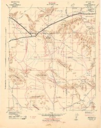
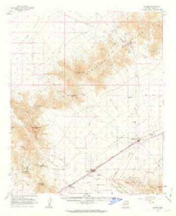
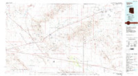
17 topographic sheets cover this place, the earliest surveyed in 1942 and the latest in 1990. It stands in the Parker census division. It lies in ZIP code area 85357. The Survey maps it on the Salome quadrangle. 458 people lived here at the 2020 count. It stands 1,867 feet above sea level.
On record in Wenden
Buildings and businesses the archive holds for this place. Each opens its own page, with the source record it came from.
On the National Register 1 record
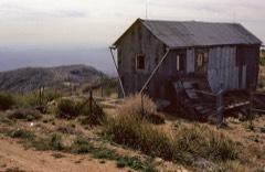 Harquahala Peak Observatorylisted 1975
Population over time
3 figuresWenden fell from 556 to 458 between 2000 and 2020. These are the recorded population figures Wikidata holds for this place, reached through the Geographic Names Information System number this page is keyed on rather than by name, so they belong to this place and not to another of the same name. Most are census counts, but not all are: an early figure may be a founding or settlement estimate, and an estimate published within five years of a census is left out. The change column is computed, and is left blank where more than 20 years separate a figure from the one before it, because a gap that long is not a change between two counts.
| Year | People | Change |
|---|---|---|
| 2000 | 556 | |
| 2010 | 728 | +172 (+31%) |
| 2020 | 458 | -270 (-37%) |
Topographic sheets covering this place
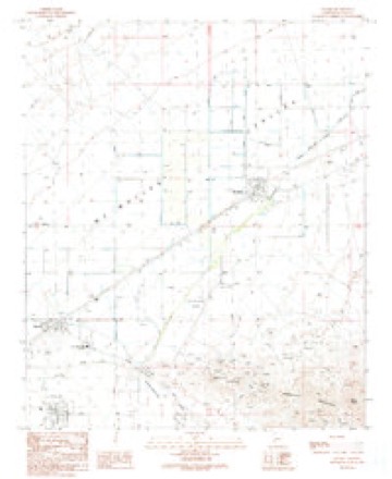
10 surveys from 17 printed sheetsMatched by testing this settlement's coordinate against the published boundary of every sheet in the United States Geological Survey's historical collection. Each opens the scanned sheet at the Survey.
- 1942 USGS Vicksburg quadrangle1:250000
- 1954 USGS Phoenix quadrangle1:250000, 5 printings
- 1957 USGS Phoenix quadrangle1:250000
- 1958 USGS Phoenix quadrangle1:250000
- 1960 USGS Phoenix quadrangle1:250000
- 1961 USGS Salome quadrangle1:62500, 3 printings
- 1969 USGS Phoenix quadrangle1:250000, 2 printings
- 1971 USGS Phoenix quadrangle1:250000
- 1984 USGS Salome quadrangle1:100000
- 1990 USGS Salome quadrangle1:24000






Fires near this place
10 since 1995Regional context, not property-specific evidence. The federal wildfire occurrence database lists 10 fires within 5 miles of Wenden between 1995 and 2016, burning about 969 acres in total. None started naturally. None was recorded as arson. Distance is straight-line from the map coordinates, so a fire counted here may appear on a neighbouring settlement's page as well.
| Reported cause | Fires |
|---|---|
| Missing data/not specified/undetermined | 7 |
| Debris and open burning | 2 |
| Equipment and vehicle use | 1 |
The most recent of them, most recent first, with the day each was reported and the service that recorded it.
| Date | Cause | Size | Reported by | Name on the report |
|---|---|---|---|---|
| 2 August 1995 | Missing data/not specified/undetermined | 600 acres | Arizona Department of Forestry and Fire Management - State Office | not named |
| 5 July 1999 | Debris and open burning | 33 acres | Colorado River District | CENTENNIAL |
| 3 July 2014 | Missing data/not specified/undetermined | under an acre | Arizona Department of Forestry and Fire Management - State Office | WENDEN |
| 9 June 2006 | Missing data/not specified/undetermined | 10 acres | Arizona Department of Forestry and Fire Management - State Office | SALOME |
| 18 June 2001 | Missing data/not specified/undetermined | under an acre | Arizona Department of Forestry and Fire Management - State Office | BAIT |
| 24 May 2013 | Missing data/not specified/undetermined | under an acre | Arizona Department of Forestry and Fire Management - State Office | WEST BOUND |
| 21 May 2006 | Missing data/not specified/undetermined | 300 acres | Colorado River District | DEL MONTE |
| 30 April 2002 | Debris and open burning | 5.0 acres | Arizona Department of Forestry and Fire Management - State Office | EARTH WENDEN |
Settlements close enough to share some of these fires:
Mines and quarries near this place
10 of 18 shownRegional context, not property-specific evidence. The federal mineral resources record lists 18 workings within 5 miles of Wenden: 12 unknowns, 6 past producers. None of them still produces. What was taken out: Geothermal, Gold, Copper, Iron. Distance is straight-line from the map coordinates, so a quarry counted here may appear on a neighbouring settlement's page as well.
| Where | Site | Commodity | Status | Recorded |
|---|---|---|---|---|
| Blue Eagle Et Al Mines | Gold, Silver, Tungsten | Past Producer | ||
| Hercules | Gold, Copper, Silver | Unknown | ||
| Hercules Mine | Gold, Silver, Copper, Iron | Past Producer | 1950 | |
| Huthmacher Mill | Tungsten | Past Producer | ||
| San Marcos Mine | Gold, Silver, Copper, Iron | Past Producer | Gold, Silver, Specularite | |
| Gold Leaf Group | Gold, Silver, Copper | Past Producer | ||
| San Marcos Mine | Gold, Silver, Copper | Past Producer | ||
| Petes Well | Geothermal | Unknown | ||
| Unknown | Geothermal | Unknown | ||
| Unknown | Geothermal | Unknown |
Storms near this place
20 since 1995Regional context, not property-specific evidence. The National Weather Service names Wenden in 20 storm reports between 1995 and 2024: 8 flash flood, 7 thunderstorm wind, 2 heavy rain, 2 flood. The reports record 1 death. Each account below is quoted exactly as the forecast office filed it, from the NOAA Storm Events Database, and each date opens the federal record of that event.
| When | Event | Place named | Harm | What the report says |
|---|---|---|---|---|
| October 2000 | Flash Flood | Wenden | 1 killed, $6,200,000 | In the early morning hours of Sunday October 22, a large low pressure area dumped four to six inches of rain over parts of eastern LaPaz and western Maricopa County. This caused flash flooding in the upper part of the Centennial Wash between the Harcuvar and Harquahala mountain ranges. The heavy runoff flowed into the town of Wenden where water ran over the highway 60 bridge. At its peak the wash was about 3/8ths of a mile wide and 12 feet deep. The resulting high water surged through the town of Wenden with at least 400 residents evacuated. There was extensive damage to the town and for many miles downstream. The reported flow was in excess of 20,000 cfs. When the flood hit Wenden, it inundated some mobile homes, causing them to lift off their foundations and float down the wash. An estimated 125 mobile homes were affected. One migrant worker was killed when flood waters swept through the town during the early morning hours. Additional heavy rainfall hit this area several days later and complicated relief efforts for many of the homeless. |
| August 2005 | Flash Flood | Wenden | $100,000 | Roads damaged by heavy rains. |
| August 2022 | Flash Flood | Wenden | $75,000 | Flow in Centennial Wash caused a low water crossing along Centennial Park Road to become impassable. An RV attempted to cross the flooded roadway but was swept off the road. Images also showed damage to the roadway from the flooding. No injuries were reported. |
| August 2022 | Flash Flood | Wenden | $50,000 | Images showed parts of Alamo Road washed out due to high flow over low water crossings. Timing and exact location estimated from radar. No injuries were reported. |
| September 2013 | Flash Flood | Wenden | $25,000 | Thunderstorms with locally heavy rainfall developed once again over portions of La Paz county during the morning hours on September 10th and as a result, flash flooding developed in the Centennial Wash. Previous heavy rains over the past day or two simply exacerbated the flow down Centennial Wash and as a result a Flash Flood Warning was issued at 1102MST for east central La Paz county including the communities of Wenden, Salome and Harcuvar. According to La Paz county Emergency Management and Sheriff's Offices, excessive storm runoff into the wash raised the water level significantly and flash flooding was occuring, threatening properties along the wash banks and leading to limited evacuations. Many roads in the Wenden area were closed as a result of flow through the wash. |
| August 2010 | Thunderstorm Wind | Wenden | $15,000 | A park ranger at the Alamo Lake State Park reported downburst winds of at least 60 mph. The strong winds resulted in many tree limbs downed. |
| September 2022 | Flash Flood | Wenden | $10,000 | Photos from the La Paz County Public Works showed parts of Alamo Road washed out due to extensive flooding from overflowing washes that intersect the road. Timing estimated from radar. No injuries were reported. |
| August 2024 | Thunderstorm Wind | Wenden | $5,000 | Reports of multiple power poles down, causing a power outage, near Salome. Wind gusts were estimated upwards of 55-60 mph. No injuries were reported. |
| July 2017 | Flash Flood | Wenden | $5,000 | Strong thunderstorms with locally heavy rain developed across portions of La Paz County during the early afternoon hours on July 24th; peak rain rates were in excess of one inch per hour and were sufficient to cause some flash flooding over the east-central portion of the county. According to La Paz County emergency managment, as of 1309MST flash flooding resulted in the closure of Salome Road between the town of Salome and Interstate 10. Salome Road was underwater and impassible. This was about 9 miles northwest of the town of Centennial. A Flash Flood Warning was issued for the area at 1222MST and it remained in effect for the rest of the afternoon. |
| July 2005 | Thunderstorm Wind | Wenden | $5,000 | Several power poles down along US route 60. |
| August 1996 | Thunderstorm Wind | Wenden | $3,000 | no account filed |
| September 2019 | Flood | Wenden | $2,000 | Scattered showers and thunderstorms continued to produce significant rainfall across much of La Paz County during the early morning hours on September 24th and several episodes of flash flooding were reported. Although most of the heavy rain ended during the early morning, water continued to drain into area washes, and across roads, for the rest of the morning and into the afternoon resulting in some lingering flooding concerns. According to the Arizona Department of Highways, at 1721MST Highway 60 was closed approximately 2 miles to the northeast of the town of Wenden. The road was closed due to flooding; flowing water from Centennial Wash as well as rains from much earlier in the day caused the flooding. Fortunately there were no reports of accidents due to the flooding and associated hazardous driving conditions. Despite the reports of flooding, no flood warnings or advisories were in effect for the area during the afternoon or evening hours. |
| March 2020 | Flood | Wenden | - | A powerful Pacific upper level low spread considerable moisture into the southwest Arizona deserts on March 12th, resulting in the development of scattered to numerous showers during afternoon and evening hours. There were embedded thunderstorms that helped generate heavy rain over portions of La Paz County. The heavy rain resulted in an episode of flooding over eastern portions of the county. According to county officials, at 2208MST Centennial Wash exceeded alarm stage due to flooding. This occurred near the town of Wenden. There were no reports of accidents due to the flooding. |
| September 2019 | Thunderstorm Wind | Wenden | - | Scattered monsoon thunderstorms developed across portions of La Paz County during the evening hours on September 1st and some of the storms produced very strong and gusty outflow winds. At 2053MST, the Smith Peak RAWS station with an ID of QHQA3 measured a wind gust to 75 mph. There were no reports of damage or injury associated with the strong gust. |
| November 2019 | Funnel Cloud | Wenden | - | A strong thunderstorm developed near the La Paz and Maricopa county border during the afternoon on November 21st. Multiple social and broadcast media reports, with photos and video, of this storm depicted a cold air funnel near mile markers 63-64 on I-10. While there was no damage associated with the funnel cloud, the rarity of the funnel made it especially noteworthy and generated significant media interest. |
| September 2014 | Heavy Rain | Wenden | - | Thunderstorms with heavy rainfall developed across central and eastern La Paz county during the late night hours on September 7th, and they continued to produce heavy rain into the early morning on September 8th. Rainfall rates with the stronger storms were at least 2 inches per hour at times, and some of the heavy rainfall affected the town of Wenden. At 0124MST, a trained spotter 2 miles northwest of Wenden measured 1 inch of rain in a period of just 30 minutes. The heavy rain caused washes in the area, such as Centennial Wash, to run very heavily. At 0117MST a Flash Flood Warning was issued for east central La Paz county, including the town of Wenden, and it continued in effect through 0415MST. |
| August 2013 | Heavy Rain | Wenden | - | Significant amounts of tropical moisture continued to spread into southern Arizona during the morning hours on August 24th, and this led to a very moist and unstable airmass. Scattered thunderstorms with locally heavy rain developed and moved into La Paz county after about 0630MST, and led to flooding of area roads and washes. Some of the areas hit the hardest were the Highway 60 and Interstate 10 corridors to the east of Brenda. A Small Stream Flood Advisory was issued for central La Paz county beginning at 0628MST and it continued through 0930MST. According to a trained spotter located about 2 miles northwest of Wenden, 1.2 inches of rain fell in a 30 minute period ending at 0715MST and it was still raining hard. |
| August 2010 | Thunderstorm Wind | Wenden | - | Law enforcement officials reported that several power poles were blown down in the city of Wenden. The poles were downed due to strong thunderstorm winds estimated to be in excess of 50kt. |
| August 1997 | Flash Flood | Wenden | - | Centennial Wash filled with water due to heavy thunderstorm rains. La Paz County Sheriff's Office reported that the water flowed across Highway 60 near Wenden and caused some damage to the highway. |
| August 1995 | Thunderstorm Wind | Wenden | - | Winds from a thunderstorm blew out windows and damaged roofs to residences and businesses. Some trees were uprooted and limbs snapped causing some minor damage to parked cars. |
Nearest settlements
The eight closest, with where each one stands in the county. Distances are straight-line, computed from the Geographic Names Information System coordinates.
Elsewhere
Matched on this settlement's Geographic Names Information System number rather than its name, so it cannot be a different place of the same name in another state.
| Wikipedia article on Wenden | An encyclopaedic summary. Its text is share-alike, so it is linked here rather than copied. |
| Wikidata item Q1639676 | The structured record the population and elevation above come from. Public domain (CC0). |
Provenance
This settlement is recorded in the Geographic Names Information System as feature 13469. The sheet list is computed by point-in-boundary test against the United States Geological Survey's historical topographic inventory. Both are works of the United States government and carry no copyright under 17 U.S.C. 105.
Wildfire. Short, Karen C. 2022. Spatial wildfire occurrence data for the United States, 1992-2020 [FPA_FOD_20221014]. 6th Edition. Fort Collins, CO: Forest Service Research Data Archive. https://doi.org/10.2737/RDS-2013-0009.6 Collected with United States Government funding and usable without additional permissions or fees.
Mines and quarries. USGS Mineral Resources Data System (MRDS) https://mrdata.usgs.gov/mrds/ A work of the United States government, no copyright under 17 U.S.C. 105.
Storms. NOAA National Centers for Environmental Information, Storm Events Database https://www.ncei.noaa.gov/stormevents/ A work of the United States government, no copyright under 17 U.S.C. 105. Narratives are quoted verbatim from the National Weather Service report and are not edited or summarised.