 Block
Ashford, Connecticut
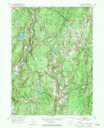
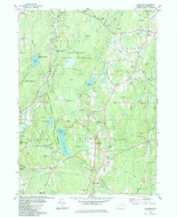
28 topographic sheets cover this place, the earliest surveyed in 1892 and the latest in 1994. It stands in Ashford town. It lies in ZIP code area 06278. It lies near Bucket Hill. The Survey maps it on the Hampton quadrangle.
On record in Ashford
Buildings and businesses the archive holds for this place. Each opens its own page, with the source record it came from.
On the National Register 4 records
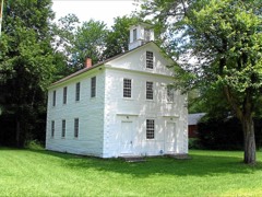 Ashford Academylisted 1988
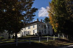 Church Farmlisted 1988
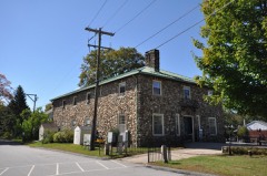 Knowlton Memorial Halllisted 1994
 Mixer Tavernlisted 1994
Topographic sheets covering this place
13 surveys from 28 printed sheetsMatched by testing this settlement's coordinate against the published boundary of every sheet in the United States Geological Survey's historical collection. Each opens the scanned sheet at the Survey.
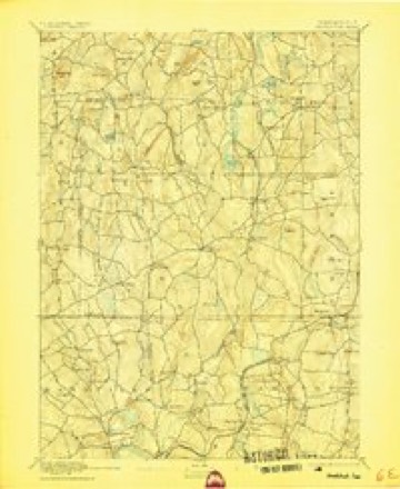
- 1892 USGS Woodstock quadrangle1:62500, 6 printings
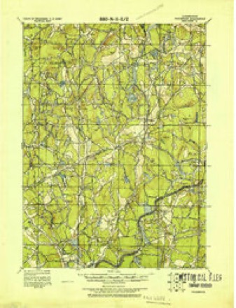
- 1921 USGS Woodstock quadrangle1:62500
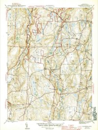
- 1944 USGS Hampton quadrangle1:31680, 2 printings
- 1947 USGS Hartford quadrangle1:250000, 2 printings
- 1948 USGS Hartford quadrangle1:250000, 2 printings
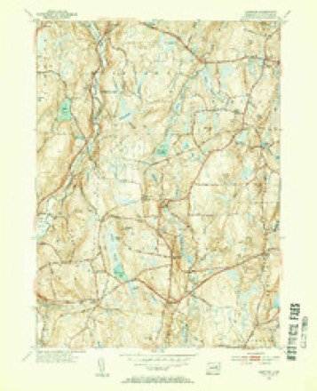
- 1953 USGS Hampton quadrangle1:31680, 2 printings
- 1953 USGS Hampton quadrangle1:24000, 3 printings
- 1961 USGS Hartford quadrangle1:250000
- 1962 USGS Hartford quadrangle1:250000, 3 printings
- 1965 USGS Hartford quadrangle1:250000, 2 printings
- 1984 USGS Hampton quadrangle1:24000
- 1986 USGS Hartford quadrangle1:100000
- 1994 USGS Hartford quadrangle1:100000, 2 printings







In the county-history sources
25,487 words on this townshipHistory of Windham County, Connecticut .., published 1889 names this settlement in its chapter on Ashford Town. These are the passages that mention it, exactly as the scans read.
At this time representations had been made to the general court of Connecticut upon wliich that body on the 9th of May, 1706, granted to " such good people as shall be willing to settle thereon," a township eight miles square, and appointed a committee of its own members to lay out the township by actual survey, also to lay out home lots and other divisions of land, to order and manage the affairs of the town and to admit and settle all such inhabitants as should be approved, and who should pay their proportionate share of the expense of surveying and settling the same. This action of the court aroused Major Fitch to action, and he at once began to push the sale of lands Avhich he claimed. In 1707, a tract five miles in length and three in width was purchased for £110, by John Gushing, Samuel Clap and David Jacob, of Scituate, and laid out on the west of the Stoddard tract, and was called the New Scituate Plantation. Captain John Chandler soon purchased a large part of this tract and a strip of land adjacent, and became the chief proprietor of New Scituate. The whole remaining territory of original Ashford, comprising 21,400 acres, was sold by Major Fitch to James Corbin, of Woodstock, in 1708, and he conveyed the same to David Jacob, Job Randall and twelve others, residents of Scituate, Hingham and Andover, Mr. Corbin retaining an equal share in the land and managing the affairs of the company. These tracts were laid out as rapidly as possible, and efforts made to initiate a settlement in advance of the government. The proprietors had but partial confidence in the validity of their titles. The first actual settlement upon this land appears to have been by John Mixer, of Canterbury, who for four pounds purchased a tract of one hundred acres, the deed to which containing the stipulation that if the proprietors' right should be proven invalid the four pounds should be returned to the purchaser. His land lay on the river at a place called Mount Hope, where the present village of Warrenville is situated. This was in January, 1710. A few months later, in April, John Perry, of Marlborough, bought three hundred and fifty acres near the present site of Eastford village, and settled upon it.
Passage source: History of Windham County, Connecticut .., published 1889.
The general court, whose committee had done nothing toward laying out a town here, now reappointed a committee with more practical instructions to proceed at once with the project of establishing a town here. The committee now took possession of the township and undertook to lay it out in the name of the col- ony. The name Ashford was suggested by the great number of ash trees which grew in the primitive forests. The region was rough, rocky and unattractive, a great portion of it being covered with dense forests which abounded in wolves, bears and various species of game. This was a favorite hunting ground of the remaining Wabbaquassets, who secured large quantities of furs here, which they furnished in trade to Mr. Corbin, who derived therefrom a considerable revenue. Only two families of white inhabitants, and they living five miles apart, were now upon the tract. The impending contest between the individual proprietors already mentioned and the government of Connecticut was a serious obstacle in the way of settlement. Both parties ap- - pealed to the general court ; the representatives of the Fitch title for confirmation of their title and liberty to settle, and the committee to show their inability to carry out their instructions under existing circumstances. While the court was undecided as to what course to take, the claimants under Fitch pushed forward the work of settlement. Philip Eastman, of Woodstock, and John Pitts, Benjamin Allen, Benjamin Russel and William Ward, of Marlborough, bought farms of James Corbin and settled on them, north of the Stoddard tract, on Still river, in the summer of 1711. Houses were built, lands broken up, and a highway was laid out by these settlers. In the following year William Price, senior and junior, David Bishop, Nathaniel Walker, John Chubb and John Ross bought land of Corbin and joined the eastern settlement. Daniel James and Nathaniel Fuller, of Windham, Josiah Bugbee, of Woodstock, and Samuel Rice and Philip Squier, of Concord, purchased farms of Captain Chandler in New Scituate. The court's committee also sold some land. Homesteads were purchased of them by Isaac Kendall, William Chapman, Isaac Farrar and Simon Burton.
Passage source: History of Windham County, Connecticut .., published 1889.
In answer to a petition of the settlers, in October, 1714, the general court granted town privileges, which included the right to elect officers for carrying on the prudential affairs of the place, building a meeting house and settling and maintaining a minister. The inhabitants were also instructed to employ the surveyor of Hartford county to lay out the town eight miles square, and each claimant of land within its limits should within one year enter the deed or other record or instrument by which he claimed title in a book to be provided by the town clerk for the purpose. At the same date a quit-claim to 10,240 acres of land in Ashford on the Pomfret line was granted by the general court to Simeon Stoddard and heirs, of Boston. Other non-resident claimants complied as soon as possible with the requirements of the court respecting the recording of land evidences.
Passage source: History of Windham County, Connecticut .., published 1889.
Machine-read from a century-old scan, so expect the errors a machine makes: misspelled names, dropped words, stray characters.
Read the whole chapter on Ashford Town - it names this place 64 more 64 times.
Fires near this place
38 since 2006Regional context, not property-specific evidence. The federal wildfire occurrence database lists 38 fires within 5 miles of Ashford between 2006 and 2020, burning about 66 acres in total. None started naturally. None was recorded as arson. Distance is straight-line from the map coordinates, so a fire counted here may appear on a neighbouring settlement's page as well.
| Reported cause | Fires |
|---|---|
| Missing data/not specified/undetermined | 28 |
| Debris and open burning | 4 |
| Recreation and ceremony | 3 |
| Smoking | 3 |
The most recent of them, most recent first, with the day each was reported and the service that recorded it.
| Date | Cause | Size | Reported by | Name on the report |
|---|---|---|---|---|
| 23 September 2020 | Missing data/not specified/undetermined | 1.0 acres | Connecticut Division of Forestry | 100 PUMPKIN HILL ROAD |
| 19 September 2020 | Missing data/not specified/undetermined | under an acre | Connecticut Division of Forestry | 100 PUMPKIN HILL ROAD |
| 16 September 2020 | Recreation and ceremony | under an acre | Connecticut Division of Forestry | 15 PUMPKIN HILL ROAD |
| 17 August 2020 | Missing data/not specified/undetermined | under an acre | Connecticut Division of Forestry | 13 BUELL DRIVE |
| 9 June 2016 | Missing data/not specified/undetermined | under an acre | Connecticut Division of Forestry | 57 UNION RD, EASTFORD CT |
| 21 May 2008 | Debris and open burning | under an acre | Connecticut Division of Forestry | not named |
| 15 May 2015 | Missing data/not specified/undetermined | under an acre | Connecticut Division of Forestry | not named |
| 13 May 2008 | Debris and open burning | 1.5 acres | Connecticut Division of Forestry | not named |
Settlements close enough to share some of these fires:
Mines and quarries near this place
1 within 5 milesRegional context, not property-specific evidence. The federal mineral resources record lists 1 working within 5 miles of Ashford: 1 past producer. None of them still produces. What was taken out: Sand and Gravel, Construction. Distance is straight-line from the map coordinates, so a quarry counted here may appear on a neighbouring settlement's page as well.
| Where | Site | Commodity | Status | Recorded |
|---|---|---|---|---|
| Latham Pit | Sand and Gravel, Construction | Past Producer |
Storms near this place
15 since 1999Regional context, not property-specific evidence. The National Weather Service names Ashford in 15 storm reports between 1999 and 2023: 10 thunderstorm wind, 1 heavy rain, 1 hail, 1 tornado. No death or injury is recorded in these reports. Each account below is quoted exactly as the forecast office filed it, from the NOAA Storm Events Database, and each date opens the federal record of that event.
| When | Event | Place named | Harm | What the report says |
|---|---|---|---|---|
| July 2006 | Thunderstorm Wind | Ashford | $50,000 | no account filed |
| July 2018 | Tornado (EF0) | Ashford | $30,000 | At 3 PM EST, an EF-0 tornado touched down west of Ashford Lake and moved generally east for about one minute. Damage was confined to a narrow area bounded by North Road to the west and Ashford Lake to the east, and by Birchwood drive to the north and Westview Drive to the south. Numerous large trees were uprooted in this area. While the tornado was over the lake, a local resident observed water from the lake was lifted fifty to sixty feet into the air. The tornado then lifted off the surface over the east end of Ashford Lake. Overall, the tornado had maximum winds of 85 MPH. Numerous trees were uprooted by the tornado along its path. Path length was 0.4 miles and width was 225 yards. |
| July 2021 | Flash Flood | West Ashford | $10,000 | In Ashford, a bridge on Cushman Road, over Knowlton Brook, which is a tributary of the Mt. Hope River, was washed out due to rapid, heavy rainfall. Rainfall totals by early evening included 4.95 inches in Pomfret, 4.75 inches in 2.5 hours in Ashford, and 3.42 inches in Woodstock. |
| February 2016 | Thunderstorm Wind | Ashford | $10,000 | Trees and wires were downed by severe thunderstorm winds. |
| December 2011 | Thunderstorm Wind | Ashford | $10,000 | Trees and wires on Route 74 and Graham Road were downed by thunderstorm winds. |
| May 2018 | Thunderstorm Wind | Ashford | $6,000 | At 4:35 PM EST trees and wires were reported down on Snow lane at Kennerson Reservoir Road in Ashford. |
| August 2004 | Thunderstorm Wind | Ashford | $5,000 | no account filed |
| July 2003 | Thunderstorm Wind | Ashford | $5,000 | no account filed |
| July 2019 | Flood | North Ashford | $2,000 | Flooding was reported in Woodstock at the intersection of Route 198 and Route 197. |
| May 2002 | Thunderstorm Wind | Ashford | $2,000 | no account filed |
| August 2002 | Thunderstorm Wind | Ashford | $2,000 | no account filed |
| July 2023 | Thunderstorm Wind | Ashford | $500 | In Ashford, a tree was down on North Rd. |
| July 2012 | Hail | Ashford | - | no account filed |
| July 1999 | Thunderstorm Wind | Ashford | - | no account filed |
| September 1999 | Heavy Rain | Ashford | - | no account filed |
Nearest settlements
The eight closest, with where each one stands in the county. Distances are straight-line, computed from the Geographic Names Information System coordinates.
| Map | Place | Distance | Sheets |
|---|---|---|---|
| Phoenixville | 1.9 miles | 28 | |
| Warrenville | 2.3 miles | 29 | |
| Eastford | 3.0 miles | 28 | |
| West Ashford | 3.2 miles | 29 | |
| Westford | 4.4 miles | 28 | |
| Natchaug (historical) | 4.4 miles | 28 | |
| Kenyonville | 4.4 miles | 28 | |
| Rawson | 5.3 miles | 28 |
Provenance
This settlement is recorded in the Geographic Names Information System as feature 212409. The sheet list is computed by point-in-boundary test against the United States Geological Survey's historical topographic inventory. Both are works of the United States government and carry no copyright under 17 U.S.C. 105.
Wildfire. Short, Karen C. 2022. Spatial wildfire occurrence data for the United States, 1992-2020 [FPA_FOD_20221014]. 6th Edition. Fort Collins, CO: Forest Service Research Data Archive. https://doi.org/10.2737/RDS-2013-0009.6 Collected with United States Government funding and usable without additional permissions or fees.
Mines and quarries. USGS Mineral Resources Data System (MRDS) https://mrdata.usgs.gov/mrds/ A work of the United States government, no copyright under 17 U.S.C. 105.
Storms. NOAA National Centers for Environmental Information, Storm Events Database https://www.ncei.noaa.gov/stormevents/ A work of the United States government, no copyright under 17 U.S.C. 105. Narratives are quoted verbatim from the National Weather Service report and are not edited or summarised.